While checking into the hostel, sign up for their most popular guided hike. It’s offered about every 2nd day for about $50 all inclusive.
7:30am departure.
Here’s our guide “Sim” parking one of the hiker shuttle vans at Sentinel car park 2,500m (8,200 ft). This is the only official day hiking trail leading to the top of the Drakensberg escarpment.
Yep. That’s the Sentinel. You cannot climb it without ropes. We’ll skirt the base.
The trail zigzags up towards the big peak. Then traverses right.
Entirely above the treeline, we did not see much in the way of wildlife. Aside from lizards, of course.
It was an easy start with perfect weather.
One short ladder on the ascent.
The crux of the hike is up this gorge.
It’s a 300m scramble. Not too difficult overall.
Atop the Amphitheater cliffs, we stopped for lunch. Our guides were disappointed that clouds obscured the fantastic views.
Note the big birds that stopped for lunch with us.
The 1990s saw the beginning of the Nepalese Civil War (1996–2006), a conflict fought between government forces and the insurgent forces of the Communist Party of Nepal (Maoist). The situation for the Nepalese monarchy was further destabilised by the 2001 Nepalese royal massacre, in which Crown Prince Dipendra reportedly shot and killed ten people, including his father King Birendra, and was himself mortally wounded by what was allegedly a self-inflicted gunshot.
As a result of the massacre, King Gyanendra returned to the throne. His imposition of direct rule in 2005 provoked a protest movement unifying the Maoist insurgency and pro-democracy activists. He was eventually forced to restore Nepal’s House of Representatives, which in 2007 adopted an interim constitution greatly restricting the powers of the Nepalese monarchy. Following an election held the next year, the Nepalese Constituent Assembly formally abolished the kingdom in its first session on 28 May 2008, declaring in its place the establishment of the Federal Democratic Republic of Nepal. …
The monarchy had governed poorly, not modernizing. A Republic will, hopefully, be an improvement.
The Nepalese Royal Family as seen in this 1989 photo at the Narayanhiti Palace in Kathmandu. The royal members, from left to right, were Crown Prince Dipendra, King Birendra, Prince Nirajan, Queen Aiswarya and Princes Shruti. An eyewitness to Nepal’s palace bloodbath said on June 7, 2001, the late Crown Prince Dipendra staggered and fell occasionally as he drunkenly mowed down most of his family in just over a minute. (Reuters)
The drunken son used 3 different automatic weapons to mow down his family. No doubt American Gundamentalists found a way to defend his access to those weapons.
The Nepalese Constituent Assembly was … formed as a result of the Constituent Assembly election that was held on April 10, 2008 in Nepal. …
The Communist Party of Nepal (Maoist) (CPN (M)) was the largest party in the Constituent Assembly, having won half of the constituency seats and about 30% of proportional representation seats. …
Prachanda … is a Nepali politician and Chairman of the Unified Communist Party of Nepal (Maoist) (UCPNM). He led a guerrilla war against the government and later served as Prime Minister of Nepal from 2008 to 2009. …
Power corrupts. Once Prachanda was in charge he took residence in a 15-room mansion and started living a wealthy lifestyle. …
Bottom line. Prachanda and the (Maoist) (CPN (M)) party was no more effective in leadership than the monarchy.
In the Nov. 2013 election Prachanda and his party came a distant 3rd.
The centrist Nepali Congress, the Himalayan nation’s oldest party, established itself as the largest group in the 601-member constituent assembly, winning 196 seats …
3:00am breakfast … terrible oatmeal, OK pancake, litre of coffee
3:30am intended start
We actually got going nearer to 4am. And it’s plenty cold standing around in the dark.
I was counting on a bright full moon.
Sadly for me, it had set long before 4am.
Finally setting off, we attempted to catch Tasha and Ivan. Breathing was difficult. Vision was worse. I finally had to step out of line to change batteries in my headlamp.
This first 45min was the worst part of the Manaslu Circuit for me, so far. 😦
Whilst moving, you are not cold.
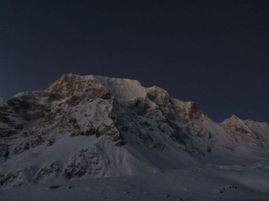
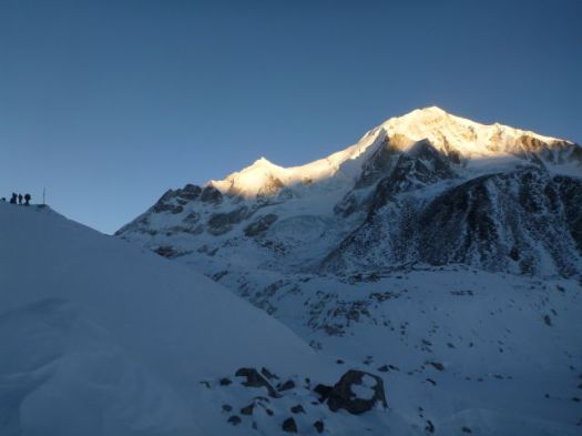
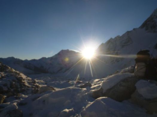
Things got better as the sky lightened.
Glorious when the sun finally appeared atop the high peaks.
It was good to be alive when sunshine hits you in the face this high up.
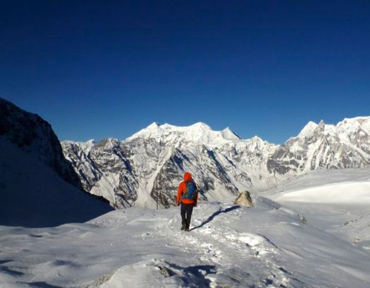
At this point we were completely confident in crossing Larkya. We could relax.
This was like any winter in my Canadian Great White North.
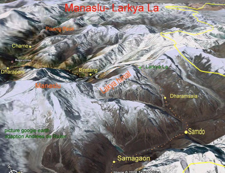
We were surprised how quickly we reached Larkya La5106m (16,751ft).
Ivan and Tasha
We’d started early to avoid severe wind here. Happily, there was very little wind.
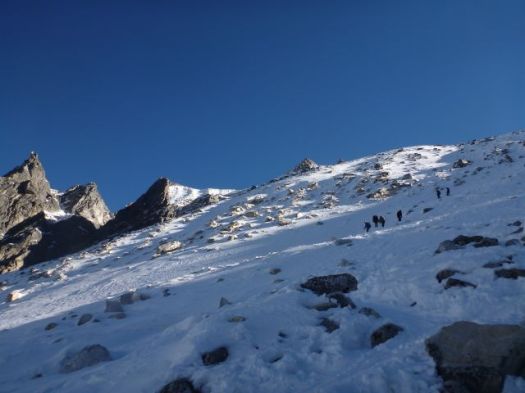
Actually, it was quite challenging on one long, steep section.
Porters, in particular, were slipping and falling. I can see why this Pass could be closed after a snow storm.
It’s a little more treacherous than it looks.
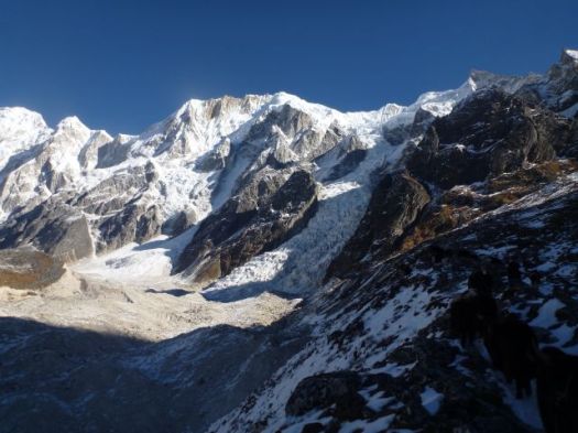
You skirt the glacier before getting back to reasonable footing.
Some make a side trip to visit the glacial lake. We skipped it.
Once finally down down, the trail is easy.
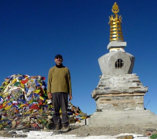
Smiles on our faces, we arrived Bimtang 3720m.
Civilization.
That might be the finest guest house we saw on the Circuit. Private cabins. It was booked, of course. By large groups of French trekkers.
It was early in the day. Mike and I were the 3rd & 4th hikers to arrive. Tasha and Ivan were 1st & 2nd.
It takes most hikers 6-10hrs to make the crossing. Much longer, of course, if you start in Samdo rather than Larkya Phedi.
We took the chance to bathe in the sun. The river was flowing, but water taps at our guest house were frozen.
And do some laundry.
I again walked the moraine ridge above Camp at sunset. But it wasn’t nearly as inspiring as the night before. Things are a bit anticlimactic after crossing the Pass.
We chatted through dinner. Went to bed early. I slept 11hrs straight through.
Note: One woman had fallen the day before we crossed the Pass. Hit her head. Though continuing immediately, she had a suspected concussion. She was resting in Bintang. Make sure your travel insurance covers hiking at altitude.
This is why you want to trek in November / early December.
Mike and I were happy to have the weather. Wanted to get up and over the Pass as soon as possible. If he were to have to backtrack to the start, he’d miss his flight back to the U.K.
The arid terrain that high up was very Tibetan.
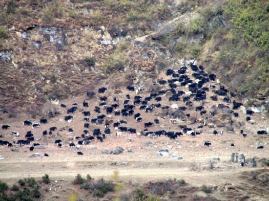
Not much can live in this climate. Yet Yaks thrive.
The scenery is fantastic. You hike closer to the big peaks than anywhere else I’ve been in Nepal.
I was one happy hiker.
Some trek from Samo only to Samdo 3690m. Then make a long, long day climbing over the 5106m Larkya Pass.
Sounds crazy to me. But it worked for a German couple we had been hiking with. Their guide doesn’ t like Larkya Phedi 4470m (Dharmsala).
Larkya Phedi is a harsh place. In every way.
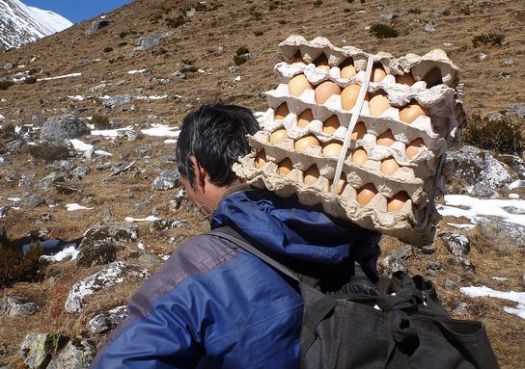
It was closed by MCAP in 2011 for being an “illegal structure”. But open since. Open normally until about Dec 15th each season. Food sometimes runs out before that date, however. Some years hikers eat nothing but potatoes before crossing the Pass.
We knew fresh eggs had arrived.
Larkya Phedi is the last place you can sleep with a roof over your head. … On the other hand, there were no beds left when we arrived. When the Pass is closed, it gets very crowded here. 😦
We set up my tent on a snow patch.I wouldn’t be getting much sleep anyway. Wake-up time would be 2am.
Hikers tried to relax in the sun. Nap if they could.
It got very cold as the sun went down.
Toilets are overflowing with feces. They don’t stink. They are frozen.
Ivan saw one Nepali shit into the stream above Camp. The only source of drinking water. That’s how uneducated some of the porters are. That’s why the water is so dangerous in Nepal.
We walked the ridge above Camp for acclimatization. And to stay warm. There were dozens of Blue Sheep up there. Until hikers scared them away.
I practiced various speeds walking both uphill and downhill to maintain an optimal temperature. This in anticipation of the Pass, considered much more difficult than Thorung La on Annapurna.
Wandering alone up there until dark, this was the single highlight of the entire trek for me. 🙂
Wonderful.
Mike and I lingered in the dining hall as late as we possibly could. Staying warm. And avoiding our cold tents. Mike and our guide were forced to share a rent a tent as all beds were taken. Porters slept on these tables and benches starting 10pm.
Last minute I ordered hot water for my Nalgene bottle, using it inside my sleeping bag to warm my feet. Temperature dropped to at least -15C. (5F)
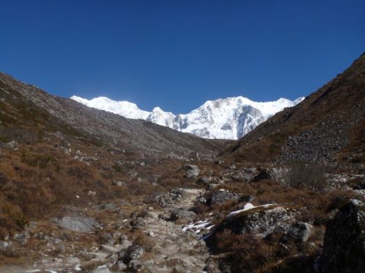
This would be the longest day so far. And the most stunning yet.
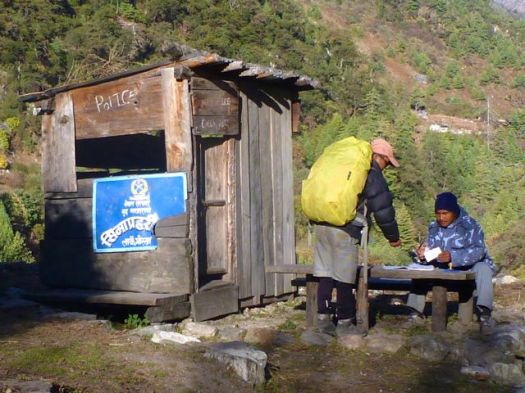
Permit check first thing in the morning.
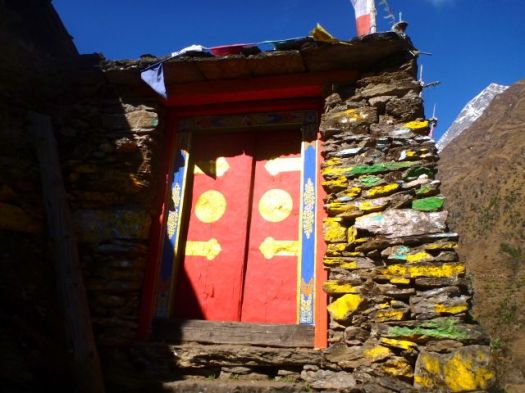
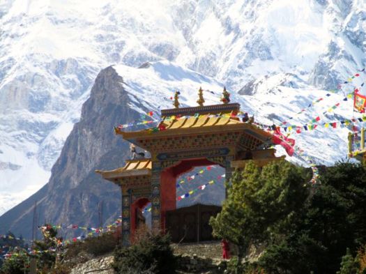
Local people and their landscape grows increasingly Tibetan as you ascend. Each village from here on up had it’s own monastery (Gompa).
It was well below freezing last night.
Still, when the sun comes out, hikers strip off their many layers quickly.
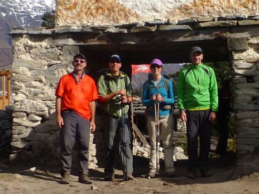
Rick, Brion, Betsy, Mike
I was astonished at what can still grow at these altitudes.
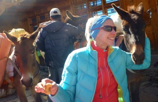
We stopped at Lho 3180m for lunch. The pack animals tried to join us at the table.
Some stayed at Lho for acclimatization. Tempting.
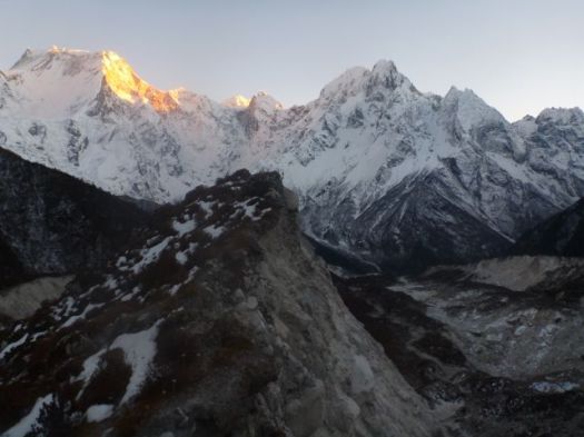
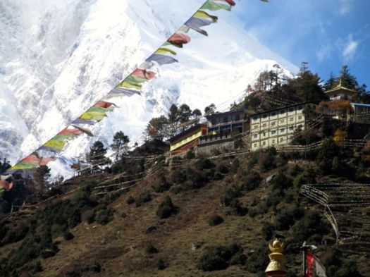
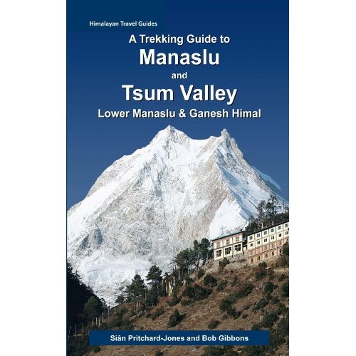
Lho has the very best views of Manaslu!
It’s the cover photo for our hiking guidebook.
This is why you hike the Himalaya. 🙂
We all felt good here at 3180m, so we pushed on to Sama 3530m.
The afternoon was fantastic, too. Grasslands of the Tibetan plateau support grazing animals nearly all year round.
Yak, Yak, Yak
There are plenty of mountain ponies, too. Used for transport.
You can rent a pony to carry you up. Or down, if you are feeling altitude sickness.
A doctor on Annapurna told us of a young Japanese hiker who’s guide put him on a pony to carry him over a high Pass there. He died of HACE or HAPE en route. 😦
We unpacked for two nights in Sama. (Samagaon) 3530m This would be our acclimatization rest day.
Sama is a surprisingly big village of about 1000 residents. Big lodges. Well stocked stores. Good restaurants. We even checked email there, the internet having arrived only 3 months prior. (2013)
Speed of the internet was good. But the computers and notebooks available to rent were atrocious. Almost unusable.
One downside of sleeping indoors rather than in a tent are rodents. In some guest houses you are kept awake by their scurrying. I even saw one in the dining room at 4470m.
Already tired of tiny, potentially unsanitary tea house bedrooms, I’d slept in my tent the previous night.
Yep. As I’ve done on my previous Himalayan tea house treks, I carried a tent. Only 2lbs (Hubba) … I like having the back-up plan.
I slept in my tent until 1:20am when guides woke me in a panic. At the next guesthouse campsite, a thief had cut through a tent and stolen a backpack. It contained a Passport, camera and plenty of cash. Everyone insisted that I must move indoors. For my own safety. 😦
Ascending next morning, the valley looked to be narrowing further.
There are people everywhere in this valley. Here Brion was looking for a public toilet. The “blue door”, he was told.
That one wasn’t bad. But as a general rule I’d recommend you avoid Nepali toilets. It’s more sanitary to sit in the woods. … Assuming you can find a good spot.
This was cute. Kids blocking off their home from pack animals.
Here’s some fencing trying to keep out hungry beasts.
Harvested crops are usually stored up high out of reach.
Tradition here is to use ladders to get up and down.
I had the standard Himalayan meal for lunch.
Dal bhat consists of steamed rice and a cooked lentil soup called dal. Potatoes on the side they call “curry”. The spiciest component they call “pickle” (achar). Often greens are included as they were this time.
Porters and guides can rarely be persuaded to eat anything else. It’s dal baht 3 meals a day. They always eat separately and after their clients. In fact, one of the highest priority jobs for any guide is to act as your waiter. They do everything they can to keep you happy and healthy on the Trail.
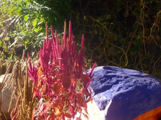
Pretty pretty.
Steep gorges like this are prone to washout.
Winter loomed. Every home had enough wood stockpiled.
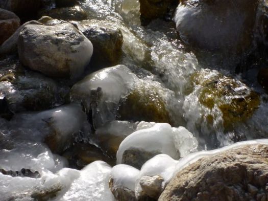
Compared with Everest and Annapurna, there are far more waterfalls on Manaslu.
Impressive too are the many beautiful butterflies.
Everyone is anticipating this adventure to boom over the next few years. We saw many, many guest houses under construction.
We were surprised to get some rain. It should be bone dry in November. … We didn’t realize at the time that this same day it was snowing up on the high Pass.
At 5:15am we rendezvoused at Touch Paradise in Thamel, Kathmandu.
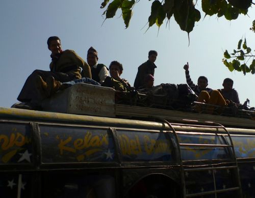
One of the main advantages in having a guide is finding transport to and from the trailhead. I’m not sure that on our own we would have found the right bus stand, the right bus. In the dark.
All the buses were packed as many were traveling during the holiday. And some were traveling for the upcoming national election. Seems many Nepali can vote only in their home village.
Mike and I were on the back seat bench, the bumpiest ride of all. I wished we’d paid $150 or so for a private vehicle.
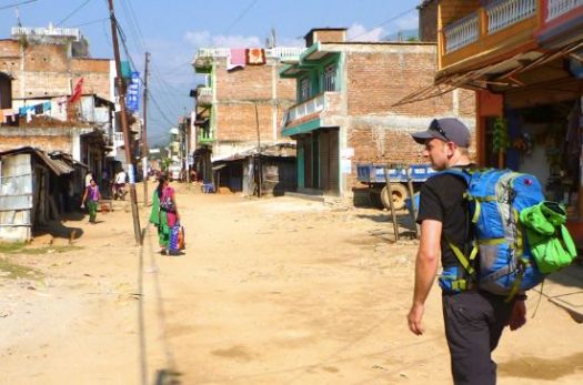
It was a long, dusty and bumpy 8hrs to Arughat Bazar, the very worst part of the Manaslu Circuit trek as far as I’m concerned.
Hikers on the bus could not be happier to disembark and start walking the 2hrs up to Arkhet Bazar.
Jeeps do run up to Arkhet, but everyone I saw starting that day preferred to walk.
Budhi Gandaki river
The scenery already pretty.
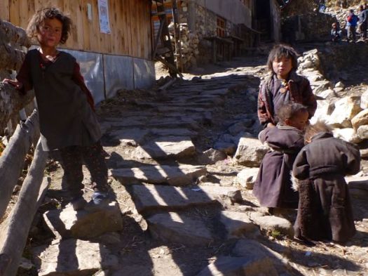
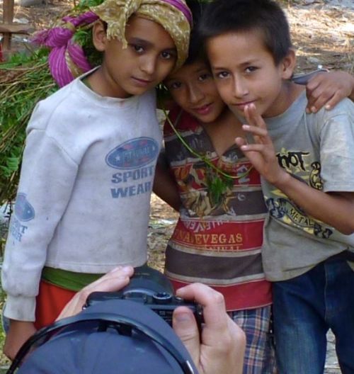
Children on this trail are cute, but pests. They still nag nearly every hiker for “pens”, “rupee” or “candy”.
Mike was patient with them, offering to take and show them photos of themselves.
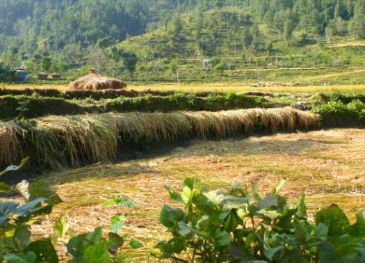
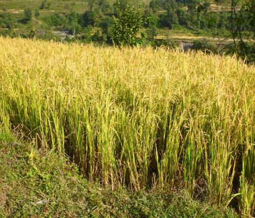
Rice is perhaps the most important crop at this elevation. Farms look prosperous.
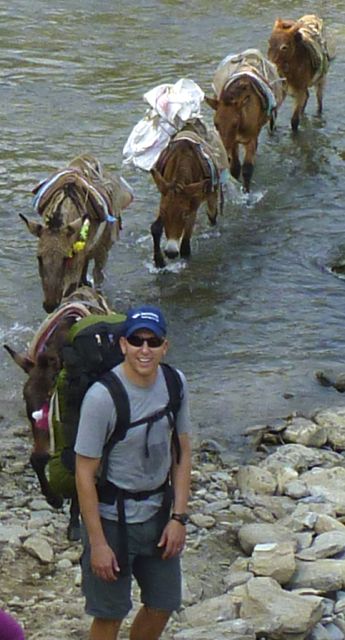
This low on the mountain the “road” was busy. We shared the trail with many pack animals.
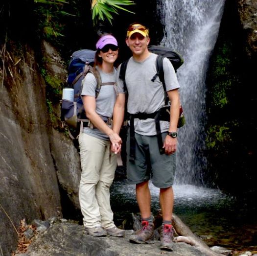
Arriving on the same bus were Brion and Betsy from Colorado, enjoying their belated Honeymoon.
Also, Ivan and Tasha from Alaska. They fish. And adventure.
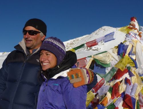
That photo was taken atop the Larkye Pass, 9 days hence. The 6 of us and our 3 guides spent a lot of time together en route. 🙂
There were motor vehicles too, but not many.
We stayed at the Mountain View Hotel in Arket. At this altitude (608m) it’s still warm in November. I didn’t bother unpacking my sleeping bag.
That was a mistake.
I’m fairly certain that it was in a $3 room where I acquired these bites. Bedbugs, I assume.
Don’t trust the provided bedding. After that night I used my own sleeping bag and silk liner exclusively, sometimes wrapping dodgy pillows in a plastic bag.
Before dark I had time to wander the small town, checking the very basic school.
En route to Thorung La I learned something new from a doctor in Manang at the daily HRA Altitude Talk.
High-altitude adaptation has a genetic component.
Some people who live at high altitudes suffer breathlessness, palpitations and dizziness, while others have no health problems, and now a new study reveals which genes may explain the difference.
The genetic changes, described today (Aug. 15, 2013) in the American Journal of Human Genetics, allow people to take in enough oxygen from the thin mountain air without developing the heart attacks and strokes of chronic mountain sickness.
“We have ascertained there is a major genetic component that allows populations at high altitude to live better,” said study co-author Dr. Gabriel Haddad, a pediatric pulmonologist at the University of California at San Diego. …
I’ve been over 5000m dozens of times, never having any altitude sickness.
Perhaps I’ve got good genes. 🙂
Read more on wikipedia – High-altitude adaptation in humans – Genetic basis:
… The underlying molecular evolution of high-altitude adaptation has been explored and understood fairly recently. Depending on the geographical and environmental pressures, high-altitude adaptation involves different genetic patterns. …


 Civilization.


 Ascending next morning, the valley looked to be narrowing further.


 Mike and I were on the back seat bench, the bumpiest ride of all. I wished we’d paid $150 or so for a private vehicle.
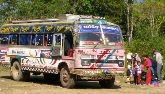
 Jeeps do run up to Arkhet, but everyone I saw starting that day preferred to walk.
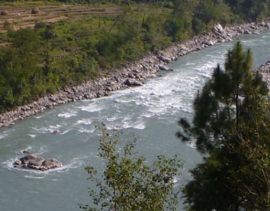
 I’m fairly certain that it was in a $3 room where I acquired these bites. Bedbugs, I assume.

 That’s 2065 in the