Posted by Andrew McManama on Facebook.
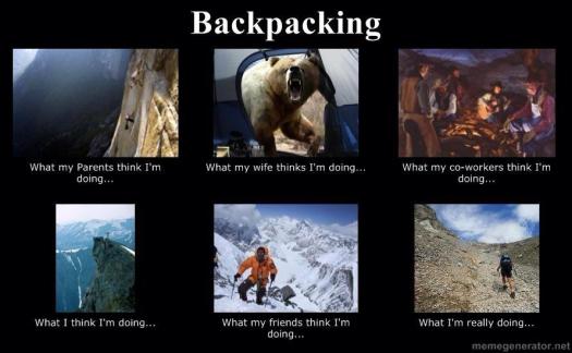
Driving to the trailhead is far more dangerous than walking the trail, of course.
On the other hand, I fell down while walking without a pack the other day. Cut up and bruised my hands. 😦
Posted by Andrew McManama on Facebook.
Driving to the trailhead is far more dangerous than walking the trail, of course.
On the other hand, I fell down while walking without a pack the other day. Cut up and bruised my hands. 😦
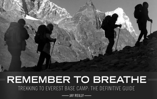
In collaboration with Frank and Sue Wall, Jay Reilly announces a new eBook. Jay lived in Nepal for 6 years, a professional trekking and mountain guide:
It includes a comprehensive guide to frequently asked questions, the best time of the year to go, your health and required first aid supplies, training to get prepared for the trek, equipment you’ll need and where to find it, and comprehensive track notes.
This 70 plus page downloadable PDF eBook is written with the first time visitor to Nepal in mind. It is packed with inside knowledge and tips to help you plan and execute your trip.
Best still – as it is a downloadable eBook you can have it today (with no need for delivery fees) It’s just $A15.99.
Our Hiking Blog – How to trek to Everest Base Camp – a independent guide book
That’s the best link for details on the book.

Click to see a sample.
I have a review copy. It looks great.
In 2014 I prefer eBooks to hard copies. On my laptop, eBooks are a dream — so easy to search.
On my phone, on the trail, it’s a little more challenging to find exactly what I want, when I want it.
Having trekked to Everest Base Camp a few years ago, carrying two heavy guidebooks, I wish I’d had this resource instead.
One point of confusion in the book:
“The TIMS Card can only be issued by a trekking agency that is registered with TAAN (Trekking Agents Association Nepal)
Along with the TIMS Card, you are required to take a Nepalese “guide” with you. The cost of this should be about 1200 NRP per day for the guide. This includes his food. Be sure to negotiate this before you pay any money.”
Only 6 months ago you could purchase a TIMS card for yourself at the Tourism Board office in Kathmandu. It was not necessary to have a guide to go to Everest.
Has something changed?
Jay’s reply:
Nothing has changed, you can still get a TIMS Card at the Ministry for Tourism if you wish. It’s a different card than the one issued by trek agents, that registers you as an ‘independant’ trekker, not requiring a guide. However-not all the check post guys know this and to them you are a trekker without a guide, and in their eyes, doing something wrong. I’ve heard of people being turned back even though they have the Ministry issued TIMS. Buyer beware…
The guide suggests Rabies shots. I’ve not encountered many trekkers who have had them. Cyclists generally do, as they are at far greater risk of being nipped at by guard dogs.
Jay:
Regarding rabies, I never personally got the vaccination, but some doctors recommend people do. Bottom line-consult a doctor and make your descisions based upon professional medical advice.
I’m planning on Nepal again Oct/Nov 2014.
Jason Weise author.
Jason was frustrated organizing his own trek, unable to find all the information he wanted in one place. The book took him over a year to write, research and has been professionally edited.
Cost is only $9.50 in PDF format. Carry it on any portable electronic device.
details – trekbasecampeverest.com
Mosi-oa-Tunya National Park is an UNESCO World Heritage site that is home to one half of the Mosi-oa-Tunya — ‘The Smoke Which Thunders‘ — known worldwide as Victoria Falls on the Zambezi River.
The river forms the border between Zambia and Zimbabwe, so the falls are shared by the two countries, and the park is ‘twin’ to the Victoria Falls National Park on the Zimbabwean side. …
The wildlife section of the park is tiny but popular. Popular because half day walking safaris are offered.
This is rare in Africa due to the risk of tourists being injured. Or eaten.
It was very early. Very rainy when I was picked up — alone — at my hostel.

We rendezvoused with a British couple alongside the Zambezi.
Everything was about to go wrong. You had to laugh.


The husband had 2 new hips, 1 new knee. He could not walk.
Improvising, we decided to take a quick driving safari before setting out on the promised “walk”.


African guides are normally super entertaining. Very knowledgeable.
We saw baboon, vervet monkey, giraffe, zebra, warthog, sable, impala and many other antelope.


When the British couple departed, I was alone for the walking Safari with a support team of up to 4 men.
I walked with a guide and an armed guard.

There’s no shortage of wildlife in Mosi-oa-Tunya National Park. But the main attraction is white Rhino. Though not indigenous, they are the most talked about wildlife in Africa.
You cannot see rhino from the road. They are understandably very shy.
Already an hour or more late, we roamed far and wide in the wet mud looking for rhino sign. The guard checked his phone constantly for an update on where we might find them.
Finally, the highlight of Mosi-oa-Tunya. A mother Rhino and her new baby, less than 2 weeks old.


The rhino in Mosi-oa-Tunya were poached to extinction in 2007. 😦
I was told they are no longer worried about poaching here. The Park is now fiercely defended. 5 adult rhino and 5 youngsters, including this newborn.
On the other hand, the enforcement officer spoke longingly of Botswana where guards can (reportedly) shoot poachers on sight.
more of my photos from the day
Leave the iPad at home.
Outside:
This new backcountry survival Android tablet works where your smartphone or iPad would fail. The rugged tablet can forecast the weather, determine your location, elevation, and let you communicate with folks back home.
About the size of an iPad mini, Earl is one tough gadget. It’s waterproof, dustproof, shockproof, and it will work in temperatures from 32 degrees to 122 degrees Fahrenheit. You can submerge it in three feet of water for up to 30 minutes with no ill effects.
Earl’s GPS uses an internal magnetometer, accelerometer, and gyroscope to track your position. It’ll guide you even if you’re navigating dense vegetation or an urban jungle without a line of site. It also gives you access to more than 300,000 trails through the site everytrail.com and high-resolution topographical maps of North America. With Earl in your hand, you have no excuse to get (unintentionally) lost. …
Trip report by site editor Rick McCharles.
day 0 | day 1 | day 2 | day 3 | day 4 | day 5 | day 6 | info page
Morning was, again, misty.

We enjoyed one of the better toilets here, however.

Sawdust does help reduce odour.
Seems the expensive solar composting toilets (used in the past) are no longer “must have” technology.
Hicham dressing for battle.

We faced the most dangerous section of the West Coast Trail — dread Adrenaline Surge.

Our arrival was perfectly timed for low tide.
Two choices. Down and back up? … Or scramble around?

We opted to stay high rather than risk a freak wave flushing us out to sea. That had happened to a friend of ours in the past. (She was washed back into the Surge on the next wave. And pulled to safety.)

All 11 made the traverse safely. But it was very, very slippery.
If not confident in your agility, take the inland route, instead.

On the other hand, in good conditions, at low tide, the coast can be like a sidewalk. Sandy and myself ALWAYS voted to take the coastal route. Vistas are magnificent.
The first word that comes to mind when describing the WCT is … LADDERS.

There are MANY. Some are LONG and STEEP.

This is no adventure for those afraid of heights.

The second word that comes to mind is … RAIN.


The WCT is no place for those afraid of slipping on wet surfaces.
Nor those who don’t like to get dirty.

Actually, we had only a few hours of rain. This was a relatively dry week on the Wet Coast Trail.
Any idiot can hike when it’s dry. It takes experience and expertise to enjoy camping in the rain.

I insisted we finish off my booze.

Good night.
more photos from this day
day 0 | day 1 | day 2 | day 3 | day 4 | day 5 | day 6 | info page
Trip report by site editor Rick McCharles.
day 0 | day 1 | day 2 | day 3 | day 4 | day 5 | day 6 | info page
Though dry, 2003 was a foggy summer on the West Coast Trail.

I’m trying to dry dew and mist before packing up.
Morning fog typically burns off fairly rapidly on the coast. But not this week.

We timed our departure to reach Tsusiat Point at low tide.


We did some gymnastics.

Warren showed off his mussels.

In 1999 we could get mobile phone service most every day. In 2013 there was nothing, no matter how you “held” your phone.

Wealthier folks than I reserve a night or two at the Dididaht tent camp.

Happy. Happy. We reach Nitinat Narrows.

The cost of this crossing is built into your hiking fees.
Some of us bought treats on the south side “restaurant”.

On recommendation of the fisherman, I ordered salmon. It was cleaned in front of my eyes. Then served up with a delicious baked potato. ($25)


This guy ordered 2 crabs for himself. And ate every bite.


Onward.

Onward.

SOMEBODY got us lost, trying to stay on the coast when it was impassable.

Who was that, Bill?

We backtracked. Then made the final push to weird and wonderful Cribs Creek campsite.


Food tastes GREAT when you are on the Trail, burning a lot of calories.


more photos from this day
day 0 | day 1 | day 2 | day 3 | day 4 | day 5 | day 6 | info page
Trip report by site editor Rick McCharles.
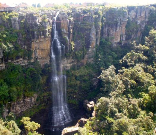
Within 36hrs of landing in JoBurg I found myself atop the Amphitheater cliffs looking down at one of the highest waterfalls in the world.

How did I get here?
It’s easy.
Catch the Baz Bus to Amphitheater backpackers in the northern Drakensberg.
While checking into the hostel, sign up for their most popular guided hike. It’s offered about every 2nd day for about $50 all inclusive.
7:30am departure.

Here’s our guide “Sim” parking one of the hiker shuttle vans at Sentinel car park 2,500m (8,200 ft). This is the only official day hiking trail leading to the top of the Drakensberg escarpment.


Yep. That’s the Sentinel. You cannot climb it without ropes. We’ll skirt the base.
The trail zigzags up towards the big peak. Then traverses right.


Entirely above the treeline, we did not see much in the way of wildlife. Aside from lizards, of course.

It was an easy start with perfect weather.
One short ladder on the ascent.

The crux of the hike is up this gorge.

It’s a 300m scramble. Not too difficult overall.
Atop the Amphitheater cliffs, we stopped for lunch. Our guides were disappointed that clouds obscured the fantastic views.

Note the big birds that stopped for lunch with us.

20min further is the top of Tugela Falls.


The water is quite warm. … I’m told.

Our guide told us that one hiker fell from here on a winter trek. Slipped on the ice.
Finally I called on the old Gods and new to dissipate the clouds.
Everything opened up. And we were shocked to see where we’d been standing so casually.

It’s about 1km down.
The Amphitheatre is widely regarded as one of the most impressive cliff faces on earth, over 5km (3.1mi) in length.

Surprisingly, these cliffs are not much used for BASE jumping and the ilk. Apparently winds are not favourable here.
One girl from Finland had been to Roraima via Venezuela. She said there were definitely similarities with the top of the Tupuis there …

… But many differences too.
The standard route is a Lollypop loop. Rather than backtracking we descended via long ladders.


From the bottom, it was another cliff traverse to regain our original trail.

The vegetation in South Africa is different than what I’m used to. The most interesting plant is this … Pineapple something.


One intensely scenic day. We all left happy.
This New Yorker was on the last 4 days of 2 years of traveling.

Back at the car park we enjoyed a gymnastics performance.

And saw one sleepy snake close to where we parked the vans.
more pics from this trek
I didn’t delete many photos as most up there in the Bergs were cool. 🙂
related – Controversy Between Tugela Falls and Angel Falls as World’s Tallest Waterfall
The governance of Nepal has been sorrowful compared with neighbors India and Bhutan.
The Nepalese monarchy persisted 240 years until 2008.
The 1990s saw the beginning of the Nepalese Civil War (1996–2006), a conflict fought between government forces and the insurgent forces of the Communist Party of Nepal (Maoist). The situation for the Nepalese monarchy was further destabilised by the 2001 Nepalese royal massacre, in which Crown Prince Dipendra reportedly shot and killed ten people, including his father King Birendra, and was himself mortally wounded by what was allegedly a self-inflicted gunshot.
As a result of the massacre, King Gyanendra returned to the throne. His imposition of direct rule in 2005 provoked a protest movement unifying the Maoist insurgency and pro-democracy activists. He was eventually forced to restore Nepal’s House of Representatives, which in 2007 adopted an interim constitution greatly restricting the powers of the Nepalese monarchy. Following an election held the next year, the Nepalese Constituent Assembly formally abolished the kingdom in its first session on 28 May 2008, declaring in its place the establishment of the Federal Democratic Republic of Nepal. …
The monarchy had governed poorly, not modernizing. A Republic will, hopefully, be an improvement.
The Nepalese Royal Family as seen in this 1989 photo at the Narayanhiti Palace in Kathmandu. The royal members, from left to right, were Crown Prince Dipendra, King Birendra, Prince Nirajan, Queen Aiswarya and Princes Shruti. An eyewitness to Nepal’s palace bloodbath said on June 7, 2001, the late Crown Prince Dipendra staggered and fell occasionally as he drunkenly mowed down most of his family in just over a minute. (Reuters)
The drunken son used 3 different automatic weapons to mow down his family. No doubt American Gundamentalists found a way to defend his access to those weapons.
The Nepalese Constituent Assembly was … formed as a result of the Constituent Assembly election that was held on April 10, 2008 in Nepal. …
The Communist Party of Nepal (Maoist) (CPN (M)) was the largest party in the Constituent Assembly, having won half of the constituency seats and about 30% of proportional representation seats. …
Prachanda … is a Nepali politician and Chairman of the Unified Communist Party of Nepal (Maoist) (UCPNM). He led a guerrilla war against the government and later served as Prime Minister of Nepal from 2008 to 2009. …
Power corrupts. Once Prachanda was in charge he took residence in a 15-room mansion and started living a wealthy lifestyle. …
Top Maoists called him corrupt.
Bottom line. Prachanda and the (Maoist) (CPN (M)) party was no more effective in leadership than the monarchy.
In the Nov. 2013 election Prachanda and his party came a distant 3rd.
The centrist Nepali Congress, the Himalayan nation’s oldest party, established itself as the largest group in the 601-member constituent assembly, winning 196 seats …
Looks like Prachanda is history.
Prachanda escapes bomb blast in western Nepal
What does all this mean for hikers?
Nothing, so far. Certainly there’s no security concern.
I do recall being asked to make a donation to the (Maoist) (CPN (M)) party on Annapurna in 1998. They were very polite. 🙂
by site editor Rick McCharles
In a rush to get clear of the Manaslu Circuit, we opted for a long, easy day from Bimtang 3720mto Dharapai 1850m.
I bought “cooked water”. Made my own instant coffee for the morning.

Departing Bimtang, the ground water was frozen. This is still high altitude.

Plunging into a forested section truly meant we were coming down.

No longer fired by adrenaline, our minor aches and illnesses seemed to become more acute.
My stomach was bad. Betsy’s was worse.

Soon, however, we were sweating as we hadn’t done in days.

We stopped for lunch at a lovely new place.

Turned out service was slow. Food lousy.
Motivation was low too. As we plodded downhill.

I had about as much enthusiasm as the mules we traipsed behind.

Seems to me there will be no road built any time soon on this side of the Manaslu Circuit. It’s a very rugged canyon.

After 7hrs of walking we rolled into Dharapani on the Annapurna Circuit.
We all enjoyed a hot shower. One last dinner together. …
… But early next morning it was time to say goodbye.

Tasha and Ivan were headed for the Everest Base Camp trek.

Brion and Betsy planned to get a very nice room and luxuriate in the last couple of days of their honeymoon.

Everyone rushed away. Except me.
I stayed to continue the trek solo, ascending on the Annapurna Circuit. 🙂
see high resolution photos from this day on flickr
Interested to trek the Manaslu Circuit yourself one day? The best starting point is our Manaslu information page.
day 0 | day 1 | day 2 | day 3 | day 4 | day 5 | day 6 | day 7 | day 8 | day 9 | day 10 | info