With a 10km run coming up January 1st, I’ve been running a lot of late.


Wet. But good fun. 🙂

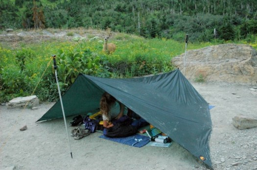
Best hikes, treks, tramps in the world.
With a 10km run coming up January 1st, I’ve been running a lot of late.
Wet. But good fun. 🙂
Great interview.
Are there extra safety precautions you take when you hike an unmarked route?
I generally leave a more detailed description of my proposed route with friends or family before setting out. For someone that is relatively new to off-trail backpacking, I would recommend erring on the side of caution in regards to food, water, sufficient layers, distance estimates, etc. You may also consider carrying a personal locater beacon, such as a SPOT or Delorme inReach. …
What kinds of maps do you use? What Scale? Have they been difficult to get? How much do you study the maps before starting?
In western countries such as the United States, it’s easy to find great topo maps (e.g. USGS 1:24,000 series). In developing nations, it’s often a very different story. Over the decades I’ve made do with everything from 1:250,000 overview sheets to a sketch map on the back of a napkin from a waiter in Arequipa, Peru (Volcan Misti hike, 1996). …
HIKER Q & A – CAM ‘SWAMI’ HONAN ON CREATING ONE’S OWN HIKING ROUTES

related – Cam’s 2015 – The Year in Pictures
Mitch Stevens on the health rewards of outdoor walking.
1. Improve Your Overall Health and Be Fit!
3. Be Happy!
12. Expand Your Mind, Visit New Places!
15 Benefits of Hiking – Get on the Path to Longevity Today!
Click through to see the rest. Plenty of tips.

Andrew Skurka :
Ten- or fifteen-thousand miles ago I believed fervently that “light is right” and “lighter is better.” I proudly considered myself a “lightweight,” “ultralight” or “super ultralight” backpacker, and I believed that the weight of my pack was linearly correlated with the quality of my experience — the lighter my pack got, the better the hiking became.
But in my blind pursuit to shed weight, I made decisions that compromised my efficiency, thus negatively impacting my trips. In other words, in an effort to “go light” I ended up going “stupid light.” (Special thanks to Phil Barton and Pat Starich for sharing this expression with me.)
I went “stupid light” by:
Not taking gear and supplies that were necessary given the conditions, and …
Taking gear and supplies that were too light.read more – “Stupid light”: Why light is not necessarily right, and why lighter is not necessarily better
I was in Spain recently, one of my main goals to hike the newly reopened Camino del Rey.
Unfortunately you can only access the trail after booking through the official portal page.

The portal shows up 3 months in advance. But it’s ALWAYS booked. 😦
I couldn’t get a reservation.
Update: It turns out that the Garganta Hotel, near the train station in Alora, will sell you an expensive lunch for 25 euro … with a “free” ticket for the hike. Other restaurants may do the same.
Here’s a May 2015 trip report (tickets from Garganta Hotel).
I wished I’d known. The official website does not mention this option.
El Caminito del Rey (English: The King’s little pathway) is a walkway, pinned along the steep walls of a narrow gorge in El Chorro, near Ardales in the province of Málaga, Spain. The name is often shortened to Camino del Rey.
The walkway had fallen into disrepair and was partially closed for over a decade. After four years of extensive repairs and renovations, the walkway re-opened in 2015. It has been known in the past as the “world’s most dangerous walkway” following five deaths in 1999 and 2000. …

trip report by site editor Rick McCharles
Happily the sun appeared around 8:30am. It had been very windy all night. (I’d not slept much.)
It was still windy. As you can see.

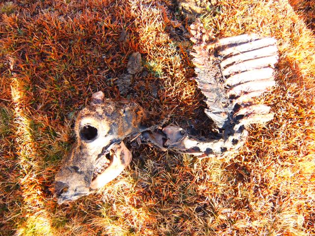
This guy didn’t make it.
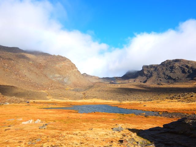
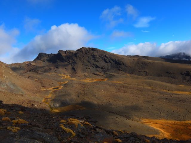
The scenery up here is otherworldly. Reminded me of New Zealand and Iceland.
Most of these photos were taken by Josh. I was impressed he managed to catch the rainbow. 🙂

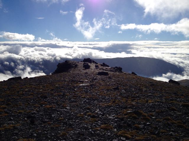
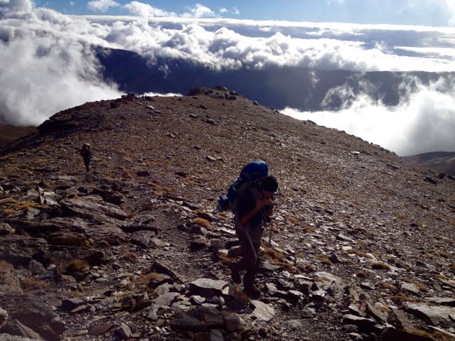
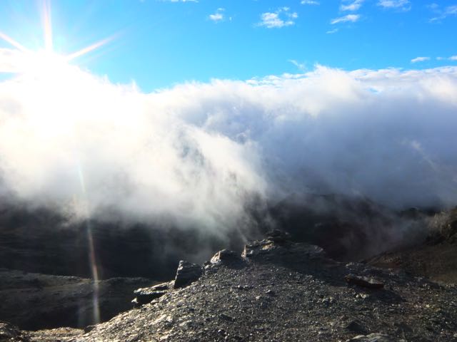
Once up on the cliff edge summit ridge, the wind was even more severe.
But it was fun to be well above some of the clouds.


From up here we could see some of the other 7 lakes (tarns).

We managed to somehow lose this very well traveled pathway, sticking close to the cliff instead.
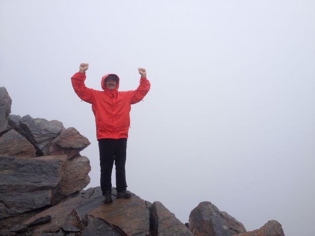
Josh had to keep moving just to stay warm. He and I pushed ahead over several false summits. To the top of Mulhacén.
We made it!

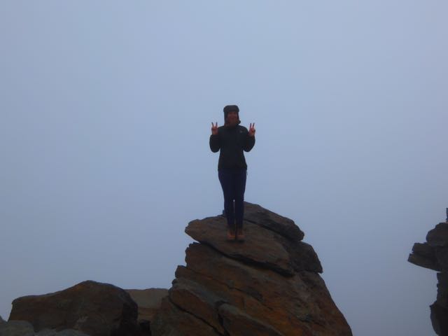
Josh huddled in the rocks at the top to warm-up while I rushed back to help Alisha. On the descent (somehow) I missed her coming up. So I rushed back up to the summit, missing her again. She’d been there already and seen Josh.
Unfortunately she’d left her backpack close to the cliff edge. And wasn’t sure exactly where.
The three of us – once finally reunited – went searching for it together. We asked one Spanish climber if he’d seen it. He had! And it was finally recovered.
In the end I summited Mulhacén 5 times that day!
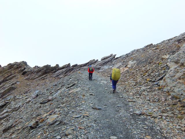
Josh really needed to get down to some place warmer. Here’s the scramble down from Mulhacén on the Traverse route.


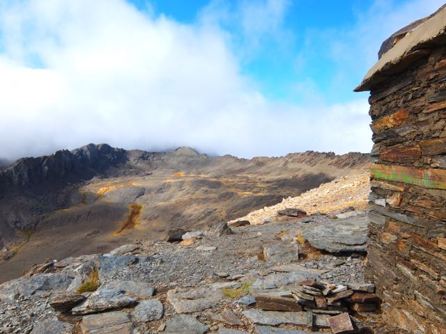
We had lunch at this crowded “Refuge”. Not all that warmer than the summit, to tell you the truth.

The route would stay above 3000m for the rest of the day, mostly along the Sierra Nevada Road. (Looks great for mountain biking.)
Lonely Planet recommended we sleep at the Cariguella Refuge atop the Sierra Nevada Ski Resort.

We had an hour of daylight left and thought we might make the next Refuge instead, shortening our day 3 back to civilization. That same Spanish walker who found our backpack happened past. He seemed to know where he was going. So we followed.
Big mistake. We ended up off route. Lost. Facing steep cliffs. Eventually we were forced to backtrack to Cariguella.
It was cold. But clean. We shared common bunks with about 6 other hikers who were planning to climb the 3rd highest peak next day.
Unfortunately a loud, obnoxious group arrived after 10pm. Absolutely no consideration for those trying to sleep. They left very early next morning, all their trash on the table. 😦
I dislike European Refuge huts. This was only the second time ever I’d tried to sleep in one.
Remind me never to sleep in one again.
Cam was warned off this (supposedly) dangerous part of the world. But decided to go anyway based on local information.
The Colombian Andes.
The most northern part of the world’s longest mountain range.
The hiking highlight of this month’s trip to the region was a circuit of the Sierra Nevada del Cocuy …
59 miles (95 km approx.) …


related – best website – pnncocuy.com
If you’ve been to Alaska, you know hiking there is challenging.
Distances are HUGE. And there are not all that many established trails.
Turns out, that’s partly by design.
GearJunkie in Denali:
The park’s 2006 Backcountry Management Plan … “Except as otherwise specified… backcountry access and travel in Denali will continue without designated routes or constructed trails to allow for freedom to explore and to minimize signs of human presence.”
Similar trail-less wilderness areas exist within Alaska, which contains more than half of all the country’s wildernesses, but Denali is by far the most popular, totaling more than 38,000 backcountry campers last year. According to Burrows, the relative ease at which visitors can access Denali’s backcountry (it’s split in two by the park road) has spurred increased exploration and cause for increased measures to keep the wilderness as Murie intended.
Very quickly after starting hiking from the park road, we ran across our faint trails, and like many of Denali’s visitors we opted to take the path less traveled, spread out to disperse our impact and take advantage of a wilderness experience unlike anyplace else.
Bushwhacking Encouraged: Denali Strives To Eliminate Ad Hoc Trails

In 2013 Justin “Trauma” Lichter and Cam “Swami” Honan completed a 381 mile (613 km) traverse of Mexico´s Copper Canyon region. A first thru hike.

The traverse was a combination of hiking, packrafting, swimming, bushwhacking, scrambling, crawling and weaving our way around clandestine drug fields.
Our route linked together the six major canyons (along with numerous minor ones) that constitute the Copper Canyon region. It took us from the region’s northwest corner (Basaseachi Falls) to its southeastern limits (Sinforosa Canyon). In the order in which they were traversed, the canyons were as follows:
Candamena
Oteros
Copper
Urique
Batopilas
Sinforosa

