Cam Honan – 10 Tips for Hiking Downhill

A very good summary. In addition, I switchback and traverse as much as possible on the steepest slopes.

Best hikes, treks, tramps in the world.
Cam Honan – 10 Tips for Hiking Downhill
A very good summary. In addition, I switchback and traverse as much as possible on the steepest slopes.
I once hiked with 4 Wheel Bob. His ascent of 14,252-foot (4344m) White Mountain Peak, California.
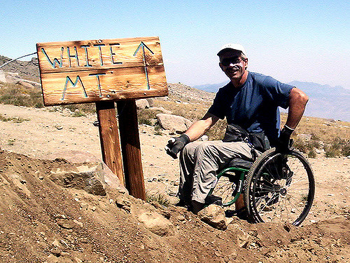
Bob’s smiling here. But let me confirm that trip was bloody tough. I could never possibly have made it in his chair.
The documentary about Bob is finally coming out.
Click PLAY or watch the trailer on YouTube.
He and filmmaker Tal Skloot have been working on it for 5 years.
Follow Bob Fourwheelbob Coomber on Facebook for updates on that project.
travel to walk:
The Ausangate circuit is a trek that is relative untouched by the massive tourism industry in Cusco. Because of that, this is one a hike where there is plenty of solitude. On the flip side, it is much tougher as it is about 1 km higher than Cusco with passes that go over 5 km in elevation (16k ft). …
… the trail is not marked and there are no signs to discriminate trails the locals use trail around the mountain. So, map skills, GPS, or a guide is imperative for a trek like this. All of this is pretty manageable for experienced backpackers.
However, we decided to add an additional layer to this already challenging task. There is information out there that the Rainbow Mountains are nearby and provides a side trip possibility. …
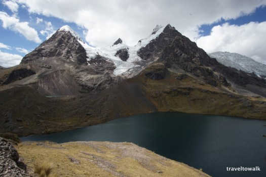
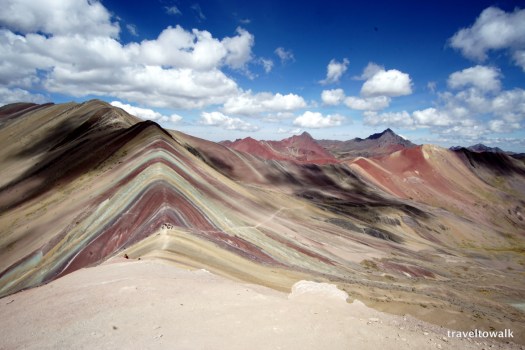
Read the entire trip report if you are planning to do this trek yourself one day – Ausangate and the Rainbow Mountains
It’s one of our top 10 hikes in the world.
Cape Scott and the North Coast Trail is the first comprehensive guidebook about one of Vancouver Island’s most iconic destinations. Each year, thousands of backpackers and nature lovers head to the northern limits of Vancouver Island, bound for the jewel of the region: Cape Scott Provincial Park and the recently completed North Coast Trail. …
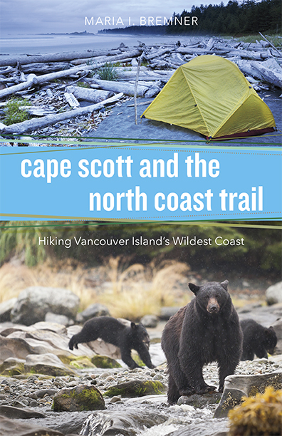

This part of the world is a fantastic wilderness. But we have serious reservations about the standard route – don’t hike the North Coast Trail
One. Crazy. Story.
trip report by besthike editor Rick McCharles
day 0 | day 1 | day 2 | day 3 | not recommended
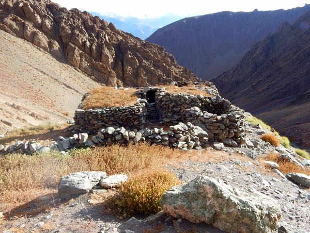
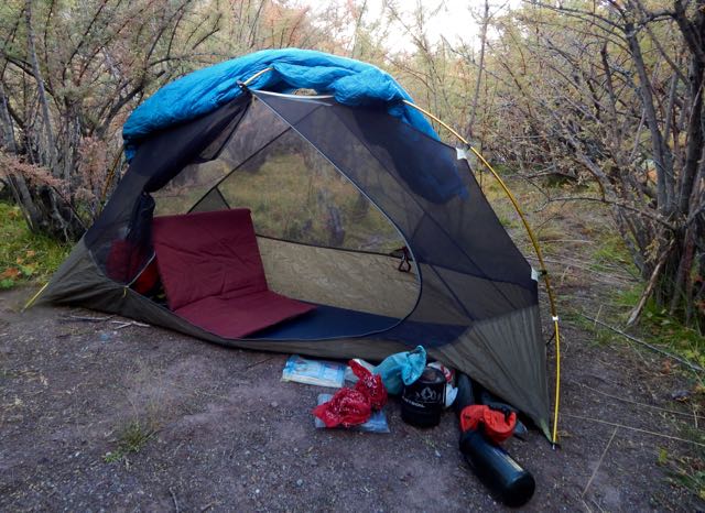
When you sleep under the net and stars, you wake at first light.
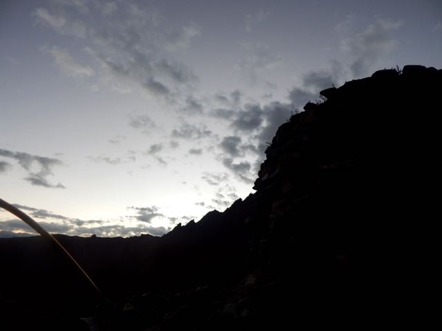
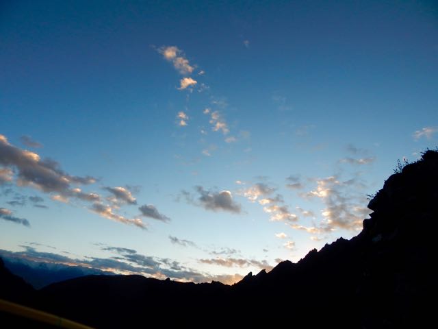
In no rush, I enjoyed 3 pots of coffee while waiting for the sun to reach my tent.
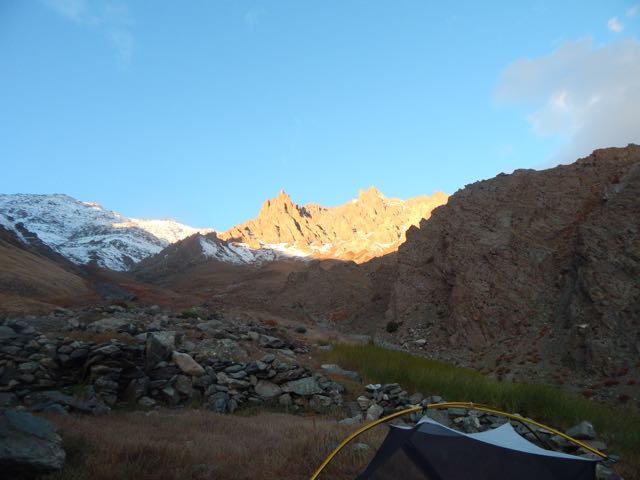
Time to GO.
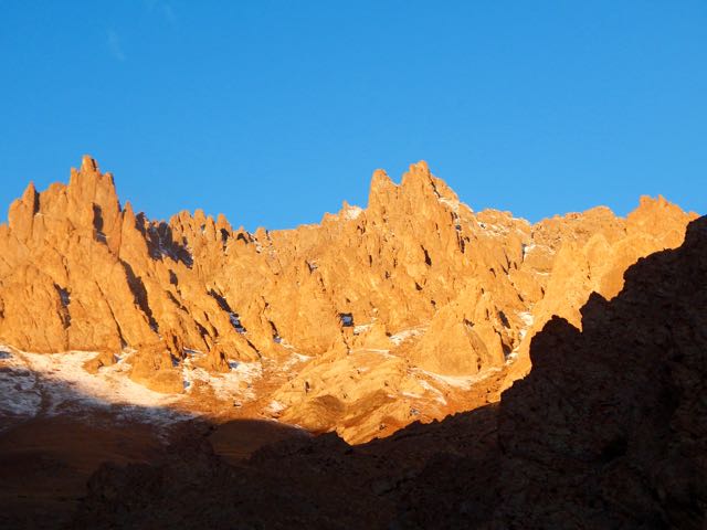
Up. Up. Up.
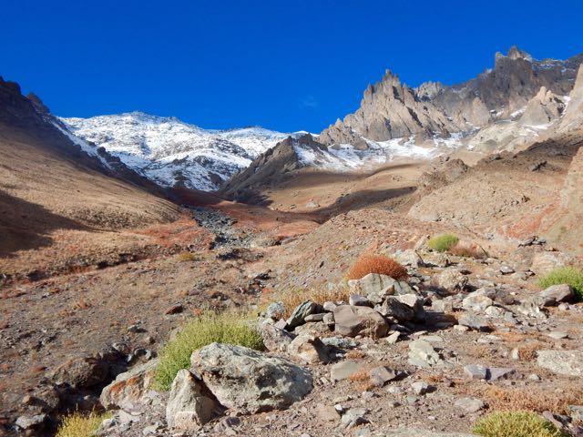
As I drew closer the crossing got increasingly more serious looking.
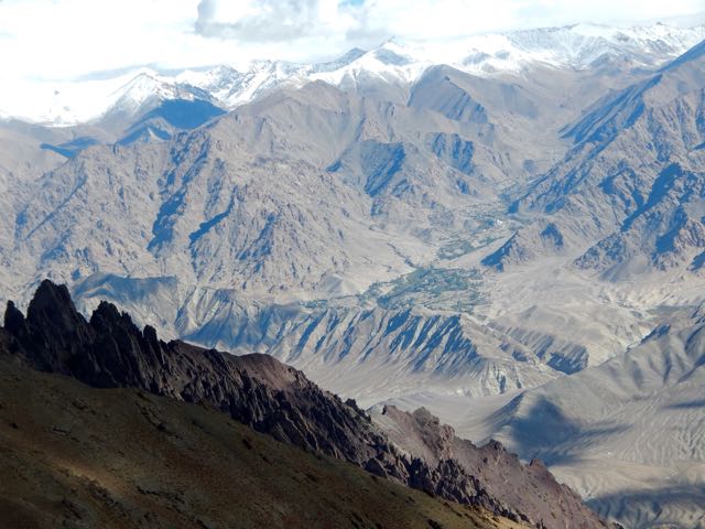
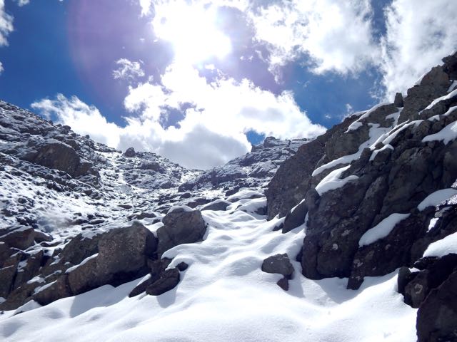
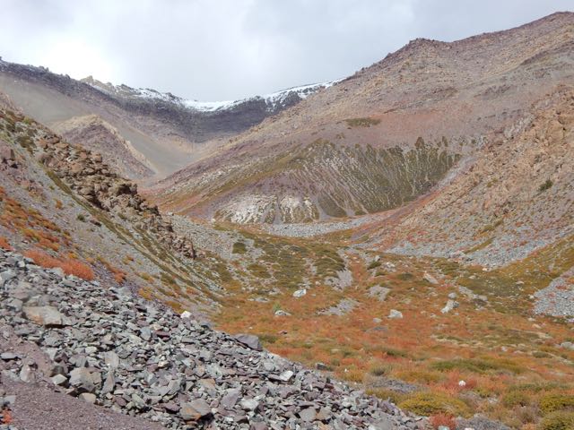
Entering this valley, the trail disappeared beneath the snow.
I was at the same altitude as the snow line on the other side of the Indus.
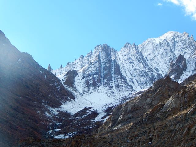
Luckily, the weather was perfect.
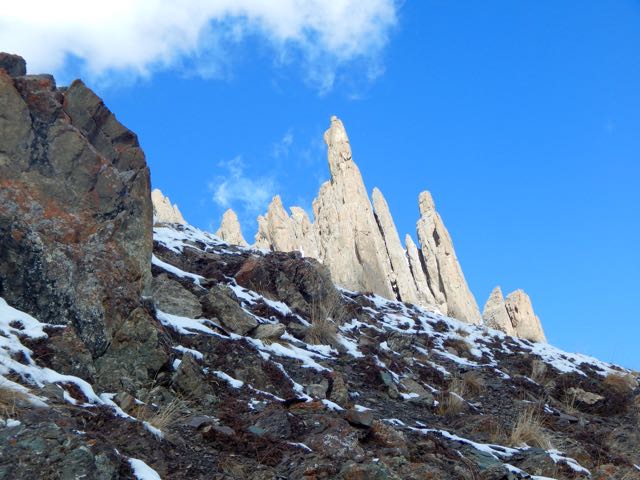
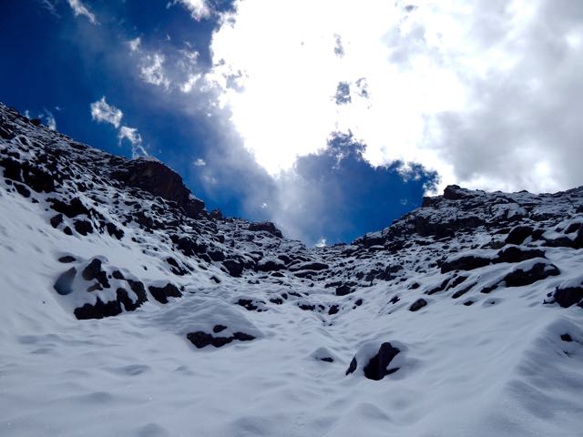
Which notch on the skyline is the pass?
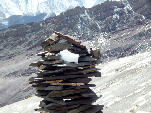
Normally I’d be able to find the route by following cairns.
Sadly, there were very, very few cairns. Mostly I made up my own route. The new snow got thicker and thicker.
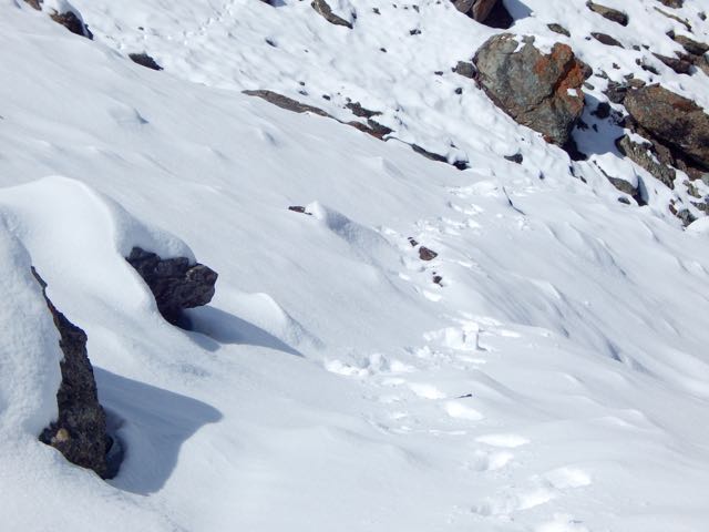
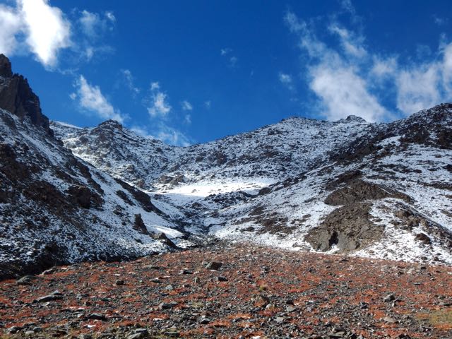
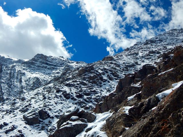
I was the second visitor here since the snow fell.
As the morning warmed-up, snow got softer. At the top there were sections of exposure.
The slope got steeper. Finally – pissed off – I dropped my pack and climbed up the slippery, frustrating slope without it.
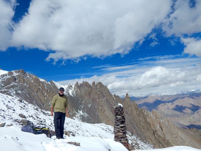
Happy. Happy. I finally saw the prayer flags of Stakspi La 5177m (16985ft).
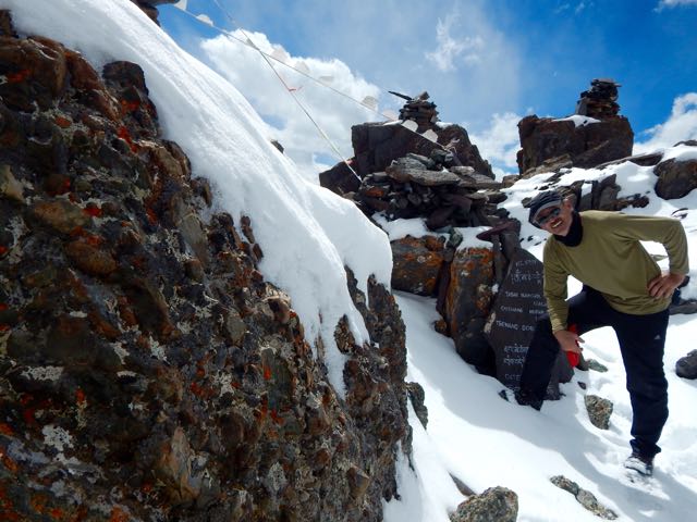
Thanks the Gods. The other side was an easy descent, in comparison. I’d feared it would be as snowy and slippery as the ascent side.
It was an 15 excited minutes down. 35 very motivated minutes back up with the pack. (The alternative – having to retreat on that soft snow could have been disastrous.)
Even better, the downhill was a soft scree slope. Fun. And very easy on the knees and feet.

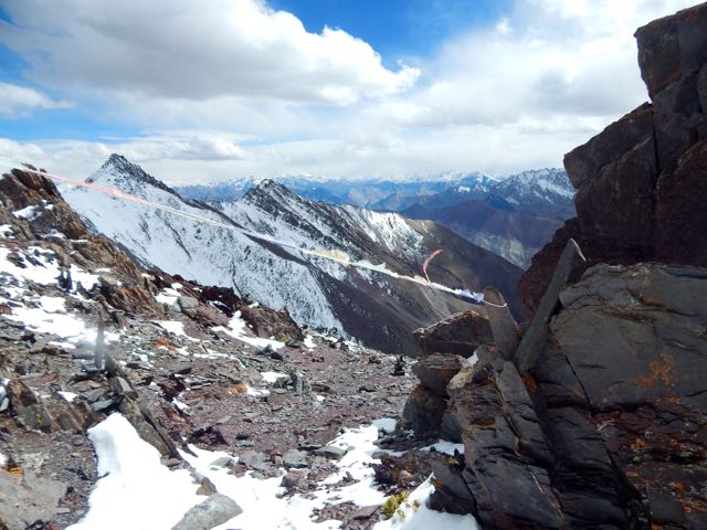
Very quickly I was at the valley bottom looking back at the Pass.
Already I’d concluded to NOT recommend this route on my hiking site. It’s far too dangerous. And it was obvious that very few people ever cross it.
I’d not taken the time to melt snow so had very little water left at this point.
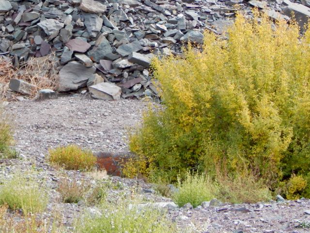
I could see small springs up high on the slopes, but was watching closely for the start of water in the main valley. And for good camp spots. I was exhausted.
I spotted one possibility.
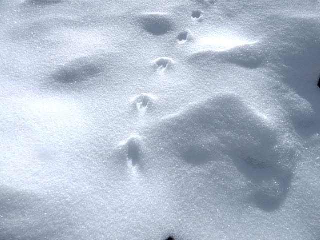
Then 2 snow leopards resting next door! There may be as few as 7000 left in the wild.
One took flight instantly. And was gone.
The other stayed. And stared me down. I franticly fired up my camera into video mode.
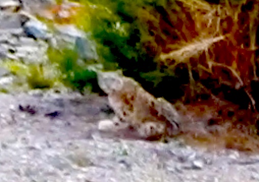
Eventually the second took off after the first, both disappearing into some scrub trees on the mountain slope.
Click PLAY or watch the video on YouTube.
I hung around for another 30 minutes, hoping to see them again. But I believe both stayed in the trees motionless. Watching me.
Needless to say, I didn’t camp there. I moved on down the valley.
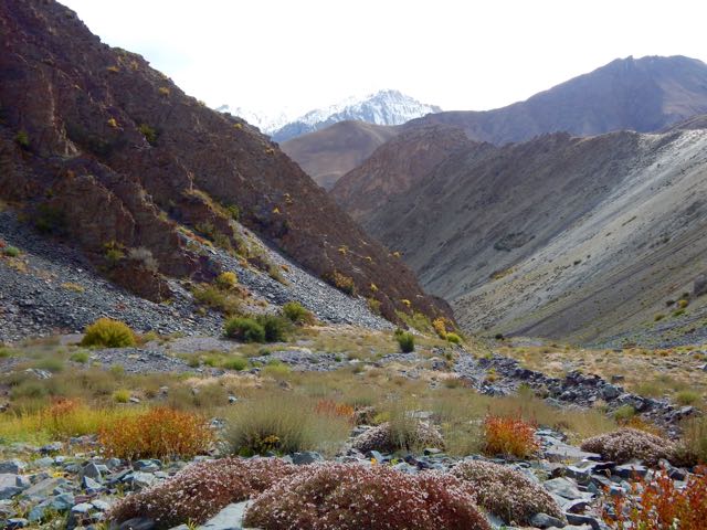
About 15 minutes later I found out why the snow leopards were so close to a human trail. They were on the hunt. This is their favourite prey – Blue Sheep.
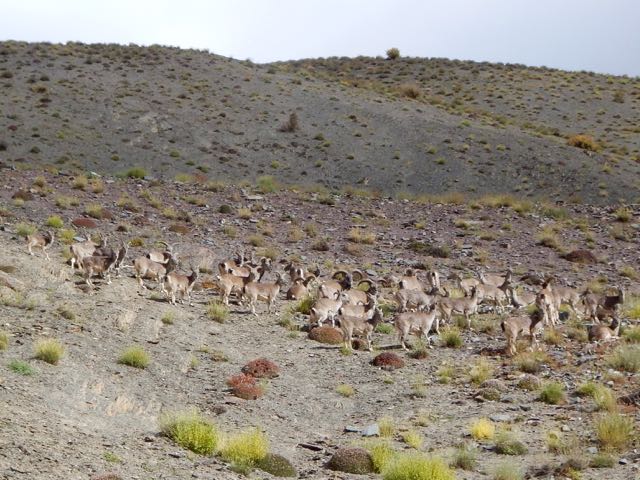
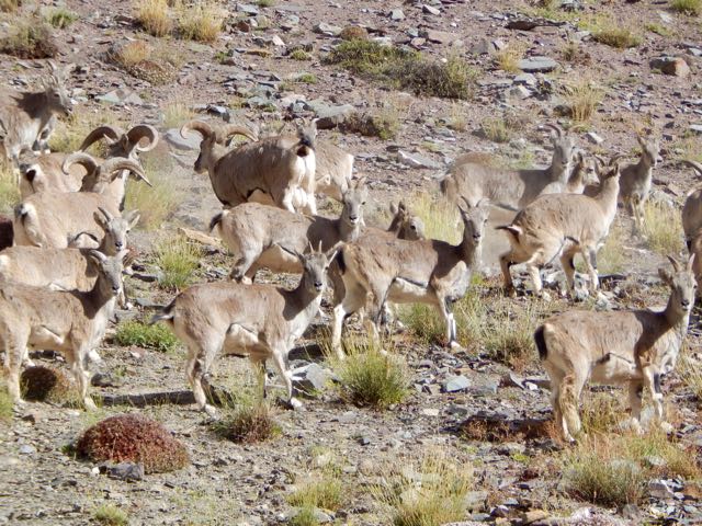
Why were these sheep so far from the protection of a rocky wall? I could only guess they’d come down for an evening drink of water.
Not much further down I found a protected, hidden spot by the finally running water. And crashed early.
It had been a rough day.
But seeing snow leopards definitely made up for my suffering on the ascent. The Snow Leopard (1978) by Peter Matthiessen is one of my favourite books. In it George Schaller and Matthiessen search for Himalayan blue sheep and Snow Leopard. Schaller eventually spots a snow leopard, but Matthiessen does not.
See all the high resolution photos from this day.
day 0 | day 1 | day 2 | day 3 | not recommended
by site editor Rick McCharles
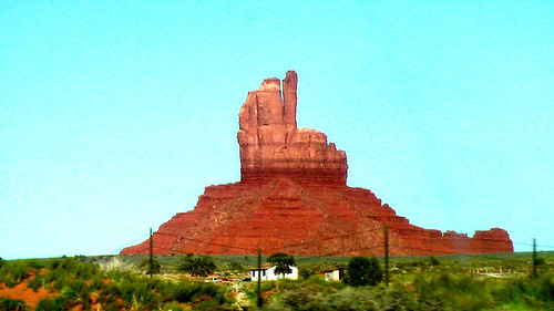
Am I just being defensive, or is this desert monument flipping me the bird?
Amanda Zeisset of Adventure Junkies posted a good list for beginners:
4. Every Time I’ve Tried Hiking I End Up Getting Blisters, How Do I Prevent Them?
14. What’s The Best Way To Treat Water?
17. I’m Out Of Shape & Not Fit Enough To Hike For Long Hours, Where Should I Start?
19. None Of My Friends Are Outdoorsy, How Do I Find People To Go Hiking With?
HOW TO GET INTO HIKING – THE 19 MOST COMMON QUESTIONS ANSWERED
Click through to see them all. With answers. 🙂
Leave a comment on that site if you’ve an opinion.

trip report by site editor Rick McCharles
day 1 | 2 | 3 | 4 | Sunshine Coast Trail information page
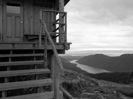
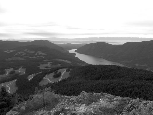
… the Tin Hat hut is an epic 360-degree mountain-top lookout that provides the quintessential view of the rugged mountains, valleys, and lakes that define the Powell River back country experience. This hut is a fully winterized cabin with pellet stove and is located in, arguably, one of the most beautiful spots on the Sunshine Coast Trail. Although it is a climb to get there, the experience is well worth the effort. Summitting this mountain will make you feel like you are, indeed, on top of the world!

It’s the highest elevation point and the biggest attraction of the SCT. I was impressed.

Still early morning, I chatted with Lisa from Calgary in the hut. Then dashed on back down the logging road to where I’d stashed my pack. A savvy hiker like myself doesn’t haul his gear up the mountain unless absolutely necessary. My guidebook hinted at an alternative SCT route that would be easier than the normal steep up and down. 🙂
I was soon lost. 😦
Views were terrific.
But I found myself on a maze of logging road switchbacks. If you don’t like clear cut, you might not like the Sunshine Coast Trail.
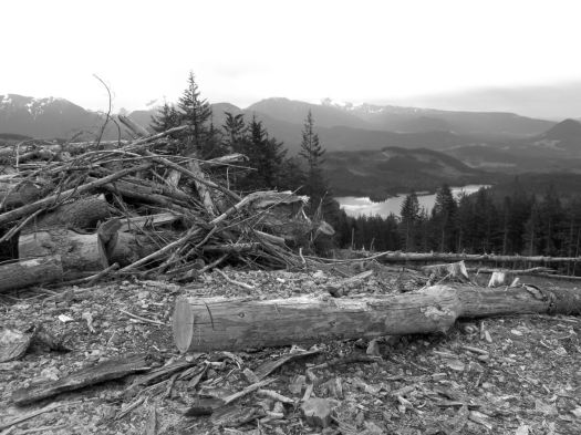
Here you can see an old growth survivor. Secondary growth. And the war zone that is clear cut logging.

Worse than forest devastation, the bugs.

By day 3 I wore my bug shirt non-stop. Flying pests are a very good argument why you should NOT hike the Sunshine Coast Trail. All of the other major B.C. coastal hikes have virtually no bugs
Eventually I found my way back to the SCT.

Past Lewis Lake.

On to Elk Lake.
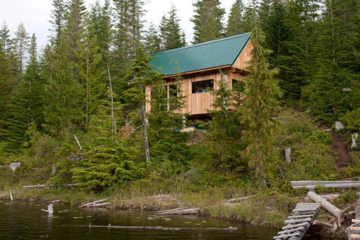
Mosquitos and I had the rustic hut to ourselves. Very tranquil.

Close to dark Alex from Ontario rushed in. Super happy to have made it to the hut in daylight. She’d come from Tin Hat Hut.
day 1 | 2 | 3 | 4 | Sunshine Coast Trail information page
trip report by site editor Rick McCharles
My camera had multiple problems on this trip. Photos are inconsistent, at best. 😦
day 1 | 2 | 3 | 4 | Sunshine Coast Trail information page
I caught the 10am ferry from Comox, Vancouver Island to Powell River.

My plan was to do the big central section. About 90km.

July 2015 we’d hired a boat to drop us at the northern trailhead Sarah Point. But quit the hike at Manzanita Hut after only 2 days. Driven out by mosquitos and wasps.
Could have taken a local bus to a trailhead, but instead walked from the ferry about 5km through town to Mowat Bay.
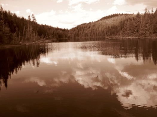
Here’s pretty Cranberry Lake in Powell River town.

Lovely day to start a hike. 🙂
Mowat Bay is close to sea level. It’s uphill from here.

Alder loves to overgrow the relatively little used trails. Blow downs are more frequent than are volunteers with chain saws. It’s rugged and challenging hiking. But pretty.

I ended up paying $5 to camp on Anthony Island. I slept in my tent.

A Danish couple took the hut.

They made dough from flour. Then wrapped it around a green branch to cook over the open fire. A Danish tradition, I understand. Burnt on the outside, raw on the inside. 🙂
day 1 | 2 | 3 | 4 | Sunshine Coast Trail information page
