Colorado Trail – Silverton to Durango – day 2

trip report by site editor Rick McCharles

day 1 | day 2 day 3 | day 4 | info page

Lime Creek – Straight Creek

Good morning. Blue sky. DSCN1975 DSCN1974Life is great in the Rockies when the weather is clear. DSCN1977 DSCN1976This marmot seemed to be questioning my good mood. What does he know?DSCN1979The wildflowers are fantastic in July. DSCN1992 DSCN1980Vistas wide open. Much of this hike is above the treeline. DSCN1983Clear mountain streams burble. DSCN1988There’s a little bit of snow left on north facing slopes. But not much. DSCN1990These ladies had an ideal campsite under the full moon. They were hiking about 10 miles / day. No rush. DSCN1991I was one happy hiker, myself. DSCN1994I snacked on raisin min-bagels and extra sharp cheddar cheese. DSCN1998Lovin’ it. DSCN2000 DSCN2014Here’s the weirdest geological anomaly.

Lizard Head Peak.
Lizard Head Peak.

On the downside you must share this paradise with car campers.
DSCN2026One group couldn’t be bothered to drive out their trash. 😦
DSCN2025Horseback travellers are cool, though. DSCN2033 DSCN2036As usual, the skies darkened in the afternoon. DSCN2048I wanted to cross Blackhawk Pass before stopping for the day. DSCN2055Here it is … I thought at the time. DSCN2054Nope. The real Blackhawk Pass (11,985ft) was far, far more challenging. I wasn’t sure I’d actually make it before the weather closed on me.

photo by Scott Morris

DSCN2058When I finally crossed and found water, there was no campsite. I went off-trail to the creek and set up my tent on the upslope side of a large tree, one of the few possible places to set up on a steep slope. DSCN2059It was fairly flat … after I propped up one corner on rocks. DSCN2060more high resolution photos of day 2

day 1 | day 2 day 3 | day 4 | info page

Colorado Trail – Silverton to Durango – day 1

trip report by site editor Rick McCharles

day 1 | day 2 day 3 | day 4 | info page

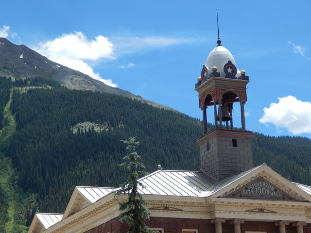
Durango – Silverton – Molas Pass – Lime Creek

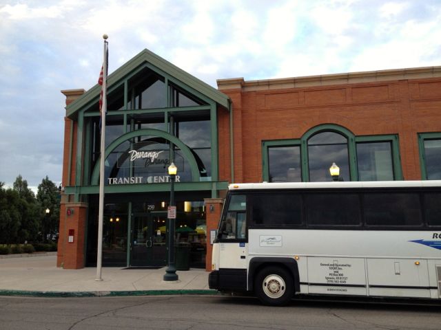
Arrived Durango, Colorado (pop. 18,000) by Roadrunner, the only long distance bus in and out of town. My plan was to take the train to Silverton. Hike back.

durangomap
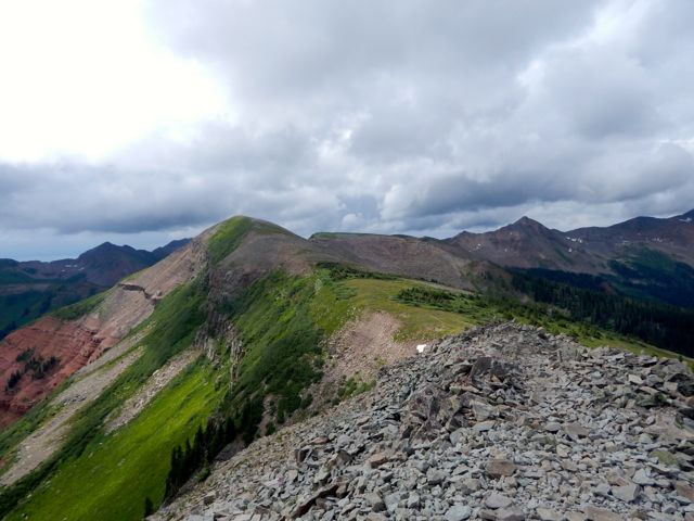
Many had recommended the very LAST section of the 500 mile Colorado Trail – the San Juan’s – as the best part. 🙂

An excellent hostel having closed a couple of years ago, the cheapest room I could find was US$120. (This tourist trap is expensive during high season.)

Therefore I would sleep rough.

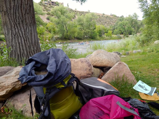
I found an excellent campsite hidden along the edge of the river in a Park currently under construction. Slept well in my tent.

I was using McDonald’s WiFi by 6am next morning.

DSCN1897
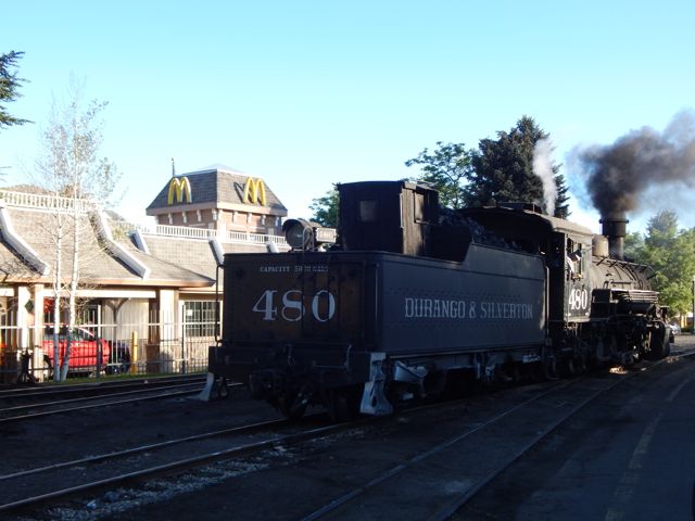
The ticket office for the Silverton train opened at 7am. Though officially “full”, one of the ticket officers managed to squeeze me on to the 8am train.

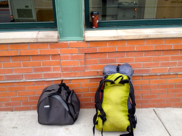
Problem. I had planned on taking the 9:30am train. Where would I store the gear I didn’t want to carry on the hike? In the 20min I had available before boarding?

No lockers at the train station. No lockers at the transit station. 😦

I ended up stashing a black garbage bag in bushes adjacent to the nearest grocery store. Hidden in plain sight in the Albertson’s parking lot.

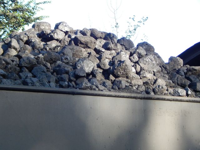
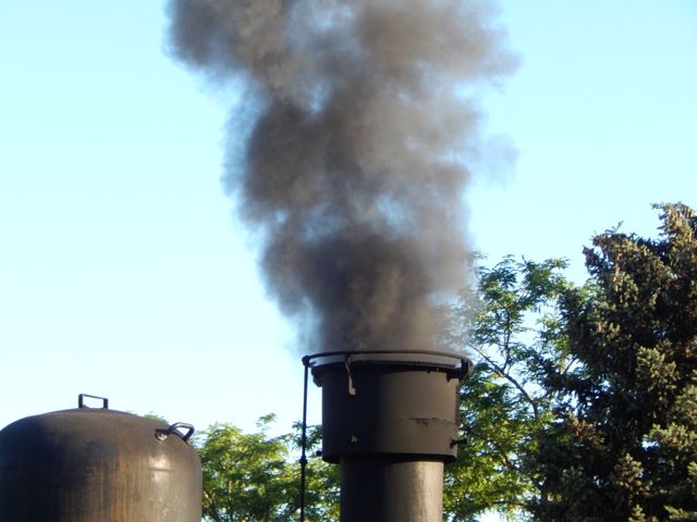
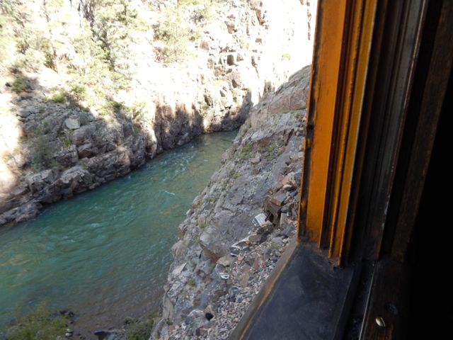
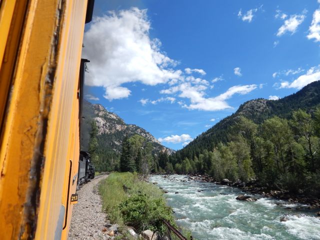
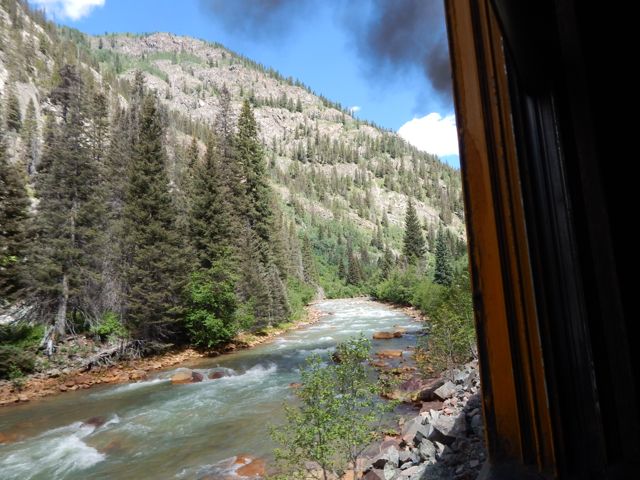
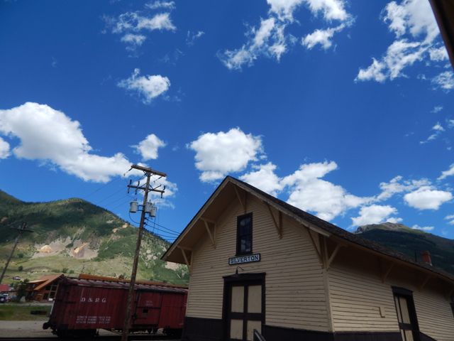
The Durango & Silverton Narrow Gauge Railroad …  operates 45.2 miles (72.7 km) of track between Durango and Silverton …

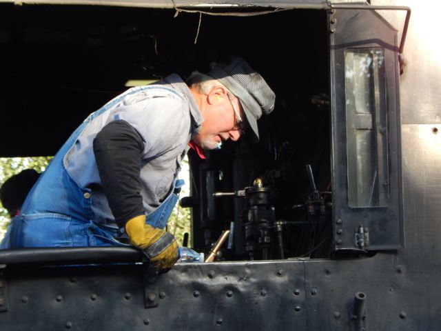
The steam-powered locomotives used today on the Durango & Silverton Narrow Gauge Railroad were built during the 1920s. …

DSCN1898 DSCN1899 DSCN1900
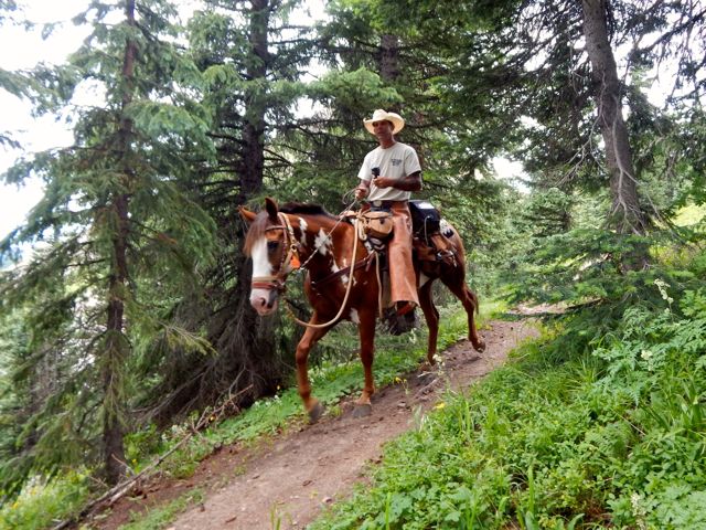
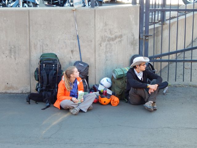
Plenty of hikers use the train to get up into the San Juan’s.DSCN1904One way scheduled trains take 3½ hours …

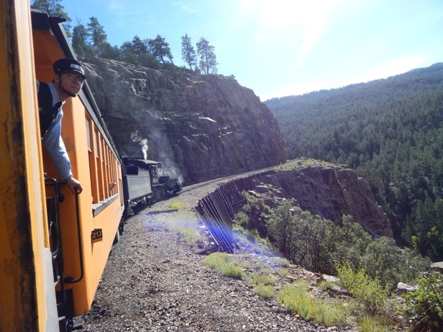
Elk Park is the last siding, wye, and flagstop before Silverton. Not as popular as Needleton for hikers, Elk Park is where the railroad crosses the Colorado Trail …

hikers Needleton

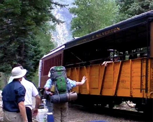
I stayed on the train at both Needleton and Elk Park. Rode it all the way to Silverton.

DSCN1905 DSCN1910 DSCN1915 DSCN1927 DSCN1930 DSCN1931
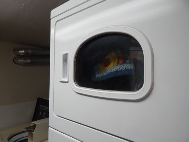
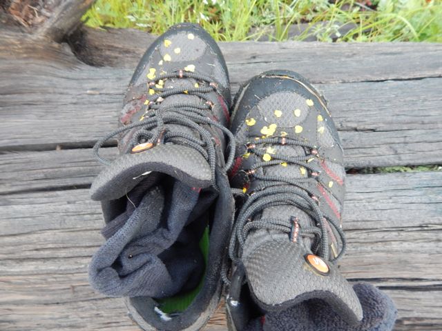
One essential task left – laundry.

The campground is happy to have hikers stop by for a wash and dry. (Or a $7 shower.)

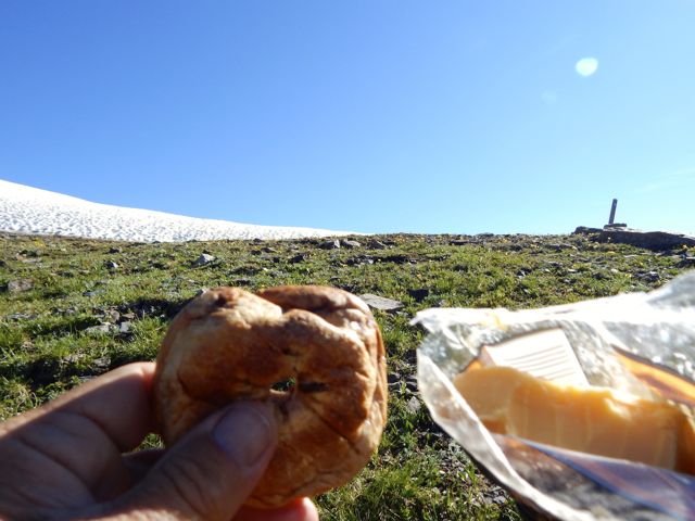
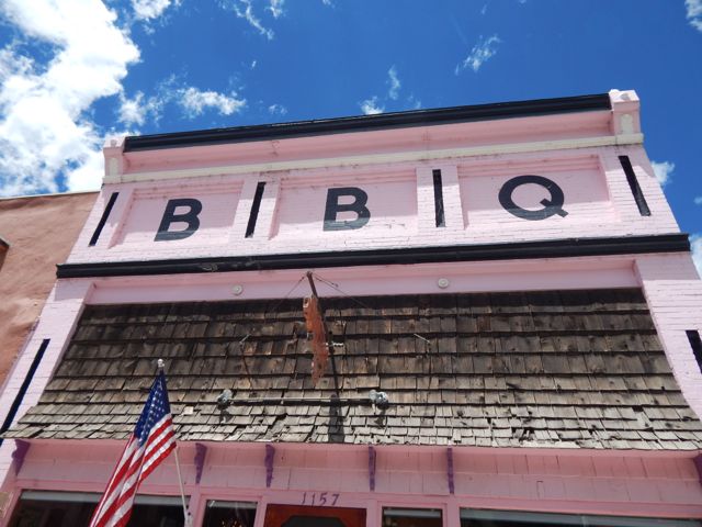
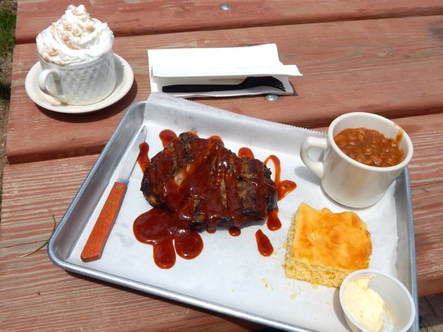
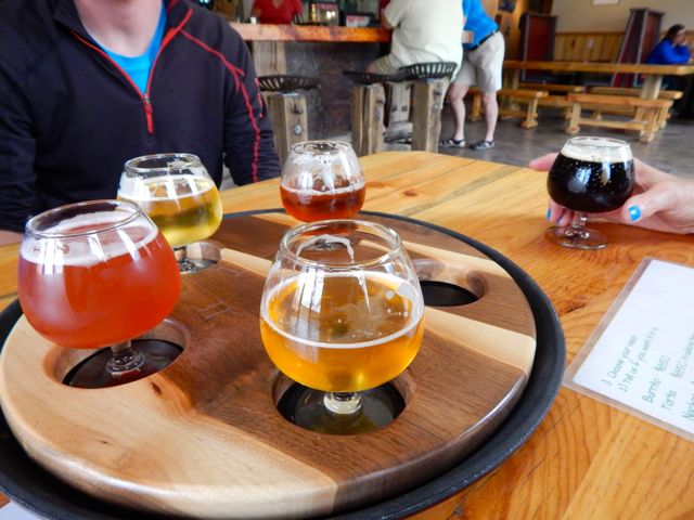
For lunch I hit the southern Barbecue joint – Thee Pits Again.DSCN1933Pork ribs, baked beans, cornbread … and very British bread pudding for desert. My last restaurant meal before hitting the trail.DSCN1936I wandered the town while my togs were drying. DSCN1944DSCN1941 DSCN1943
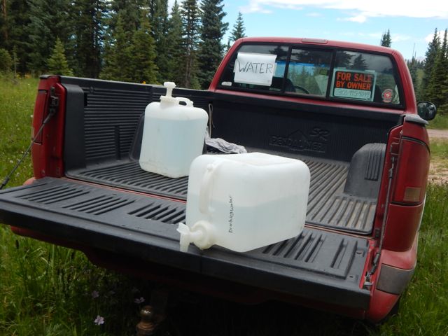
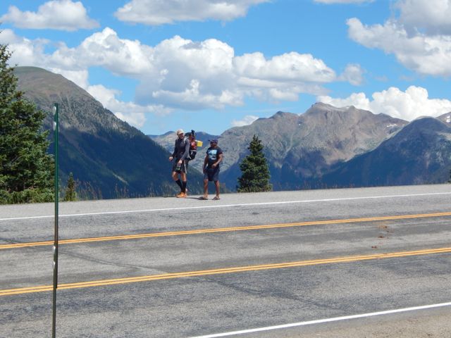
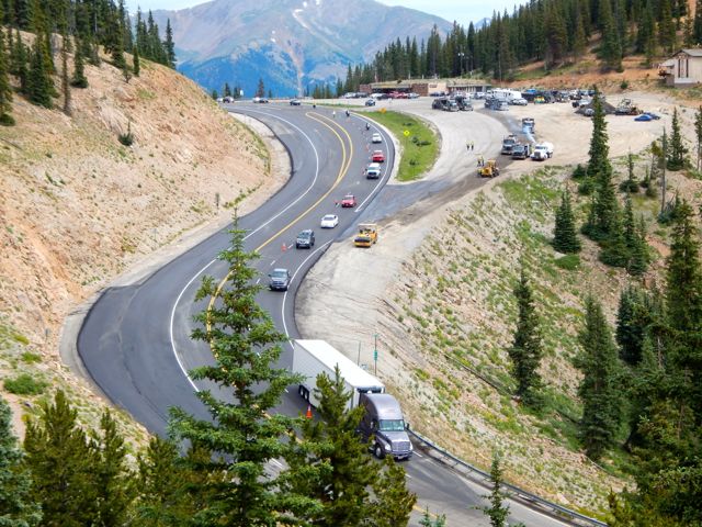
Getting out of Silverton was another blunder. I started hitchhiking … in the wrong direction. A local gent drove me up to the correct highway and to the best place to hitch. I had a ride within minutes. Hikers are hitching back and forth the 7 miles to Molas Pass all the time.

Arriving at the pass I met a European who was nearly finished the 500 mile Colorado Trail. But he needed to resupply in Silverton, staying at the hostel there one night.  Oddly, he got a 7 mile ride with this truck driver. Some scam was in the works, I suspected. DSCN1953 DSCN1954Actually, Silverton has no grocery store. But does have a gear shop (fuel) and plenty of restaurants.

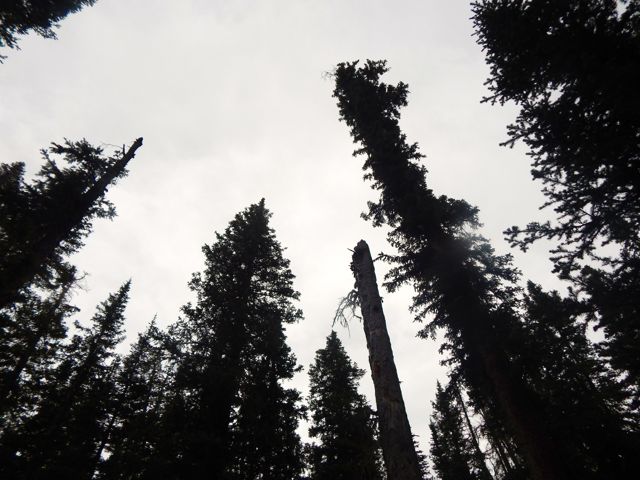
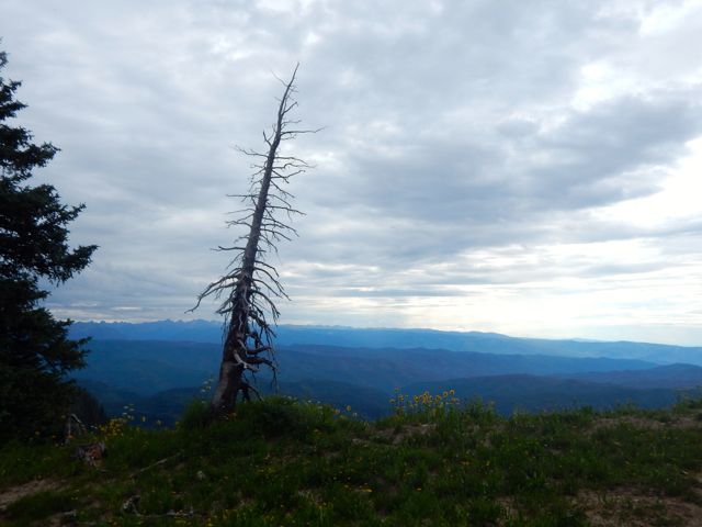
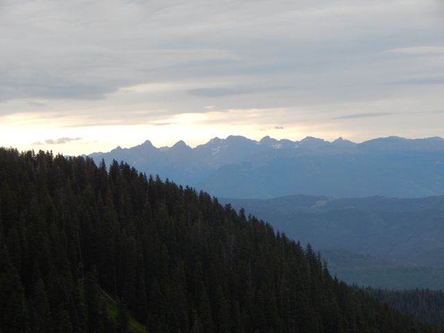
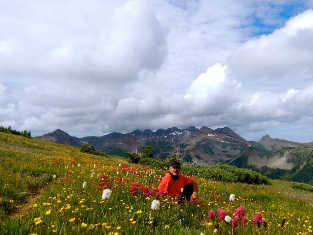
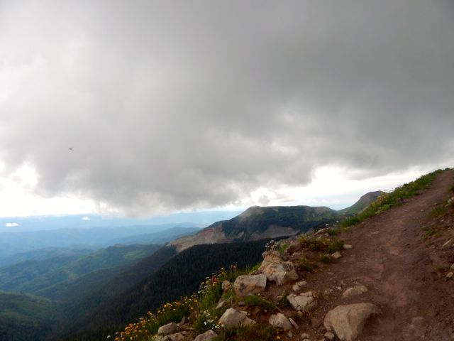
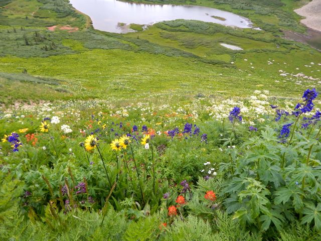
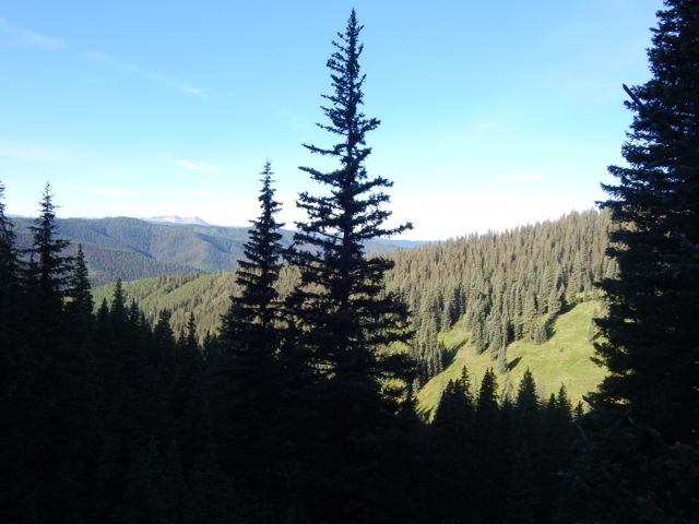
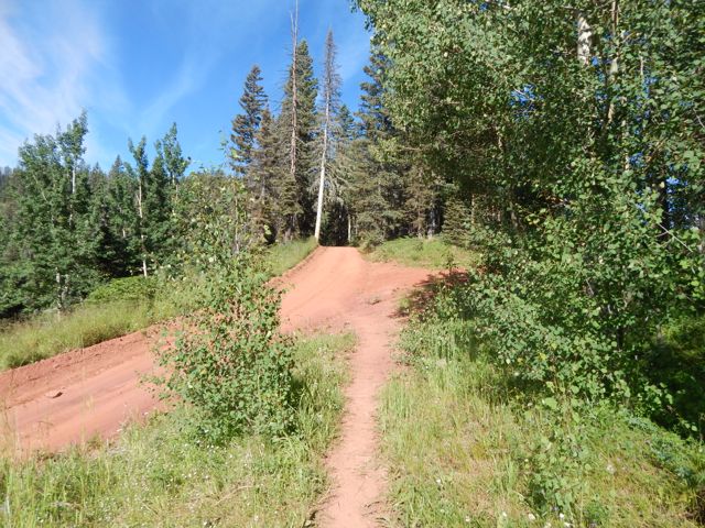
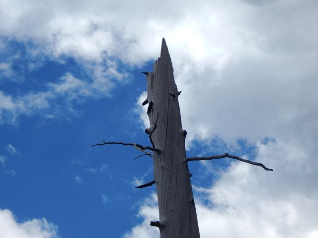
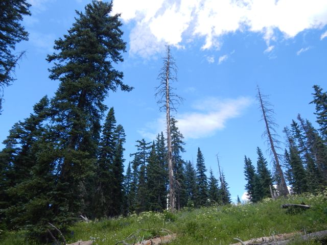
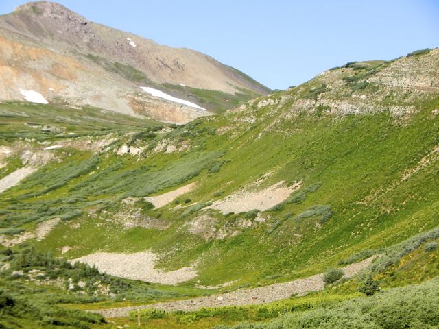
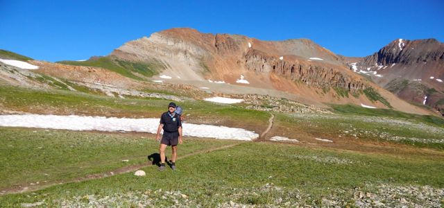
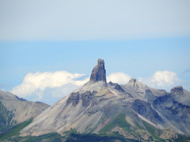
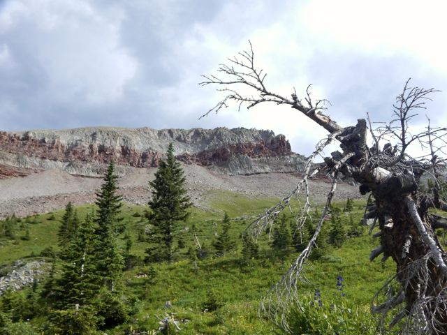
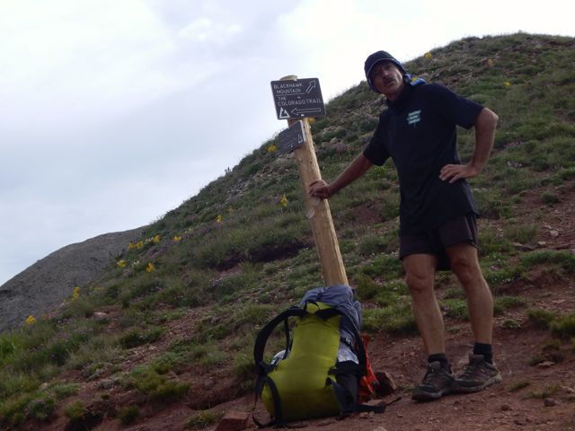
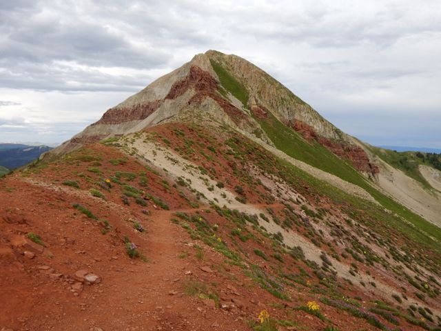
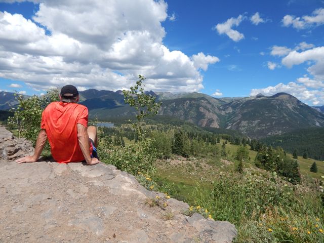
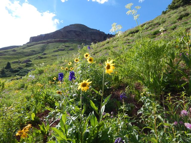
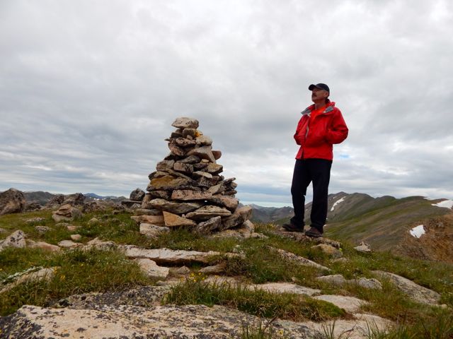
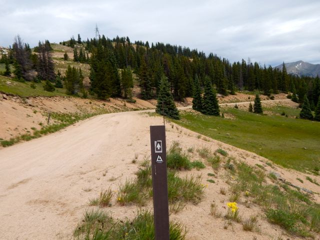
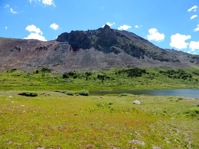
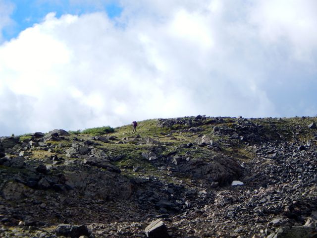
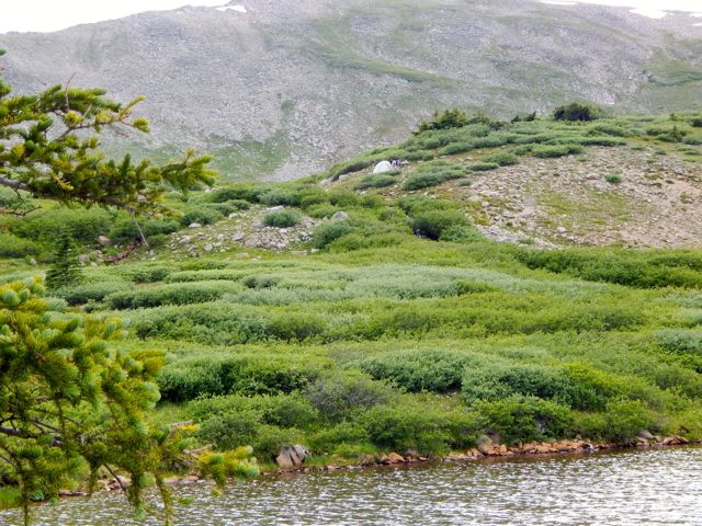
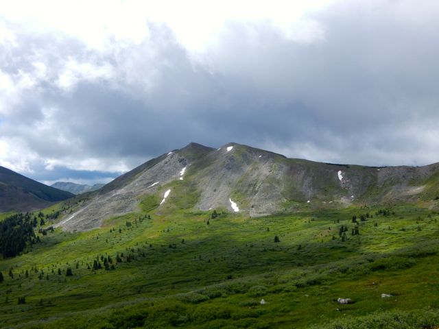
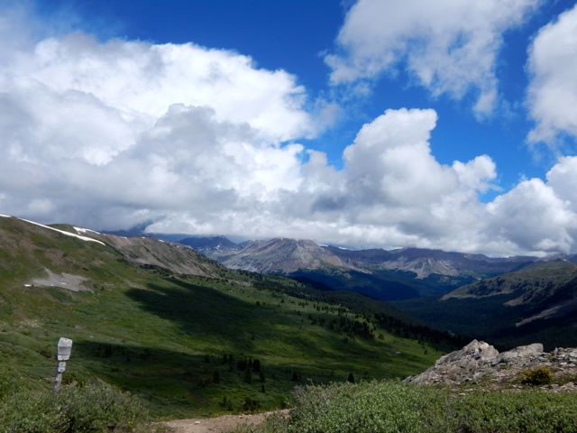
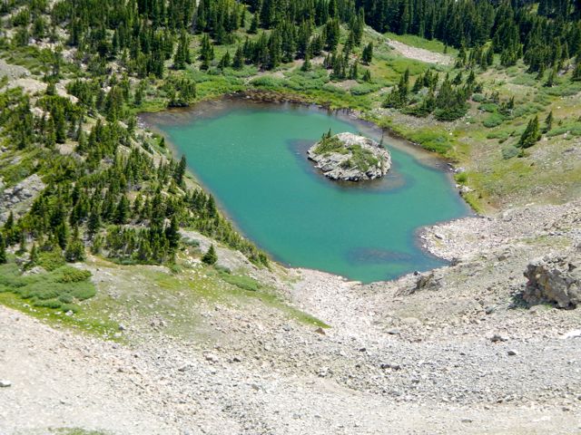
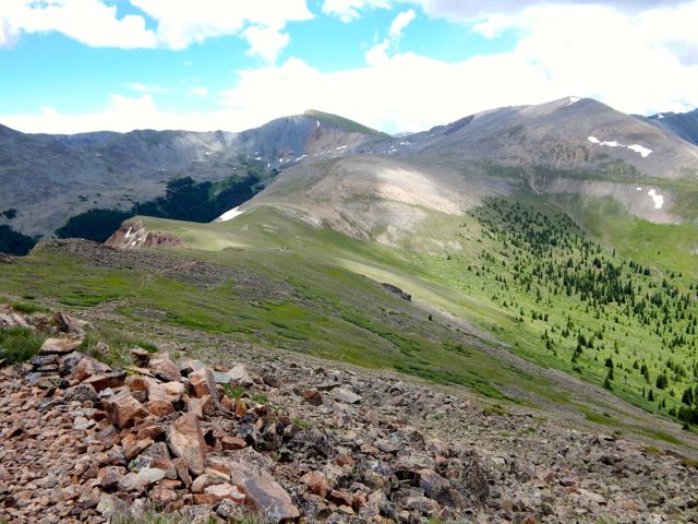
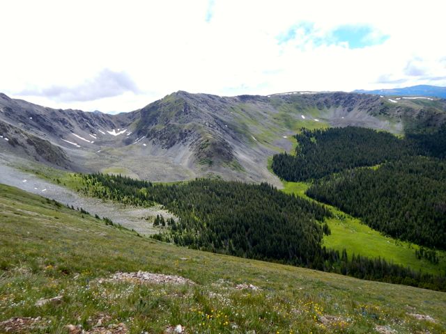
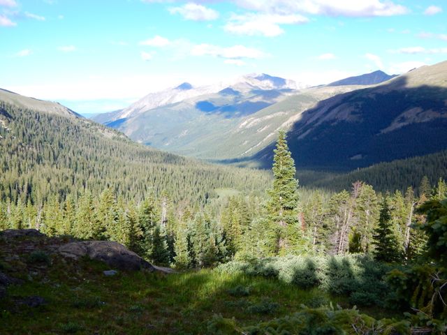
The vista looked great from Molas. Here I’m looking back at the section prior the one I was about to do.DSCN1949  Across the highway. Off and up.DSCN1956
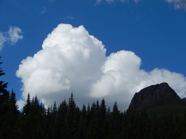
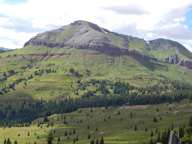
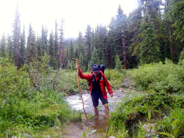
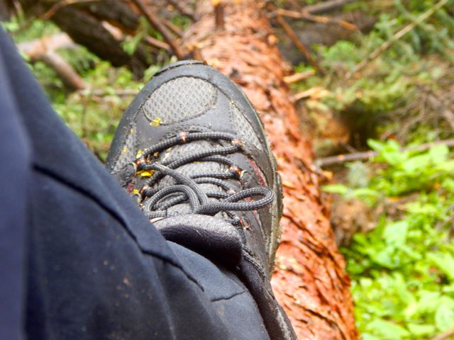
Gorgeous scenery. Though my pack felt heavy. I should have left more STUFF hidden in a garbage bag.DSCN1959DSCN1965
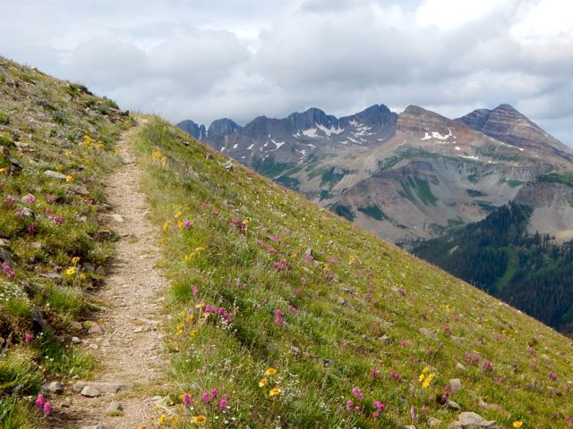
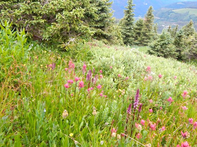
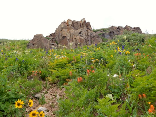
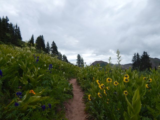
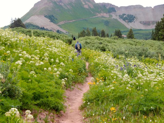
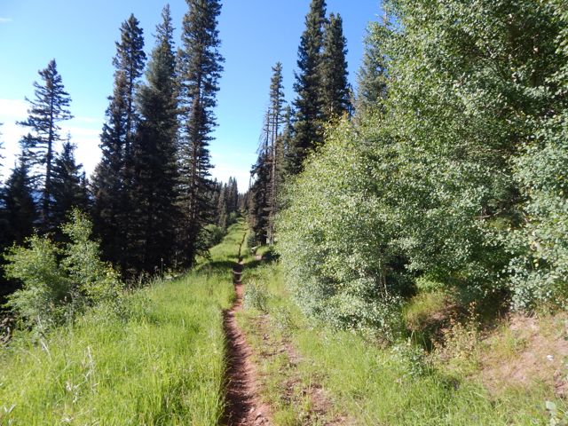
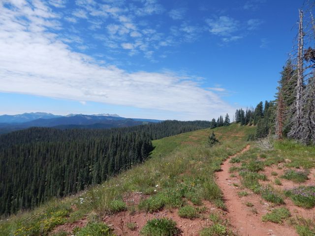
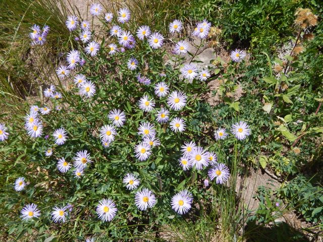
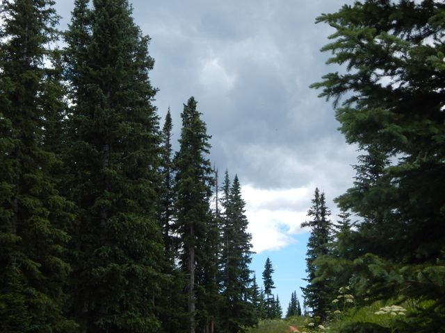
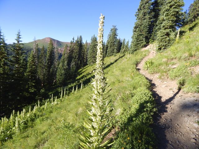
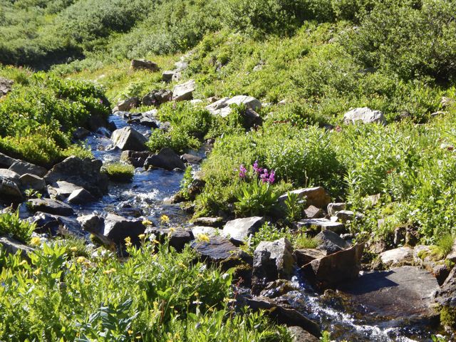
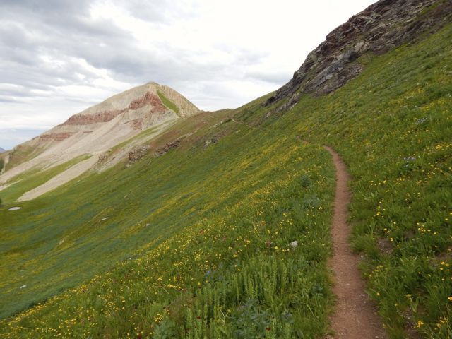
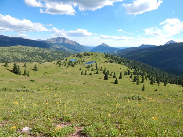
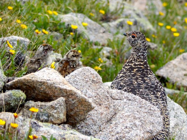
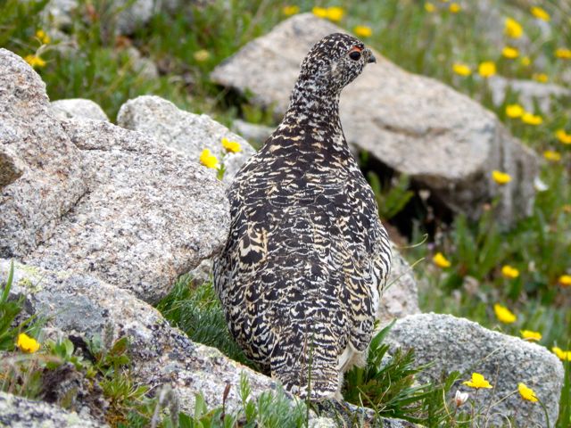
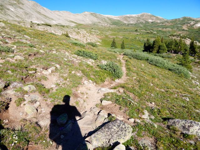
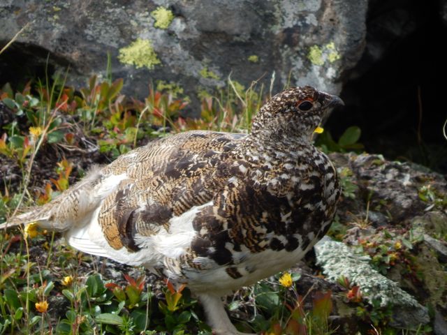
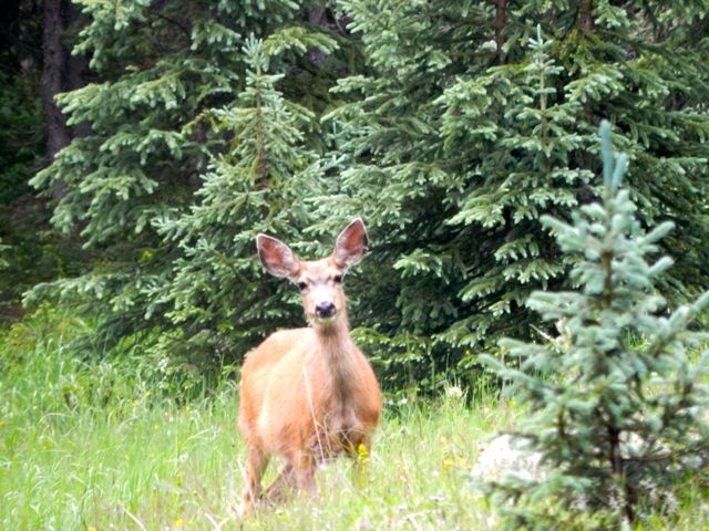
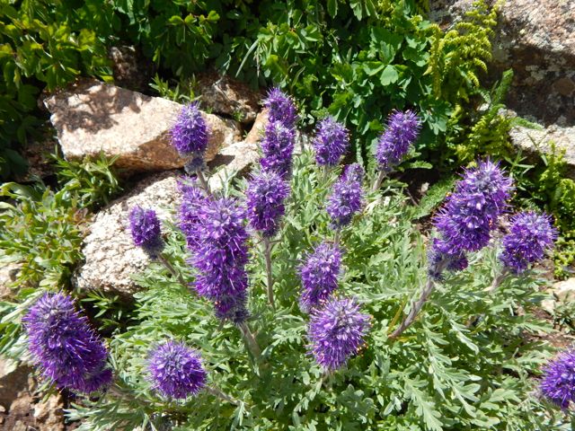
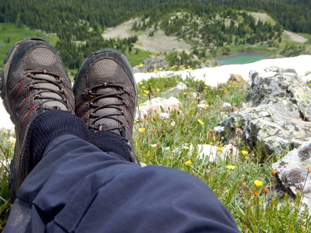
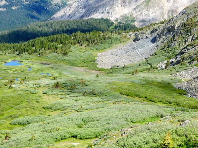
The wild flowers are shoulder high in places.DSCN1963
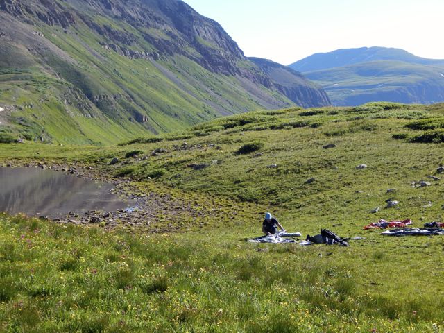
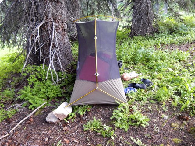
I set up in a lovely spot.DSCN1968DSCN1970
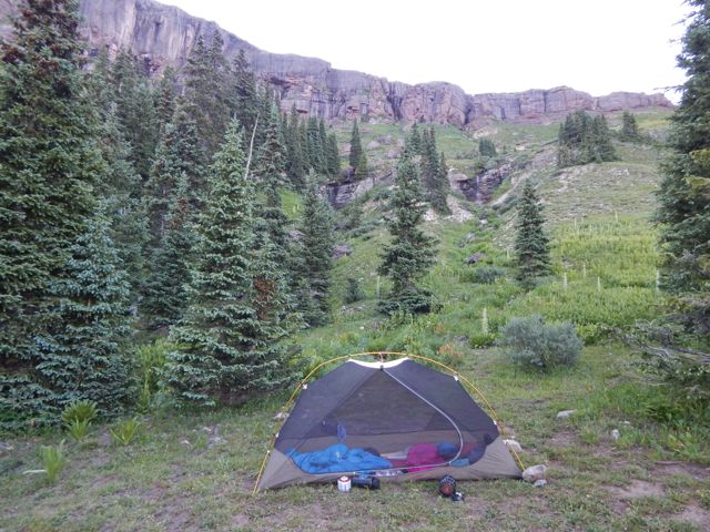
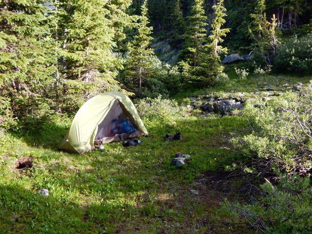
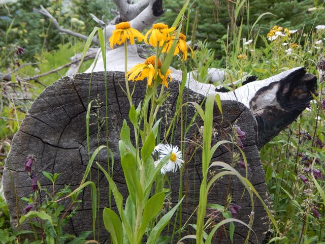
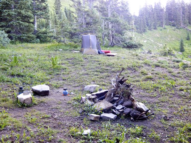
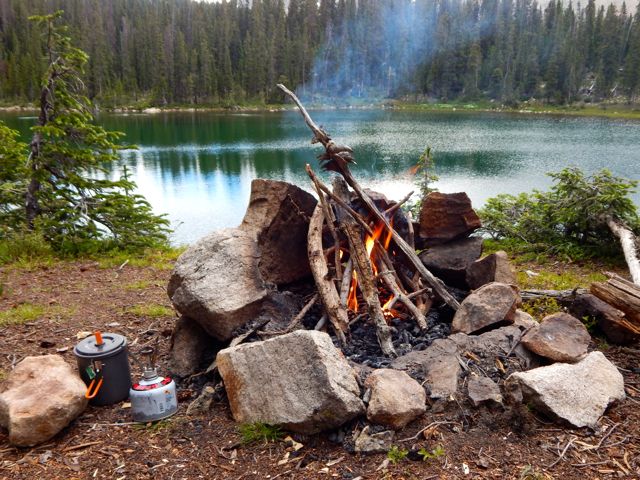
Failed to get the campfire going this time. (Tried to skimp on kindling.)

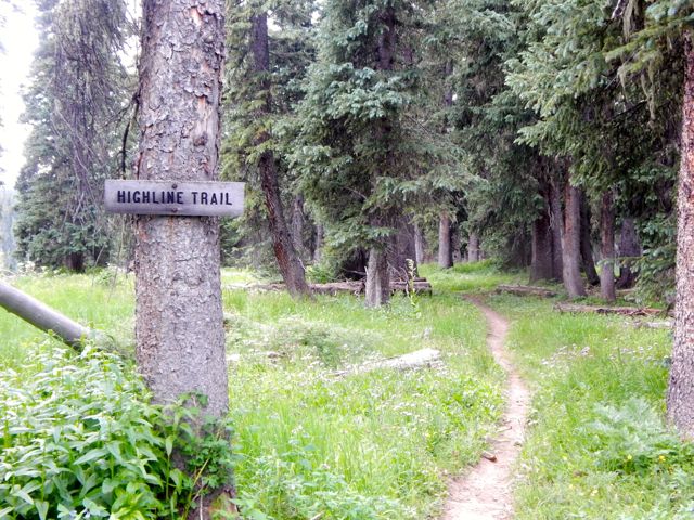
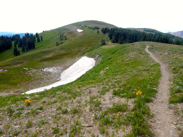
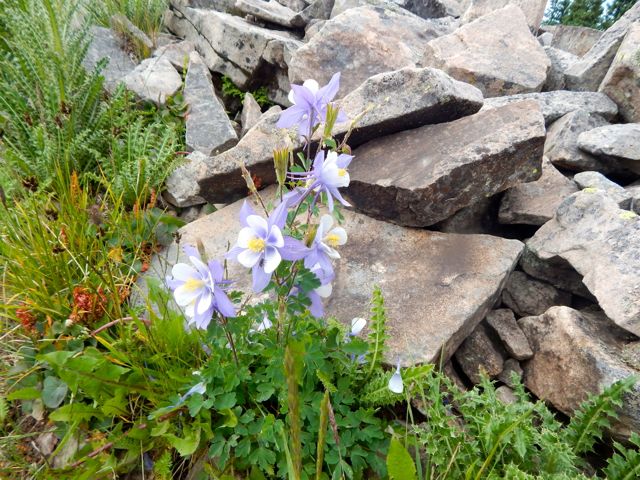
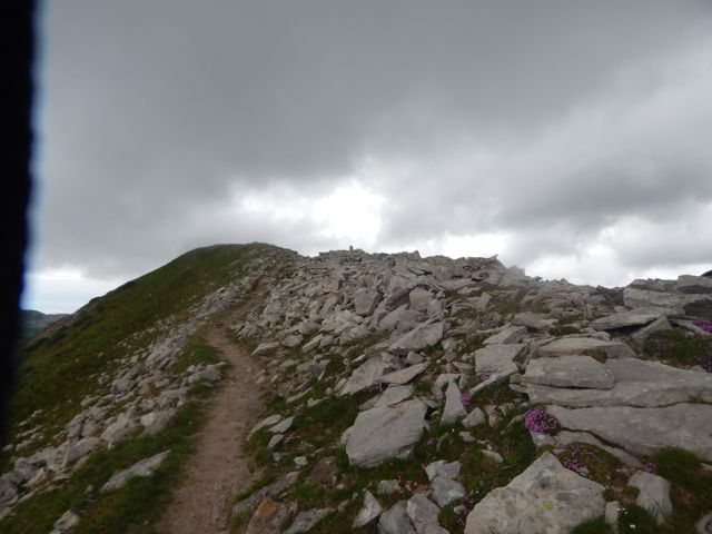
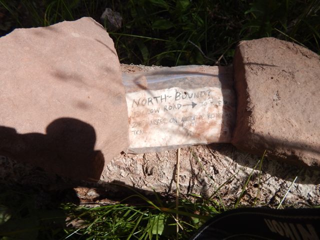
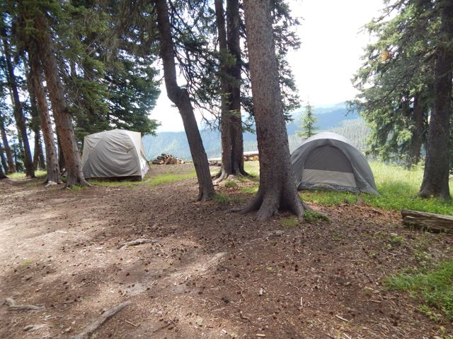
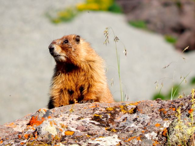
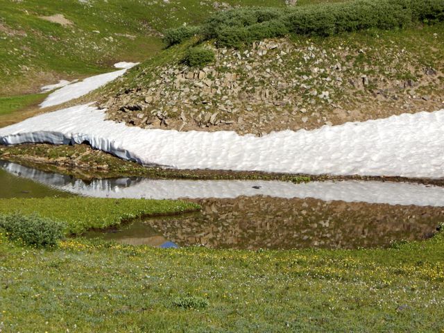
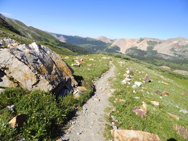
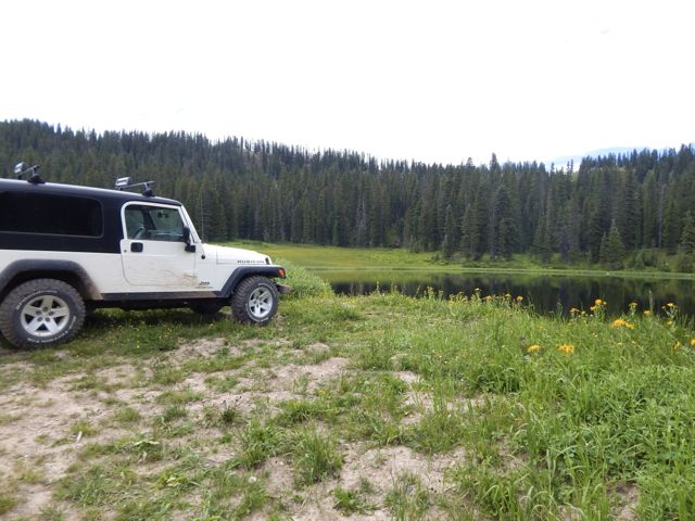
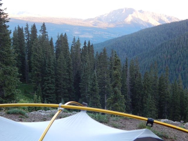
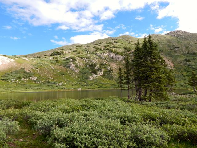
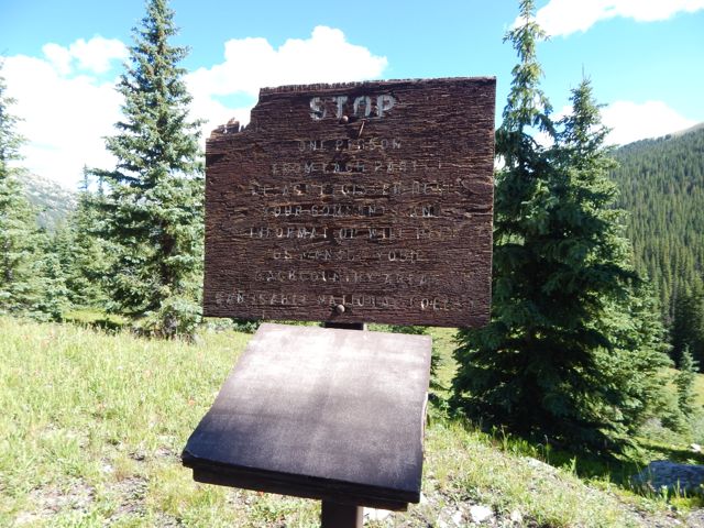
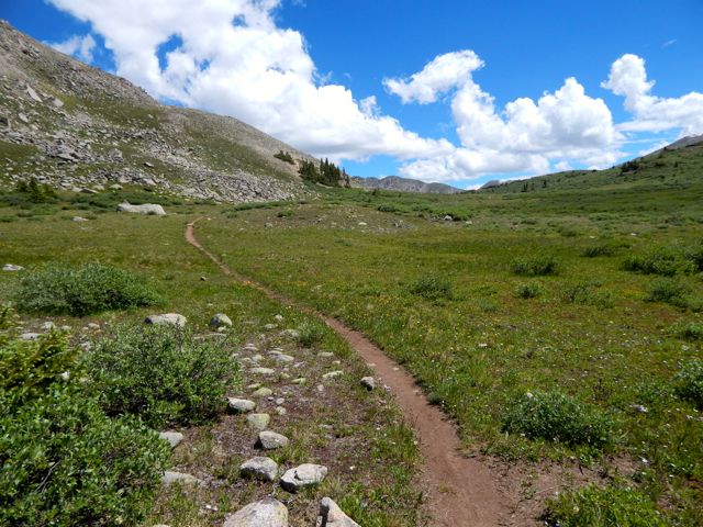
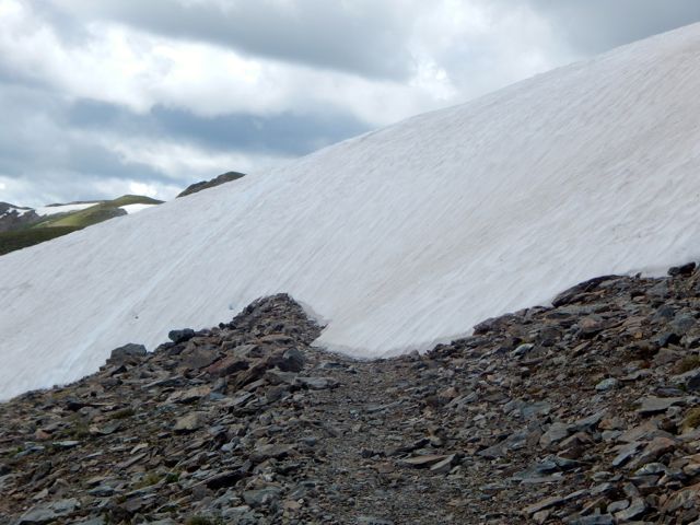
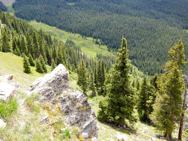
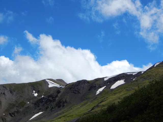
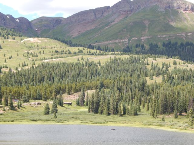
The Colorado Trail is mostly dispersed camping. Put up your tent anywhere you like.
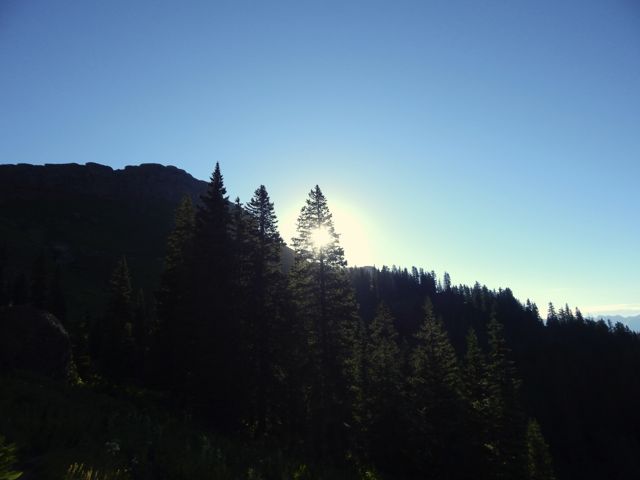
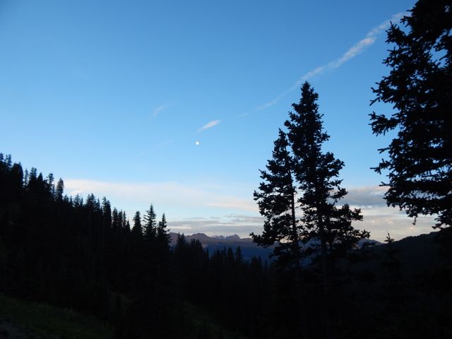
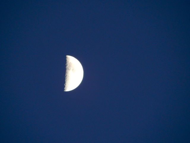
Clear skies. Nearly a full moon.DSCN1967more high resolution photos of day 1

day 1 | day 2 day 3 | day 4 | info page

Colorado Trail – Collegiate West day 6

trip report by besthike editor Rick McCharles

day 1 | day 2 | day 3 | day 4 | day 5 | day 6 | info page

Hunt Lake to Monarch Pass

I was up at first light. But everyone else heading south was already gone. DSCN1824 DSCN1829 DSCN1827I enjoyed a pot of coffee, as usual. DSCN1831It was up, up and away from pretty (but buggy) Hunt Lake. DSCN1834For some reason the steep climb to the only major pass felt easy today. Perhaps I’m getting used to this.DSCN1836 DSCN1837 DSCN1838The map showed a long, leisurely walk out along the continental divide. DSCN1839 DSCN1841More ptarmigan. These 4 chicks were very young. DSCN1857 DSCN1849 DSCN1845The end is near. Electricity. DSCN1862Traversing the roads atop of Monarch Ski Resort was a bit confusing. There are few trail signs.DSCN1865 DSCN1868 DSCN1872Here’s the finish. Paved paradise, put up a parking lot. DSCN1875I caught a lift with a trail angel from Buena Vista. In thanks – and celebration – I treated for beer samplers and pork tacos at Elevation brewery. DSCN1878She dropped me at BV tourist information. I hoped to find a bus headed towards Aspen. Bad news: Though public transit is fantastic on the other side of Independence Pass, there are no buses in the poorer Arkansas River valley. 😦

Though I hate hitchhiking, a paddling guide drove me up to the Twin Lakes turnoff. … Then a fascinating world travelernext skiing in Chile before settling down to research Dahl Sheep in Alaskadrove me the rest of the way to Aspen.

From there, in the pouring rain, I caught a $6 bus back to surprise my friends in Carbondale.

Done.

more full resolution photos

day 1 | day 2 | day 3 | day 4 | day 5 | day 6 | info page

___

If you are looking for a great 80 miles of hiking on the Continental Divide Trail, the new Colorado Trail Collegiate West is a terrific option. 🙂


Colorado Trail – Collegiate West day 5

trip report by besthike editor Rick McCharles

day 1 | day 2 | day 3 | day 4 | day 5 | day 6 | info page

Tunnel Lake to Hunt Lake

I made it through the night without putting the fly on the tent!

DSCN1732UP – as usual – to the next pass. DSCN1735It looked imposing. DSCN1736On the other side are some buildings in Hancock. DSCN1740It was a relief, actually, to make better time walking an old rail line. DSCN1741Everyone loves the under regulation of hiking in Colorado. There are very few restrictive rules. One thing asked is that hikers register in log books as they pass by. Unfortunately each I passed was full. There were no pages left. Seems the system is broken. 😦DSCN1744In 2015 we still walked roads along the Arkansas River head waters en route to Hancock Lake. But volunteers were there in force building the trail which will soon run parallel to the roads. I was impressed with their enthusiasm. DSCN1754Roads – and historical artifacts – exist in unusual places due to mining. DSCN1752I was happy to reach this lovely spot.

Hancock Lake
Hancock Lake

I chatted with a  fisherman. He’d seen a herd of elk cross Chalk Creek Pass this very morning. DSCN1759I didn’t see the elk. But there were three moose at Upper Hancock. DSCN1760 DSCN1767Chalk Creek Pass was glorious. It’s a joy to get good weather up so high.DSCN1773 DSCN1774In the heat, marmots got lazy. DSCN1775 DSCN1791 I happened upon the empty Trail Crew camp. It inspired me to volunteer myself, one day. 🙂DSCN1796 DSCN1803Over the bridge. Up to Boss Lake. DSCN1798 DSCN1807I was keen. The weather was great. But an Austrian couple 3 weeks on the CDT convinced me I didn’t have time to make the final 9 miles so I set up at Hunt Lake. DSCN1810It turned out to be the prettiest campsite of my week. DSCN1812 DSCN1817 DSCN1814 DSCN1821more full resolution photos

day 1 | day 2 | day 3 | day 4 | day 5 | day 6 | info page

Colorado Trail – Collegiate West day 4

trip report by besthike editor Rick McCharles

day 1 | day 2 | day 3 | day 4 | day 5 | day 6 | info page

Mineral Basin to Tunnel Lake

Good morning from the sunny continental divide. 🙂

DSCN1634I hate starting with a steep climb. Steep climbs like this.
DSCN1637 DSCN1640A lady hiking the opposite direction spotted ptarmigan.
DSCN1643 DSCN1649I celebrated reaching this 12,824ft (3908m) pass. It should be a big deal. Yet this pass has no name, no sign. Not even a cairn.

DSCN1660It was windy, as usual. So I didn’t stay long. Down and down.
DSCN1666 DSCN1670 DSCN1671There are many different species of birds I can’t recognize. Woodpeckers are noisy in forested areas. Those I can identify. 🙂
DSCN1672Glorious.
DSCN1680 DSCN1687 DSCN1692 DSCN1696That’s Tincup Pass Road near St Elmo. ATVs were here in number.
DSCN1697I washed up in the creek.
DSCN1703Then took a siesta for an hour or so. DSCN1711The Tunnel Lake trail ascent more gentle than usual.DSCN1712DSCN1717

Tunnel Lake
Tunnel Lake

Wanting some shelter from (possible) lightning storm, I camped by the lake. Oddly there were almost no established tent sites. In the end I crammed my Hubba into this spot.DSCN1724Another couple set-up in a fairly lousy spot, I thought, up above. DSCN1723At dusk a hare came by to check me out. The first time I can recall any rabbit being curious about my tent.

more full resolution photos

day 1 | day 2 | day 3 | day 4 | day 5 | day 6 | info page

Colorado Trail – Collegiate West day 3

trip report by besthike editor Rick McCharles

day 1 | day 2 | day 3 | day 4 | day 5 | day 6 | info page

Texas Creek to Mineral Basin

Wet morning.

DSCN1534I finished my book – Dances with Marmots – a Kiwi’s memoir of hiking the PCT – and left it on the trail for anyone craving an amusing read.

DSCN1541This was the toughest creek crossing. Not bad. DSCN1544 DSCN1546Volunteers are working on this section of the Colorado Trail. I expect there will be a wood bridge here soon.

Despite the wet conditions, I was impressed with my Merrill shoes. No blisters.

DSCN1548This guy goes barefoot in the rain. DSCN1568Water was running high for July. It’s been a wet year.

I was worried, again, about lightning. Happily I’d see no more for the week.DSCN1558The weather improved as I climbed to Cottonwood Pass, a popular tourist stop that I’d visited my only other time in Colorado. DSCN1572I took the high trail approach. And the California couple passed me once again. I saw them climb into a car and drive away. They’d told me they didn’t have enough food to reach their next resupply. So needed to side trip to town for grub.

Cottonwood Pass
Cottonwood Pass

An Austrian couple (I learned later) left the trail here too – their tent and sleeping bags too soaked to continue. It’s a good escape route as many tourists are happy to rescue someone from the continental divide.

On the other side the trail was blocked by snow. Hikers were still detouring to bypass. DSCN1583Here begins my favourite section of the Collegiate West. DSCN1588Miles of continental divide ridge walk. DSCN1592 DSCN1597 DSCN1599 DSCN1600The weather continued to improve. One happy hiker.DSCN1602 DSCN1605 DSCN1608 DSCN1613 DSCN1624It had been a long, tough day, however. And I was happy to finally drop down to find a protected campsite.

DSCN1626I set up in a spot as out-of-the-wind as possible. DSCN1628No water. But good protection.

my dinner vista
my dinner vista

more full resolution photos

day 1 | day 2 | day 3 | day 4 | day 5 | day 6 | info page

Colorado Trail – Collegiate West day 2

trip report by besthike editor Rick McCharles

day 1 | day 2 | day 3 | day 4 | day 5 | day 6 | info page

Clear Creek to Texas Creek

I carried my food in an Ursack. Very convenient. The trees here are not ideal for hanging a bear bag.

DSCN1443After a pot of coffee , it was time to do my doodie. A job well done this day. You’d never guess what’s under that flat rock. 🙂

DSCN1442There are no formal campgrounds on Collegiate West. No pit toilets. It’s dispersed camping only.

DSCN1446As so often in the Rockies, you start in the trees and climb to another high pass.

DSCN1448Seems the Collegiate Wilderness has a welcome dog. 🙂 If you want to hike with your dog, Colorado is a great place. I saw many hiking dogs over the week.

DSCN1462These were the only pack lamas I saw. The guys told me they were very helpful. Very good natured.
DSCN1466Mud is a concern in the Colorado Rockies. The Sierras in California are a far dryer alternative.
DSCN1470But I was loving the high altitude scenery.
DSCN1455 DSCN1482 DSCN1473It’s heaven up here when the sun shines.
DSCN1479DSCN1483 DSCN1484Crossing the pass. Again a little snow.

DSCN1491DSCN1498Wow.

DSCN1493 DSCN1505It’s difficult to capture the splendor in a photo.

I dropped down to Texas Creek.

DSCN1507Nice weather. If you are a beaver.

DSCN1525I probably should have stopped in a de facto campground when you first reach the creek. It’s an open field with road access.

Instead I pushed on ending up … here.

DSCN1528It was wet.

DSCN1529Yet … a glorious hiking day, all in all. 🙂

DSCN1449more full resolution photos

day 1 | day 2 | day 3 | day 4 | day 5 | day 6 | info page

Colorado Trail – Collegiate West day 1

trip report by besthike editor Rick McCharles

day 1 | day 2 | day 3 | day 4 | day 5 | day 6 | info page

Twin Lakes to Clear Creek

Absurdly unprepared. But a superb day anyway. 🙂

I had trouble deciding where to hike in Colorado. There are simply too many great options.

The new Collegiate Loop sounded like an excellent and challenging possibility:

… In 2012 the Colorado Trail added an 80 mile stretch of trail that serves as an alternate route around the Collegiate Peaks. The new route, called the Collegiate West, follows the continental divide at much higher elevations. The Collegiate West is above tree line much of the time, which makes for rugged hiking and incredible views. …

The Collegiate East is part of the traditional Colorado Trail that stretches 500 miles from Denver to Durango. The 160-mile Collegiate Peaks backpacking loop is formed by hiking both the Eastern and Western routes of this section.

Clever Hiker

Collegiate LoopWe dropped my friend Betsy at a mountain running race near Aspen. Husband Brion drove me on to Twin Lakes, recommended as one of the best places to start the Collegiate Loop. I was hoping to get information at the General Store.

DSCN1385They sold me a new map covering the entire Collegiate Loop, but the shop-keep had not heard of the new dedicated guidebook.

Historically they’ve considered Collegiate West the Continental Divide Trail, Collegiate East the Colorado Trail.  It’s going to take some years before locals start considering the western side part of the Colorado Trail.

I was excited to get this adventure started. Ready or not.

DSCN1387Brion and Julius started up the trail with me around 11am. Thanks for the send off.

DSCN1393Just after posing for this shot, I knocked my pack into that creek. 😦
DSCN1395 DSCN1397Happily almost everything inside is kept in waterproof bags.
DSCN1398It’s a steep climb to reach the treeline en route to Hope Pass, the highest point on the Collegiate Loop 12,500ft (3810m).

I didn’t suffer much from altitude despite having only one acclimatization hike since flying in from sea level. Smarter hikers than myself would have finished crossing Hope Pass rather than starting here.

On the downside, it was raining.

DSCN1401I took shelter under those far trees with an older couple from California who were section hiking, year by year, Canada to Mexico on the Continental Divide Trail. Like me, this was their first day. They’d also started at Twin Lakes. The twosome and their dog planned to hike to the New Mexico border this summer.

DSCN1402I was embarrassed to admit to them I didn’t know whether I was hiking north or south. That’s how unprepared I was. I hadn’t yet opened my new map.

They’d hiked Collegiate East the previous summer and told me it was much less spectacular. Right then and there I decided NOT to do the entire 160 miles, but rather just the most spectacular half.

DSCN1404When the rain let up a little, I tried to get up and over Hope Pass as quickly as possible. Lightning is a real danger in the Colorado Rockies. The couple told me to go ahead and that they’d plod along behind. (The tortoise and the hare, I thought.)
DSCN1412End of July 2015 the remaining snow was not a problem. Earlier some seasons it would be a good idea to bring an ice axe.

DSCN1413 DSCN1419A couple of trail runners paused to chat. They were changing gears from uphill to downhill. This spot is where some of the Leadville Trail 100 mile racers come to grief. It’s  3,400ft of vertical on the front side, descending about 2,600ft.
DSCN1421 DSCN1420 The southern side  of the Pass was equally scenic. Plenty of wild flowers. It had been a very wet Spring and Summer here.
DSCN1422
DSCN1423I saw all kinds of wildlife: a ptarmigan family, chipmunks, pica, marmot, weasel. The oddest was a group of snakes sunning on trailside rocks. I was so surprised I didn’t manage to get a good photo.

DSCN1425At another stop I carefully set down the pack. Then watched it roll downhill finally coming to rest in the bushes.
DSCN1432Quite quickly, dropping down to the valley, vegetation changes.  DSCN1433You pass a number of old mine shafts. DSCN1434The final few miles to Clear Creek near Winfield were exhausting though the trail was comparatively flat. I’d been running on enthusiastic adrenaline. It finally ran out.

About 6pm I grabbed the first campsite I saw.

Clear Creek CampGood night.

more full resolution photos

day 1 | day 2 | day 3 | day 4 | day 5 | day 6 | info page

restoration of the Elwha river

The Elwha Dam was a 108-ft (33 m) high dam located in the United States, in the state of Washington, on the Elwha River approximately 4.9 miles (7.9 km) upstream from the mouth of the river on the Strait of Juan de Fuca.

It was taken out in an effort to restore the original habitat, especially for fish breeding.

Looks pretty good in 2015. I did a short day hike from the viewpoint.

High Divide - 2

High Divide - 1

You didn’t want to be downstream when the floodgates were unleashed.

Click PLAY or watch it on YouTube.

related:

• World’s Largest Dam Removal Unleashes U.S. River After Century of Electric Production

Olympic National Park’s newest attraction is made out of an old dam [Photo Gallery]

Monteverde Cloud Forest Reserve, Costa Rica

trip report by site editor Rick McCharles

DSCN0115

The highlight was seeing 2 resplendent quetzal. Another Canadian saw 4 the same day. May is breeding season.

440px-Quetzal01

… The “song” is a treble syllable described as kyow or like “a whimpering pup”, often in pairs, which may be repeated monotonously. …

It was something closer to a puppy whimper than a kitten’s sound.

… classified as near threatened on the IUCN Red List due to habitat loss. …

The Monteverde Cloud Forest Reserve (Reserva Biológica Bosque Nuboso Monteverde) … founded in 1972 … visited by roughly 70,000 visitors a year. …

… extremely high biodiversity, consisting of over 2,500 plant species (including the most orchid species in a single place), 100 species of mammals, 400 bird species, 120 reptilian and amphibian species, and thousands of insects, has drawn scientists and tourists since. …

I hiked all the trails in less than 4 hours. A number were closed. They looked to me to be closed permanently.

trail map

I did take one of the closed trails for a few hundred metres, just to compare. It seemed about the same but without trail maintenance.

IMG_2954

For lunch I propped myself up against my pack under a giant tree. And enjoyed it so much that I left behind a Summit Stone.

IMG_3004

A second highlight was the bridge through and above the forest canopy. Dangling plants living only on “air” are amazing.

click for larger version

Cost for entry in 2015 was $20 for a foreign adult. Locals consider that high compared to a similar experience in the other reserves.

On the other hand, this is the only official local hiking area that reaches the continental divide.

IMG_2946

Though you are not likely to see any animals … (I saw only one mammal fleetingly) … I recommend this hike.

IMG_3019

Transportation between San Jose and Monteverde is relatively painless. You can easily get to the Arenal volcano, as well.

costarica-monteverde

I recommend it. Monteverde Cloud Forest Reserve is one of the best hikes in Costa Rica.

more photos