trip report by editor Rick McCharles
day 0 | 1 | 2 | 3 | info page | video
I was up early. Drinking coffee. Watching the sun catch high peaks.

I waited until 8am to start and was still first to depart Confluencia.

In fact I wasn’t sure of the route as it wasn’t signed at the start. A couple of people pointed me in the right direction.
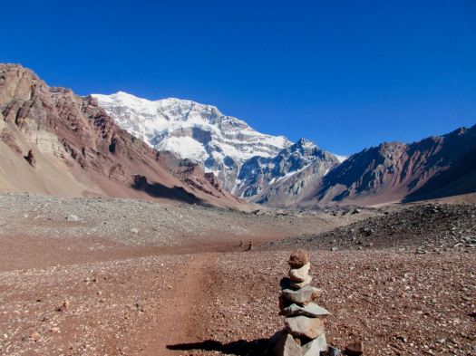
Very soon the signage began. It’s clear. You can’t easily get lost (though people have). No GPS, guidebook or map is needed. Follow the cairns.
With about 1000m to climb I carried a fairly light pack. I was in the shade of the mountains for the first 2 hours.

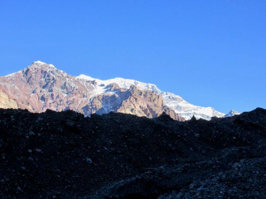
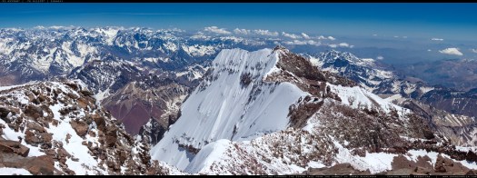
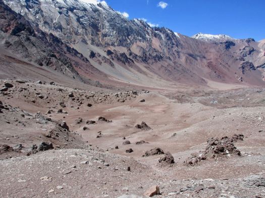
You see the big mountain appear early on.
WOW. This must be one of the best days of the year. Very little wind.

Was I in Nepal? Or the Andes.
Once you get above vegetation there’s no way to tell.
Many people finish at the second of two viewpoints. The view is as good here at 4126m as anywhere.
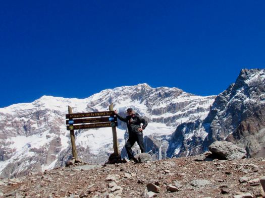
But, alone, first hiker of the day, I continued another 45 minutes on to French Camp.

As you can see, it was t-shirt weather.
The only reason to hike the final rugged stretch after the viewpoint is to get an even closer view of the massive south face wall. The hanging glaciers. It’s not easy to believe that’s a 3km drop from the top.
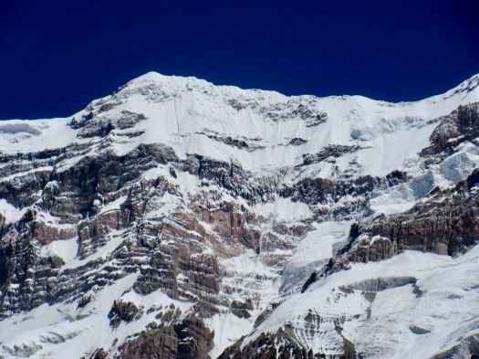

I couldn’t guess what line they’d climb. It looked impossible.
Turns out they’ve climbed many impossible lines.
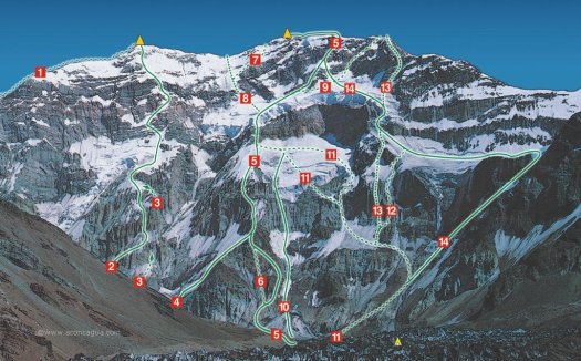
This same day a guy I met later was on the other side of the mountain slogging through metre deep new snow. His entire group turned back at 6600m aside from one character who did (somehow) summit.
Excited I’d been so lucky with my weather, I turned back quickly. Perhaps I could hike some of the trail towards Mule Camp before dark.
Vistas in the other direction are beautiful. I’d not looked back much on the way up.
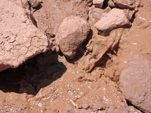
I’d expected plenty of water but you should carry up all you need. It’s a desert. And most of what’s running is silted.
On the way down I took time to observe the glacier. Most of the trail is on glacial moraine.

Almost nothing can live up here. This thorny bush is hardiest.

THIS astragalus arnottianus somehow survives too.

By the time I got back down to the main trail I was exhausted. There’d be no more hiking for me this day.
It was 8 hours tent-back-to-tent moving quite quickly.
 I again climbed into my bag for a nap, but this time also to get out of the sun. Though careful with face and head, I’d managed to sunburn my hands and forearms. There’s very little shade available.
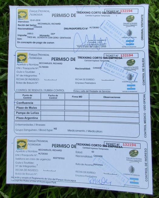
That evening I went over for my mandatory doctor’s check-up. He listened to heart rate. Blood pressure. Asked a few questions. Then signed my permit.
In the tent that night I listened to Coffee Break Spanish language podcasts and got into a hilarious book about character named Hard Luck Hank.
Two tents of noisy independent Russians had arrived. They argued and shouted late into the night. With headphones on, I didn’t care.


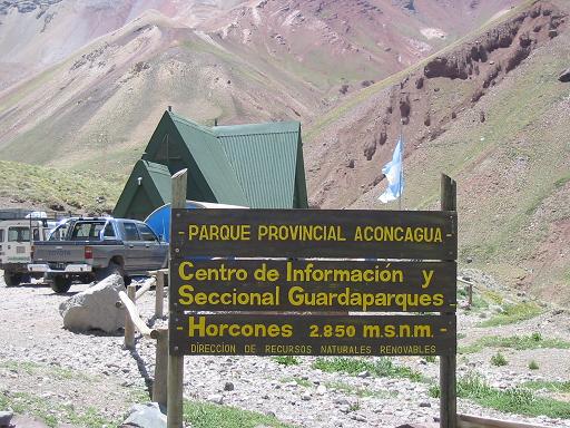

 I was to be surprised how many helicopters race up to Aconcagua every day. Two are parked here at the entrance. Ready to go.
 Only those with trekking permits can cross the river. I felt I was finally on the Francia trek.
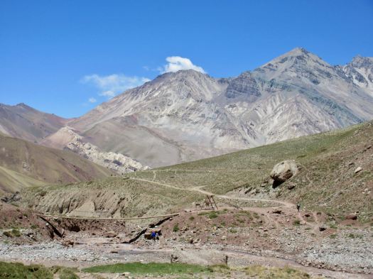 Excited, I rushed up to Confluencia camp (3350m) as quickly as I could.
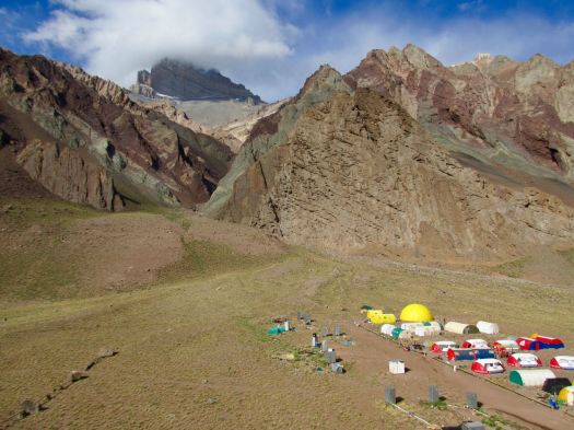 It looks much more impressive from a distance than up close.
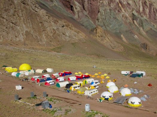 In fact, it’s rather crowded and dirty.
 When not in use they are protected.
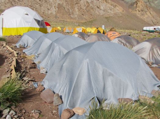 I do like their big bright shared areas.

 On arrival you check in with the camp guards. They directed me to the tiny area where independent campers are allowed to pitch. We are definitely second class clients here.
 Toilets are BAD for guided clients as well as independents.

 Cheeky Andean fox tend to show up at campsites about dusk. I saw this one hanging around at dinner hoping for leftovers. And another two in the early morning.
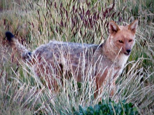 BIG day tomorrow. I tried to get as much sleep as I could at 3350m.