- up to 8 days
- up to 120km (74.5mi)
- guided
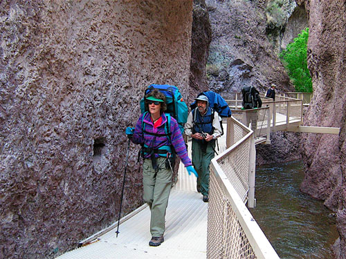
Karen Watkins:
The … Naukluft hiking trail is regarded as one of Africa’s toughest. I went along to find out why. …
Travel Namibia News (2012)


Best hikes, treks, tramps in the world.
Karen Watkins:
The … Naukluft hiking trail is regarded as one of Africa’s toughest. I went along to find out why. …
Travel Namibia News (2012)
Next time I get to Vegas I plan to cross the Mojave National Reserve south to north.

I’ll start from highway 40 heading towards the Granite Mountains. Refill at Kelso Depot. Hike on to Mid Hills Campground , refilling my water bottles. And exiting at Nipton.
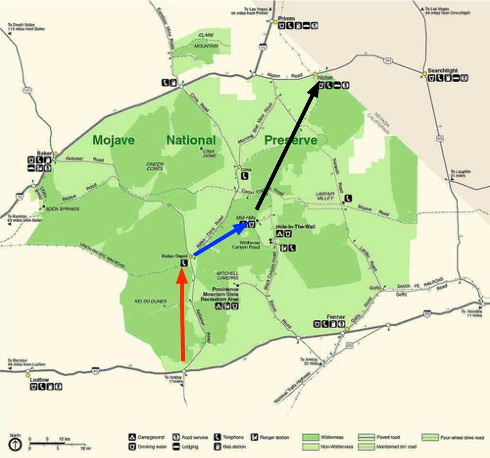
Surprisingly, water will not be a problem.

I won’t count on natural springs, however. Let’s leave that for the wildlife.
I’ll carry the Tom Harrison map. Wish me luck.
trip report by site editor Rick McCharles
Northeastern Arizona.
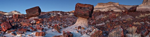
Named for its large deposits of petrified wood, the fee area of the park covers about 230 square miles (600 square kilometers), encompassing semi-desert shrub steppe as well as highly eroded and colorful badlands. …
The site, the northern part of which extends into the Painted Desert, was declared a national monument in 1906 and a national park in 1962. About 800,000 people visit the park each year and take part in activities including sightseeing, photography, hiking, and backpacking. …
The park’s seven maintained hiking trails, some paved, vary in length from less than 0.5 miles (0.8 km) to nearly 3 miles (4.8 km). …
Hikers and backpackers may also visit the park’s wilderness areas. Free permits are required for overnight stays …
I enjoyed the 1 mile hike at Blue Mesa. Reviews.

Entry fee.
Have you been following Peter McBride & Kevin Fedarko?
Epic Grand Canyon Hike: A 650-Mile Challenge (Part 1)
Epic Grand Canyon Hike: Frozen Shoes and Low on Food (Part 2)
I liked the 3rd and final instalment best.
Click PLAY or watch Thirst and Threats in the Godscape on YouTube.
trip report by site editor Rick McCharles
I love Mojave National Preserve about an hour away from Las Vegas.
But I’d already done most of the popular hikes on previous trips.
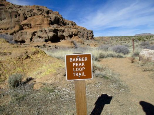
Happily this time I discovered the Barber Loop Trail apparently the newest of the established trails.
Ideal for those sleeping at Hole-in-the-Wall Campground.

It’s a loop so you can hike in either direction.

Best is to start off into the desert, return via the Rings Loop Trail
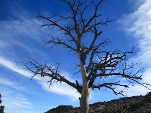
I was a bit disappointed. Standard flat desert.

I’d hoped the trail would loop up on top of Barber Mountain. It doesn’t.

There are a few things to see in the desert, of course.


The best part is the section you could do separately as the Rings Loop Trail.


If you want to know more, Bird and Hike posted an excellent trip report.
trip report by site editor Rick McCharles
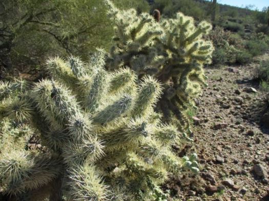
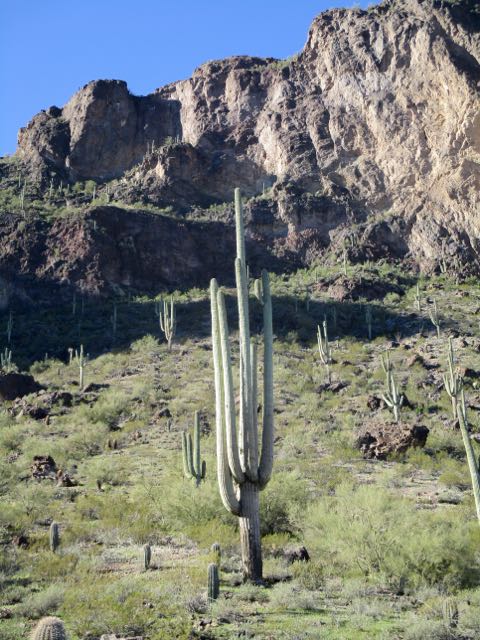
My old friend Francis Tally took me to one of his favourite hikes out of Usery Mountains Regional Park near his winter home in Mesa, AZ.

Huge Saguaro cactus are the highlight. And the brazen chipmunks. 🙂
Francis told me an awful story of a hiker who fell into one of the OTHER types of cactus. It took paramedics 3 hours to remove enough spines just to transport him by ambulance!
We arrived on a Sunday morning to learn that weekend mornings are a zoo on this popular trail. It was difficult to find parking .

The trail itself is not all that difficult. Many children hike it.
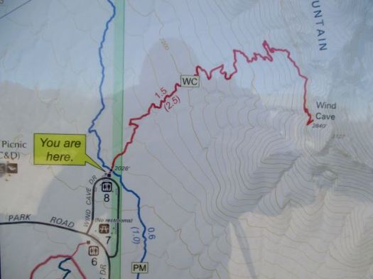
The Wind Cave isn’t really a “cave” but rather an indent to shelter from the wind.

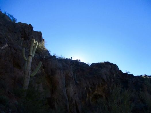
Almost everyone stops here. Francis and I scrambled on to the top of the mountain.
Finding some pink ribbons we decided to follow that off-trail route.

Here we be. The sprawl of greater Phoenix at our feet.

This is a terrific area for day hikes.

Thanks Francis. … I assume the name tag on your hat is to help authorities return you to your retirement park if you get lost. 🙂

Exiting the Park Francis took me over to a nearby gun range just below the Phoenix sign. I’d never seen one before.

They are LOUD.
related – Roads Less Traveled trip report
trip report by site editor Rick McCharles
I had a half day free to hike. Not sure where to go, I drove up to Peralta trailhead close to Mesa, AZ. Of the many options from the trailhead, this looked best to me.

It was a beautiful day climbing up and along a creek. Here’s the vista on one side.

And the other side.
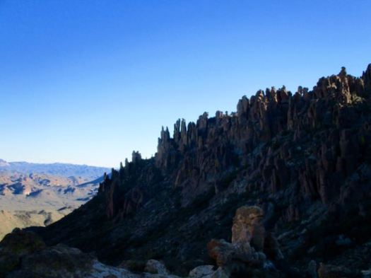
At the Fremont Saddle kids were scrambling the boulders. Moms tried to avert their eyes.

The most spectacular feature on the other side … Weaver’s Needle. Some people climb it.
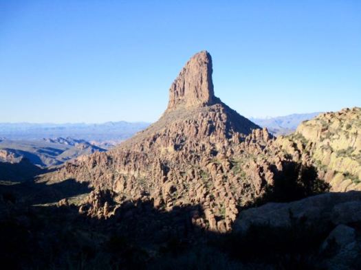
If you have two vehicles, you might want to continue past Fremont Saddle.
trip report by site editor Rick McCharles
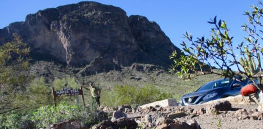
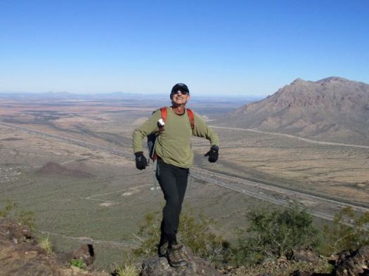
Like many others driving between Phoenix and Tuscon, I’d always wanted to climb this unique volcanic plug.

It looks challenging, but I found it not too bad.
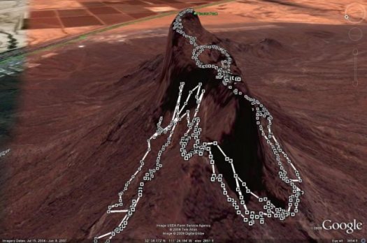
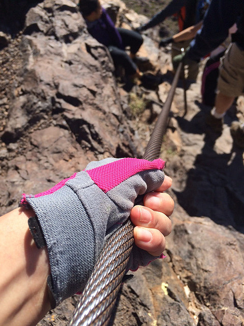
It’s not via ferrata, but there are cables and other assistance everywhere needed.
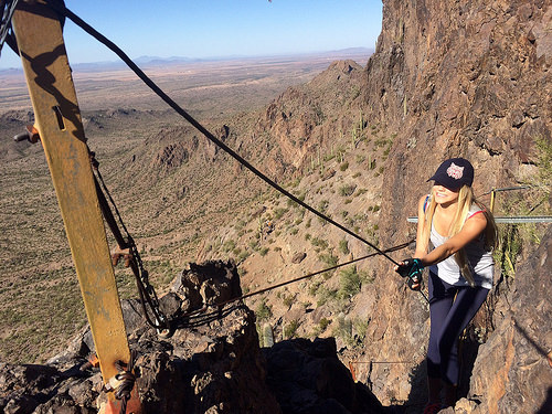
Bring gloves.
As a former gymnast, I was certainly overconfident on arrival at the trailhead.
I’d already embarrassed myself pronouncing the name of the peak as Pikachu. That’s wrong.

Though one hiker cried 4 times getting up and down, I found it fun.
I love the giant, individually unique saguaro cactus.
On the way up it’s difficult to imagine there’s actually a hiking route.

This beautiful day attracted many to the peak. Everyone made it to the top so far as I could see. Myself included.
Certain birds and animals make a good living waiting on lunch crumbs here.

The vista from the top is not all that spectacular.

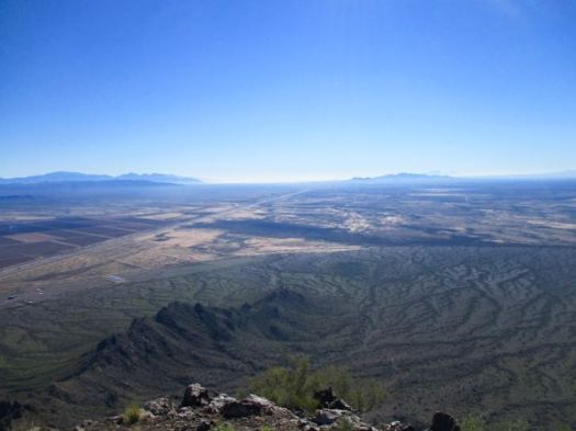
I made a sidetrip to a smaller peak. Here’s the vista looking back to the summit.
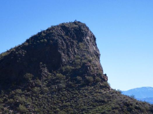
Still, Hunter Trail to Picacho Peak is unique and interesting enough to be added to our list of best hikes in North America.
If you have two vehicles consider climbing up via Hunter Trail, returning via Sunset Trail.
trip report by site editor Rick McCharles
You’ve heard of Gila Cliff Dwellings National Monument.
It’s adjacent to the Gila Wilderness.
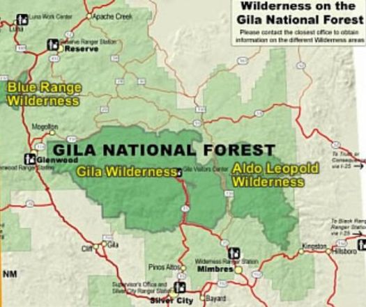
Gila Wilderness was designated the world’s first wilderness area on June 3, 1924. … part of New Mexico’s Gila National Forest. …
The Mogollon Mountains traverse an arc across the wilderness. The tallest peak within this range, Whitewater Baldy at 10,895 ft (3,321 m) …
I headed for the most popular Baldy trailhead – Crest Trail #182.
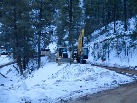
I never made it due to mountain road improvements January 2017. ROAD CLOSED.
So I read some of the Peakbagger trip reports instead.
The consensus was not good: bad roads, snow into July, forest fire recovery sections, hunters. It will not go on our list of the best hikes in North America.
The most popular hike in Gila Wilderness is the Catwalk – “… a one-mile trail suspended above a rushing stream in a gorge only a few feet wide.”
It had been rebuilt over a period of 2 years costing over $4.4 million dollars. And opened again in 2016.
I’d been advised by a Ranger that only the catwalk part of the trail was open. Hikers often continue on to #207. I would have wild camped if it had been open.
Sadly, that Ranger was wrong. It was all closed due to flooding.
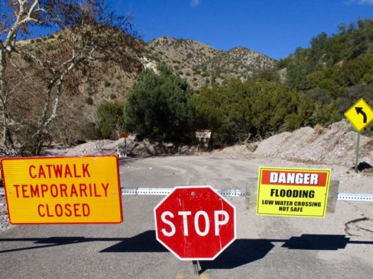
Still, the Catwalk does look very cool.
The 1.1-mile Catwalk National Recreation Trail winds through the canyon’s steep, pink walls of volcanic rock, following the path of a pipeline built in the early 1890s to provide water and electricity for the mining town of Graham. …
LESSON LEARNED — Before driving out to hike the Gila Wilderness, phone first to be sure your trail is open.
New Mexico
trip report by site editor Rick McCharles
Length: 2 miles (3.5 km), round-trip
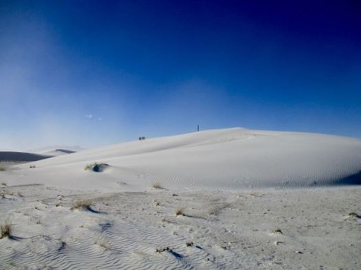
The White Sands National Monument … at an elevation of 4,235 feet (1,291 m). …
It is the largest gypsum dune field in the world. …
The Monument is completely surrounded by military installations (White Sands Missile Range and Holloman Air Force Base) and has always had an uneasy relationship with the military …
Located on the northernmost boundaries of White Sands Missile Range, the Trinity Site can be found, where the first atom bomb was detonated. …
There are non-stop warnings about dehydration.

Let’s go.
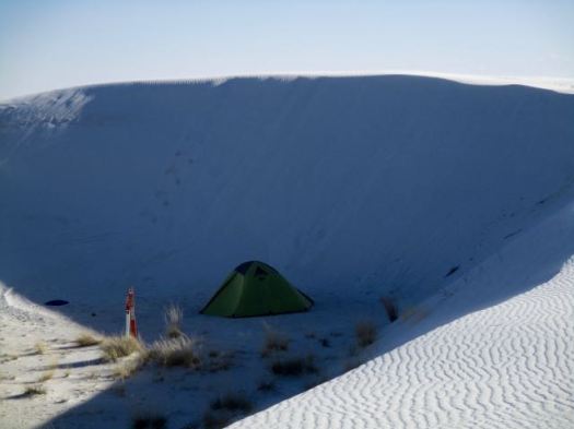
I wore these lightweight camp shoes. They turned out to be perfect for the soft sand.

It was VERY windy.

Deserts are always interesting.


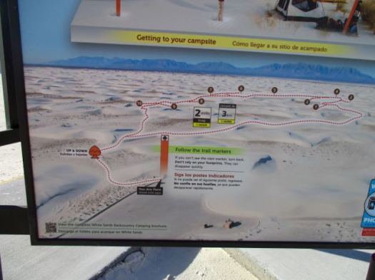
There are 10 backcountry campsites available.
details on Backcountry Camping
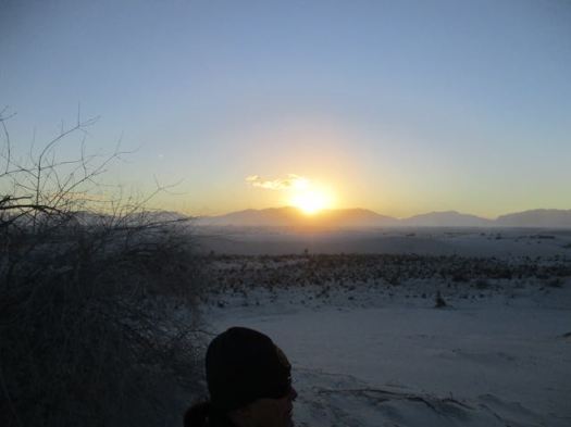
Following my hike, I joined the sunset dunes walk led by a Ranger.

It was very interesting and entertaining. This entire structure was created by that plant.

Sunsets are wonderful in the desert.
The Ranger noted that any President could remove National Monument status. Potentially this land could be given to the military. 😦
details – Backcountry Camping Trail
There’s a longer (5 mile) Dunes hike called the Alkali Flat Trail. If you want more.
