Gxalingenwa hike, South Africa

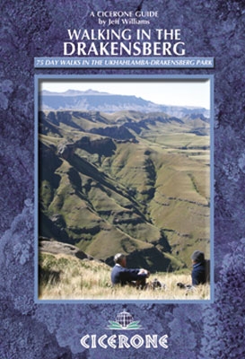
trip report by site editor Rick McCharles

One of the best day hikes in South Africa.

At Sani Lodge Backpackers in the Drakensberg you get everything you need.

trail description, permit, map

Step out the back door, you’re on your way.

IMG_0209

IMG_0212

After about 250m you reach the perimeter fence of the KZN protected lands. Permit to hike costs about $3.

IMG_0214

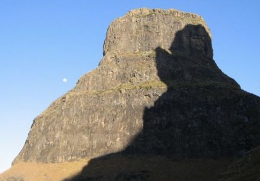
Every step is beautiful in the Drakensberg. Wide open.

IMG_0217

Some African dung beetles are endangered. NOT the ones in these mountains. There are plenty.

IMG_0224

Lizards are constant companions.

IMG_0229

You see a lot of scat, many interesting prints, yet not much wildlife. Animals here have evolved to be elusive.

IMG_0235

I was thrilled to see my first grey rhebok.

IMG_0232

Alpha males “cough” at you from a safe distance.

Wild flowers were still in profusion, mid-summer. We’d had a lot of rain.

IMG_0245

I left a Summit Stone for some future hiker to discover.

IMG_0220

Here’s Gxalingenwa cave. These two spent two nights here, sheltered from the rain.

IMG_0249

Later I learned you are not officially allowed to camp there.

From the cave I had to either backtrack … or finish a loop down the river.

IMG_0252

I’d been warned that the water was high. That I’d most likely need to wade the creek several times.

IMG_0255

Boulder hopping my second crossing, I fell in. 😦

And — since the shoes were wet — I waded 3 more crossings.

IMG_0253

IMG_0256

Russell at Sani Backpackers wants to improve the trail staying on one side of the creek. One day.

IMG_0260

I was glad to have done Gxalingenwa as a loop. It’s very pretty coming down.

IMG_0258

IMG_0259

Some hike up to these waterfalls from the roadway.

The only downside of the Gxalingenwa loop from Sani Backpackers is a road walk finish.

IMG_0265

Happily, I was picked up. Given a lift by University researchers who happened to be staying at the Backpackers.

more photos from this day hike

Kili’s Machame-Mweka route

Bob Foulkes:

I signed up, raised some money from incredulous friends, some of whom thought it cheaper to give than to have me committed, and started training.

On January 13, 2014, in my 65th year, I joined the group in Amsterdam for the flight to Moshie to start the trek to summit Mount Kilimanjaro. We are 13, 10 women and 3 men, ages varying from mid twenties to mid sixties. We’ve raised almost $100,000 for Outward Bound and have paid our own way here.

Summiting Kilimanjaro is simple but not easy. …

At 5895 meters (19, 340 feet), it is Africa’s tallest peak. It demands a high level of fitness; six to eight hour days of high altitude trekking is demanding. Our well trodden trail, the longer Machame-Mweka route covers 55 kilometers that takes us up a flank of the summit and then traverses slowly across the width of the mountain to the final camp above 4800 meters; from which we strike out for the summit. The longer route allows more time for acclimatization, improving our chances of summiting. …

read more – Climbing to the top of Africa – Part 1

Kili

Bob’s book will be available soon — Off the Couch and Out the Door.

Thukela Gorge, South Africa

I hiked to the top of Thukela Falls, one of the highest in the world. There’s another terrific trek in the National Park to the base of the Falls.

Trip report from the Cooking in Tongues blog:

Royal Natal National Park, Drakensberg Mountains, South Africa, September 26, 2011

I’m up early hoping to catch the first rays of light on the Amphitheater. The cliff face glows in the early morning light just before 6. …

… about nine miles round trip up the gorge with great views of the Amphitheater. …

Royal Natal Rest Camp - early morning

We follow the river upstream until we come to the confluence of two rivers. Here you have the option of taking the “tunnel” along the river through the gorge or climbing the chain ladder up about 50 feet to a path that bypasses the “tunnel”. …

Royal Natal - Gorge walk - inside tunnel

read more …

Amphitheater trek, South Africa

Trip report by site editor Rick McCharles.

Within 36hrs of landing in JoBurg I found myself atop the Amphitheater cliffs looking down at one of the highest waterfalls in the world.

IMG_0090

How did I get here?

It’s easy.

Catch the Baz Bus to Amphitheater backpackers in the northern Drakensberg.

While checking into the hostel, sign up for their most popular guided hike. It’s offered about every 2nd day for about $50 all inclusive.

7:30am departure.

IMG_0004

Here’s our guide “Sim” parking one of the hiker shuttle vans at Sentinel car park 2,500m (8,200 ft). This is the only official day hiking trail leading to the top of the Drakensberg escarpment.

IMG_0010

IMG_0008

Yep. That’s the Sentinel. You cannot climb it without ropes. We’ll skirt the base.

The trail zigzags up towards the big peak. Then traverses right.

IMG_0009

IMG_0034

Entirely above the treeline, we did not see much in the way of wildlife. Aside from lizards, of course.

IMG_0012

It was an easy start with perfect weather.

One short ladder on the ascent.

IMG_0029

The crux of the hike is up this gorge.

IMG_0047

It’s a 300m scramble. Not too difficult overall.

Atop the Amphitheater cliffs, we stopped for lunch. Our guides were disappointed that clouds obscured the fantastic views.

IMG_0056

Note the big birds that stopped for lunch with us.

IMG_0057

20min further is the top of Tugela Falls.

IMG_0080

IMG_0085

The water is quite warm. … I’m told.

IMG_0086

Our guide told us that one hiker fell from here on a winter trek. Slipped on the ice.

Finally I called on the old Gods and new to dissipate the clouds.

Everything opened up. And we were shocked to see where we’d been standing so casually.

IMG_0110

It’s about 1km down.

The Amphitheatre is widely regarded as one of the most impressive cliff faces on earth, over 5km (3.1mi) in length.

IMG_0114

Surprisingly, these cliffs are not much used for BASE jumping and the ilk. Apparently winds are not favourable here.

One girl from Finland had been to Roraima via Venezuela. She said there were definitely similarities with the top of the Tupuis there …

IMG_0115

… But many differences too.

The standard route is a Lollypop loop. Rather than backtracking we descended via long ladders.

IMG_0133

IMG_0128

From the bottom, it was another cliff traverse to regain our original trail.

IMG_0137

The vegetation in South Africa is different than what I’m used to. The most interesting plant is this … Pineapple something.

IMG_0143

IMG_0144

One intensely scenic day. We all left happy.

This New Yorker was on the last 4 days of 2 years of traveling.

IMG_0130

Back at the car park we enjoyed a gymnastics performance.

headstand South Africa

And saw one sleepy snake close to where we parked the vans.

more pics from this trek

I didn’t delete many photos as most up there in the Bergs were cool. 🙂

related – Controversy Between Tugela Falls and Angel Falls as World’s Tallest Waterfall

arrived Drakensberg

Just checked in at Amphitheatre Backpackers in the northern Drakensberg. Superb location. Weather is great for January.

P1270016

P1270018

South Africa is incredibly easy to travel staying in hostels like these. Getting around by Baz Bus.

I’m already booked for the essential Amphitheatre trek tomorrow, guided. That takes us to the top of Tugela Falls (Thukela Falls), a total drop of 947 metres.

The day after we’ll take a cultural hike in Lesotho. Or climb Cathedral peak — if enough people sign up. 🙂

Thukela Gorge Walk trip report (Sept)

related – India hates tourists

Annapurna Base Camp

Adventure Blog:

The trek to Annapurna Base Camp has long been seen as one of the best hikes in the world. Wandering through the Himalaya in Nepal, the trail takes backpackers through remote mountain villages, over high passes, and through scenic valleys, before eventually arriving at the base of the 8091 meter (26,545 ft) peak. …

Video: Trekking To Annapurna Base Camp

Click PLAY or watch it on Vimeo.

http://vimeo.com/83984068

researching the Drakensberg

I’m off to South Africa. By the weekend you’ll find me at Amphitheatre Backpackers in the northern ‘berg.

Drakensberg

My only guidebook, so far, is Cicerone Walking in the Drakensberg by Jeff Williams.

That hostel provides a hiker’s shuttle to Royal Natal National Park.

The Bell

Leave a comment if you have advice on best hikes in the Drakensberg.

Mike Howarth – Manaslu Circuit

I spent over 2wks with Mike in Nepal, 10 days on the Manaslu Circuit. Along with:

Brion & Betsy – the not so newly weds.
Tasha & Ivan – the Alaskan powerhouses

A few of his photos:

Summit Stones

Nepali girl

Manaslu

Rakshi

Mike’s a true photographer. I’m more of a fauxtographer. 🙂

Here’s Mike’s trip report on our adventure.

see all of Mike’s Manaslu photos on flickr

Mike’s now down in Patagonia, trekking and cycling north towards the equator.

Dientes Circuit, Chile

The Dientes Circuit in Chile is of the best hikes in the world.

It’s also called:

Isla Navarino Circuit
• Circuito Dientes de Navarino
• the teeth of Navarino

Dientes

Leo Turpan via email:

Just got finished with the Dientes trek yesterday. Pretty amazing stuff out there.

Got a bunch of snow, but it made for a beautiful christmas and even more beautiful landscape. …

Getting to Puerto Williams:

Option 1- Boat from Ushuaia (doesn´t leave everyday, need to check departures at Ushuaia dock) $750 Argentinian Pesos, about $115

Option 2- Ferry from Punta Arenas (leaves only once or twice a week, Tranbordadora Austrual Broom, takes 30 hours but is highly recommended) $90,000 Chilean Pesos, $170 US

Option 3- Flight from Punta Arenas (one flight everyday, I think.) $60,000 Chilean, $115 US

Town/Trek Info:

-There is one map of the trek, not professional, but does have contour lines and GPS markers. The map can be purchased from a small camping store near the center of town. The store also stocks some types of gas, knives, tents, sleeping bags, etc. You can also rent a GPS there that has the circuit route already uploaded

-There are two supermarkets in the center of town that stock all the basic food necessities

-Multiple hostels in town, all priced at 10,000 Pesos or more. All have info about trek

-Register for hike at the police station, no rangers or servicemen on this trek

Trek/Logistics:

-31 Km route, 4 days 3 nights recommended, some do it in 5 days but pace is slow

-clockwise direction starting from Puerto Williams; do NOT reverse the route, you will not have a good time.

-A decent amount of trailfinding will need to be done, do not underestimate the mileage, miles are long due to weather, trailfinding, and trail conditions

-The route can be extremely muddy and wet, gaiters and gortex are a good idea

-Can camp virtually anywhere

-Tons of water

-can extend the trek with a connection to the Lago Windhond trek

-2 hour walk back to Puerto Williams on the road once you reach the end of the trail, but Chile is known as an easy place to hitchhike

map


Check out Dientes information page.