The Tibetan belief is that the winds blow the positive energy of the prayers and chants imprinted on the flags into the world- and into all sentient beings they touch. As a result you’ll usually see the flags strung in high places where they can have maximum effect.
view from the top of Kala Patthar above Everest Base Camp
… a collection of my pix with prayer flags in them. Most are taken from hikes in the Annapurna and Khumbu region of Nepal, but you’ll also find flags fluttering in Patagonia, near Jasper in the Canadian Rockies, above the heads of chanting monks in Bohd Gaya in India, in the Christiania area of Copenhagen in Denmark, and in my neighbourhood above the eastern banks of the Don River in Toronto. …
Hiker Gregg Hein of Clovis “entertained the idea” of possibly dying in the high Sierra of Sequoia and Kings Canyon National Parks as he lay severely injured for six days.
But he said the thought only crossed his mind a few times. The 33-year-old experienced hiker, rock climber and rafting guide was determined to live — and he did.
From a wheelchair Tuesday at Community Regional Medical Center in Fresno, Hein talked about breaking his leg on July 5, hiking down from 13,600-foot Mount Goddard, and his eventual rescue Thursday by a National Park Service helicopter. …
… he dislodged a boulder that plowed into the back of his right calf, breaking bones in three spots. The impact forced bone to protrude about an inch and a half through the skin, Hein said.
His foot was soon “dangling,” Hein said. “I had to grab it so hopefully it wouldn’t rip off.” …
In the summer of 2013 Casey Gannon and Colin Arisman thru-hiked the Pacific Crest Trail with cameras in hand. “Only The Essential” is the story of their 5 month, 2668 mile journey on foot from Mexico to Canada across the wilderness of California, Oregon, and Washington.
I was told the rappel was fun. But the water VERY cold.
Many turn back at Ripley.
I continued on in the direction of Arethusa Falls, a rough, muddy and rooty track.
On the 5th of July, that trail was not busy.
Arethusa, at around 140ft high, the 2nd highest falls in the State, was crowded. Dogs, kids, people unprepared for a serious hike. Most had arrived via the Arethusa Falls trail.
The highest waterfall in New Hampshire is Dryad Falls, which is seasonal. Arethusa is highest flowing year round.
Rather than backtrack, I decided to return via the Frankenstein Cliff trail.
How could you not want to hike something called “Frankenstein Cliff“?
It was the most interesting of the 3 trails.
Some cliffside vistas.
On the way up I’d walked across the train tracks. Coming back the trail ducked under the tracks.
The only downside of my route was a long walk back along the highway to my rent-a-car.
There are better options than the 7mi+ route I ended up doing. 🙂
With the dissolution of her marriage and the death of her mother, Cheryl Strayed has lost all hope. After years of reckless, destructive behavior, she makes a rash decision. With absolutely no experience, driven only by sheer determination, Cheryl hikes more than a thousand miles of the Pacific Crest Trail, alone.
WILD powerfully captures the terrors and pleasures of one young woman forging ahead against all odds on a journey that maddens, strengthens, and ultimately heals her.
The film is based on Cheryl Strayed’s wildly popular memoir. Reese Witherspoon optioned the rights to the book for her upcoming movie even before it became a New York Times bestseller and was selected for Oprah’s Book Club 2.0.
Now the trailer is out for the film, Wild, based on Cheryl Strayed’s 2012 memoir Wild: From Lost to Found on the Pacific Crest Trail. Starring Witherspoon and directed by Dallas Buyers Club’s Jean-Marc Vallée, the film tells the story of Strayed’s 1,100 mile trek to find herself.
Because the Presidential Range is in the pathway of several major storm tracks, Mount Washington is known to have a severe combination of wind and cold. The average annual temperature is 27.1°F, the summit temperature has never risen above 72°F, and the mountain holds the world-record for a wind speed of 231 mph, recorded on the summit in 1934.
(Barrow Island, Australia, October 4, 1996 had big wind. Gusts might have even been higher speeds.)
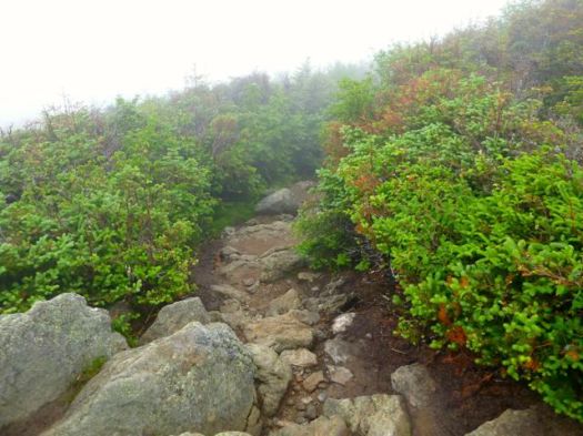
Hurricane-force wind, dense fog, driving rain, and snow occur even during the summer months, and sudden and extreme weather variations are common. Although hazardous conditions do not occur daily, it is important to be aware of the weather before you begin your hike.
This mountain is accessible to many poorly prepared and inexperienced hikers. About 50,000 people a year climb the mountain.
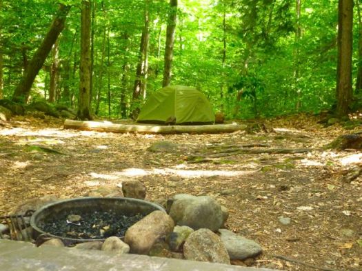
Having done very little advance research, I arrived at the excellent Appalachian Mountain Club Pinkham Notch Visitor Center on Route 16. Dozens of hikers lounged around, starting or finishing trips. This is the main trailhead for Washington. The 2 most popular trails start here: Tuckerman Ravine Trail and the Lion Head Trail.
Helpful ladies at the information desk convinced me to climb (next day) the less crowded Jewell route from the west side.
Of the major, direct trails, Jewell is the longest, but probably the least difficult in terms of terrain, with moderate grades throughout.
It reaches treeline at about 3.0 miles, and climbs rockily to the Gulfside Trail at 3.7 miles (5400 feet). This route then follows the Gulfside Trail (passing by the Westside Trail and the Great Gulf Trail) and meets the Crawford Path just below the summit of Mount Washington (6288 feet) which it reaches at 5.1 miles (3900 feet of elevation gain).


 trip report by site editor Rick McCharles


 … and hang out at the nearby gorgeous, historic Mount Washington Alpine Resort.


 The top of the mountain is crowded with suitcase tourists who have arrived by road or train.


