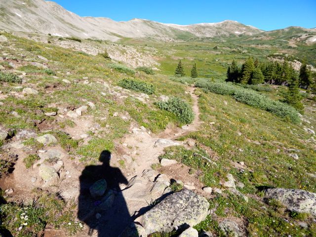
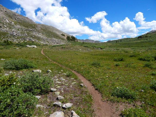
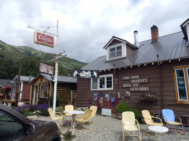
I was up at first light. But everyone else heading south was already gone. I enjoyed a pot of coffee, as usual. It was up, up and away from pretty (but buggy) Hunt Lake. For some reason the steep climb to the only major pass felt easy today. Perhaps I’m getting used to this.The map showed a long, leisurely walk out along the continental divide. More ptarmigan. These 4 chicks were very young. The end is near. Electricity. Traversing the roads atop of Monarch Ski Resort was a bit confusing. There are few trail signs.Here’s the finish. Paved paradise, put up a parking lot. I caught a lift with a trail angel from Buena Vista. In thanks – and celebration – I treated for beer samplers and pork tacos at Elevation brewery. She dropped me at BV tourist information. I hoped to find a bus headed towards Aspen. Bad news: Though public transit is fantastic on the other side of Independence Pass, there are no buses in the poorer Arkansas River valley. 😦
Though I hate hitchhiking, a paddling guide drove me up to the Twin Lakes turnoff. … Then a fascinating world traveler – next skiing in Chile before settling down to research Dahl Sheep in Alaska – drove me the rest of the way to Aspen.
From there, in the pouring rain, I caught a $6 bus back to surprise my friends in Carbondale.
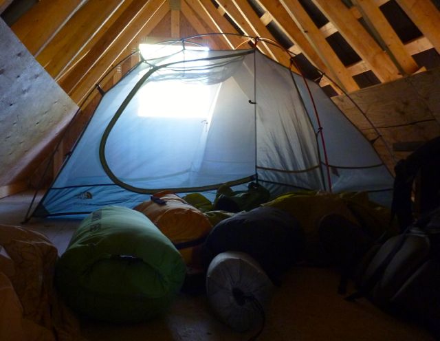
I made it through the night without putting the fly on the tent!
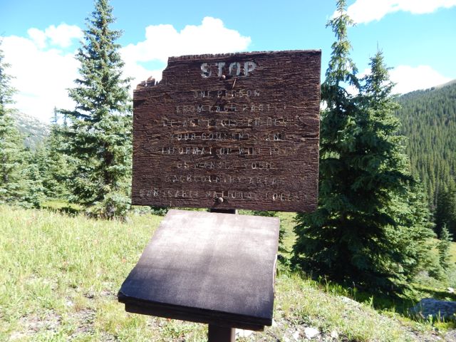
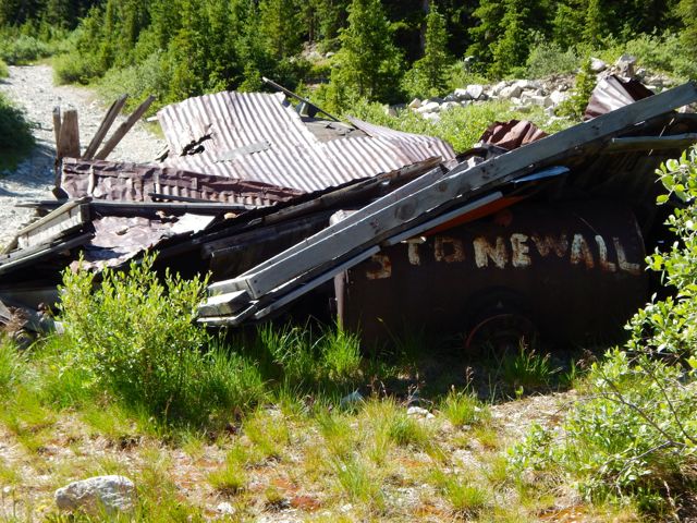
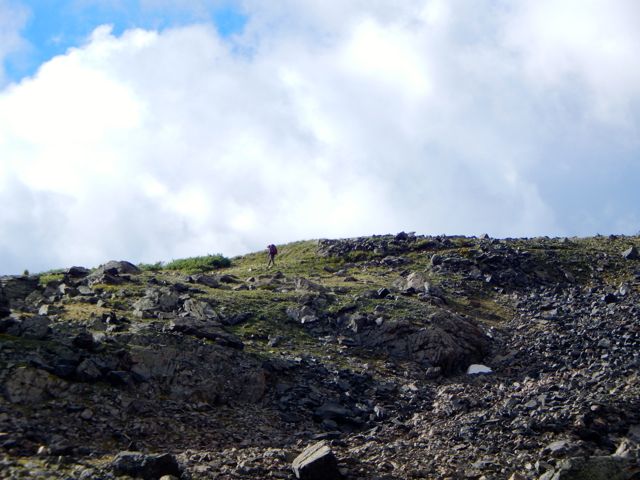
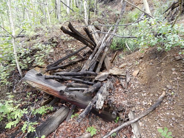
UP – as usual – to the next pass. It looked imposing. On the other side are some buildings in Hancock. It was a relief, actually, to make better time walking an old rail line. Everyone loves the under regulation of hiking in Colorado. There are very few restrictive rules. One thing asked is that hikers register in log books as they pass by. Unfortunately each I passed was full. There were no pages left. Seems the system is broken. 😦In 2015 we still walked roads along the Arkansas River head waters en route to Hancock Lake. But volunteers were there in force building the trail which will soon run parallel to the roads. I was impressed with their enthusiasm. Roads – and historical artifacts – exist in unusual places due to mining. I was happy to reach this lovely spot.
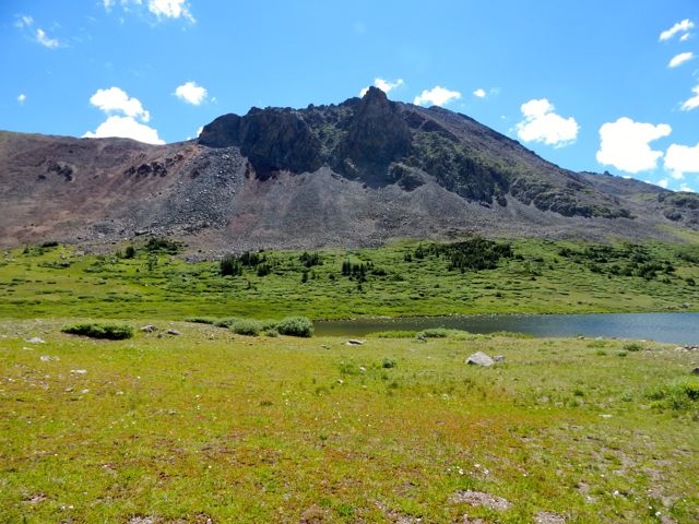
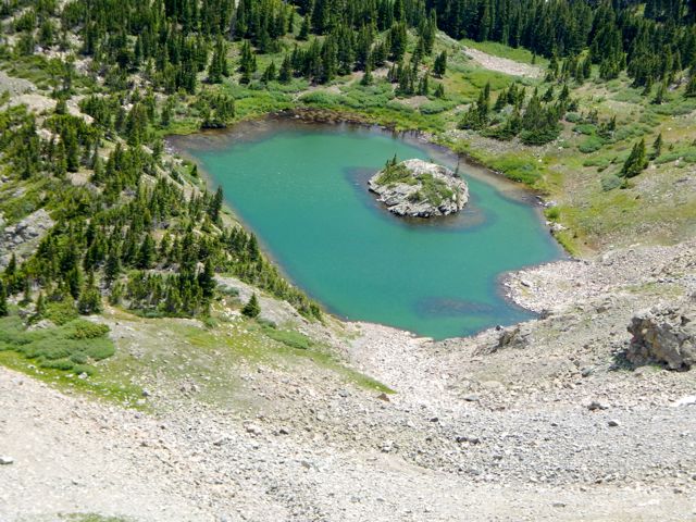
Hancock Lake
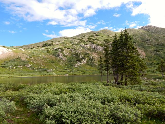
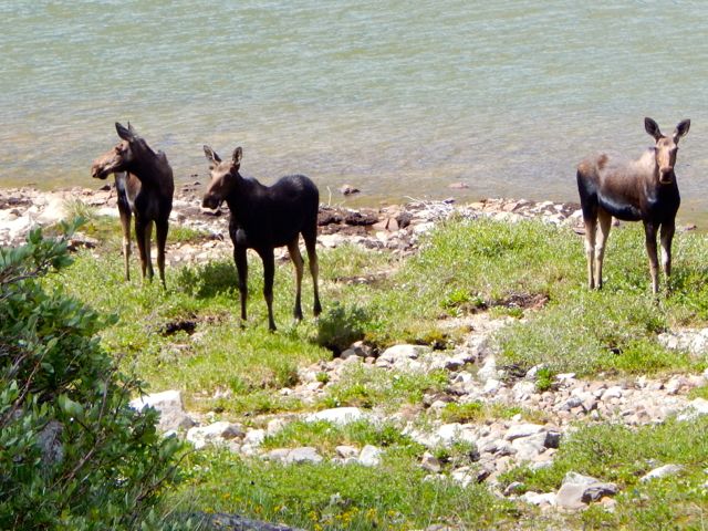
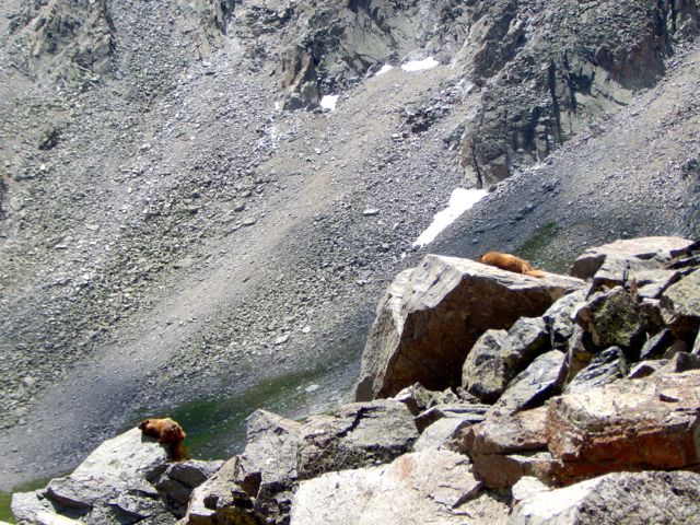
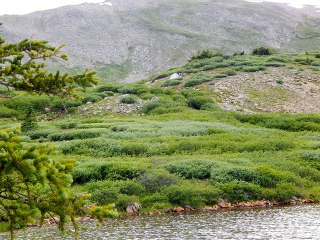
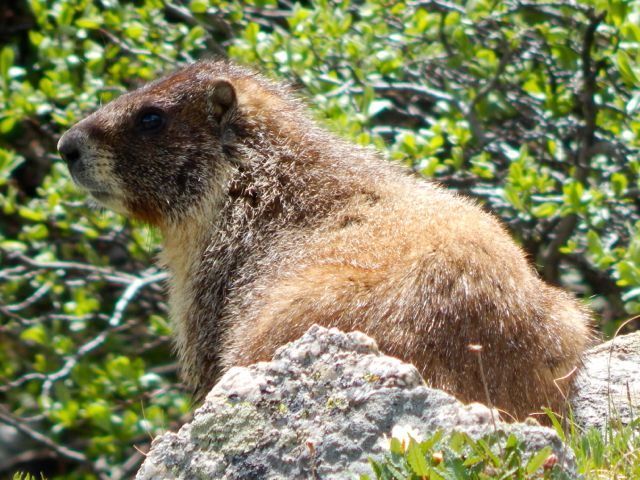
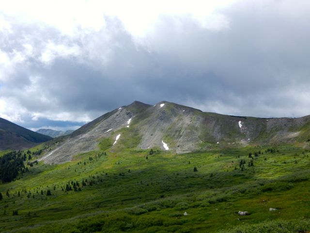
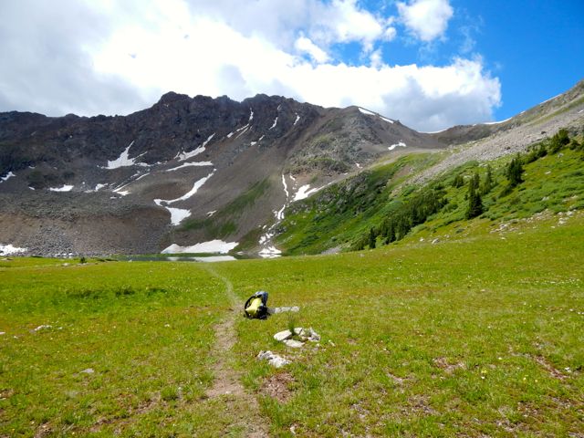
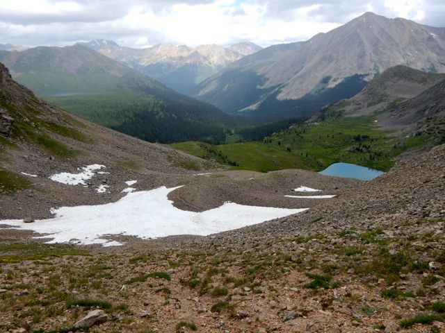
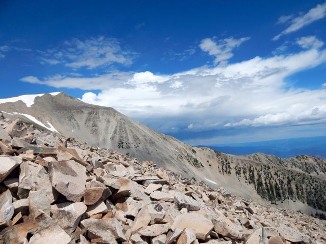
I chatted with a fisherman. He’d seen a herd of elk cross Chalk Creek Pass this very morning. I didn’t see the elk. But there were three moose at Upper Hancock. Chalk Creek Pass was glorious. It’s a joy to get good weather up so high.In the heat, marmots got lazy. I happened upon the empty Trail Crew camp. It inspired me to volunteer myself, one day. 🙂Over the bridge. Up to Boss Lake. I was keen. The weather was great. But an Austrian couple 3 weeks on the CDT convinced me I didn’t have time to make the final 9 miles so I set up at Hunt Lake. It turned out to be the prettiest campsite of my week. more full resolution photos
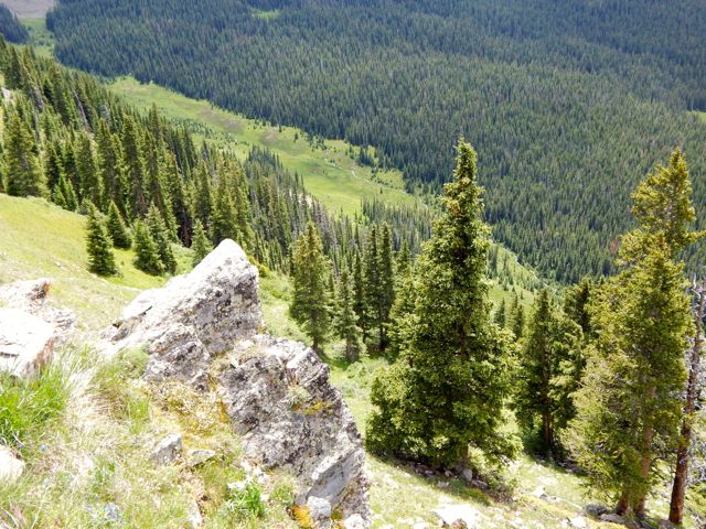
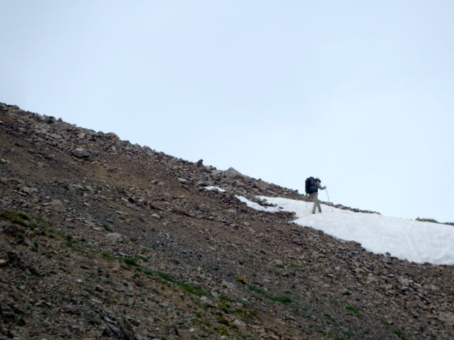
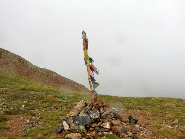
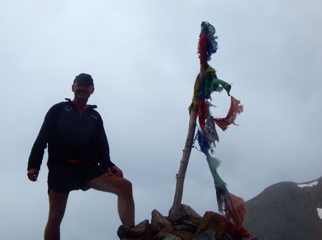
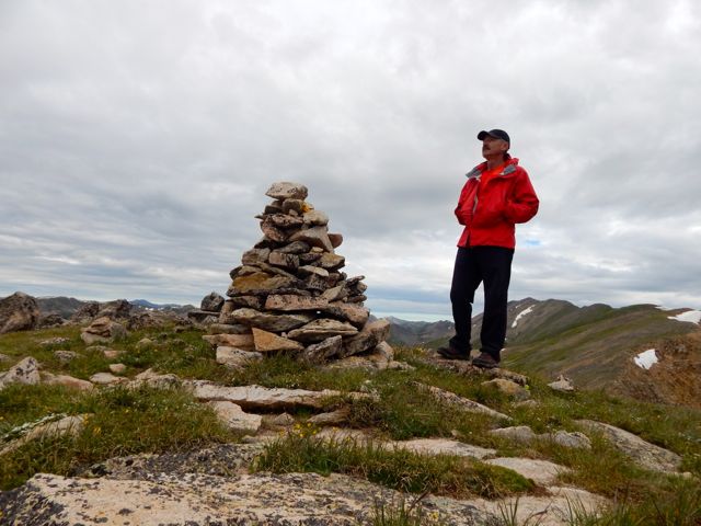
I hate starting with a steep climb. Steep climbs like this. A lady hiking the opposite direction spotted ptarmigan. I celebrated reaching this 12,824ft (3908m) pass. It should be a big deal. Yet this pass has no name, no sign. Not even a cairn.
It was windy, as usual. So I didn’t stay long. Down and down. There are many different species of birds I can’t recognize. Woodpeckers are noisy in forested areas. Those I can identify. 🙂 Glorious. That’s Tincup Pass Road near St Elmo. ATVs were here in number. I washed up in the creek. Then took a siesta for an hour or so. The Tunnel Lake trail ascent more gentle than usual.
Tunnel Lake
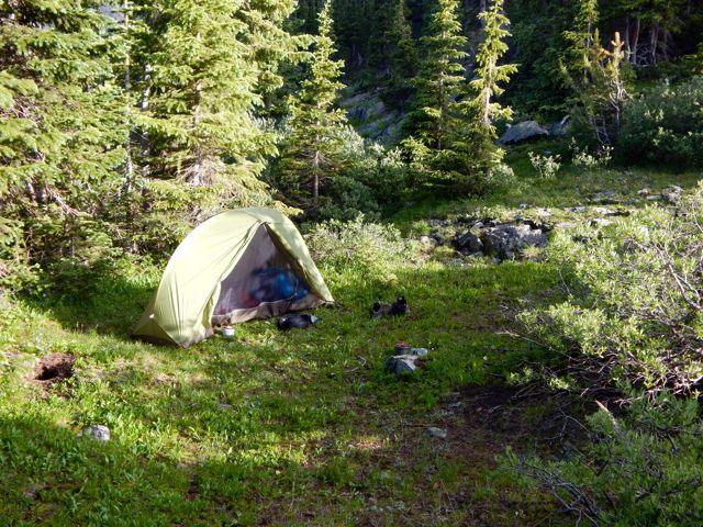
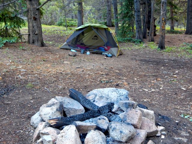
Wanting some shelter from (possible) lightning storm, I camped by the lake. Oddly there were almost no established tent sites. In the end I crammed my Hubba into this spot.Another couple set-up in a fairly lousy spot, I thought, up above. At dusk a hare came by to check me out. The first time I can recall any rabbit being curious about my tent.
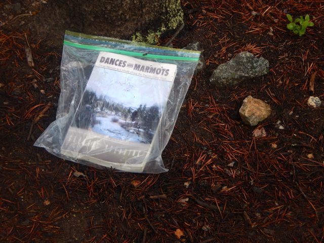
I finished my book – Dances with Marmots – a Kiwi’s memoir of hiking the PCT – and left it on the trail for anyone craving an amusing read.
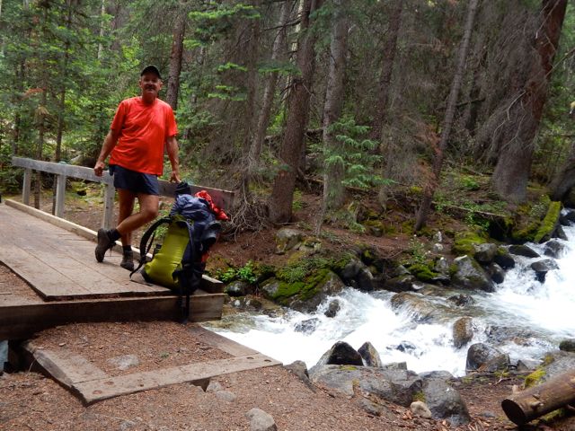
This was the toughest creek crossing. Not bad. Volunteers are working on this section of the Colorado Trail. I expect there will be a wood bridge here soon.
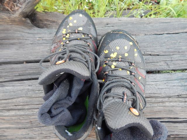
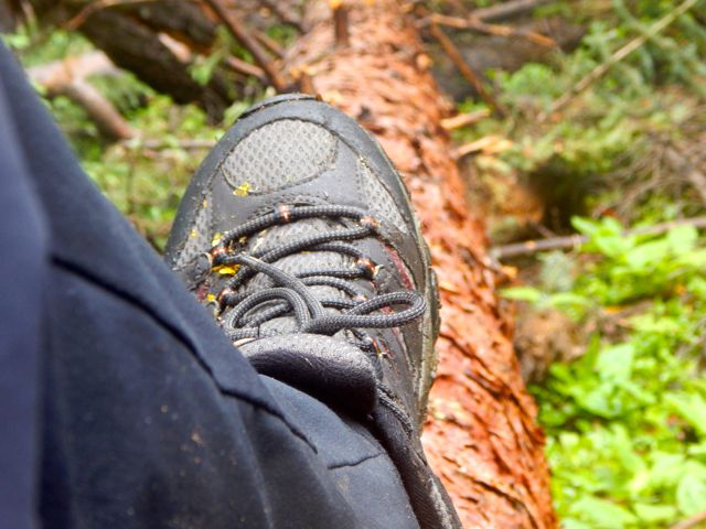
Despite the wet conditions, I was impressed with my Merrill shoes. No blisters.
This guy goes barefoot in the rain. Water was running high for July. It’s been a wet year.
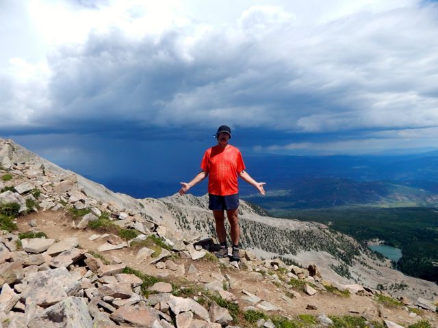
I was worried, again, about lightning. Happily I’d see no more for the week.The weather improved as I climbed to Cottonwood Pass, a popular tourist stop that I’d visited my only other time in Colorado. I took the high trail approach. And the California couple passed me once again. I saw them climb into a car and drive away. They’d told me they didn’t have enough food to reach their next resupply. So needed to side trip to town for grub.
Cottonwood Pass
An Austrian couple (I learned later) left the trail here too – their tent and sleeping bags too soaked to continue. It’s a good escape route as many tourists are happy to rescue someone from the continental divide.
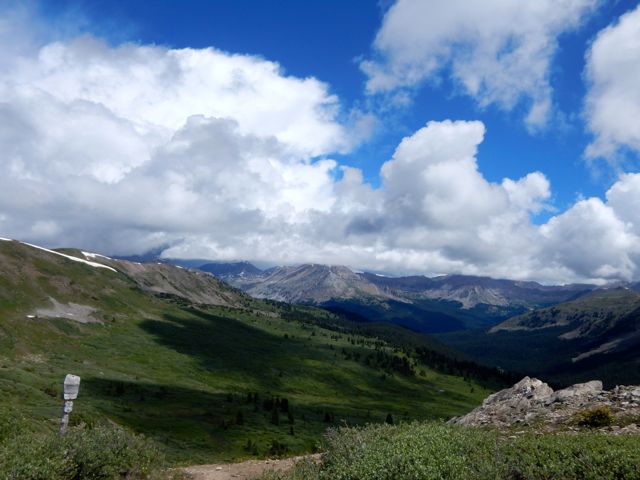
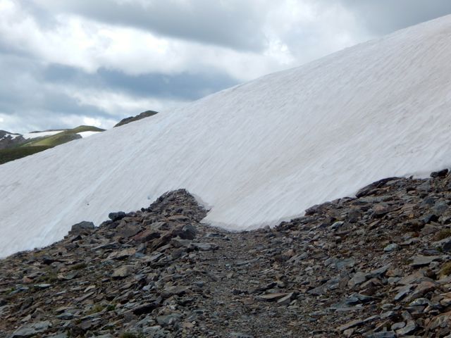
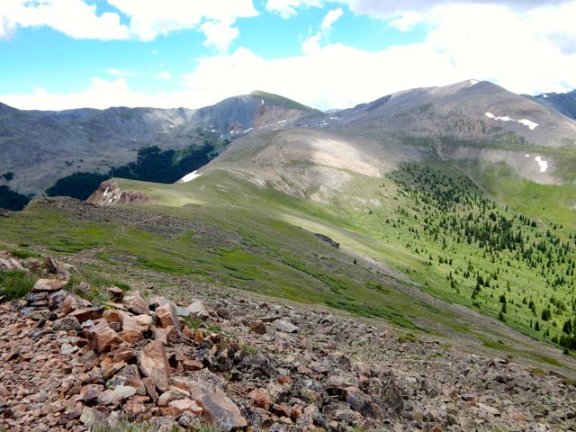
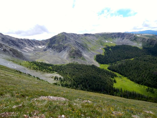
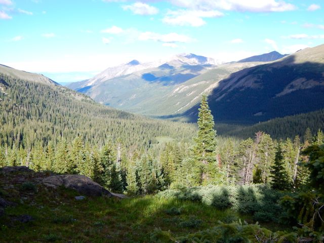
On the other side the trail was blocked by snow. Hikers were still detouring to bypass. Here begins my favourite section of the Collegiate West. Miles of continental divide ridge walk. The weather continued to improve. One happy hiker.It had been a long, tough day, however. And I was happy to finally drop down to find a protected campsite.
I set up in a spot as out-of-the-wind as possible. No water. But good protection.
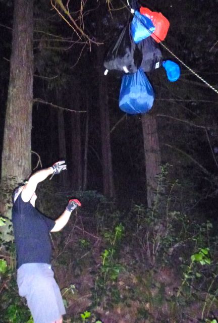
I carried my food in an Ursack. Very convenient. The trees here are not ideal for hanging a bear bag.
After a pot of coffee , it was time to do my doodie. A job well done this day. You’d never guess what’s under that flat rock. 🙂
There are no formal campgrounds on Collegiate West. No pit toilets. It’s dispersed camping only.
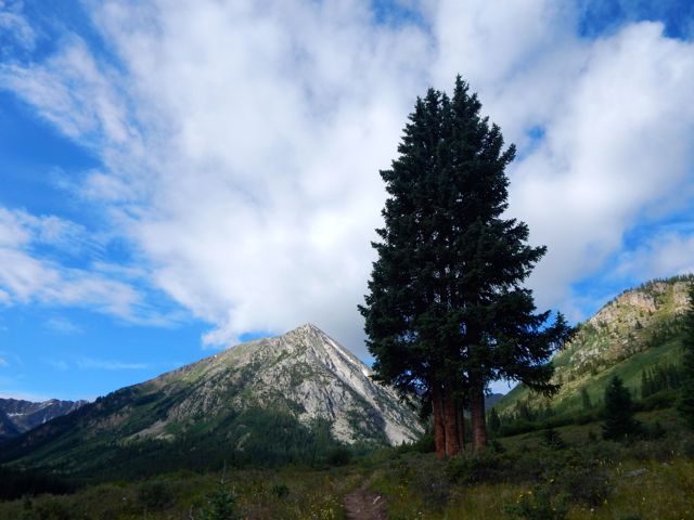
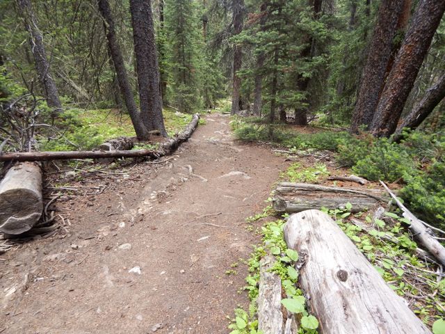
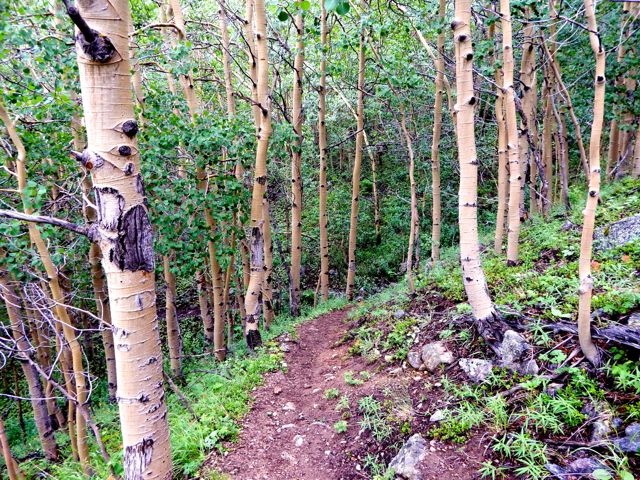
As so often in the Rockies, you start in the trees and climb to another high pass.
Seems the Collegiate Wilderness has a welcome dog. 🙂 If you want to hike with your dog, Colorado is a great place. I saw many hiking dogs over the week.
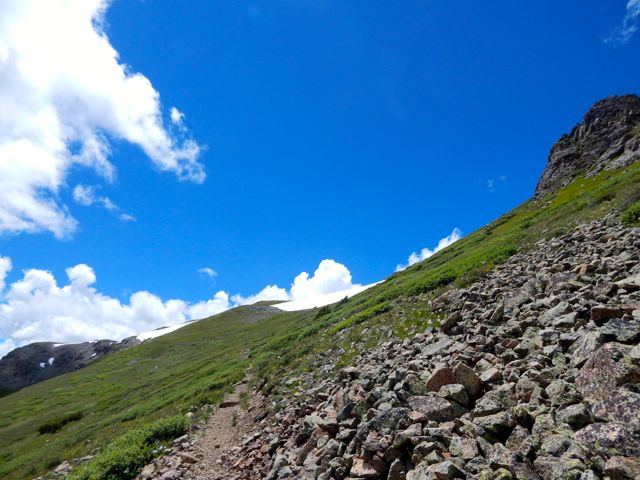
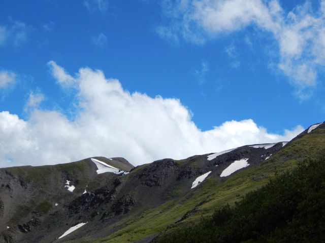
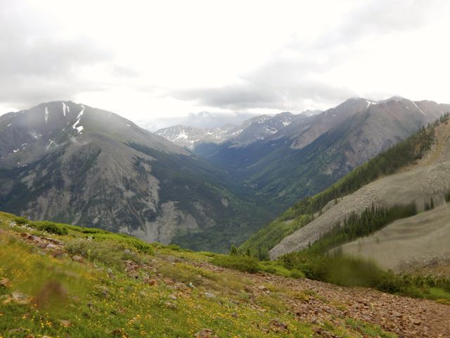
These were the only pack lamas I saw. The guys told me they were very helpful. Very good natured. Mud is a concern in the Colorado Rockies. The Sierras in California are a far dryer alternative. But I was loving the high altitude scenery. It’s heaven up here when the sun shines. Crossing the pass. Again a little snow.
Wow.
It’s difficult to capture the splendor in a photo.
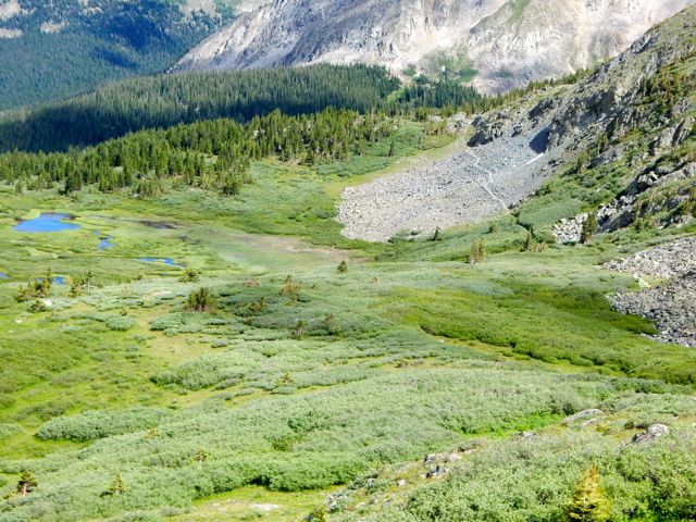
I dropped down to Texas Creek.
Nice weather. If you are a beaver.
I probably should have stopped in a de facto campground when you first reach the creek. It’s an open field with road access.
I had trouble deciding where to hike in Colorado. There are simply too many great options.
The new Collegiate Loop sounded like an excellent and challenging possibility:
… In 2012 the Colorado Trail added an 80 mile stretch of trail that serves as an alternate route around the Collegiate Peaks. The new route, called the Collegiate West, follows the continental divide at much higher elevations. The Collegiate West is above tree line much of the time, which makes for rugged hiking and incredible views. …
The Collegiate East is part of the traditional Colorado Trail that stretches 500 miles from Denver to Durango. The 160-mile Collegiate Peaks backpacking loop is formed by hiking both the Eastern and Western routes of this section.
We dropped my friend Betsy at a mountain running race near Aspen. Husband Brion drove me on to Twin Lakes, recommended as one of the best places to start the Collegiate Loop. I was hoping to get information at the General Store.
Historically they’ve considered Collegiate West the Continental Divide Trail, Collegiate East the Colorado Trail. It’s going to take some years before locals start considering the western side part of the Colorado Trail.
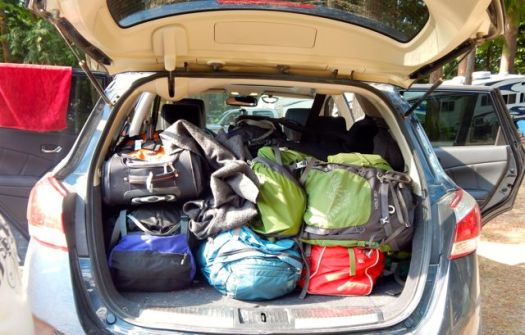
I was excited to get this adventure started. Ready or not.
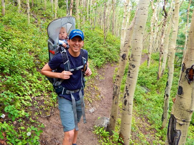
Brion and Julius started up the trail with me around 11am. Thanks for the send off.
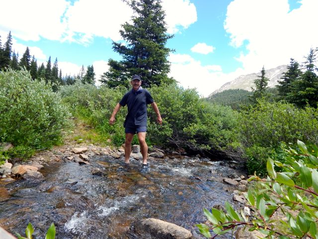
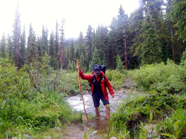
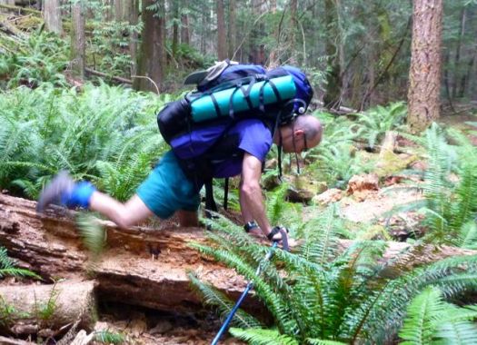
Just after posing for this shot, I knocked my pack into that creek. 😦 Happily almost everything inside is kept in waterproof bags. It’s a steep climb to reach the treeline en route to Hope Pass, the highest point on the Collegiate Loop 12,500ft (3810m).
I didn’t suffer much from altitude despite having only one acclimatization hike since flying in from sea level. Smarter hikers than myself would have finished crossing Hope Pass rather than starting here.
On the downside, it was raining.
I took shelter under those far trees with an older couple from California who were section hiking, year by year, Canada to Mexico on the Continental Divide Trail. Like me, this was their first day. They’d also started at Twin Lakes. The twosome and their dog planned to hike to the New Mexico border this summer.
I was embarrassed to admit to them I didn’t know whether I was hiking north or south. That’s how unprepared I was. I hadn’t yet opened my new map.
They’d hiked Collegiate East the previous summer and told me it was much less spectacular. Right then and there I decided NOT to do the entire 160 miles, but rather just the most spectacular half.
When the rain let up a little, I tried to get up and over Hope Pass as quickly as possible. Lightning is a real danger in the Colorado Rockies. The couple told me to go ahead and that they’d plod along behind. (The tortoise and the hare, I thought.) End of July 2015 the remaining snow was not a problem. Earlier some seasons it would be a good idea to bring an ice axe.
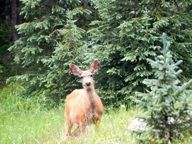
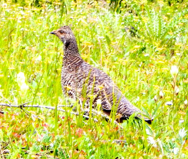
A couple of trail runners paused to chat. They were changing gears from uphill to downhill. This spot is where some of the Leadville Trail 100 mile racers come to grief. It’s 3,400ft of vertical on the front side, descending about 2,600ft. The southern side of the Pass was equally scenic. Plenty of wild flowers. It had been a very wet Spring and Summer here. I saw all kinds of wildlife: a ptarmigan family, chipmunks, pica, marmot, weasel. The oddest was a group of snakes sunning on trailside rocks. I was so surprised I didn’t manage to get a good photo.
At another stop I carefully set down the pack. Then watched it roll downhill finally coming to rest in the bushes. Quite quickly, dropping down to the valley, vegetation changes. You pass a number of old mine shafts. The final few miles to Clear Creek near Winfield were exhausting though the trail was comparatively flat. I’d been running on enthusiastic adrenaline. It finally ran out.
Thinking of Étienne Lemieux and Louis-Vincent Lessard today. 😦
Police in New Zealand believe two bodies found in avalanche debris are Louis-Vincent Lessard and Étienne Lemieux, two Quebec travellers who went missing during an outdoor adventure trip. …
The first body was found over the weekend in a field of avalanche debris about 350 metres below the Kepler track, where the two had planned to go hiking. A second body was discovered Monday at about 10:30 a.m. New Zealand time. …
“The majority of people who walk the Kepler track do it in summer and there’s seldom any snow. Totally different story in winter, when large volumes of snow can fall in that area. Not many people at all walk the Kepler track in winter.” …
I’m arrived Colorado. 🙂 Only my second hiking trip to this fantastic State.
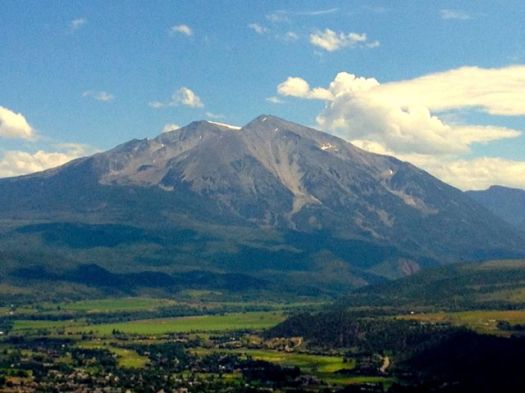
As a warm-up leg stretcher, on Saturday I attempted Sopris, the imposing peak above Carbondale. Elevation 12,953 feet.
We were up at 6am. My host, Brion, owner of Independence Run and Hike, wished it had been 5am. The Colorado Rockies are famous for mid-day lightning storms.
At the trailhead Brion took off for a training run. I turned the opposite direction to start up Sopris.
Brion warned me of aggressive cows and possibly even bulls. They weren’t aggressive with us. But they were a bit of a pain.
I met Matt – recently moved to Colorado from the East coast – at the start. He and I walked together to the top.
We took no breaks up to the Thomas lakes. Happy with the speed of ascent, we decided to carry on and have our first break above the treeline.
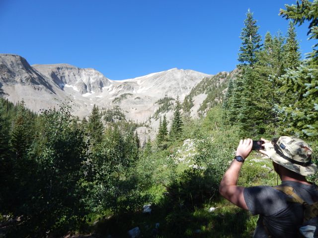
Lunch on the ridge was terrific. Big vistas down both sides.
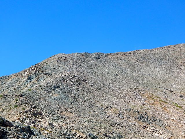
Above the treeline the scramble up Sopris begins. The trail disappears at times up unstable boulders.
Our goal was the first summit. It looked an easy hour from our lunch vantage.
Up on the scree ridge footing gets easier leading to the false summit. Many stop here as the views are just about as good as on the summit. But Matt and I felt good. Wanted to go all the way.
And the weather was holding. Check this blue sky. 🙂
Sadly, in the other direction big scary clouds were rushing up the valley. When we saw the first lightning bolts, we turned back. 🙂
I planned to hurry down to the lakes. And cool my feet in cold alpine waters.
It’s far more dangerous going down than climbing up. Be careful.
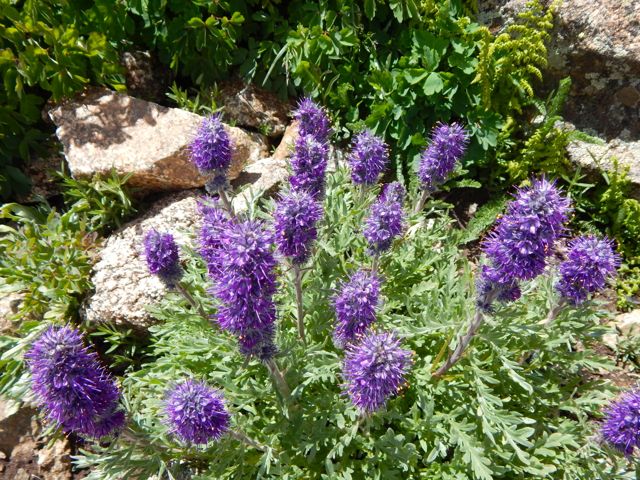
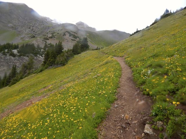
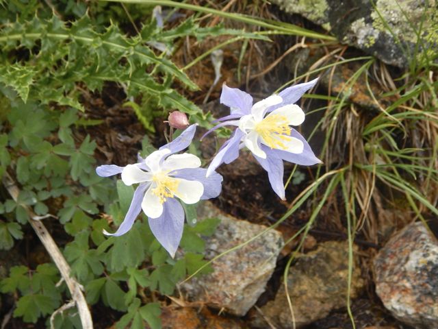
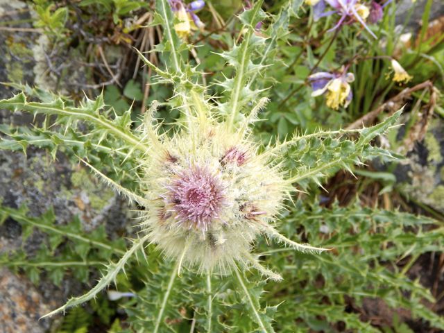
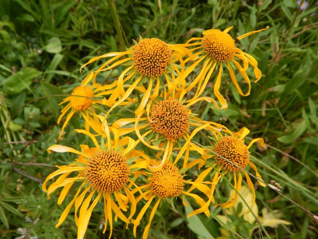
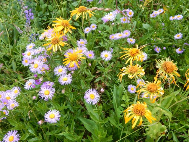
A real highlight this time of year is wild flowers.
As the weather worsened, I increased my pace. But still got caught in a downpour the last 20 minutes to the parking lot.
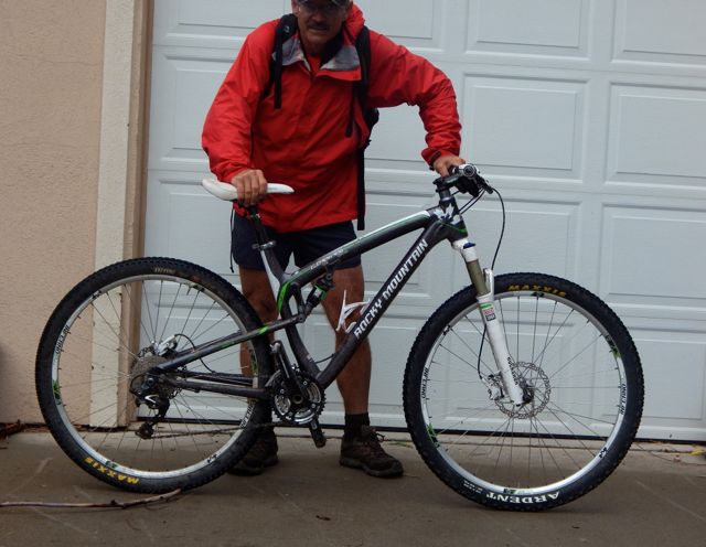
I hid from the rain at the pit toilet, changing clothes for the long mountain bike ride back to Carbondale.
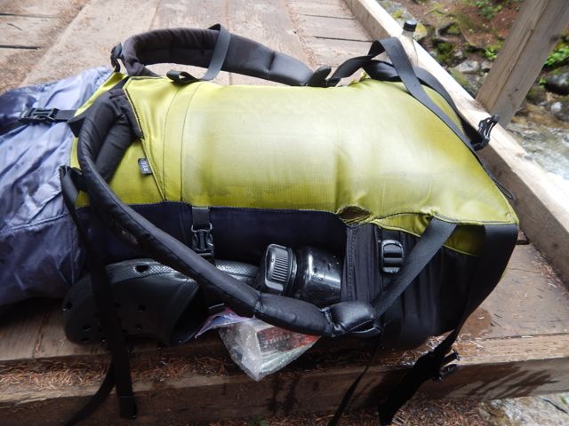
I always carry empty dry bags in my pack just for this kind of soaking rain.
It was a fun, muddy roll down the mountain. The best part of the day.
dirtbag — a subculture consisting of ski bums, vagabonds and climbers well practiced in the ways of avoiding work, while spending as much time as possible pursuing their outdoor passions. …
holloway — a sunken path worn down due to foot traffic, rain and erosion that has fallen significantly below the vegetative banks on each side. …
krummholz — bent, stunted trees found in mountainous and arctic regions, twisted by steady winds and short growing seasons. …
verglas — a thin coating of ice that forms on rocks overnight, or when snow melts and then refreezes. …
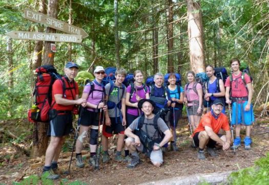
Eleven hikers from flat, dry central Canada – Saskatchewan – met up at Nancy’s bakery in remote Lund, B.C.
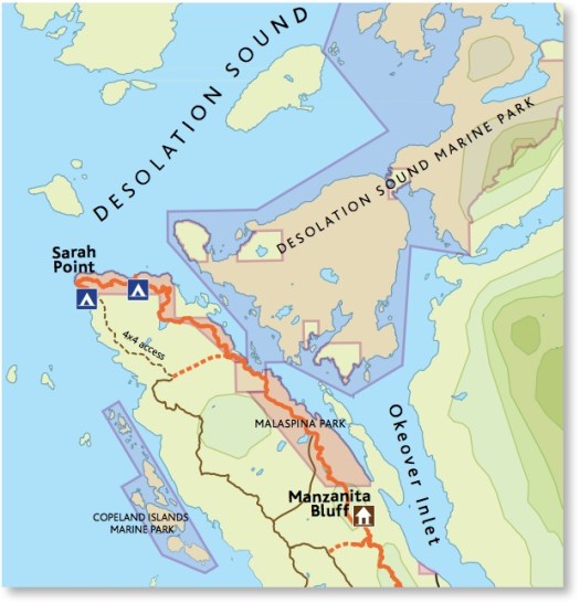
Our plan was to hike from Sarah Point to Powell River in 5 days, 4 nights. The first section of the 180km Sunshine Coast Trail.
We ended up exiting after 2 nights walking out from Manzanita hut right back … to the bakery. 🙂
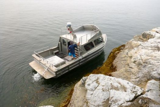
We’d booked a water taxi from Lund to the trailhead at Sarah Point.
Our skipper was excellent. The weather perfect. Yet the scramble up steep, slippery rock to the trailhead was challenging. I’d hate to do it in rough seas.
We were off. 🙂
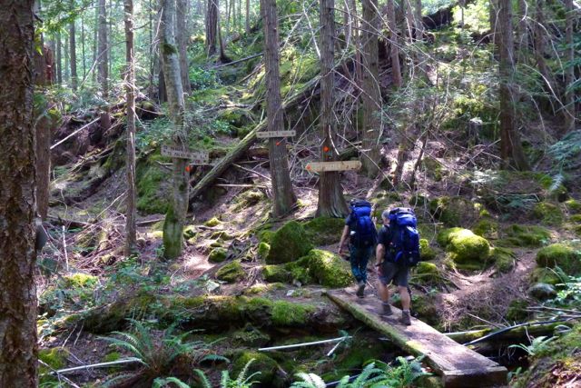
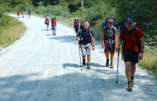
The trail is well flagged but requires frequent scrambles over, under or around fallen trees. Our packs felt very heavy at this point.
Early July 2015 the Pacific N.W. was atypically hot and humid. Forest fire hazy clouded the sky.
Mosquitoes and wasps were a real pest. Four of our group were stung over 3 days.
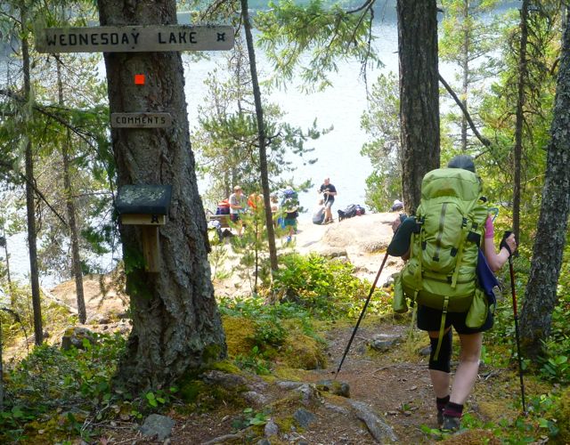
It quickly became evident our large group, starting late in the day, would never make it to our intended destination – camping at Wednesday lake.
Instead we dropped down to a disused campsite at Cochrane Bay. It turned out to be a lovely spot. The pit toilet (which we found the next morning) still in working order.
It was dark when we went to hang the food.
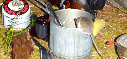
Rodents quickly pounced on my dinner pot (salmon) once I set it on the ground.
The sea a glassy lake next morning.
We suffered some foot and knee pain. And morning stiffness, of course.
A steep, sweaty climb up from the sea brought us to Wednesday lake where we refilled all our water bottles. You need at least 3 litres / person on this dry section of the Trail.
We needed this refreshing break as the climb up to the Manzanita bluff was particularly gruelling.
Joan’s last hike?
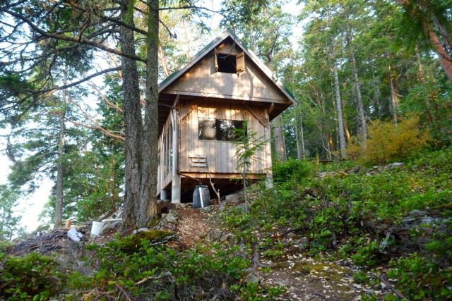
It was with relief that we arrived at Manzanita hut early in the day.
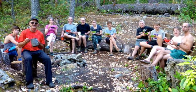
It is a treat to have tables and fire pit after the wilderness camp of the previous night.
We split up some sleeping in their tents, some in their tents in the loft.
Running low on water, some of the keeners walked about 1.5km down hill to find a stagnant spring. Carried it back up. You need to treat all water on the SCT.
By morning it was decided. We were going to quit the SCT and exit to Lund. Our spiritual leader Bill Wallace and his doppelgänger consulted the guidebook, brochure map and some local day hikers to calculate the best route.
The manly men checked to see if they were strong enough for the escape … by trying to do a chin-up with full pack.
Bill leading the quitters to safety.
Civilization. 🙂
siesta
We checked in at the Willingdon Beach campground in Powell River. It’s a good spot, walking distance from the ferry.
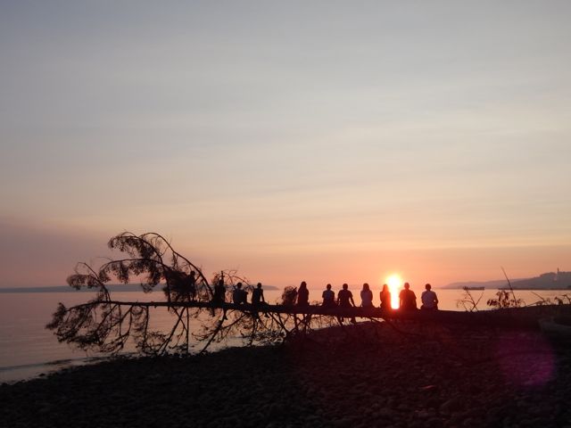
The sunset is gorgeous from here. Sandy descended the steep, slippery cliff to shore faster than anyone else. 🙂
With the extra time we decided to kayak Desolation Sound. It turned out to be the best day of the week!
Back to Saskatoon. Back to reality. 🙂
Lessons learned on the Sunshine Coast Trail:
it’s mostly inland
great vistas are infrequent. Many sections are tree-locked.
it’s rarely flat
much more challenging than expected
Two ladies who had done half the Pacific Crest Trail found the long day from Sarah Point to Manzanita hut a serious day. They went straight to bed after dinner and were gone by 6am next morning. Do not underestimate this trail.
I’m hoping to get back in September / October when the bugs are less a problem. Cold doesn’t worry me.


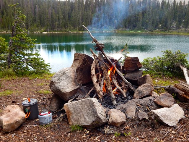
 I enjoyed a pot of coffee, as usual.
  It was up, up and away from pretty (but buggy) Hunt Lake.
  For some reason the steep climb to the only major pass felt easy today. Perhaps I’m getting used to this.

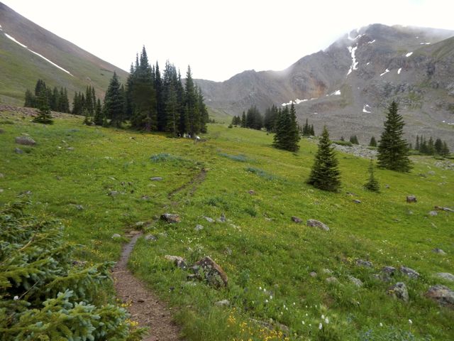
 The map showed a long, leisurely walk out along the continental divide.
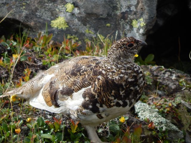
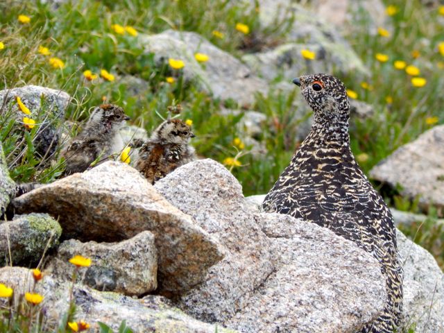
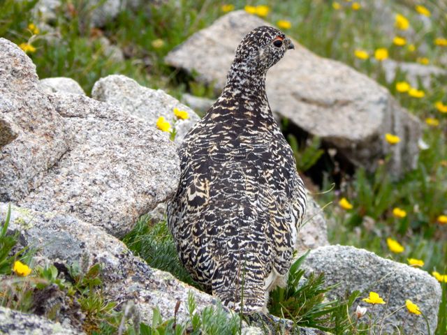
 More ptarmigan. These 4 chicks were very young.
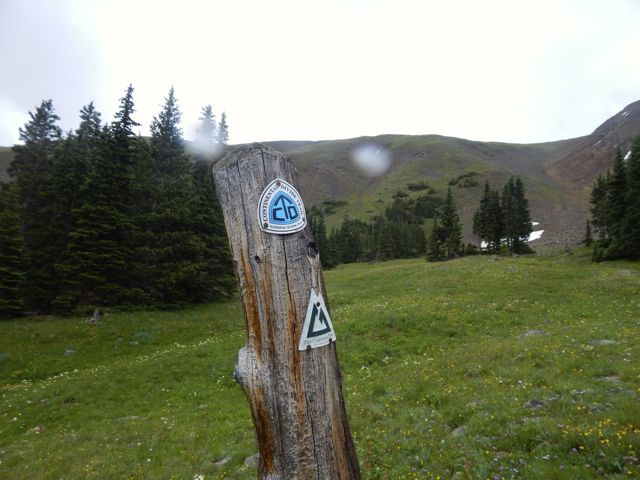
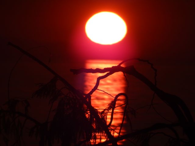
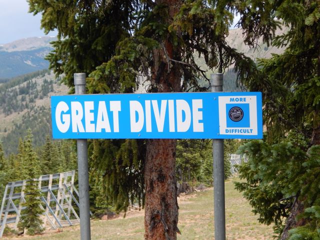
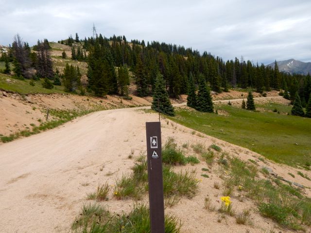
 The end is near. Electricity.
  Traversing the roads atop of Monarch Ski Resort was a bit confusing. There are few trail signs.
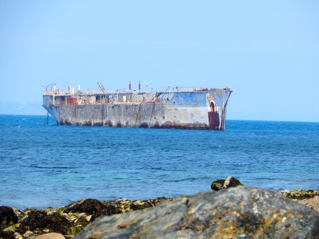
 Here’s the finish. Paved paradise, put up a parking lot.
 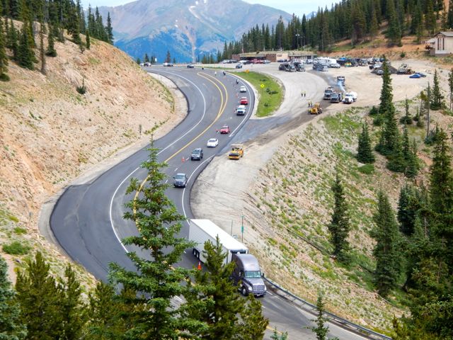 I caught a lift with a trail angel from Buena Vista. In thanks – and celebration – I treated for beer samplers and pork tacos at Elevation brewery.
 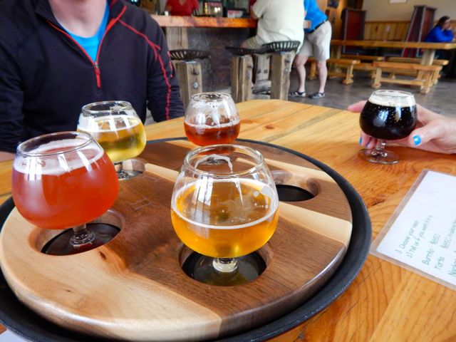 She dropped me at BV tourist information. I hoped to find a bus headed towards Aspen. Bad news: Though public transit is fantastic on the other side of Independence Pass, there are no buses in the poorer Arkansas River valley. 😦