MB Guiding posted the best page for hikers interested in planning a North Coast Trail adventure either independently or guided.
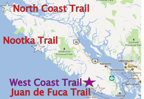

Here’s my own take on that hike, one of the best in the world … with some reservations.

Best hikes, treks, tramps in the world.
MB Guiding posted the best page for hikers interested in planning a North Coast Trail adventure either independently or guided.
Here’s my own take on that hike, one of the best in the world … with some reservations.
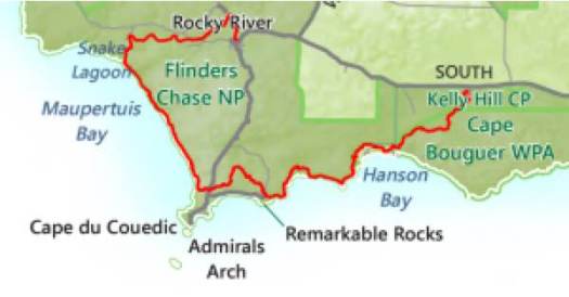
5 days, 66 km close to Adelaide. Opened October 2016.
Click PLAY or watch it on YouTube.
… a unique nature-based experience, giving visitors access to one of the most rugged, remote and spectacular coastlines in Australia.
This section of south-west Kangaroo Island is renowned for its rare and diverse wildlife, pristine bushland and sweeping coastal views. Imagine: the isolation; the serenity; and the natural wonders of this special part of South Australia, and all while walking alongside the vast, awe-inspiring expanse of the Southern Ocean with nothing between you and Antarctica. …

Sunday 10 September 2017.
Check out the scenery. Click PLAY or watch it on Vimeo.
The Khardung La Challenge (72 km) is the Highest Ultra Marathon in the World. … you will be running approximately 60km of the race at above 4000m ( 14,000ft) …
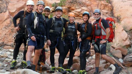
Zion National Park 2015
A canyoneering route.
… Hours after they entered Keyhole Canyon, dark skies unleashed fierce rains that sent water surging through the chasm, sweeping the seven people to their deaths Monday. …
Final image of 7 hikers swept away in Zion flood
Be careful out there.
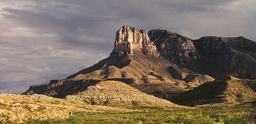
Highpointers are all interested in getting to the top of this mountain. The trailhead is near the Pine Springs Visitor Center.
Guadalupe Peak, also known as Signal Peak, is the highest natural point in Texas, with an elevation of 8,751 feet (2,667 m) …. It is located in Guadalupe Mountains National Park …
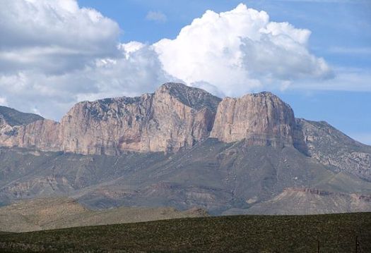
The peak can be climbed by a maintained stony trail (4.25 miles or 6.8 kilometres each way) at any time of the year. …
A stainless steel pyramid marks the summit. It was erected by American Airlines in 1958 to commemorate the 100th anniversary of the Butterfield Overland Mail, a stagecoach route that passed south of the mountain. …

Once there you might want to scramble down and back up to the top of El Capitan, the most impressive face of the massif.
If interested in climbing Guadalupe, click over to SummitPost for details.
Click PLAY or watch it on YouTube.
We’ve updated our Africa page. Leave a comment if any of your favourite hikes are missing.
In addition, we’ve been experimenting adding our best hikes to a custom Google map. At a glance you can see locations on the continent.
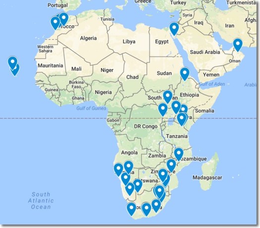
We’ll experiment with this map before adding the rest of the continents.
Click PLAY or watch it on Facebook.