Wales – Pembrokeshire Coast Path – day 3

Trip Report by BestHike editor Rick McCharles

day 1 | 2 | 3 | 4

I had a plan. And plenty of doubts whether or not I’d make all the connections.

8am breakfast at the Manorbier Youth Hostel
8:33am bus to Tenby
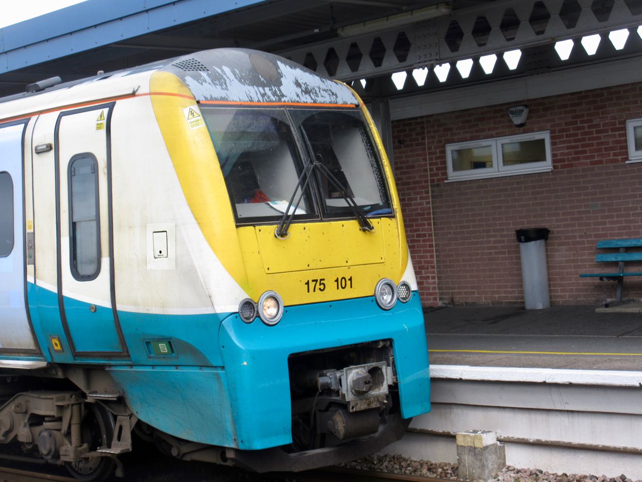
9:37am train to Fishguard

That all worked! I was pleased.

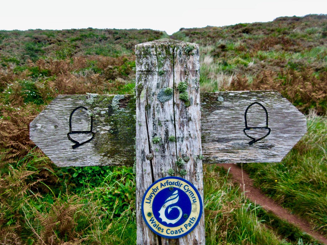
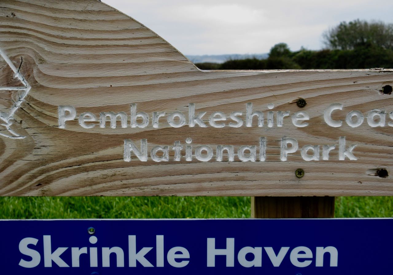
I wanted to continue my hiking on the spectacular northern end of the Coast Path.

I studied the litter by the train tracks. Mostly drink containers. Some fast food wrap. Cigarette packages.

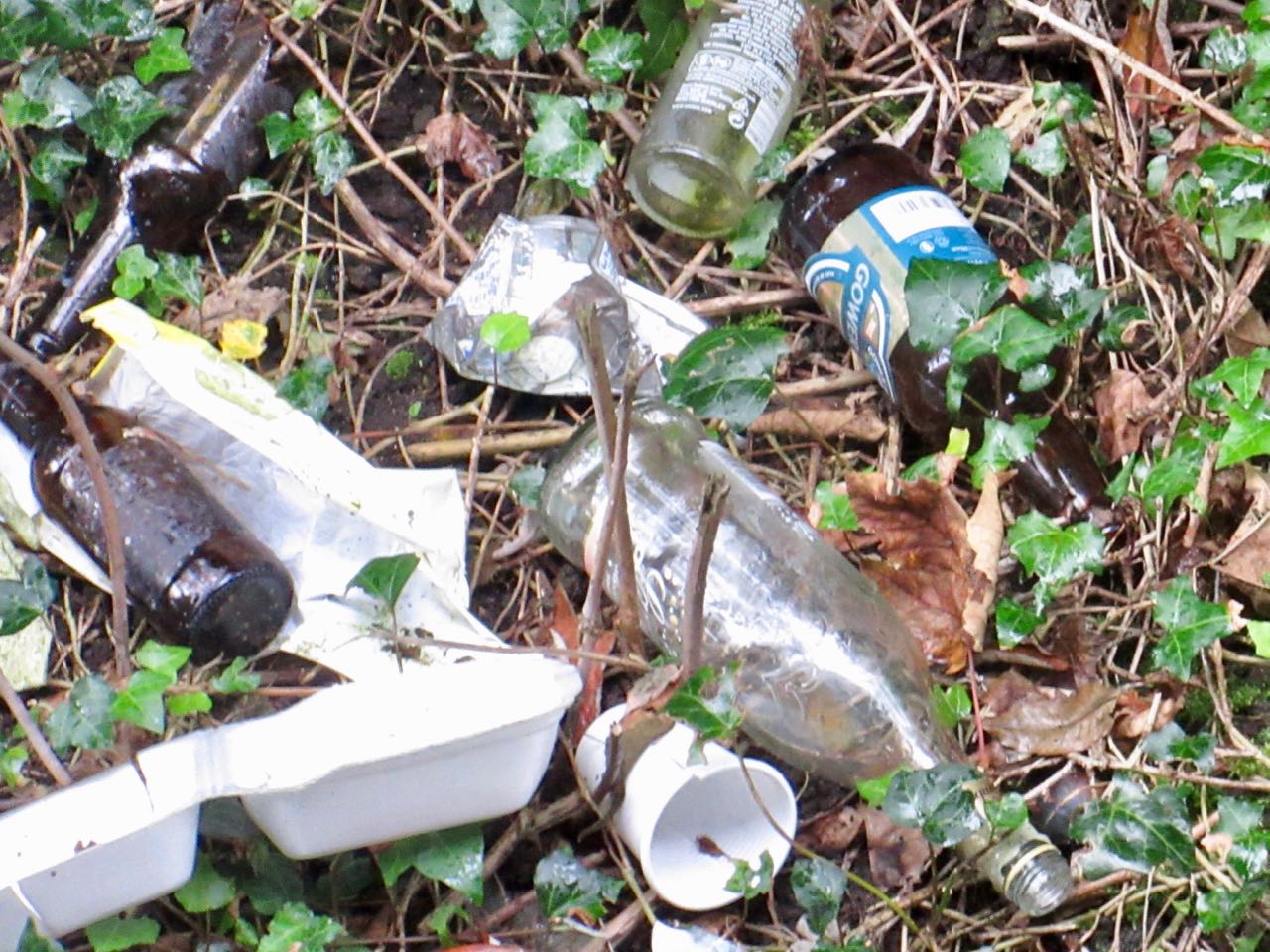
There was no trash can available on this platform. No wonder, Wales.☹️

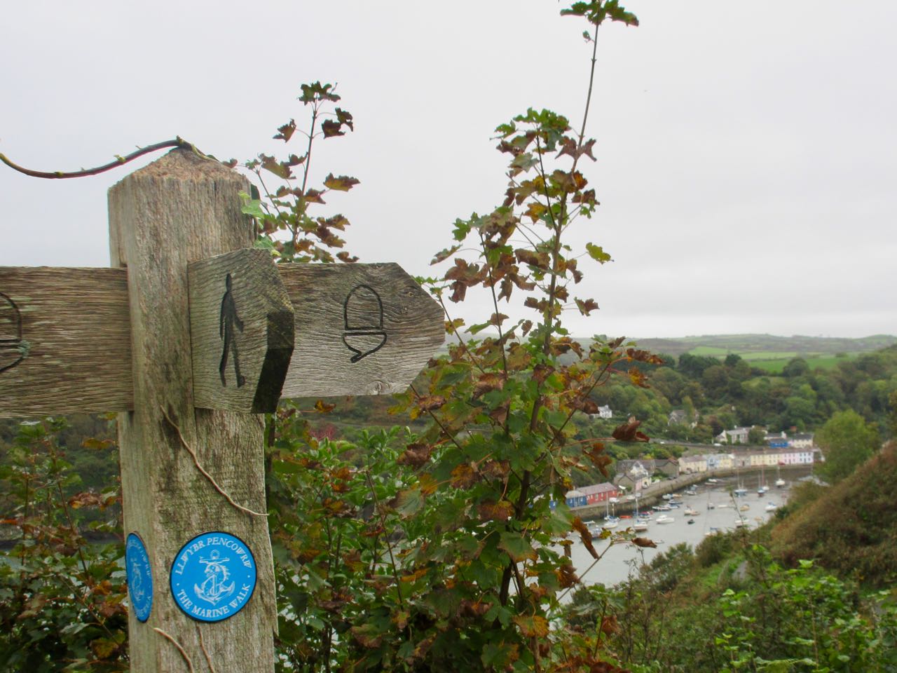
I headed for Fishguard because it had a train station. From there I hoped to catch one of the much promoted coastal bus lines.

Wanting to head in the direction of St. Davids, locals sent me to catch the Strumble Shuttle. Starting Oct 4th it went on winter hours. Only two days a week: Thursday and Saturday.

I checked my watch. I’d arrived Friday, Oct 5th. ☹️

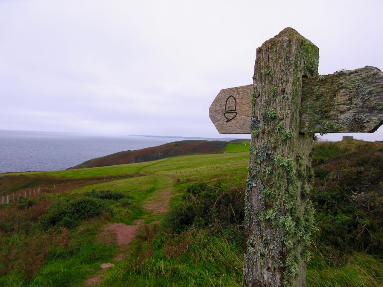
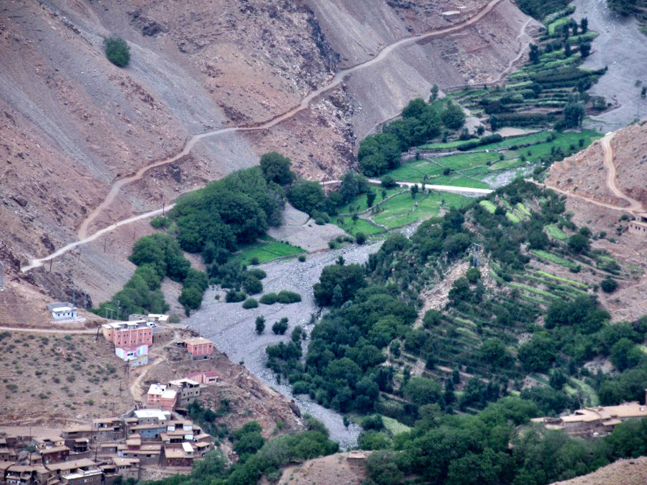
… Oh well. I started walking instead in the other direction. Towards the north end of the Coast Path. The best and most difficult section.

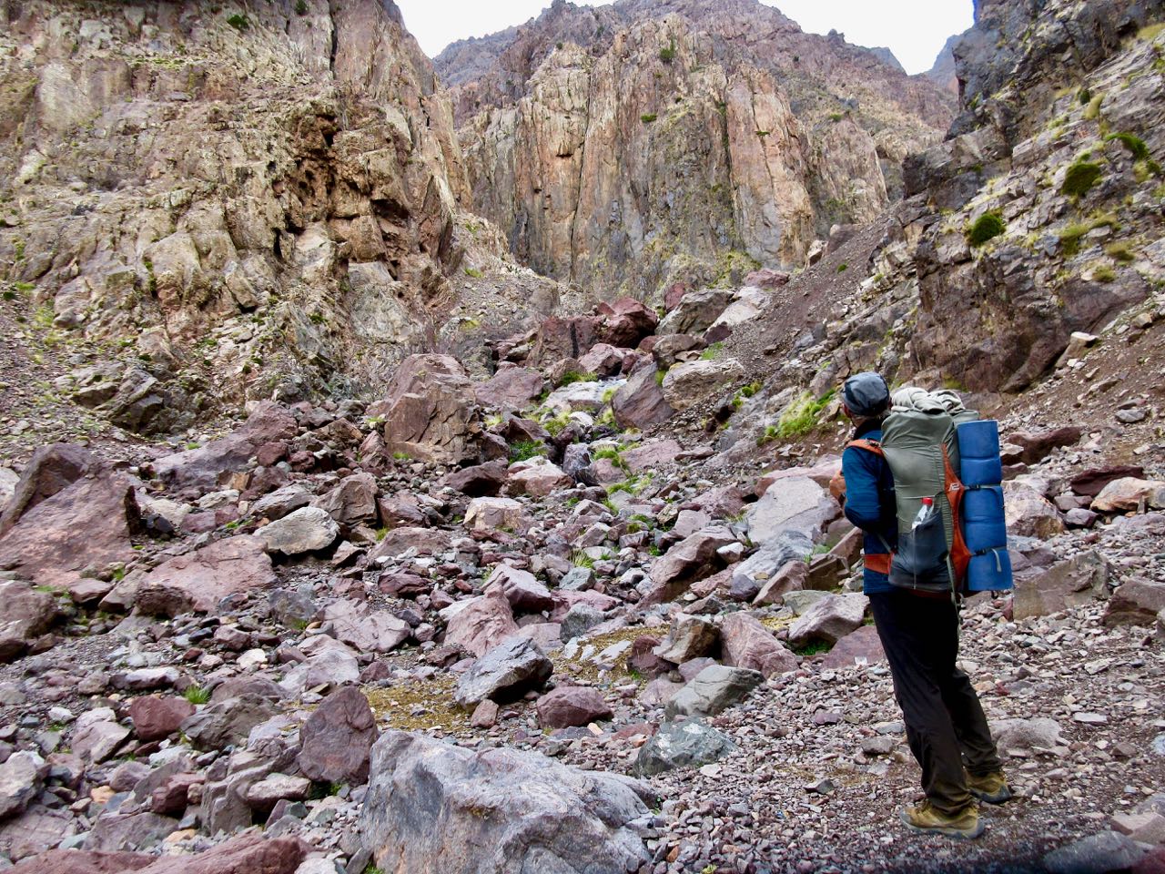
I picked up some provisions (including 2 litres of water) in town before climbing up and away towards headlands.

It was 1pm. I had about 6 hours of daylight to get as far as I could … wanting to shorten tomorrow’s final, most difficult day. I left Fishguard as quickly as possible.

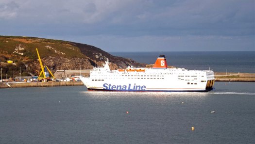
There’s the ferry to Ireland.

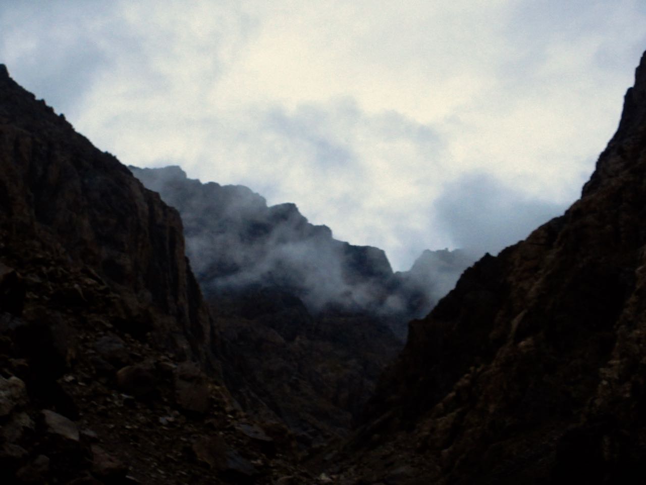
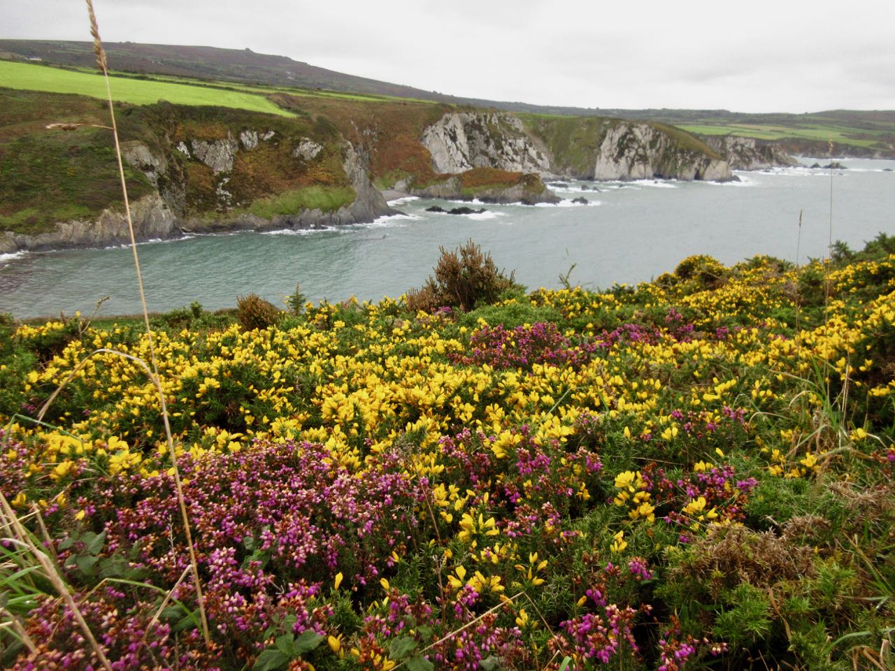
It was misty, almost drizzling, all day. Many of my panorama photos looked a little grey.

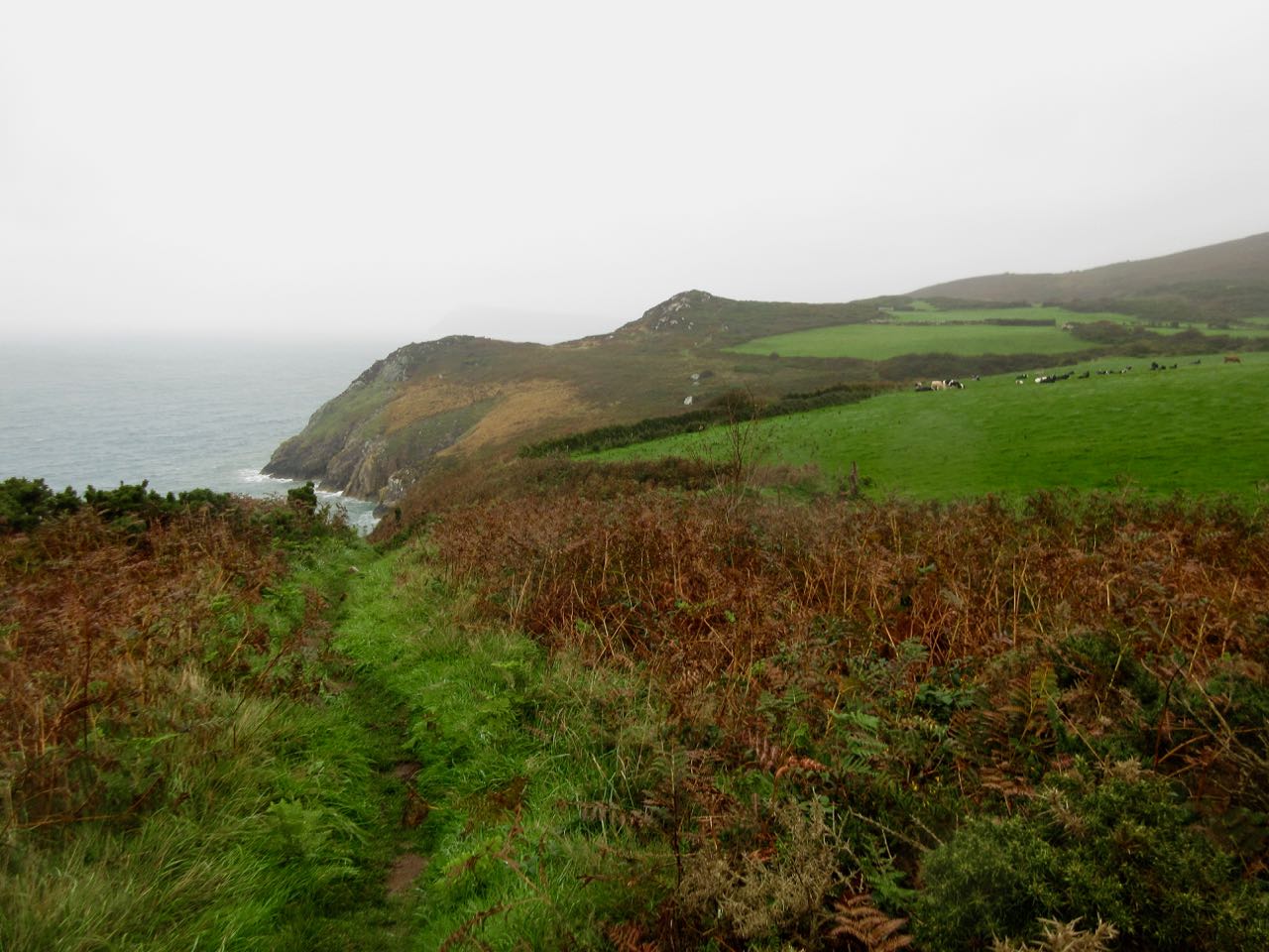
Still, every hiker I spoke with felt it was great weather for walking. I heard it had been too hot in this section during summer 2018.

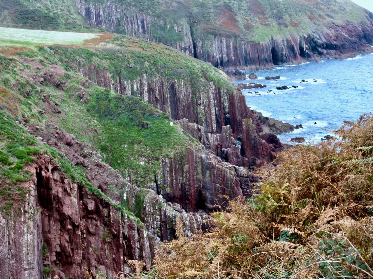
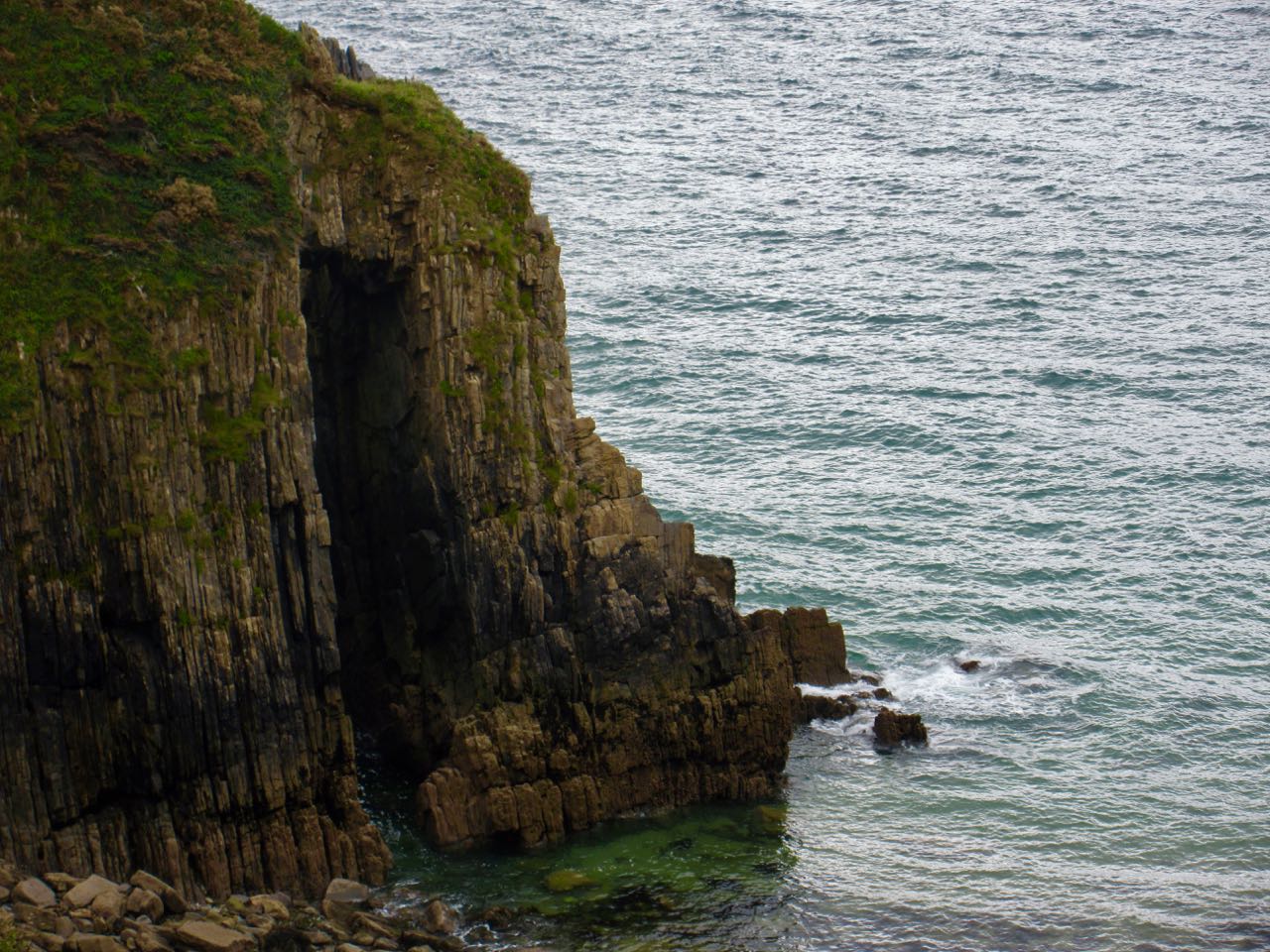
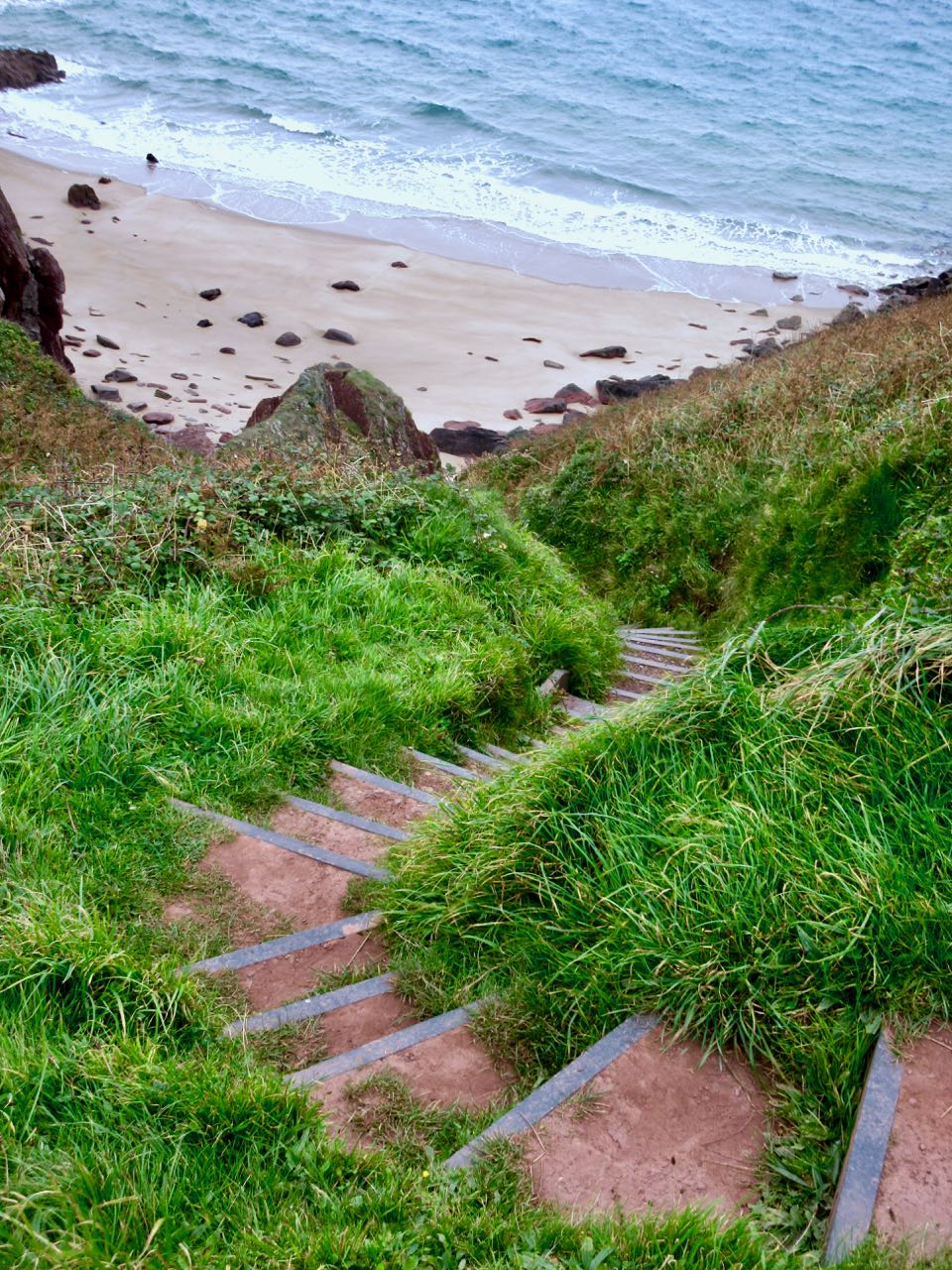
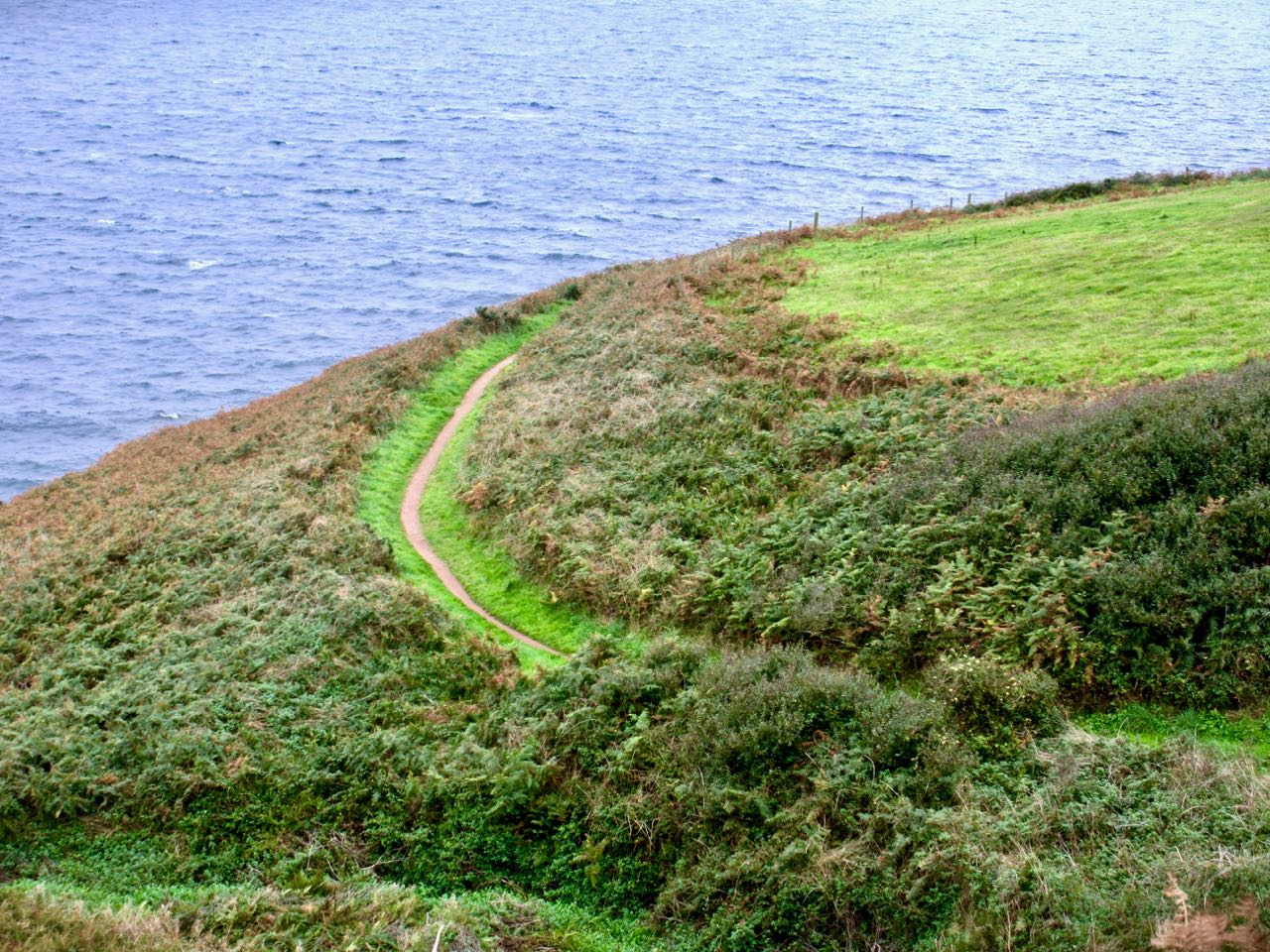
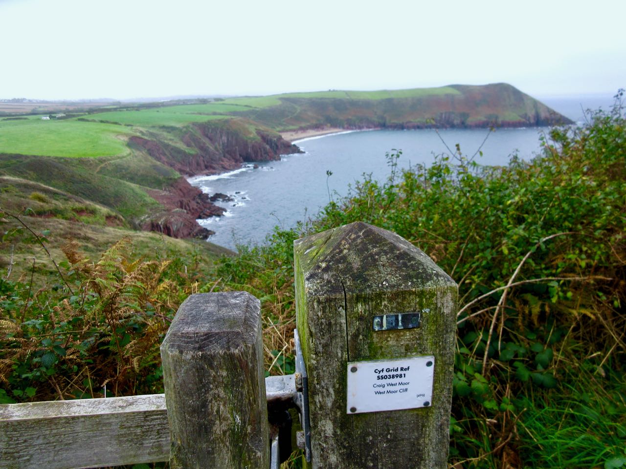
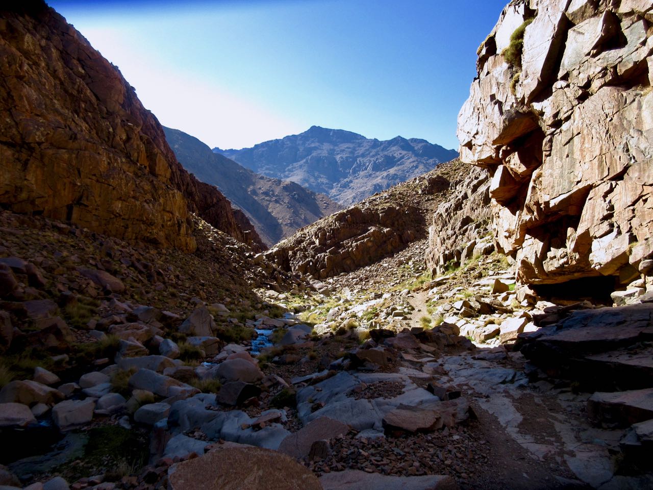
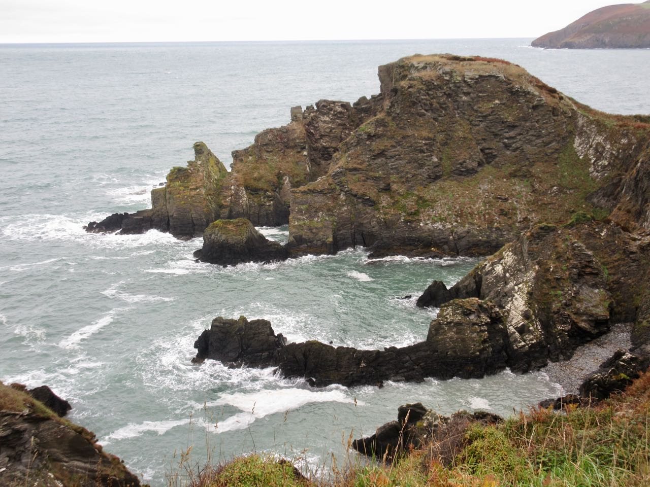
The cliffs grew increasingly rugged. Increasingly challenging. The highpoint of the day is 465ft (142m).

There are more cows than sheep.

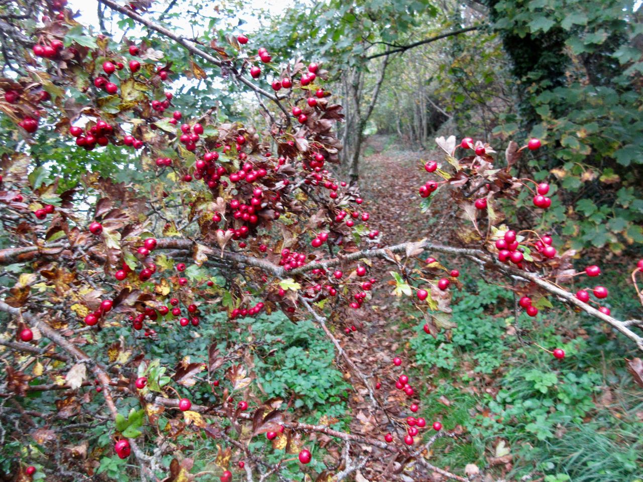
Vegetation is dense. Plenty of thorny berry bushes.

I considered tenting in this bay, but it was still too early in the day.

Certainly I enjoyed the walking. There’s much to distract from the exertions of climbing up and down cliffs with full pack.

About 6pm I started looking for a discrete place to wild camp. Slim pickings. The Welsh have had hundreds of years to lock up their private property. There’s no “right to roam” in Wales.

The public space was a narrow path, dense shrub and then a deadly fall to the sea.

I lucked out reaching a now closed nature reserve. Climbed the fence. Found a secluded spot. And set up the Hubba.

It still had not rained. … Not until the middle of the night when I had to scramble and put on the fly.

day 1 | 2 | 3 | 4

Wales – Pembrokeshire Coast Path – day 2

Trip Report by BestHike editor Rick McCharles

day 1 | 2 | 3 | 4

Day 1 had gone perfectly.

Day 2 would be problematic. I could hike in the opposite direction from the hostel … but it was unlikely I’d find a bus to get me back.

In the end I decided to take a chance. If I couldn’t find a bus, I’d backtrack the way I came. My turnaround time would be 3pm.

Immediately the scenery was more dramatic than anything I’d seen so far. BIG cliffs.

This rugged, remote area is used for military training. At one point I was forced to walk around a training camp.

Most of my day was walking high cliffs.

The few coves had stairs. Most of them, in any case.

You can see how the earth was flipped 90 degrees at some point in geological history.

The Pembrokeshire Coast Path (opened 1970) is part of the longer Wales Coast Path. Many of these trails have multiple logos.

Though I’d been staying at the the Manorbier Youth Hostel (in Skrinkle), I finally made it to the village of Manorbier.

I’d been looking forward to see the quite intact Manorbier Castle. It’s privately owned now, but public can buy tea and access.

Across the way is the 12th century Norman Church.

More interesting to me was an ancient dovecote. This was home to about 250 birds. Doves and pigeons laid 2 eggs about six times a year. Squabs (4-6 weeks) were an important food source as were the eggs.

I carried on. It was hazy all day, but did not rain.

I saw many hikers.

Finally. Clearwater East Beach. It was here I was hoping to find a bus.

I walked the sand dunes to town.

Bad news. The chap in the ice-cream truck told me buses after Oct 1st only run once a day each way. The bus I needed had past about 2 hours earlier.

I ended my hiking day here. Had a bite to eat at the only pub in town. And retraced my steps, running most of the flat sections.

It was still a terrific hiking day.

day 1 | 2 | 3 | 4

Wales – Pembrokeshire Coast Path – day 1

Trip Report by BestHike editor Rick McCharles

day 1 | 2 | 3 | 4

I’ve been trying to get to the Pembrokeshire Coast Path for years. It’s one of our top 10 coastal hikes in the world.

Happily, I can now personally confirm that it deserves to be on that list.

Opened 1970, it’s 186 miles (299km). You can hike it in 12 days of about 15 miles.

Few thru hike. But it’s very popular with day hikers.

I knew the area around Tenby had some of the best hiking sections. So decided to take the train from Cardiff to Tenby to start.

A second train got me 2 miles away from the Manorbier Youth Hostel. (It’s in Skrinkle, not Manorbier.) I used my camera flashlight and Maps.me to find my way over dark rural roads. I arrived at the hostel 9pm.

Next morning I fueled up with a hearty Welsh breakfast. And plenty of coffee.

The hostel is perfect. Right on the Coast Path.

They have inexpensive private rooms, tenting and these cute huts.

It’s an ideal base for hiking. Head for the water. And follow the acorn blazes.

The weather this day was … Welsh. Threatening. But no rain.

Though parkland, much of the walk has grazing animals staring at you.

As expected, these cliffs are rugged.

It’s an area that that has been much used by the British military over the years. Near Penally you can still see trenches where troops trained during WW I.

Approaching Tenby you begin to see holiday home trailer parks.

The number of full time residents is smaller than I’d expect.

The trail is endless entertaining. There’s always something unexpected around the next corner.

I was impressed with Tenby from some distance away.

In fact, I’d say Tenby is as cute and interesting a holiday destination as any town I can recall. Visit Tenby and stay 2-3 nights. There’s plenty to do and see.

Past Tenby is one official end of the Pembrokeshire Coast Path. It’s a nice walk to Amroth.

And I was happy to reach the start.

I caught the last bus returning to Tenby. And the last bus from Tenby back to the hostel.

There are buses along the Pembrokeshire Coast Path, but some run very few times a day. Especially during the “winter” season which normally starts October 1st.

All in all, an excellent hiking day.

day 1 | 2 | 3 | 4

“Hidden Gem” hikes USA

Have you heard of any of these?

1) Gore Range, Eagles Nest Wilderness, Colorado
2) Gap Run, Shenandoah National Park, Virginia
3) Jones Hole, Dinosaur National Monument, Utah
4) Indian Point, Garden of the Gods Wilderness, Illinois
5) Redwood Canyon, Kings Canyon National Park, California
6) Sal Hollow, Mammoth Cave National Park, Kentucky
7) Sahale Glacier Camp, North Cascades National Park, Washington
8) Charon’s Garden, Wichita Mountains Wildlife Refuge, Oklahoma
9) Yankee Paradise, Cumberland Island National Seashore, Georgia
10) Mt. Cabot, White Mountain National Forest, New Hampshire

Find a new adventure in the book “Backpacker Hidden Gems: 100 Greatest Undiscovered Hikes Across America.” Author Maren Horjus, Backpacker Magazine’s destinations editor.

Zion Narrows Backcountry Trek closed

If there’s one iconic backcountry trip at Zion National Park in Utah that lures visitors from around the world, it’s the 16-mile hike through the Zion Narrows. On Tuesday, however, that trek was put out of reach when a private landowner closed his property as an access point to The Narrows. …

National Parks Traveler

It’s still possible to wade / walk part of the Narrows, but not the traditional route.

Morocco’s Toubkal Circuit – day 5

Trip report by BestHike editor Rick McCharles.

day 1 | 2 | 3 | 4 | 5 | info | video

Most guided hikers departed in the dark as — normally — the peak is clearest in the morning. I decided to wait until first light, instead.

In fact, before dawn there were lightning flashes in the direction of Toubkal. I rolled over thinking I’d not be doing the peak at all.

On waking I enjoyed 2 pots of coffee … and waited about an hour before packing up.

… but weather seemed to be clearing.

It was worth giving it a try. I could always turn back if lightning resumed.

The start of the Toubkal climb is the most challenging part. It’s a scramble.

While I was beginning dozens were descending, many wearing headlamps. That was a bit disconcerting. #late #late #late

Vertical gain is about 960m, but it seemed to go quickly and easily for me. I was well acclimatized for altitude.

There are several false summits. Here was my first glimpse of the top.

Myself and a couple from eastern Europe were the highest humans for at least 2000km. And the views were great. 🙂

I could look back to where I’d come from a couple of days ago.

If anything, weather was still improving.

We were the last people on the mountain … except for one Canadian coming up even later. And a Moroccan couple. They were very late because they’d walked up from Imlil. That’s over 2400m of gain in one day!

The couple had found my PHONE! I’d left it on a boulder on the way up. Whew!

I enthusiastically thanked them and urged them to continue as they’d be getting much better weather than the early morning mob.

… I was way wrong. ☹️

Thunder and lightning returned about an hour later. The Canadian turned back. Last he saw the Moroccan couple were still ascending into the lighting storm. Very dangerous.

Me? I hid in a cramped cave.

Once it finally quit I trudged tiredly down to Imlil.

It’s a pretty town, actually.

I was totally psyched to make it back to Marrakesh same day. I pushed.

But the road near the taxi stand was impassable due to flash flood.

I turned back and had dinner in a crossroads restaurant. A huge, steaming omelette.

A Brit I’d spoken with earlier on the street had recommended their hotel — Les Etoiles de Toubkal.

It was excellent. The best room I’d had in nearly 2 months. It cost me $30 including breakfast.

I took several hot, hot showers and went to sleep early.


Next morning I was up before daylight as almost every other guest was packing up and getting ready to hike up to the Refuge. It was fun having breakfast with an enthusiastic group from the U.K.

They left at 8am just as their mules were arriving. YES they did have mules, not horses.

Their U.K. guide confided to me that getting a large group like this started was like herding cats. But once on the trail, it was easy.

My hotel told me the road might open about noon. That prices for transportation would be higher than normal because of the backlog.

I walked down to check. Road still closed. Big machines still arriving.

But the Atlas Extreme shop was finally open. It is well stocked. Copies of all the english language trekking guidebooks including the one I had wanted – Moroccan Atlas by Alan Palmer. Every kind of camping fuel. Top line gear.

Eventually I noticed that the shop was not actually open. The workers there were doing some renovations.

I met the Canadian who got caught in the storm again.  He had an afternoon bus reservation. We decided to try to walk out past all the road blockages to get the first possible transport.

It was less than a km to reach waiting taxis. He and I outbid others wanting to climb into the first waiting vehicle. I paid 6 times what I’d paid on the way up.

It was worth it.

AND he made it to the bus station in Marrakesh on time. With 10 minutes to spare.

My adventure was a surprising success considering how little information I had on arrival in Imlil five days earlier.

day 1 | 2 | 3 | 4 | 5 | info | video

Morocco’s Toubkal Circuit – day 4

Trip report by BestHike editor Rick McCharles.

day 1 | 2 | 3 | 4 | 5 | info | video

Once again the guided hiking group nearby was up and gone before I’d even woken up.

I started up into a very cool gorge section. It was dark and hazy.

This is Azib Imi n’Ouassif (2841m), a crossroads of several gorges where some people camp.

From here it’s a steep climb to the pass at Tizi n’Ouanoums.

Escapee goats live on these inhospitable cliffs. There’s not much to eat.

It was a bit of a relief to reach the second high pass of the circuit. From here it was all downhill … at least while carrying full pack.

Descending the pass was supposed to be a bit treacherous. As I crossed it wasn’t all that bad.

I could see some of the Iceland group having lunch at the bottom. By the time I got there they had begun climbing a secondary trail up the other side to the 2nd / 3rd highest peaks in north Africa. Their guide stayed back having hurt his ankle. In fact he sent the group cook as guide in his stead.

I had some lunch too. Then, with plenty of time, followed. Weather looked good.

The scramble to one Ouanoukrim summit — Ras Ouanoukrim (4083m) — in a hail storm turned out to be the highlight of the entire circuit. We had a blast.

Click PLAY or watch it on YouTube.

I hustled over to another lump of a peak — Timzguida (4089m) — which we later found out to be 5m higher.

In fact my phone had it (wrongly) at 4100m.

I left a Summit Stone.

Once safely down, the others headed off briskly (as they always did) to rejoin their group. One of the men, Dorfi, had once led a 3 week horse trek across Iceland. This weather was nothing to him. He wore a wool sweater under a waterproof poncho on that trip. Never got wet.

In no rush I walked slowly downhill to Toubkal Refuge (3207m).

I’d plan to wild camp again … until I saw the massive complex. It looked intriguing.

As it was raining too I decided to camp at Refuge Mouflon and sign up for the 7pm dinner. It was pretty good.

I charged my batteries in Mouflon after dinner and watched an episode of Better Call Saul on my phone as I waited. Then headed out into the rain to my tent.

day 1 | 2 | 3 | 4 | 5 | info | video

Morocco’s Toubkal Circuit – day 3

Trip report by BestHike editor Rick McCharles.

day 1 | 2 | 3 | 4 | 5 | info | video

I had camped at a site called Azib Likemt with a guided German group.

They were up and gone long before I finished my coffee.

I followed the last of their horsemen up and over a low pass.

From the col you descend to the impressive Berber village of Amsouzert (1797m).

When water is available this mountain range is incredibly lush.

It’s a very interesting place. I could see staying overnight here.

Many homes had satellite dishes.

In fact, I later decided to recommend future hikers start at Amsouzert. It’s on the N10 highway connecting Marrakesh and Ouarzazate. A private taxi is the easiest way to get here.

Not stopping at the many shops and restaurants, I continued up up up to famous Lac d’Ifni back in the National Park.

It’s incredibly rugged with the trail forced high above.

Here I debated whether to stop at the lake. Or continue up towards the gorge climb for the next day.

Pushy shopkeepers decided it for me. I don’t like being harassed while hiking.

So it was out onto the massive spring flooding wash of stones.

Surprisingly, I couldn’t find any water until I reached camp.

Once again I camped near a guided group, this one from Iceland.

I chose my tent site as safest from rockfall.

It was still fairly early in the evening so I did some wandering, mostly laughing at the goats and sheep coming down from the gorge for nightfall.

day 1 | 2 | 3 | 4 | 5 | info | video

Morocco’s Toubkal Circuit – day 2

Trip report by BestHike editor Rick McCharles.

day 1 | 2 | 3 | 4 | 5 | info | video

I woke at dawn. Shared a couple of cups of coffee with Aziz.

Then told him I might return if I couldn’t find the route.

I climbed back up to the paved road surprised to find this hotel.

If I was to do the circuit again I’d hire a cab in Imlil to deliver me here on the paved road. Begin the hike next morning.

I still had no idea where to start the climb up to Tizi Likemt (3550m), the first high pass.

Happily I saw a brightly coloured people walking down the highway in my direction. It was an Israeli couple who had just finished the circuit the opposite direction.

Waiting on them was the smartest thing I did all week. They told me the entire circuit is available on Maps.me. I had downloaded it in advance. My navigation problems were solved.

Maps.me saves the day again.

I’m sure they thought I looked too energetic. Over-confident.

I was raring to go.

On the other hand, this poor carnivore might have been a bad omen.

The climb was very long. And not all that thrilling.

Looking backward …

There’s a Japanese donated weather station at the pass, but you can’t see it from the side I climbed.

It was hot and sunny. No water.

My Darn Toughs did all 5 days of the hiking. I switched to camp socks / shoes each evening.

It was a long, hot descent as well.

In fact, a pass this high first day is stupid. That’s not smart acclimatization. On the way down I resolve to NOT recommend these first 2 days to future hikers.

Here’s the first water I’d seen in hours. All water sources should be treated in these mountains unless you see it coming out of the mountain with your own eyes.

I was happy to reach the river. A German group had already claimed the best spot.

Further along I enjoyed a couple of pots of coffee.

This is a summer grazing settlement. Animals and their keepers will head down soon when snow threatens.

The next section climbing through a gorge was very entertaining. One of my favourite bits.

I finally camped at an open area on another creek near yet another guided hiking group.

Dinner in the dark was coucous, soup, raisins and peanuts. For Morocco I switched from my usual instant mashed potatoes base to couscous.

day 1 | 2 | 3 | 4 | 5 | info | video