Buy less. Buy used.
Repair what you wear out.
Demand recycled.
Demand Fair Trade.
Demand organic.
Click PLAY or watch it on YouTube.

Best hikes, treks, tramps in the world.
Buy less. Buy used.
Repair what you wear out.
Demand recycled.
Demand Fair Trade.
Demand organic.
Click PLAY or watch it on YouTube.
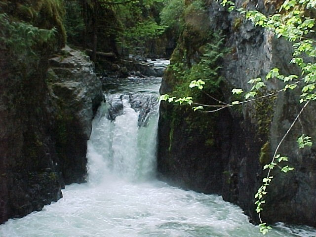
Little Qualicum Falls Provincial Park, established 1940 to protect the old growth forest, offers a terrific 1 hour hike if you are driving between Nanaimo and Port Alberni.
There are plenty of other nearby attractions including Cathedral Grove.
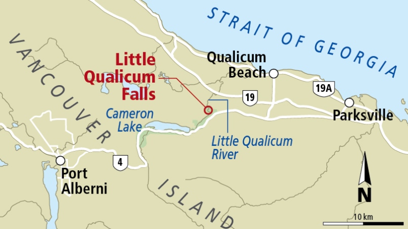
Swimming is possible in good weather. But know that people have drowned here.
Outdoor Vancouver – Little Qualicum Falls Loop
Click PLAY or watch it on YouTube.
Peter Hochhauser put together a wonderful video of his 2016 PCT Trail.
Click PLAY or watch it on YouTube.
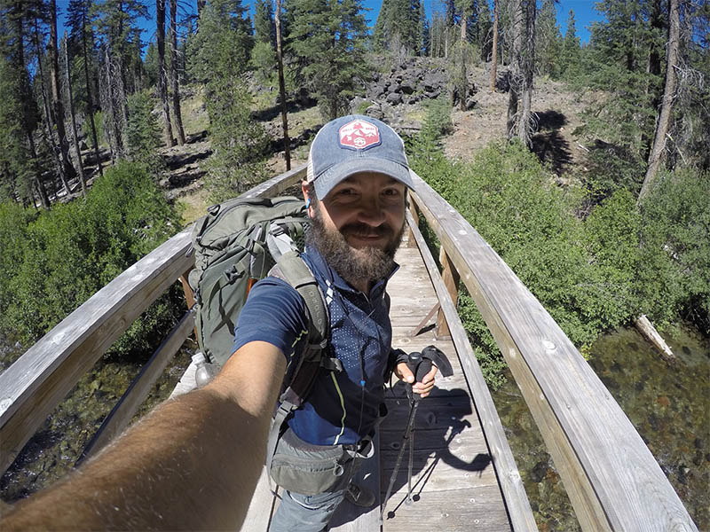
BestHike editor Rick McCharles.
Many, many times I’ve walked the spectacular 2km loop at Englishman River Falls Provincial Park near Parksville B.C.
Often I cycle there from Parksville. Then walk or run the loop a number of times.
Click PLAY or watch a November run on YouTube.
B.C. Parks website. The campsite has over 100 spaces.
Read more – Bikepacking.com – Miles Arbour – ENGLISHMAN RIVER OVERNIGHTER
Click PLAY or watch a summer run on YouTube.
Late November we’re still seeing hundreds / thousands of ducks and geese at low tide.
Click PLAY or watch it on YouTube.
I thought I’d heard of ALL major New Zealand tramps. I lived there for a year.
The 27 km Nydia Track in the Sounds area of Marlborough is an easy 2 day tramp. Plan on an overnight stop at Nydia Bay.
World Expeditions offers a guided tour.
Click PLAY or watch it on YouTube.
The poster boy for Fastest Known Times is Kílian Jornet Burgada.
As I post, Kilian holds the fastest known time for the ascent and descent of Matterhorn, Mont Blanc, Denali and perhaps Everest.
But it’s Buzz Burrell who really popularized the concept, co-founding fastestknowntime.com with Peter Bakwin and Jeff Schuler.
Those three run the site on a voluntary basis. And it’s a ton of work.
Buzz himself had been racing routes for decades. He set the FKT on the Colorado Trail in 1999. The FKT on John Muir in 2000.
This interview with Buzz will fill you with respect. Buzz co-hosts his own audio show called the FKT Podcast.
The Croatian Long Distance Trail (CLDT) was pretty much invented by Nikola (Tesla) Horvat.
Croatia shares a maritime border with Italy. The capital city is Zagreb.
As I post the trail is not recommended due to COVID-19 restrictions. Hopefully it will be possible again starting 2021.
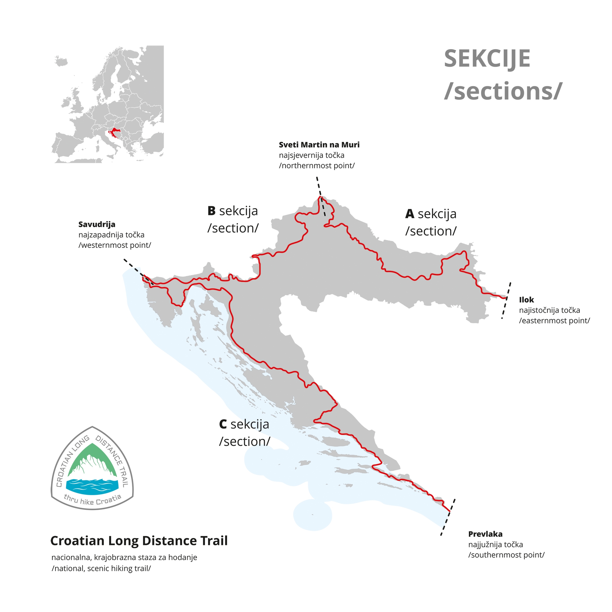
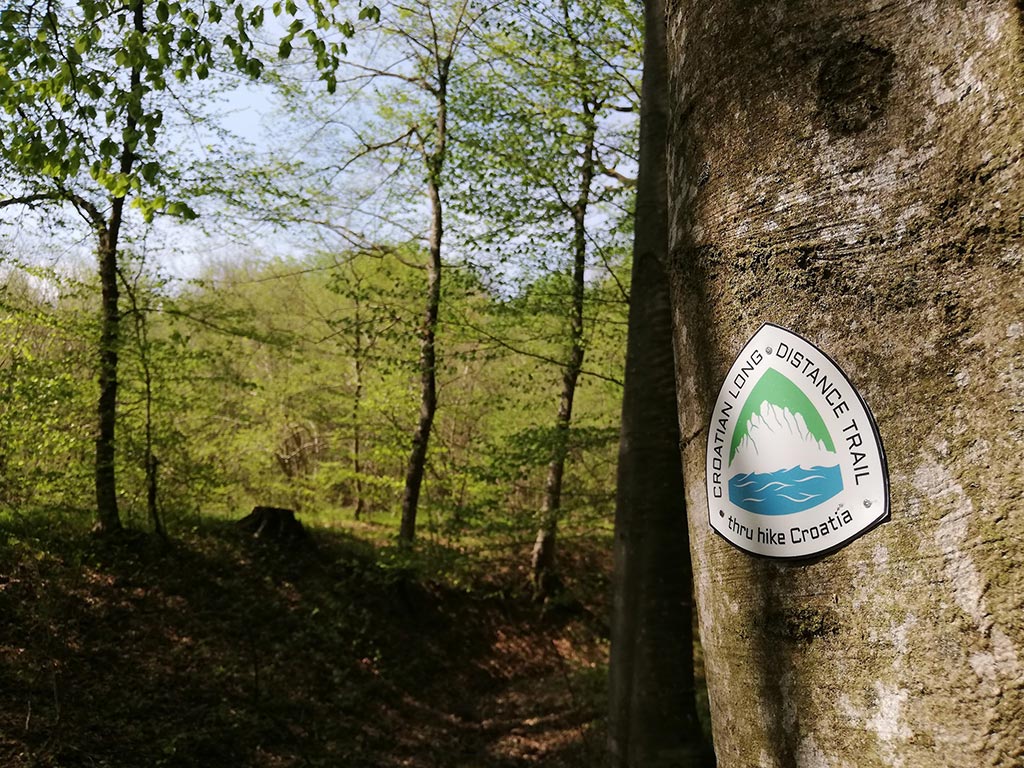
As very few have hiked it yet, you’ll be pleased to hear there is a Guthook Guide. There are some blazes and emblems, as well..
Details on the official website
Dawn low tide at Rathtrevor Beach in Parksville on Vancouver Island.
I’ve been walking early morning at Rathtrevor for months during COVID lockdown. This edit gives you a good feel for the glorious setting.
I’ve not yet tired of taking a morning walk in exactly the same place each day. Every dawn is different.
Low tide here stretches nearly a kilometre out into the Strait of Georgia.
Thousands of birds are here Spring and Autumn during migration. This video shot in November.
Rathtrevor has a terrific campground, if you ever get the chance to visit.
Click PLAY or watch it on YouTube.
Nikola (Tesla) Horvat hiked the Colorado Trail in 2019 putting together this award winning video
Very philosophical. Nature, Time, Community, Mental Health and Final Chapter.
Click PLAY or watch it on YouTube.
Nikola Horvat is a successful PCT and Colorado Trail thru-hiker, author, filmmaker, and founder of the Croatian Long Distance Trail.
He pioneered the CLDT upon returning to Croatia from the PCT in 2016.
He mapped the route himself, authored a guidebook, and founded the Croatian Long Distance Trail Association, of which he is the president.
Two others have thru-hiked the CLDT after him—no foreigners yet, though Second Chance Hiker is on-trail at the moment.
The Trek
