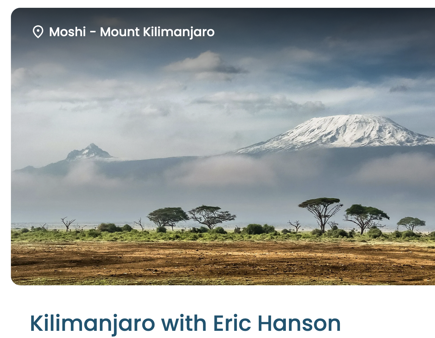
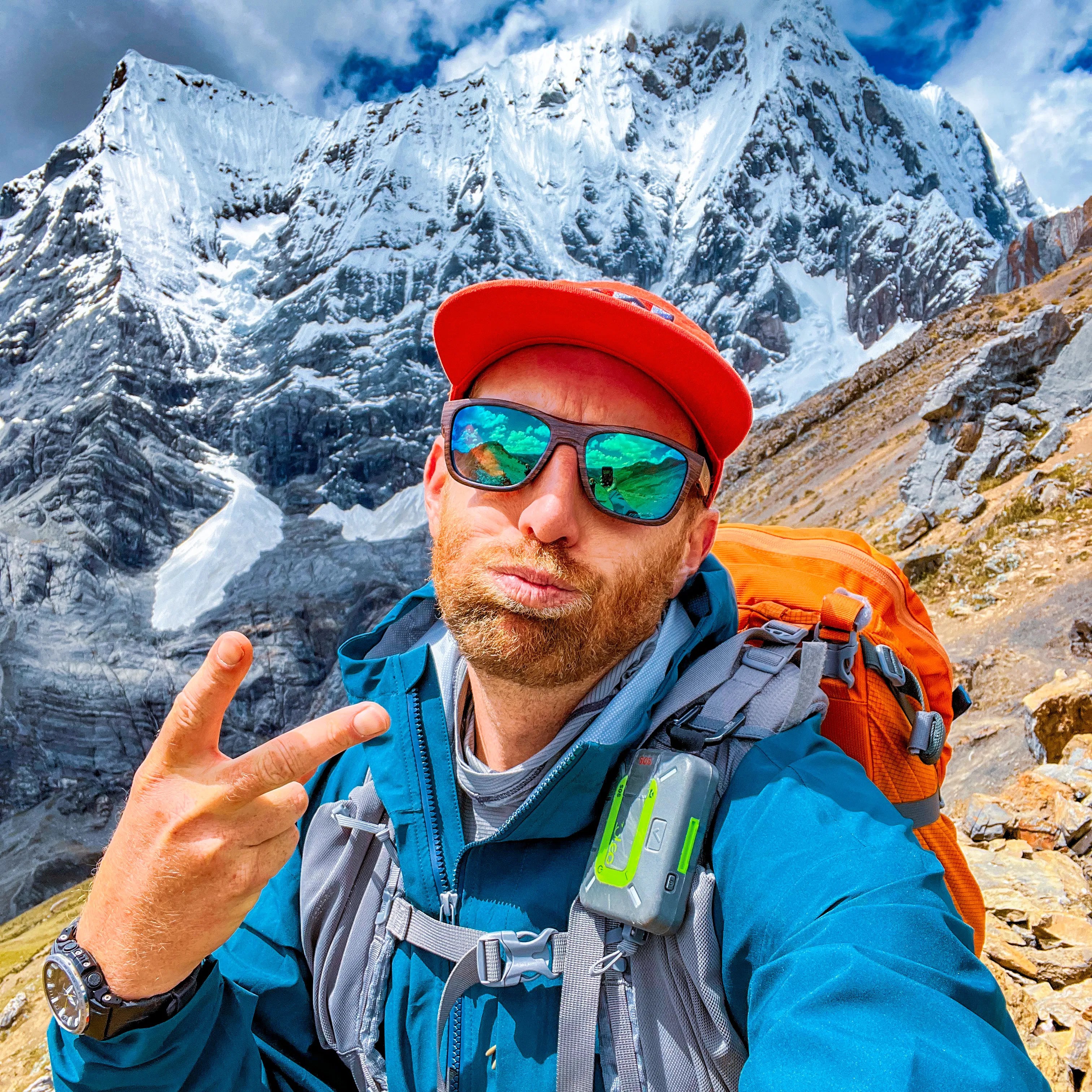
Machame Route (Whiskey Route) for me should be relatively easy. BUT many have to turn back due to altitude sickness symptoms.
My plan is to spend some weeks in Ecuador above 3000m and — hopefully — have some acclimatization ➙ then fly directly to Kilimanjaro airport. Altitude sickness is near impossible to predict. (I’ve never had any despite hiking higher than 6000m many times.)
I’ll stay on in East Africa following Kili. My first visit.
This is the 2nd time I’d signed up for Kilimanjaro. The first was in 2020 — cancelled by Covid.
Joining a group on the trip makes it much less expensive than booking privately. And more fun.
I’d sent in passport and a doctor’s letter confirming my health — but LFC still couldn’t put me on Pinatubo.
Who knows why? In my mind, just another example of how so many things don’t work in the Philippines.
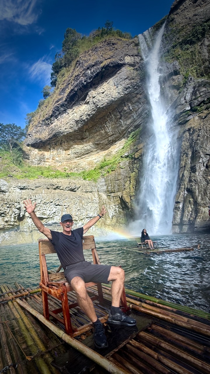
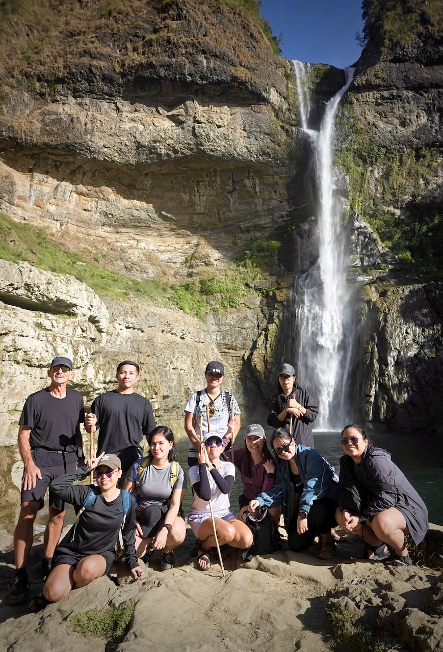
LFC offered me an alternative for the next day ➙ Aw-Asen Falls at 142 feet (43 meters).
I signed on, still irked that it wasn’t Pinatubo.
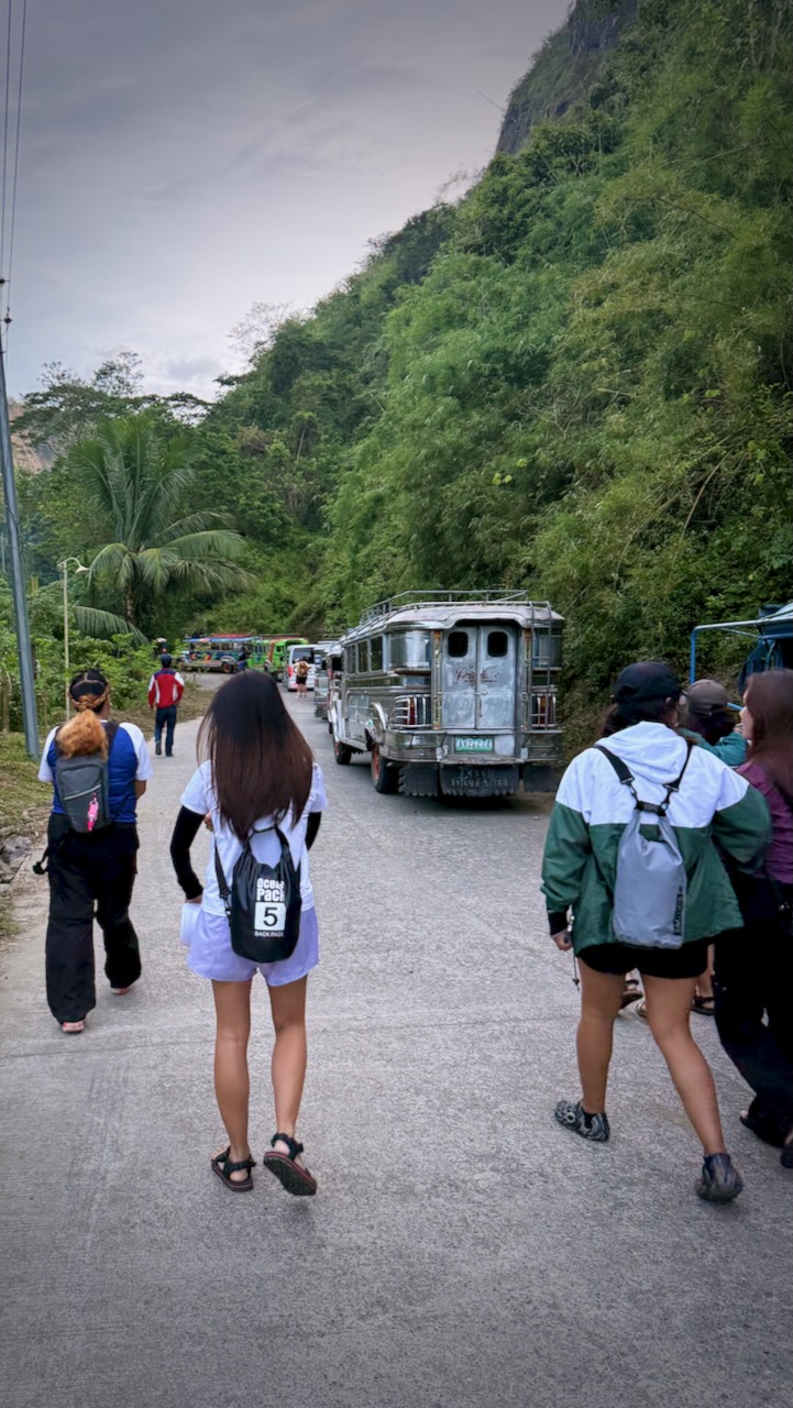
Hikers are picked up in the middle of the night in a Hiace van.
Delivered to the parking lot first thing in the morning. About 5 hours of not sleeping / dozing for me coming from Clark. It’s about 8 hours from Manila!
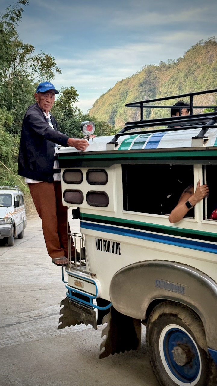
Switched to the worst possible vehicle for the final 17km to the trailhead ➙ an underpowered Jeepney with not much suspension.
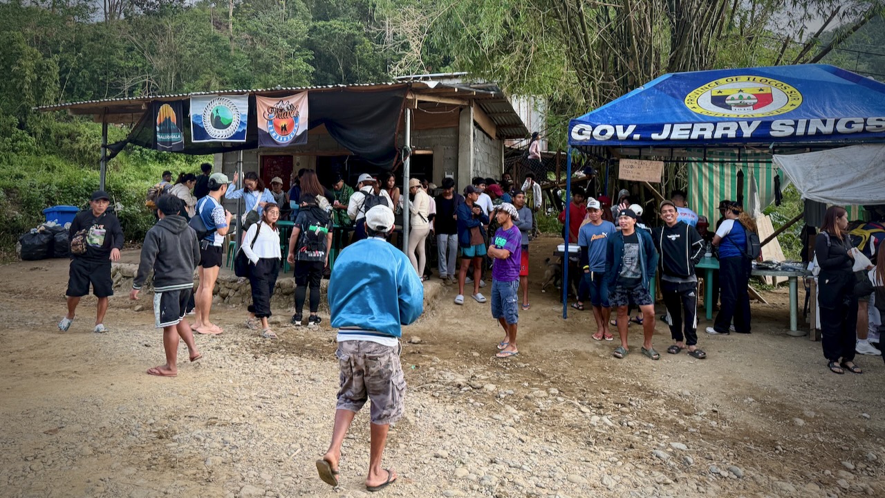
I was shocked to see a couple of hundred hikers out here on a Sunday morning.
I’d say 80% were women. Mostly young women.
It’s not a long hike. BUT there are 919 stone steps up and 919 down. 😀
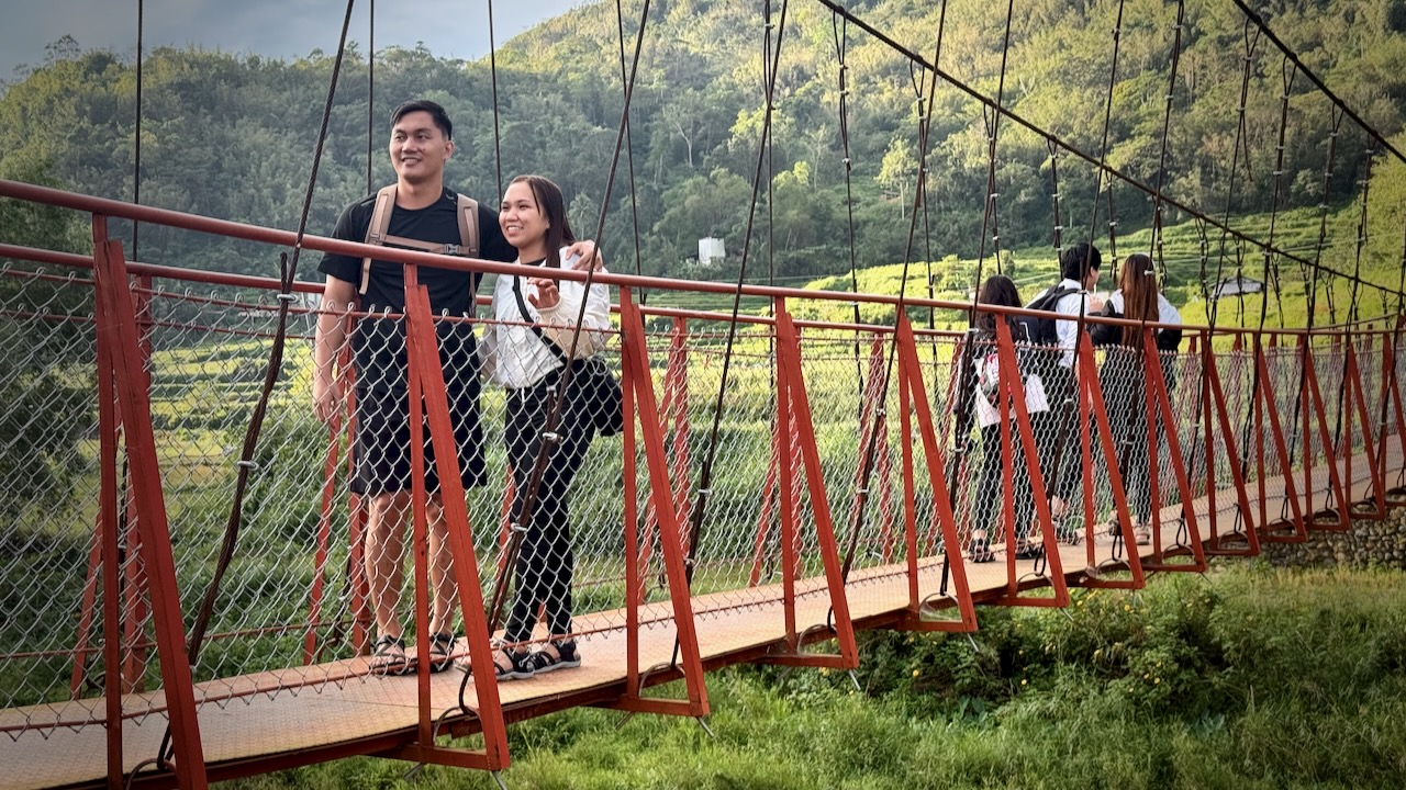
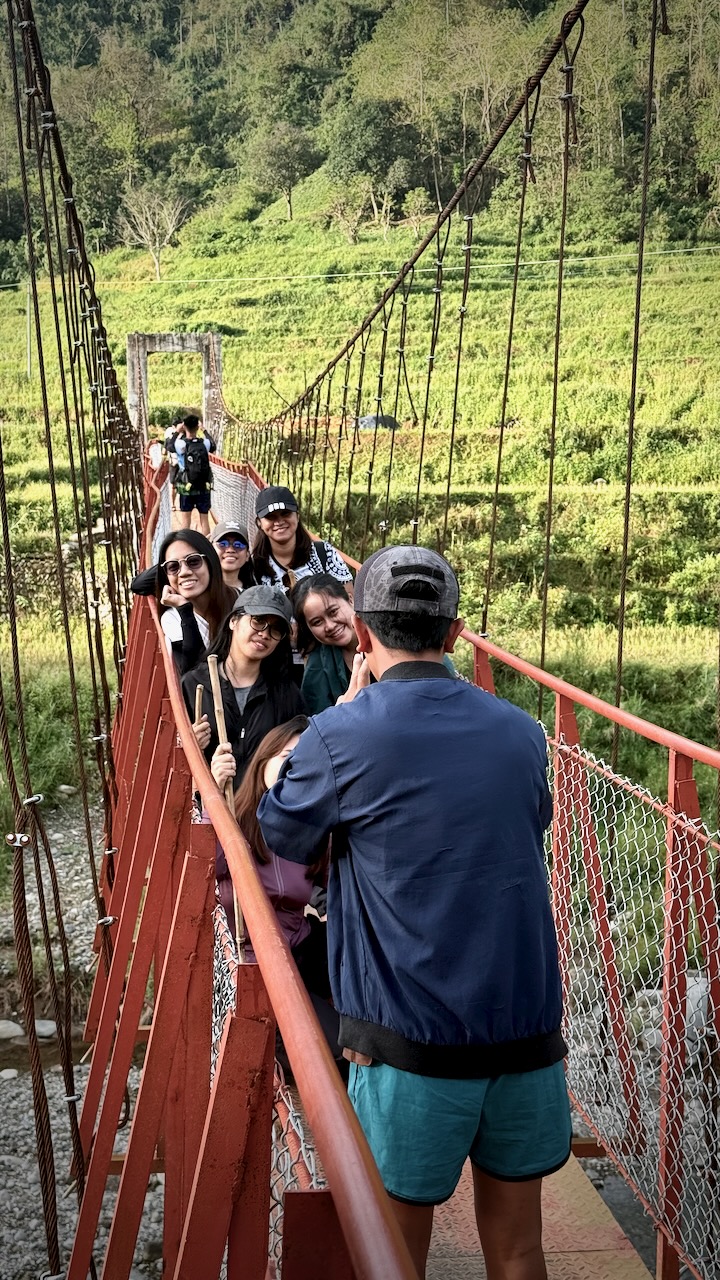
First you cross 2 suspension bridges.
YES, Filipinos love a photo op.
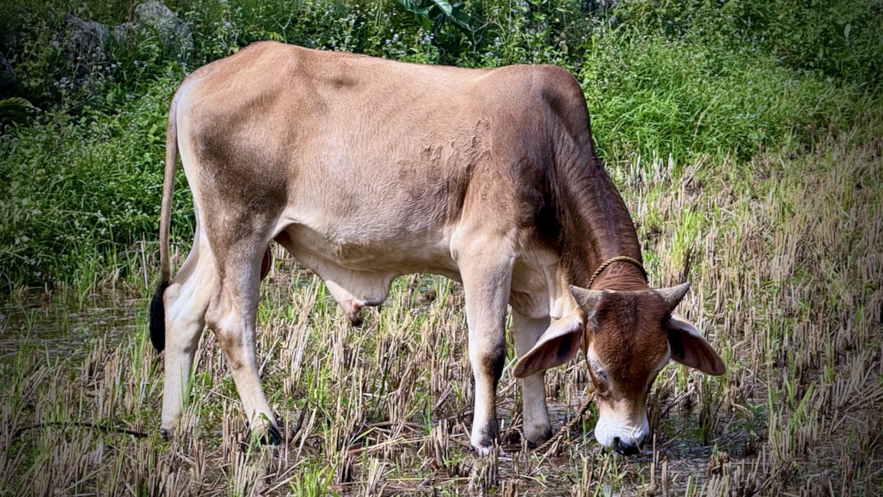
We marched through some paddies.
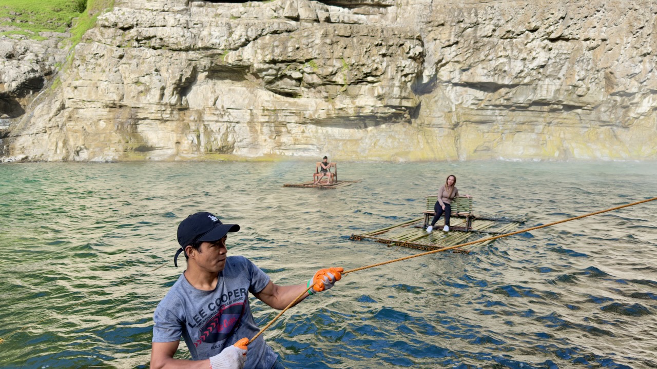
Reaching the Falls, people relaxed for a couple of hours. We’d all arrived early in the day.
Drones are allowed. So there is plenty of footage on YouTube. And even more on TikTok.
Here’s our group. I only saw one other foreigner at the Falls. This hike seems to be quite unknown outside the nation. It’s not even on AllTrails.
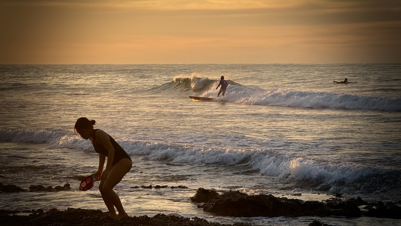
On the return drive, we stopped for sunset at San Juan, La Union, a famed surfer beach. Consistent intermediate quality waves make it ideal for beginners.
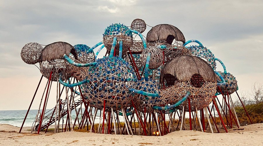
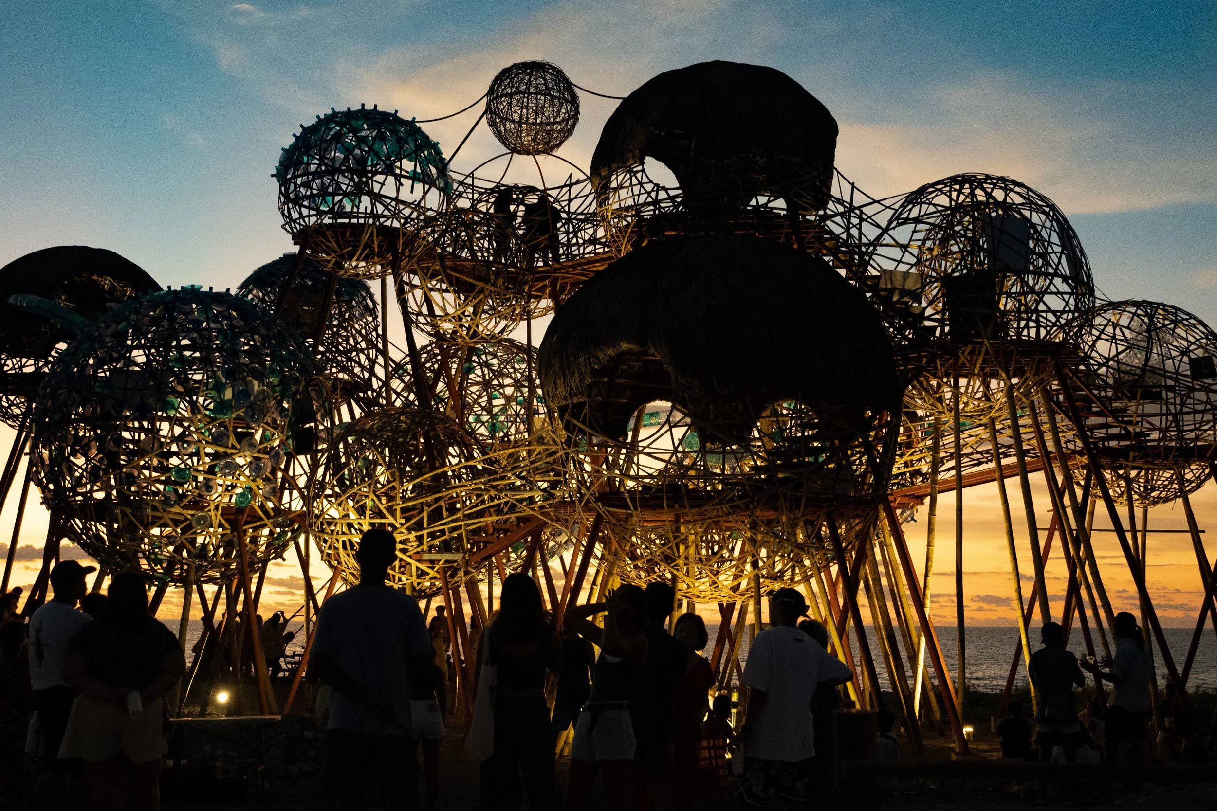
Mebuyan’s Vessel, an homage to the Bagobo goddess of the underworld, is an installation of 21 interconnected, inhabitable pods.
Signage said it could be climbed — but it was inexplicably closed. I must be in the Philippines.
A good trip, all in all.
Plenty of night driving, however. Those coming from Manila got very little sleep 2 nights in a row.
But I understand Wikiloc is good for Europe and South America.
I use Komoot for bikepacking and have been very happy with that product. Is it any good for hiking?
In this post I compare offline navigation for the paid subscriptions.
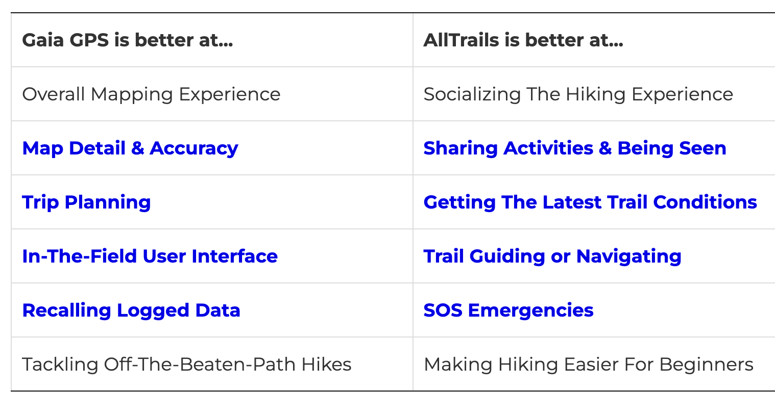
For discovering trails nearbyme (Parksville, Vancouver Island) on their websites, I felt Komoot was weakest. AllTrails best, by far.
On the other hand, one problem with AllTrails is displaying too many options. Too many variations in the same hiking area can be confusing. Since there is a lot of user generated content, quality is mixed.
When I decided on a well known, popular hiking area ➙ Little Qualicum Falls, again AllTrails was by far best at giving me hiking options.
In terms of description, the AllTrails preview graphic video is most useful for me. I make a lot of decisions on which hike to choose based on these preview videos.
So far, AllTrails is by far my favourite of the three.
Next I went to my iPhones.
Logged into all 3 apps, I searched for “Englishman River Falls“. This is one of the most popular and well established hikes nearby. Komoot identified the trail on a map, but didn’t offer a way to SAVE and download.
I did the hike simultaneously using Gaia and AllTrails on two phones. Both worked well at the basic function of navigation.
I won’t use many of the functions, including Lifeline on AllTrails.
IF I want to make a record of any particular hike, I use the free version of the ReLiveapp. I’ve had a paid subscription in the past, but find the free features enough for my purposes.
Most mornings I take coffee down to Rathtrevor Beach Provincial Park, my favourite walk in the area.
Again,
Johnny Cheng did a deep dive into both apps, concluding that more inexperienced hikers would probably like AllTrails better. That hunters and those going off trail would appreciate the enhanced mapping features of Gaia GPS.
I’ll search for hikes using a number of different sources as AllTrails can be confusing.
Look at the video preview on AllTrails.
Mostly use AllTrails for navigation. And compare with Gaia if there is any confusion.
Honestly, for the majority of trails I hike I follow signage. And check the free offline Maps.me app to confirm I’m still on popular trails. It’s all I used on the challenging Laugevagur Trail in Iceland, for example, summer 2023.
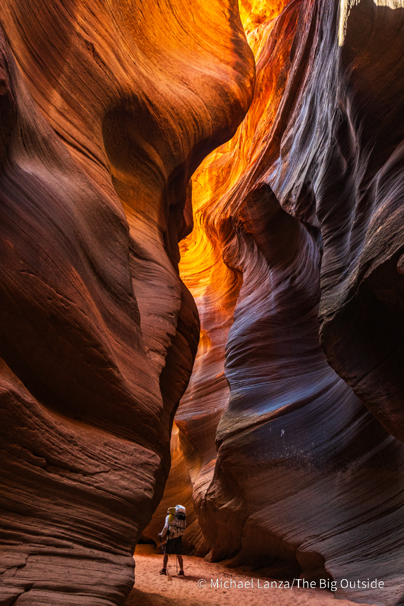
Widely considered the best slot canyon hike in the world!
Michael Lanza wrote-up a terrific trip report:
Before long, the walls stand barely more than shoulder-width apart and perhaps a hundred feet tall and the light at the bottom of this slot canyon grows dim.
We downclimb a sturdy wooden ladder installed for getting over a pour-off that drops several feet.
Little or no direct sunlight reaches us now, only the reflected light hitting the tops of these walls and seeping downward. In rare places where the twisting canyon aligns with the sun, the sudden direct sunlight feels intensely hot, especially in contrast to the pleasant coolness of the deep shade filling most of this slot.
A UNESCO World Heritage site, one of the great tourist destinations of the world, most everyone likes the quaint mountain town, Banff, in the Canadian Rockies. Growth is strictly limited by National Park regulations.
… at 1,463 m (4,800 ft), it is the town with the second highest elevation in Canada, the highest being Lake Louise.
It is surrounded by mountains, notably Mount Rundle, Sulphur Mountain, Mount Norquay, and Cascade Mountain; and situated above Bow Falls near the junction of the Bow and Spray Rivers. Banff is located 126 km (78 mi) west of Calgary and 58 km (36 mi) east of Lake Louise …
…. It is a major destination for outdoor sports and features extensive hiking, biking, scrambling and skiing areas within the region. …
Canmore is a smaller town (pop. 12,000) just outside the park, a great alternative to touristy Banff. Alpine Club of Canada headquarters are located in Canmore. Many experienced hikers prefer it as a home base.
Two of our top 10 hikes in the world can be reached from here:
Lake O’Hara, for example, is the prettiest mountain hiking in the Rockies.
Plan for July to mid-September in the northern Rockies. Banff is a great town, but the hiking season is short. Blizzards are not uncommon in September. We often suggest Aug. 1st as a good start date for a walking holiday here. Disclosure: besthike is based out of Calgary. Banff is our backyard playground. You could certainly accuse us of bias. 😀
BestHike editor Rick McCharles spends a week or so each Spring hiking and skiing. The trails are near empty — though you might want to wear spiked shoes.
I’ve mostly been very lucky with the weather over 4 months in S.E. Asia and Taiwan.
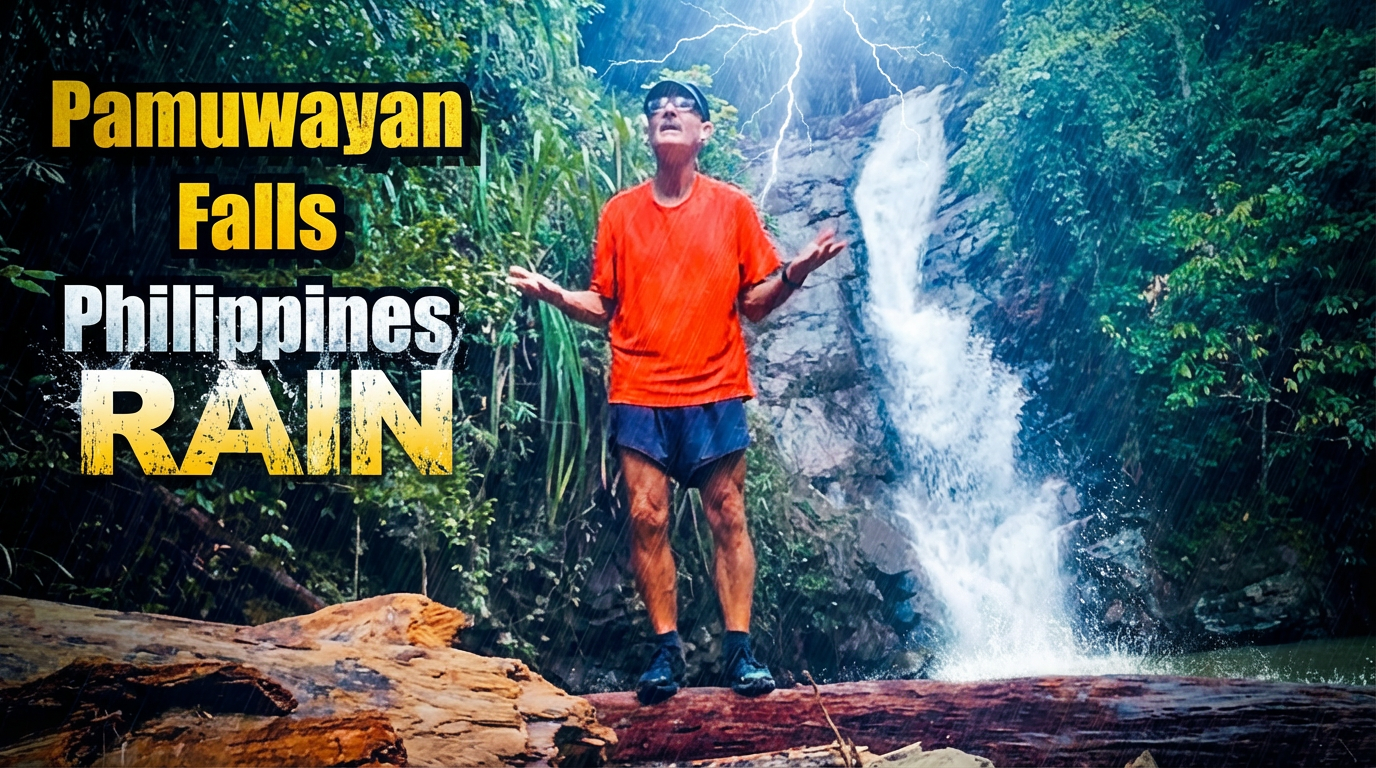
BUT it’s rained every day since I got to Palawan island.
A.I. enhanced photo. No actual lightning at the waterfall.
They have frequent earthquakes, cyclones, and volcanic eruptions here. Who knew? 😀
The dry season in the Philippines generally runs from December to May.
But 2025 has been wetter than normal. I spoke with one tour guide with a group of Romanian tourists who’s had to change plans most days for the past 2 weeks.
Many tours, especially those by boat, are cancelled by government order.
I started a day hike to Pamuayan Falls out of Port Barton in good weather. The rain pounded down for perhaps 20 minutes. Then cleared up again.
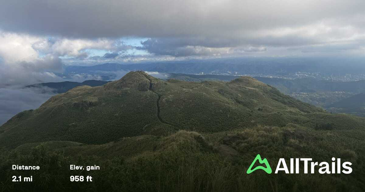
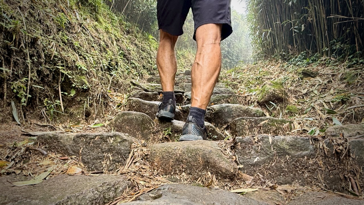
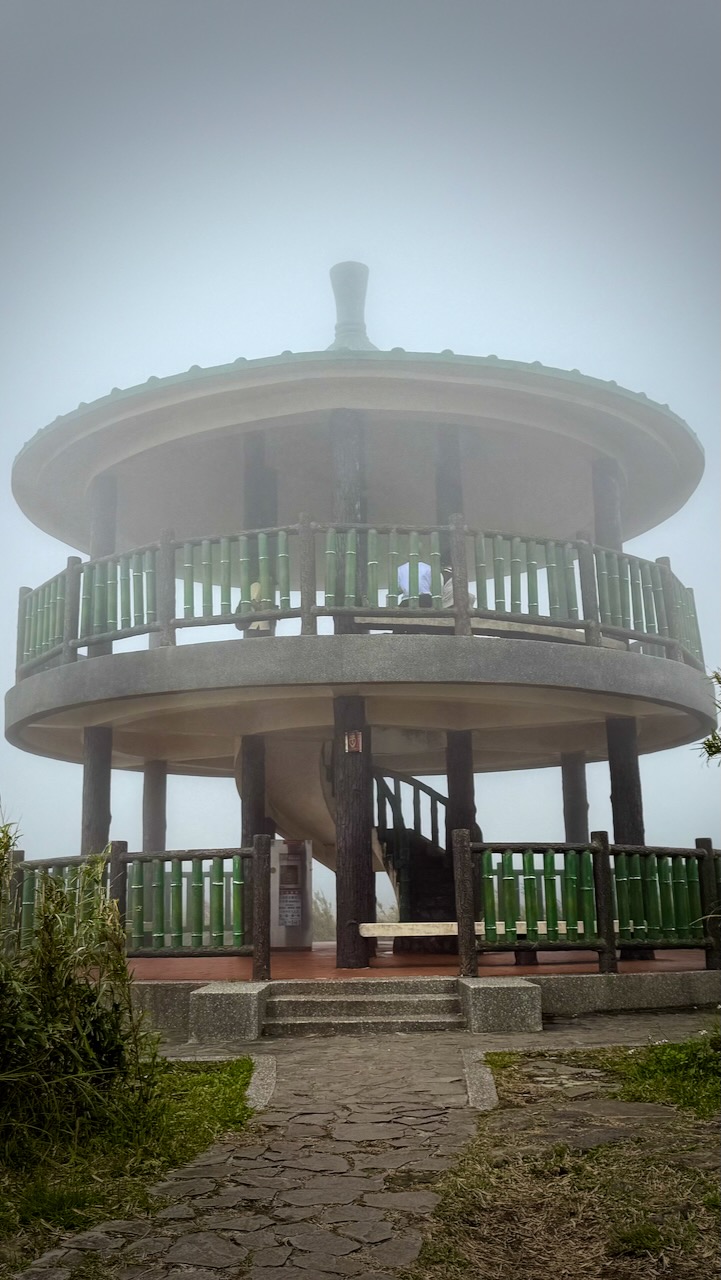
All trails are well-maintained with stone steps and converge at the windswept main peak.
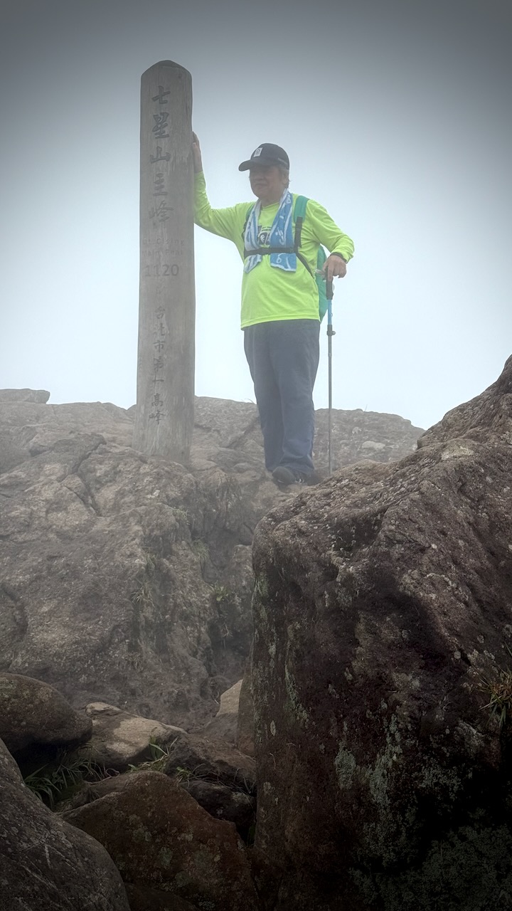
The summit is the ultimate reward, offering a magnificent 360-degree panorama of the entire national park, the Taipei cityscape, and the northern coast on clear days.
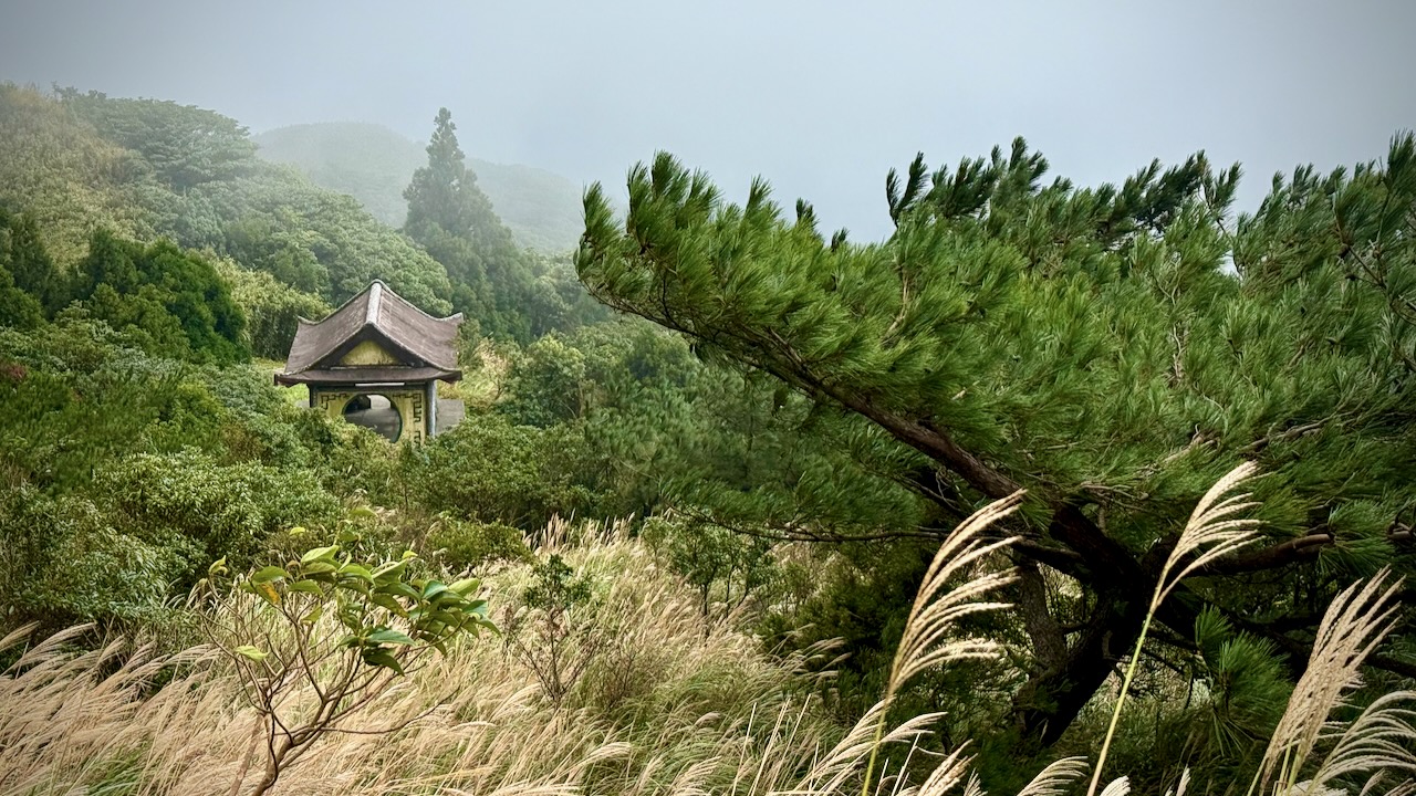
The national park is known for its cherry blossoms, hot springs, sulfur deposits, fumaroles, venomous snakes, and hiking trails, including Taiwan’s tallest dormant volcano, Qixing (Seven Star) Mountain rising to 1,120 m (3,675 ft).
There are several Visitors Centres, each very helpful in helping you decide on hikes ➙ starting and finishing. Public transportation is super crowded here.
As you can see, clouds covered the peak when I was there. Not unusual.
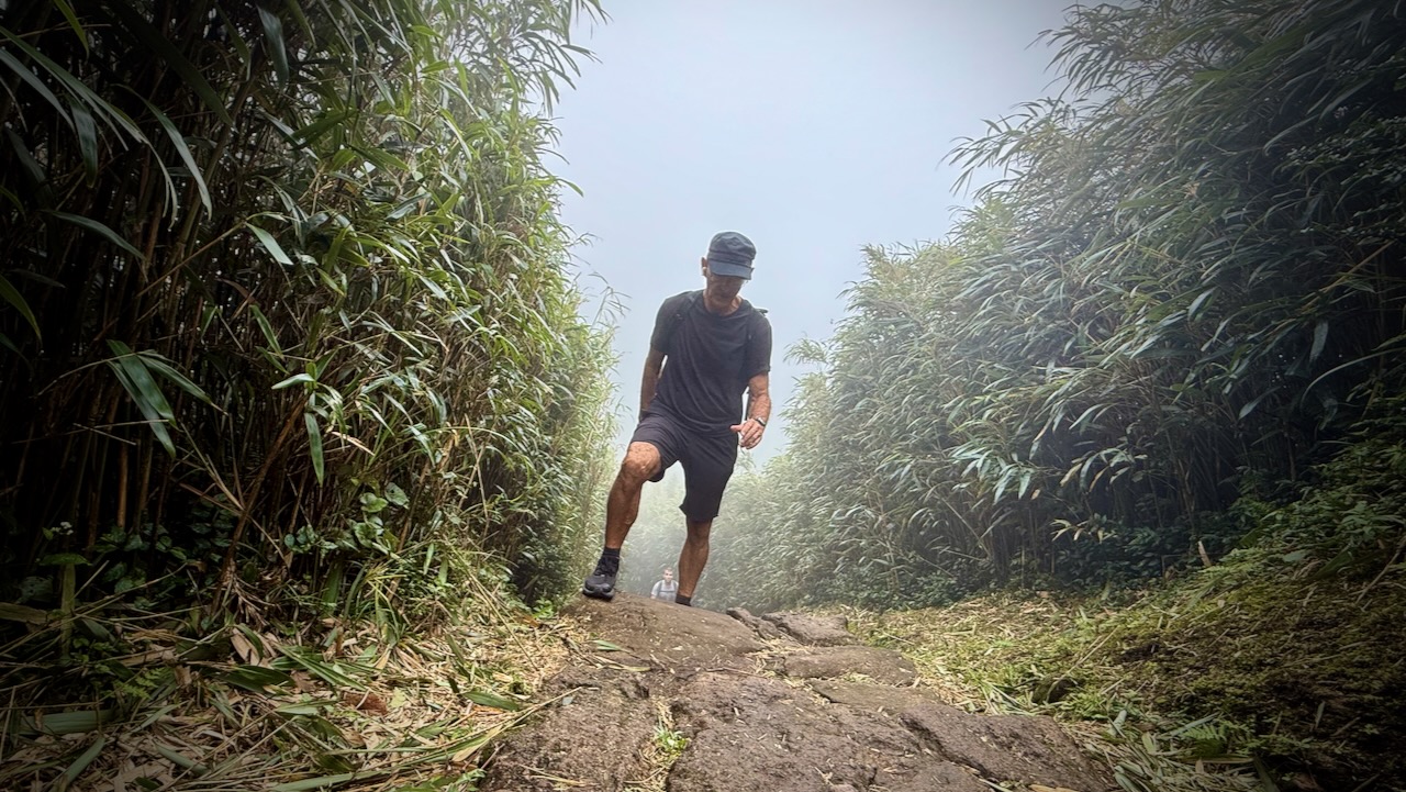
Stone steps keep you out of the mud in most cases. But they are irregular shapes and sizes.
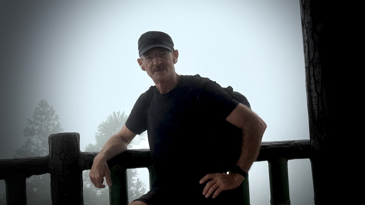
The summit is often crowded. I didn’t linger long.
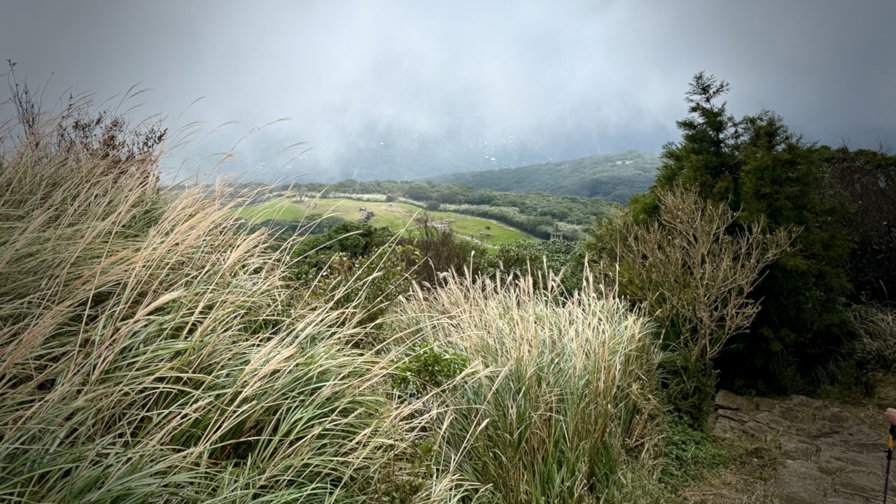
Actually, I enjoyed the clouds blowing in and out, sometimes revealing the vista below.
It can get windy up here, of course
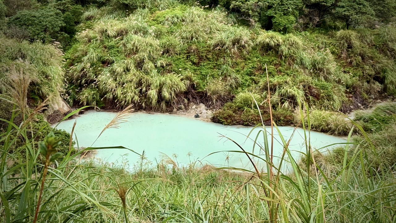
Volcanic sediments in this pond give it a milky appearance.
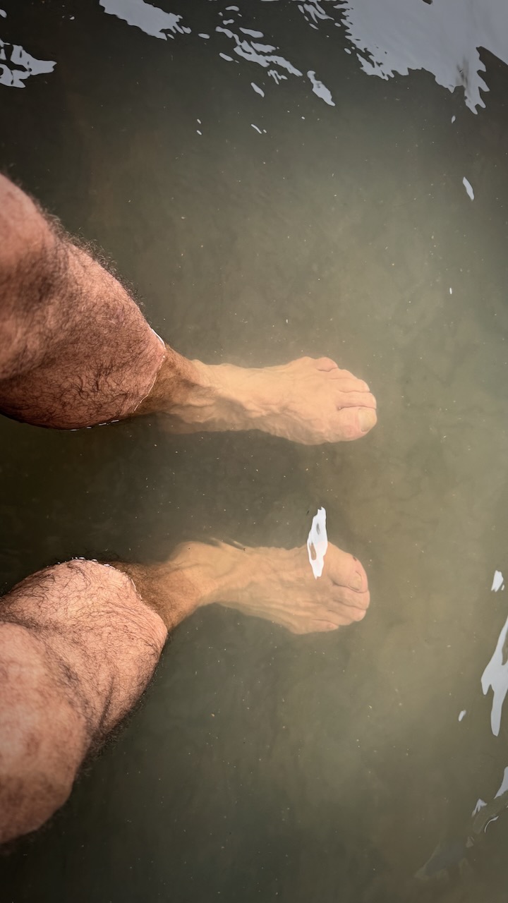
I finished near Lengshuikeng Hot Springs and would love to have finished with a soak. But these Springs have unusual opening hours. Locked when I was there. AND I was worried about getting back to Taipei on the busy tourist buses.
So I simply soaked my feet in the outdoor pothole.
All-in-all, it’s well worth getting out to Yangmingshan National Park if you are ever in Taipei.