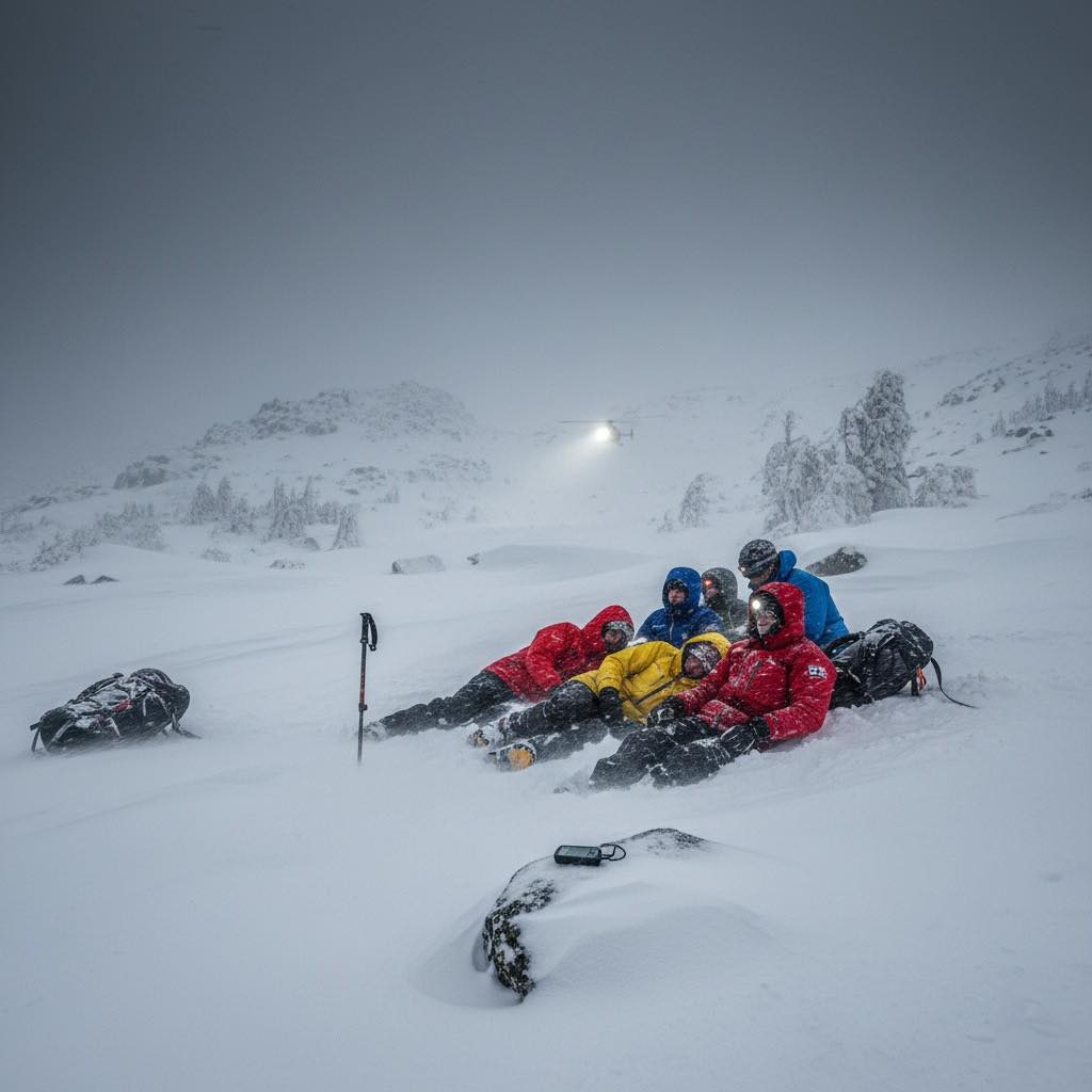
Cristina Calvillo Tovar, 37, and Julian Garcia Pimentel, 36 — Nadine Lichey, 45, and Andreas von Pein, 52 — and Victoria Bond, 40.
Could these deaths have been avoided?
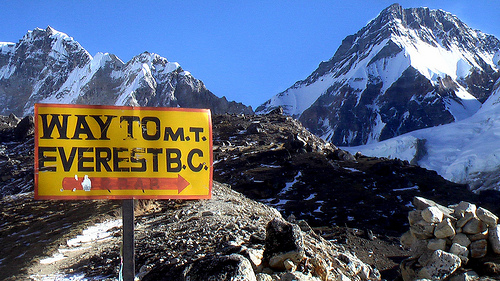
… On November 16, the weather was mild, and the usual number of hikers, 40 or 50, crossed the pass without incident. By that evening, those who would suffer the worst of the storm had converged at Los Perros campsite, the last sheltered refuge before the exposed John Garner Pass. …
On November 17 between 5 to 7 am, about 30 hikers left Los Perros for John Garner Pass.
Conditions started drizzly, but deteriorated rapidly after 10 am. Winds reached 193kph, and visibility dropped to less than three meters. The temperature fell to −5 °C, but the wind chill was far below -20°C. …
Those who turned back barely made it down safely. …
A distress post appeared on the Torres del Paine Facebook group around 2 to 3 pm. Initial response by CONAF was slow, and bad weather grounded the helicopters. …
Twenty-seven hikers required medical attention, according to the final tally released by the Regional Government of Magallanes on November 20. …
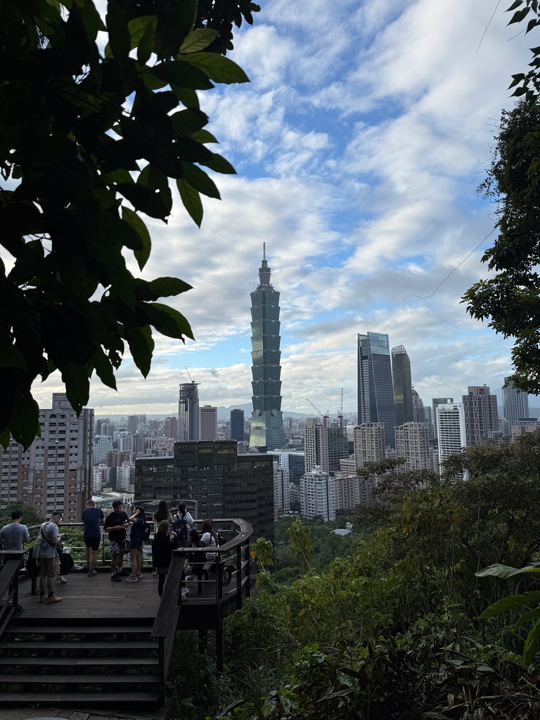
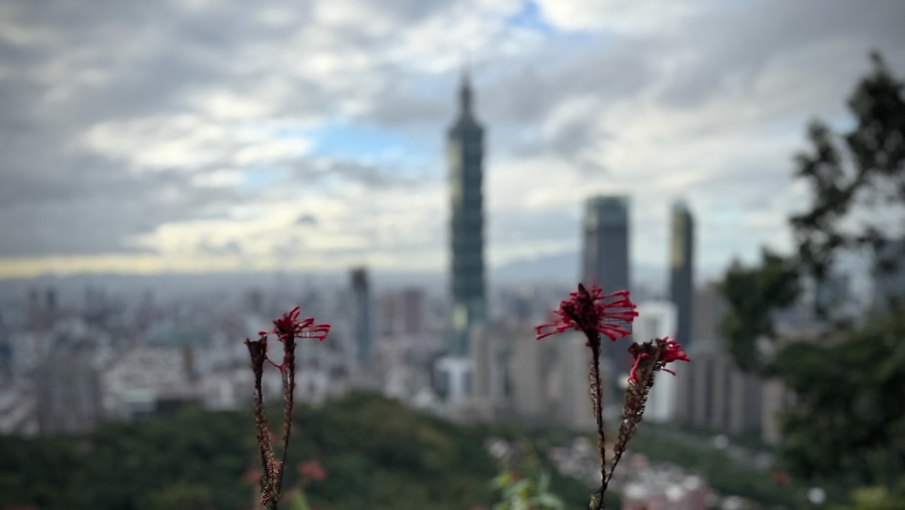
Many tourists visiting Taipei, Taiwan climb short, steep Elephant Mountain to get a great view of the city, including landmark Taipei 101 — a building 101 stories high.
1.1 km
141m elevation gain on well maintained stone steps
normally very crowded at all hours of the day and evening
Best is to climb up one trail, descend on another. There are many options. So many, in fact, that the signage gets confusing. Use a phone app like AllTrails.
I climbed Elephant mountain twice while in Taipei. It’s easy access from a subway station.
El Camino de Costa Rica is a breathtaking 280 km / 174 mile hike from the Atlantic to the Pacific Ocean, which is no easy feat even for the most experienced hikers.
While it can be intimidating to take on this type of adventure, there are so many incredible things to see and do while trekking this route, from tropical beaches and dense trails to mountain villages and indigenous communities.
Planning a multi-day adventure in Death Valley? While the desert terrain may look intriguing, it requires serious preparation to spend an extended amount of time here. No matter where you hike – but especially in a place as extreme as Death Valley – your gear and equipment can make the difference between a thrilling trip and a more unpleasant ordeal.
To help you make the most of your trip, here are the essential items you’ll want to pack.
Water, food and cooking items
It goes without saying that the park can get extremely hot – summer temperatures often reach around 120 degrees Fahrenheit. Death Valley is called Death Valley for a reason, and you don’t want to be stuck without water in this vast expanse of desert terrain. Therefore, make sure you have an ample supply – it’s recommended that you plan for several litres per day.
Likewise, food is a necessity, and you’ll need to make sure you’re consuming nutritious meals to sustain your energy. Pack high-protein snacks, meals, and equipment to cook or prepare them if needed. It’s also a good idea to include waste bags and utensils if you plan to cook.
Shelter supplies
A multi-day hike means finding somewhere to stay overnight. A specialised tent or other shelter is essential, and it should both keep you cool during the heat of the day and warm at night – despite what you may think, the desert can get very cold when the sun goes down. Make sure you also have a good quality sleeping bag and sleeping pad.
This Original Travel guideshares some of the park’s best campgrounds, with entrance fees included so you can budget for your trip. While straying off the beaten path may feel like an adventure, it’s best to stick to designated campgrounds for your personal safety – and to protect the landscape around you.
Climate-appropriate clothing
It can be tricky to plan outfits that are both cool enough for the daytime and warm enough for nighttime – as well as being comfortable and appropriate for hiking. In addition to everyday clothing items, it’s a good idea to bring layers and accessories such as:
Wicking base layer and insulating mid layer
Outer shell/wind jacket
Broken-in, comfortable hiking shoes and socks
A wide-brimmed hat and a beanie
High-quality sunglasses with full UV protection
Don’t forget a good backpack that can carry everything you need. It should be durable and waterproof, to keep your belongings safe no matter the weather.
Navigation and emergency gear
While it’s unlikely that you’ll find yourself in an emergency situation, it’s always best to be prepared for the unexpected. Particularly in a place as harsh as Death Valley, where you may find yourself miles away from help should you need it, it’s important to have the essentials to hand.
Bring a map and a compass, and consider a GPS device – it can be easy to get lost, particularly on backcountry routes which can be remote and tricky to navigate. You should also always carry a first aid kit, a torch with batteries, and basic repair tools. Above all else, always let somebody you trust know where you are – even if that just means sharing a general plan before you leave and keeping in touch each day.
Once you’ve got the basics taken care of, all that’s left is to plan your route and enjoy the park. If in doubt, always pack extra and stick to established routes – there’s so many stunning sights to see, and you don’t have to venture off into the unknown to have a wonderful time.
My favourite hostel in Taiwan — Meander 1948 — offers a weekly free special event. Often a hike.
My week we signed up for the Jiantanshan Trail, easily accessible by bus or subway.
This trail is famous for its unique vistas from its various lookout points.
The “Old Place Lookout” is the most sought-after spot, which provides a thrilling, unobstructed view of airplanes taking off and landing at the nearby Songshan Airport.
Screenshot
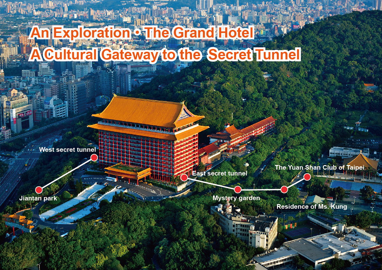
The hike also features classic, postcard-worthy views of the iconic, red-pillared Grand Hotel and the Keelung River.
First 5 star hotel in Taipei
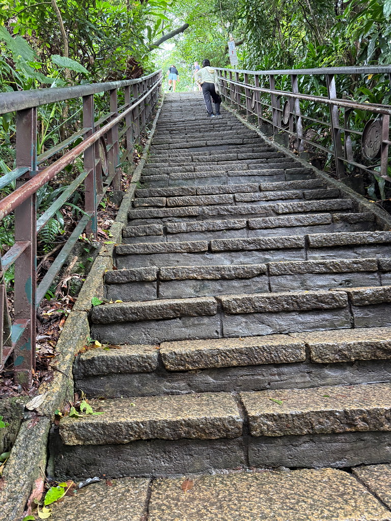
The trail system consists of a well-maintained network of paved paths, wooden boardwalks, and stone staircases that wind along the ridge.
PJ, our guide, prefers this hike to the more popular, nearby Elephant Mountain as the vistas are more varied.
This section in the city is just one part of the much longer Taipei Grand Hike which PJ completed in 2022;
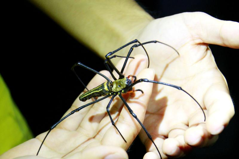
The most amazing sight for me was the giant orb weaver spider. Adult females are very large, with a body length of 25 to 50 mm (1 to 2 inches). Happily, it’s rare to have cases where humans are bitten.
I’ve seen hardly any spiders nor biting insects after months in tropical S.E. Asia. (But huge spiders are common on Hong Kong hiking trails.)
After the hike, PJ took us to a couple of spots for local specialities.
Shaved Ice
This is a variation of red bean cake. Most of us opted for whipped cream filling, rather than the more savoury alternatives.
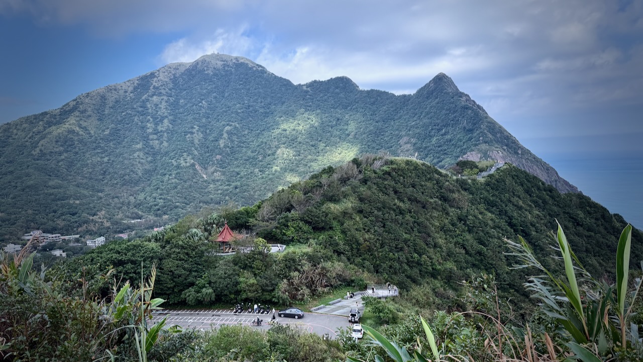
I’d heard good things about this short day hike —Teapot Mountain Trail — a final approach to the summit needing a fun scramble through a narrow passage in the teapot-shaped rock.
The hike begins with a steady ascent up a well-maintained stone staircase. With every step, breathtaking views of the Ocean and the rugged northern coastline improve. The path winds up the green, rolling hills that characterize this scenic area.
Click PLAY or watch it on YouTube. You can see the scramble. It’s short, not difficult, BUT very narrow. I had to take off my day pack.
3.2km out and back (though you can descend on different trails and extend the hike)
283m elevation gain, mostly on good stone steps
slippery coming down in the rain. GOOD SHOES needed.
some road walking, depending on route
easy access by local bus from Jiufen, a super popular tourist trap.
There are a number of tunnels still open for exploration.
Screenshot
Up and down there are many rest stations, shrines, and temples.
John Marvin Raganas had the trail almost to himself. (It was crowded to the point of being dangerous when I was there. I spent as little time on the summit as possible.)