I’ve long wanted to climb astonishing Mount Rinjani not far from Bali, Indonesia.
I took the local boat from Gili Trawangan to Lombok island for the start of our guided climb of Rinjani. I could see it in the distance.
Our group met up at a local restaurant close to Bangsal Port ➙ then we were efficiently (if dangerously) driven up to Senaru village at 400m.
Screenshot
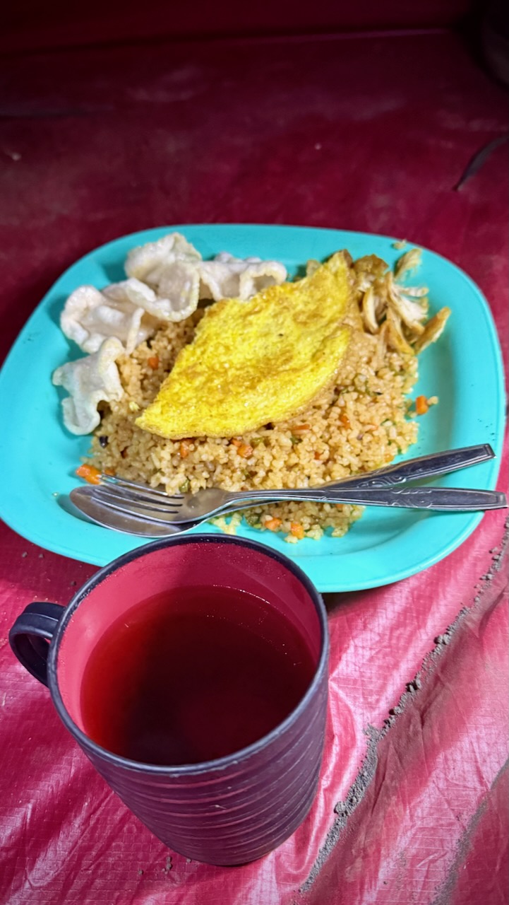
We had a typical Indonesian lunch based on rice or noodles.
We dropped bags in our surprisingly interesting rooms.
Then set off to see two local waterfalls.
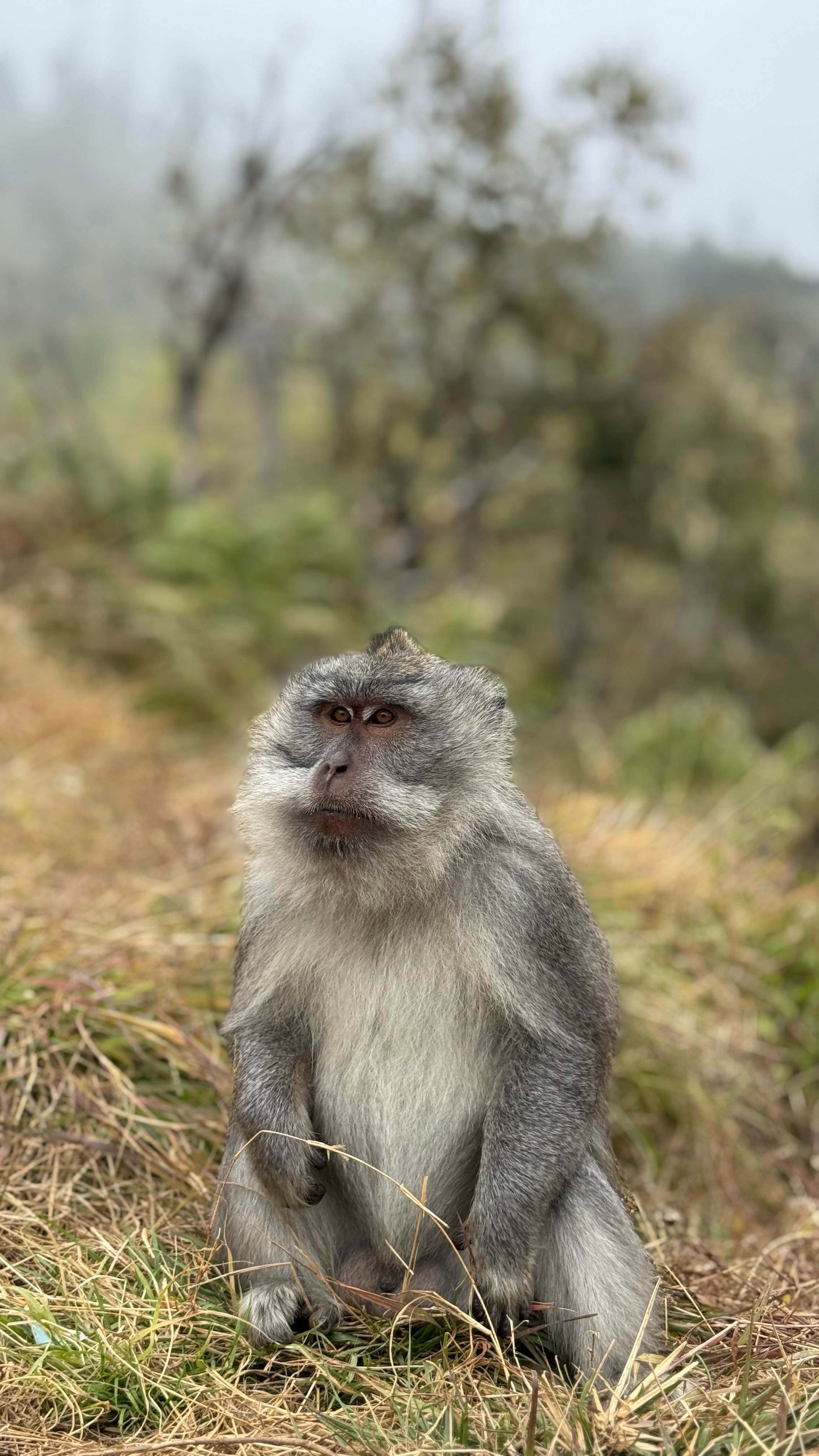
Plenty of macaques await ready to grab at your purse, backpack, or any kind of plastic bag.
Here’s the 1st waterfall.
MOST interesting here is a fun tire tube ride underground through the irrigation channel. I’d be too chicken, myself. 😀
Here’s the 2nd even more impressive falls.
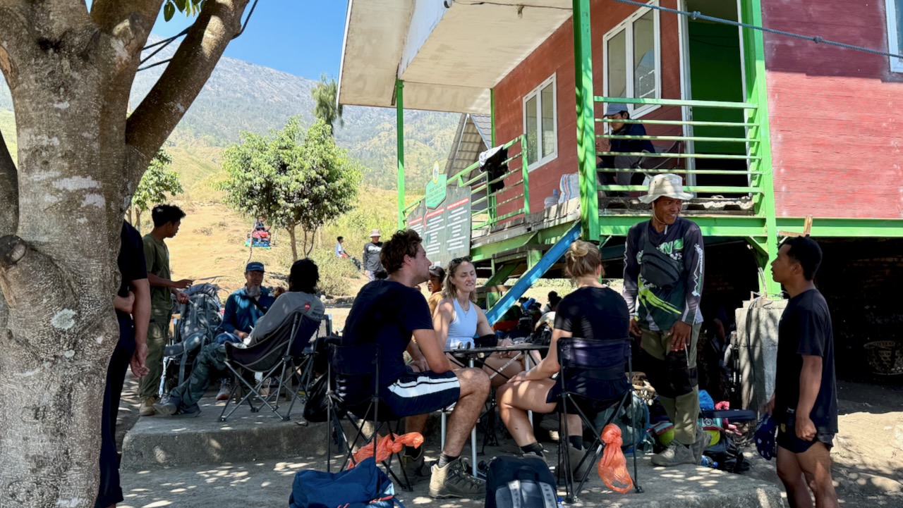
Back at the guesthouse we did our introductory briefing on the volcano climb. We had hoped two more would join us. One was in hospital for some reason. The other cancelled last minute.
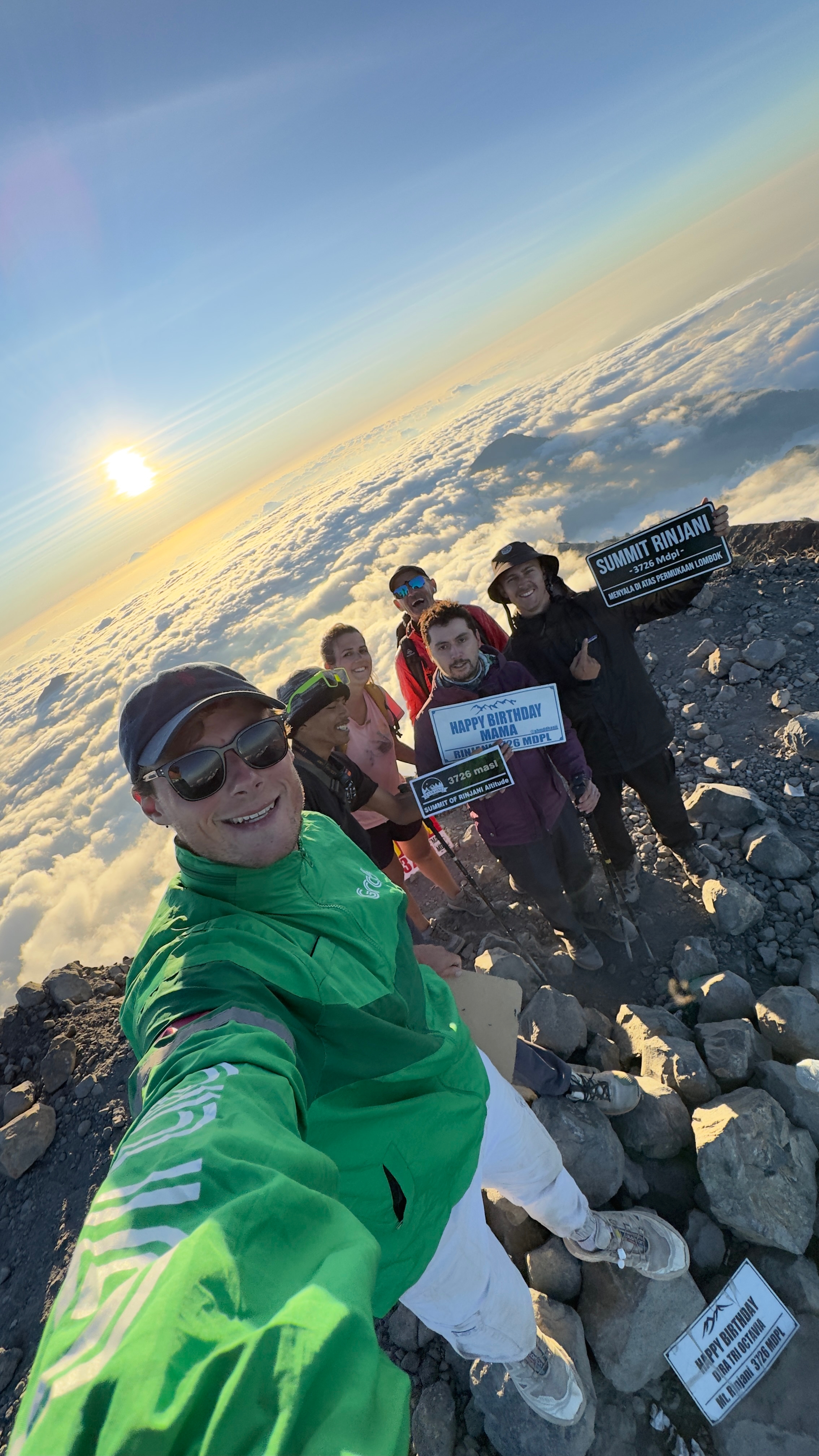
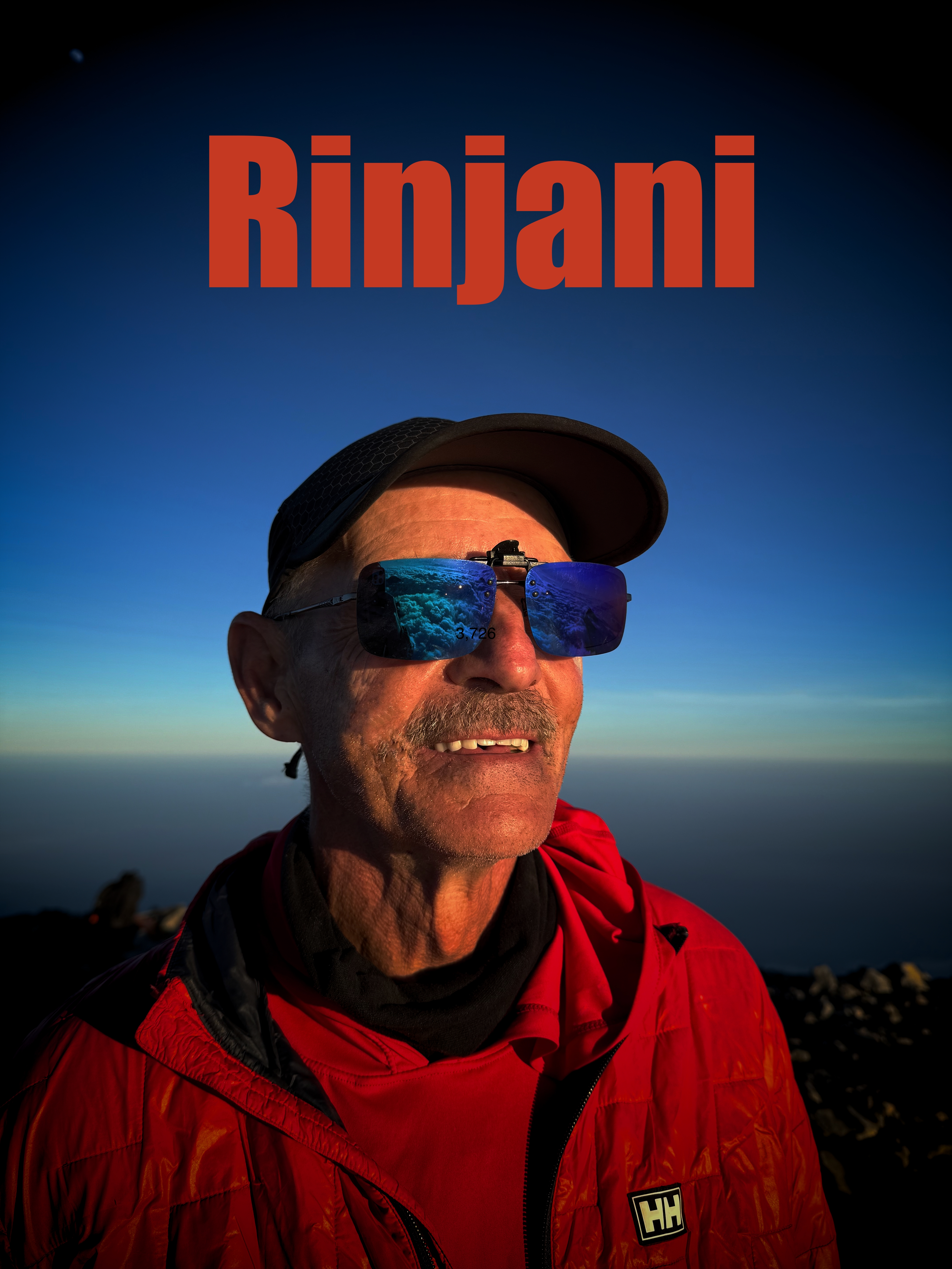
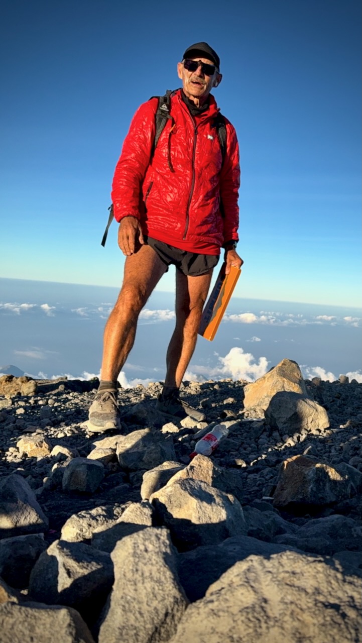
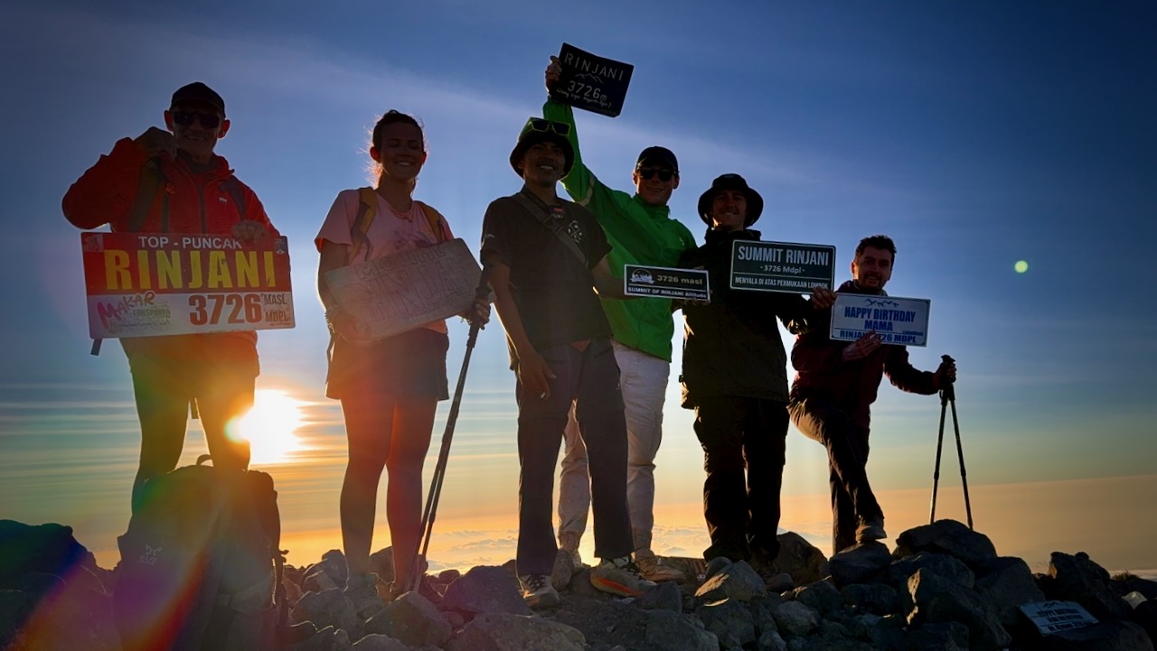
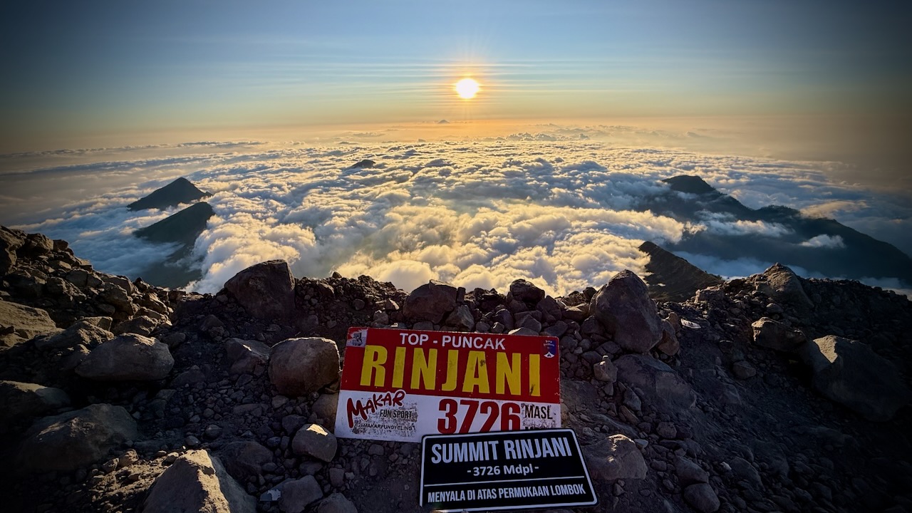
Rinjani is 3,726 metres (12,224 ft), making it the second-highest volcano in Indonesia.
We had signed up for the longer 3 days, 2 nights in the tent option.
That turned out to be the right decision. Our itinerary the BEST HIKE.
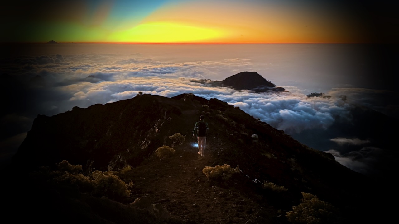
MOST groups on our itinerary camp on the 1st volcano ridge day 1. Our guide offered us the chance to descend 3 hours to camp at the lake, instead. Super tough 1st day — but we were all glad we did it.
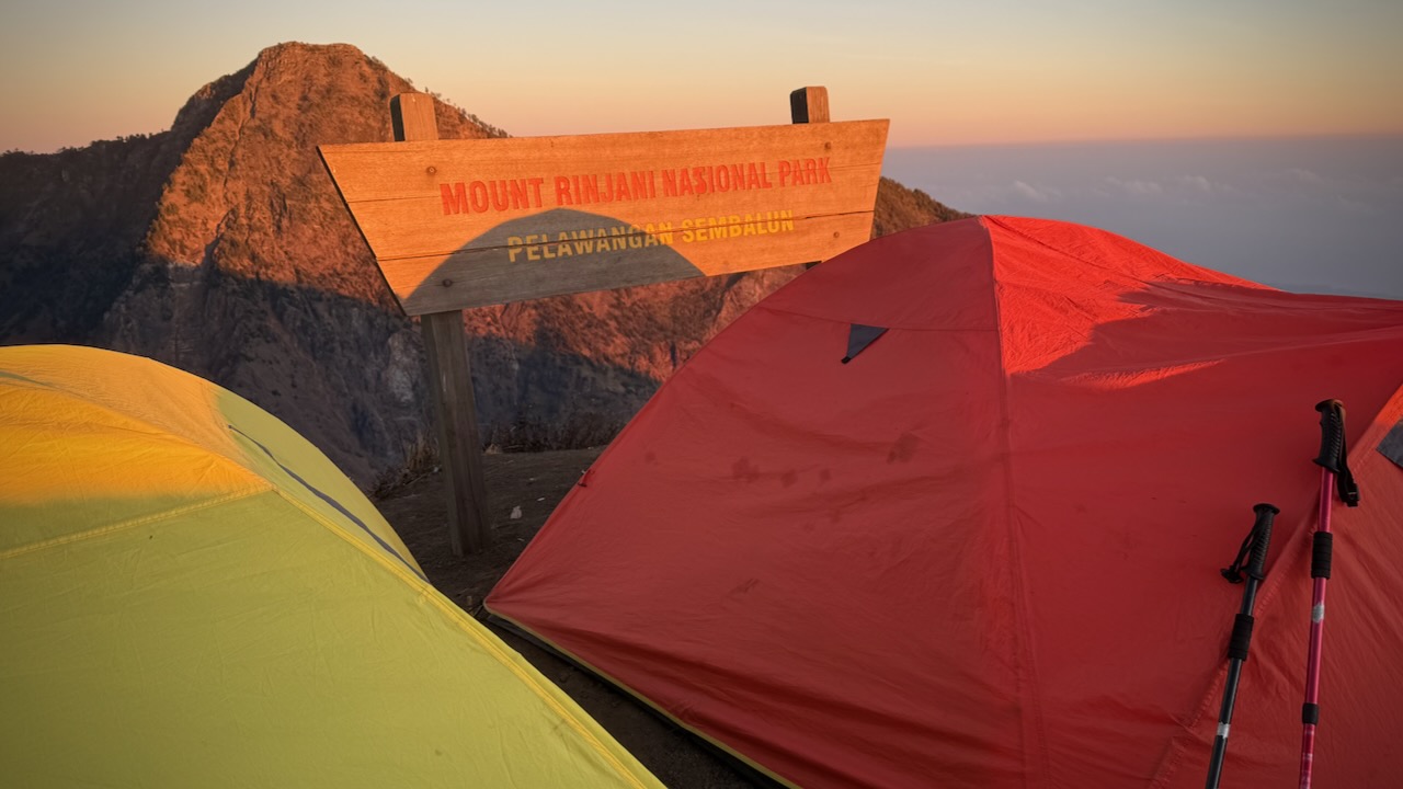
Mount Rinjani Crater Rim 1st night on the 3 day trek.
We were up for the dawn. I added milk powder to my brutal black instant coffee.
Banana pancakes excellent, as always.
Driving up to the start at 600m we stopped for a blessing. An important tradition with the local Sasak people as well as Hindus.
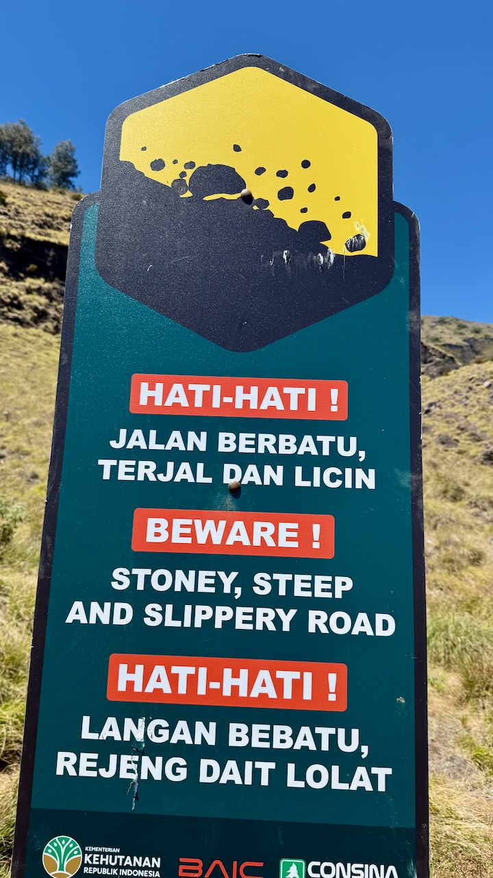
We each had to register with photo ID. The Gunung Rinjani National Park, established 1997, is trying to make this adventure safer — but they have a long way to go. It’s dangerous.
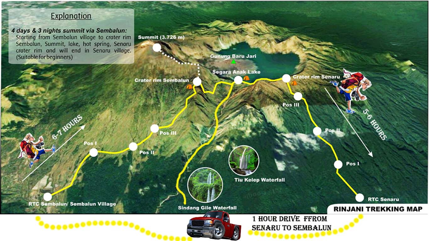
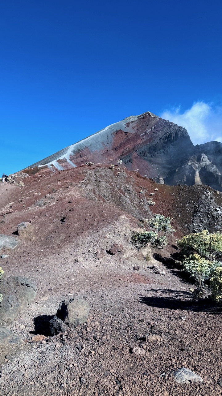
Our goal was the 1st crater rim — only 6.9km. Sounds easy until you calculate you need gain 2km in elevation over that short distance!
We started on the far right of this map.
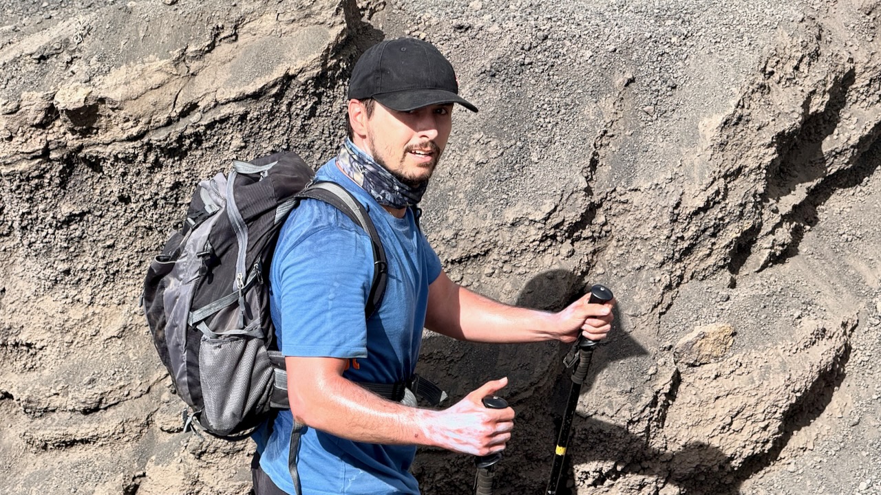
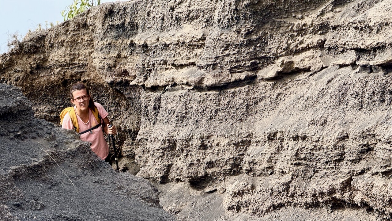
The start through jungle was relatively easy. THEN it got steep and challenging.
These wild cousins are more worrisome than the ‘tame’, well-fed ones in the Monkey Forest, Ubud.
Breakfast !
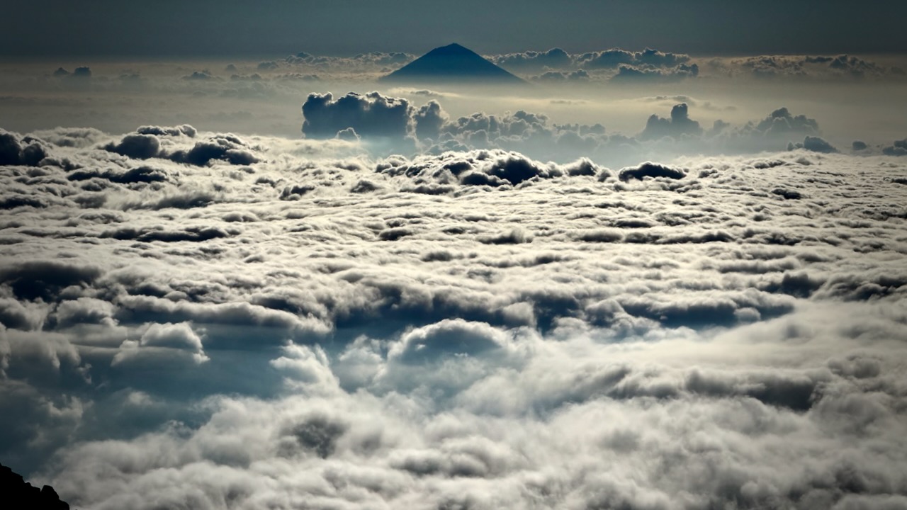
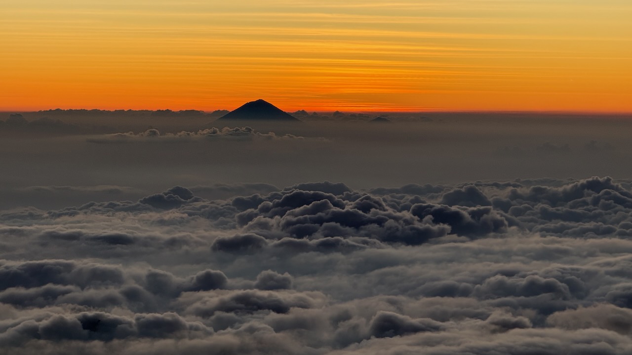
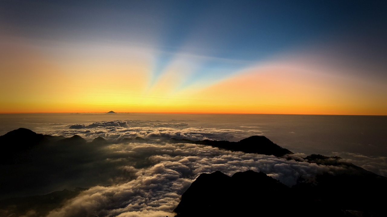
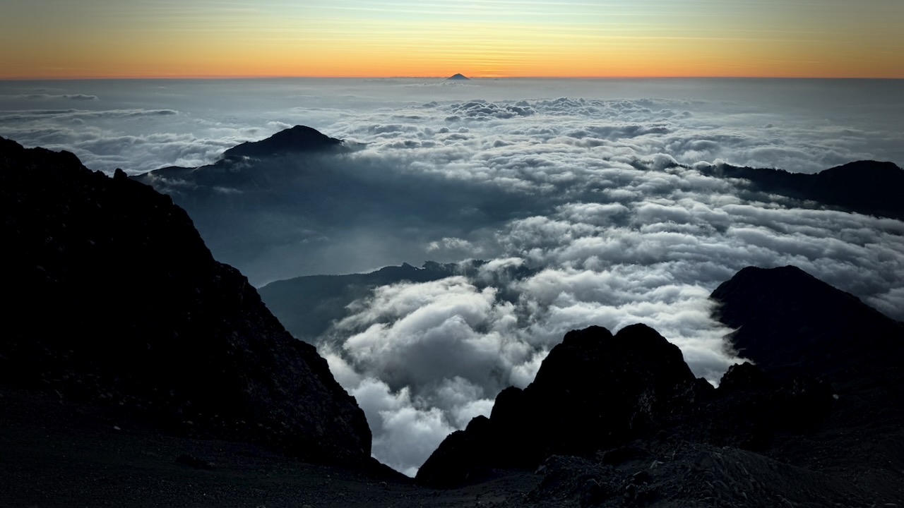
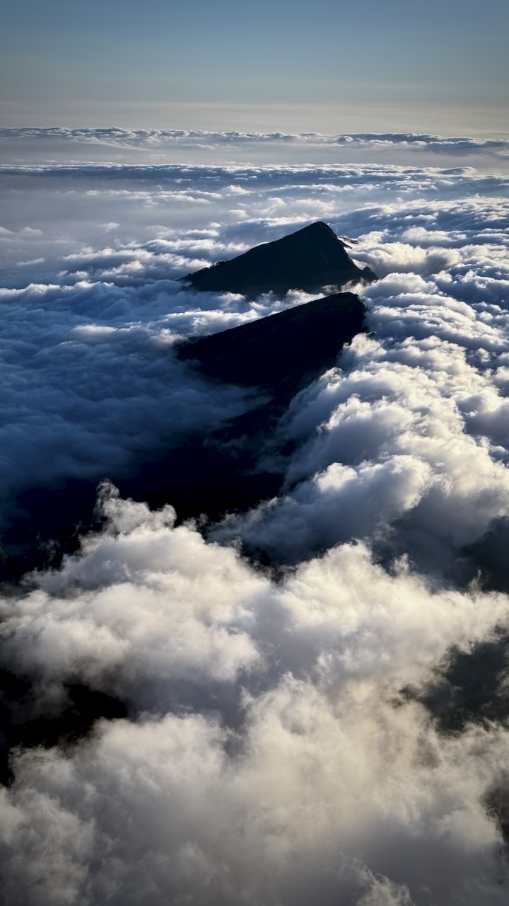
We hiked into and out of clouds.
Crater rim beckons.
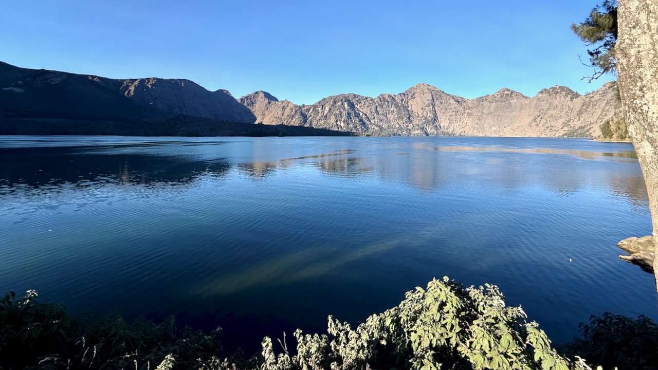
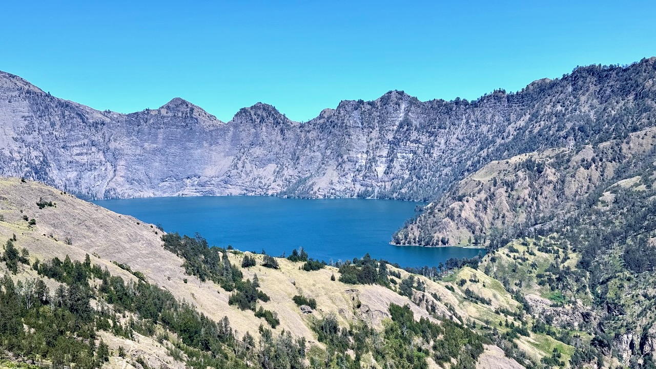
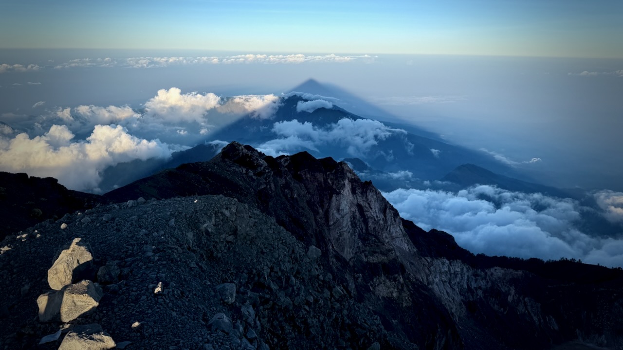
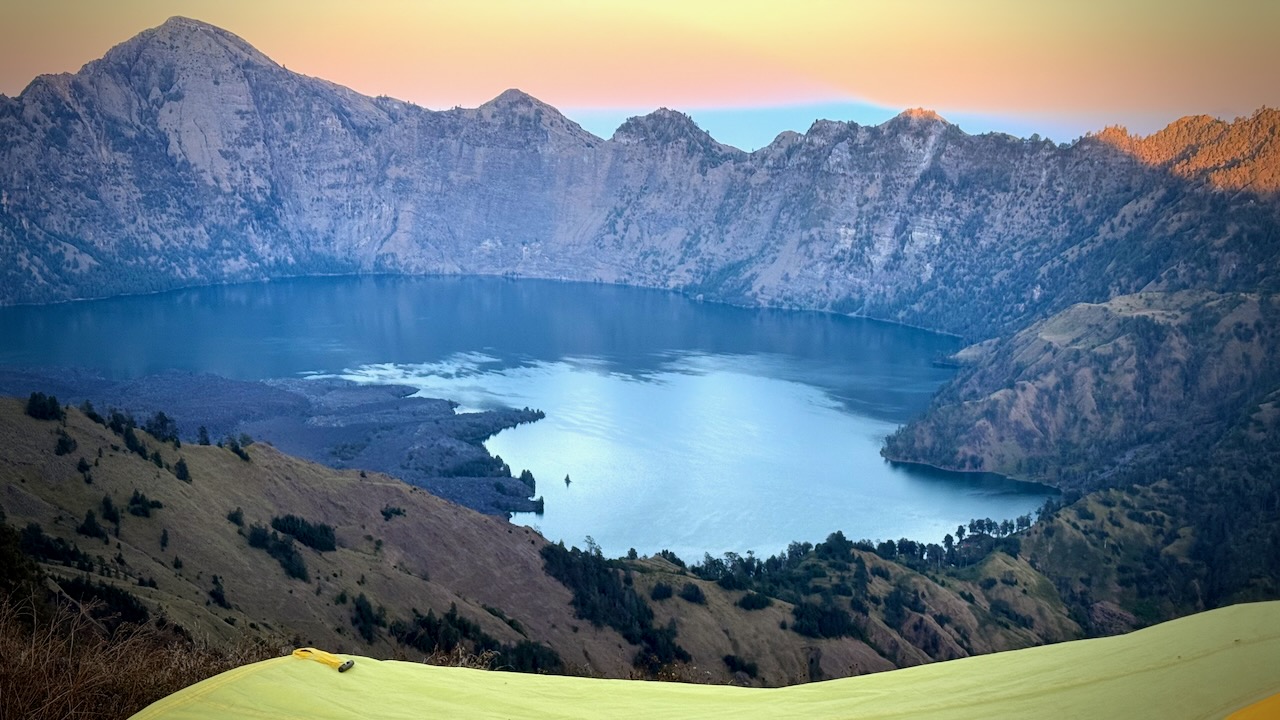
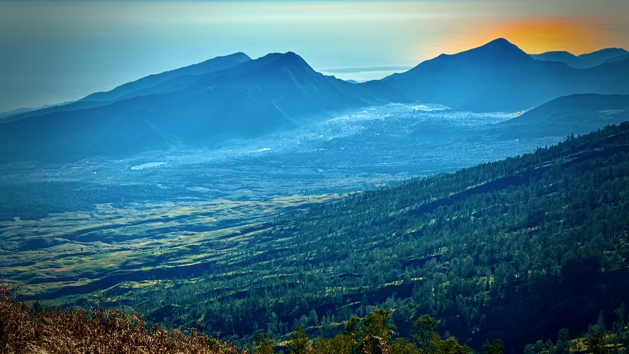
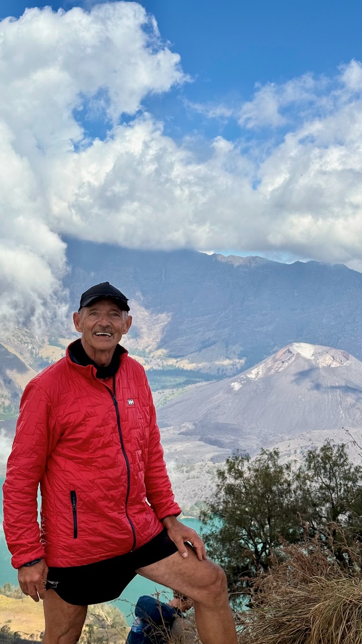
This — really — is the best vista on the hike. Crater lake Sagara Anak is huge, the colour unforgettable. The volcano’s eruption in 1257 is considered one of the most powerful global volcanic events of the last 2,000 years.
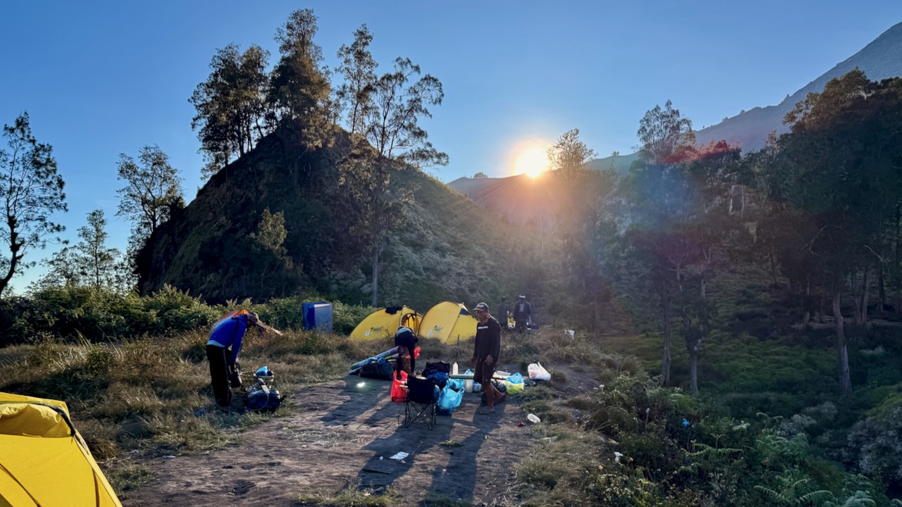
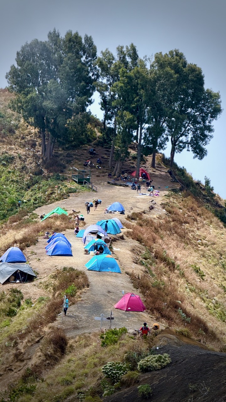
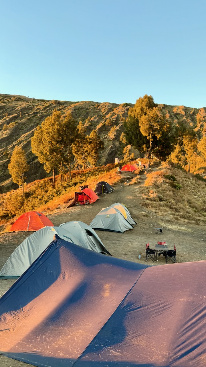
We were scheduled to set up our camp on the ridge here at 2,600m.
But we opted, instead, to hike down to the lake at 2000m, saving us 3-4 hours on day 2.
We all agreed to go for it.
OUCH …
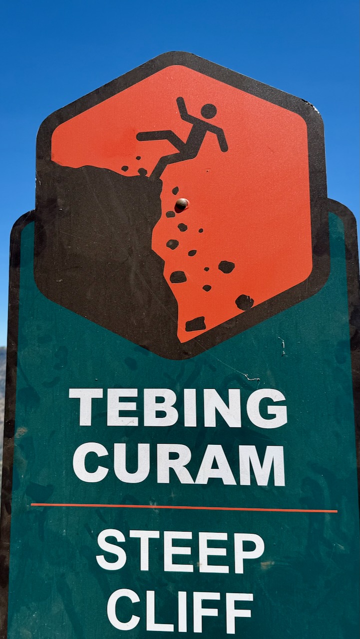
That decent is awful and dangerous. I took no photos. We had to concentrate on every technical step.
It was a relief to finally get to the lake. This one of my toughest hiking days of all time.
We arrived just before dusk.
Alpenglow time.
Each group has their own toilet tent.
The alternative at major camps are these good looking public toilets. This one was filthy! But some are quite new. Fairly clean.
Major camps have emergency shelters. I don’t doubt they are used frequently. The trek is risky.
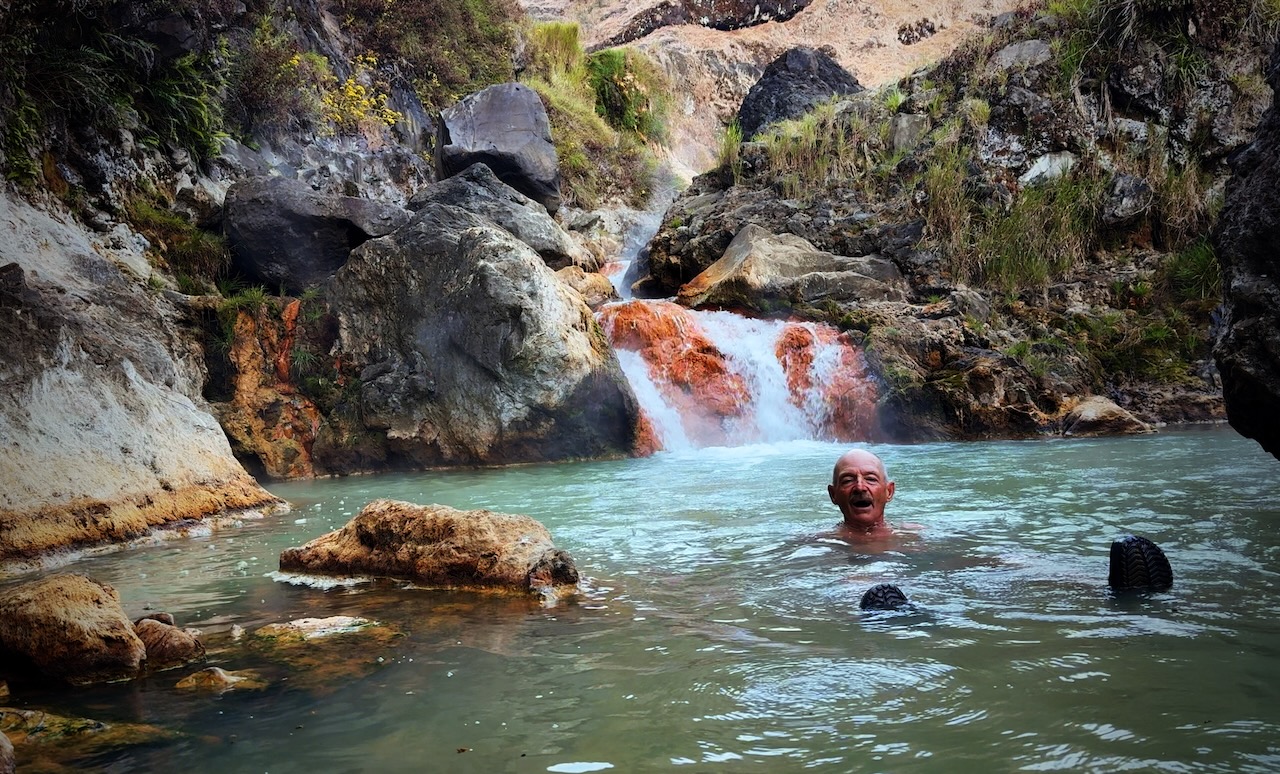
Our guide sent us to the hotsprings with one of the porters. Fantastic. A highlight of the entire trip.
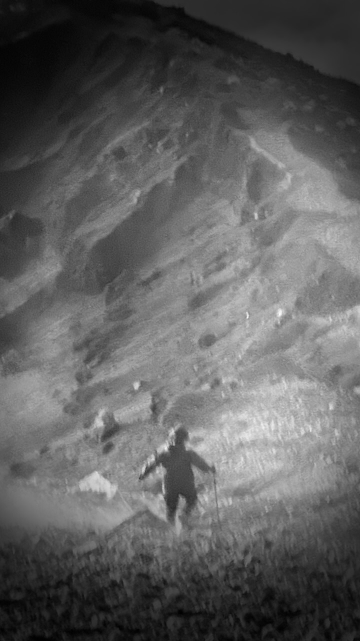
Tim (tim_de_bruijn on Instagram) was a full-time social media manager for a major Dutch soccer team. He showed us fantastic photography tips on his iPhone, including these two. It was pitch dark at the hotsprings!
Pitch dark at camp, as well.
tim_de_bruijn
Most amazing of all was his capture of the night stars. Very few of these were visible to the human eye. This from an iPhone 16 Pro Max.
I actually carried my own tent on this adventure. Air mattresses in the provided tents were not good. 😀
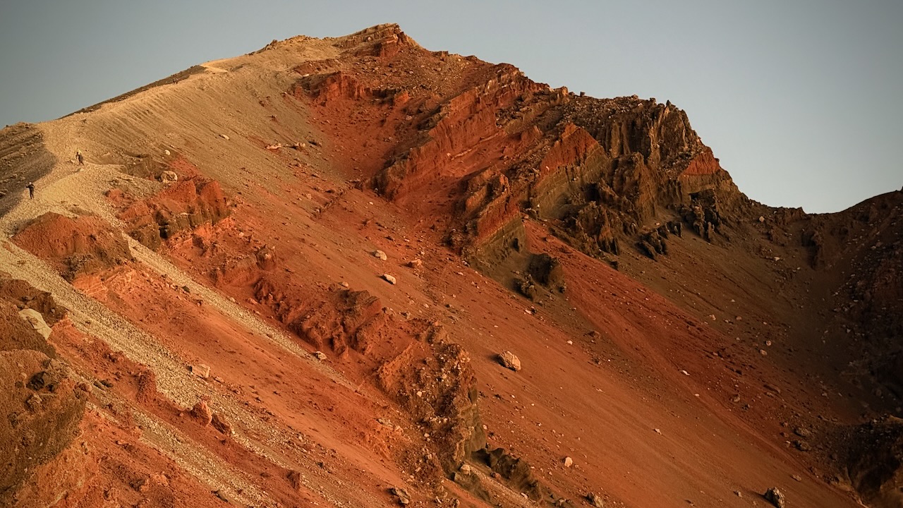
The crater rim vistas really are superb.
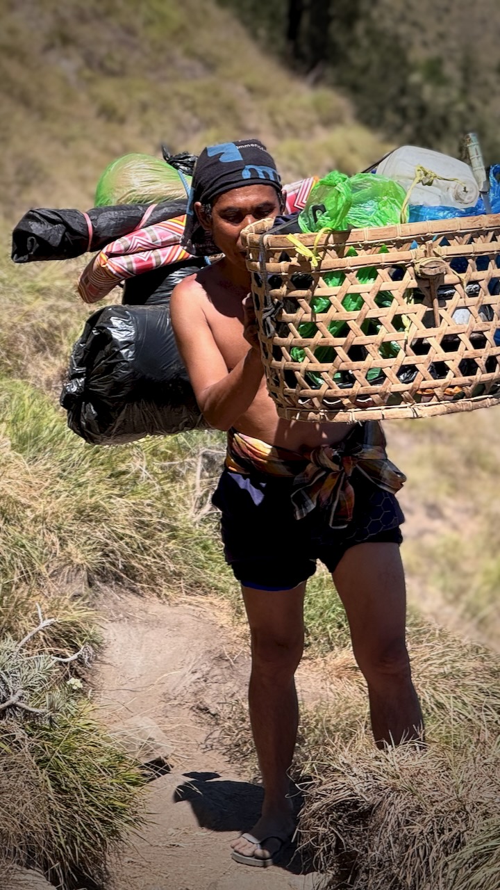
The biggest takeaway from this trip for everyone is being impressed with the porters. Rather than use the more efficient tump system, they balance these loads on one shoulder while doing big step-ups and step-downs.
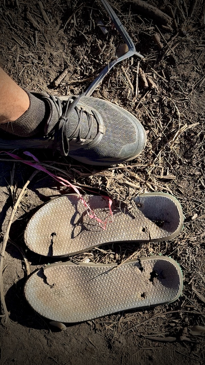
They all wear flipflops. Until they break.
We were headed down, back to civilization.
Somewhat slippery — but overall fairly easy.
We had lunch in a shady forest, monkeys and cows standing by to gobble down what leftovers they could get.
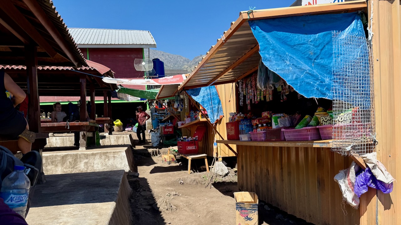
It was a shock to get to the trailhead. Noisy motor cycles.
Perhaps 120 people readying to start.
Those who sign up for 2 days, 1 night begin and end here close to Sembalun village. They miss the lake and hotsprings.
It took about an hour to drive back from Sembalun to our start at Senaru village. We returned rented gear and recovered our luggage left in storage.
TIPS
BEST HIKE is our itinerary (3 days, 2 nights in tent) with an afternoon ascent rather than the crowded, dusty line-up for dawn. Day 1 is long and hard, however.
WAIT for a good weather forecast, if you can
Green Rinjani looked one of the most professional companies at camp, to me. Modern tents. Tables and chairs.
Grippy and comfortable shoes are the most important piece of gear. Wear a size larger than normal so your toes aren’t crushed on the descent.
Protection from sun and wind is important. Sun screen. I brought a sun hoodie.
Porters provide as much water as you can drink.
I fell about 8 times over the 3 days. No injuries as I almost always landed on my backpack.
I didn’t bring trekking poles. And that was a mistake. Our guide gave me one pole for long down climbs.
It’s badly littered.
Sanitation standards are low. No water for washing up. Not even the expected containers of alcohol gel that I’ve had on similar trips around the developing world.
I completely enjoyed Rinjani. It could hardly have gone any better for our group with the afternoon ascent.
BUT ➙ Bottom line ➙ I can’t recommend this hike. It’s simply too dangerous.
During the July 2018 Lombok earthquake, multiple climbers and guides were killed by landslides triggered on Rinjani’s slopes.
March 2007, seven people died of exposure after illegally scaling the volcano during a ban.
Be sure to have evacuation insurance, just in case.
Getting there is a wild ride. Almost everyone signs up for a jeep tour. Only these small Toyota Landcruiser Jeeps are allowed up the mountain.
I departed my hostel in Malang City at 12:45am. It was a scary Mad Max ride over dirt tracks before reaching the viewpoint at 3:15am.
They get you there so early in case of road problems. And jeep breakdowns. It happens.
They also hope you’ll rent warm jackets and blankets. Or buy some souvenirs.
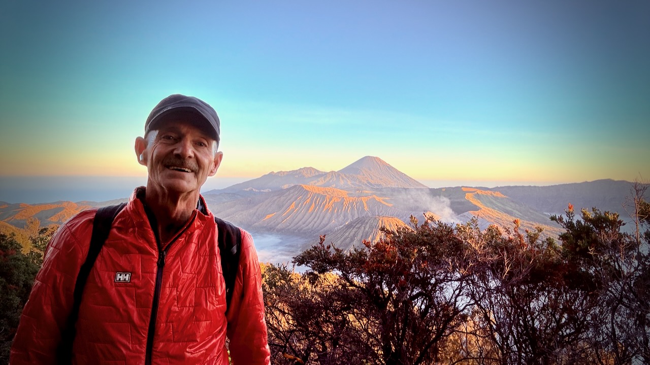
It’s well worth being there at very first light through dawn, in any case. The volcano vista keeps changing. Every photo a possible postcard.
Here are just a few of the dozens I shot.
It’s crowded! Everyone scrambling for the best position.
The adventurous bushwhack down the hillside looking for more unique framing.
I’ll never forget Bromo.
From here the jeep takes you down to the smouldering caldera for a crowded, dusty climb up stairs. I was disappointed with this and the sea of sand beneath. There are many better volcanoes to climb in Indonesia.
DETAILS
Of a number of 1, 2, or 3 day options, I ended up doing the most popular ➙ Bromo Sunrise Tour. Very inexpensive at CAD $50 which includes entry fees.
Itinerary:
00:30: Prepare for pick-up from Malanghostel by 4×4 Jeep
01:00: Journey to Penanjakan (sunrise viewpoint by jeep).
03:30: Arrive at the viewpoint and wait for sunrise
05:00: Witness the magical sunrise from Penanjakan.
Highest Elevation: 7,350 ft. Timberline High Point
Lowest Elevation: 3,300 ft. Near Ramona Falls
Elevation Gain (approx.): 9,000 ft.
Best Time to Hike: July-September
Permits: Yes (May 15th to October 15th)
Difficulty: Challenging
Permits
Permits are required for overnight trips on the Timberline Trail from May 15th to October 15th, but they are free and can be found at trailheads around Mt. Hood. Simply fill one out before you hit the trail. Some trailheads do require a Northwest Forest Pass for parking.
Jon posted a detailed trip report on their August 2019 circuit of Oregon’s highest peak. It’s close to Portland.
This report is all you need to organize that adventure for yourself.
Plenty of climbs and descents. Quite a few creeks crossings. Not what we’d call an easy week.
They started and ended at Timberline Lodge. And hiked clockwise.
The report includes excellent photos so you really get a feel for what to expect.
Mount Hood (photo credit: Dan Nevill, CC 2.0)Ramona Falls (photo credit: Dan Nevill, CC 2.0)
Patagonia is massive and bleak. Yet we love the Patagonian Andes, 2000km (1243mi) in length, but averaging less than 100km (62mi) in width. You could take years exploring just the eastward (drier) side of the mountains.
Towering granite peaks, untouched lakes, massive glaciers, huge volcano trekking peaks. This land is phenomenal.
Trekkers target five areas:
The Araucania
Lakes District
Central Patagonia
Southern Patagonia
Tierra del Fuego
Start in Mendoza, Argentina and visit the highest mountain outside Asia, Aconcagua. Next bus to the Switzerland of South America (Lake District). Some of the highest volcanoes of the world are here. Finally, work your way south by air and ferry to the granite spires at the south tip of the continent.
Trekking season here is Nov-Apr. (Feb-Mar often the best weather) That said, the wind and weather in Patagonia is notorious. Independent hikers need be prepared for anything and everything.
Conversational Spanish highly recommended for those travelling independently.
These lists are far from definitive. They are more conversation starters to get you thinking where you might want to go next.
For example, the Tonquin Trail is a 4.0-km out-and-back trail near Tofino on Vancouver Island. I’m on the island right now and can name easily a dozen better hikes close by. 😀