South Lykken Trail, Palm Springs

Just behind my cheap motel (Desert Inn $40) in downtown Palm Springs was the South Lykken trailhead.

One afternoon I hiked. The next I did a trail run.

trail run

Palm Springs

elevation gain

more of my photos from those day hikes

… the North and South Lykken Trails are named in honor of Carl Lykken, Palm Springs’ first postmaster. …

related – Hiking in Palm Springs

scrambling Piestewa Peak, Phoenix

False summits discourage some non-hikers, but I loved the most acclaimed urban peak climb in Phoenix, Arizona.

false_summit

Vistas from the top are fantastic.

summit

… The Piestewa Peak (formerly Squaw Peak) Summit Trail (elevation gain = 1,190 feet in 1.2 miles) is climbed thousands of times per week by locals and visitors seeking a cardio-vascular workout, great views, or a family outing. However, quite a few hikers do not actually reach the top due to the fact that this trail is more difficult than it looks, especially in the summer when temperatures are well over 100 °F. No water is available on the trail and dehydration is a common and serious problem with hikers who come unprepared. …

The hike itself takes anywhere from 15 to 60 minutes depending on each hiker’s capabilities in fair weather (higher temperatures and sunny conditions may force the hiker to take twice as long). A beginning hiker should allow 60 minutes for a leisurely ascent and 30 for descent. The path is mostly well marked.

… There are a few sections that are technically difficult as they are steep and there are no guard rails.

There are approximately fifteen miles of interconnecting trails in the Preserve, ranging from easy to difficult.

Arizona is one of the best places to hike in North America. In February. 🙂

Rick Piestewa

Best hiking in Hong Kong

Tim Cheung:

Highly addictive, mildly dangerous: four hiking gurus come clean about their obsession

300 kilometers of designated trails, varying in length and difficulty, traverse the territory and many locals hike religiously.

To really experience Hong Kong get out to one of the four major hiking trails: the MacLehose Trail, Wilson Trail, Hong Kong Trail or Lantau Trail.

Travel CNN

Click through for advice on perhaps the best urban hiking area in the world.

Long Ke Wan

related – Budget Hong Kong: Coward’s Route To Victoria Peak

wandering Boracay, Philippines

trip report by site editor Rick McCharles

How long can a hiker lie around on a Beach before getting bored?

Not long.

Boracay is an island of the Philippines located approximately 315 km (196 mi) south of Manila …

The island is approximately seven kilometers long, dog-bone shaped with the narrowest spot being less than one kilometer wide …

Once a day I’d take off jogging wherever tourists do not go.

I checked out the dump. Excellent. And watched how trash is collected. Very efficiently.

Bottles are recycled.

Here is a tourist attraction, a Zorb run. Unfortunately the Zorb doesn’t roll unless a group arrives together, pre-booked. Otherwise I would have signed up.

On another lonely road I found two new born goats. Mama nowhere to be found. When I jogged back a half hour later, they were still there.

The highlight was navigating narrow alleys where the poorest folks eek out a living. I didn’t take any photos, but it looks something like this.

Actually, the people looked surprisingly healthy and happy. The animals sickly and pitiful. In fact, I saw an emaciated cat in it’s death throes, ignored by one and all. There was no way I could put it out of its misery.

Very best of all was arriving at a new Mosque being built by the minority Muslim population. Clearly it will be the pride and joy of the community, once finished. They asked how it compared with Mosques in Canada. Equally grand, I told them.

… It was always good to get back to my inexpensive hotel for a shower and a rest.

Before the long rest.

See more photos or check my Boracay holiday posts.

Shing Mun Reservoir hike, Hong Kong

trip report by site editor Rick McCharles

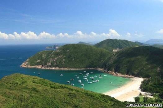
On advice of the The Inside Guide to Hikes and Walks in Hong Kong booklet distributed free by Hong Kong Tourism, I set off for what they call “Shing Mun Reservoir” (11km) in the New Territories.

It’s easy to get to the trailhead by public transit — except on Sunday afternoons in November when the bus is PACKED. Huge groups were organizing barbecue parties in Shek O Country Park.

I checked in first at the small Tai Mo Shan Country Park Visitor Centre and was greeted by these local critters …

That’s a Barking Deer. Weird.

It’s an easy up from the Visitor Centre on well marked and maintained trails.

But at one point, the trail became a paved road. Not awesome. I opted to detour instead under the peak passing the Youth Hostel. This turned out to be the right decision.

Since I never got to the top of the mountain, I left a Summit Stone in this outcropping, my lunch stop.

Here are my favourite cookies. Buy them.

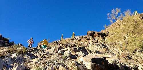
Once past the hostel, I saw only these two other hikers the rest of the day.

I was off-trail of course, yet some kind of path was flagged all the way down.

It led me to a Chinese graveyard.

Many memorials had tables and stools to welcome visits from surviving family and friends.

Eventually I found my way to a bus stop. And back to the subway. It’s not all that easy to get “lost” in Hong Kong, one of the advantages of an urban hike.

Great adventure. … On my advice another couple from the hostel tried the same thing — and also had FUN times inventing their own route down the mountain.

See more photos from my day hike.

first hike Hong Kong

trip report by site editor Rick McCharles

Arriving at my hostel after midnight, I was pleased to meet local hiker Michael Edesess at 8:30am next morning.

He explained that hiking Hong Kong usually meant a short subway trip, a shorter walk through a modern shopping mall … and directly on to the trail!

Well signed. Well maintained. Super popular tracks.

… This must be the best major city in the world for getting on a trail quickly and easily.

Michael clearly had a destination in mind …

And here it is.

We finished at Groucho’s on Stanley beach for Michael’s favourite Belgian brew and a burger.

This is urban hiking!

more photos from our day hike

Mark Moxon – London Tube 500mi walk

Mark Moxon launched his excellent Long Distance Walks site in December 2003.

It was one of my earliest inspirations as a hiking blogger.

He’s done many amazing trips. But the most amazing yet is this one:

Mark Moxon:

In summer 2008, I spent three months walking the entire London Underground network, overground. This is the story of that walk, along with over 9700 photographs, route maps, points of interest and tips for those looking for a different way to explore London on foot. …

TubeWalker.com

Wow !!

And he loved it.

For a quick interview with Mark click over to Daniel‘s blog on CheapTents.com – Mark Moxon Long Distance Walker Interview

walking Arthur’s Seat, Edinburgh

In (relatively) good weather, this is one of the great urban walks of the world.

I had a lovely, mellow morning up there.

Arthur’s Seat is the main peak of the group of hills which form most of Holyrood Park, a remarkably wild piece of highland landscape in the centre of the city of Edinburgh, about a mile to the east of Edinburgh Castle. The hill rises above the city to a height of 251 m (823.5 feet), provides excellent panoramic views of the city, is quite easy to climb, and is a popular walk. …

The hill bears a strong resemblance to the Cavehill in Belfast in terms of its geology and proximity to a major urban site. …

Wikipedia

800px-Edinburgh_Arthur_Seat_dsc06165

Arthurs Seat, Victoria, Australia was named after the hill in Edinburgh.

more interesting photos tagged Arthur’s Seat, Edinburgh

Industrial & Urban Trekking

Baytown Bert from Texas has a personal fitness blog with an interesting twist:

indy_trek.jpg

Industrial & Urban Trekking is using available resources to climb and hike a series of obstacles in the form of hills, bridges, stairs and ladders in the workplace and your neighborhood/city to promote good fitness and health.

He calls this “IndyTrekking“.

(It sounds a little like a hiker’s version of Parkour / Free Running.)

Beautiful cool and sunny weather beckoned me to climb the towers and reactors today. I did a level two, which entails climbing three towers/structures, walking a half mile, climbing three more structures and finishing with another half mile walk.

It felt great as I finished in fifty-five minutes and today, I feel invigorated due to yesterdays exertion. We have the same weather today, so maybe I’ll attempt a level three, which adds two more structures for a total of ten evolutions.

Knocking out a Level Two

I love it.

Industrial & Urban Trekking – blog

top 10 walkable cities in the USA

Well, if you live in San Francisco, New York or Boston you’re lucky enough to live in one of the top three. With Chicago, Philadelphia, Seattle, Washington D.C., Long Beach California, Los Angles and Portland .. rounding out the list.

Treehugger

2562501537_e8c157a194.jpg

Things to Do in San Francisco

Top 10 Least Walkable U.S. Cities

1. Jacksonville
2. Nashville
3. Charlotte
4. Indianapolis
5. Oklahoma City
6. Memphis
7. Kansas City
8. Fort Worth
9. El Paso
10. Mesa

Treehugger

Indianapolis is not so bad. Let’s replace it with Phoenix.