scrambling Red Rock Canyon, Vegas

I met up with my friends from Couer d’Alene, Idaho. Their gymnasts were competing at the Lady Luck Invitational.

red-rock-2017

d-red-rock

Branch Whitney:

Red Rock Canyon (20 miles west of Las Vegas) is home to the best scrambling (climbing up, over, around, and down rock) routes in the world. If you liked mazes when you were a kid, you will love Red Rock Canyon. …

Las Vegas’ best kept secret: Hiking and rock scrambling just minutes from the Strip

We’d never seen Red Rock Canyon so busy. Seems my favourite tourist destination in the city is no longer off the radar.

Entry fee.

hiking the Stairway to Heaven, Oahu

The Haʻikū Stairs, also known as the Stairway to Heaven or Haʻikū Ladder, is a steep hiking trail on the island of OʻahuHawaii. The total 3,922 steps span along Oahu’s Ko’olau mountain range. …

The City and County of Honolulu has stated that there is currently no plan to open the stairs for public use, citing liability concerns …

Dozens of people, however, routinely hike up the stairs every day …

Andy Beth Miller hiked it.

stairway-overview_edit

stairway_at_night_edit

trip report – Hiking Oahu’s Forbidden Stairway to Heaven

6 Best Hikes Rio de Janeiro

Rio de Janeiro may be famous for it’s beaches, but it’s so much more than that- the city is also home to the Tijuca National Forest, the world’s largest urban forest full of hiking trails, breathtaking views and endless rainforest terrain to keep you busy off the beach.

If you’re coming to Rio, you won’t want to miss hiking at least one of these trails so you can see the other half of Rio de Janeiro’s beauty. There’s something for everyone here, so whether you’re a dedicated mountain climber or just a curious traveler ready to wander off the beach for the day, you won’t be disappointed. …

Henry-Dois-Irmaos-Hike-Vidigal-Rio-de-Janeiro-Brazil-The-Borderless-Project Best-Hikes-Rio-de-Janeiro-The-Borderless-Project

Borderless Project

If you don’t speak Portuguese, logistics are more complicated than expected. Asking a bus driver to let you off at the correct stop not easy. GPS advised.

Hiking is not yet much developed in Brazil. 😦

Shek O beach to D’Aguilar Peak

An off trail hike.

Photographer Peter Lam:

… D’Aguilar Peninsula (named after Sir George Charles D’Aguilar, former Lieutenant Governor of Hong Kong) is located on the south-eastern end of Hong Kong Island. The major mount in the area is D’Aguilar Peak, at 325m, where a radio transmission station and numerous terrestrial antennae are installed.

At the southern end of the peninsula, Cape D’Aguilar (also known as Hok Tsui 鶴咀) is the site of a Marine Reserve – The Swire Institute of Marine Science. Here you will also find the Cape D’Aguilar Lighthouse (or the Hok Tsui Beacon), the oldest lighthouse in Hong Kong and a declared historical monument. …

Off-Trail on D’Aguilar Peninsula

cape-daguilar-4556

Marine Reserve

Hong Kong offers some of the best urban hiking in the world. 🙂

Morrell Nature Sanctuary, Nanaimo

11km of temperate rain forest trails. No mountain bikes allowed.

78_big

Morrell Nature Sanctuary is a privately owned nature reserve leased and managed by Morrell Sanctuary Society for Environmental Education, a not-for-profit organization managed by volunteers …

Watch for gnome homes on the (wheelchair accessible) Yew Loop trail.

gnome homes

morrelltrailmap

trip report – Trail Exploration In Nanaimo

related – TripAdvisor reviews

10 Great City Hikes

Tijuca Forest, Rio de Janeiro
Great Coastal Walk, Sydney
Thames Path, London
Hoerikwaggo Trail, Cape Town
Berlin Wall Trail, Berlin
Seawall, Vancouver
South Mountain Park, Phoenix
Coast to Coast Walk, Auckland
Arthur’s Seat, Edinburgh
Hong Kong Trail, Hong Kong

Lonely Planet – Ten of the world’s best city hikes

Only the Hoerikwaggo Trail and Hong Kong Trail are included on our list of the best hikes in the world.

Rio does look GREAT, however. 🙂

Rio

Everest Estate disaster

by site editor Rick McCharles

Colonel Sir George Everest (July 4, 1790 — December 1, 1866) was a Welsh surveyor and geographer, and the Surveyor General of India from 1830 through 1843.

GeorgeEverest
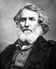
Everest was largely responsible for completing the Great Trigonometric Survey of India along the meridian arc from southern India extending north to Nepal, a distance of about 2,400 kilometres (1,500 mi). …

Many consider the Trigonometric Survey one of the greatest accomplishments of man.

He was a “humourless individual having the knack of putting everyone’s back up. But since he was a genius, his antisocial habits have been glossed over.”

– Trekking Holidays in India

He did not want Chomolungma to be named for himself. George might never have seen Everest. And had no interest in it. After all, he was Surveyor General of India. The world’s highest peak is on the Tibet / Nepal border.
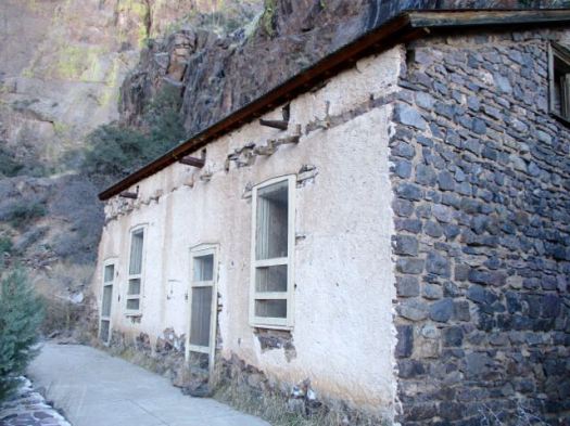
Sir George Everest’s House and Laboratory, also known as the Park Estate, is situated about 6 kilometres (4 mi) from the Mall in Mussoorie.


… The house is situated in a place from where one can catch the panoramic view of Doon Valley on one side and a panoramic view of the Aglar River valley and the snowbound Himalayan ranges on the other.

The house is under the jurisdiction of the Archeological Survey of India and has been long neglected. …


… The floor is littered with bricks, stones and cow dung. The house is also used as shelter from rain and snow by the cows, goats and horses from the nearby village. Its walls are covered with graffiti, which are mostly declarations of love. …

wikipedia

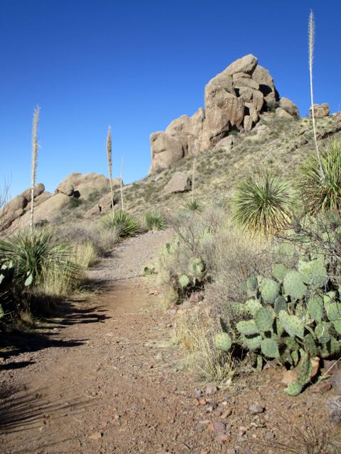
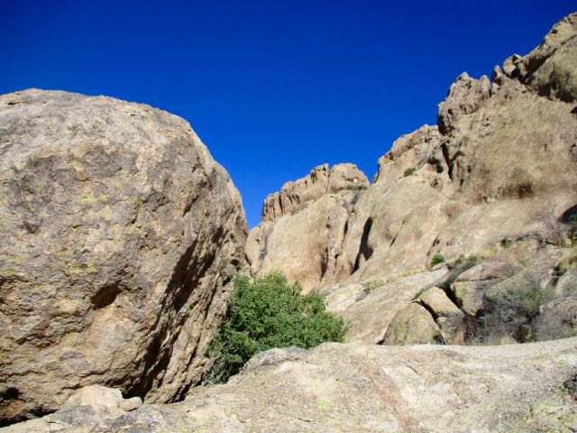
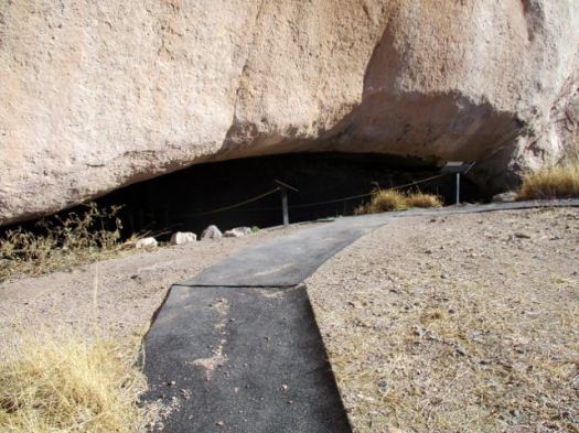
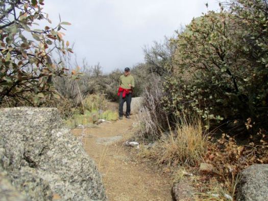
Day hiking (part of the Benog Tibba Circuit) to visit his former Estate, I bumped into a Christian evangelist, Ray Eicher, whose family have lived in India for generations. He set me in the right direction, in a couple of ways.

Everest Estate, Mussoorie-4

Everest Estate, Mussoorie

Everest Estate, Mussoorie-2

Everest Estate, Mussoorie-3

more of my photos

more Everest Estate photos

This kind of neglect of historical monuments is typical in India. My evangelist friend, who lives nearby, is sorely disappointed.

The historic Clock Tower in Mussoorie was recently torn down. At this point, plans to rebuild are stalled.

P.S.

…. Sir George Everest’s surname is pronounced … Eve-rest with “Eve” pronounced as in the woman’s name. …

South Lykken Trail, Palm Springs

Just behind my cheap motel (Desert Inn $40) in downtown Palm Springs was the South Lykken trailhead.

One afternoon I hiked. The next I did a trail run.

trail run

Palm Springs

elevation gain

more of my photos from those day hikes

… the North and South Lykken Trails are named in honor of Carl Lykken, Palm Springs’ first postmaster. …

related – Hiking in Palm Springs

scrambling Piestewa Peak, Phoenix

False summits discourage some non-hikers, but I loved the most acclaimed urban peak climb in Phoenix, Arizona.

false_summit

Vistas from the top are fantastic.

summit

… The Piestewa Peak (formerly Squaw Peak) Summit Trail (elevation gain = 1,190 feet in 1.2 miles) is climbed thousands of times per week by locals and visitors seeking a cardio-vascular workout, great views, or a family outing. However, quite a few hikers do not actually reach the top due to the fact that this trail is more difficult than it looks, especially in the summer when temperatures are well over 100 °F. No water is available on the trail and dehydration is a common and serious problem with hikers who come unprepared. …

The hike itself takes anywhere from 15 to 60 minutes depending on each hiker’s capabilities in fair weather (higher temperatures and sunny conditions may force the hiker to take twice as long). A beginning hiker should allow 60 minutes for a leisurely ascent and 30 for descent. The path is mostly well marked.

… There are a few sections that are technically difficult as they are steep and there are no guard rails.

There are approximately fifteen miles of interconnecting trails in the Preserve, ranging from easy to difficult.

Arizona is one of the best places to hike in North America. In February. 🙂

Rick Piestewa