El Camino de Costa Rica 280 km

El Camino de Costa Rica is a breathtaking 280 km / 174 mile hike from the Atlantic to the Pacific Ocean, which is no easy feat even for the most experienced hikers.

While it can be intimidating to take on this type of adventure, there are so many incredible things to see and do while trekking this route, from tropical beaches and dense trails to mountain villages and indigenous communities.

official website

Click PLAY or watch it on YouTube.

BestHike #1 – West Coast Trail, British Columbia

West Coast Trail is our top hike in the world.

Click PLAY or watch a 1-minute preview on YouTube.

West Coast Trail

Challenging in many ways.

So much VARIETY in pristine Canadian coastal wilderness.

Mystic dawns and mind-blowing sunsets. Hidden pocket coves and weird coastal geology.

You’ll never forget the West Coast Trail.

WCT ladders

AT A GLANCE

  • 75 km (47 mi), 5-7 days Pachena Bay <> Gordon River
  • 3-5 day routes possible via Nitinaht Village trailhead
  • southwestern edge of Vancouver Island
  • Pacific Rim National Park
  • Permits required 
  • May 1 – September 30
  • extremely rugged, requires a high level of fitness
  • 6,000+ backpackers / year

Read more on our WCT information page.

Cape Scott Trail, Vancouver Island

Trip report by BestHike editor Rick McCharles

I hiked the North Coast Trail in 2012.

Vowed to return to the beaches on the Cape Scott Trail. One day. The best part of the North Coast Trail.

In 2025 I waited for good weather. And headed back to this paradise.

The worst part of this adventure is the 60km drive in on a gravel road. Bring a good vehicle.

Highlights for many in this remote N.W. corner of Vancouver Island is wildlife. Especially bears and the quickly evolving coastal wolves.

The trail itself is super interesting. Plenty of boardwalk.

Some of the old growth trees were cut in the past. But there’s still plenty of fascinating greenery.

First stop is fantastic San Josef Bay (3-4km from the parking lot).

stunned at the magical scenery 😀

From there, I continued on to the biggest and best beach of all ➙ Nels Bight.

There are a couple of campsites on the way with platforms.

Continue to Nels if you have the time and energy.

This was close to where I camped in 2012.

Sunset was fantastic on the west coast.

Here’s the view from my tent.

No photo editing.

Pit toilets are decent.

Be sure to lock up all your food on arrival as bear sightings are almost guaranteed. (I saw only 1 bear next morning. Unlucky. Everyone else saw more.)

Weather on awakening was far more typical. Overcast with fog.

It can be very muddy. Bring good footwear.

On the return to the parking lot, I stopped to read signboards and visit the historical sites.

From 1896-1907 approximately 100 Danish settlers attempted to establish a self-governing farming and fishing community. It was extremely difficult.

A 7-foot-high dyke built to protect these flatlands was wiped out the 1st year.

Later, the government offered incentives to all. By 1912 more than 600 people were homesteading in the Cape Scott area. By 1917 most of the settlers had left the area, leaving behind whatever they could not easily pack out, including farm tools, buildings, stoves, machinery, and vehicles.

Walking out seemed to go more quickly than walking in. That often happens to me on out and back hikes.

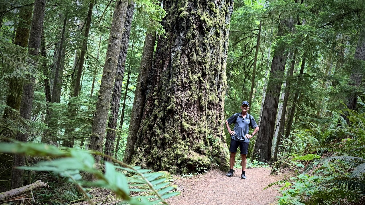
Always a pleasure to hike temperate rain forest.

I do hope I get back to the beaches at least once more in this lifetime. 😀

2025
paradise - Nel's Bight, Cape Scott Trail, BC
2012

Surprisingly, I saw not one wolf in two days. I’d seen plenty in 2012.

Dakota 576 Crash Trail, Vancouver Island

The Dakota 576 Crash Site Trail near Port Hardy, Vancouver Island, leads to the sad wreck of a 1944 Royal Canadian Air Force Dakota plane

The out and back trail starts on a road near the Bear Cove parking lot.

Sidetrips to a narrow, overgrown trail.

Ends up in a rugged, muddy track with some steep sections requiring ropes.

Arriving at the crash is haunting. Wreckage still strewn through the forest.

Happily, the site seems little vandalized or looted.

Pilot Officer J.M. Talbot and Navigator T.S. Wardlow were killed. A third crew member, Sgt. T.R. Moss, survived the crash.

Dave Farrant Trail, Vancouver Island

Out of the Forest Campground at Telegraph Cove is the Dave Farrant Trail to Blinkhorn Point trailhead.

1st Viewpoint

The challenging trail is a labour of love from Dave Farrant himself, who hacked out a route with chainsaw while hanging from a rope over the cliff.

It’s steep and rugged.

The campground asks that you sign-in when setting off for this trail. I suspect some inexperienced hikers have gotten in trouble in the past.

I only went as far as the “bus stop” (outhouse) which marks the scramble up to first scenic overlook.

That was enough for me. I turned around rather than continue to the Blinkhorn Peninsula. I’d fallen once already — and once was enough.

Looking back, the trail was fun. Scrambling over fallen logs. Navigating trippy roots.

There are some huge old growth stumps to admire.

Elk Falls, Campbell River, Vancouver Island

Trip report by BestHike editor Rick McCharles.

The day hike on AllTrails out of Campbell River is Elk Falls via Millenium Trail.

  • up to 7.2 km return
  • up to 262m elevation gain
  • family friendly
  • excellent trail maintenance

Elk Falls are spectacular. But be warned there’s a lot of construction nearby in 2025 and for years to come.

The suspension bridge has great views down into the canyon.

Old growth forest is always a joy to walk.

About 200,000 visit each year. Free parking in a Provincial Park.

Trail maintenance is excellent.

Surprisingly, you can legally walk right to the edge of the falls.

Serpent’s Back Trail, Hope, B.C.

Serpent’s Back Trail (aka Dragon’s Back or Kw’okw’echíwel Stl’áleqem) is a good description of a popular hike out of Hope, British Columbia.

  • 4km return
  • 424m elevation gain
Summit Viewpoint

Constant steep switchbacks through temperate rain forest. Mostly good footing.

Rest at a series of lookouts.

Mount Hope Viewpoint
West Viewpoint

Detour at Stone Garden.

A good hike.

The gravel road to the official trailhead was pretty rough, so I parked below and walked up.

You know you are in the right place when you see this impressive sign.

Start of the trail.

About 6km past the trailhead, there’s a small campground.

Farewell Rathtrevor Beach, Vancouver Island

Over the years, I’ve taken thousands of photos Rathtrevor Beach Provincial Park close to Nanaimo, Vancouver Island.

Most of those near dawn. I’d enjoy my first coffee of the day on the beach.

BUT summer 2025 I’m relocating back to my home townCalgary, Alberta.

I’ll miss those Rathtrevor mornings.

Click PLAY or watch it on YouTube. Montage of some of my favourite photos.

See more of my favourite Rathtrevor pics on Flickr.

Of course I’ve made many VIDEOS on Rathtrevor, as well.

My favourite of those is Vancouver Island at Dawn — 4 Seasons 🎵.

Click PLAY or watch it on YouTube.

When I first got into serious VIDEO editing — during COVID — this 2020 edit is another favourite. 😀

Click PLAY or watch it on YouTube.

Top Bridge Regional Trail, Vancouver Island

Trip report by BestHike editor Rick McCharles

The closest officially designated hiking trail to Parksville is Top Bridge Regional Trail from Rathtrevor Provincial Park.

I’ve hiked it at least 100 times — though it’s been rerouted in recent years.

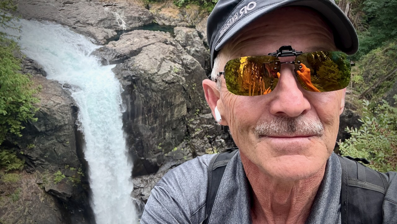
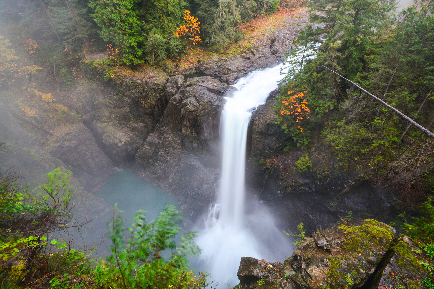
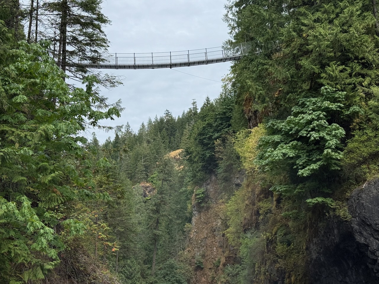
Only 4km one way to an impressive pedestrian-cyclist suspension bridge from my favourite beach on Vancouver Island, Rathtrevor.

Normally I don’t start from Rarthrevor. I skip the road walking and begin at the “I” information sign. That’s the trailhead parking lot: 175 Allsbrook Rd, Parksville.

Click PLAY or watch it on YouTube.

NOTE ➙ There are plans to expand the municipal trail system by connecting Top Bridge and Coombs to Parksville Rail Trail.

Saysutshun (Newcastle Island), Vancouver Island

Trip report by BestHike editor Rick McCharles

Saysutshun (Newcastle Island Marine) Park is a family friendly adventure, accessible only by foot passenger ferry or your own boat from NanaimoBritish Columbia, Canada.

I put my bike on an intercity bus. Then rode the fantastic Nanaimo bike trails to get to the ferry.

It’s a quick, scenic trip over to Saysutshun.

Many simply kayak over to the island. It’s quite protected and safe.

I believe it’s obligatory 😀 to take a photo at the first totem pole.

There are a number of trails to explore on foot and (some) on bike. I did both.

Most day trippers spend about 2 hours walking the trails.

With frequent stops for photos.

Surprisingly, coal was mined here 1853 – 1882. Hence the name, Newcastle.

The rocky shelf is perfect for exploration.

Most fun for me was exploring some of the boat wrecks at low tide.

As you can see 😀, I pushed this one boat back into the ocean.

Here’s the one I might want to salvage. 😀

Click PLAY or watch it on YouTube.

You are almost certain to see some of the Nanaimo ferries.

Sandstone quarrying began on Newcastle Island 1869. There is plenty of evidence of that stonework, even today.

Happily, you can still see some huge old growth trees.

I saw many deer. A few rabbits. None of the worrisome racoons.

For the first time at Saysutshun, I camped one night.

18 walk-in campsites are located in a quiet forested area a mere 5-minute walk from the docks.

Five group campsites are also available that can accommodate up to 50 guests.

Potable water is available along with flush and pit toilets, hot showers, and food lockers to protect your rations from local raccoons!

With no cars allowed on the island, the quiet is serene, with nothing but the sound of the ocean, birds and wind in the trees. And with no bears or cougars on the island, there is little worry of any alarming wildlife encounters.

Sites are available on a first-come first-served basis, but reservations are highly recommended.

Reservations can be made through the BC Parks online reservation system.

It took 3 tries and 2 different email addresses to get my campsite booked. Also, you have to book at least 48 hours in advance.

The campsites weren’t full in early June. But group sites were packed with school kids. Having fun.

I enjoyed most cycling and hiking after the last ferry returned to Nanaimo. It’s very peaceful.

I highly recommend you visit Saysutshun (Newcastle Island Marine) Park if you get to Nanaimo.