hiking Jostedalsbreen, Norway

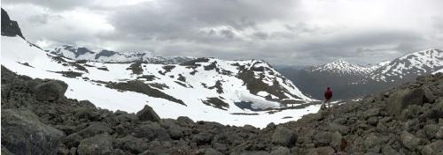
Jostedalsbreen National Park, in the Sognefjord region of central Norway, is home to continental Europe’s largest ice sheet – the Jostedal glacier – which spills over from a high plateau into a succession of dramatic lake-filled valleys and fjords.

Although Jostedalsbreen is a popular tourist destination (you’ll see plenty of tour buses at the best-known spots) the hiking trails in the region – which given the forbidding topography tend to be steep and strenuous – don’t seem to be well-known outside Norway. …

A few good day hikes:

• Climbing the Skala
• Briksdalsbreen
• Storevatnet trail from Briksdalen

… Norway is expensive, …

Prices range from the merely high (hotel rooms, rental cars) to the eyewateringly exorbitant (restaurant meals, alcohol of any kind).

Camping is very popular in Norway (in addition to official campgrounds, you see impromptu campsites in many rural areas) so for a visit on the cheap you might consider taking a tent and buying food in supermarkets.
… read more

That’s all from the excellent site by Phil Armitage, landscape photographer.

Start on his home page.
besthike photo inspired artist

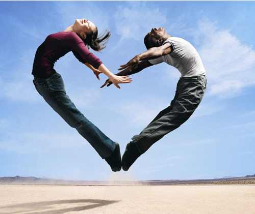
Professional artist Richard Mravik asked to use one of our photos as the concept for one of his paintings. He’s just finished.

Here’s a low resolution version of that painting.

He’s sent it to Stephen Lowe art gallery. Eventually you’ll be able to see it on Richard’s page there.

Milford Track, New Zealand

If you checked out Jed Micka’s Hiker’s Haute Route, Chamonix to Zermatt trip report you know that they are detailed, amusing with superb photos.

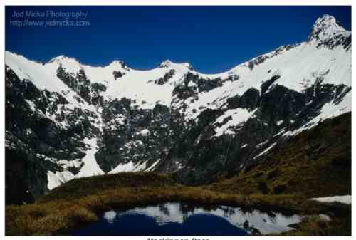
Here’s one of Jed’s earlier treks, the famed Milford Track. He couldn’t get a spot for an independent hike … so signed on for one a guided adventure. … A guided adventure being the kind where you have hot chocolate waiting at the hut. And hot showers.

It’s a fixed itinerary:

Day 1: Lake Te Anau to Glade House
Day 2: Glade House to Pompolona Lodge
Day 3: Pompolona Lodge to Quintin Lodge
Day 4: Quintin Lodge to Sandfly Point

Back in 2002 Jed was a “rookie” hiker with new untested gear. He writes his impressions at that time:

… It begins with a boat-ride from lake Te Anau to a drop-off point, from which one must traverse wetlands, temperate rainforest, suspension bridges, and an alpine pass, before finishing some 53km later, at Sandfly Point, on the edge of Milford Sound. Because of the delicate nature of the ecosystem and the inherent danger to the hikers (for some portions of the trail are routinely submersed under the very heavy rain and others traverse avalanche fields … 56 in all!) …

After arriving at Sandfly Point, weary, bitten, yet still elated, we boarded a ferry that took us to Mitre Lodge, where we had rooms, a hot meal, plenty of wine, and a dry pair of clothes waiting for us.

And although the hike was nominally finished for me, I knew that it was just a beginning: an introduction to the world of trekking that had already infected me with a desire to explore other regions of the planet. With this in mind I carefully catalogued the gear that worked well for me, and that which needed to be remedied before my next hike …

click over to Jed’s site to read more – The Milford Trek

best photos 2010

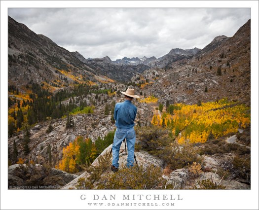
Here’s a favourite of photographer G Dan Mitchell:

A daily photograph, news, observations, and ideas about photography

see more – G Dan Mitchell Photography

Photographer Michael Frye …

… asks you to click through to his 46 Best Photos of the past year, … and select the 10 you like best. (Leave your picks in the comments of that post.)

(via Tom Mangan on Facebook)

17 famous Mountain Peaks

Lindi Horton over on the wonderful Matador Network did a recap & review of our World’s Top 10 Hiking Towns.

It’s GREAT. I learned new things about our own list.

Matador – The World’s Top 10 Hiking Towns

Lindi linked to another terrific Matador post – Photo Essay: 17 of the World’s Most Recognizable Mountain Peaks

hiking Tecolote Beach, Baja

trip report by site editor Rick McCharles

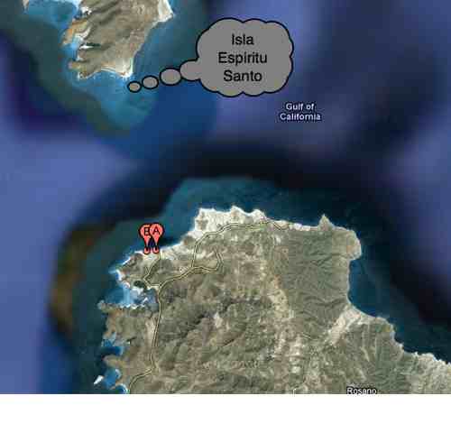
Tecolote … (A) is an isolated beach community located in the municipality of La Paz in the state of Baja California Sur, It is 25 km from the city of La Paz …

It is one of the most extensive of the beaches in this area with fine, white sand gentle waves and little undertow. Water skiing and jet skiing are available here as well as a boat that goes to Isla Espíritu Santo.

Google maps

I’d been here several times in the past, most memorably on my kayak tour of the island (PHOTOS).

You can walk anywhere in this desert. I headed east along the shore, like Graham MacIntosh. Here’s a view looking back to Tecolote.

The highlight is sea birds. Especially Pelicans.

This little lizard is the only other beast I saw.

Seems the area has many wild burros. They were all around. But I never saw even one.

Perhaps the ATVs scare them away.

Here’s the ferry La Paz – Mazatlan.

There are plenty of ramshackle fishing shacks along the coast. Most empty.

I decided to head inland to tent.

Perfect weather, I enjoyed a peaceful sunset and sunrise. Someone had previously tented up here, already clearing a spot.

In the arms of that cactus near my tent, I left a Summit Stone.

Deserts are some of my favourite hikes. But you cannot go out long. Drinking 4 litres, I was already thirsty after 21 hours.

See the rest of my photos from this hike.

Westwood Lake, Nanaimo, B.C.

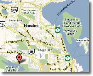
… Westwood Lake is an ultimate destination for many kinds of Nanaimo-ites, owing to its kilometres of springy pathways for runners and walkers, beaches for swimmers, fish for canoers, and its access to Mount Benson and Westwood Ridge …

I did just the 6km loop around the lake, catching some interesting photos.

Westwood Lake, Nanaimo, B.C.

The sun we hadn’t seen for many days was evaporating snow into mist.

Westwood Lake, Nanaimo, B.C.

Westwood Lake, Nanaimo, B.C.

Westwood Lake, Nanaimo, B.C.

see the rest of my pics on flickr

The best guidebook for the many local trails like this on Vancouver Island are the Hiking Trails series (3 volumes) by Vancouver Island Trails Information Society.

Jeju Olle hike, Korea day 3

#Jeju #JejuOlle

trip report by site editor Rick McCharles

Day 1 | 2 | 3 | 4 | 5 | (routes 1→ 6 = 106km)

I did part of this route with the Walking Festival. And came back later by myself, to finish.

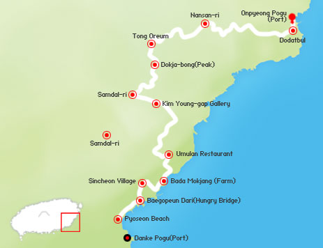
Route 3 - Jeju Olle, Korea

Walking in Korea and most of Asia is traditionally for the purpose of religious pilgrimage. To walk for fun and fitness is a relatively new and foreign concept.

Festival motto – be happy on the trail

Route 3 - Jeju Olle, Korea

Perhaps the most amazing sight on the sections I hiked was this vast area covered with Mandarin orange peels. We were told that, once dried, it would be used in tea.

Route 3 - Jeju Olle, Korea

The aroma was wonderful.

It was here, too, that our hiking group sampled the famous Jeju pork. Delicious.

Route 3 - Jeju Olle, Korea

Of the stretches along the water, I think this was my favourite.
Route 3 - Jeju Olle, Korea

Near the coast there are always surf cast fishermen in sight.

Route 3 - Jeju Olle, Korea

Most of the “beaches” are black and stony …

This one, Pyoseon, near our official Conference hotel was a rare sandy treat

Route 3 - Jeju Olle, Korea

We took a shortcut to the finish

Route 3 - Jeju Olle, Korea

Christian funeral monument.

Route 3 - Jeju Olle, Korea

Korea is about 40% Christian though none of the huge churches you’ve seen on TV are located on Jeju.

Route 3 - Jeju Olle, Korea

One of the bloggers saw some of the famous diving women of the island close to here.

It’s an interesting story, those divers.

Another saying of this island is that “rocks, wind and women are plentiful“. It’s a bit of a matriarchal society.

Haenyo are skilled divers who are known to be able to hold their breath for more than two minutes and dive to depths of 20 meters. Diving was the first profession for women in Korea and the Haenyo are some of the best free divers in the world.

Route 3 - Jeju Olle, Korea

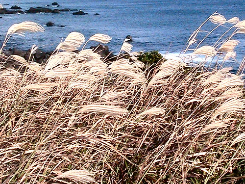
I set up a tent in a spot hidden by tall grasses. This, my only companion, didn’t reveal I was there.

Route 3 - Jeju Olle, Korea

Read more about route 3 on the official website.

See the rest of my route 3 photos on flickr.

Day 1 | 2 | 3 | 4 | 5 | (routes 1→ 6 = 106km)