While traveling, I want to capture VIDEO and PHOTOS as quickly and easily as possible.
BEST for me in 2026 is to simply carry my iPhone 16 Pro. Typically I shoot video in the standard Camera app, 4K, 60 frames / second. HDR in automatic mode.
Only 5x optical zoom is a bit of a limitation, but it’s much better zoom than phones in the past. (I am tempted by the higher zoom in the 17 Pro.)
More often than not, I bring my inexpensive tripod from Fotopro. (Similar to JOBY GorillaPod — but a little better.)
The tripod works like a selfie stick. Or I can quickly set it up almost anywhere.
That tripod has a simple ball head. To it, I attach the Ulanzi ST-27 Metal Phone Clip to keep my phone secure. It fits a large smart phone with cover.
I’m addicted to my Apple Watch — and use the Camera Remote app as a viewfinder for taking photos and videos from a distance. I have that app as one of my Complications on the Apple Watch face so it’s always quickly available.
For multiple day adventures, I’ll bring one or more external batteries. . HEAVY — YES. But they are the safest way to recharge my electronics on the trail. These brutes have saved me many, many times in the past.
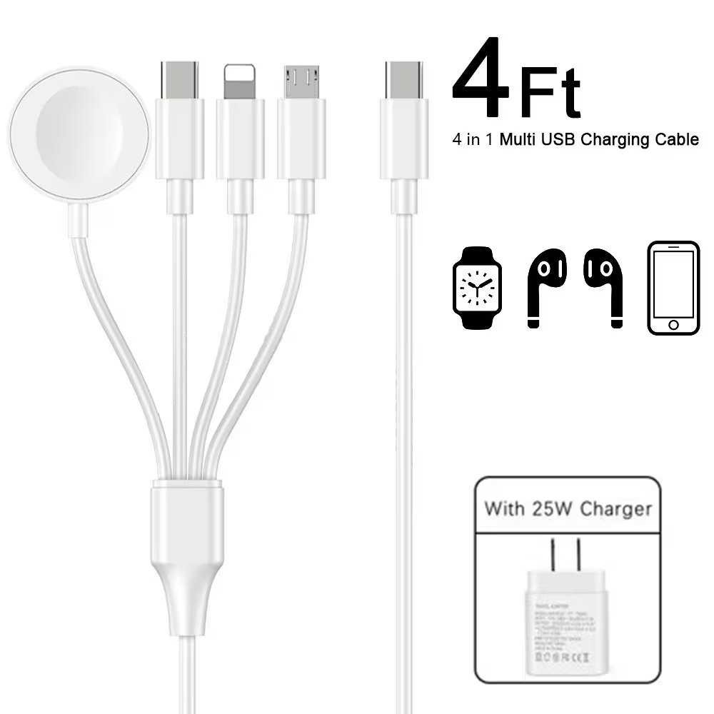
Currently my travel favourite is the inexpensive INIU Charger 22.5W 20000mAh with attached USB-C cable as a handle. In fact I’m taking two of these on my next trip as I’ll often be away from electricity.
It can charge 5 devices simultaneously including a laptop, but I find the 4th and 5th (USB-A) really don’t get much juice compared with the first 3 ports in line. Almost all my devices now are USB-C.
If cycling — where weight and bulk are less an issue — I usually bring along a short extension cord. This makes it more convenient to plug into libraries, coffee shops, hostels, shopping malls, etc. (The UGREEN tends to fall out of a loose wall socket.)
The BIG decision for me last year was whether or not to take the DJI Mini 4 Drone. The Controller is essential. … In fact, so far I always bring the bulky carrying case and 3 extra batteries. A major commitment.
BUT I love shooting drone video. And I am often willing to suffer with the extra bulk and weight.
Actually, all this gear is not bad when I’m bikepacking. I add even more gear including the world’s best helmet. 😀
Sadly, I lost the Mini 4 in S.E. Asia on the last trip. And have now switched to the smaller, lighter, much cheaper, more durable DJI Neo 1. I call it a toy drone.
Mostly I’ll use this drone handheld. No phone. No controller.
For more complicated shots, I’ll take the time to use my phone as a controller.
For long trips, I bring along my old MacBook Air and 3-4 external 2TB SSD drives for back-up and video / photo editing.
I normally leave the Apple charging brick at home, using USB C charging, instead.
Critical for cycling is navigation. I use an old iPhone with a QuadLock attachment to the handlebars. And a rain poncho, when necessary. I keep my Canadian SIM card in this phone to ensure texts still reach me at the end of the world.
I’ll stop here …. though there are times I bring even MORE along in the bike saddle bags. 😀
IF I might need light at night, I’ll bring my tiny Nitecore headlamp and short charging cable.
Anker IQ wall plug for a quick charge at a coffee shop. ??
Bottom line? Show up with your phone and a back-up external battery. That’s what the smart folks do. 🙏
Me? I’ll always have the phone and drone.
For example, for my last international trip (hiking, not cycling) this was my MAIN recharging set-up. One electrical outlet ➙ light extension cord ➙ International adapter ➙ my UGREEN Nexode 100W 5 Port USB C Charger Block ➙ 1) laptop, 2) INUI external battery (charging watch), 3) UGreen (charging phone).
Cables are long for convenience in awkward recharging locations. Cables are high speed. Priority is keeping my external batteries charged for use away from an electrical outlet.
In addition are my devices to be charged irregularly. I’ll do these once the MAIN group of devices is done.
In foreign nations, I’ll put a local SIM card into the 16 Pro.
This is the bulky, heavy drone with 4 batteries. (My next drone is lighter and smaller.)
I do have AirPods, as well. Normally I top those up from the external battery when needed. In fact, I carry a spare AirPod.
I rarely take the Flow Pro 2 Gimbal — but that battery seems to stay charged almost indefinitely. 😀
Electronics are carried in my trusty old laptop case. Drone and accessories, separate.
For 2026 I’ve reduced bulk and weight of electronics. Next trip I’m going to try to combine my laptop bag and day pack into one.
NEW ➙ My day pack cable can recharge Apple Watch, old iPhone, USB-C, and USB-A.
Personally, I felt the storytelling average. Sometimes pretentious.
What kept me going was the plot ➙ story of the search for Valerie Gillis, a 42-year-old hiker known as “Sparrow,” who vanishes while navigating the challenging Appalachian Trail.
After weeks experience on the A.T., Sparrow makes many dumb mistakes.
The book was slightly inspired by the story of Geraldine Largay who went missing in 2013 and survived for 26 days.
Valerie pours her thoughts into fractured, poetic letters to her mother as she battles the elements and struggles to keep hoping.
At the heart of the investigation is Beverly, the determined Maine State Game Warden tasked with finding Valerie, who leads the search on the ground. Meanwhile, Lena, a seventy-six-year-old birdwatcher in a Connecticut retirement community, becomes an unexpected armchair detective. …
… The mystery inspires larger questions about the many ways in which we get lost, and how we are found. …
… 3 ports: a USB-C port for charging the unit at a maximum power of 65W — capable of being fully recharged in 2 hours using a 65W AC charger — and for outputting up to 100W, another USB-C port that supports outputs up to 45W, and a USB-A port that allows for outputs up to 18W.
… a small LED panel designed for a singular purpose — to display the battery capacity …
The trail was covered over with snow, and I had no guide to lead the way. I only tented one night. Awoke with a a bad stomach ache. Then turned back.
AT A GLANCE
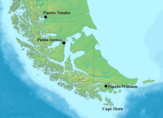
world’s most southerly major hike?
circumambulate the jagged spires of Cordon de los Dientes
out of Puerto Williams, Chile, on Isla Navarino (pop. 2,262 last time we counted)
recommended 5 days, 4 nights in the past. Most hikers are doing it in 4 days, 3 nights now as the route is better cairned and signed. Kraig did it in 3 days, 2 nights.
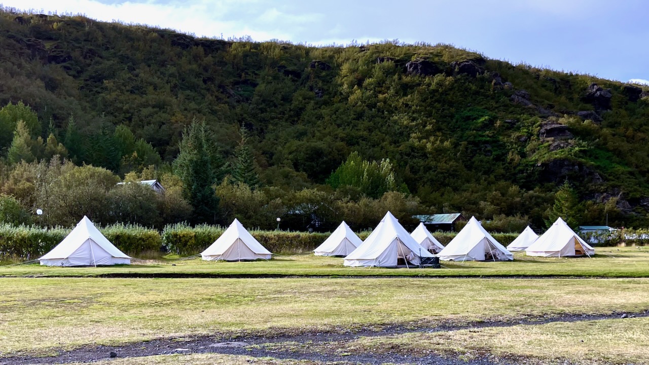
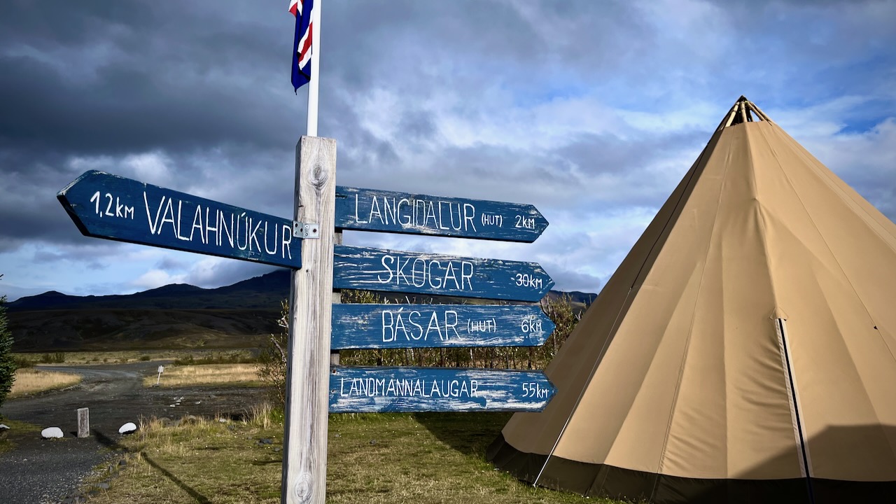
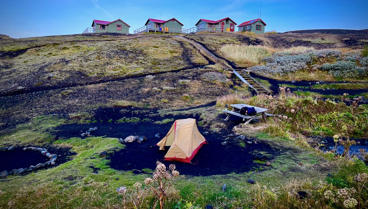
Volcano hut offers these luxurious rental tents. Glamping. 😀
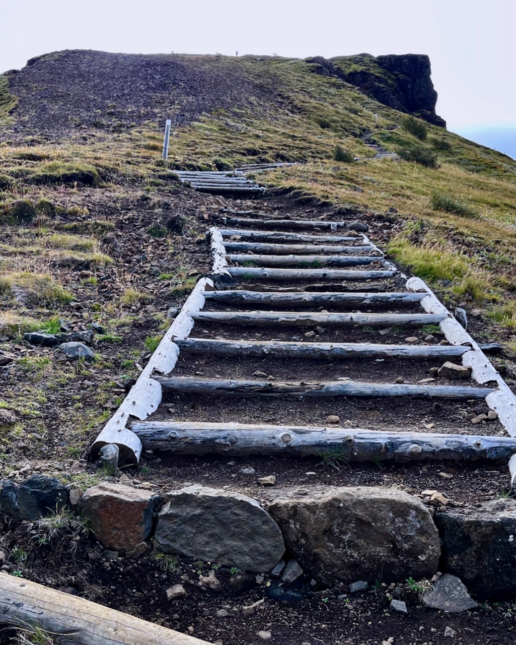
I dropped my pack and — as the weather was good — hiked up the closest viewpoint with most everyone who had arrived with me.
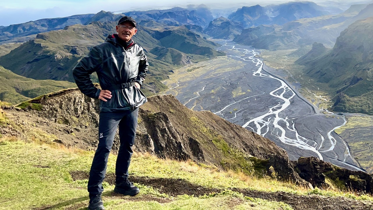
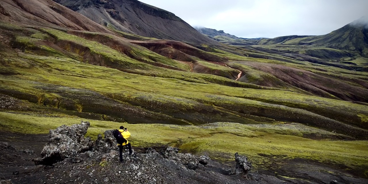
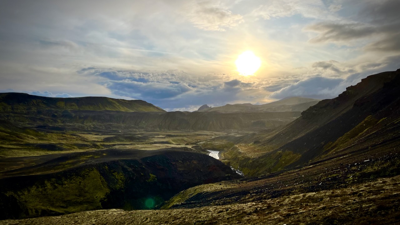
Wow. This is the Iceland I remember.
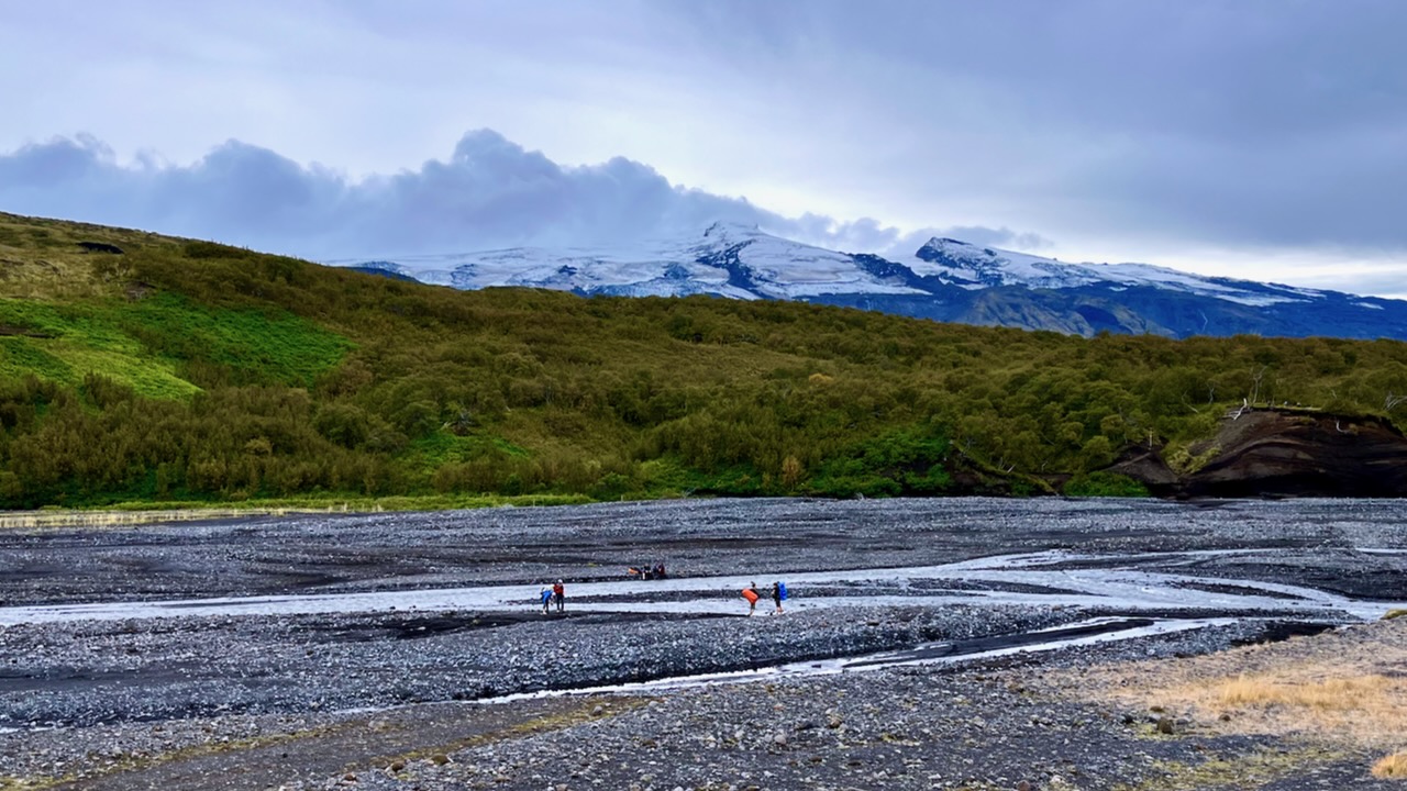
I planned to cross this river on foot when I returned.
We took a different trail down to Langidalur camp. Then hiked around the mountain back to Volcano.
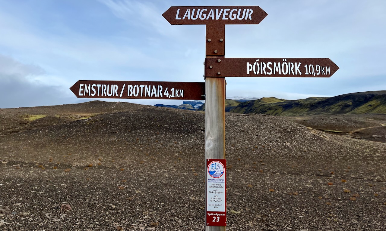
It was only 13.5km to the first official campsite Emstrur / Botnar so I was in no rush.
I took a lot of photos. Shot plenty of video.
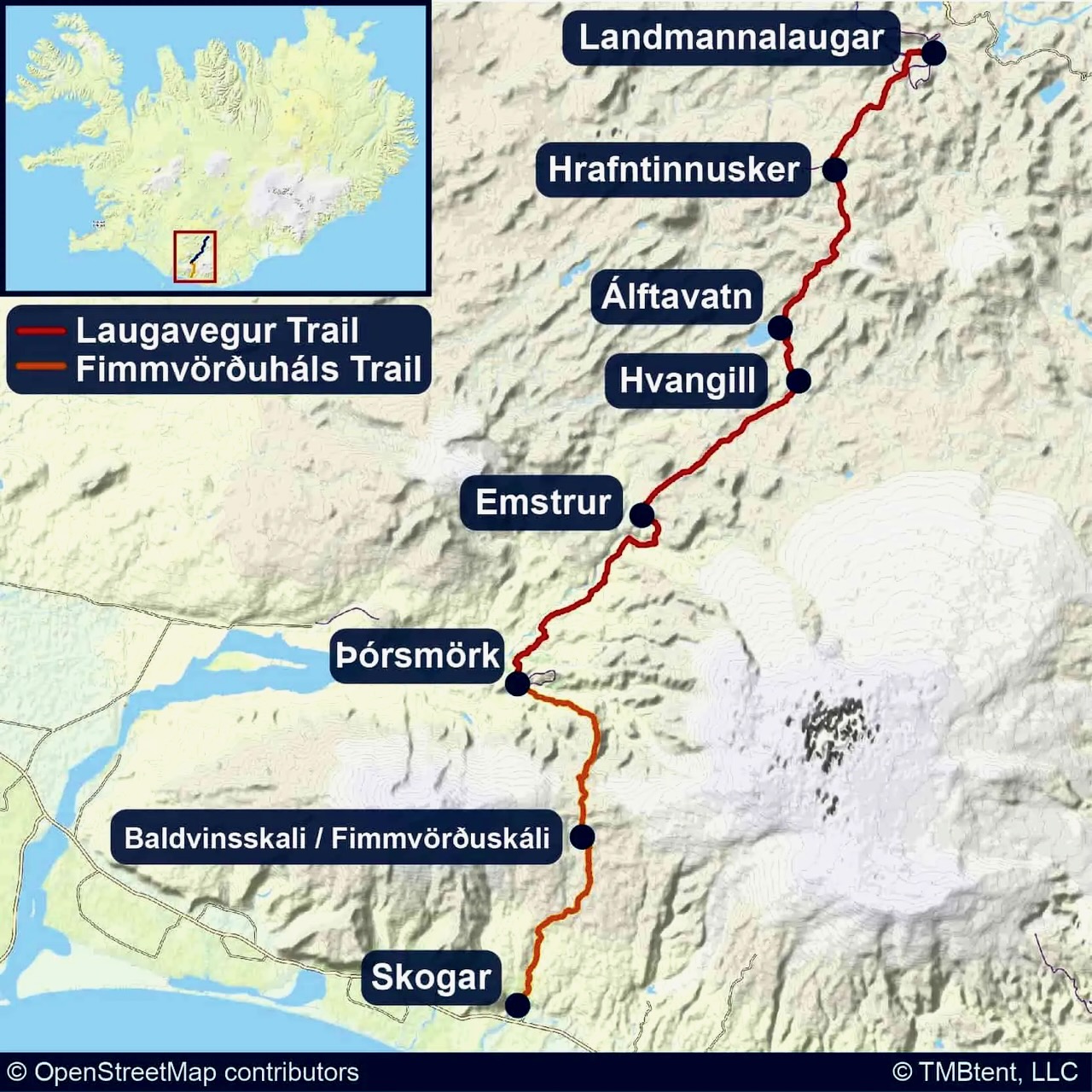
River Crossings
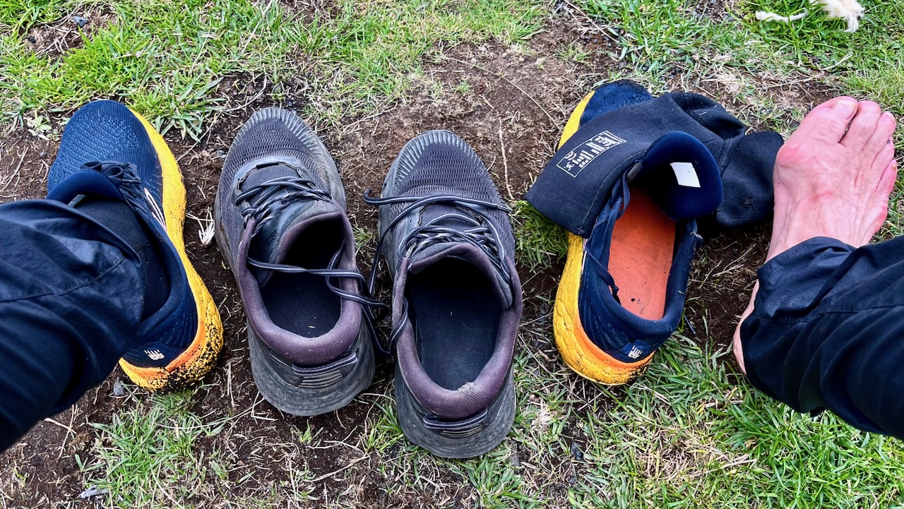
The most dangerous part of hiking Laugevagur are the river crossings. Plan carefully what footwear you want for wading slippery stones in (potentially) a thigh high. strong current.
I hiked in approach shoes. Used trail runners with neoprene booties for the river crossings and around camp.
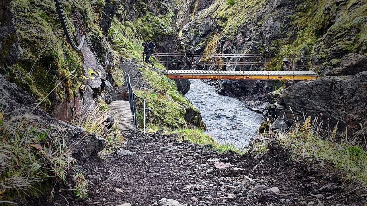
Once in a while you have the luxury of a bridge.
Most available bridges are across gorges too steep to wade.
The trail is fairly well signed.
IF you have good visibility, it’s not easy to wander off trail.
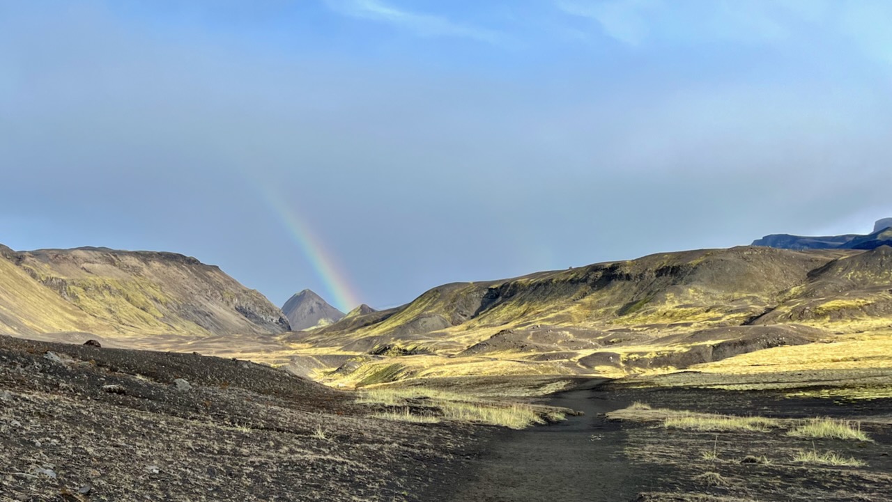
Weather changes frequently. Sometimes drastically.
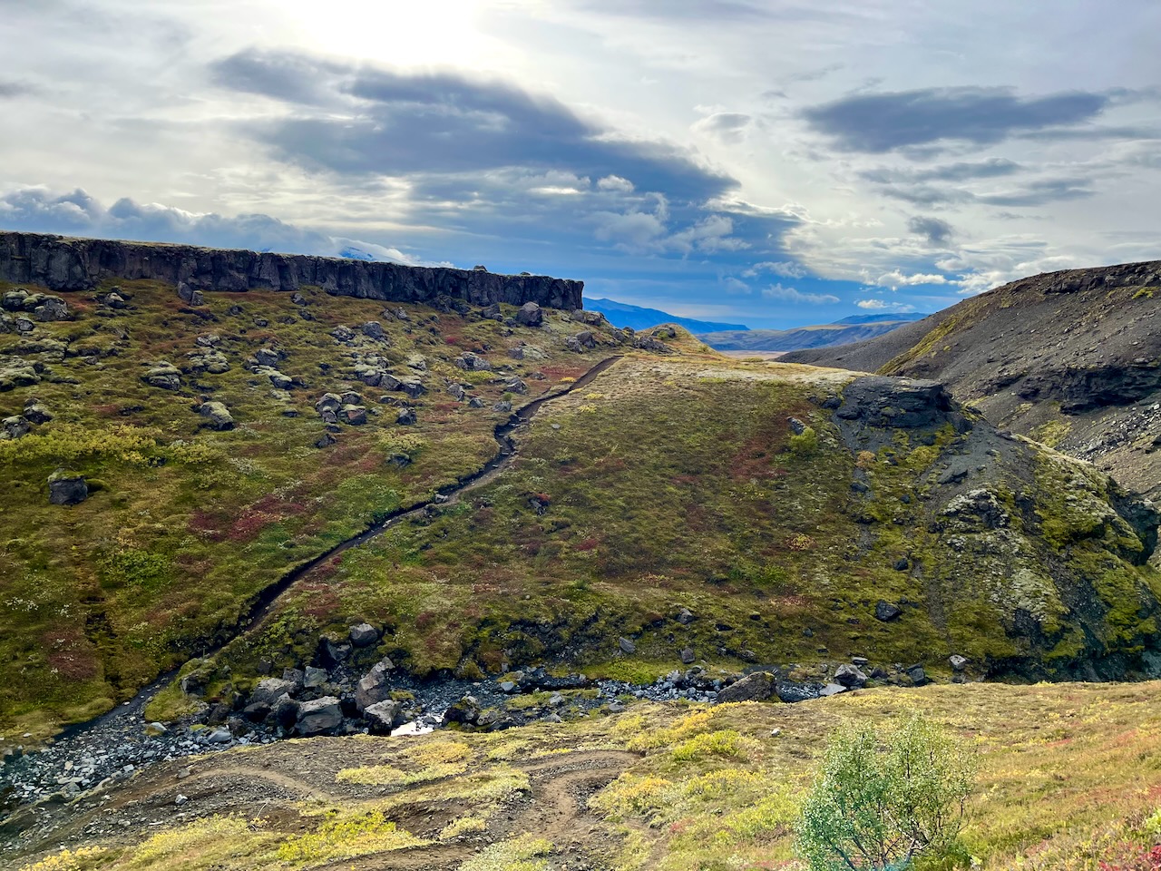
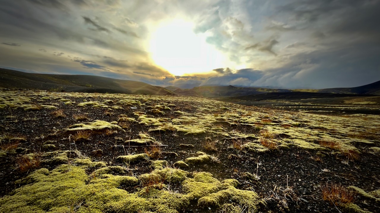
I love the bleak, treeless landscapes when the sun is low.
I’d camped at Emstrur Botnar 5 years earlier and liked the tent sites, somewhat protected from the wind.
I was probably making a mistake going so late in the season. Laugevagur could shut down any time after Sept. 11th due to weather.
All agree that Laugavegur is the best hike in Iceland. It’s fairly close to Reykjavik. There are a number of transportation options to get to the trailheads.
Cost
For me as a tourist, Iceland has been by far the most expensive nation. And I’ve been to over 90 nations.
Bring. Money. $$$$$
You probably don’t need any Icelandic currency as they accept credit card almost everywhere. The notable exception is local buses that only take cash or payment by their own app.
Food & Fuel
Knowing that food is expensive and limited in variety, I brought quite a bit of camping grub with me on the plane.
I bought the rest in Reykjavik. And bought a small canister of very expenisve fuel.
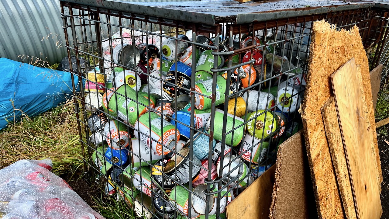
Of course there are hundreds of partial containers at the trailheads, but I didn’t want to risk not having fuel.
Fuel canisters left behind at Langidalur, Sept. 2023
Transportation
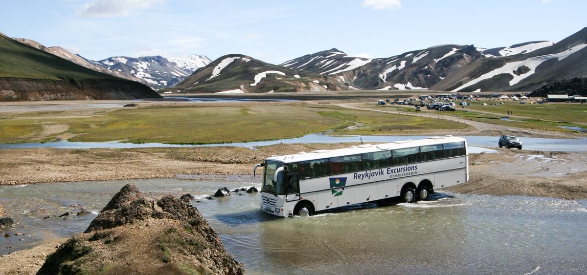
Deciding on this adventure last minute, I was excited to do it late in the season when there would be fewer hikers. Of course, bad weather is a greater risk.
What I didn’t realize until arrival is that bus service to the trailheads started shutting down Sept. 11, 2023.
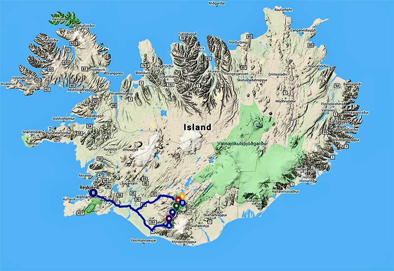
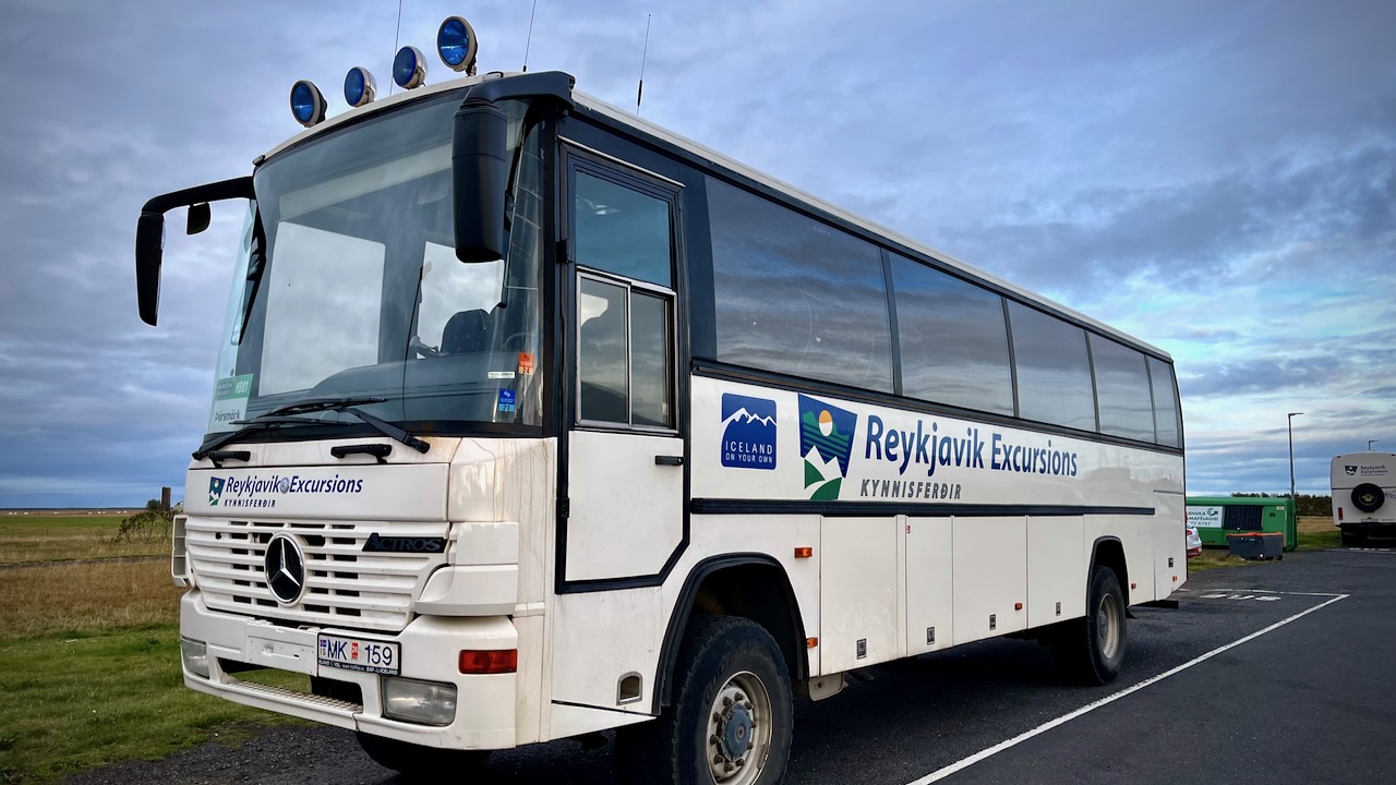
I decided to take the Reykjavik Excursions bus to Þórsmörk on Sept 13.
I’d YOYO the Laugavegur — hiking it both ways back to my starting point. Then continue over the Fimmvörðuháls pass to Skógar on the coastal highway. From there it would be easy to find transportation back to Reykjavík.
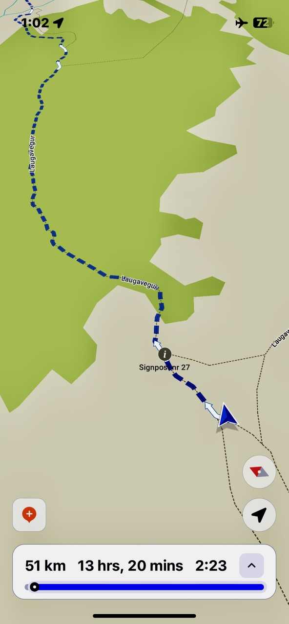
I did carry a paper map as back-up, but mostly used the free Maps.me app offline whenever I wanted to check that I was on track. It’s excellent for Laugevagur and most major hikes worldwide.
The one time I really needed Maps.me was coming in to camp in the dark with headlamp. It’s very easy to get confused when you can’t see the next post in the distance.
Electronics
There’s no access to power on the trail. In order to keep your devices working, bring enough power bank batteries. I brought two 20000mah batteries on my hike.
Be sure to carefully store your electronics in waterproof ways. It’s difficult to keep the rain out.


