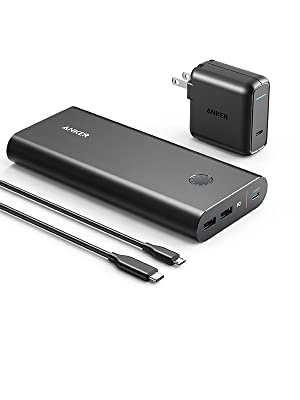
Flower Ridge Trails, Strathcona Park B.C.

Trip report by BestHike editor Rick McCharles.

Experts agree that the Flower Ridge trails are some of the best in Strathcona Provincial Park, Vancouver Island.

The up-and-back Flower Ridge Trail:

  • 27km return
  • 1-3 days
  • 1970m elevation gain/loss
  • summit of Central Crags 1642m 
  • no permit needed
  • Phillip Stone – Exploring Strathcona Park guidebook
  • no electricity nor mobile phone service

If adventurous, you could return via other longer routes including:

  • Comox Glacier to Buttle Lake Traverse
  • Ash River Horseshoe
  • Mt. Rosseau to Cream to Bedwell lakes
  • Green lake to Price creek

Good navigation needed on all those options, of course.

I was actually hoping to return via the Henshaw Creek Horseshoe since it returns you to where you started. A perfect loop.

In fact, it’s one of guidebook author Phillip Stone’s favourite hikes in the Park.

But I would have needed a guide and full mountaineering gear to pull that off in June.  Perhaps a helicopter, as well. 😀

I was there early season.


Beautiful morning. Ideal campsite in the Marine Park next to Buttle Lake campground.

It was June 14th. Free. ($10/night/site starting June 15th.)

I enjoyed a leisurely morning.

Next cycled to the trailhead, easy access from gorgeous Buttle Lake Parkway.

It’s close to Ralph River campground.

Full Strathcona Park map (PDF).

Strathcona Park had just opened following the COVID-19 shutdown.

The previous day I’d tried King’s Peak with a light day pack. Didn’t get higher than 770m due to high creeks.

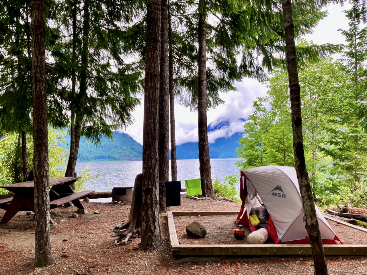
Learning my lesson, for Flower Ridge I brought food for up to 3 days. Full pack.

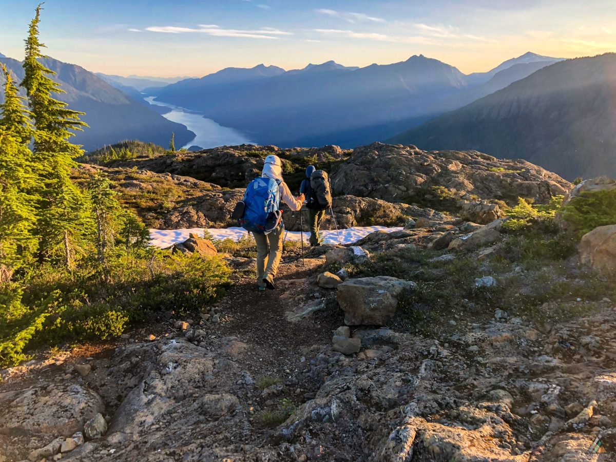
Started up about 5pm.

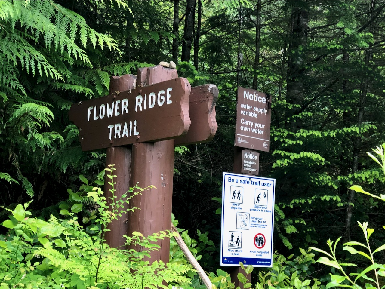
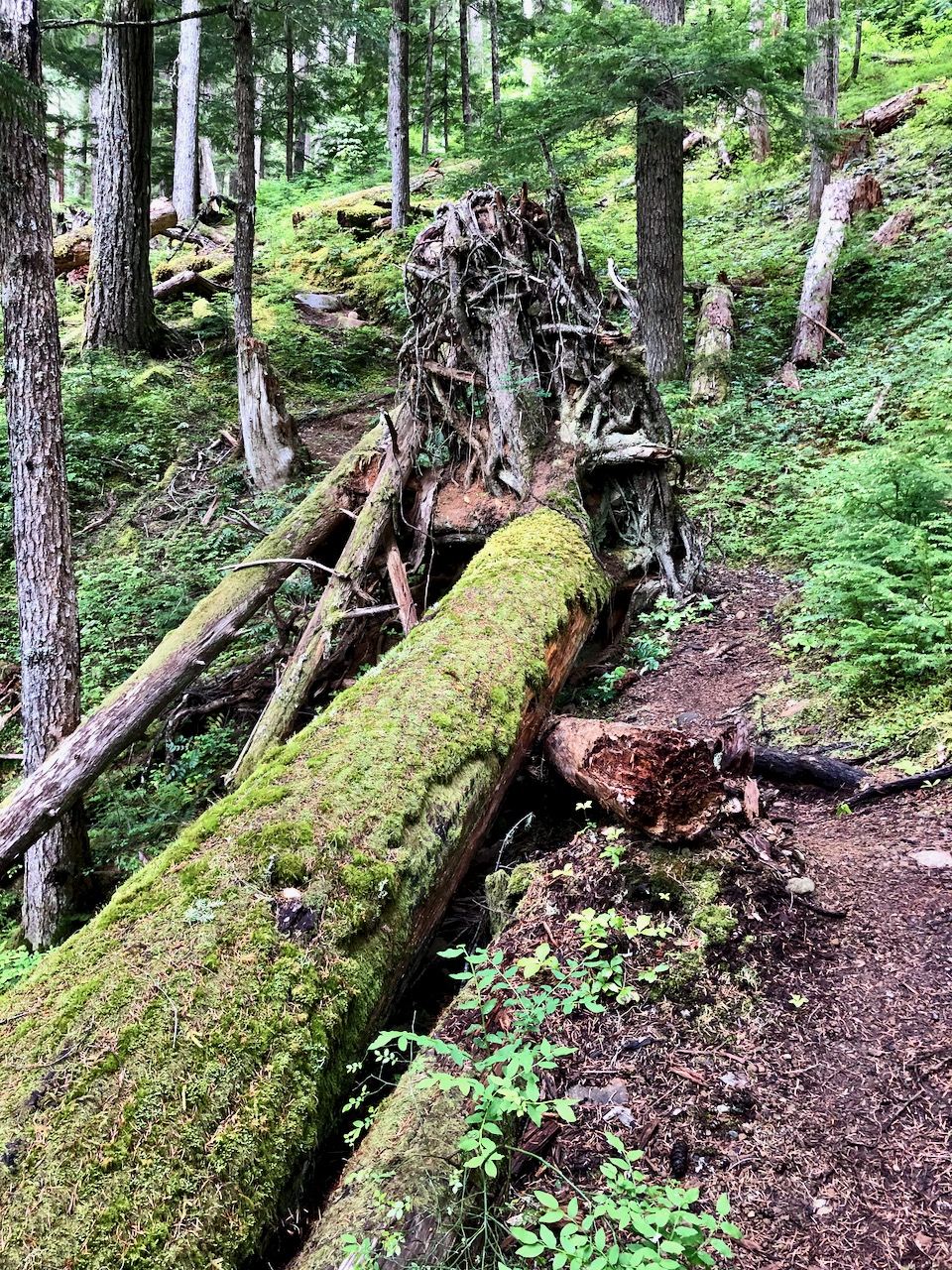
Like many Strathcona hikes, Flower Ridge starts with a steep climb. But less steep than most others

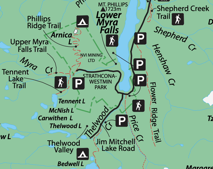
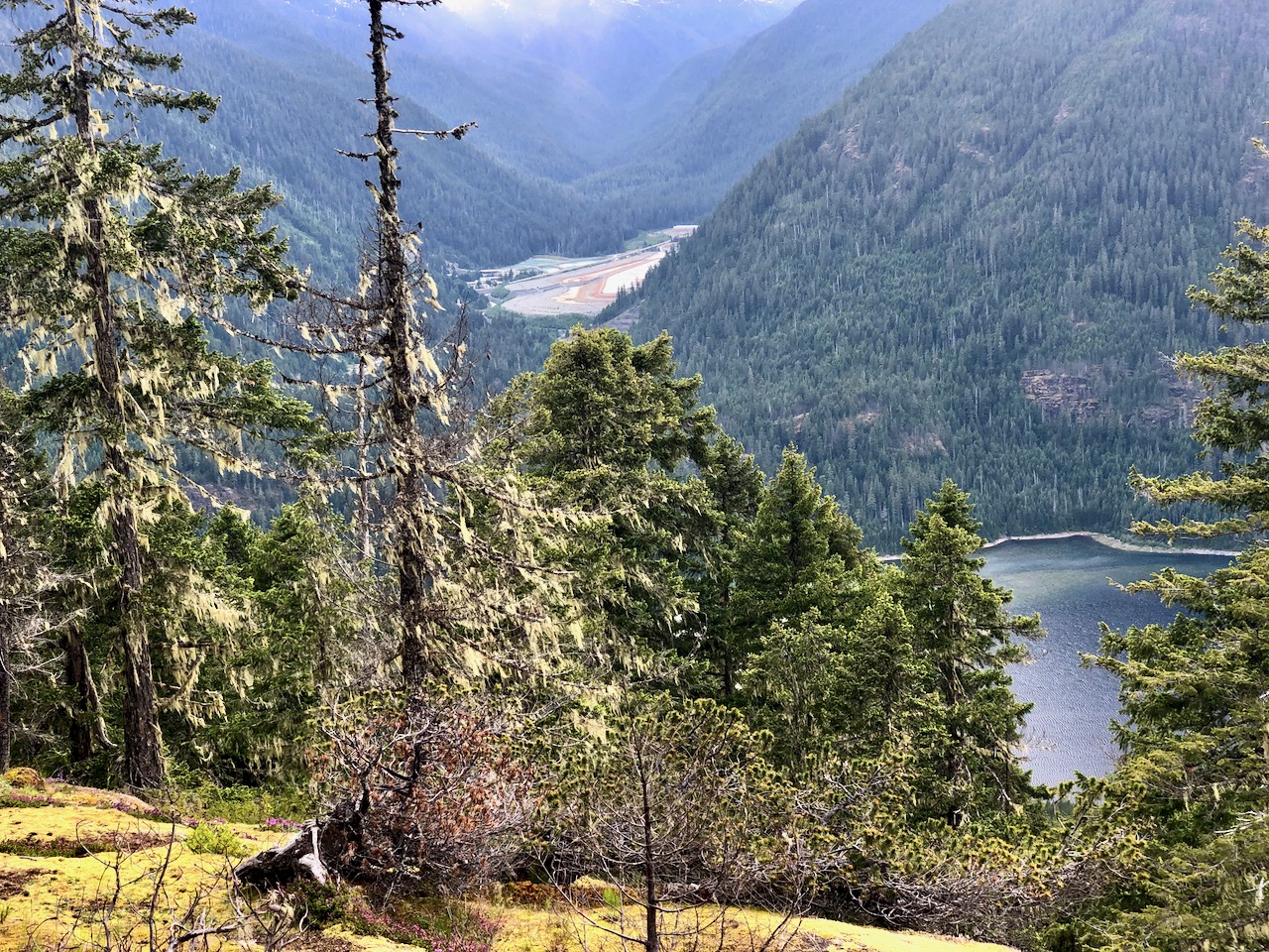
Not many views early on. When you do, it’s of the the Myra Falls Mine (opened 1959)

The mine is currently owned by Nyrstar and produces zinc, lead, copper, silver and gold concentrates.

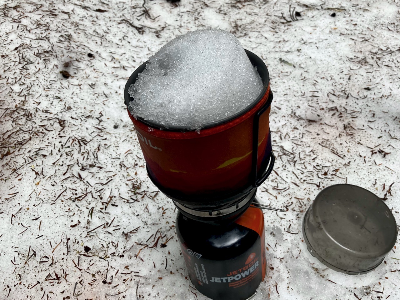
Any time you are hiking a ridge, finding running water might be a problem. But my guidebook said there was one reliable creek — I never found it.

No worries. There is plenty of snow to melt. You dig to find the clean white stuff.

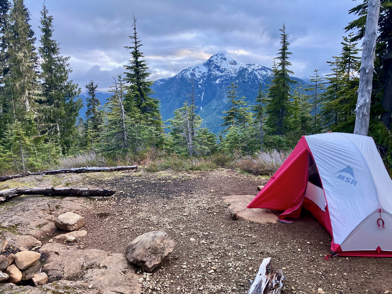
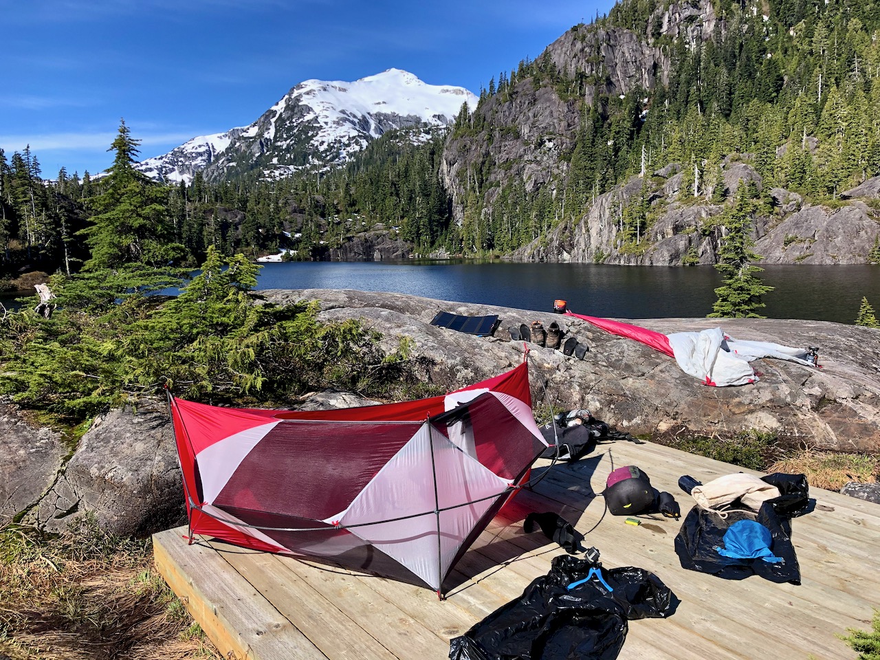
I set up 8:30pm at the first obvious campsite. Days are long in Canada in June.

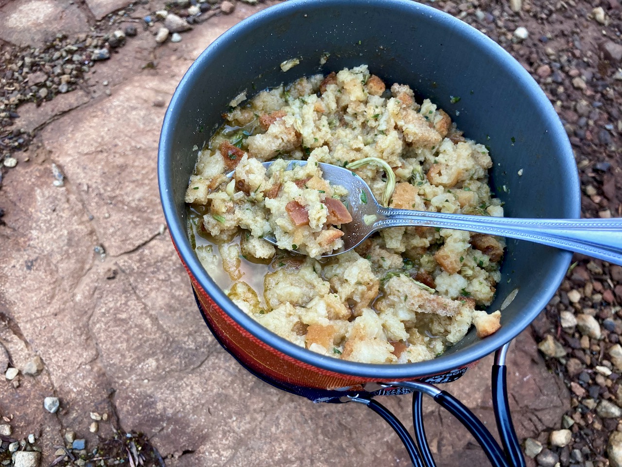
Normally my dinners are based around instant mashed potatoes. But for this trip I went all in for instant stuffing.

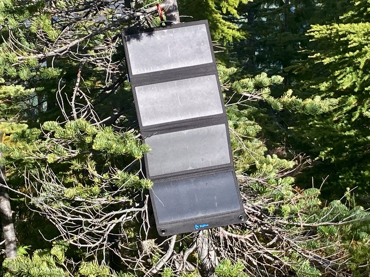
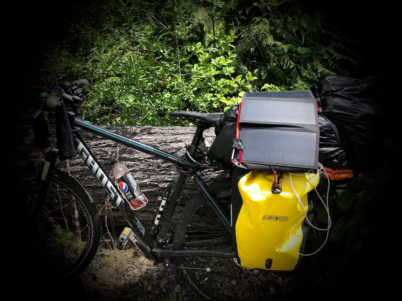
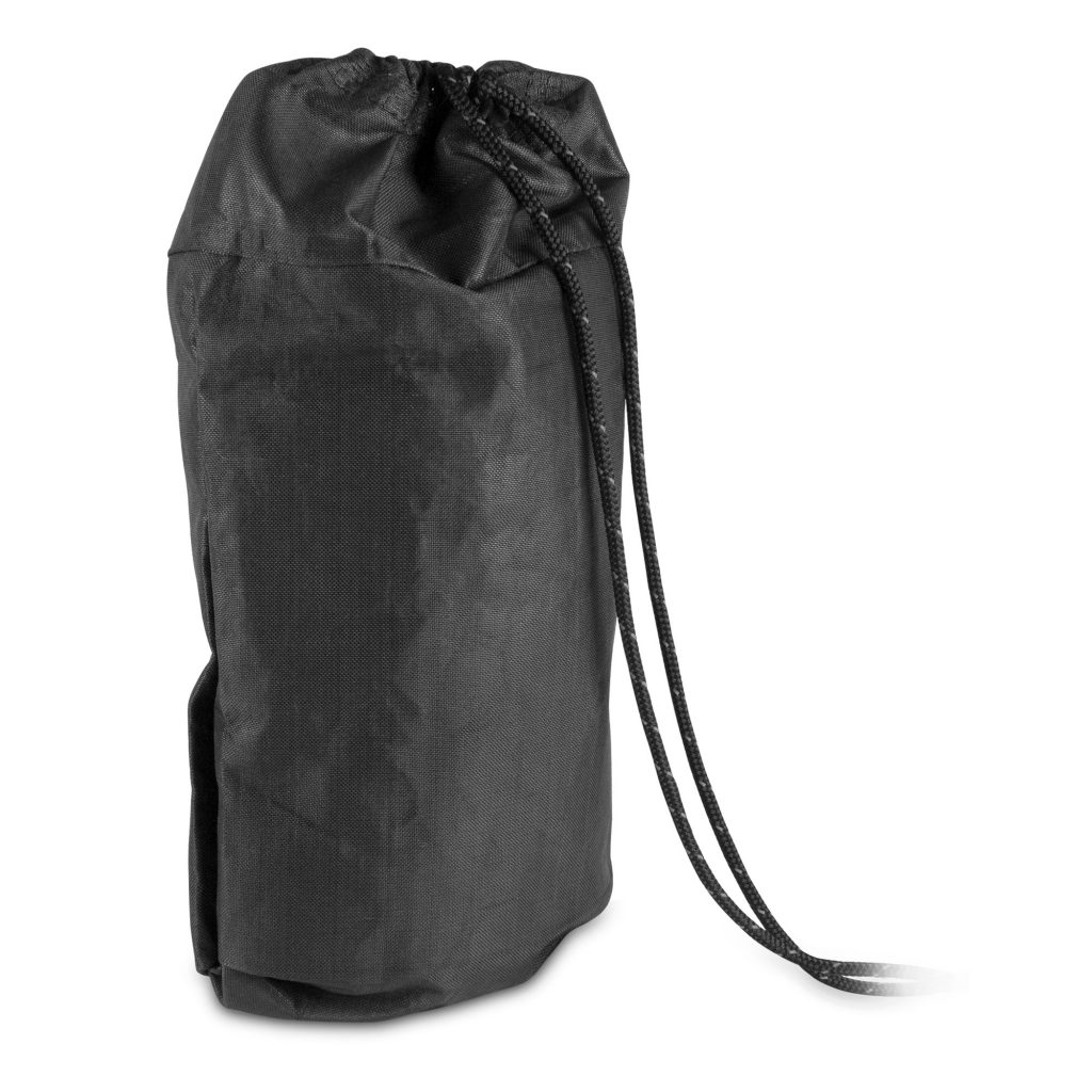
I carried my 1.2 pound solar charger for the first time. Normally it stays with my bikepacking gear.

There’s no electricity in Strathcona. No mobile phone service.

I climbed higher next morning. But quickly the snow got too deep. Just like King’s Peak the previous day, I only reached perhaps 800m elevation before turning back.

The ridge is about 1200m.  In those meadows I would have found more famed spring flowers.

I really need to return to Strathcona late season: August – September.

#LessonLearned

If you want to do it right, click over to MBGuiding:

Flower Ridge Trail – July 13-15, 2018

MBGuiding.ca


The best hiking guidebook is Exploring Strathcona Park. Dead tree version available only. 

See our list of the best hikes in North America

BigBlue 28W USB Solar Charger

UPDATE:  Love the solar charger.  But on the last trip it stopped charging my Apple watch.  Not sure why.  But it would charge my Anker PowerCore Fussion 5000 battery which does charge the watch.  

My first solar power charger.  No built-in lithium ion battery.

I chose BigBlue 28W USB Solar Charger over similar products based on the positive Wirecutter review. AND this one is quite inexpensive.

I plan to use it mostly for bikepacking where weight is less a concern. But I carried it on a few hikes as well.

1.2 pounds.

Flower Ridge Trail, Strathcona

Baby Bedwell Lake, Strathcona

On the bike, it can get bumpy.

Mostly I’m wanting to keep charged:

    • iPhone
    • EarPods
    • Apple Watch

It works well in direct sunlight.  Slowly when overcast.

Click PLAY or watch it on YouTube.


Hubba NX, UberLite & Corus Down Quilt

by BestHike editor Rick McCharles 

I updated my sleeping system for summer 2020.

  • Therm-a-Rest Corus 0C Down Quilt CAD $260 (US $186)
  • Therm-a-Rest NeoAir UberLite WV Sleeping Pad – Unisex CAD $254 (US $181.50)
    Hubba NX 2020 tent CAD $479 (US $342)
  • Nemo Switchback Foam Sleeping Pad – Unisex CAD $49.95 (US $35.70)

I bought everything from Mountain Equipment Co-op in Canada, trying to support companies other than Amazon during COVID-19.

I’ve spent hundreds of nights in Hubba and Hubba NX tents. Never a complaint aside from pole failures.

Happily, the latest edition has new composite poles. They look stronger.  Especially the hubs.

OLD poles on top, new on the bottom

NX weight is listed at 1.29 kg (about 2.84 lbs). 

My pillow is a partially inflated Therm-a-Rest NeoAir® XLite (small) wrapped in a shirt — which I love.

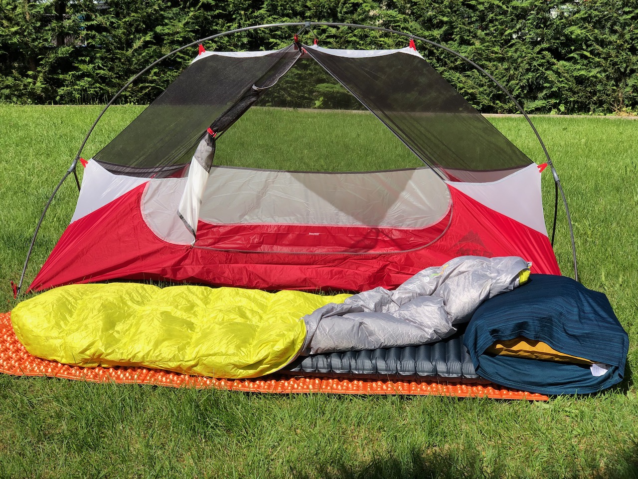
In fact the XLite  is the sleeping pad I normally use so it is also my back-up in case the somewhat fragile UberLite gets punctured.

When I want to carry the extra weight (415 gm)  and bulk, I’m bringing along the orange Nemo foam pad to protect the UberLite from the ground. And to keep my tent a little cleaner.

For bikepacking I’m also using the Nemo folded as a flat platform across my rear panniers.  Happy to have it.

The Therm-a-Rest Corus is my first quilt.

Read the cleverhiker review.

 I actually am happy with sleeping bags, never feeling claustrophobic in the past.  On my recent 6 day bikepacking trip I carried both the Corus as well as a down bag.  Both were fine for me.  In fact, after the test I used both — not for warmth, but for coziness.

I’ll carry the Corus for hikes and bikepacking where weight and volume is an important factor.

Here I am setting up my previous system earlier in the spring.

Click PLAY or watch it on YouTube.

Ursack Quick Release Knot

I recall being reluctant to buy an Ursack to protect my food from bears and other critters — but finally got one in 2011.

This was the first time I used it, on the Howe Sound Crest Trail out of Vancouver.

2011

I was won over instantly.

Though I own two Bear Vaults, I always carry the Ursack instead if it’s allowed where I’m hiking.

It’s much less bulky.

Though my old white one is going strong, Ursack has newer models in black . And a quicker way of tying the bag to the tree.

Ursack AllMitey bear bag

I’ll probably get the larger capacity URSACK MAJOR XL when I eventually have to replace my old white one.

On my recent cycling / hiking trip through Vancouver Island I tented 6 nights.

There are PLENTY of black bears. I’d never seen so much scat anywhere as on the Juan de Fuca Marine Trail, for example.

You absolutely MUST PROTECT YOUR SMELLIES in this part of the world.

For the first time I used the new recommended quick release knot to attach the Ursack to a tree.  It is a big improvement.

Click PLAY or watch it on YouTube.

Tuck in your Pants to avoid Ticks 🕷

I cycle, run and/or hike every day while on Vancouver Island, Canada.

The risk of tick-borne disease here is low. But I’m still tucking in my pants before going out.

Mine are very light weight, slippery nylon. (Light coloured clothing would be better as it’s easier to spot ticks.)

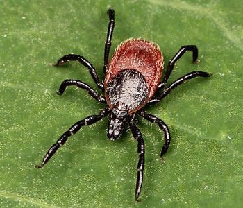
The biggest danger in my neck of the woods is the western black-legged tick. It can transfer Lyme disease.

Western Black-Legged Tick

Fortunately for me, in order for a human to be infected by the bacterium, the tick must be attached for approximately 36 to 48 hours. I shower and check after each workout.

There is a report of one hiker who contracted Lyme on the nearby West Coast Trail. On that week long hike you may not be washing or checking regularly.  😐

Check the tick risk where you are adventuring. There are about 30,000 new cases of Lyme Disease each year in the States. The number seems to be increasing with global warming. New species of ticks are becoming known.

Check your pets for ticks.

If you get one, gently remove a tick embedded in your skin with tweezers. Firmly grasp the tick’s head without squeezing and pull upwards.  Save it in a plastic sealed bag.  Use a felt pen to write the date, name and address of person bitten.  I’ve only ever found one once.

Click PLAY or watch it on YouTube.

related – Wikipedia – Lyme disease

Getting FRIENDS to join you hiking

No doubt you are trying to convince non-hiking friends and family now with plenty of time available to get out on some trails.

It’s ideal social distancing.

Paula Casey from Gabor Shoes sends these tips for them.

Click for a larger version of the infographic.

popular gear on the Continental Divide Trail

With “social distancing” being recommended around the world, I’m personally looking at doing even more hiking than usual in 2020.

The objective of social distancing is to reduce the probability of contact between persons carrying an infection, and others who are not infected, so as to minimize disease transmission …

One of the earliest references to social distancing dates to the seventh century BC in the Book of Leviticus, 13:46: “And the leper in whom the plague is…he shall dwell alone; [outside] the camp shall his habitation be.”

Mac annually posts a Continental Divide Trail Thru-hiker Survey.

Click through to find out what gear was most popular in 2019.

For example … SHOES:

Merrell Moab 2 Vent
  1. Merrell Moab 2 Vent (Hiker Rating: 5/5)
  2. La Sportiva Wildcat (4.80/5)
  3. Salomon XA Pro 3D (4.64/5)
  4. Altra Timp (4.29/5)
  5. Altra Lone Peak (4.28/5)

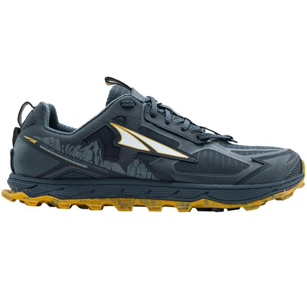
I wear various Moab shoes as I find them so much more durable than trail runners. Merrell comes in very wide sizes, as well, which I need due to bunions.

best hiking gear on the PCT 2019

Mac posted his 7th annual survey — this year 846 Pacific Crest Trail hikers were interviewed.

The Altra Lone Peak was the most popular shoe on the PCT this year – used by nearly a third of PCT hikers. It’s a zero-drop shoe and, on average, hikers who completed the trail used 4.65 pairs – nearly $600 in shoes (at full retail price).

On the other hand, there were plenty of complaints about Lone Peaks.

Personally, I prefer sturdier Merrell Moabs.

FAVORITE PCT GEAR

MOST COMMON PCT GEAR

Read more:

The Pacific Crest Trail Gear Guide: Class of 2019 Survey

Khopra Ridge trek, Nepal – day 5

Naya Pul to Ghandruk trip report by BestHike editor Rick McCharles. 

day 1  | 2 | 3 | 4 | 5 | 6/7

Nov 4, 2019 – Khopra Ridge tenting 3640m  to Tadapani 

It was a cold night in the tent. I had to mummify myself in my ultralight sleeping bag and wear all my layers.

I only slept a couple of hours, the rest of the time listening to an excellent audio book.

At first light I packed up the frozen Hubba quickly (no coffee!) and got moving to warm-up.

n about 90 minutes I made it to Bayeli Guest House for breakfast. The sun was out and it looked a beautiful morning. I was happy to get there.

The Annapurna massif includes one peak over 8,000 metres (26,000 ft), thirteen peaks over 7,000 metres (23,000 ft), and sixteen more over 6,000 metres (20,000 ft). It’s 55 kilometres (34 mi) long. A monster.

I was a tiny ant climbing up and down ridges at around 3000m.

It clouded up early today. Unusual. November normally brings day-after-day of clear skies. Nepalis told me this was atypical weather. Yet this turned out to be one of my favourite days. Different. The autumn colours brightest.

Walking alone through these high grasslands was wonderful.

I’ll be recommending the Khopra Ridge trek to those who want to get away from roads and development. Most is wilderness, well above farms.

Loads are still brought up by horse or porter.

I heard they sometimes carry up to 90kg !

As clouds descended and I descended some vistas reminded me of the Pacific N.W.

There is still much accessible wilderness within the Annapurna Conservation Area.

Without a guide, I accidentally took a different trail than most. My lower track was empty. Quiet. Tranquil.

At this unusual shelter I left a Summit Stone.

Stopping for milk coffee at Isharu, I really enjoyed chatting with the lodge owner. He’d seen Himalayan Black Bear up here.

Everyone expects the Khopra Ridge trek to continue to grow in popularity. It’s part of a trend launched by one man — Mahabir Pun — who was educated at University of Nebraska. 

Mahabir is helping mountain communities to promote new trails close to Annapurna & Dhaulagiri. To build eco-friendly lodges. Some distance from traditional villages. The idea is that Income from lodges goes to support schools and local health clinics.

Trails like Khopra Ridge will replace some existing hikes that have been degraded by road building.

Another nice touch in this section are trash bags at regular intervals on the trail. (Those are for locals, not tourists. Hikers don’t litter here.)

I also liked this day in that it was mostly downhill. 😋

I checked into a good room in Tadapani (2710m). My batteries needed recharged. And I needed a bed. It was only 2pm.

When I awoke from siesta the power had gone out. It was pouring rain.

It’s not supposed to rain here in November. Monsoon arrived late this year. Perhaps everything was pushed later.

As Warren often points out, weather should not be a problem for a hiker properly equipped.

Many were not prepared.

I wandered Tadapani in the rain. Yes, I was carrying good wet weather clothing.

Paint cans with different plants.

Tadapani is not a particularly nice village. Yet it’s a super popular stop — a crossroads for many different hikes. In fact, it’s the official end point for the Khopra Ridge trek. From here I have options.

BEST would be starting up to the Annapurna Sanctuary, an amphitheatre of huge Himalayan peaks.

I’ve done that trip before so will head down — instead — to Ghandruk.

day 1  | 2 | 3 | 4 | 5 | 6/7