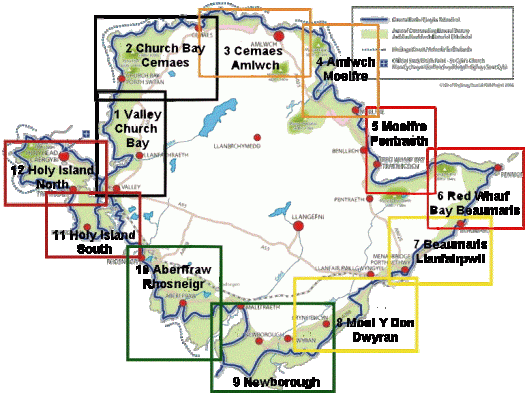
The Anglesey Coastal Path is a 200-kilometre (124 mi) long-distance footpath around the island of Anglesey in North Wales. The route is part of the Wales Coast Path. …
Or check the official map.

related – annual Walking Festival and Walkathon

Best hikes, treks, tramps in the world.
The Anglesey Coastal Path is a 200-kilometre (124 mi) long-distance footpath around the island of Anglesey in North Wales. The route is part of the Wales Coast Path. …
Or check the official map.
related – annual Walking Festival and Walkathon
Cam Honan:
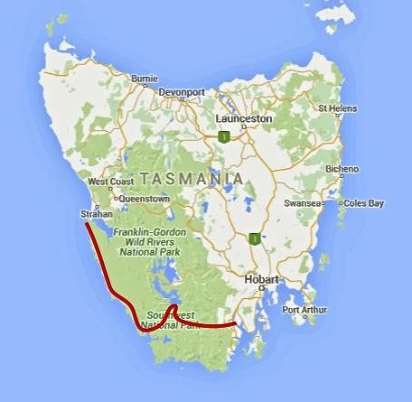
Between February 27 and March 22 of this year, I completed a traverse of the southwestern region of the state. One of the wildest, most pristine backcountry areas on the planet, it was a hike I had dreamed of doing for almost two decades. …
200 miles (322 km) approx. …
Time: 24 days
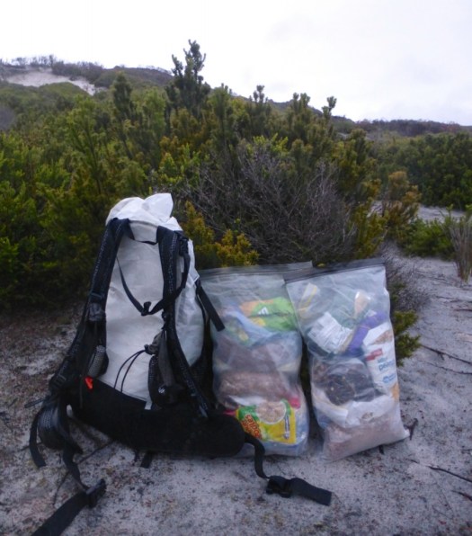
Daily Average: 8 miles (13 km) approx. This included one rest/resupply day. Hiking, scrambling, bushwhacking, climbing, paddling, crawling, swimming, rock hopping…………yep……..the terrain really was that challenging …
by site editor Rick McCharles
updated April 2016
But what are the best coastal hikes anywhere?
 #1) West Coast Trail, BC Canada
#2) Otter Trail, South Africa
#3) Abel Tasman Track, New Zealand
#4) Lost Coast Trail, California
#5) Thorsborne Trail, Australia
#7) Kalalau Trail, Kauai, Hawaii
#8) Pembrokeshire Coast Path, U.K.
#9) South Coast Track, Tasmania
10) Great Ocean Walk, Australia
Leave a comment if you have more to add to this list.
Canada’s West Coast Trail is so popular that many other alternatives have been developed nearby:
What about Canada’s east coast?
I’ve still yet to hike all of the Shipwreck Coast Trail (Rialto Beach to Shi Shi Beach) in Washington State.
Hiking is so popular and so well developed in the U.K. that there are many alternatives to the Pembrokeshire:
In Italy there are some classic short walks suggested by Andrea:
Other recommended in the past:
Australia must have more coastal hiking than any nation in the world. There are many good candidates including:
Personally, I liked the Queen Charlotte Track in New Zealand even better than the Abel Tasman.
And the Fisherman’s Trail, Rota Vicentina, Portugal is high on my personal life list.

related – Adventure Junkies – TOP 11 BEST COASTAL HIKES FROM AROUND THE WORLD TO ENJOY IN 2016
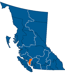
World → North America → Pacific NW → Canada → Sunshine Coast Trail
Nearby West Coast Trail is the best hike in the world. Right?
The SCT is the latest of a number of WCT alternatives. And it’s an excellent alternative. Be aware that “Sunshine Coast” is the name of the region. Not much of the SCT is on the coast. It’s almost entirely inland.
 AT A GLANCE
Read more on our Sunshine Coast Trail information page.
Click PLAY or watch a trailer for a new Sunshine Coast Trail documentary on Vimeo.
The Three Capes Track is a brand new, 4-day, 46 km, bushwalk in cliff-hugging wildness of Australia’s far south-east. Forty eight permits are issued each day, and the walk is self-guided.
The track opened Dec 23, 2015 …
The track features over 35 “art” pieces, most of which provide a seat” for walkers to sit and enjoy the natural surroundings of a particular area, whilst learning about the Tasman penninsula’s natural, maritime, and convict history. …
Lonely Planet calls the Three Capes Track “The hottest new travel experience of 2015”. …
3Capes Track – D3 (Munro – Rutakunna [Jan 1, 2016])

The Boab Nut did our favourite hike in Africa.
Check the trip report – Otter Trail (what goes down, must come up again) 🙂

Otter Trail information page
An off trail hike.
Photographer Peter Lam:
… D’Aguilar Peninsula (named after Sir George Charles D’Aguilar, former Lieutenant Governor of Hong Kong) is located on the south-eastern end of Hong Kong Island. The major mount in the area is D’Aguilar Peak, at 325m, where a radio transmission station and numerous terrestrial antennae are installed.
At the southern end of the peninsula, Cape D’Aguilar (also known as Hok Tsui 鶴咀) is the site of a Marine Reserve – The Swire Institute of Marine Science. Here you will also find the Cape D’Aguilar Lighthouse (or the Hok Tsui Beacon), the oldest lighthouse in Hong Kong and a declared historical monument. …


Hong Kong offers some of the best urban hiking in the world. 🙂
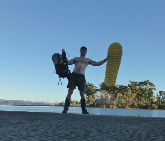
A Swiss hiking buddy told me their Army hates sand. It gets in EVERYTHING. Ruins zippers.
Personally, I love sculpting the perfect sand platform and setting up with a water view.

Outbound – 21 Beautiful Beach Campsites
After freezing for 3 nights on the Sierra Nevada Traverse, the nearby Mediterranean coast of Spain appealed.

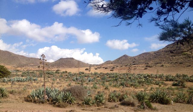
Cabo de Gata-Níjar Natural Park is Andalucia‘s largest coastal protected area, a wild and isolated landscape with some of Europe’s most original geological features. It is the only region in Europe with a true hot desert climate.
The eponymous mountain range of the Sierra del Cabo de Gata with its highest peak El Fraile is Spain’s largest volcanic rock formation with sharp peaks and crags in red/ochre-hues. It falls steeply to the Mediterranean Sea creating jagged 100-metre (330 ft) high cliffs, which are riven by gullies leading to hidden coves with white sandy beaches, some of the most beautiful in Andalucia. …
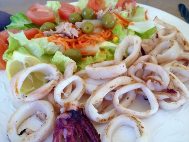
I departed Granada by bus at noon. And was sitting down in Cabo de Gata town for Calamari by 4pm.
Cabo de Gata is a popular beach town in “summer”. But by mid-October it looks like this.

Mine was the only open restaurant. I need to wait for siesta to finish so I could buy 6 litres of liquid (mostly Coke Zero) to start the walk. Happily, the tiny supermarket opened at 5pm.

Lonely Planet Hiking in Spain describes a 52km coastal walk from Cabo de Gata to Aqua Amarga. I planned to start. And continue as long as I wanted. Bus transport back from Aqua Amarga is a problem. 😦

Passing retirees enjoying the sun, first stop is the Cabo de Gata tower.

Turns out there is a series of these ruins up and down the coast.
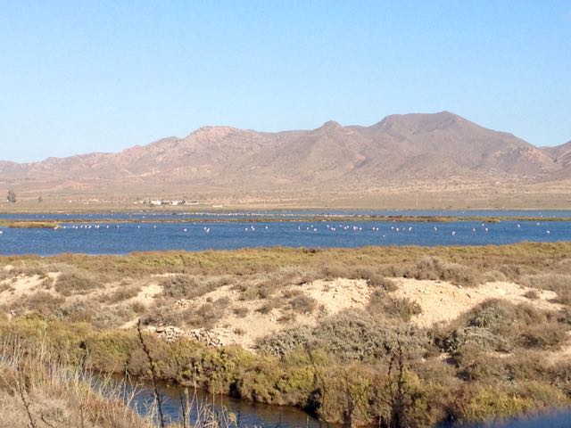
Between the village of San Miguel and the Cabo de Gata point are salt flats. This is an important stopping point for migrating flamingoes and other birds.

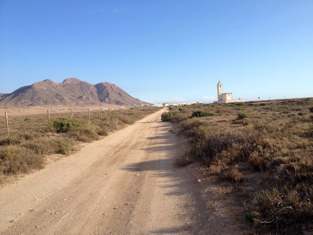
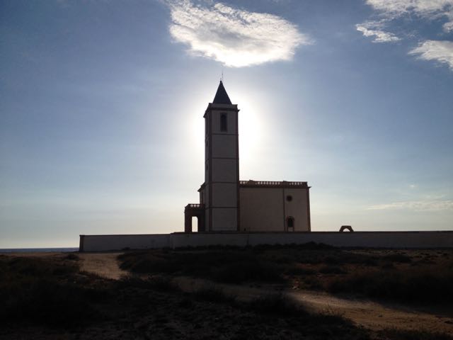
In the distance loomed this impressive church.
The beaches were near empty. Only one fisherman on this one.

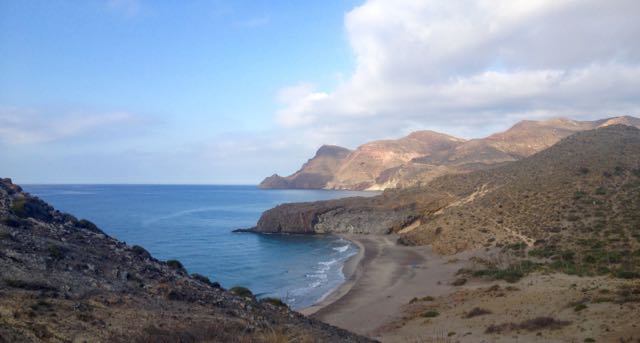
It was a steep climb up and over to reach the Cabo de Gata light station.

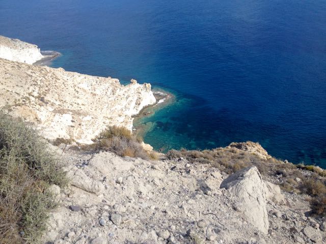
The rugged geology is impressive.

Many tourists drive out to enjoy the views at dusk.

The only other person left standing in the dark with me was a young German who had rented an apartment in San José for a week. We walked together past the road block, back towards his place.
Together we found this tent spot. Quiet. Peaceful. And much warmer than 3000m in the Sierra Nevada.

___
Here’s a glimpse looking back to where I’d come from. Next morning.

I’d been looking forward to tramping a series of pocket beaches.

If the tides are right, you can scramble between most of them. This was a highlight of the trip.

This time of year you’ll see nude and topless sunbathers at pretty much every near deserted beach.
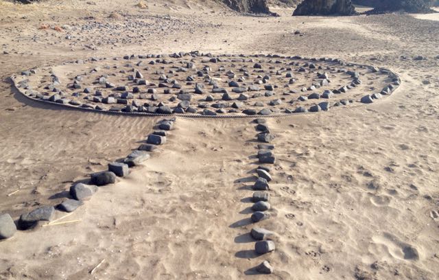
And artists. 🙂

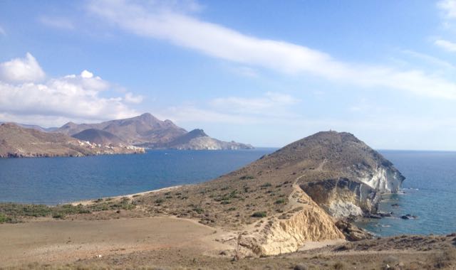
There’s San José (Almeria) in the distance. The centre of Parque Natural de Cabo de Gata.
I’ve seen cows (Sri Lanka), kangaroos (Australia) and goats (Spain) on beaches. Never once understanding why they would want to be there.

This is a desert. There’s very little water.
This windmill marks the start of town.

I could spend a week or two in San José. It’s lovely. Population about 1000. Plus tourists. And there are very few tourists in October despite daily highs around 28C.
An ideal idyl for cyclists, hikers, artists and photographers, I’d say. Lawrence of Arabia and the Clint Eastwood spaghetti Westerns used this location.
The campground was (surprisingly) closed. On a whim I checked the Aloha Hotel, recommended by Lonely Planet. When they offered me a pool view room for only 40EU, I couldn’t resist. After all … “recovery is an important component of every successful hike”. Plus wine. 🙂
In the afternoon I continued my hike – without backpack – up into the hills beyond San José. Here’s a glimpse back to town.
It’s rough and arid.
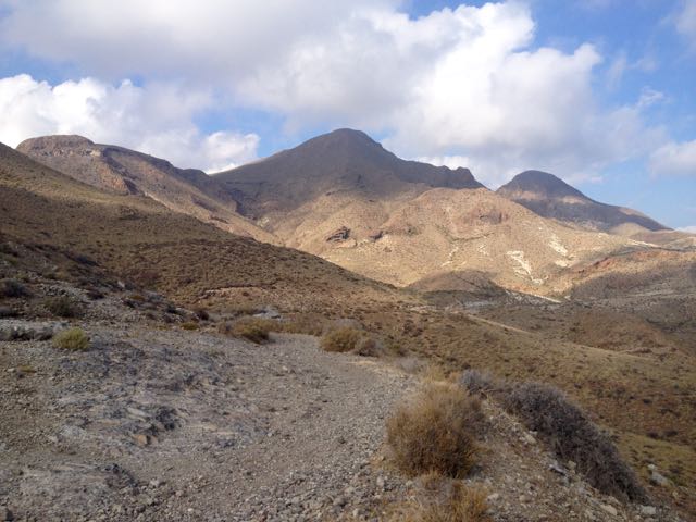
But with gorgeous coastal views.
I enjoyed chatting with a very tan elderly couple from GBR before finally stopping at this ruin.


This vista was the end of my Cabo de Gata hike.
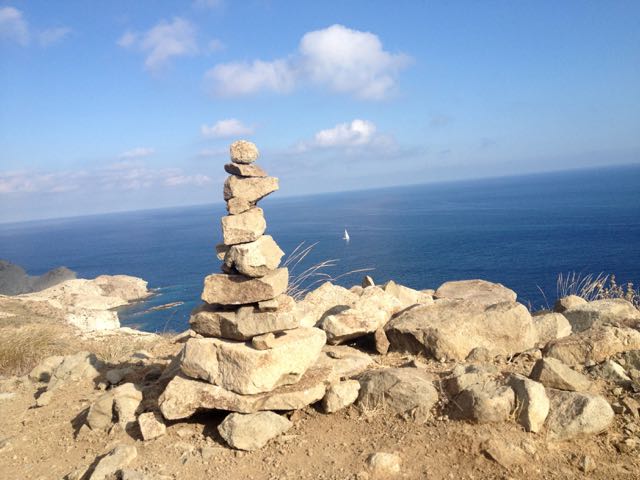
I turned back to civilization.

