Murder in the High Himalaya – a review

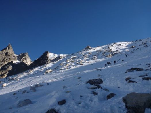
Popular and a prize winner, I’d been looking forward to listening to this book on my recent trip to the Himalaya.

Audible
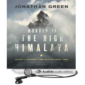
Murder in the High Himalaya: Loyalty, Tragedy, and Escape from Tibet (2010)

It’s based around the Nangpa La shooting incident of 2006 near Cho Oyo:

… A group of unarmed Tibetan pilgrims attempting to leave Tibet via the Nangpa La pass were fired upon by Chinese border guards. Kelsang Namtso, a 17-year-old nun, was killed and a number were injured. …

The Chinese government initially denied the charges, but Kelsang’s murder was graphically filmed by a Romanian photographer, who was nearby as part of a climbing expedition.

After Romanian photographer Sergiu Matei smuggled the video out of Tibet, it became headline news around the world, drawing attention to the plight of Tibetans under Chinese rule/occupation. …

A documentary called Tibet: Murder in the Snow, based on this incident, was released in 2008 by 360 Degree Films, an Australian production company, working in collaboration with the BBC. …

It’s an awful story.

There’s no need for the author to demonize the Chinese. Their crime speaks for itself.

Click PLAY or watch a book trailer on YouTube. The video includes the shooting of Kelsang Namtso.

Quickly I lost confidence in first time author, investigative journalist Jonathan Green.

The telling is very cliche. Everything China BAD. Everything Tibetan GOOD.

It was as balanced a portrayal of the situation as the film Seven Years in Tibet. Biased.

He keeps making the statement: “oxygen level is half what it is at sea level“.

Of course the percentage of oxygen in the air does not change significantly with altitude, but absolute O2 content decreases as air pressure decreases.

Is that investigative journalist clear on the difference?

I’m not sure he knows what he’s talking about.

One character in the book when questioned states that Annapurna is in Tibet. It’s entirely within Nepal.

Apparently Jonathan Green spent a lot of time the Himalaya.

It’s not apparent in this book.

This is a disappointing read.

hiking/biking Annapurna day 7

by site editor Rick McCharles

Farewell Marpha.

P1260580

I’d loved the previous day, cycling down the world’s “deepest” gorge, the Kali Gandaki.

P1260584

Sure you face the odd traffic jam in the Himalaya. 🙂

P1260591

P1260592

But cycling was better than walking.

P1260583

Unfortunately, as you descend it’s difficult to avoid the dusty, busy road.

I detoured off it whenever I could.

P1260604

P1260603

All was well … until this.

P1260608I replaced the tube in the flat tire. But it wouldn’t hold air.

I spent 90min trying to repair that flat. In frustration, I finally decided to wave down the next passing vehicle.

It was a bus. And refused to stop.

Right behind the bus arrived … Reto Brunner.

flat tire

He’d been on the road with his bike for 2 1/2 years. About 10 flats himself over that time.

But at one stint he worked in bicycle repair in Oman. He quickly detected a leak in my new replacement tube, patched it. And we rolled on down the mountain together.

In payment, I paid for lunch. We talked of his upcoming cycling trip the length of Baja, California with a Mexican girlfriend. Reto planned to add Spanish to the many languages he already spoke.

Reto had cycled the entire Annapurna Circuit to and from Pokhara.

I’d crossed the high Thorung Pass alongside a Nepali cycling guide and his German client.

cycing guide Thorung cycling

It was easy for the Guide. But the German fell 3 times on the descent, nearly breaking his wrist on one fall.

It was mid-afternoon before Reto and I got serious about getting back on the bikes.

P1260619

Our best section of single track was getting lost on the wrong side of the river.
P1260620
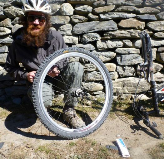
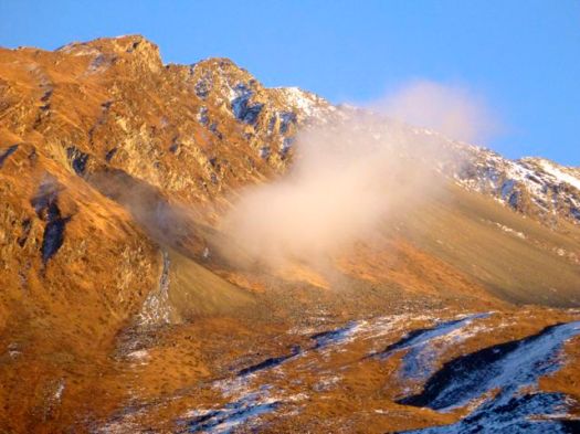
The road got worse and worse. One of the worst rides of my life.

Ruts , dust and traffic.

P1260612

Finally, a crash. Luckily I suffered only minor scrapes and bruises. Another reminder to have travel insurance that covers cycling. World Nomads is probably the most popular company with the hikers I spoke with.

P1120071
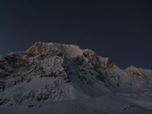
It was dark by the time we climbed into the hotsprings at Tatopani.

Tatopani
Glorious. 🙂

Next morning I waved goodbye to Reto. He was cycling on to a Yoga Retreat.

P1260625

I headed to Pokhara by motor vehicle. My 17 days on Manaslu and Annapurna were over. A great trip.

Leaving mid-day turned out to be a mistake. Most vehicles depart in the morning.

It took 2 taxis to get there.

see high resolution photos from this day on flickr

day 1 | day 2 | day 3 | day 4 | day 5 | day 6 | day 7 | info

hiking/biking Annapurna day 6

by site editor Rick McCharles

After 15 days continuous hiking on Manaslu and Annapurna, I was pleased to be able to saddle up on a mountain bike.

P1260507

Mustang Mountain Bikes opened in Muktinath in 2012. It’s run by Jurriaan Prakke (NED) and a Nepali partner.

Most ride Muktinath 3760m 1 day down to Jomson 2800m (airport). Or 2 days down to the hotsprings at Tatopani 1190m. I paid $30 / day for a “basic bike” to the hot springs. Money well spent. 🙂

P1260514

Jurriaan, the owner, was riding down same day as me. We set off together.

P1260522

Downhill, dry and open, cycling is fairly easy on the Tibetan plateau.

I stopped often for photos.

P1260518

Mustang gave me recommendations on where to eat. And where to sleep en route. Much appreciated.

Jurrian himself had recommended “Applebees” in Kagbeni, my favourite village the last time I hiked Annapurna.

P1260529

This is the gateway to the (formerly) forbidden Kingdom of Lo Mustang, getting more popular with trekkers in recent years.

P1260532

I wandered Kagbeni for an hour or more. It’s a very interesting town.

P1260536

Descending, I often needed to decide whether to take the river (easier) or the road (higher & dustier). Most often I opted for river, sometimes to my grief.

P1260550

There was a fair bit of hike-a-bike in these sections.

P1260552

I stopped in the big city of Jomson for lunch. And to check email.

Then continued on to the recommended stop at Marpha.

P1260564

Marpha is wonderful.

600px-Goats_in_MarphaI checked out the monastery.

Marpha roof

Then climbed up above town.

P1260574

Tourism, apple growing and mule rearing are the means of survival.

All the Mustang rental cyclists that day stayed in the recommended guesthouse in Marpha. Room price was only $1. Lodges on this side of the Annapurna Circuit were mostly empty, trekkers now flying out of Jomson. Or catching motor vehicles down the mountain.

One hope for the future is mountain biking getting more popular

All-in-all, that was one fantastic cycling day. 🙂

One sour note … On a late night walk through Marpha a healthy dog decided to playfully nip my Achilles. Not appreciated, I can tell you. I’ve never taken the 3 shots required for Rabies.

see high resolution photos from this day on flickr

day 1 | day 2 | day 3 | day 4 | day 5 | day 6 | day 7 | info

hiking/biking Annapurna day 5

by site editor Rick McCharles

I “slept-in” until 5:13am.

Enjoyed a hot breakfast.

P1260346

Many had already left, headlights bobbing up the mountain in the dark, worried about wind on the high Pass.

My plan was to leave late. To wait for the sun.

P1260347

I felt great. Had slept warm on 2 mattresses, with 2 extra blankets provided by the guesthouse.

On Manaslu I felt it was a mistake to start hiking in the dark. This time I’d wait to start until no headlamp was needed.

P1260364

It got bright in no time. I’d heard that Thorung La was higher, but easier than Larkye La on the Manaslu.

P1260368

We made good time.

P1260375

On reaching the snow line, some guides and hikers were worried. For me — a Canadian — this was like walking to school.

P1260376

P1260379

No problem.

P1260386

The moon was gorgeous.

P1260389

Love this bleak landscape.

It’s a surprisingly long way from Thorong Phedi to the Pass. About 1km in elevation gain.

P1260401

But when the weather is good, you can walk it with your hands in your pocket.

P1260402

The Annapurna 8,091m (26,545 ft) massif is huge and complex.

… thirteen additional peaks over 7,000 m (22,970 ft) and 16 more over 6,000 m (19,690 ft).This section is a 55 km-long (34 mi-long)  …

I couldn’t keep track of which huge mountain I was looking at.

P1260408

No wind. 🙂

Even the 7000m peaks had no spindrift.

P1260406

I left a Summit Stone in thanks for safe crossing.

P1260419

I’d once heard you could scramble a peak (illegally) from Thorung La. But it doesn’t look easy.

P1260426

The other side of the Pass looked even simpler than the ascent. It’s longer though.  About 1.7km of net vertical lost.

P1260412

And even more Tibetan plateau. I love these colours.

P1260427

A guide told me this was the “road” under construction climbing up and over Thorung La. We agreed that it was a mistake to take motor vehicles over the top.

P1260447

Everyone celebrated on reaching a series of small restaurants. For me it was my favourite soup, noodle with egg.

P1260453

On a sunny day you can melt and even boil water on one of these.

P1260450

I continued on down to the first town on the other side, bleak Muktinath 3,710m.

P1260480

I’d last been here 14yrs ago, the highest I got on this side of Annapurna.

P1260498
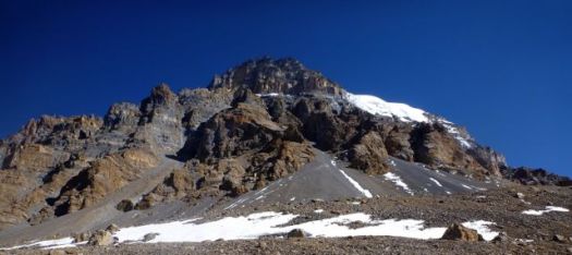
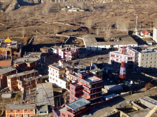
Muktinath still has no ATM. Some hikers are running out of cash by this point in the trip. Many spend more than they expect on the Circuit.

P1260474Muktinah is an ugly tourist town much worried about the expected decline in Annapurna Circuit trekking. No one is confident that building alternative trails off the road is going to work. Trekkers, in future, might go to Manaslu instead.

P1260472

Was that a new water tower under construction?

P1260475

Later I learned they are building a giant Buddha statue. A tourist attraction, amongst other things.

P1260479

After 15 days continuous hiking, I’d stop here. Ride a mountain bike down the other side.

P1260502

I felt great. It seemed to me that I could easily hike another 15 days. Continue on the Nepali Great Himalaya Trail.

P1260501

see high resolution photos from this day on flickr

day 1 | day 2 | day 3 | day 4 | day 5 | day 6 | day 7 | info

hiking/biking Annapurna day 4

by site editor Rick McCharles

The high Pass loomed. I was up and packed early, waiting for the restaurant to open at 6am.

Happily, sunlight reaches Manang early.

P1260239

My stomach felt fine. Weather was fantastic. I spun every prayer wheel in town I could.

P1260246

I was going to cross the Thorung La.

P1260252

I really enjoyed Manang. And would happy to go back any time.

P1260249

It’s high and dry above Manang. True rain shadow. True Tibetan plateau.

P1260254

I couldn’t resist stopping for brunch here.

P1260268

Carbo loading for the Pass.

P1260267

This hiking day was all good.

P1260273

People had smiles on their faces, happy to be in clear November.

P1260284

It was looking pretty easy from here. I expected another early arrival in Camp today.

P1260290

I stopped to take photographs of one unusual Himalayan sight – a burning barrel.

P1260297

It’s obvious to me that the easiest way to dispose of trash way up here, is to burn it. Instead Nepalis throw it off a cliff. Or into a river. 😦

I’m not sure why George Schaller had so much trouble finding Blue Sheep. If they got any closer to me on this Trail, they’d be on my plate. 🙂

P1260331

P1260324

With all this sunshine and mild weather, there were still plenty of Yaks & ponies grazing. Ponies are used for emergency transport of altitude sick hikers.

P1260305

This pika seemed to be looking for a tourist handout.

P1260319

Up and up.

The afternoon was taking far longer than I expected.

P1260310

It was almost dark by the time I reached Thorong Phedi 4420m.

P1260336

I got the second last available room.

What a location!

P1260344

Many take an acclimatization hike up towards the Pass after arrival. I was too late. Too tired.

Instead I enjoyed the last rays of the sun.

P1260338

That night was fun. Japanese girls flirted with their porters in the dining hall.

The last hiker to leave the table, I saw a brazen rodent cleaning up scraps from the floor. It’s almost certain that mice get into the food. Standards of hygene are low in the Himalaya, especially in Thorong Phedi.

Safest would be to sleep in a tent. Cook your own food.

You are advised to drink as much as possible at altitude. I did. But that means a number of trips to pee during the night.

And it’s COLD above 4000m.

see high resolution photos from this day on flickr

day 1 | day 2 | day 3 | day 4 | day 5 | day 6 | day 7 | info

hiking/biking Annapurna day 3

by site editor Rick McCharles

My guesthouse hosts had advised me that breakfast would be served 6am.

It was election day. They wanted to rush as early as possible to the voting station at Manang.

That was fine with me. The earlier I got to Manang today, the better.

P1260164

P1260163

At first light the road was already busy. Election turn-out was high. This was only the second National election ever.

P1260173
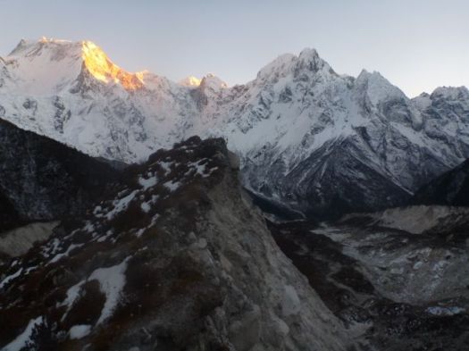
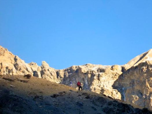
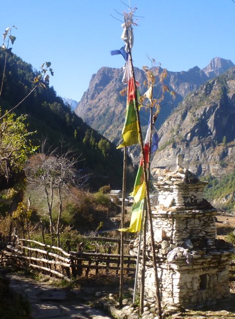
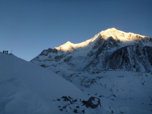
The highlight of the morning was  Bhraka Gompa at dawn. Ancient looking … but with satellite dishes.

P1260174

The smell of burning juniper in the morning brought back memories of past hikes in Tibetan lands.

P1260179

Things were looking decidedly more Tibetan as I climbed.

P1260169

P1260181

I passed one of two schools in Manang where people could vote.

P1260184

Manang … 3,519 metres (11,545 ft). … population of 2863 people … To the north there is the Chulu East peak of 6,584 meters. …

The village is situated on the northern slope, which gets the most sunlight and the least snow cover in the winter. …

P1260196

I arrived early in Manang with a long list of chores to accomplish.

#1 was machine wash of my stinky clothing

I’m not sure I’ve ever carries such toxic gear, one plastic bag full of wet clothes reeked of ammonia.

I took an acclimatization hike up to Gangapurna Glacier.

P1260197

It was oddly hazy.

P1260198

Almost everyone stays 2 nights in Manang. Since I was already acclimatized, I’d spend only one.

The Manang Museum is very interesting, in particular one exhibit showing some of the first photos taken of Manang. And the reactions of locals in those photos when shown them decades later. 🙂

P1260216

P1260215

P1260218

P1260217

At 3pm every day volunteers from the USA, Canada and the UK put on an Altitude Sickness presentation.

I learned that acclimatization is partially genetic.

After the talk I asked one lady Doctor her advice regarding me crossing via Tilicho Lake rather than the normal route.

480px-Tilicho_Lake
She had been to the Lake but not across. Her opinion was that one landslide section was a bit dangerous to cross. That it would be better to go as a group with a guide. With tent and stove.

I was convinced to save Tilicho for another day. Perhaps a Nar Phu to Tilicho itinerary.

P1260189
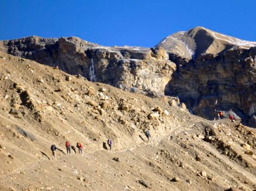
One big difference from Manaslu is the number of young men hanging around motor bikes on the Annapurna Circuit, smoking, with not much to do. If trekking tourism continues to decline they’ll have to move to Kathmandu or India for work.

P1260236

I couldn’t resist relaxing at a film. Luxury.

I chose Seven Years in Tibet. An awful film in almost every way. But it does have stunning Tibetan cinematography. And no Annapurna hiker can complain about pains after watching what Heinrich and Peter went through.

P1260227

Good night.

see high resolution photos from this day on flickr

day 1 | day 2 | day 3 | day 4 | day 5 | day 6 | day 7 | info

hiking/biking Annapurna day 2

by site editor Rick McCharles

I slept long and well again, still catching up from the short night crossing Larkya Pass on the Manaslu Circuit.

Breakfast was omelet $2, pot of milk coffee $4.50, room $1.50 and $1 for recharging batteries. Annapurna is a little less expensive than the Manaslu Circuit.

P1260121

Chame did not look quite so ugly in the morning light.

Still, I was keen to get high as quickly as possible. I planned another long hiking day.

Winter was coming. People were collecting deadfall.

P1260122

There is a “road” on this side of the Annapurna Circuit, but it wasn’t all that busy when I was there.

P1260130

Again today no motor vehicle carrying hikers passed me. It’s possible to hire a motorcycle driver, but I never once saw a hiker on one.

P1260124

The Annapurna Circuit is sometimes called the Apple Pie trek. For good reason.

P1260125

This was the second construction site stopping 4-wheel drive vehicles. There’s no bridge across this river.

P1260135

Local tractors could get through.

P1260139

I did have a long, leisurely lunch with new friends I’d met the night before. One  already with seriously huge blisters. He switched out of new hiking boots and into his sandals.

P1260142

Most hikers leaving Chame, including that British couple, were heading to Pisang. Upper Pisang if they could find space in a lodge. I took a sidetrip across the river to check out the pretty hillside village.

P1260148

With daylight remaining, I pushed on to the mountain airport town, Humde, arriving at dark.

It was empty of tourists. With no flights the next day, no tourists were in town. Except me. This hike was starting to feel a little lonely,.

P1260153

I ate meals in the family kitchen, lit & warmed by wood fire. Two fuel stoves sat unused. Wood is cheaper, obviously.

P1260158I did get the best room in the house.

P1260157
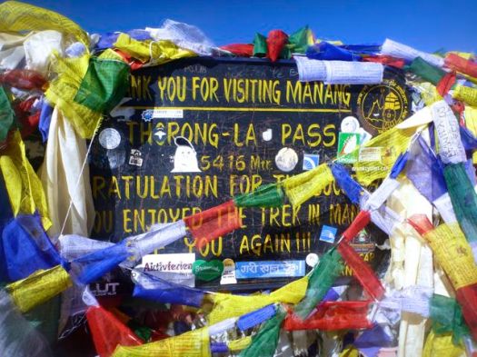
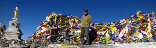
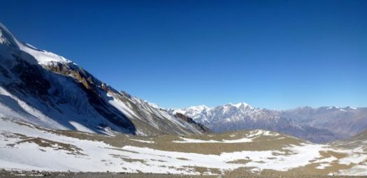
The airport was still locked next morning. I’d been considering a loop over Thorang Pass, back to this airport via Tilicho Lake, then flying out to Pokhara …

I decided against.

see high resolution photos from this day on flickr

day 1 | day 2 | day 3 | day 4 | day 5 | day 6 | day 7 | info

hiking/biking Annapurna day 1

by site editor Rick McCharles

I was up early for breakfast. And to say goodbye to the friends I’d spent the past 10 days with … hiking the Manaslu Circuit. Our 3 guides departed with them, dashing down the Annapurna Circuit. Back to civilization.

P1260104

I enjoyed a bit of solitude for the fist time in 2 weeks. Drank coffee. Read.

view from my room
view from my room

Finally I had to psych-up to start climbing again. Alone this time.

I was in Dharapani, where the Manaslu Circuit and the Annapurna Circuit intersect.

Manaslu-Circuit-Trek-II-location-map

Already acclimatized from 10 days trekking up and over a 5000m Pass, my thinking was:

  • I’m here.
  • I’ve got time.
  • I’ve got the required permits.
  • Why NOT continue on the Annapurna Circuit? 🙂

I recalled famed mountaineer Anatoli Boukreev after the brutal 1996 Everest disaster (where no client of his expedition died). He soloed  8,516 metres (27,940 ft) Lhotse the next day.

He was acclimatized. The weather was good.

Why not?

… On the other hand, Boukreev was killed in an avalanche on Annapurna Christmas day 1997.

I started up towards Manang.

annapurna-circuit-map

My plan was to flag down a passing jeep or bus. None passed. So I walked 7hrs without a major break.

P1260113

My stomach was still bad from Manaslu, so I didn’t eat much.

To boost my energy level I listened to Game of Thrones on an iPod.

P1260111

It was a relaxed and pretty day. My most mellow in weeks in Nepal

P1260117

So far Annapurna felt less crowded than Manaslu.

Chame was the end of the road for 4 wheel vehicles. Only motor bikes could get past this construction.

P1260118

Chame is the headquarters of Manang District in the Gandaki Zone of northern Nepal. At the time of the 2001 Nepal census it had a population of 1204 people … Manang District is the lowest populated district in Nepal …

There was some excitement in town, however. People had to register for the upcoming National election.

Alone for the first time, I got to know some new hikers in my guesthouse. A young guy from Barcelona — his first day hiking in the Himalaya — was quite worried about whether or not he would freeze on the Thorung Pass. 🙂

I went to sleep early.

see high resolution photos from this day on flickr

day 1 | day 2 | day 3 | day 4 | day 5 | day 6 | day 7 | info

Manaslu Circuit – day 10

by site editor Rick McCharles

In a rush to get clear of the Manaslu Circuit, we opted for a long, easy day from Bimtang 3720mto Dharapai 1850m.

I bought “cooked water”. Made my own instant coffee for the morning.

P1260066

Departing Bimtang, the ground water was frozen. This is still high altitude.

P1260068

Plunging into a forested section truly meant we were coming down.

P1260070

No longer fired by adrenaline, our minor aches and illnesses seemed to become more acute.

My stomach was bad. Betsy’s was worse.

P1260077

Soon, however, we were sweating as we hadn’t done in days.

P1260076

We stopped for lunch at a lovely new place.

P1260081

Turned out service was slow. Food lousy.

Motivation was low too. As we plodded downhill.

P1260085

I had about as much enthusiasm as the mules we traipsed behind.

P1260087

Seems to me there will be no road built any time soon on this side of the Manaslu Circuit. It’s a very rugged canyon.

P1260095

After 7hrs of walking we rolled into Dharapani on the Annapurna Circuit.

We all enjoyed a hot shower. One last dinner together. …

… But early next morning it was time to say goodbye.

P1260100

Tasha and Ivan were headed for the Everest Base Camp trek.

P1260102

Brion and Betsy planned to get a very nice room and luxuriate in the last couple of days of their honeymoon.

P1260104

Everyone rushed away. Except me.

I stayed to continue the trek solo, ascending on the Annapurna Circuit. 🙂

see high resolution photos from this day on flickr


Interested to trek the Manaslu Circuit yourself one day? The best starting point is our Manaslu information page.

Manaslu mapday 0 | day 1 | day 2 | day 3 | day 4 | day 5 | day 6 | day 7 | day 8 | day 9 | day 10 | info

Manaslu Circuit – day 9

by site editor Rick McCharles

Today was the day. We’d cross Larkya La.

nepal-dia.de

  • 2am wake up … plenty of noise in Camp
  • 2:30am packed up my tent
  • 3:00am breakfast … terrible oatmeal, OK pancake, litre of coffee
  • 3:30am intended start

We actually got going nearer to 4am. And it’s plenty cold standing around in the dark.

P1260036

I was counting on a bright full moon.

Sadly for me, it had set long before 4am.

Finally setting off, we attempted to catch Tasha and Ivan. Breathing was difficult. Vision was worse. I finally had to step out of line to change batteries in my headlamp.

This first 45min was the worst part of the Manaslu Circuit for me, so far. 😦

P1260037

Whilst moving, you are not cold.

Things got better as the sky lightened.

P1260038

Glorious when the sun finally appeared atop the high peaks.

P1260039

It was good to be alive when sunshine hits you in the face this high up.

P1260040

At this point we were completely confident in crossing Larkya. We could relax.

P1260041

This was like any winter in my Canadian Great White North.

We were surprised how quickly we reached Larkya La 5106m (16,751ft).

Ivan and Tasha
Ivan and Tasha

We’d started early to avoid severe wind here. Happily, there was very little wind.

Rick Mc
Rick Mc

I left a Summit Stone in thanks for safe passage.

The descent should be easy.

P1260047

P1260048

Actually, it was quite challenging on one long, steep section.

P1260050

Porters, in particular, were slipping and falling. I can see why this Pass could be closed after a snow storm.

P1260051

It’s a little more treacherous than it looks.

You skirt the glacier before getting back to reasonable footing.

P1260054

Some make a side trip to visit the glacial lake. We skipped it.

P1260053

Once finally down down, the trail is easy.

P1260056

Smiles on our faces, we arrived Bimtang 3720m.

P1260057Civilization.

P1260058

That might be the finest guest house we saw on the Circuit. Private cabins. It was booked, of course. By large groups of French trekkers.

It was early in the day. Mike and I were the 3rd & 4th hikers to arrive. Tasha and Ivan were 1st & 2nd.

It takes most hikers 6-10hrs to make the crossing. Much longer, of course, if you start in Samdo rather than Larkya Phedi.

We took the chance to bathe in the sun. The river was flowing, but water taps at our guest house were frozen.

P1260060

And do some laundry.

P1260061

I again walked the moraine ridge above Camp at sunset. But it wasn’t nearly as inspiring as the night before. Things are a bit anticlimactic after crossing the Pass.

P1260064

We chatted through dinner. Went to bed early. I slept 11hrs straight through.

Note: One woman had fallen the day before we crossed the Pass. Hit her head. Though continuing immediately, she had a suspected concussion. She was resting in Bintang. Make sure your travel insurance covers hiking at altitude.

see high resolution photos from this day on flickr

day 0 | day 1 | day 2 | day 3 | day 4 | day 5 | day 6 | day 7 | day 8 | day 9 | day 10 | info