lost on the Heart Mountain Horseshoe

Heart Mountain is west of Calgary, Alberta …

The 2,149 m (6,020 ft) mountain is easily distinguishable by its heart-shaped summit

Heartrte2

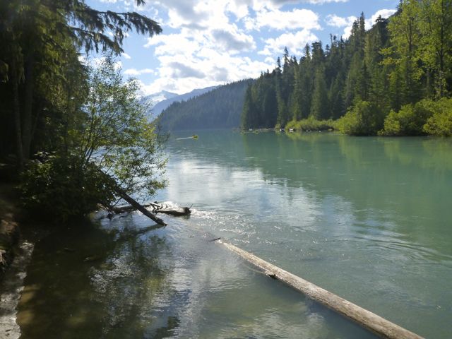
At the base of the mountain a left turn onto the flat, good quality, Quaite Creek trail delivers us past a pristine swamp with mirror surface water and back to the car. The 11 KM (7 mile) loop

Hiking with Barry

Barry makes it sound easy. 🙂

Local hiking Guru Kelly Mock recommended that loop, due to an early winter snowfall, but in reverse. Finishing coming down the Hart Mountain trail. We parked at the the Heart Creek trailhead.

P1300741

P1300753

Steve had done the loop before, but in the normal direction. We set off looking to ascend on the Quaite Creek trail.

Heart_Mountain_Hike_Alberta_Topographical

P1300748

Only Sept 13th, there was much more snow than we anticipated. But we hoped the snow would have been blown off the ridges, once we got up there.

P1300776

We tried bushwhacking through deep snow between trees to get up on the windswept ridge.

We tried.

If was tough going, postholing non-stop. For hours. Off trail. 😦

Here’s the highpoint reached.

10687364_689375491152198_2012647043025195073_o

Sadly slipping on that snowfield up to the ridge was a death drop. We turned back, the sun warm, the sky blue, the wet snow … turning to slush.

steep Heart Mtn

Yes. It was steep.

P1300773

We scrambled off trail down a different route, eventually getting back to the regulation track after 8 hours.

10479677_689375787818835_1260580944863415466_o

Phoning Kelly Mock to curse his bad advice, it turned out Kelly had started the Horseshoe in the normal direction, hoping to surprise us half way round.

After a half hour Kelly quit. You’d have to be an idiot to try Heart in these snow conditions. 🙂

Oh well. It was a terrific quad workout.

more of Steve’s and my photos

Lagunas Altas Loop, Patagonia National Park

Lagunas Altas, the first major trail constructed at the future Patagonia National Park, offer a challenging day hike or overnight. The 23-km route offers spectacular views in all directions, from the Northern Patagonian Ice Field to the Jeinimeni Mountains. …

Lagunas AltaEstablishing the Lagunas Altas Trail

lakesHow to get there.

Nat Park

Arriving from the north (Santiago/Puerto Montt)

The easiest way to reach the park is to fly to Balmaceda Airport (Coyaique); LAN (www.lan.com) and SKY (www.skyairline.cl) both operate flights to Balmaceda from Santiago and Puerto Montt. Buses also arrive in Coyhaique from points north.

To reach the park from Balmaceda or Coyhaique, drive or take a bus south on the Carretera Austral (route 7). You can rent a car at the Balmaceda airport or in Coyhaique, or catch a bus south in Coyhaique. Three bus companies offer service south from Coyhaique: Buses Don Carlos, Acuario 13, and Buses Sao Paulo. Between the three companies, there’s usually one bus leaving every morning during the high season, around 9 am. Tickets cost ~$20 USD. …

how to get there

related:

Where to Stay

Conservation Patagonia

Helm Creek to Black Tusk

trip report by site editor Rick McCharles

Whistler is a Canadian resort town in the southern Pacific Ranges of the Coast Mountains in the province of British Columbia, Canada, approximately 125 km (78 mi) north of Vancouver. … 

Over two million people visit Whistler annually, primarily for alpine skiing and snowboarding and, in summer, mountain biking …

Very few of those 2 million visitors climb up to one of the most iconic Canadian peaks, Black Tusk.

The Black Tusk is a stratovolcano and a pinnacle of volcanic rock in Garibaldi Provincial Park of British Columbia, Canada. At 2,319 m (7,608 ft) above sea level, the upper spire is visible from a great distance in all directions. It is particularly noticeable from the Sea-to-Sky Highway just south of Whistler


Black Tusk
Black Tusk

Most hikers approach from the Taylor Meadows campground to the south near Garibaldi Lake, although there is a second route from the north that travels by way of Helm Lake. …

Locals advised me to avoid the crowded trailhead off the highway, and hike via the Helm Creek Trail instead. That’s the Cheakamus Lake trailhead, closer to Whistler.

I bought my $10 / person / night camping permit online from BC Parks. You can pay cash at a machine only at the Diamond Head and Garibaldi Lake parking lots, not at the Cheakamus Lake parking lot.

Why doesn’t BC Parks have an office somewhere near Whistler?

Cheakamus Lake to Black Tusk Meadows via Helm Creek:

• Length, 14.5 km; suggested time, 6 to 7 hours one way;
• elevation change, 600 metres.
• 1.5 km along the Cheakamus Lake trail, drop down to a bridge across the Cheakamus River.

P1300549 P1300552On the other side of the river the trail switchbacks upward steeply to the Helm Creek Campground.

P1300561 P1300566I carried on to gorgeous Black Tusk Meadows.

P1300577Hikers coming down from the south summit told me it was too late in the day for me to start up.

After weighing my options (I was carrying a head lamp) I finally decided to wander the meadows, instead.

P1300572 P1300581 P1300589It turned out to be a leisurely night.

P1300602

Next morning I turned my back on Black Tusk and headed back down to my car.

P1300610 P1300611

I had time for a sidetrip to pretty Cheakamus Lake via lush temperate rain forest.

P1300622 P1300624 P1300625Black Tusk is off limits to mountain bikes, but the ride to this lake is superb.

All in all, a wonderful 2-day hike.

If I had one more day I would have done the 34km route Helm Creek, Panorama Ridge and Black Tusk shoulder detailed in this 9min video.

Click PLAY or watch Summer hiking featuring Helm Creek, Panorama Ridge and Black Tusk on YouTube.

I might even exit from there to the highway. It’s still possible to hitchhike near Whistler. 🙂

more photos from my hike

related – BC Parks – Garibaldi Provincial Park

Lake Lovely Water Trail, B.C.

The Tantalus Range is easily viewed from the “Sea to Sky Highway” that travels from Vancouver to Squamish and Whistler.

Tantalus

Lake Lovely Water is a Mountaineer’s and Scrambler’s Paradise. But it’s not for the inexperienced nor ill-prepared.

There is a 6.5 km (4-6 hour) hike to Lake Lovely Water. The trail is very rugged and steep. Good route finding skills and proper equipment and clothing are required. Weather can change quickly, causing limited visibility.

There are steep and rugged established trails leading from the cabin towards Niobe Meadows (approximately 2.5km one-way) and Lambda Lake Meadows (approximately 3.5km one-way).

BC Parks

Access to the Lake Lovely Water trail requires crossing the Squamish River. Jetboat service may be available out of Brackendale. Or you could chopper out of Squamish Airport direct to a hut. Contact Omega Aviation 604-898-1067 or Black Tusk Helicopters 604-898-4800.

I’ve heard of hikers canoeing across.

By reservation only, you could stay at either Tantalus Hut on the Lake (3850ft) or Jim Haberl Hut (6800ft).

Lake Lovely Waterrelated – Tantalust, Part V: Epilogue (heli hiking)

Loggers Lake – Whistler, BC, Canada

On a trail run/hike out of my residence, Whistler’s Athletes Lodge, I passed this pretty volcanic crater lake.

You can’t lose hiking near Whistler B.C.

It’s all good.

This slideshow requires JavaScript.

One of the easier Whistler, BC, Canada lakes to access by walking a short distance. But, be aware, the distance to the lake may be short but the steep climb to the lake is not easy. … mainly loose rocks following a deactivated road, now hiking and mountain biking trail, for 350 metres.

Loggers Lake – Whistler, BC, CanadaLogger’s Lake, considered a watershed, is a small lake surrounded by trees and rock formations located in the Whistler Interpretive Forest. …

Loggers Lake Trail – Whistler, BC, Canada

Whistler Athlete’s Lodge

For the second time in 2014, I’m staying at an athlete’s hostel built for the 2010 Winter Olympics near Vancouver, B.C.

Inexpensive. And brilliant.

Click PLAY or watch it on YouTube.

If you want to be inspired to do more outdoor sport, stay at Whistler Athlete’s Lodge.

Simien Mountains, Ethiopia

Once you’ve been up on the Roof of Africa in the Ethiopian Highlands, you won’t want to come down

Jemima Sissons:

… I spent my first few days in Ethiopia exploring the capital, Addis Ababa, then caught a flight to Gondar in the north, where I met Mulat and our driver, Melsie Nuru, and started preparing for our four-day, 50-kilometer trek across the Simien Mountains.

The Chinese-built roads make the three-hour drive to the base camp at Sankaber an easy whiz through lush pastures and past goat herds weaving their way across the road, oblivious to traffic. Soon the roads give way to dirt tracks, and after leaving the final village, the real adventure begins. It is unimaginable to contemplate this stretch without an SUV, as we lurch from side to side through unfathomably deep mud, on a number of occasions jolting within a hair’s breadth of the precipitous edge.

When the car finally stops, the cook and driver go off to set up camp, while my guide and I begin our trek. …

Take a Hike Across Ethiopia’s Simien Mountains

Simien Mountains

Rattlesnake Ledge, WA

trip report by site editor Rick McCharles

Though I’d rushed through Snoqualmie Pass dozens of times over the years – to or from Seattle – this was the first time I’d ever stopped to hike.

IMG_2175

4.0 miles, roundtrip

Gain: 1160ft
Highest Point: 2078ft

No pass or permit required. And, no, there are no rattlesnakes.

This is a fine hike on a well maintained, albeit busy trail through the forest with views of the Cedar River watershed, Mount Si, Mount Washington, Rattlesnake Lake and Chester Morse Lake.

As soon as you arrive in the parking lot you have a view of Rattlesnake Ledge’s sheer rock face across Rattlesnake Lake. At this point it seems amazing to think you will be up there by the end of your hike, but a look at a trail map will reveal some well-engineered switchbacks …

WTA – Rattlesnake Ledge

It’s super popular. Hikers. Dog walkers. I saw many trail runners. (I walked up. Ran down, myself.)

IMG_2186

Careful. In 2009 two different hikers fell to their deaths.

IMG_2182

IMG_2183

related – A lookout of legendary proportions

trek the Dientes Circuit in Patagonia

We’ve moved and updated our Dientes information page.

AT A GLANCE

  • circumambulate the jagged spires of Cordon de los Dientes
  • out of Puerto William, Chile, on Isla Navarino (pop. 2,262 last time we counted)
  • recommended 5 days, 4 nights
  • world’s most southerly major hike?

Why We Like This Hike

  • great views, most of the trek is above the treeline
  • vista over the islands making up Cape Horn (about 150km south)
  • condors, guanaco & beaver may be seen
  • it’s close to Paine & Fitz Roy, our favourite hikes in Patagonia
  • no risk of altitude sickness
Radek Tezaur

 Check the rest on our Dientes information page.