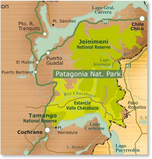
Lagunas Altas, the first major trail constructed at the future Patagonia National Park, offer a challenging day hike or overnight. The 23-km route offers spectacular views in all directions, from the Northern Patagonian Ice Field to the Jeinimeni Mountains. …
The easiest way to reach the park is to fly to Balmaceda Airport (Coyaique); LAN (www.lan.com) and SKY (www.skyairline.cl) both operate flights to Balmaceda from Santiago and Puerto Montt. Buses also arrive in Coyhaique from points north.
To reach the park from Balmaceda or Coyhaique, drive or take a bus south on the Carretera Austral (route 7). You can rent a car at the Balmaceda airport or in Coyhaique, or catch a bus south in Coyhaique. Three bus companies offer service south from Coyhaique: Buses Don Carlos, Acuario 13, and Buses Sao Paulo. Between the three companies, there’s usually one bus leaving every morning during the high season, around 9 am. Tickets cost ~$20 USD. …
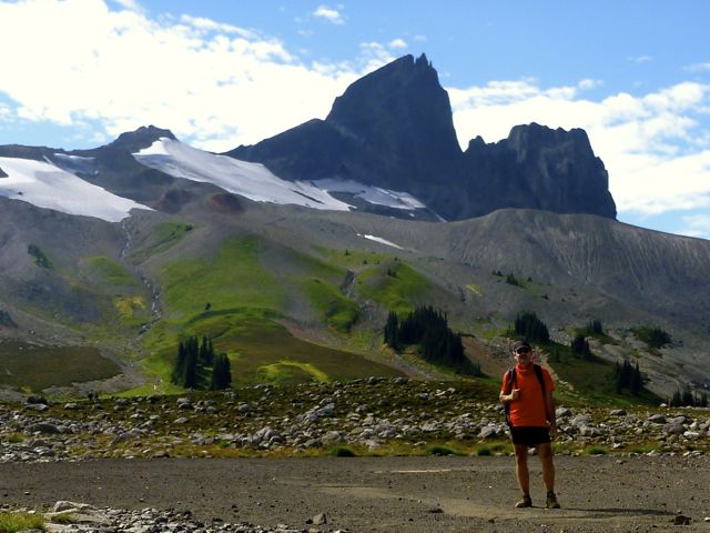
Most hikers approach from the Taylor Meadows campground to the south near Garibaldi Lake, although there is a second route from the north that travels by way of Helm Lake. …
Locals advised me to avoid the crowded trailhead off the highway, and hike via the Helm Creek Trail instead. That’s the Cheakamus Lake trailhead, closer to Whistler.
I bought my $10 / person / night camping permitonline from BC Parks. You can pay cash at a machine only at the Diamond Head and Garibaldi Lake parking lots, not at the Cheakamus Lake parking lot.
Why doesn’t BC Parks have an office somewhere near Whistler?
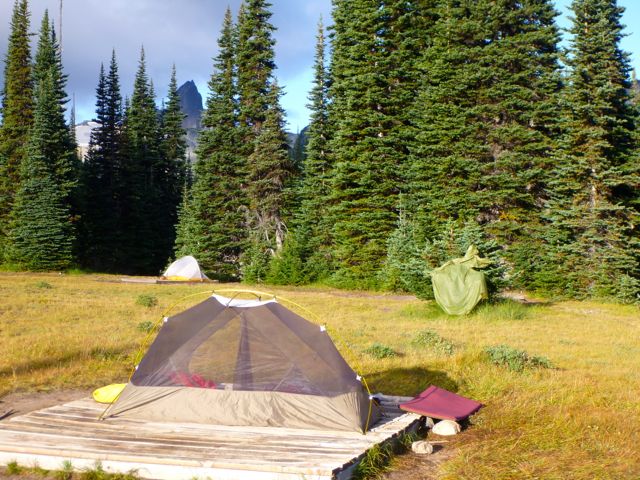
Cheakamus Lake to Black Tusk Meadows via Helm Creek:
• Length, 14.5 km; suggested time, 6 to 7 hours one way;
• elevation change, 600 metres.
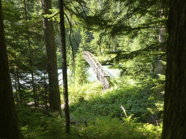
• 1.5 km along the Cheakamus Lake trail, drop down to a bridge across the Cheakamus River.
On the other side of the river the trail switchbacks upward steeply to the Helm Creek Campground.
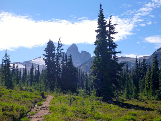
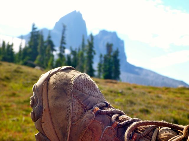
I carried on to gorgeous Black Tusk Meadows.
Hikers coming down from the south summit told me it was too late in the day for me to start up.
After weighing my options (I was carrying a head lamp) I finally decided to wander the meadows, instead.
It turned out to be a leisurely night.
Next morning I turned my back on Black Tusk and headed back down to my car.
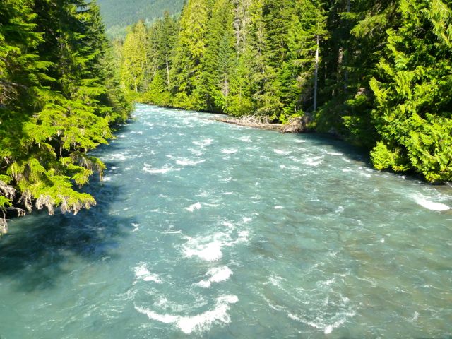
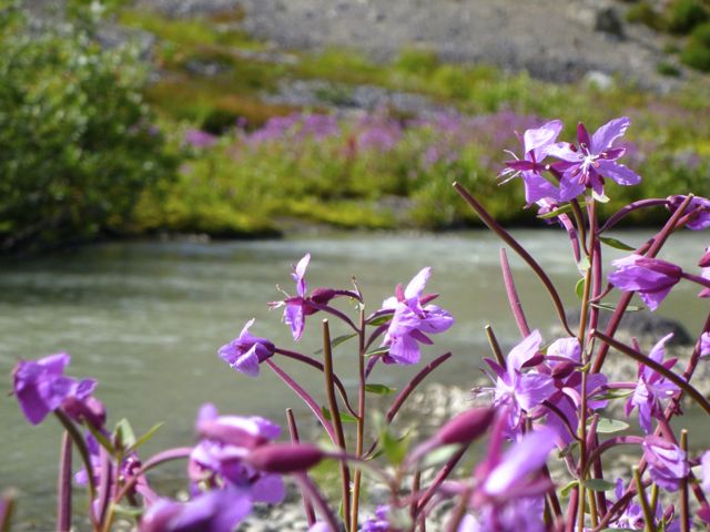
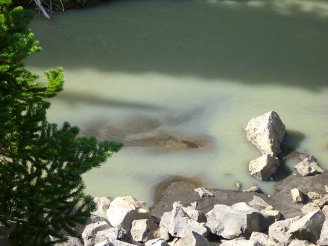
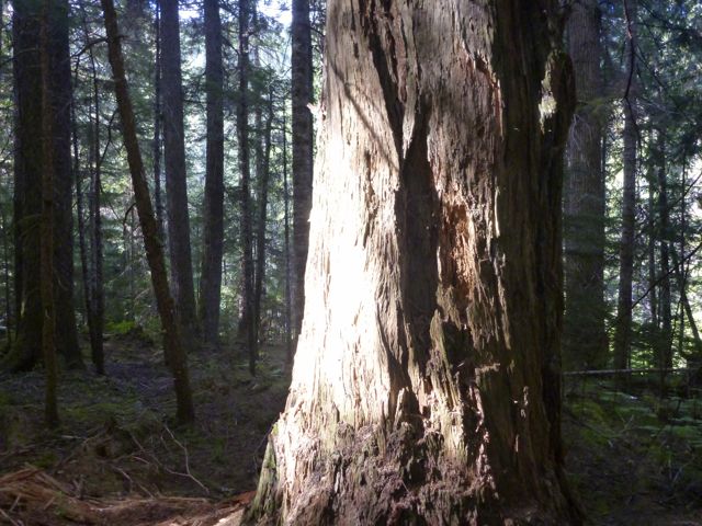
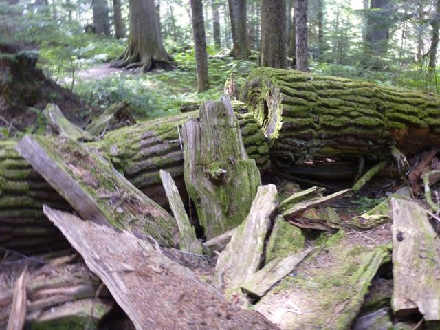
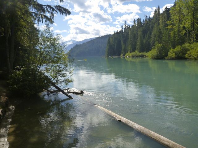
I had time for a sidetrip to pretty Cheakamus Lake via lush temperate rain forest.
Black Tusk is off limits to mountain bikes, but the ride to this lake is superb.
All in all, a wonderful 2-day hike.
If I had one more day I would have done the 34km route Helm Creek, Panorama Ridge and Black Tusk shoulder detailed in this 9min video.
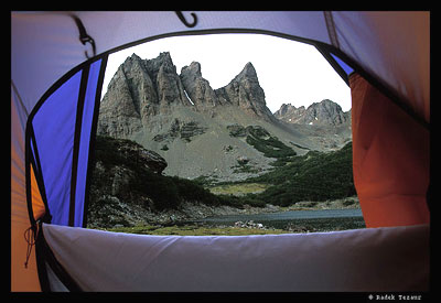
Lake Lovely Water is a Mountaineer’s and Scrambler’s Paradise. But it’s not for the inexperienced nor ill-prepared.
There is a 6.5 km (4-6 hour) hike to Lake Lovely Water. The trail is very rugged and steep. Good route finding skills and proper equipment and clothing are required. Weather can change quickly, causing limited visibility.
There are steep and rugged established trails leading from the cabin towards Niobe Meadows (approximately 2.5km one-way) and Lambda Lake Meadows (approximately 3.5km one-way).
Access to the Lake Lovely Water trail requires crossing the Squamish River. Jetboat service may be available out of Brackendale. Or you could chopper out of Squamish Airport direct to a hut. Contact Omega Aviation 604-898-1067 or Black Tusk Helicopters 604-898-4800.
I’ve heard of hikers canoeing across.
By reservation only, you could stay at either Tantalus Hut on the Lake (3850ft) or Jim Haberl Hut (6800ft).
On a trail run/hike out of my residence, Whistler’s Athletes Lodge, I passed this pretty volcanic crater lake.
You can’t lose hiking near Whistler B.C.
It’s all good.
This slideshow requires JavaScript.
One of the easier Whistler, BC, Canada lakes to access by walking a short distance. But, be aware, the distance to the lake may be short but the steep climb to the lake is not easy. … mainly loose rocks following a deactivated road, now hiking and mountain biking trail, for 350 metres.
Loggers Lake – Whistler, BC, CanadaLogger’s Lake, considered a watershed, is a small lake surrounded by trees and rock formations located in the Whistler Interpretive Forest. …
Once you’ve been up on the Roof of Africa in the Ethiopian Highlands, you won’t want to come down
Jemima Sissons:
… I spent my first few days in Ethiopia exploring the capital, Addis Ababa, then caught a flight to Gondar in the north, where I met Mulat and our driver, Melsie Nuru, and started preparing for our four-day, 50-kilometer trek across the Simien Mountains.
The Chinese-built roads make the three-hour drive to the base camp at Sankaber an easy whiz through lush pastures and past goat herds weaving their way across the road, oblivious to traffic. Soon the roads give way to dirt tracks, and after leaving the final village, the real adventure begins. It is unimaginable to contemplate this stretch without an SUV, as we lurch from side to side through unfathomably deep mud, on a number of occasions jolting within a hair’s breadth of the precipitous edge.
When the car finally stops, the cook and driver go off to set up camp, while my guide and I begin our trek. …
Though I’d rushed through Snoqualmie Pass dozens of times over the years – to or from Seattle – this was the first time I’d ever stopped to hike.
4.0 miles, roundtrip
Gain: 1160ft
Highest Point: 2078ft
No pass or permit required. And, no, there are no rattlesnakes.
This is a fine hike on a well maintained, albeit busy trail through the forest with views of the Cedar River watershed, Mount Si, Mount Washington, Rattlesnake Lake and Chester Morse Lake.
As soon as you arrive in the parking lot you have a view of Rattlesnake Ledge’s sheer rock face across Rattlesnake Lake. At this point it seems amazing to think you will be up there by the end of your hike, but a look at a trail map will reveal some well-engineered switchbacks …
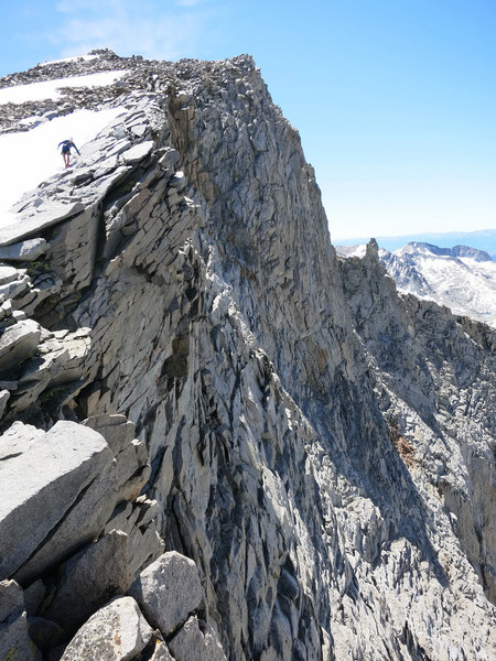
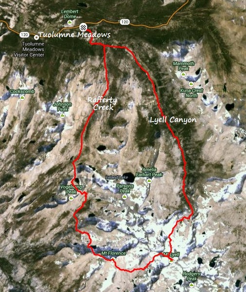
Leor Pantilat seems to have invented his own high Sierra route:
The Roof of Yosemite Loop travels to the highest point in Yosemite National Park on 13,114 ft Mount Lyell and also includes ascents of 12,900 ft Mount Maclure (5th highest in the park) and 12,561 ft Mount Florence (9th highest in the park). …
The Roof of Yosemite Loop combines many of the highlights of this region into an aesthetic and highly scenic loop. …

 Establishing the Lagunas Altas Trail
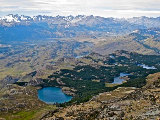 How to get there.