It’s taken decades for the National Park Service (NPS) to purchase the land needed to build an uninterrupted hiking experience through Santa Monica Mountains National Recreation Area. However, it’s now possible for Southern Californians to hike 67 complete mountainous miles across the range on the Backbone Trail, according to the L.A. Times. …
If you are interested in hiking the trail, as this writer is, you can learn more about the process at the National Park Service website. …
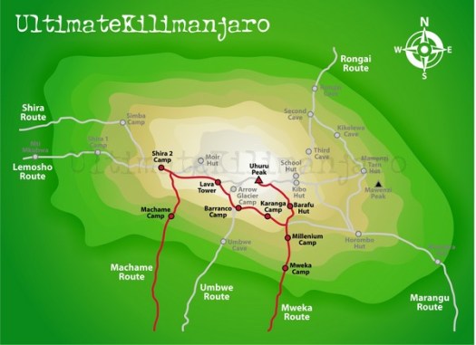
The Machame route is probably the most popular route these days and is also called “the whiskey route”. This route is steeper than the Marangu and Rongai routes and physically more demanding and for that reason better suited for the more determined and fitter climbers (view a map of Machame). …
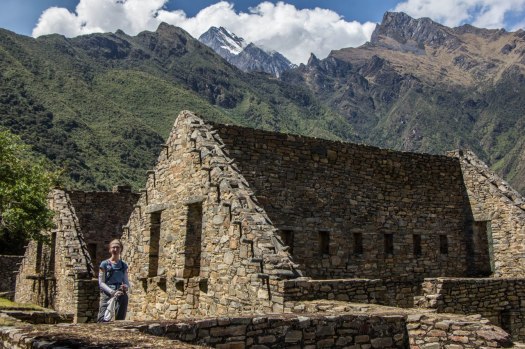
Choquequirao is quite big, you need at least one full day to explore it.
… buildings with steep roofs, terraces, massive walls.
… views to the valley and canyon from the ruins are stunning, specially at the sunset.
What we really liked about Choquequirao is its quietness, in all day we saw 6 people, you have ruins all to yourself. Unfortunately Peruvian government is planning to build a cable car all the way to the ruins, it’ll bring a lot of money for the region which is good, but at the same time will destroy unique atmosphere. …
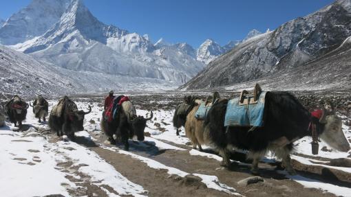
You have two main options on how tho do the trek to Everest Base Camp, you can either do it through an agency or do it yourself.
Doing an organized tour through an agency is easy but expensive, you will probably be in a big group with someone carrying your bag and organizing where you stay.
Doing it yourself is not hard and plane tickets from Kathmandu to Lukla is the only thing that you have to organize. You follow a very clear path, everybody stays in the same little “towns” with many tea houses, it is not necessary to pre-book anything. …
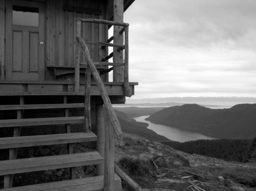
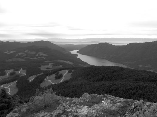
… the Tin Hat hut is an epic 360-degree mountain-top lookout that provides the quintessential view of the rugged mountains, valleys, and lakes that define the Powell River back country experience. This hut is a fully winterized cabin with pellet stove and is located in, arguably, one of the most beautiful spots on the Sunshine Coast Trail. Although it is a climb to get there, the experience is well worth the effort. Summitting this mountain will make you feel like you are, indeed, on top of the world!
It’s the highest elevation point and the biggest attraction of the SCT. I was impressed.
Still early morning, I chatted with Lisa from Calgary in the hut. Then dashed on back down the logging road to where I’d stashed my pack. A savvy hiker like myself doesn’t haul his gear up the mountain unless absolutely necessary. My guidebook hinted at an alternative SCT route that would be easier than the normal steep up and down. 🙂
I was soon lost. 😦
Views were terrific.
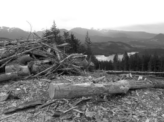
But I found myself on a maze of logging road switchbacks. If you don’t like clear cut, you might not like the Sunshine Coast Trail.
Here you can see an old growth survivor. Secondary growth. And the war zone that is clear cut logging.
Worse than forest devastation, the bugs.
bug shirt
By day 3 I wore my bug shirt non-stop. Flying pests are a very good argument why you should NOT hike the Sunshine Coast Trail. All of the other major B.C. coastal hikes have virtually no bugs
Eventually I found my way back to the SCT.
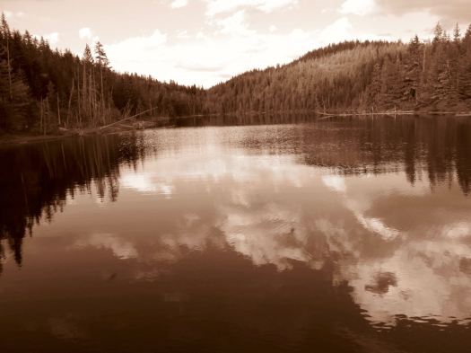
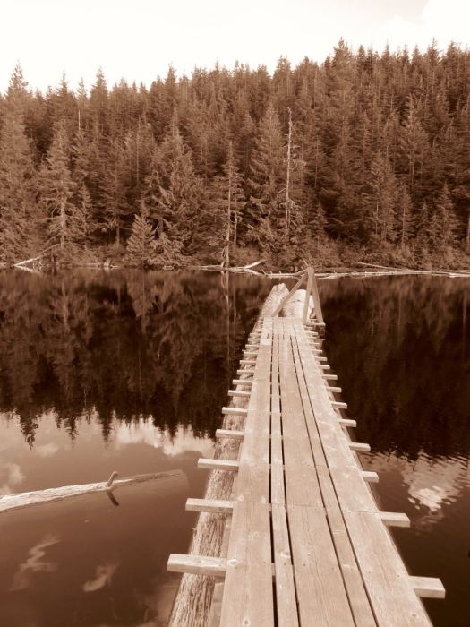
Past Lewis Lake.
On to Elk Lake.
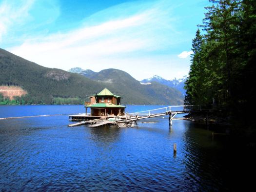
Mosquitos and I had the rustic hut to ourselves. Very tranquil.
Close to dark Alex from Ontario rushed in. Super happy to have made it to the hut in daylight. She’d come from Tin Hat Hut.
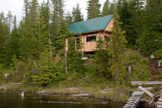
This was my toughest day. A steep scramble up to Confederation Hut on the same-named lake. Then a long descent down to Fiddlehead Landing Hut. And finally a steep slog up to the top of Tin Hat Mountain.
This is not Fiddlehead Landing Hut. Rather a floating holiday home next door.
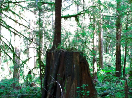
Hiking temperate rain forest can be lovely. Soft mulch underfoot. Plenty of variety. Nurse logs. Good visibility even in the trees.
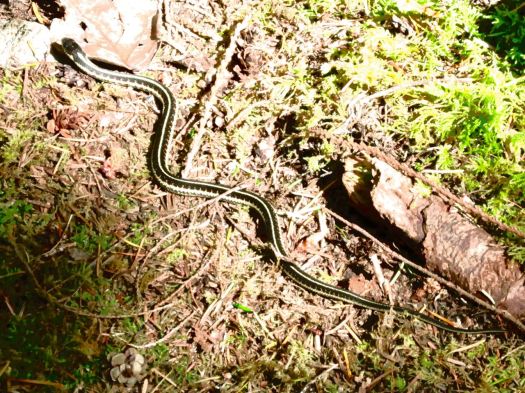
I didn’t see much wildlife. Other than garter snakes.
One snake was eating a banana slug. I’d believed NOTHING could eat a banana slug. 🙂
Lisa from Ontario had seen a bear near the start of SCT. But – in general – you don’t see much aside from birds.
… Fact is, I never made it to the top of the mountain. About an hour short of Tin Hat Hut I dropped my pack on the trail and set-up on the trail.
Could barely keep my eyes open. That was 7pm. I’d been almost all of 12 hours on my feet. Mostly climbing up or down.


 +
+