Beautiful.
Click PLAY or watch it on Vimeo.

Best hikes, treks, tramps in the world.
Trip report by BestHike editor Rick McCharles
In 2022, I enjoyed hiking Sandbotnen beach to Ryten Summit out of Fredvang.
Definitely one of the best hikes in Norway. Almost every hiker has Ryten on their Lofoten list.
In 2023 I was back — but the weather was overcast.
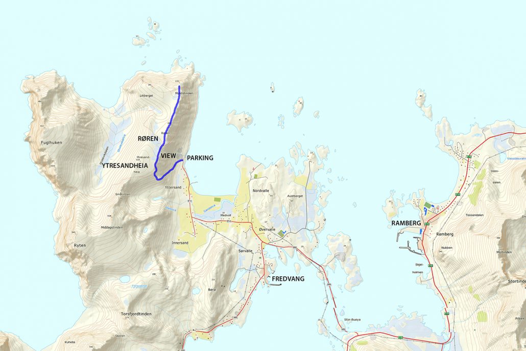
Staff at the Lydersen Rorbuer hostel suggested the nearby Røren / Ytresandheia hike as a good alternative when Ryten is covered with clouds.
With no real expectations, I headed up. And it was excellent.
Click PLAY or watch it on YouTube.
Røren / Ytresandheia is not so much a mountain peak, but rather a long flat ridge on the northernmost tip of Moskenesøy.
With only a small amount of elevation gain and a good trail, this short little hike provides fantastic views over the turquoise waters of Yttersand beach and across to the distant mountains of Flakstadøy. …
68North – RØREN – YTRESANDHEIA HIKING GUIDE
I had seen this hike on World Wide Hearts.
Click PLAY or watch it on YouTube.
Tongariro Northern Circuit is one of our top 10 hikes in the world.
Click PLAY or watch a 1 minute introduction on YouTube.
Our favourite multi-day tramp in our favourite hiking region of the world — glorious New Zealand.
AND our top volcano hike worldwide.

by Jeff Pang
Read more on our Tongariro Northern Circuit information page.
Trip report by BestHike editor Rick McCharles
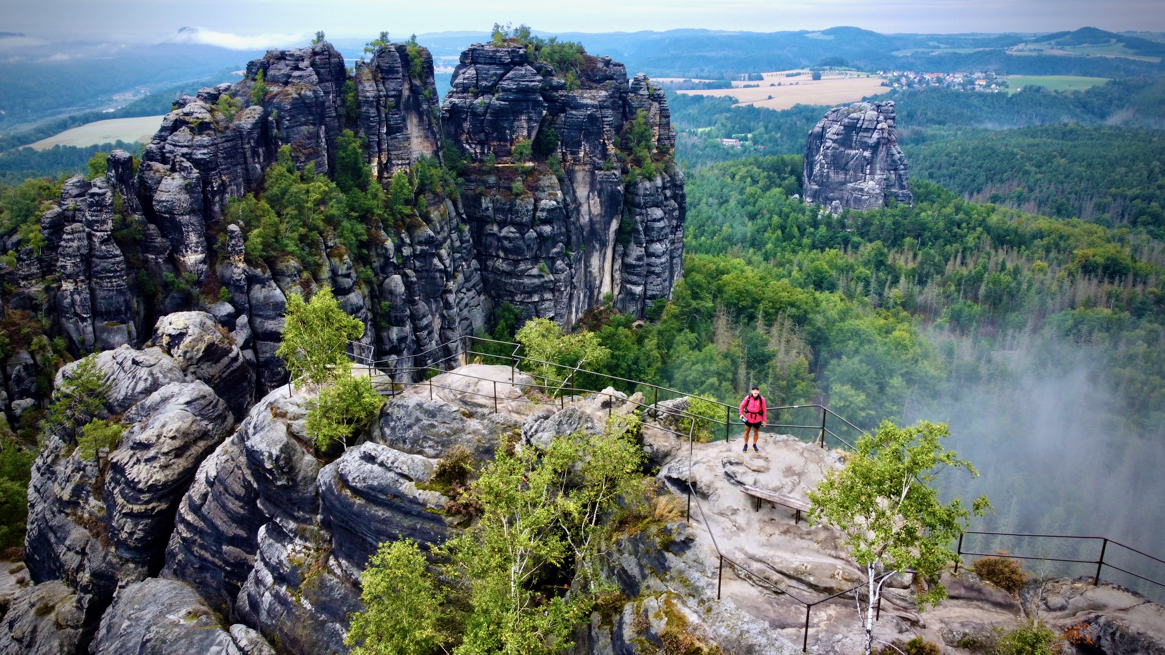
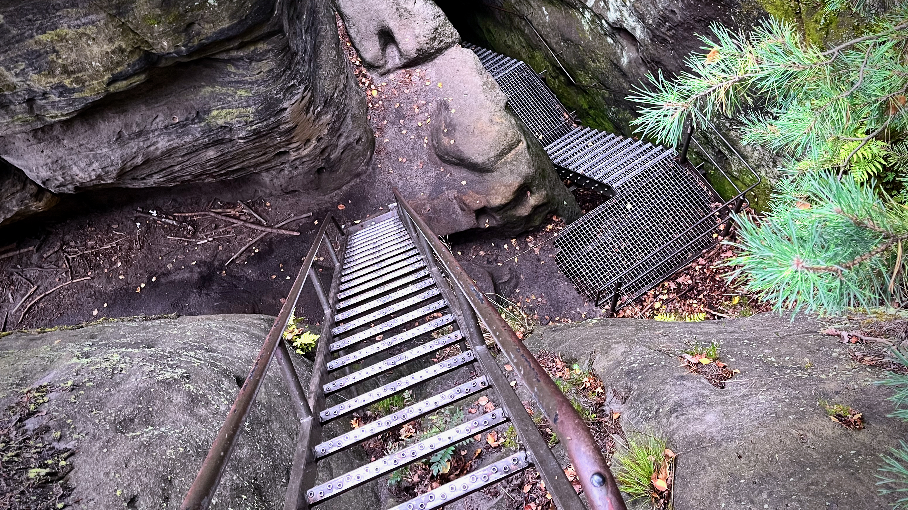
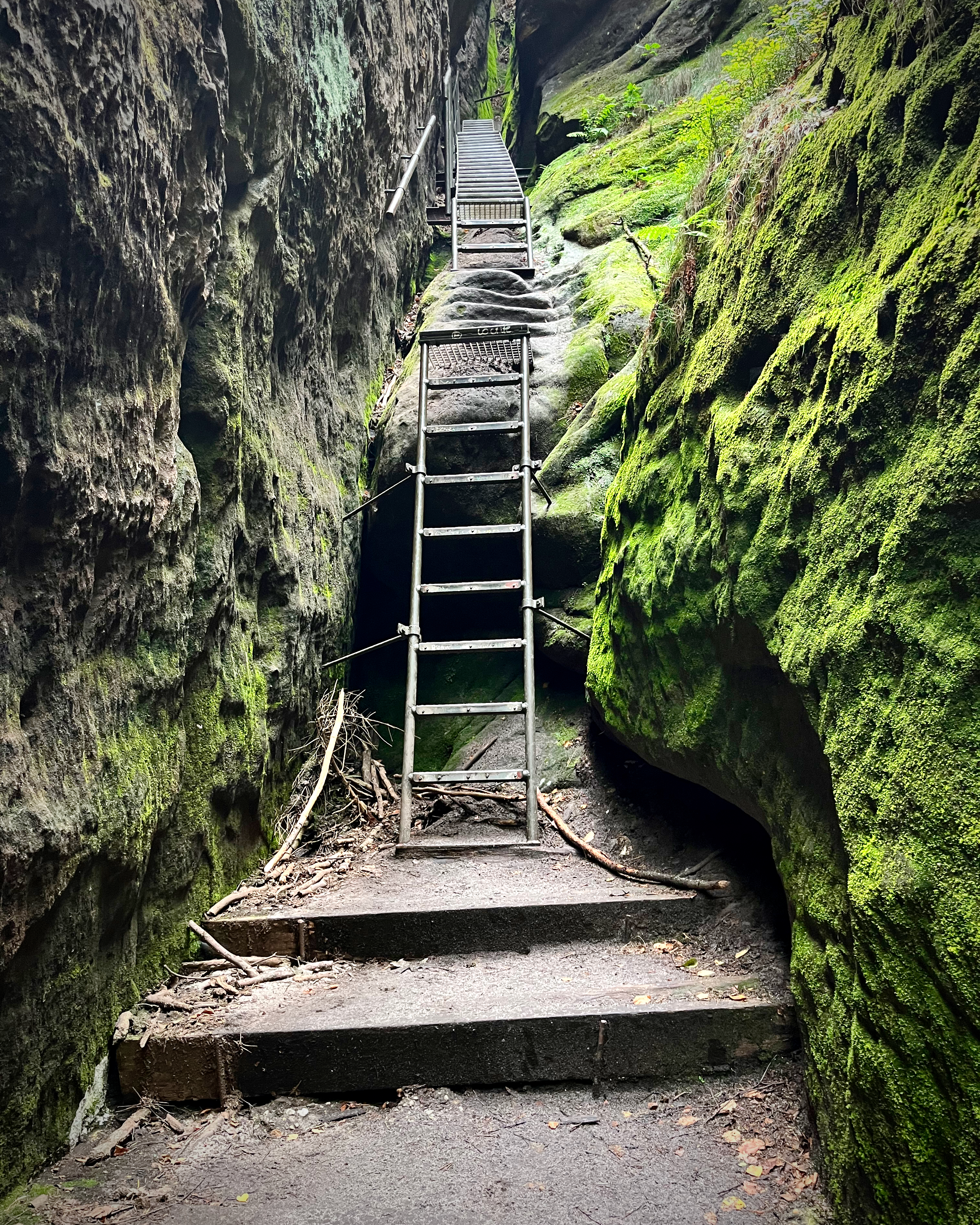
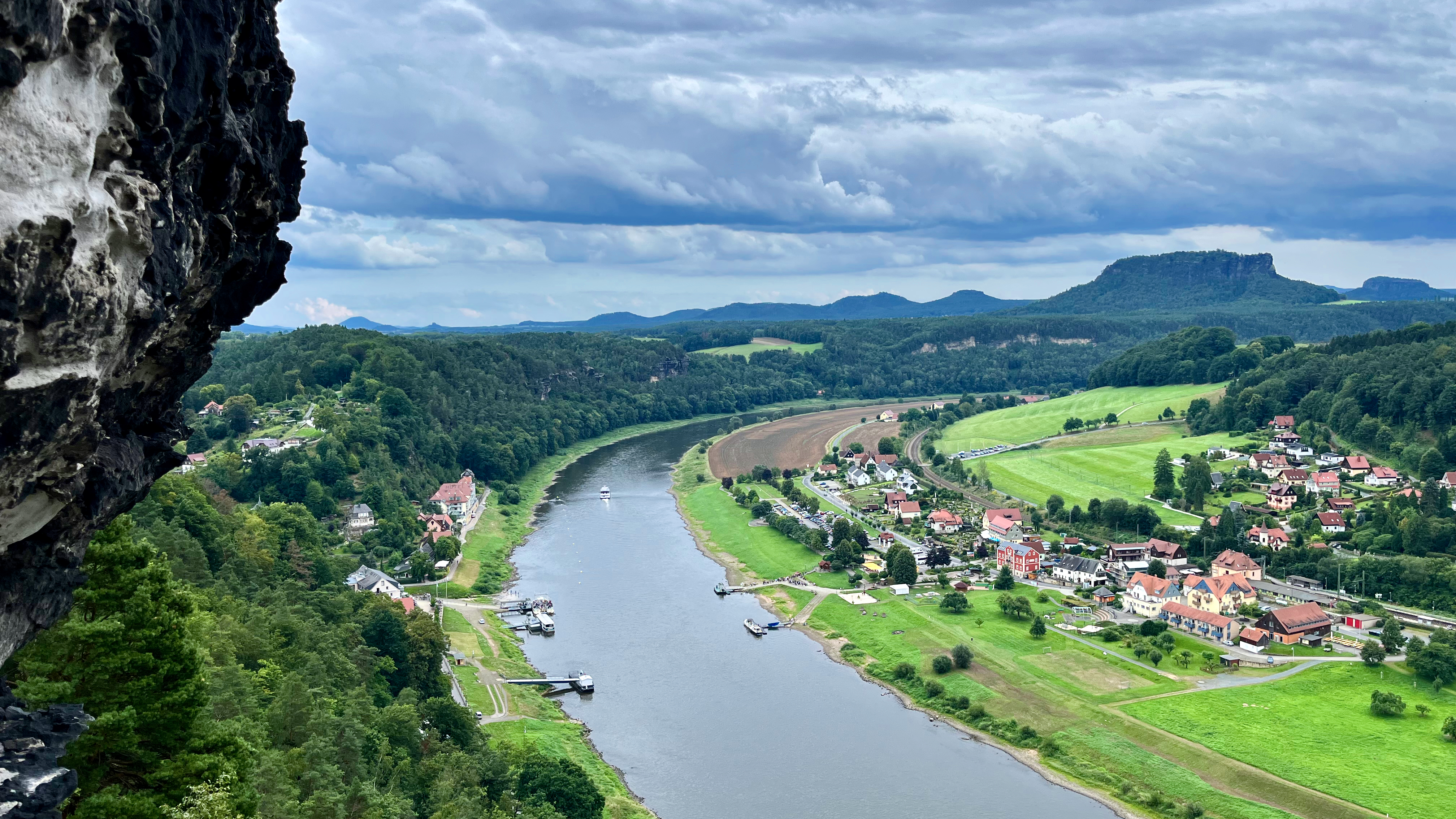
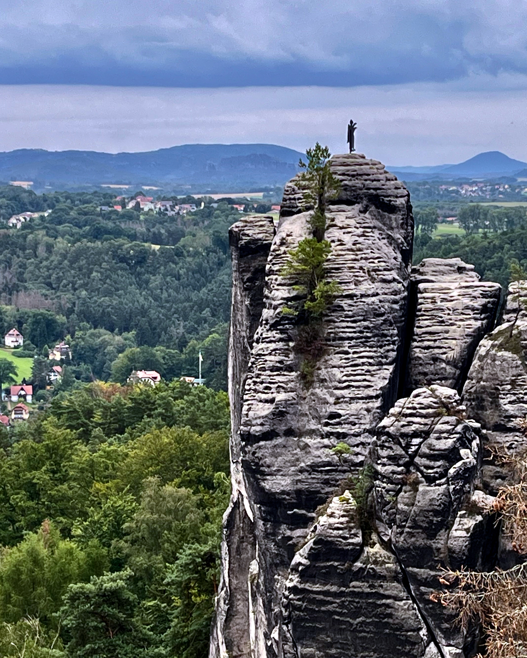
I’ll bet you’ve never heard of the Schrammsteine rock formation close to Dresden.
Located in Saxon Switzerland National Park on the eastern German border.
Click PLAY or get a glimpse on YouTube.
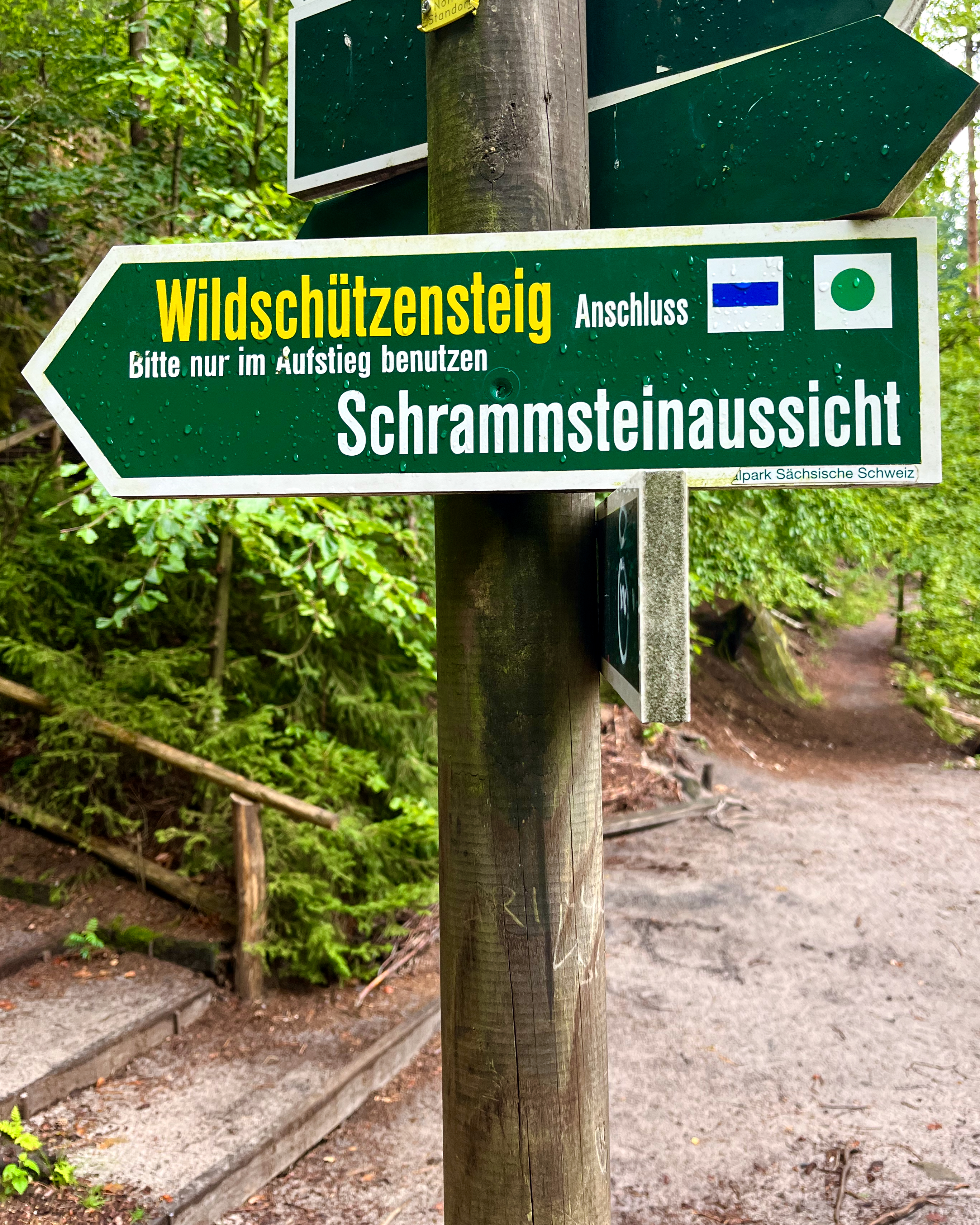
Though it’s a long, strung-out, jagged rock formation, most hikers head up to this view point at a height of 417.2 m.
To get there, I followed signs saying “Schrammsteinaussicht” (Schrammstein view) until close to the top when they switched to “Wildschützensteg“.
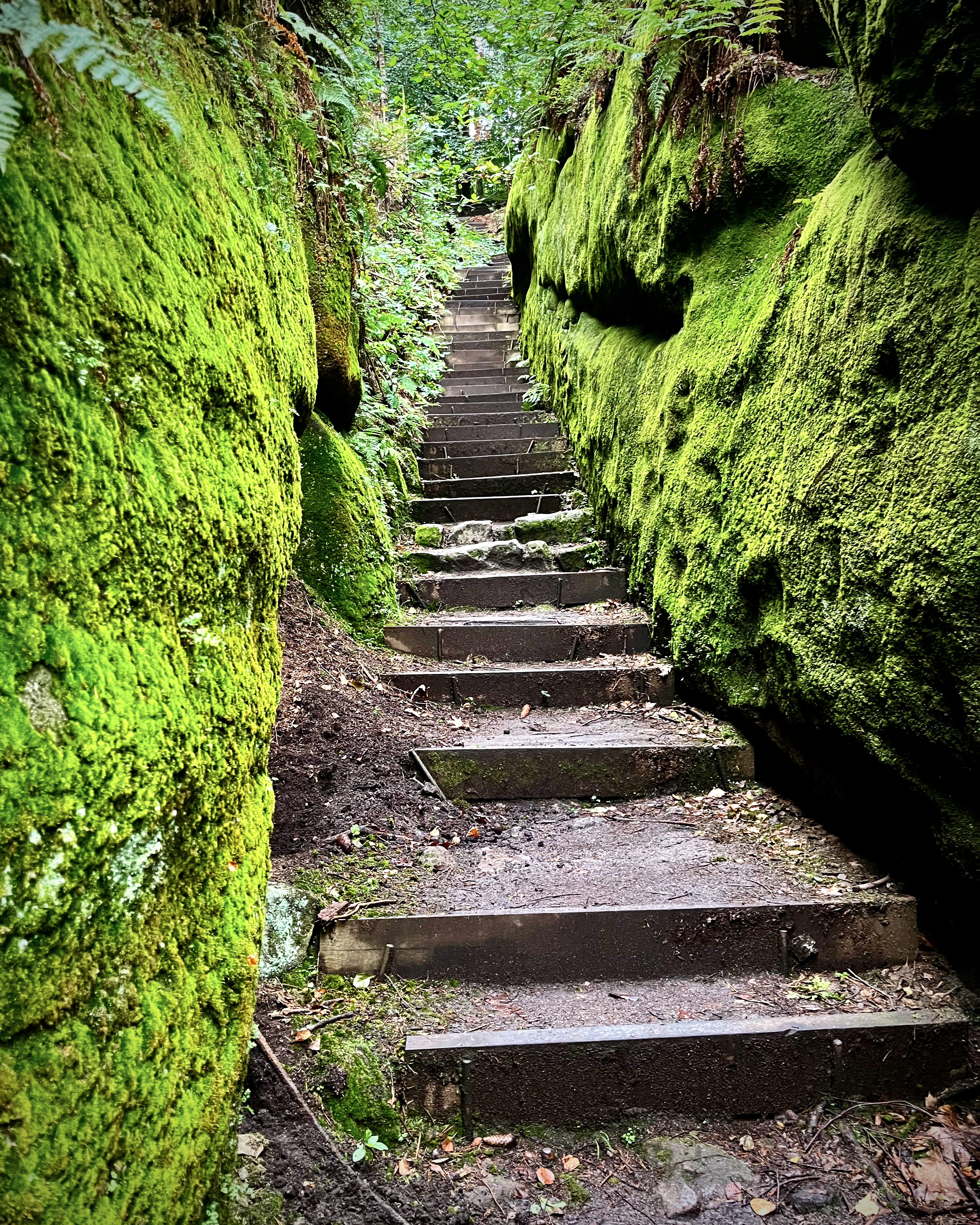
There are many ways up, however. I doubt you could easily get lost.
Be psyched for many ladders and some scrambling. No exposure, however. Typically you are wedged into the rock.
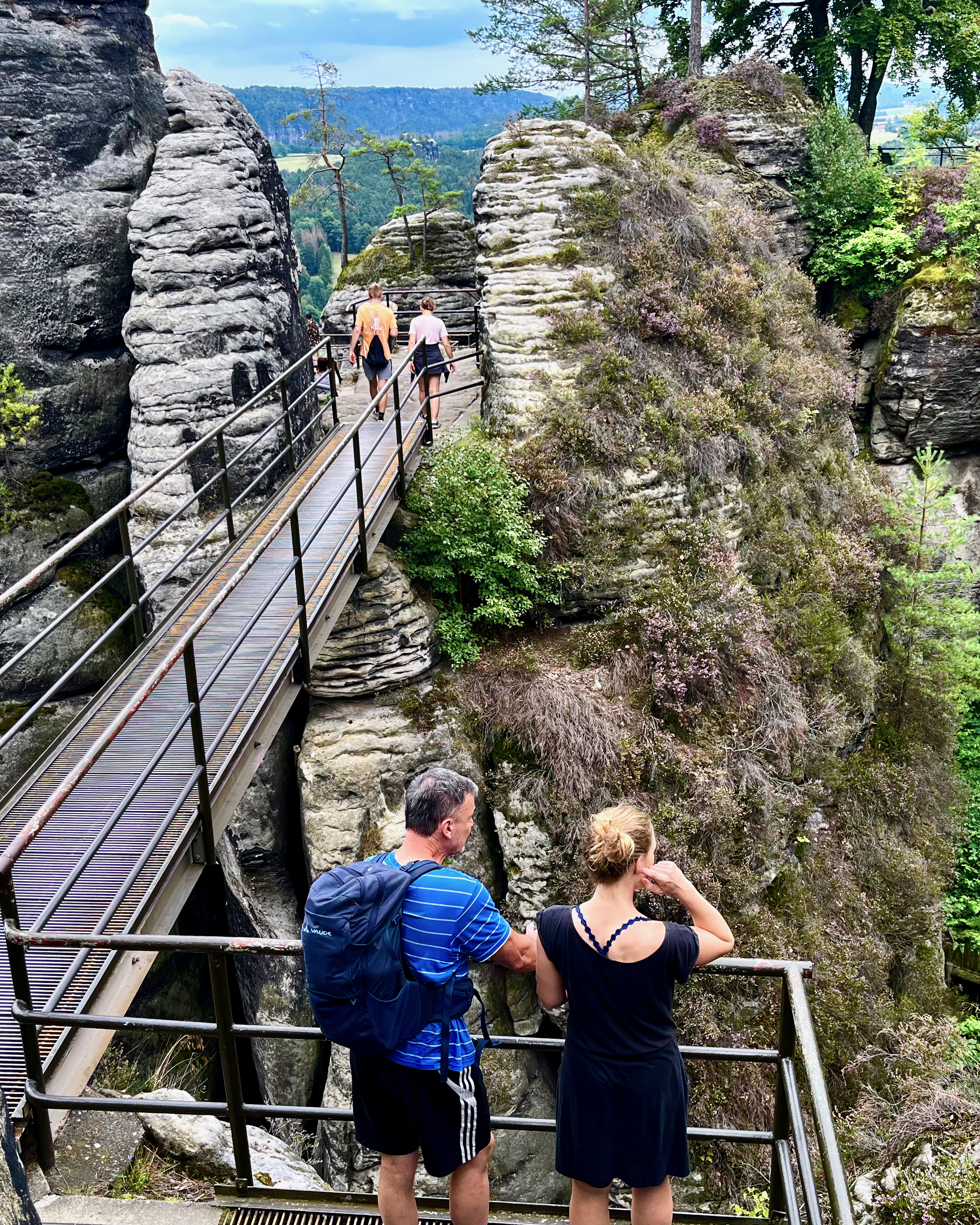
I came to this National Park for the much more famous, nearby Bastei Bridge hike. But I’d say Schrammsteine is equally good.
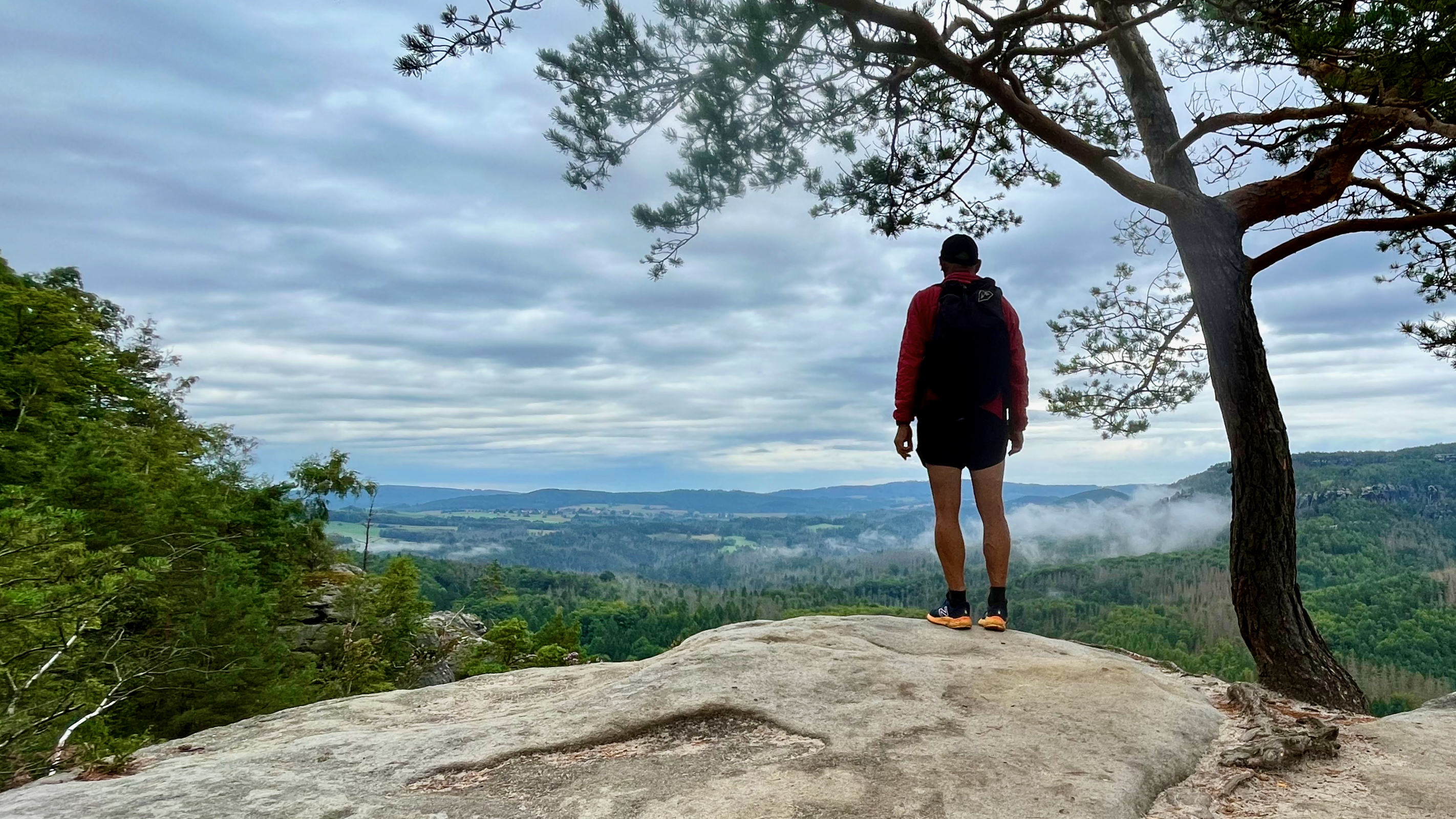
And I had the view point to myself while nearby Bastei is thronged with tourists.
This would be an experience. 8000 steps.
The Fanjingshan (Chinese: 梵净山; pinyin: Fànjìngshān) or Mount Fanjing, located in Tongren, Guizhou province, is the highest peak of the Wuling Mountains in southeastern China, at an elevation of 2,570 m (8,430 ft). …
Fanjingshan is considered a sacred mountain of Chinese Buddhism, ranking just below the Four Sacred Mountains of Buddhism. …
Click PLAY or watch it on YouTube.
Trip report by BestHike editor Rick McCharles
Click PLAY or get a glimpse on YouTube.
I traveled by train to Dresden and cycled to Saxon Switzerland National Park mainly inspired by the chance to hike Bastei Bridge.
And it’s awesome. 😀

First ➙ let’s clear up the confusion.
Saxon Switzerland National Park is in eastern Germany.
Saxon, Switzerland is a village of about 7000 in Switzerland.
Yeesh. 😀
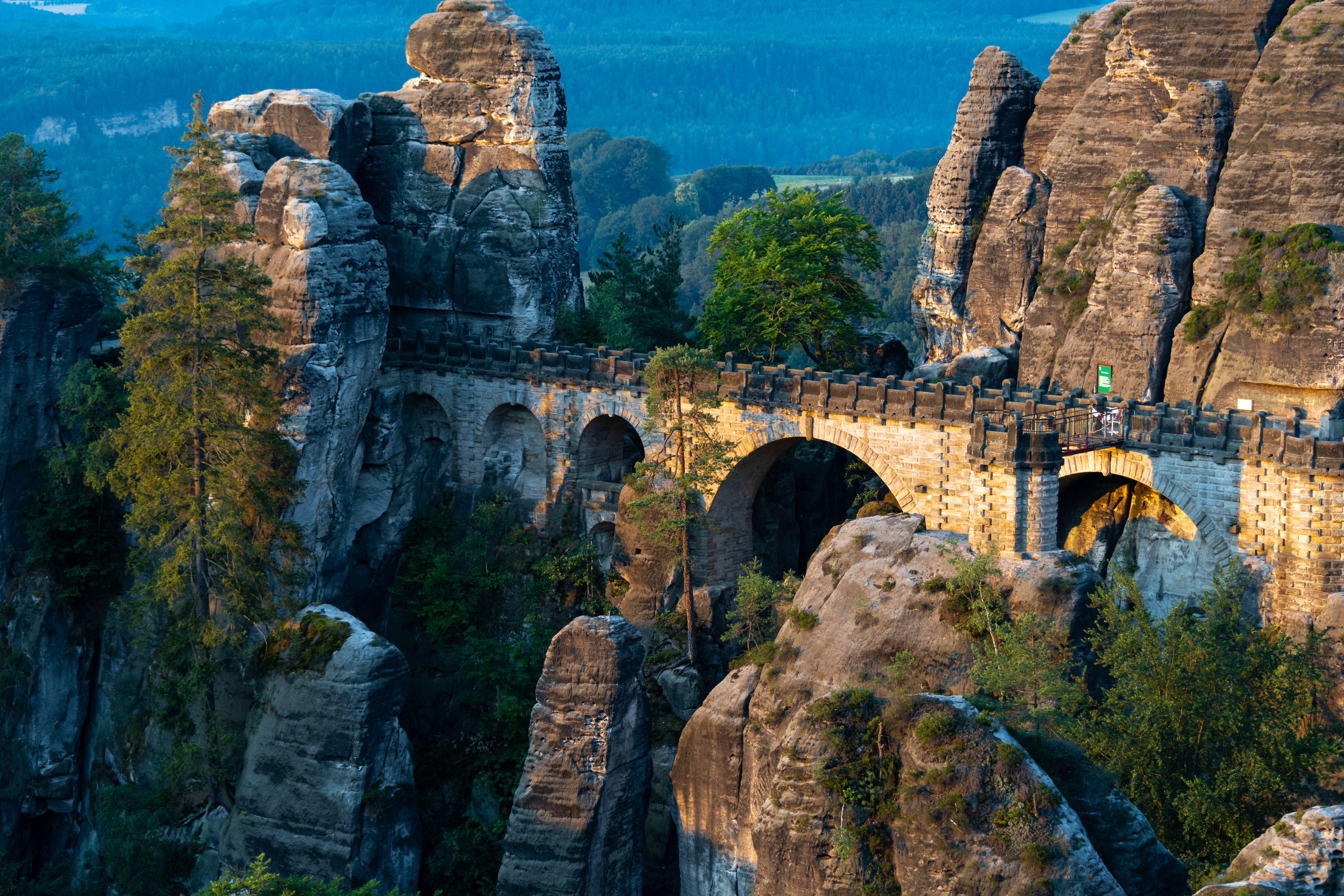
The Bastei is a rock formation rising 194 metres (636 ft) above the Elbe River …
… situated near Rathen …
The Bastei (“bastion”) has been a tourist attraction for over 200 years. In 1824, a wooden bridge was constructed to link several rocks for the visitors. This bridge was replaced in 1851 by the present Bastei Bridge made of sandstone. …
I took the train one way to Rathen. Cycled the other.
Camped at the very convenient hostel.
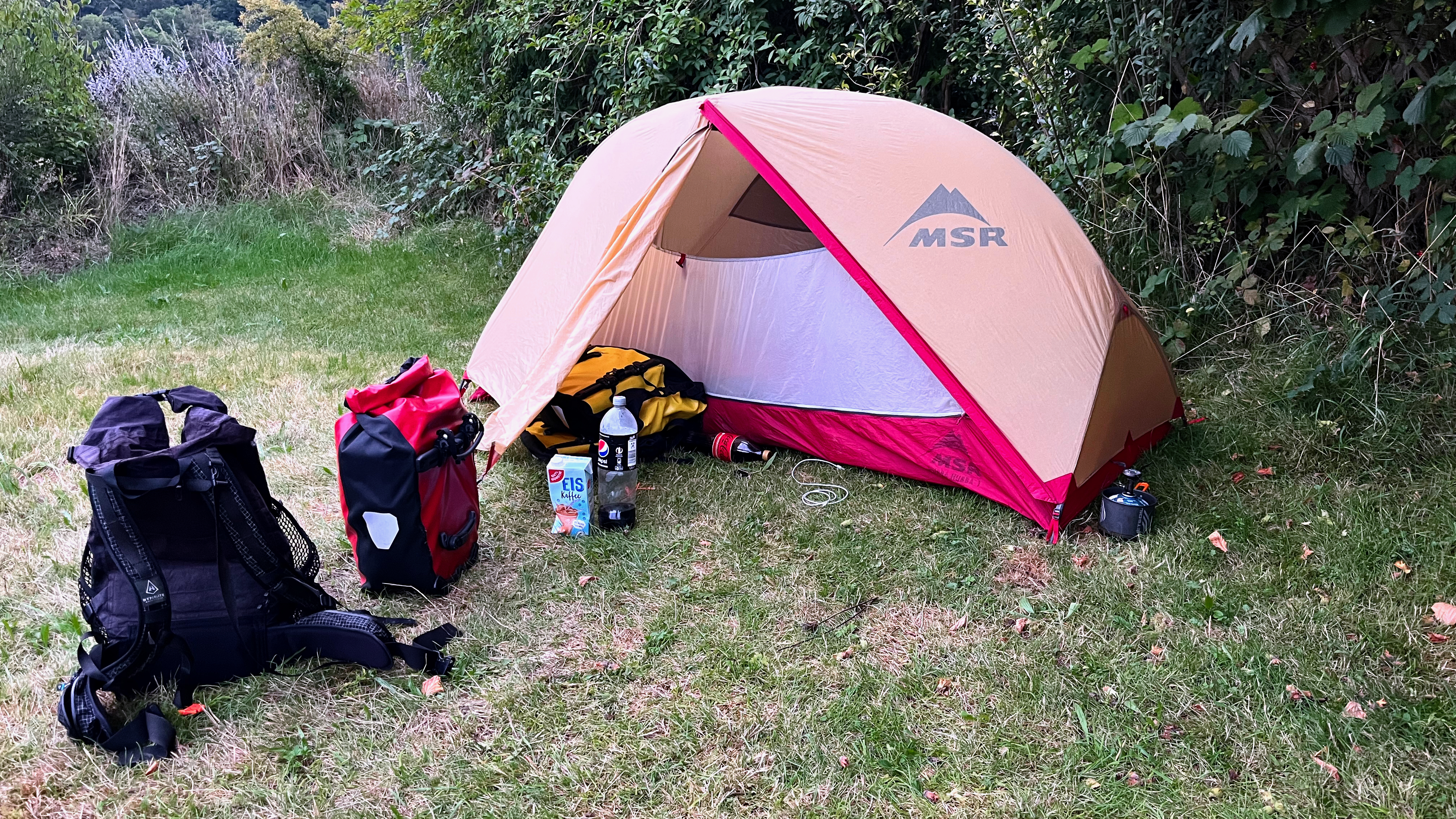
My tent is my home away from home. Protection from the elements.
You take a short ferry across the river to reach the Bastei trailheads.
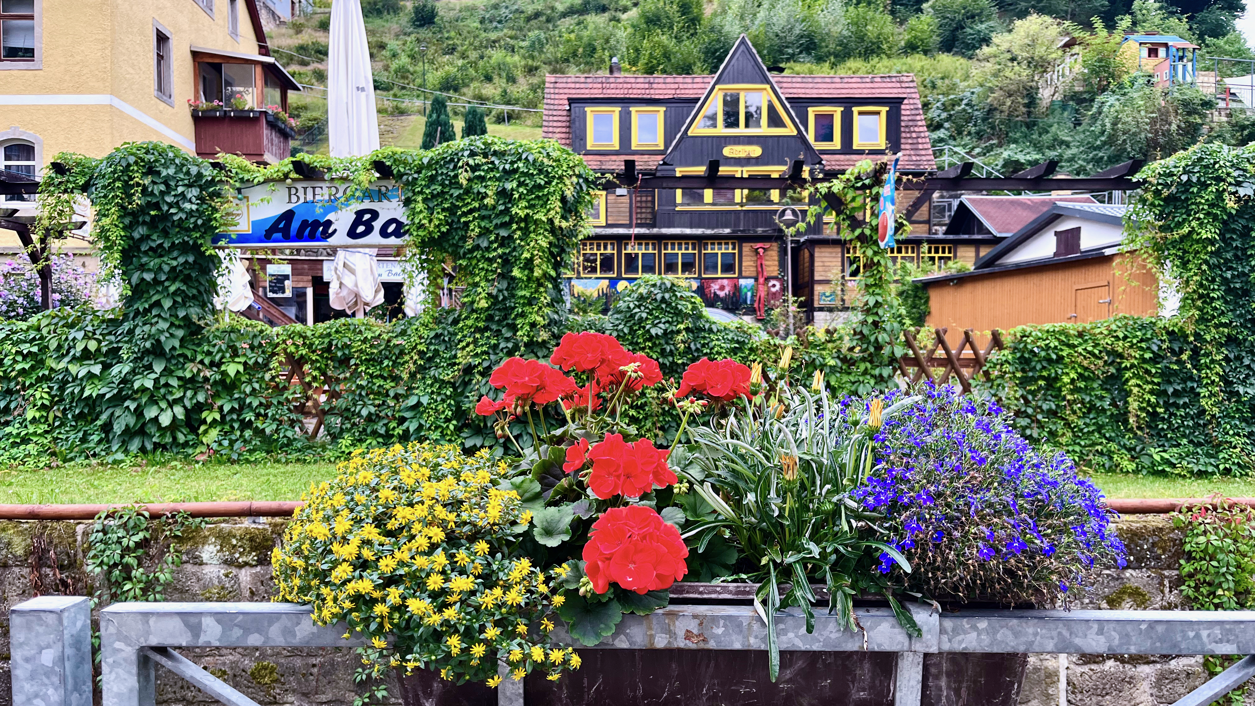
I do love the German country homes. Many are spectacularly colourful and well maintained.
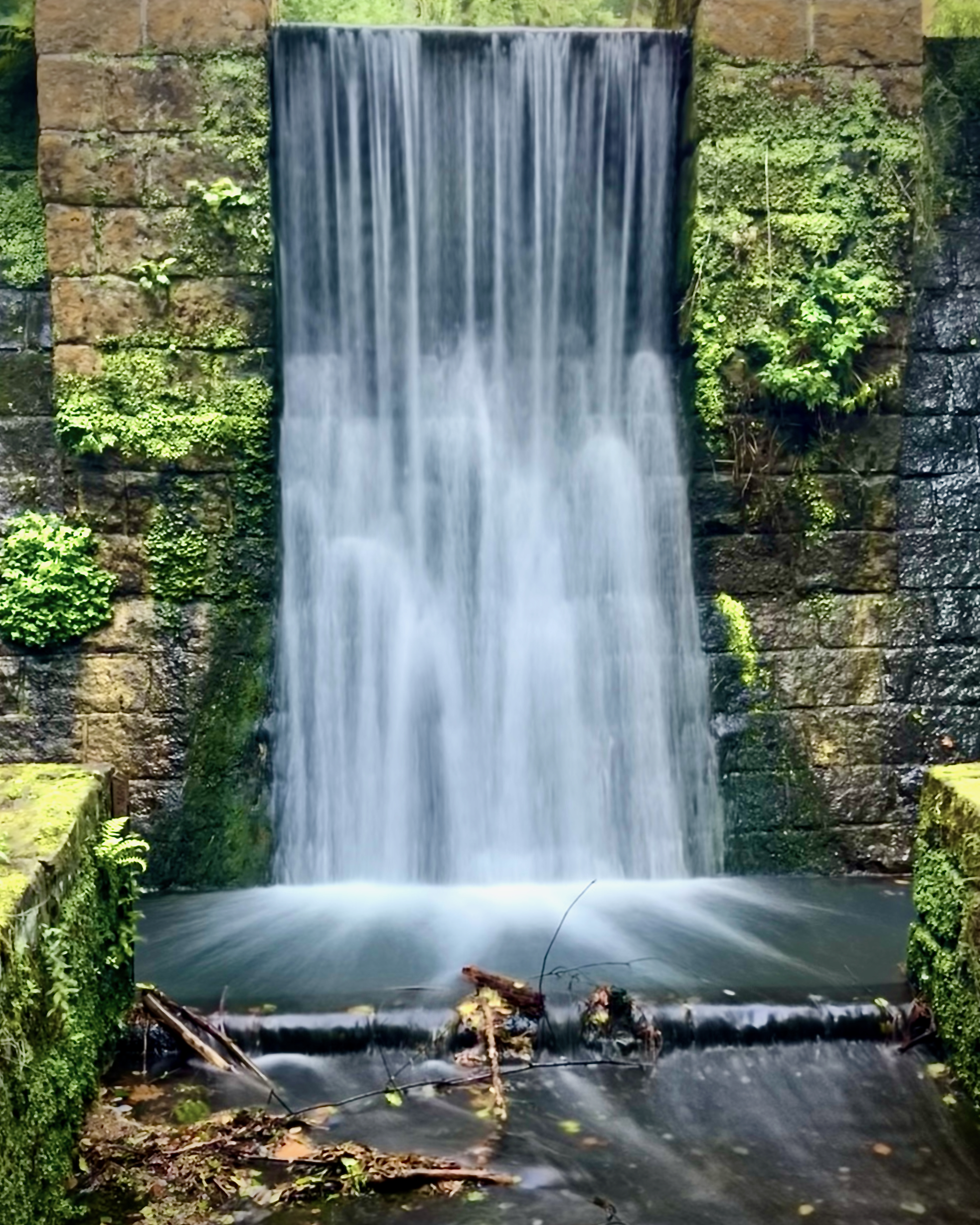
There’s a scenic walk along waterways …
… then several steep ascent trails to get to the bridge.
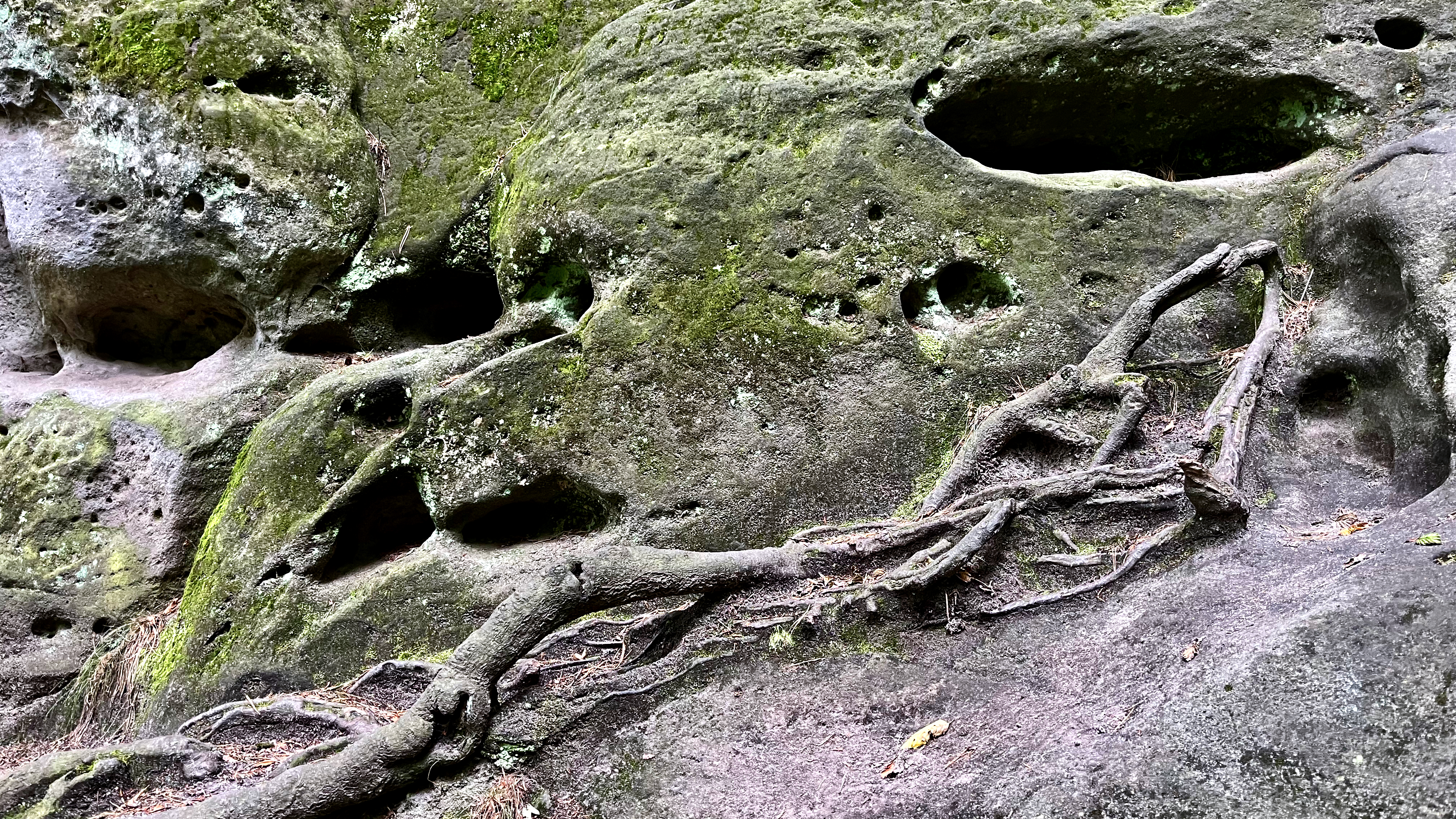
A medieval catapult and many of the boulders are on display.
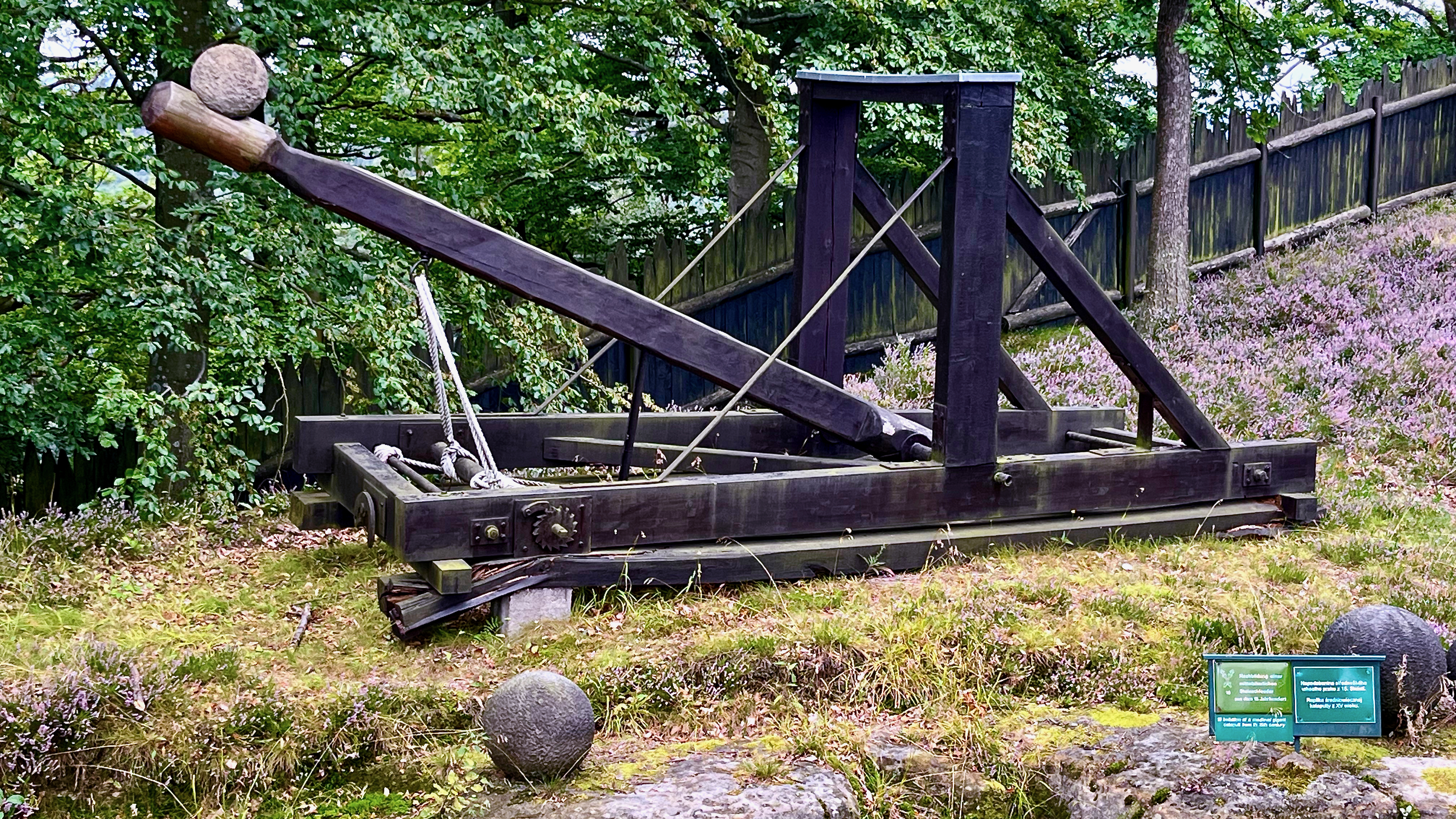
Of course the archeology of the eroded sandstone is varied and interesting.
Once up high it’s all good. Most of the trails are free. But to walk across the bridge itself there is a small fee.
The views are just as good from the free trails, in my opinion.
It is high. If you have a fear of heights, this might not be the hike for you.
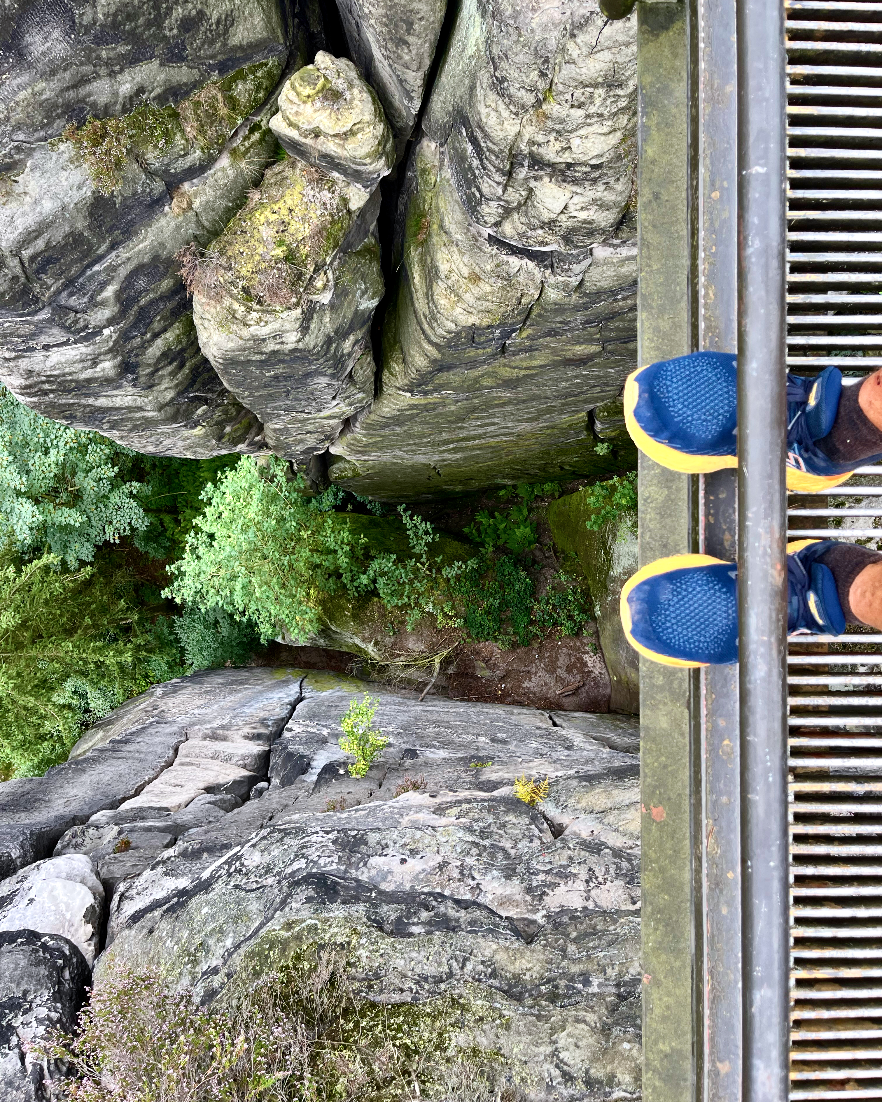
It is busy. If you don’t like crowds on high walkways, come earlier or later in the day.
If you have the time, consider doing more hiking in the area. One popular hike runs from Stadt Wehlen via Bastei to Kurort Rathen (or the other way round).
On this hiking tour, also called the “Golden Triangle”, sights such as the ruins of Wehlen Fort, Bastei Bridge and the Schwedenlöcher (Swede Hole) Trail can be discovered.
saechsische-schweiz
Trip report by BestHike editor Rick McCharles
I really wanted to use the word circumambulating. 😀
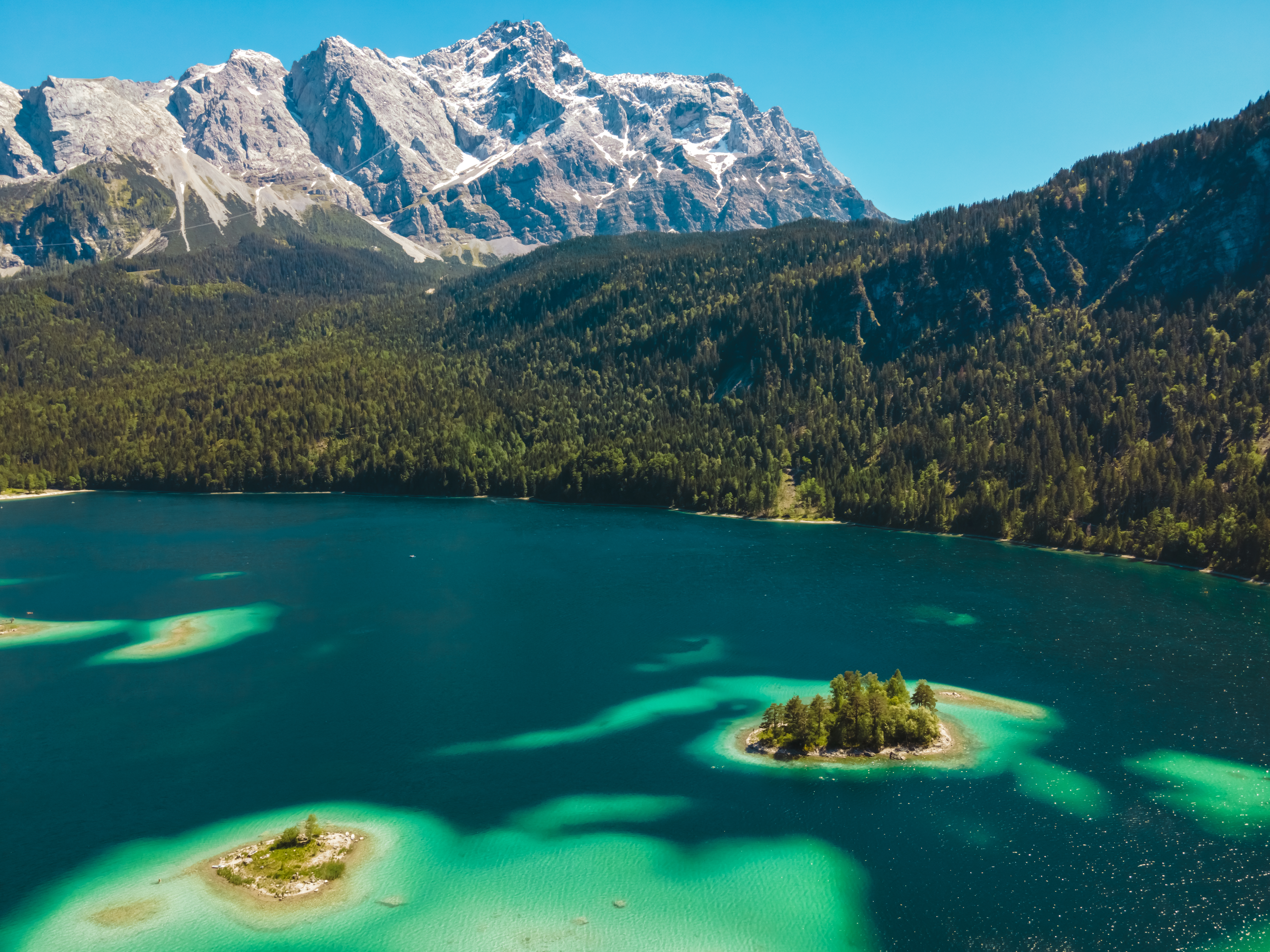
Eibsee (“yew lake”) is a lake in Bavaria, Germany, 9 km southwest of Garmisch-Partenkirchen and roughly 100 km southwest of Munich. …
It is at the northerly base of the Zugspitze (2,950 metres (9,680 ft) above sea level and 3.5 km to the south), Germany’s highest mountain. …
I like this video from Eduardo Rojas. Interesting use of drone and Insta360.
Click PLAY or watch it on YouTube.
Cycling and hiking around lakes is super popular in Bavaria.
This was already my 4th or 5th in a couple of weeks out of Munich.
Like many others, I liked the look of the lake from atop Zugspitze.
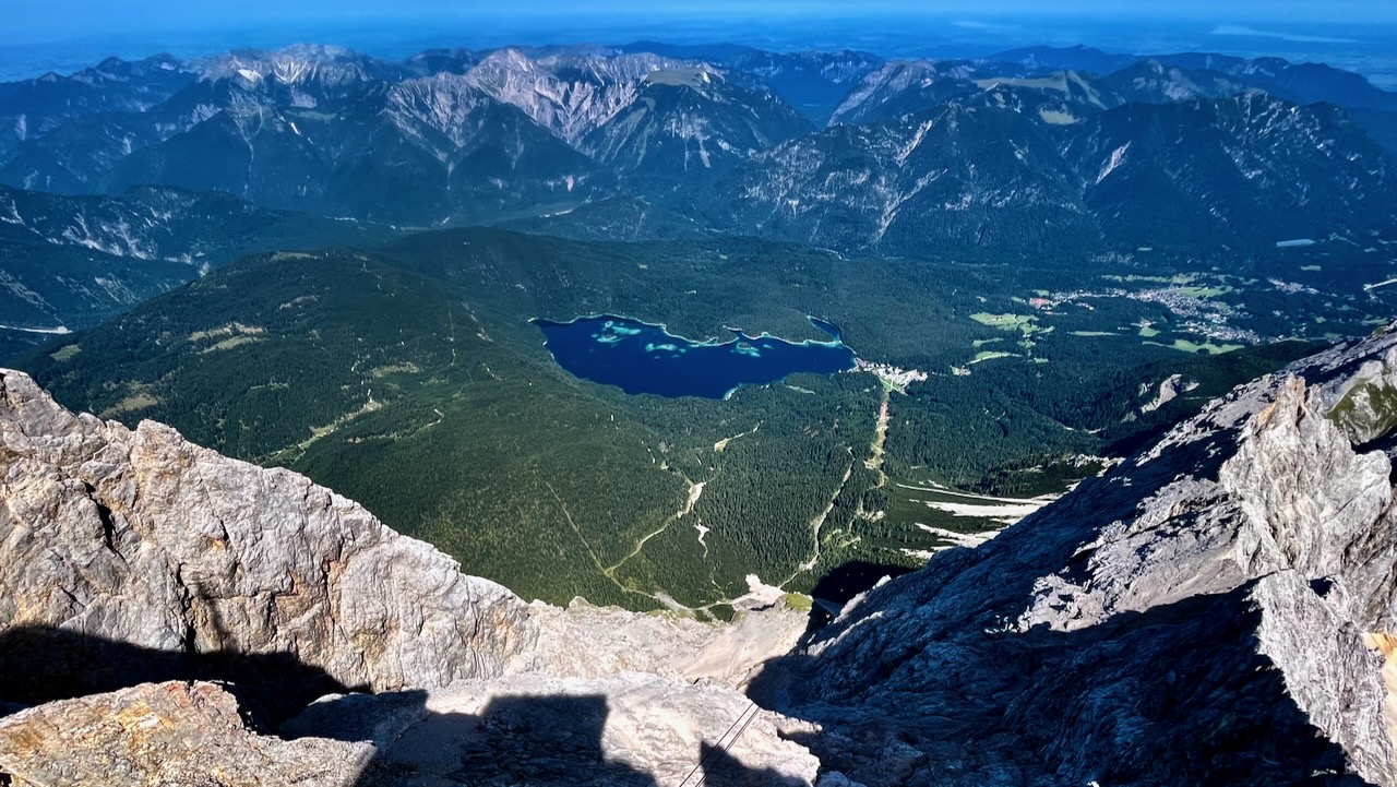
And like many others, I went directly to Eibsee on getting back to the base of the big mountain.
Gorgeous colours from certain angles.
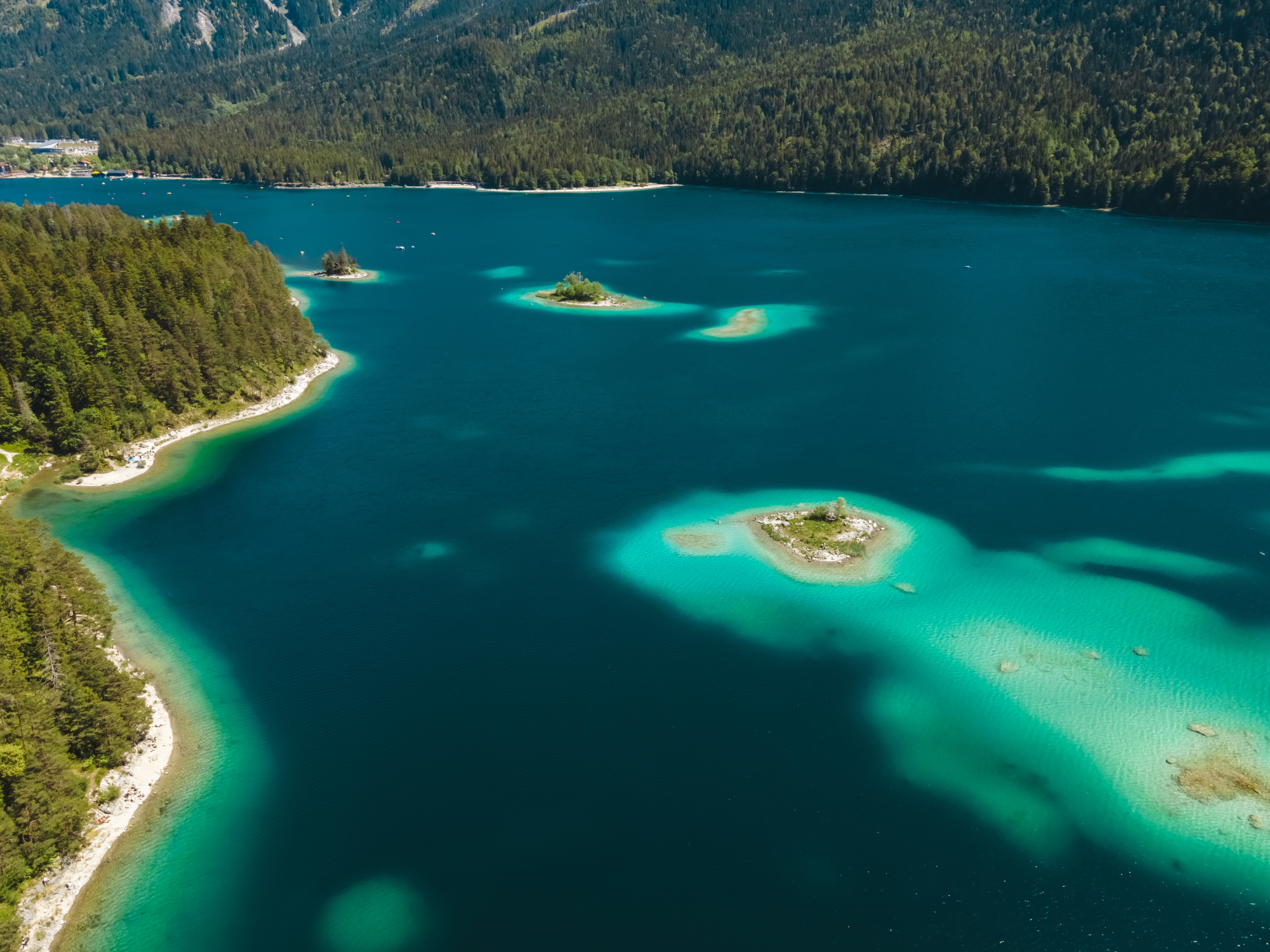
AllTrails – 7.2-km Eibsee Loop. About 2 hours.
Trip report by BestHike editor Rick McCharles
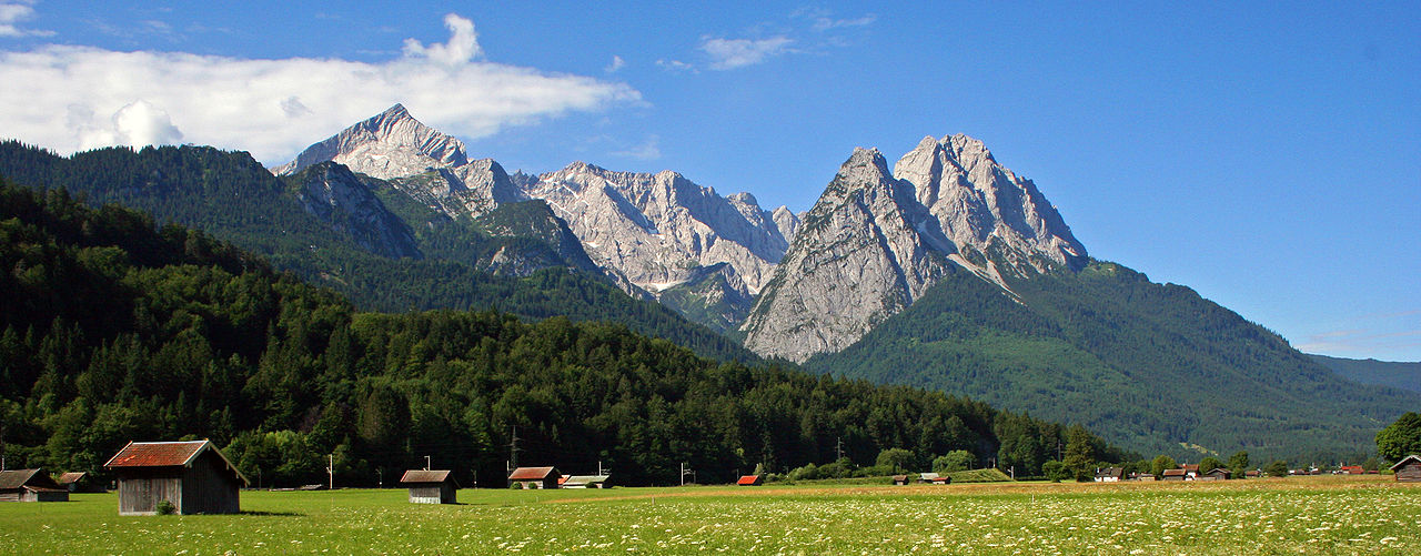
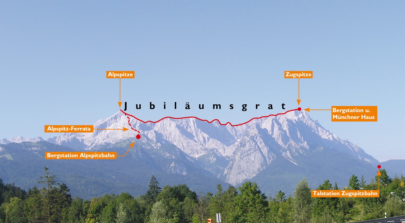
The Alpspitze is a mountain, 2628 m, in Bavaria, Germany.
Its pyramidal peak is the symbol of Garmisch-Partenkirchen and is one of the best known and most attractive mountains of the Northern Limestone Alps.
Click PLAY or get a glimpse on YouTube.
I cycled from my campground early morning.
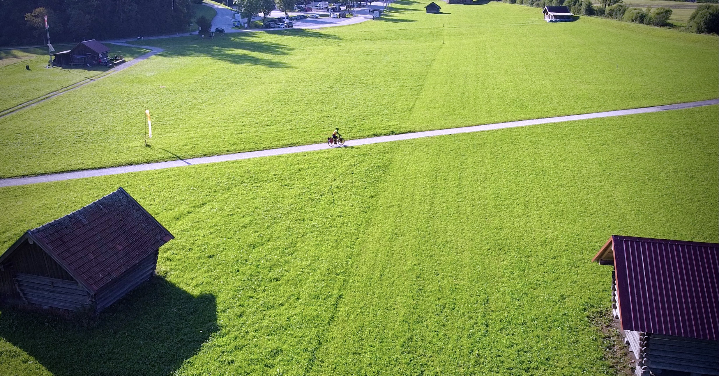
There are a number of ways up and down.
I chose to take the Alpspitze cable car up. Hike down.
Arriving at the top, I was surprised to see that most of the morning crowd was made up of climbers. Many were taking the Alpspitz Ferrata (or Alpspitze Klettersteig) to the top.
Many tourists chug up to the top of Zugspitze, next door. The highest mountain in Germany. And don’t bother with Alpspitze.
Both are good. But there’s much more and easier hiking on Alpspitze.
I quite enjoyed the long walk down.
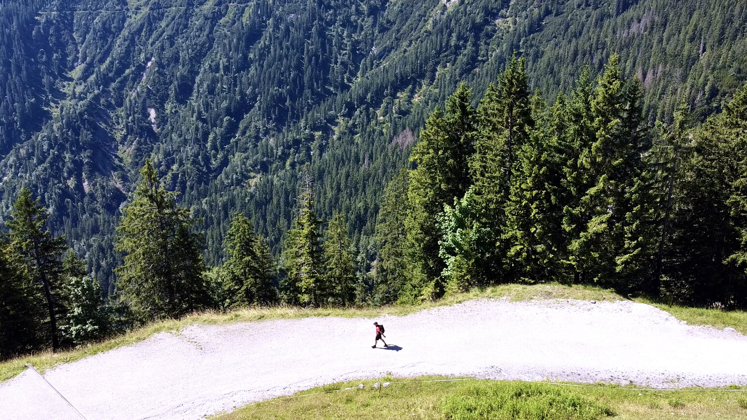
It’s fun to watch the many paragliders. Most exit from lower on the mountain.
Best hike Alpspitze?
Depends on the weather. What you are looking for.
I’d say best is to either hike up, ride down. Or the opposite, as I did.
Trip report by BestHike editor Rick McCharles
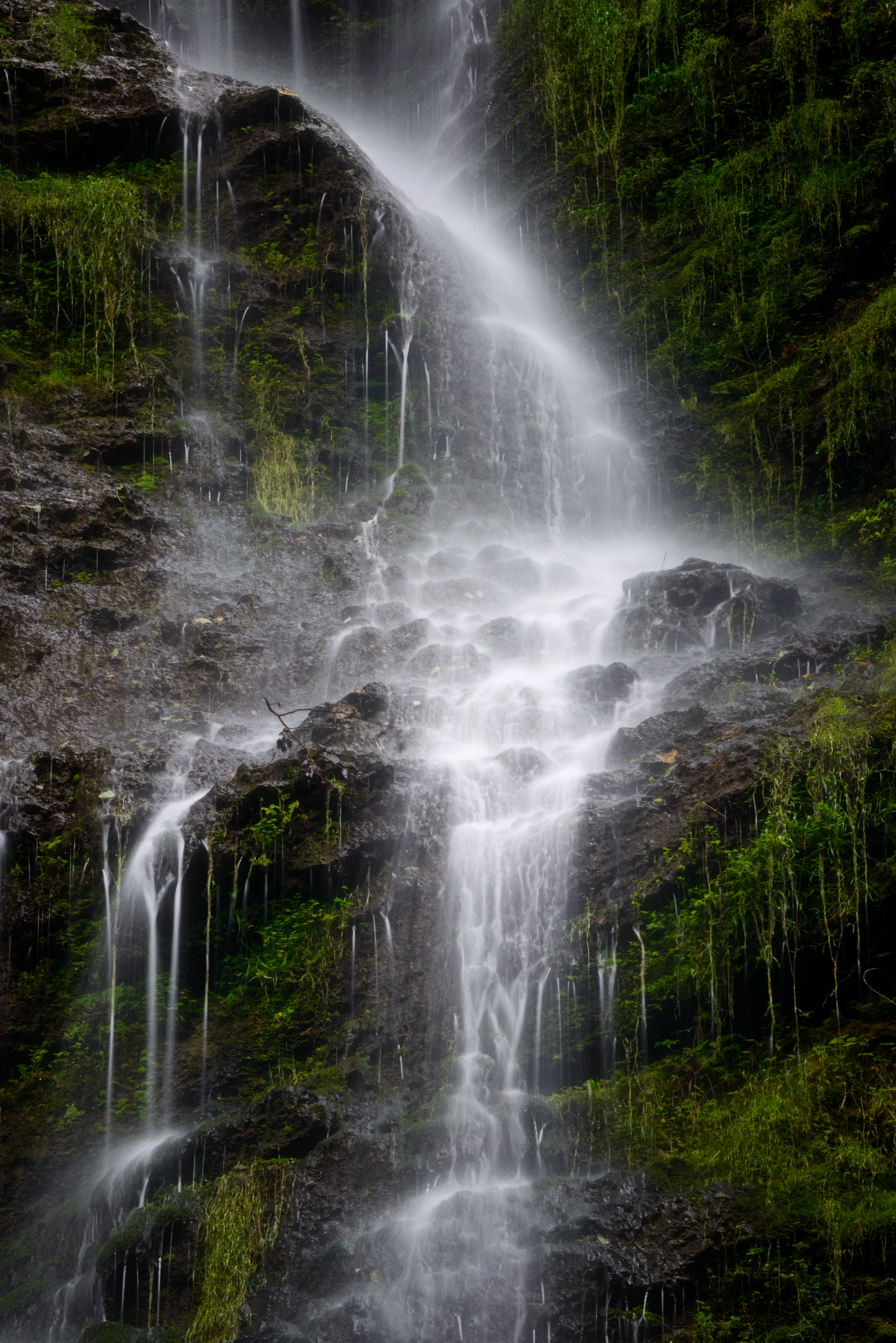
Like nearby Höllental Gorge, this walk through a narrow canyon is wet, dark, and cool.
A nice escape on a hot summer day in Garmisch-Partenkirchen.
You should probably bring a raincoat.
Click PLAY or get a glimpse on YouTube.
It’s popular. Narrow. And crowded.
Best go early or late in the day.
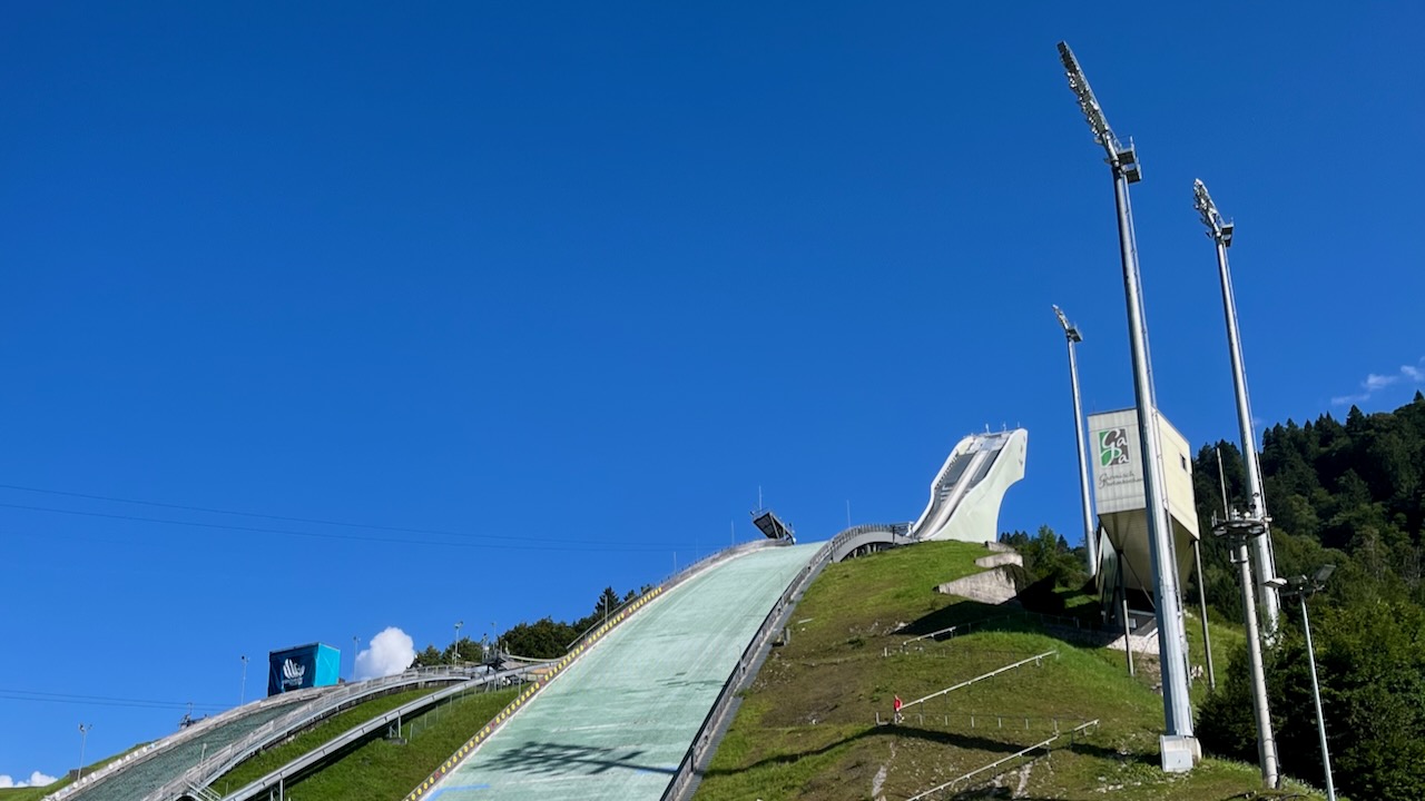
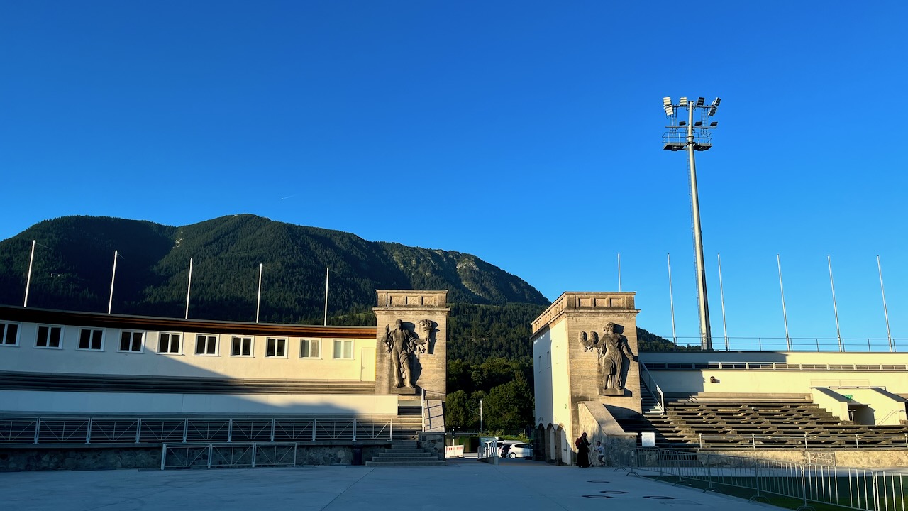
Easy access from near to the 1936 Olympic ski ramp in Garmisch-Partenkirchen.
There’s a small fee to enter the gorge. Well worth it.
I was surprised at the challenging uphill climb going into and out of tunnels.
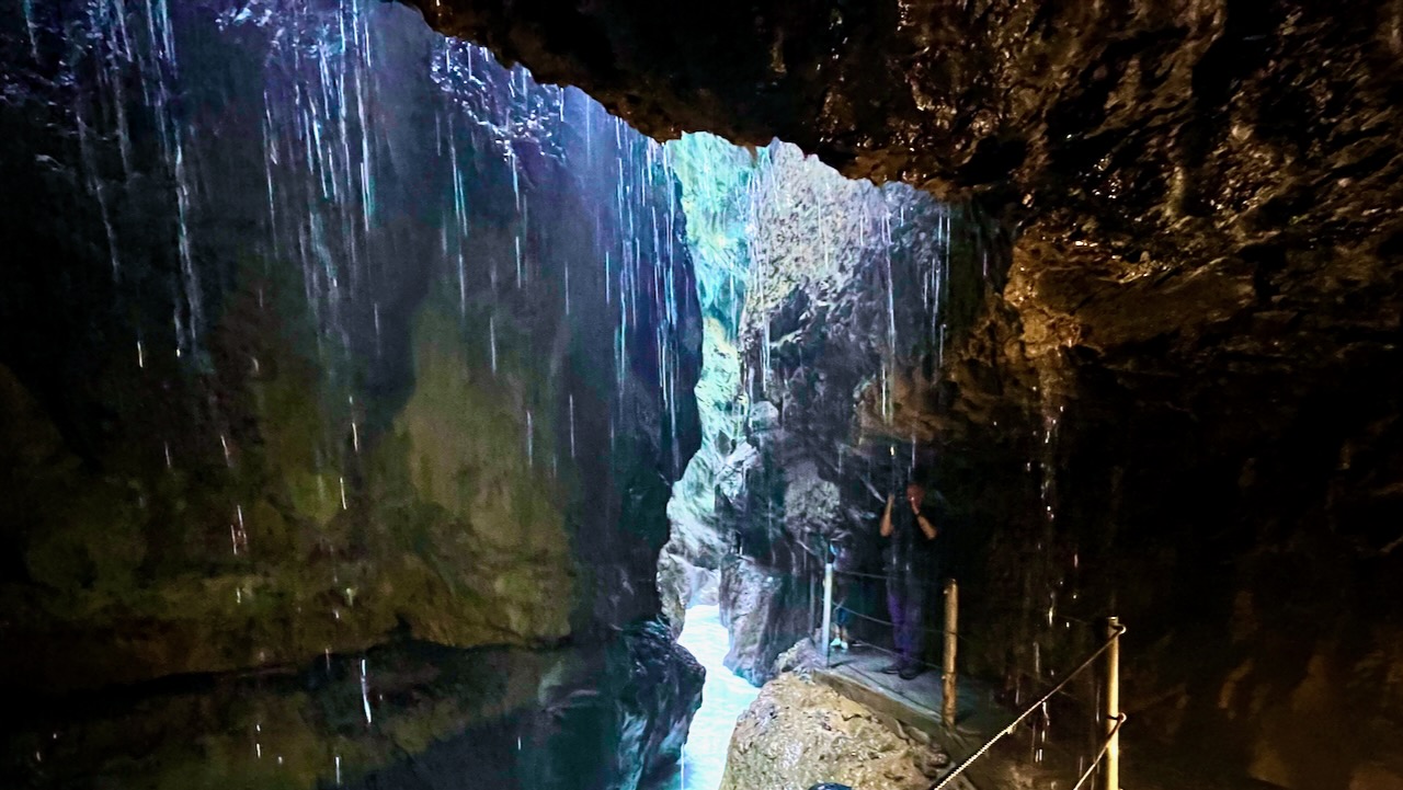
In fact, I was worried for some of the elderly tourists and small children. The footing is rough.
I was tempted to backtrack through the gorge as it is amazing — but instead returned to the start on a trail up above the gorge.
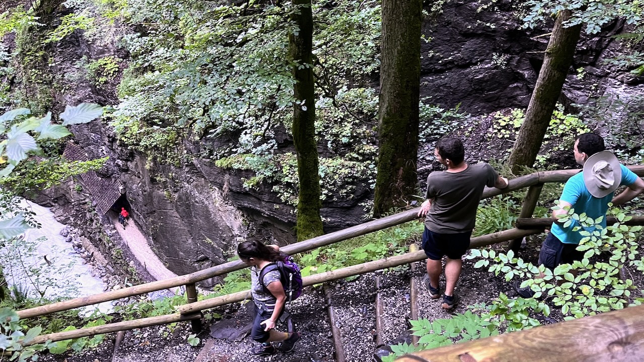
Again, it was surprisingly challenging.
There were warning signs, including one stating a bridge was closed. I crossed it anyway, as did everyone.
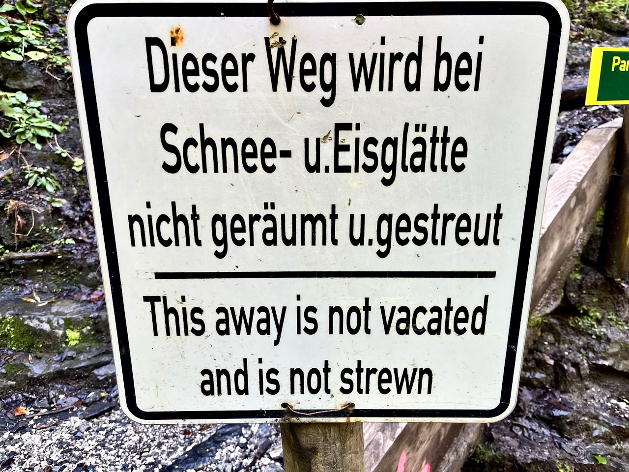
Luckily, you don’t need to read German as the signs were translated. 😀
Don’t miss Partnach and Höllental gorge walks if you get to Garmisch-Partenkirchen.
