Larry Smith of AeroVestâ„¢ asked me to test their ultralight, air inflated survival vest.
It works exactly as advertised. I highly recommend this product. And it’s very inexpensive at $15.
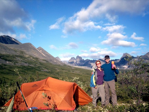
I tested it in the Tombstone mountains in the Yukon, not far from the Arctic Circle, inflating the vest in the evening and then sleeping in it all night. (This is me the following morning.)

As you can see, I survived.
AeroVest Survival Vest
The 2 oz. AeroVestâ„¢ is compact, lightweight and inexpensive insurance against emergencies. It packs up smaller than a deck of cards yet inflates into a full sized emergency vest that shields you from wind and rain. The silver lining refects radiated heat back to you while the 18 air pokets insulate you from the cold. …
* 18 air pockets help keep heat in, cold out.
* Your 98.6 degree breath provides instant warmth
* Bright Yellow/Orange exterior for increased visibility in an emergency
* AeroVestâ„¢ comes in a single size that can fit teens and adults up to XL (men’s 46 jacket)

It’s not necessarily something you need to add to your basic hiking kit — but the AeroVest would be ideal for a hiker to keep in the trunk of a vehicle, in a boat or at the cabin. Any place in fact where hypothermia is a risk.