Trip report by BestHike editor Rick McCharles
I arrived Sicily from nearby Malta.
PLAN was to climb Mount Etna, the tallest active volcano in Europe, and one of the most active in the world, currently 3,403 m (11,165 ft) high.
I figured it would be an easy day trip after Kilimanjaro.
Should have done some research. Summit trekking peak tours of Etna generally operate from April through November, with the main hiking season starting around May.
I arrived late March. There was a LOT of snow, even around 1900m. It can be 10–15°C cooler than in Catania. Many tourists arrive underdressed. And with footwear better for the beach than snow. 😀
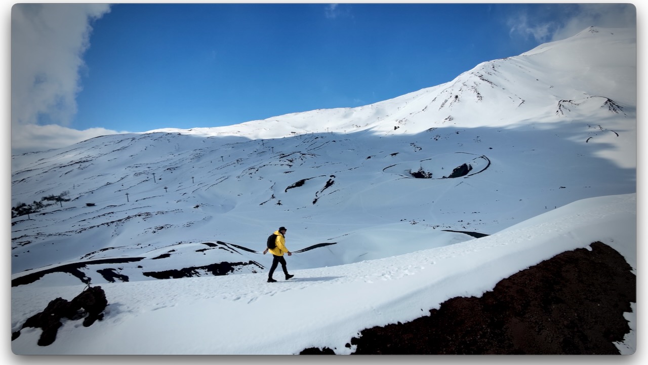
Volcanic rock is somewhat sharp. It can cut flip-flops. I wore approach shoes and was OK on the snow and ice. Coming from Canada, this was normal for me. I didn’t see anyone using any kind of ice cleats.
They ski and snowshoe here. There are 2 small ski resorts.
I’d flown into the jumping-off point for Etna, the city of Catania.
There are dozens of options for day hiking Etna, from dozens of companies. It’s confusing.
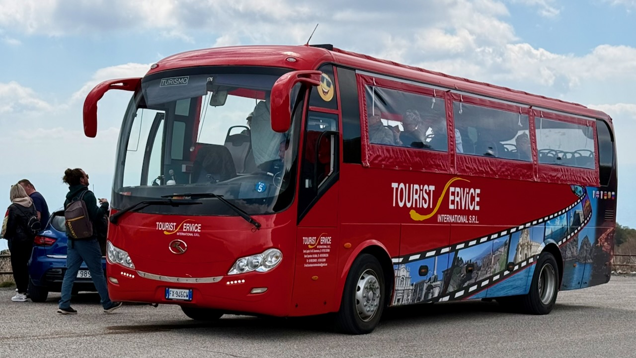
My hostel recommended a day trip by bus offered by Tourist Service for €30, discounted from a posted €35 regular price. Since their office was right next door to my accommodation, I signed up.
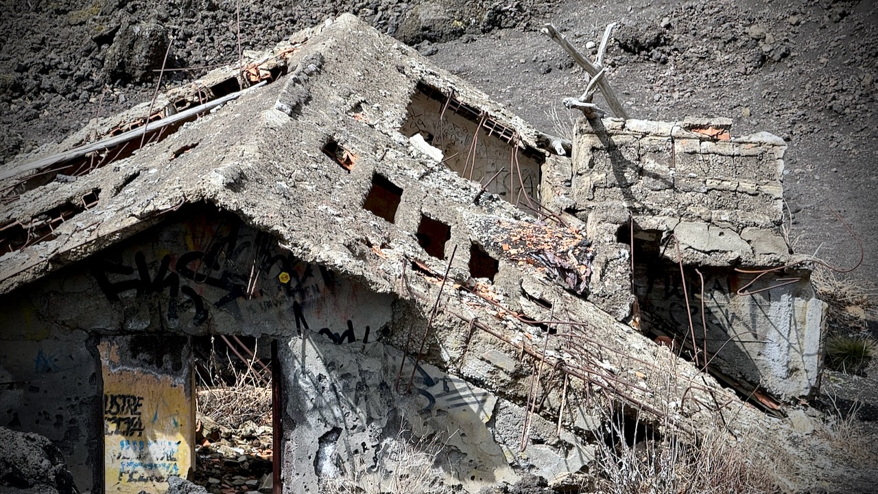
It’s about 2 hours (with traffic) to Etna from the city. On the way up, we stopped to see a recent example of eruption damage. Yikes. This mountain has killed a lot of people over the centuries.
Bus delivered us to Rifugio Sapienza at around 1900m on the more popular south side of the mountain. A bit of a tourist trap. The north trailhead (Piano Provenzana) is better for offers wilder hiking trails and fewer crowds.
From Sapienza you can take a cable car up to 2500m. It’s expensive at €54 return when I was there. And you can hire a 4×4 contraption to pay even more. Guides are required at higher elevations.
I opted to stay close to the Rifugio Sapienza trailhead, saving my money for a summit climb some time in future.
There’s an additional €5entry fee for the Silvestri Craters on the south side. Well worth it. The highlight for me.
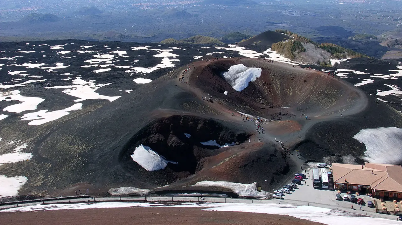
It’s only about 1km to circumambulate all 5 craters — but they are scenic.
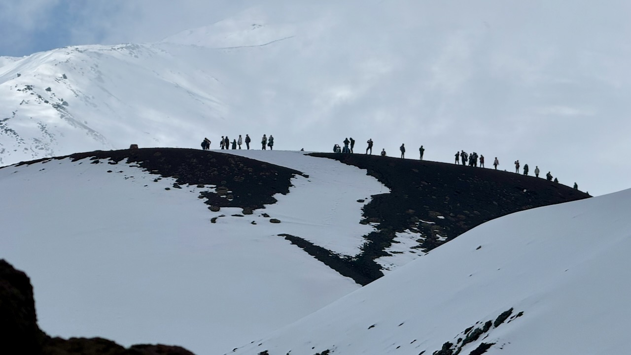
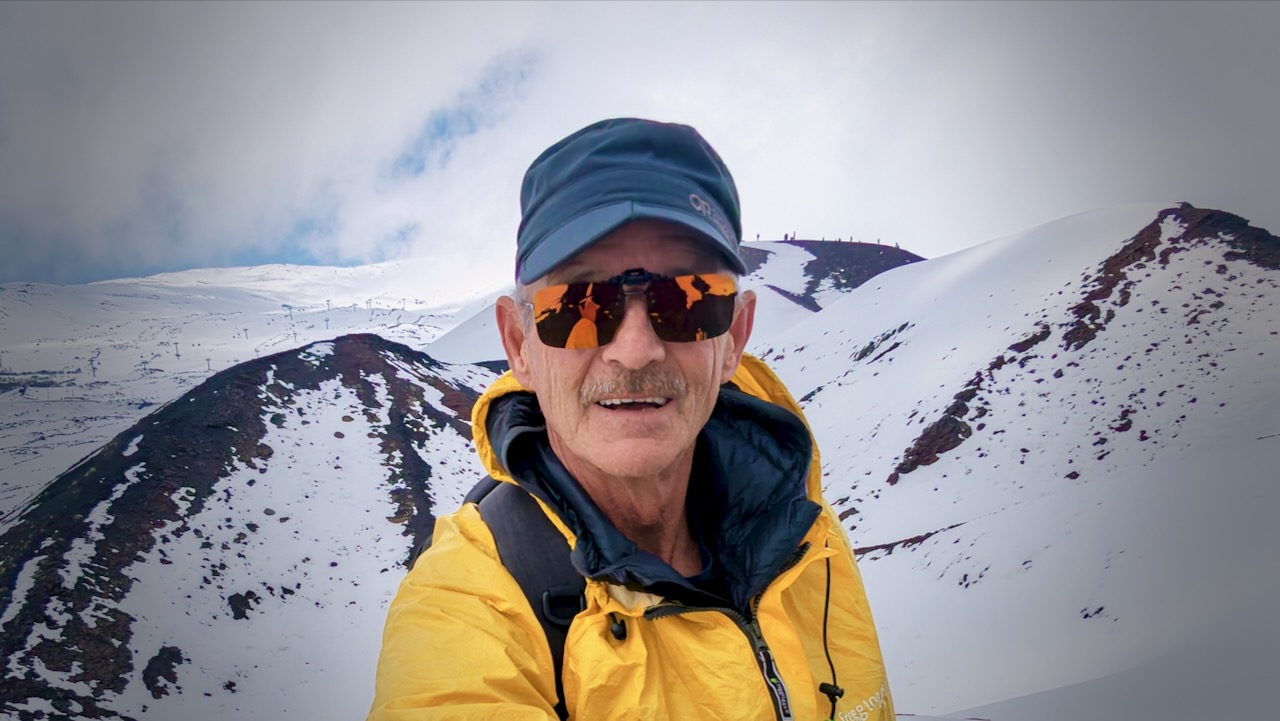
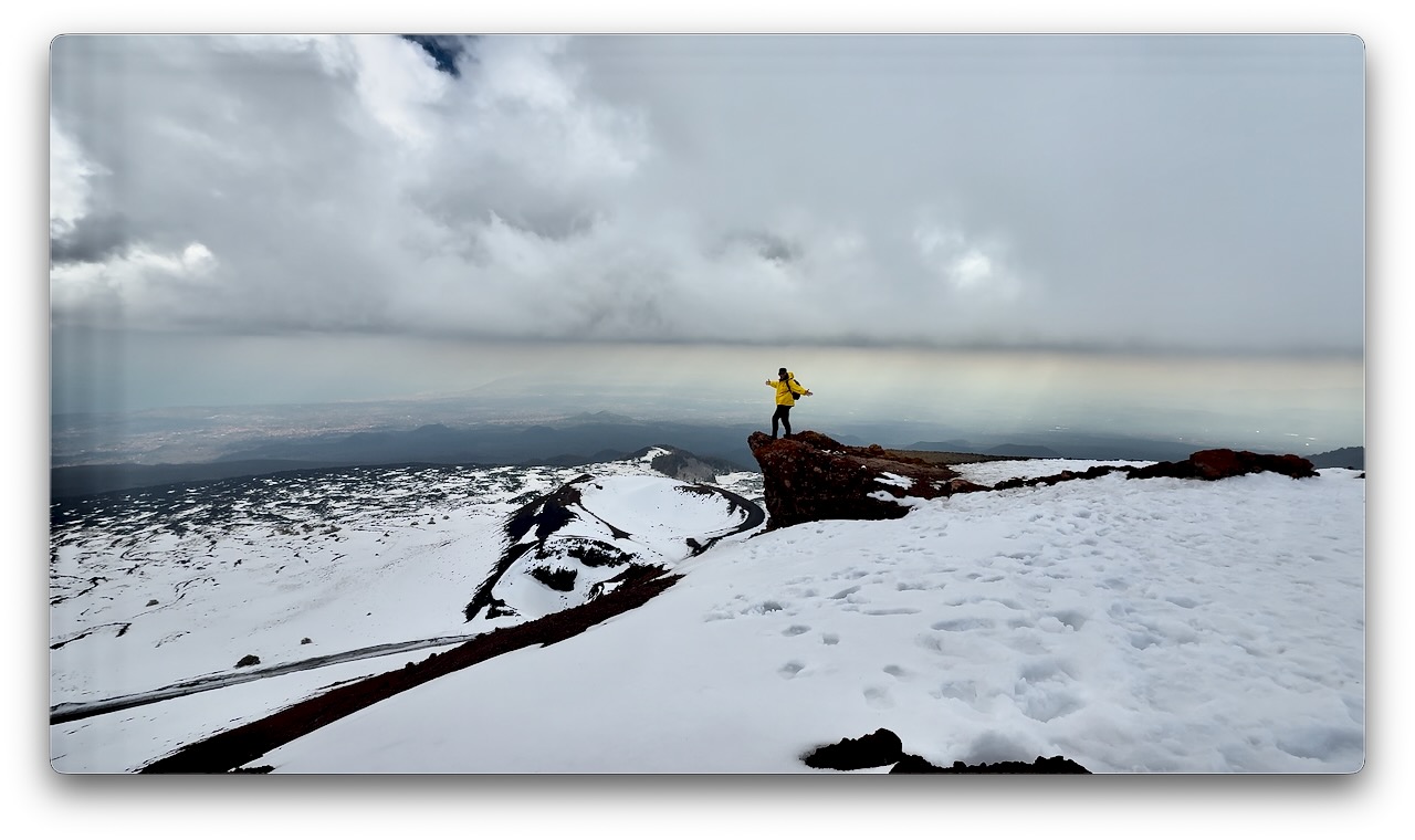
With an hour left before my bus departed, I climbed the most conspicuous cone.
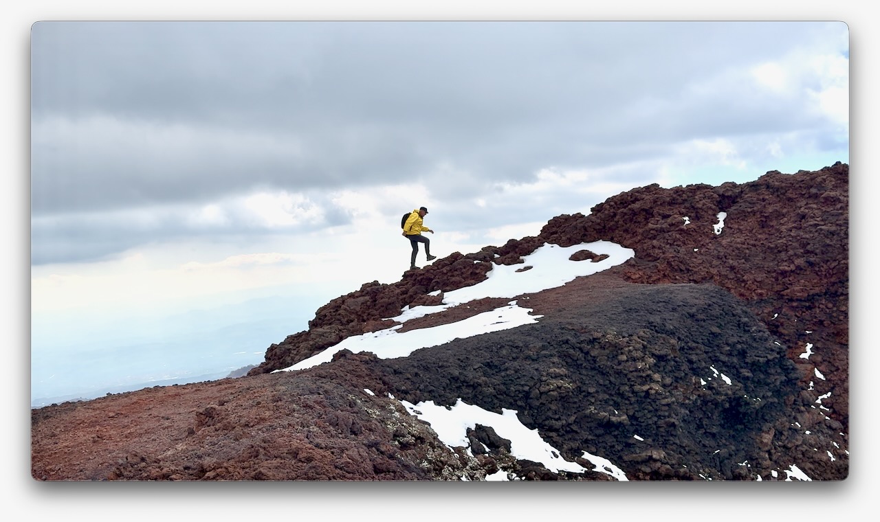
Had the top to myself for about 20 minutes.
Driving your own vehicle to Rifugio Sapienza is a good option. And there’s a public bus €6.60 return — but it leaves Catania very early. Returns very late. I assume that service runs mainly for employees.
related – Visiting Mount Etna | Everything You Need To Know Before the Hike
Click PLAY or watch a 1-minute highlights video on YouTube.