many U.S. Parks FREE June 5-6th

GET OUT THERE.

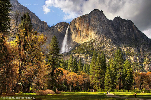
… June 5 and 6, more than 100 parks will throw open their gates and waive the entrance fee to all guests.

The complete list of parks that will be free next weekend can be found by clicking here …

Kraig Becker – Gadling – All U.S. national parks free next weekend

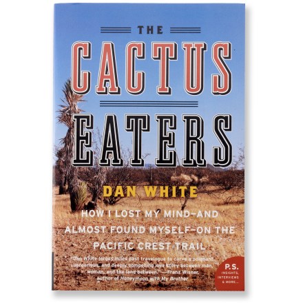
book review – The Cactus Eaters

How I Lost My Mind–And Almost Found Myself–On the Pacific Crest Trail

Excellent.

Traversing broiling deserts, snowy mountain passes and dank rain forests on its crooked way from Mexico to Canada, the Pacific Coast Trail is an epic challenge for die-hard backpackers. White and his girlfriend, Melissa, set out, late in the season and bereft of experience, to tread all 2,650 miles of it, leaving behind lousy reporting jobs and hoping to find self-definition and a deepened relationship. (They call their trek the Lois and Clark Expedition.)

Hilarious greenhorn misadventures ensue—including the author’s ill-advised chomp, while dizzy with dehydration, into a reputedly moisture-laden prickly-pear cactus—that tested their survival skills and commitment as a couple. …

Amazon

This book reminded me of both A Walk in the Woods and A Blistered Kind of Love: One Couple’s Trial by Trail.

It confirmed the certainty that I would never do a thru hike with any partner.

The biggest question I had as the sorry tale unfolded … Will Melissa come to her senses and finally dump this loser?

related – Brad Wieners and his wife Mary – Couple’s Therapy via Adventure Racing

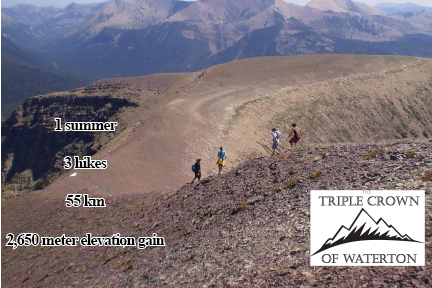
Triple Crown Hikes in Waterton this summer

by site editor Rick McCharles


3 hikes
up to 55km
2650m elevation gain

I can’t resist. Waterton is the best kept secret in Canadian hiking. Tourists flock to Banff in the Rockies, leaving Waterton National Park to us local insiders.

I’m going to complete the Triple Crown myself and get my name on the Glory Board.

Crypt Lake (9km), Akamina Ridge (20km) and the Alderson-Carthew Summit (16km) in one summer.

I’ll do the 3 during one trip, I think. Either end of June. … Or in August.

I’ve done Crypt and Alderson-Carthew in the past. But never Akamina. It looks great.

Details on ExperienceWaterton.com.

Leave a comment if you want to use the Triple Crown challenge as an excuse to get your butt to Waterton.

hiking Boardman Park, Oregon

trip report by site editor Rick McCharles

Astonishingly, Oregon has kept it’s coastline mostly undeveloped.

… 1967’s Oregon Beach Bill allows free beach access to everyone. This Bill allows private beach landowners to retain certain beach land rights, but it removes the property tax obligation of the beach landowner. In exchange, the beach landowner grants an easement passage to pedestrians. …

Wikipedia

But where’s the best place to hike that pristine coast?

hiking Boardman State Park, Oregon

For some reason the authors of Lonely Planet HIking USA directed me to Samuel H. Boardman State Scenic Corridor, close to the California border:

Dramatic sea-stacks, arches and offshore islands seen on this short, down-and-back day hike … are one of Oregon’s best kept secrets …

5.4mi (8.87km)

I drove to the Arch Rock trailhead, locking up my mountain bike to a railing. …


larger map (PDF)

… Then drove to the Natural Bridges trailhead to start the hike.

It is gorgeous. Here are a couple of the many “natural bridges”.

Natural Bridges Cove - Boardman State Park, Oregon

hiking Boardman State Park, Oregon

This “hike” is a series of steeply dropping trails that then backtrack up to the highway. You might drop down to see a secluded beach …

hiking Boardman State Park, Oregon

… or a minor waterfall.

waterfall - Boardman State Park, Oregon

The lush vegetation I liked.

hiking Boardman State Park, Oregon

But the trail itself sometimes returns all the way to paved highway! Dislike.

hiking Boardman State Park, Oregon

I’d not call this a best hike. For once Lonely Planet gets it wrong.

The strategy for Boardman is to drive (or cycle) to each trailhead in series. Then hike down and back each.

I’m still looking for the best long section of the mythical Oregon Coast Trail. Leave a comment if you have advice.

falling to fly, not falling to die

Dean Potter is one of the most interesting extreme athletes in history.

Death wish? … Or does Dean have it all figured out?

Dean Potter is characterized by creativity, commitment and challenge. He started climbing as a child, with a free solo fall from a stone wall as one of his earliest memories. Since that time, he has speed soloed Half Dome and El Capitan, Cerro Torre, and Fitzroy. He was the first to make a one-day free ascent of El Cap and Half Dome, and a one-day speed linkup of both of those big walls and Mount Watkins, Yosemites third Grade VI wall. He has also established testpiece crack routes in the Utah desert and highball boulder problems in Yosemite.

Dean has walked the longest highlines, often without a safety leash, though he has dedicated over a decade of engineering and testing to create the safest highline systems currently used. Most recently, he has combined BASE jumping skill with highlining and free soloing, using a specially engineered ultralight BASE rig as his backup system. …

Click PLAY or watch it on YouTube.

hiking the Oregon Dunes

trip report by site editor Rick McCharles

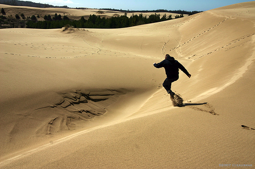
I’m please to report I finally got there.

photo by Artbandito

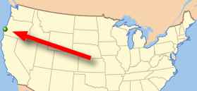
The Oregon Dunes National Recreation Area (or NRA) is located on the Oregon Coast, stretching approximately 40 miles north from the Coos River in North Bend, to the Siuslaw River, in Florence. …

… a unique area of windswept sand that is the result of millions of years of wind, sun, and rain erosion on the Oregon Coast. These are the largest expanse of coastal sand dunes in North America. Some dunes tower up to 150 meters above sea level, providing numerous recreational opportunities …

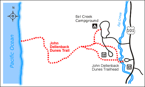
There are plenty of places to get on the dunes, but best for hikers is the John Dellenback trailhead at the Eel Creek Campground.

At a wild guess, I hiked about 5mi (8km) on this route.

Only hikers and leashed pets are allowed on this part of the dunes. (Others are swarming with off-road vehicles.)

Oregon Dunes - John Dellenback Trail

The rough trail is marked, yet it’s still difficult to find the Pacific Ocean. Look for some sort of gap in the coastal foliage:

Oregon Dunes - John Dellenback Trail

The wild Oregon coast. Gorgeous.

Oregon Dunes - John Dellenback Trail

Wonderful, wonderful … the Oregon Dunes are definitely one of the best hiking destinations in the world.

Oregon Dunes - John Dellenback Trail

more photos from my day hike

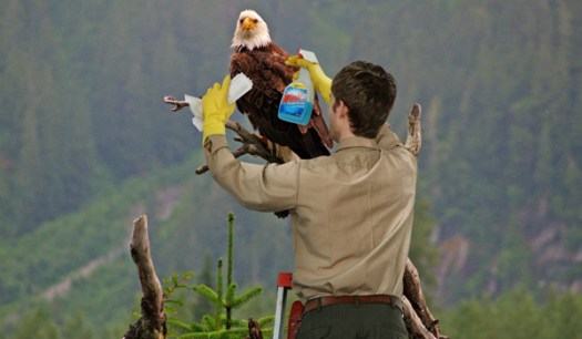
National Parks Closed For Annual Remajestification

Don’t you just love, The Onion?

… With their current condition “marginally breathtaking at best,” America’s national parks will be closed this week for their exhaustive annual cleaning and remajestification, the U.S. Department of the Interior announced Monday.

“It’s that time of year again when we roll up our sleeves and begin the painstaking task of resplendoring our parks,” Interior Secretary Ken Salazar said …

read more – National Parks Closed For Annual Remajestification

_____

… perhaps related:

My flippant proposal to privatize Parks, due to one terrible road sign, resulted in some interesting comments.

hiking the eastern Eastern Sierra

Last June I tried hiking Kearsarge Pass in the Eastern Sierra Nevada, California.

I didn’t get very far. The snow on the trails was too deep, even at fairly low elevation.

This year I was there even earlier, in mid-May. (When will I learn?)

Older and wiser, I stopped by the Inter Agency Visitor Center in Lone Pine (where you pick up Whitney permits) … and looked for the eldest, wisest Ranger. He instantly knew where to send me when I asked,

“Where’s the best hike … TODAY?”

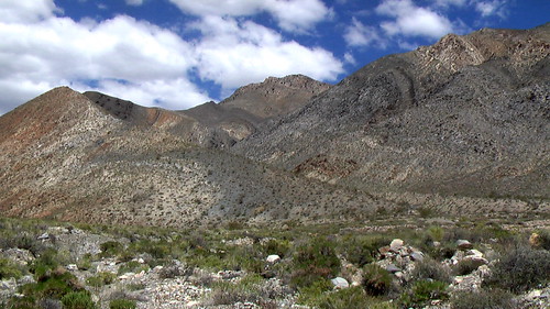
Immediately he gave me directions to an unmarked hiking area on the eastern side of Highway 395. The mountains on the Nevada side were mostly clear of snow.

hiking the eastern Sierra Nevada

The trails were rutted ATV and jeep tracks, so I took off cross-country to the top of the nearest peak.

Check out the views of Mt. Whitney across the valley.

Rick hiking the eastern Sierra Nevada

My half-day hike was fun. And challenging, actually. I decided on a slightly more adventurous descent via this water course.

hiking the eastern Sierra Nevada

Lesson learned – seek expert local knowledge before you go off hiking. It worked for me.

The only other hike I’ve ever done in the eastern Eastern Sierra was Mt. White, with 4WheelBob. (PHOTOS) (VIDEO)

hiking the Grand Canyon is EASY

trip report by site editor Rick McCharles

The most popular overnight hikes in the Grand Canyon require a permit for the Bright Angel campground.

I didn’t have one. You need reserve 4 months in advance!

So first stop was the National Park South Rim Backcountry Office.

Rick at the Grand Canyon

Here I got a number (#4), some paperwork, and instructions to be standing in front of the door next morning when it opened at 8AM.

Happily that worked. I snagged a last-minute camping permit for departure the following day. Of the 3 buses to the Kaibab trailhead, I took the latest, 7AM.

My plan: descend the Kaibab Trail, camp one night, ascend the Bright Angel Trail. That would bring me back to my parked vehicle.

Here we are at the South Kaibab Rim Trailhead 7:30AM.

hiking the Grand Canyon

It’s a Switchback marathon, but worth it, I thought, as the trail follows a ridge crest right to the bottom. Great views!

hiking the Grand Canyon

I was there in early May, wildflowers a definite highlight.

hiking the Grand Canyon

hiking the Grand Canyon

It was an easy 2hr descent to the river. Why does my guidebook call it 5-6 1/2 hours?

hiking the Grand Canyon

By 11AM I was in my tent. Siesta time.

hiking the Grand Canyon

At Noon I headed over to the nearby Phantom Ranch. Ordered a coffee and read a picture book on the reintroduction of the California Condor. A success story, so far.

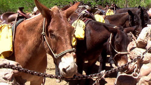
These locals didn’t have much to say. They stood in the sun, silent.
hiking the Grand Canyon

The most exciting animal I saw was a bushy tailed fox, slinking through Phantom Ranch at dusk. His regular route, I was told.

Already feeling some kind of a wimp, finished hiking so early in the day. I felt even worse after talking to this character.

hiking the Grand Canyon

On an 800mi Arizona Trail bike race, he’d been required to carry the bike through the National Park.

What to do with the rest of my afternoon? …

I was tempted to dash up to the North rim and back with just a day pack. But one toe had taken some damage, jammed into the front of my shoe on the descent.

Instead I did a short, intensely scenic day hike, a loop around the two bridges.

I had time to stop and smell the flowers.

hiking the Grand Canyon

hiking the Grand Canyon

I spent a fair bit of time waiting on one of the passing rafts to overturn.

hiking the Grand Canyon

No luck.

After having lunch with these Mulies, I entrusted them with a secret. …

hiking the Grand Canyon

It had amused me to place a Summit Stone conspicuously under the Bright Angel bridge. The anti-summit, the very lowest point on my rim-to-rim hike.

Next morning I left in no hurry. The Bright Angel Trail is much easier than Kaibab South, though longer.

hiking the Grand Canyon

It’s green. And lush, in the Spring. With plenty of shade and water.

hiking the Grand Canyon

Again I felt personally lazy … after watching these trail runners buzz by.

trail runners in the Grand Canyon

Marathon runner Margaret Bradley died doing exactly the same thing in 2004, but on a lesser used trail. It was July, not May.

In fact, a number of people die in the Grand Canyon every year. If worried, stay home, and read Over the Edge: Death in Grand Canyon, instead.

Mine was a wonderful hike, my first in the Grand Canyon.

Next time I’ll do something much more challenging
. Perhaps rim-to-rim in one day, taking the shuttle back to my vehicle. No permit required.

But I won’t hike in Summer. No way. I don’t want to collapse like George Novak did. That would be embarrassing. My reputation as a best hiker would be ended.

See the rest of my photos from this 2-day hike.