Harding Icefield Trail, Alaska

Hank Leukart is in Alaska.

HOW TO HIKE THE HARDING ICEFIELD TRAIL

OVERVIEW: The Harding Icefield Trail is an 8.2-mile, 5-hour hike round trip with a 3,150-foot elevation gain. Hiking conditions are best from June to September. Early in the season, about half of the trail is covered in snow, but hikers with boots will have little problem walking through it.

DIRECTIONS: Kenai Fjords National Park is about a three-hour drive, south of Anchorage, Alaska. …

ROUTE: Even in the snow, the trail is well-marked with signs and orange flags. …

details on Without Baggagewhere days last forever.
… exploring the land of the midnight sun.

more photos

scrambling Mt Remus, Alberta

Great day.

Evidence we made the summit – Amber writing us up in the summit log.

summit log

Of our group of five hikers, three were gymnasts. Here’s Krista celebrating the summit.

Krista - handstand - Remus summit
_____

We cycled in 6.5km (4mi), then had trouble finding the small cairn marking the start of the rough path to the river crossing. Our experience was exactly that posted on peakware:

Description – by Dow Williams:

Mount Remus is part of the horseshoe shaped Fisher Range at the front end of Kananaskis Country in the Elbow-Sheep Wildland Provincial Park.

Kananaskis Country is a maze of provincial parks which encompasses over 4,000 square kilometers of foothills and mountains bordering Banff National Park in the central Canadian Rockies.

Mount Remus starts one end of the horseshoe and Mount Fullerton the other. In between lies Mount Romulus and Fisher Peak. Mount Remus was officially named in 1940 along with Mount Romulus after the legendary twin brothers and founders of Rome.

Remus summit

The only published route up Mount Remus is the moderate to difficult scramble up its eastern slopes to its summit block. The guide book determines the chimney up the center of the summit block to be difficult with an optional moderate approach from the north. I found the chimney did not present a difficult challenge and rate this scramble moderate at most.

IMGA0718.JPG

The most challenging aspect of the day involves crossing the Little Elbow River. This aspect of the trip more than likely explains why there is no trail and few, if any, cairns, thus little evidence of any traffic up this mountain. …

read more on peakware

IMGA0664.JPG

IMGA0669.JPG

Most fun was screeing and glissading descents. Here’s my butt track after I discovered tobogganing was even easier.

IMGA0747.JPG

more photos from this great day hike

related post – biking hiking Banded Peak, Alberta

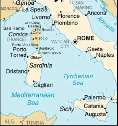
hiking Mediterranean islands …

I’m ruminating on a series of hikes for this Fall:

Cinque Terre in northern Italy → CorsicaSardiniaSicily → …

I’d take ferries from one to the next, I assume.

Leave a comment if you have any advice for me. I’ve never hiked this region before.

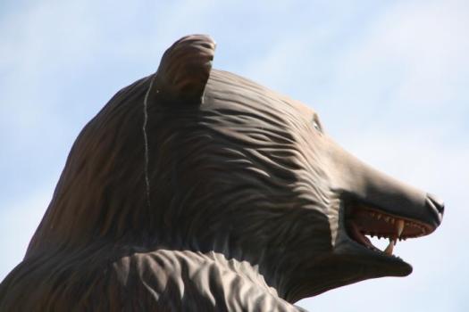
hike the Bear’s Hump, Waterton

A classic day hike in southern Alberta is the Bear’s Hump, overlooking Waterton townsite.

My favourite memory was a race to the top when I was much younger and much more reckless.

We were showing off the beautiful Rockies to Kate, from Ottawa. She’s been happily married to this guy, ever since.

Shewchuk

Rating – Moderate to difficult (but well worth it)!

Distance – Approximately 1.5 kilometers

Elevation Gain – 240 meters (787 feet) … oh yeah, this is steep!

Number of Switchbacks – 18

Duration – 20 minutes – 50 minutes one way (depending on the number of breaks you take).

The hike is short but steep and most people in fair condition can make it up in 40 minutes (even my Pekingese dog made it to the top).

Click through to see a map and slide show from a Fall hike on Scenic Travel Canada.

related post – Triple Crown Hikes in Waterton this summer

Lost City Trek, Colombia

Jessica Crump of GetUp&GoFilms sends us a link to a movie trip report.

Without question this is one of the best hikes in the world. In Spanish it’s called Ciudad Perdida.

5 days, 50 kilometers, Mountains, Jungle, Rivers…

Discover the sacred city of Tayuna in the Sierra Nevada of Santa Marta Colombia.

I was there about 15yrs-ago. Seems very little has changed.

Click PLAY or watch it on Vimeo.

details on our Lost City Trek information page

No independent trekking is allowed. Contact Sierra Tours for details on a guided adventure.

hiking Havasu Falls, Arizona

It’s not easy to get to the trailhead …, but nobody can deny that Havasu is one of the most beautiful waterfalls in the World.

Click PLAY or watch a Beautiful Places In HD profile of the Grand Canyon on YouTube.

Havasu Falls is only the second of a series of Havasu Creek cascades.

photos tagged “havasu falls”

UPDATE – Trip Report by Tim Miner:

Absolutely, the best hiking experience I have ever had! Waterfalls, steep canyons, caves, mules, did I say waterfalls! The Havasupai Indian Reservation is not part of the Grand Canyon National Park, but you cannot tell that from the scenery. From your very first step at the trailhead parking lot until your return at the end of your trip, you will be swiveling your head side to side to take it all in. …

Trail Sherpa

Cape to Cape Track, Australia

Ross Sanders out of Perth is a big time hiker. (He’s done 325km of the 965km Bibbulmun Track.)

Ross recommends:

Name : Cape to Cape Trail – 135km. (map)
Location : South West Coastal Region of WA

I have recently completed it and it is ABSOLUTLEY brilliant.

You can do it in 5-7 days. The guidebook is A$22.00.

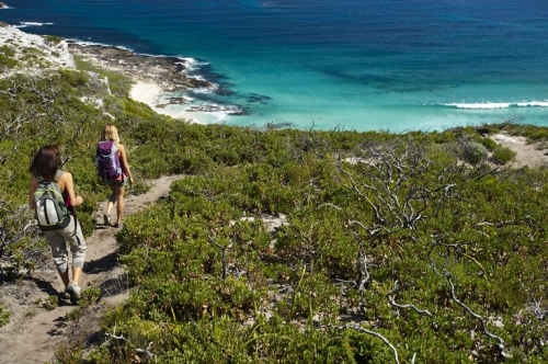
… The Cape to Cape Track is situated in the far south western corner of Western Australia. It runs for 135 km along the spine of the Leeuwin-Naturaliste Ridge, through the Leeuwin-Naturaliste National Park, between the lighthouses of Cape Naturaliste and Cape Leeuwin.

The Track mostly follows the coast, alternating spectacular sweeping cliff-top views with stretches of pristine beach. There are several inland loops however, which take in some lovely sheltered woodland sections as well as the magnificent Boranup karri forest. Fascinating geological features, such as cliffs, caves, headlands and rock formations can to be seen along the way, and the vegetation and wildflowers present an ever-changing display. …

“About the Track”

more information – Cape to Cape Track


You can sign on a guided hike, if you prefer.