Not albino.
SenecaWhiteDeer.org is a site dedicated to preserving a unique herd of white deer in Seneca County, New York State.

(via New York Outdoors Blog and Hiking in the Smokys)

Best hikes, treks, tramps in the world.
Not albino.
SenecaWhiteDeer.org is a site dedicated to preserving a unique herd of white deer in Seneca County, New York State.
(via New York Outdoors Blog and Hiking in the Smokys)
New Zealand Track Profiles (NZTP)
Outdoor route planning made easy
New Zealand Track Profiles (NZTP) provides a comprehensive solution to route planning for the New Zealand outdoors:
Elevation profiles for ALL walking tracks in New ZealandHigh resolution 3D topography covering the WHOLE of New Zealand with all the essential details and features normally found only in printed maps. Each map sheet has equivalent area coverage as the corresponding commercial paper map.
Comprehensive track statistics which describe the characteristics of each track and its level of difficulty.
Navigation aids in the form of GPS and Google Earth files, for each track in the map sheet.
Each map sheet is available as a set of two ZIP files which can be downloaded independently.
Some of the 12,000 tracks are free. The rest cost a maximum of $2. … Cheap.
I’m thinking of returning to New Zealand for hiking next year. It’s our #1 hiking destination in the world.
The East Coast Trail stretches for 340 miles along the Atlantic coast of Newfoundland, while the West Coast Trail runs for 47 miles along Vancouver’s southwestern shoreline. …
Recently, endurance athlete Gary Robbins set the daunting goal for himself to attain speed records on both of these trails, starting in Vancouver and the WCT on August 4th.
Running North to South, Gary completed the entire 47 miles in just 10 hours and 8 minutes, which does indeed establish a new record for that route. Of course, that was just a warm-up for the much longer, and more challenging ECT, which he began on August 20th and completed on the 22nd, finishing the entire route in a blistering 35 hours and 17 minutes. …
The Adventure Blog – Endurance Athlete Sets Speed Records on Canada’s East and West Coast Trails
trip report by besthike editor Rick McCharles
• 28mi (45.1km)
• moderate difficulty
• free backcountry permit
• 4 passes all higher than 12,000ft
For years I’ve wanted to get to this, one of the most photographed idyls in the Rockies.

The Maroon Bells is a mountain in the Elk Mountains that consists of two peaks, South Maroon Peak and North Maroon Peak, separated by about a third of a mile.
… about 12 miles southwest of Aspen. Both peaks are counted as fourteeners …
The Maroon Bells 4 Pass Loop starts here, high at 9580ft (2920m), mostly above the treeline.
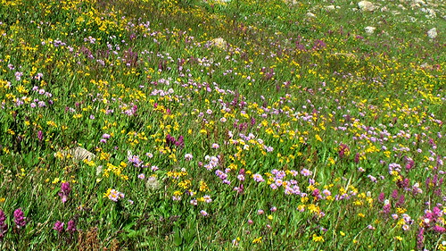
The wildflowers were still quite good mid-August.

As usual in late afternoon in the Rockies, weather was iffy.

It was an emergency tent site I finally found just at dark. Happily, next morning dawned brilliantly clear:

Early morning I crossed pass #1: West Maroon.

En route to Pass #2: Frigid Air:

The trails are fantastic, … aside from one much cursed section I called THE QUAGMIRE. Once you reach the biggest waterfall on the Crystal river, the track disappears into a bog of mud and fallen trees.
Who’s responsible?
Here I am cleaning my shoes (deliberately) on a creek crossing.

When I met an oncoming hiker who had heard about THE QUAGMIRE, he decided to bushwhack on the opposite side of Crystal river. It couldn’t possibly be worse.
See the next high pass?

That’s #3, Trail Rider.
It was a long, exhausting climb. Yet gorgeous.

Hikers on Trail Rider pass:

The vistas of Snowmass Lake on the other side were all that was keeping me going.

Tenting is super popular at Snowmass. I decided to carry on until dusk, approaching the 4th and final pass. …
Next morning I was up at first light, first human at pass #4 Buckskin. It was just me and the mountain goats.

I’ll always remember the big open vistas of the Maroon Bells. And the wildflowers.
Highly recommended. One of the best hikes in the world.

trip report by besthike editor Rick McCharles
This is Crater Lake Trail #623 in the San Juan National Forest between Silverton and Durango. … Not the more famous (but far less appealing) Crater Lake in the Maroon Bells.

The Crater Lake Trail is an excellent long day hike or overnight that begins at Andrews Lake. Crater Lake is nestled in a basin at the foot of Twilight Peak. This peak and Snowdon Peak are both accessible from the Crater Lake Trail. …
• 5.5mi (8.8km)
• trailhead at 10,800ft
• Crater Lake at 11,600
I had planned to climb Twilight or Snowdon early morning after the night I tented at Crater. But it rained steadily all night. Both peaks were cloud shrouded in the morn. I marched directly out.
Richard Tulloch’s amusing summary of his early season trek on one of the very best hikes in the world.
The full circuit of Europe’s highest range is some 170km long and takes about 60 hours of walking. Most people do it in 8-12 days. ….
It’s staggeringly beautiful terrain – or is that my pack making me stagger? …
Doing it in June is risky:
… We’re in a bit of trouble on our hike, high on Switzerland’s Col d’Emaney. It’s blowing a gale and there’s frozen snow on a treacherously steep slope. My Dutch companions are carrying ice axes, but I’m not roping myself to anyone who learned their mountaineering below sea level in Amsterdam. …

Click through to see how they got out of this situation …
TOUR DE MONT BLANC – the Swiss section
And while you’re there, click through on HIKING for Richard’s adventures in New Zealand, Australia, Europe and more.
→ besthike TMB information page
report by besthike editor Rick McCharles
I was a bit disappointed that you cannot hike to the “crater” of Sunset Crater near Flagstaff. It’s been off limits for decades due to erosion. The 1mi easy loop takes you only to the base.
Signage is interesting, though.
Sunset Crater Volcano was born in a series of eruptions sometime between 1040 and 1100. Powerful explosions profoundly affected the lives of local people and forever changed the landscape and ecology of the area. Lava flows and cinders still look as fresh and rugged as the day they formed. But among dramatic geologic features, you’ll find trees, wildflowers, and signs of wildlife – life returns.
NPS – Lava Flow Trail
I was first visitor early morning, keen to test my new camera / camcorder (Canon FS300). In sunlight and shade.


OK. … But not superb focus. … It’s still on all default settings.
trip report by besthike editor Rick McCharles
I couldn’t resist America’s Newest National Park (2004): The Great Sand Dunes National Park and Preserve in Colorado.

Explore any part of the 30 square mile dunefield you wish; there are no designated trails in the sand. …

… The “High Dune” is neither the highest in elevation nor the tallest in the park, but it looks that way from the main parking lot. It is about 650 feet (198 m) high. Cross the flats and zigzag up the ridgelines to reach it. The 360 degree view is inspirational. From High Dune, the largest dune you see to the west is the Star Dune, rising 750 feet (229 m). It is the tallest dune in North America, and is most dramatic when viewed from the park entrance. To reach it from High Dune, journey another mile and a half up and down across the dunes to its summit. …
I couldn’t tell which dune I climbed. … It looked to be the highest.

A few young people brought their own sand boards. Here’s one guy trying to get back up the steepest slope.

… My camera died on this adventure. Perhaps the blowing sand got into the moving parts.
See the last batch of photos ever (from that camera).
Another great Photodiary of a Nomad trip report from June 2010:

… A 170 km circumnavigation of the highest mountain in the European Alps, it is truly one of the classic treks, not only for its splendid scenery and demanding geography, but for its history.
For thousands of years, people have been passing through this region for trade or conquest, Celts, Romans and others. The common historic and franco-provencal linguistic origins of the region and its people are implanted in the valleys of Savoie, Valdôtain and Valais, coloured by their relatively recent associations with France, Italy and Switzerland, respectively – three countries, but one overarching culture. …
There’s a LOT of snow this early in the summer. The photos look very dramatic, the trail much less crowded than it will be later in the season.

But, of course, it was wildflower season:

read it all – Tour de Mont Blanc
And check our besthike information page on the TMB

