Kolby Kirk is some kind of Da Vinci of the trail. Check this sample page from his 2011 PCT journal.
I saw JEFF THROPE link to that on Adventure Journal:
… After being laid off from his job in April 2011, Kolby Kirk (The Hike Guy) decided he would attempt to complete as much as he could of the 2,650-mile Pacific Crest Trail.
Starting at the Mexican border near Campo, California, he walked for 159 days and nearly 1,700 miles. In that time, Kolby wrote 850 pages in his journals, a few of which he has started to scan …
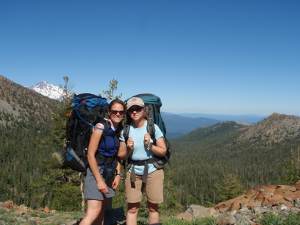
In July 2010, researchers Marni Goldenberg and Briget Eastep caught up with the “herd” of hikers near Mount Shasta to discover the benefits of long distance hiking on the Pacific Crest Trail.
Known as the “Research Girls,” they hiked for four days, interviewing a group of 37 male and 19 female hikers between 20 and 66 years old. The hikers participated in more than 13 hours of interviews and had hiked a cumulative 78,382 miles on the PCT at the time of their interviews. …
Female hikers appeared to gain self-respect, esteem, or confidence from their Trail experiences, especially through hiking and interacting with other people.
Male hikers appeared to enjoy warm relationships with others through their new perspectives gained from hiking, the new experiences and opportunities the Trail provides, and being in the wilderness or outdoors.
While the experience of long-distance hiking on the PCT is truly different for each hiker, the experience does offer numerous life values including a sense of belonging, self-fulfillment, a sense of accomplishment, appreciation, self-awareness, self-respect/esteem/confidence, warm relationships with others, fun and enjoyment of life, and transference of benefits of other areas of one’s life.
Located at the entrance to the WORLD HERITAGE listed CRADLE MOUNTAIN – LAKE ST CLAIR NATIONAL PARK is this cool temperate ‘ENCHANTED FOREST’ – a silent, cool damp place, where both trunks of trees and the forest floor are festooned with a luxuriant carpet of mosses and lichens. …
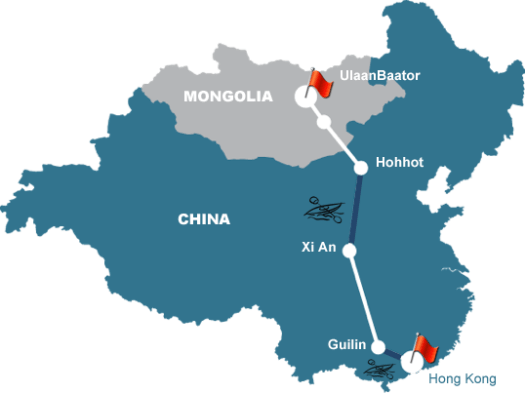
Rob Lilwall and Leon McCarron are surviving (so far) a mid-winter a 5,000km winter expedition through the heart of China.
Carrying all of their gear, they will start amidst the wastelands of Outer Mongolia from where they will head south by foot through the Gobi Desert. Crossing into China, they will follow the Great Wall down to the turbulent waters of the Yellow River, where they will inflate the kayaks in order to paddle downstream to the legendary city of Xi An. Leaving the water, they will then hike onwards through the snow-capped mountains of central China, until finally they reach their finishing point at the glittering skyscrapers of Hong Kong.
… Let’s consider the Appalachian Trail, 2178 miles long. The days of averaging a dollar a mile are long gone, although it can be done. Twenty-three years ago, Roland Mueser, in his later book, Long Distance Hiking–Lessons from the Appalachian Trail, came up with an average cost of $3200.00 dollars or about $1.50 a mile. But that was 1989. …
So what about today? Figure about $2.50 a mile, or $5500.00 for the A.T., and that is conservative. One recent blogger said he wouldn’t feel comfortable unless he had saved $10,000 for the hike. …
Thule won it all in Tasmania, to nobody’s surprise.
It took more than five days of racing and, despite the extremely tough course being largely dominated by Team Seagate, the Swedes pipped rival teams at the post, thanks to a four-hour penalty time that Seagate had to serve out.
Team Silva took second place with Seagate coming in third after serving out what must have been a very long four hours.
79 teams from all corners of the world began the adventure race with six of those teams forced out. The remaining teams continue to race through Tasmania’s rugged wilderness and wet weather across a 700km course. …
I was in Macao only for 2 days, camping at Hac Sa beach. And was pleased to get out for even one hike.
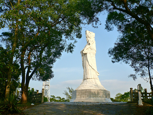
With no guidebook, I headed directly to the A-Ma Statue atop Alto de Coloane (176m). It’s a 20m-high white jade statue of the goddess who gave Macau its name erected in 1998.
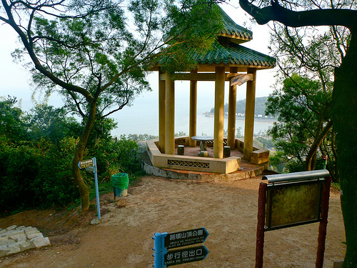
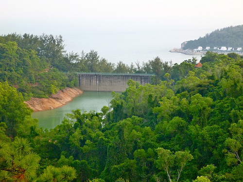
I worked my way randomly through two contiguous Parks, the signage and maps quite helpful.
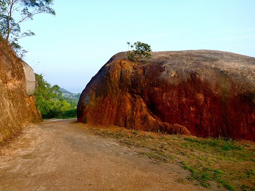
I decided to leave a Summit Stone atop the boulder right … but found I couldn’t scramble it.
In the end, I tossed the Stone up top, a reward for the next bolder boulderer than I. 🙂
The hiking was much better than I expected. Yet uncrowded.
In 3hrs I saw only one other hiker, and one trail runner. It was perfect November weather on a Saturday.
Seems people do not go to Macao for walking, even though it’s next door to the hiking Mecca of Hong Kong.
If you research the topic, very quickly you’ll find this list:
MacLehose Trail (100km)
Lantau Trail (70km)
Hong Kong Trail (50km)
Wilson Trail (78km)
Some actually do those long trails end-to-end with backpacks. Staying at hostels or tenting (free).
Fragrant Campsite, Tai Mo Shan Country Park
But I’d recommend day hiking Hong Kong, cherry picking the best sections. It’s terrifically convenient to take public transport to and from trailheads.
In November — prime hiking season — special hiking events are scheduled. For example, FREE guided hikes are offered for tourists. (Sign up at Tourism Board Visitor Centres by Friday at 4pm.)
Without question Hong Kong is the best major city for urban hiking. Are there any other cities even close? … Leave a comment if you know of one.
A free booklet is widely available called The Inside Guide to Hikes and Walks in Hong Kong, in several different languages. It was all I used.
It recommends:
New Territories:
• MacLehose Trail – sections 1 & 2
• MacLehose Trail – section 2 (Tai Long Wan)
• Shing Mun Reservoir (TRIP) (highest section of the MacLehose Trail)
Hong Kong:
• Dragon’s Back (TRIP)
• Peak Circle Walk
Lantau Island
• Tung Chung
vista from atop Mt Davis
Highly addictive, mildly dangerous: four hiking gurus come clean about their obsession



 … Let’s consider the Appalachian Trail, 2178 miles long. The days of averaging a dollar a mile are long gone, although it can be done. Twenty-three years ago, Roland Mueser, in his later book, Long Distance Hiking–Lessons from the Appalachian Trail, came up with an average cost of $3200.00 dollars or about $1.50 a mile. But that was 1989. …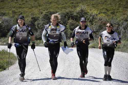


 besthike.com