Ryan Shirley was back in 2024.
Here are his favourite spots in the fantastically scenic Lofoten Islands — with bonus destinations within driving distance.
Click PLAY or watch it on YouTube.

Best hikes, treks, tramps in the world.
Ryan Shirley was back in 2024.
Here are his favourite spots in the fantastically scenic Lofoten Islands — with bonus destinations within driving distance.
Click PLAY or watch it on YouTube.
As selected by Markus Rosehill.
10. Picos de Europa, Spain
9. Cinque Terre, Italy
8. Romsdals-eggen, Norway (Troll)
7. Alicudi, Italy
6. Oeschinen-see, Switzerland
5. Mulagljufur, Iceland
4. Faja Racon, Spain
3. Pico to Pico, Madiera, Portugal
2. Schaeffer Hut, Switzerland
1. Tre Cime di Lavaredo
I’ve only hiked 3 from that list — but the rest make me want to go back to Europe pronto.
Markus put together all 10 in one long video — with links where you can get more information.
Click PLAY or watch it on YouTube.
Fantastic hiking, cycling, and climbing — but complicated and difficult to reach.
The Hoggar Mountains (Arabic: جبال هقار (Ǧibāl Haqqār), Berber: idurar n Ahaggar) are a highland region in the central Sahara in southern Algeria, along the Tropic of Cancer. …
… home to the Ahaggar National Park …
The area is largely rocky desert with an average elevation of more than 900 m (3,000 ft) above sea level. The highest peak, Mount Tahat, is at 2,908 m (9,541 ft). …
The jumping off point is the city of Tamanrasset, population about population of 93,000.
Visit during the cooler months.
Click PLAY or watch it on YouTube.
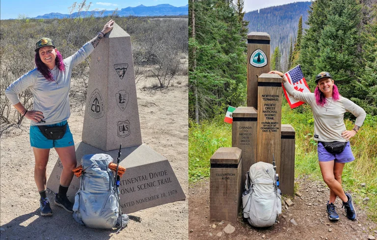
Lyla Harrod is a super experienced thru hiker.
The first trans woman to complete the Triple Crown in 2023, set out to INVENT a new even more difficult challenge.
She calls it the Divide to Crest.
You’re not likely to cross paths with trail name Sugar because this route is so remote, so difficult.
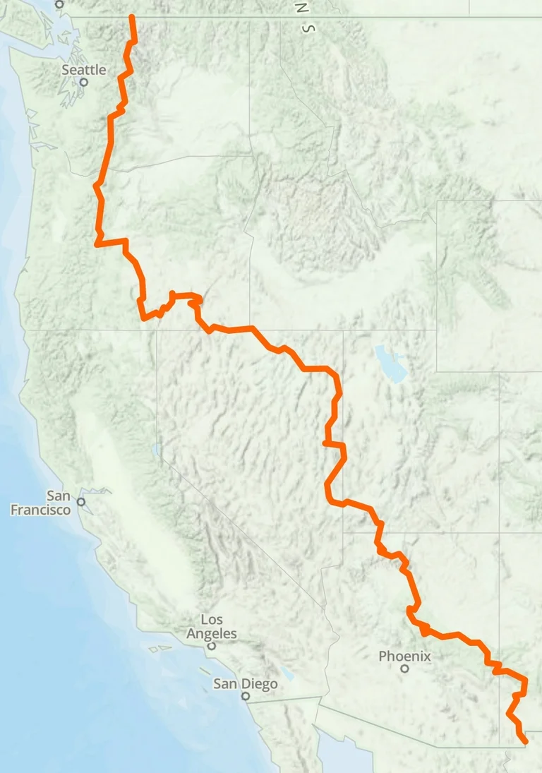
Two trails piqued Harrod’s desert hiking interest: The 500-mile Mogollon Rim Trail in Arizona and the 750-mile Oregon Desert Trail. She wondered if she could somehow connect them. …
… Nevada’s Basin and Range Trail proved to be the missing piece. The 1,090-mile route through eastern and central Nevada allowed Harrod to begin planning her diagonal traverse from the barren deserts of New Mexico to the glacial peaks of Washington. …
Backpacker – Lyla Harrod’s 3,000-Mile Divide to Crest Route Might Be the Wildest New Thru-Hike in America
Since Cam “Swami” Honan named the Cape Wrath one of his favourite hikes worldwide, it’s been high on my personal life list.
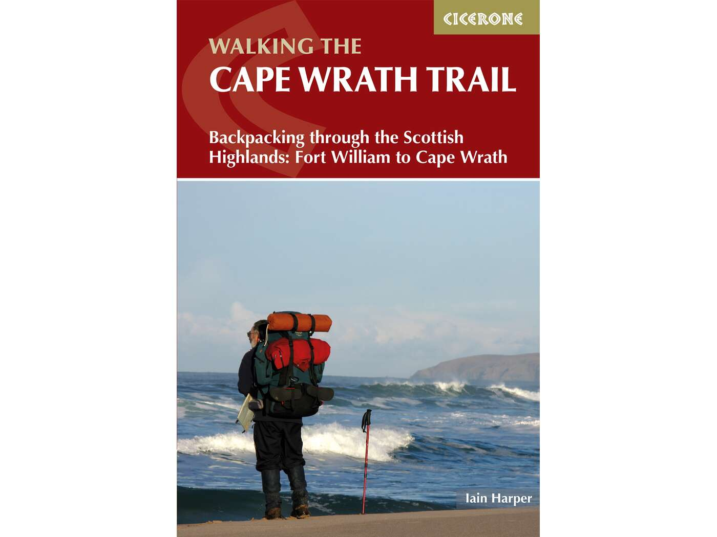
The biggest concern stopping me is midges. I HATE highland midges.
Elizabeth Gadd hiked April-May, early enough in the season not to be much bothered by biting insects. And had a wonderful adventure.
Click PLAY or watch it on YouTube.
by BestHike editor Rick McCharles
When I’m visiting Parksville on Vancouver Island — my parent’s home — most mornings I pick up coffee and head to Rathtrevor Beach, my favourite on Vancouver Island.
Walk with coffee.
Most mornings I take some wonderful photos.
I’ve hiked a lot in WA.
Always good.
Lonely Planet posted a list of their 10 most magnificent hikes in Washington:
Click through for details.
Click PLAY or watch Pacific N.W. highlights on YouTube.
Backpacking on Vancouver Island: The Essential Guide to the Best Multi-Day Trips and Day Hikes, was selected top guidebook at the 2024 Banff Mountain Book Competition.
Author Taryn Eyton.
I’m spending most of the year on Vancouver Island myself and can heartily recommend the destination and this guidebook.
In fact, the West Coast Trail on Vancouver Island is our #1 hike in the world.


