where’s Dead Burro Canyon?

… I really need to start hiking with a GPS. 😦

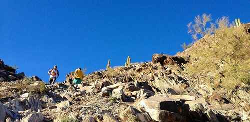
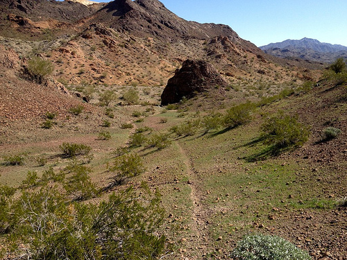
I set out into the Arizona desert with typically vague details I found online.

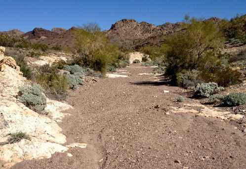
Dead Burro Canyon Trail is a loop hike for the adventurous around a mountain block through a deep scenic canyon in Havasu National Wildlife Refuge, a wilderness setting where very few trails exist. Look for wild burro and Bighorn sheep! …

As expected, I was quickly lost.

One wash looks much like the next.

wash

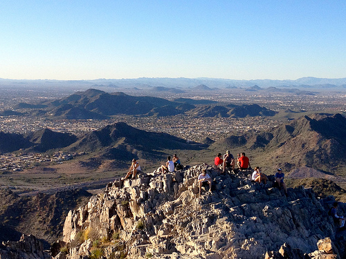
On the other hand, I enjoyed a solo morning off trail. It’s all good in the desert outside Lake Havesu, Arizona in February.

desert trail

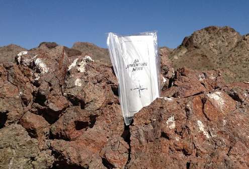
I dropped a Summit Stone atop one random stone mountain.

Summit Stone

The highlight was finally spotting wild burros. LIVE ones.

burros

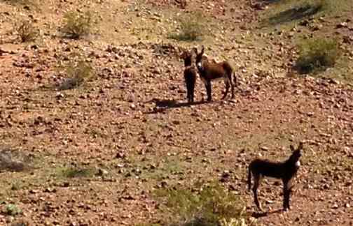
There were over 2000 of these beautiful animals running wild in Arizona as of 2010. They are regulated by the Wild and Free-Roaming Horses and Burros Act of 1971.

more photos

If you actually want to reach Dead Burro Canyon, my advice is to download the GPS track.

scrambling Piestewa Peak, Phoenix

False summits discourage some non-hikers, but I loved the most acclaimed urban peak climb in Phoenix, Arizona.

false_summit

Vistas from the top are fantastic.

summit

… The Piestewa Peak (formerly Squaw Peak) Summit Trail (elevation gain = 1,190 feet in 1.2 miles) is climbed thousands of times per week by locals and visitors seeking a cardio-vascular workout, great views, or a family outing. However, quite a few hikers do not actually reach the top due to the fact that this trail is more difficult than it looks, especially in the summer when temperatures are well over 100 °F. No water is available on the trail and dehydration is a common and serious problem with hikers who come unprepared. …

The hike itself takes anywhere from 15 to 60 minutes depending on each hiker’s capabilities in fair weather (higher temperatures and sunny conditions may force the hiker to take twice as long). A beginning hiker should allow 60 minutes for a leisurely ascent and 30 for descent. The path is mostly well marked.

… There are a few sections that are technically difficult as they are steep and there are no guard rails.

There are approximately fifteen miles of interconnecting trails in the Preserve, ranging from easy to difficult.

Arizona is one of the best places to hike in North America. In February. 🙂

Rick Piestewa

Choquequirao to Machu Picchu guided

The best way to get to Machu Picchu is via CHOQUEQUIRAO.

choquequirao-cover

If you want to be guided, here’s one recommended option.

Choquequirao trek to Machu Picchu Trek Private Service, 8 Days/7 Nights Program

Prices are per person : 2 people US$840, 3 people US$790, 4-5 people US$740, 6-8 people US$620, 9-11 people US$590, 12-16 people US$550.

details on Mythical Trails Peru

You can do that independently, of course.

And NOT CHEAT by taking the bus up from Aguas Calientes. Instead you climb in the dark, be waiting for the Gates to open. Then rush up to take photos before the hordes arrive.

Insect repellant essential at some times of the year.

How Much Does Your Gear Cost Per Use?

Good question.

BRENDAN LEONARD SEMI RAD:

… How many times are you really going to use that $3,500 bike? The $600 worth of cams. The $800 skis? No, wait, the $850 powder skis. The really fat ones.

The fact is, if you buy a $3,500 mountain bike and ride it 20 times before you talk yourself into buying a new one, you paid $175 per ride. (not counting gas, new parts, tune-ups, replacement tires, chain lube, and all that stuff).

Craigslist is full of ads selling used bikes that have only been ridden “a handful of times.” …

bike

Adventure Journal

Wales Coast Path

Wales Coast Path mapThe Wales Coast Path … is a long-distance footpath which follows the whole of the coastline of Wales. It opened on 5 May 2012, and offers a 870 miles (1,400 km) walking route from Chepstow, in the south, to Queensferry, in the north.

Wales is the first country in the world to provide a dedicated footpath along its entire coastline. The Path runs through 11 National Nature Reserves and many more local Wildlife Trust and RSPB reserves. …

The 870 miles (1,400 km) of the Wales Coast Path links with the Offa’s Dyke Path National Trail, which loosely follows the border with England, to create a 1,030 miles (1,660 km) continuous walking route around the whole of Wales, although skirting past Flintshire and Wrexham. …

Click PLAY or watch some highlights on YouTube.

Controversy

The Open Spaces Society has criticised some landowners who do not allow the path onto their coastal land. This means 170 miles (270 km) – more than 20% of the route – will be on roads, sometimes out of sight of the sea.

official website

Ciudad Perdida (Lost City) trek

Daniel has a blog all about his year spent in the town of Soledad, Barranquilla, Colombia.

One Adventure took him on a 5-day guided trek to one of the best walks in the world.

Ciudad Perdida (The Lost City) is like the Machu Picchu of Colombia: located deep in the Sierra Nevada it is an old city built by indigenous people where their Shaymans (religious leaders) lived with their wives and families. …

… Some of us bitched about the ones marching on ahead to the front, others bitched about those coming up too slowly behind- and everyone bitched about bloody Mosquitos. …

… The terrain ranged from the clay sandy trails, to riverside walks and treks into deep jungle. Colourful butterflies seemed to constantly encircle us, we spotted a (dead) snake, and lots of tropical birds.

After night 2 the novelty of sleeping in a hammock had disappeared, and the reality of an uncomfortable nights sleep in the cold was hard to deal with. The food was great- our chef Yorman made great meals and often surprised us with treats of chocolate bars and lollipops. Everyone’s dietary needs were taken into account …

read more – CIUDAD PERDIDA / THE LOST CITY

They made it.

Lost City

related – our Lost City information page