The Otter Trail is a hiking trail along the Garden Route coast of South Africa and is named for the Cape Clawless Otter which occurs in this region.
… widely regarded as one of the finest in the world and stretches from Storms River Mouth in the east to Nature’s Valley in the west, is 26 km long as the crow flies and 41 km as the hiker walks.
Walking the trail takes 5 days, and the 4 nights are spent in comfortable huts with superb views. The route is located entirely within the Tsitsikamma National Park, which protects an 80 km long strip of coastal mountains, forest and beaches.
… an extremely scenic landscape, never straying far from the shoreline, but often climbing steeply and then descending to the beach or a river crossing. …
Jens Niere’s trip report video gives a good feel for what I have to look forward to.
• DAY 1: Storms River Mouth to Ngubu Huts – 4.8kms – 3 hours
• DAY 2: Ngubu Huts to Scott Huts – 7.9kms – 6 hours
• DAY 3: Scott Huts to Oakhurst Huts – 7.7kms – 4 hours
• DAY 4: Oakhurst Huts to Andre Huts – 13.8kms – 8 hours
• DAY 5: Andre Huts to Nature’s Valley – 8.3kms – 3 hours
It’s tough to get a hiking permit. But by applying solo, and being flexible on start date, I was able to nab one in high season only a couple of months in advance.
Stretching for 4132 miles and crossing through ten countries, the Nile is the longest river on the planet.
… During the 19th century, the river inspired explorers to go in search of its headwaters. Numerous expeditions were mounted to map its length. But none of those explorers ever managed to walk the entire length of the Nile from source to sea.
That’s exactly what two British adventurers intend to do when they launch a 12-month long expedition later this year.
Levison Wood and Simon Clarke are in the final stages of planning for what they call the Walking the Nile expedition. The two men, who met and became friends while serving in the British military, say that they were inspired to undertake this epic trek by fellow countryman Ed Stafford. In 2010, Stafford famously completed a 4000+ mile long trek along the length of the Amazon. That journey helped Wood and Clarke come up with the idea of hiking along the world’s other great river – the Nile. …
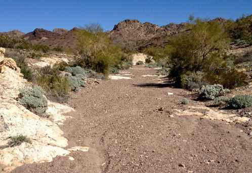
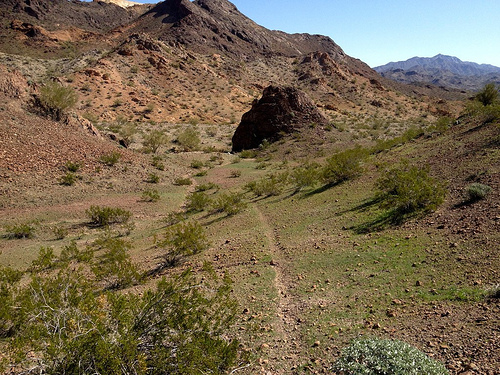
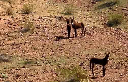
Dead Burro Canyon Trail is a loop hike for the adventurous around a mountain block through a deep scenic canyon in Havasu National Wildlife Refuge, a wilderness setting where very few trails exist. Look for wild burro and Bighorn sheep! …
As expected, I was quickly lost.
One wash looks much like the next.
On the other hand, I enjoyed a solo morning off trail. It’s all good in the desert outside Lake Havesu, Arizona in February.
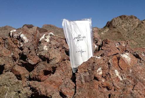
I dropped a Summit Stone atop one random stone mountain.
The highlight was finally spotting wild burros. LIVE ones.
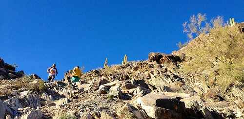
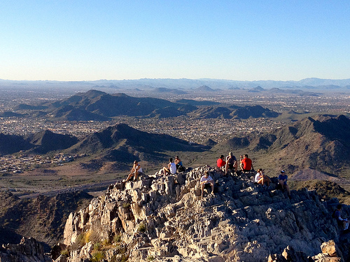
False summits discourage some non-hikers, but I loved the most acclaimed urban peak climb in Phoenix, Arizona.
Vistas from the top are fantastic.
… The Piestewa Peak (formerly Squaw Peak) Summit Trail (elevation gain = 1,190 feet in 1.2 miles) is climbed thousands of times per week by locals and visitors seeking a cardio-vascular workout, great views, or a family outing. However, quite a few hikers do not actually reach the top due to the fact that this trail is more difficult than it looks, especially in the summer when temperatures are well over 100 °F. No water is available on the trail and dehydration is a common and serious problem with hikers who come unprepared. …
The hike itself takes anywhere from 15 to 60 minutes depending on each hiker’s capabilities in fair weather (higher temperatures and sunny conditions may force the hiker to take twice as long). A beginning hiker should allow 60 minutes for a leisurely ascent and 30 for descent. The path is mostly well marked.
… There are a few sections that are technically difficult as they are steep and there are no guard rails.
There are approximately fifteen miles of interconnecting trails in the Preserve, ranging from easy to difficult.
Arizona is one of the best places to hike in North America. In February. 🙂