hiking Hurricane, Olympics WA

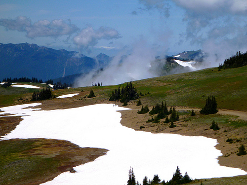
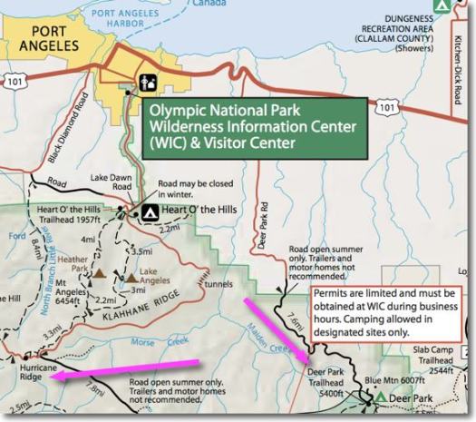
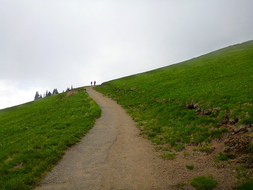
At an elevation of 5,242 feet (1,598 m), Hurricane Ridge is a year-round destination. In summer, visitors come for views of the Olympic Mountains, as well as for superb hiking. …

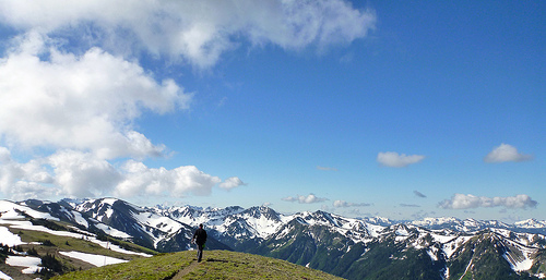
Spectacular views of the Olympic National Park can be seen from the Hurricane Ridge viewpoint. The road leading west from the Hurricane Ridge visitor center is dotted with picnic areas and trail heads.

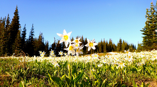
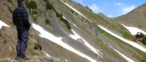
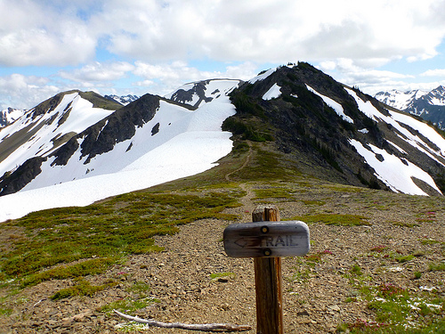
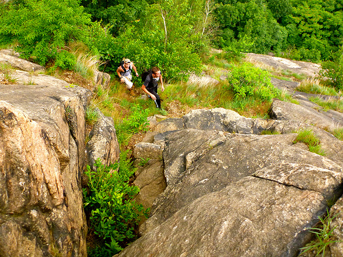
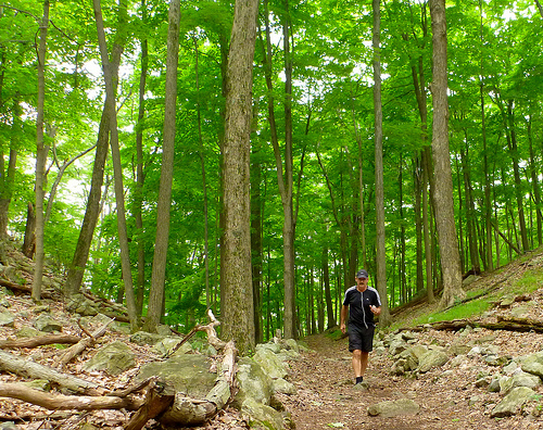
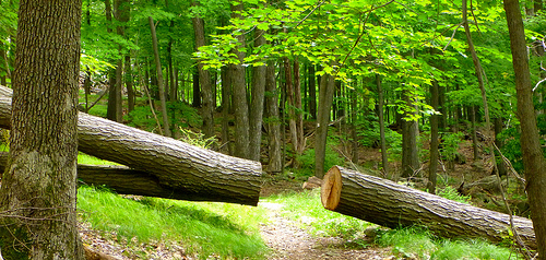
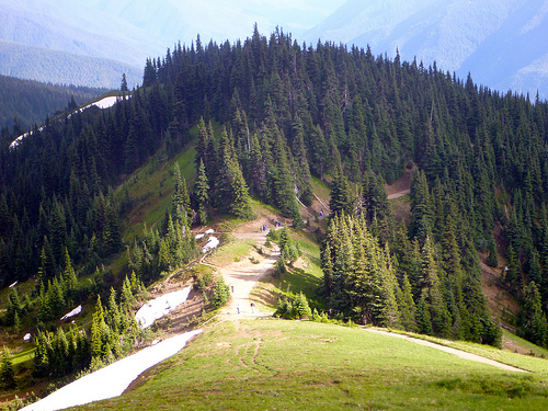
A paved trail called the Hurricane hill trail is popular with visitors, and is about 1.6 miles long (one-way) with an elevation gain of about 700 ft. It is not uncommon to find snow on the trails even as late as July. …

Hurricane Ridge is named for its intense gales and winds. The weather in the Olympic Mountains is unpredictable …

Don’t drive up the mountain before checking weather conditions.

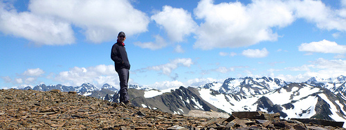
Hurricane Hill is great.

Hurricane

Hurricane cloud

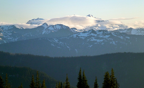
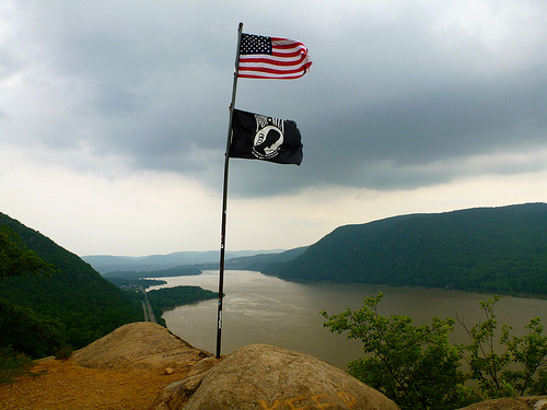
Sadly I got the the more typical vista when looking north to Canada. Nothing but cloud.

map

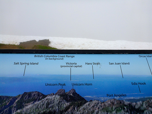
It started to clear as I descended.

descending Hurricane

Most visitors drive up. Take one of the wheelchair accessible walks, consume 1000+ calories at the snack bar. And drive on.

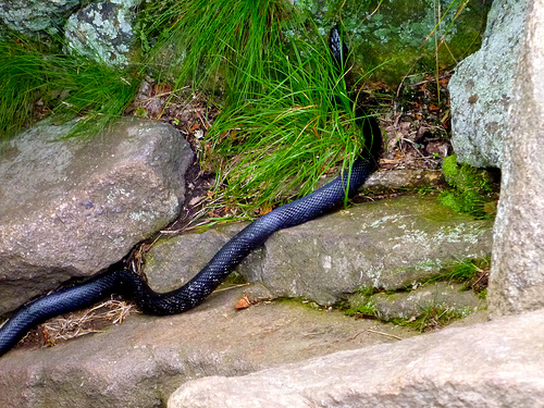
The biggest problem at Hurricane ridge, is this.

deer photo

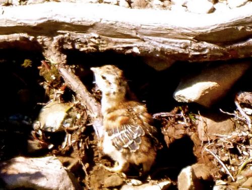
Many wild animals get accustomed to humans. There’s supposedly never been a bear encounter in the park, but there have been animal encounters.

For example … A deer first followed. And then charged a leashed dog.

Click PLAY or watch it on YouTube.

Owner not much help. 😦

In bright sunshine, however, it’s difficult to beat Hurricane Ridge. I like it even better than Logan Pass, the equivalent at Glacier National Park.

hiking Hurricane

more of my photos from Hurricane Ridge

flickr photos tagged “Hurricane Ridge”

hiking Obstruction, Olympics WA

trip report by site editor Rick McCharles

The famed 7.7mi road from the Visitor’s Center to Obstruction Point trailhead 6150ft (1875m) was CLOSED for 2013 due to budget cuts. Lucky us.

Visitors

A road’s a road.

But this CLOSED road is a wonderful ridge walk.

road

Non-stop magnificence.

Olympics

Once departed the Visitor’s Center at Hurricane Ridge, I saw only 3 other people over 2 days. Two of those were trail runners.

Starting late in the day, I decided to stop at an unofficial campground near the P.J. Lake Trail turnoff. A nice quiet spot but one without water. We’re too high here.

Next morning I arrived Obstruction Point Campground.

Campground?

It’s nothing but a parking lot with a toilet.

toilet

No water. But I found a nice snow melt runoff stream nearby. No mosquitoes. 🙂

On the bright side, it was nice to stash pack with food in the biffy. Away from critters.

Ridge hiking out of Obstruction is unbelievable. I’ll let the photos prove my point.

deer

backpack

avalanche lilies
avalanche lilies

flowers

dusk

I made an afternoon scramble of Moose Peak, a highlight.

Ptarmagin must be the stupidest birds on the planet. How do they survive?

Ptarmigan

This dumb mother was doing a terrible job of protecting her new chicks.

chick

The only other hiker tenting at Obstruction that night was from Denmark. With the good weather report, he’d bought gear at REI and driven straight to Hurricane Ridge.

Denmark

Found himself in Heaven.

coffee

Next morning I enjoyed coffee with a superb vista.

I’d hoped to take the GRAND Ridge Trail in the direction of Deer Park. … But Rangers had warned that it was probably impassable without an ice ax.

Rick on Grand

Yep.

After making an attempt to climb over the steep snow. And under the steep snow. I gave up.

But I’ll be back. 🙂

Rick

more photos

The Subway – Zion National Park

There are two ways to explore The Subway (the Left Fork of North Creek). …

From the Bottom Up

This is a strenuous 9-mile round-trip hike through the Left Fork of North Creek that requires route finding, creek crossing, and scrambling over boulders. …

From the Top Down

This is a strenuous 9.5-mile hike that requires rappelling skills, 60 feet of rope, and extensive route finding experience. The route also requires swimming through several deep pools of very cold debris-filled water. …

details

Subway Permits are awarded by lottery. Occasionally walk-in permits are available the day prior.

Click PLAY or watch a well edited trip video on YouTube.

November through March no permit is necessary.

Hmm …

Thanks George.

scrambling Moose Peak, WA

trip report by site editor Rick McCharles

My FUN adventure in Olympic National Park Washington State.

Obstruction Point
Obstruction Point

You MUST have good weather. Otherwise, stay low. Obstruction Point is already high at 6100ft. The summit of Moose is 6753ft (2058m).

It’s mostly gorgeous alpine meadow ridge walk in the direction of Moose Lake. There was some snow left on the trail on July 4th, but nothing to worry about.

ridge

Hikers enjoy the wild flowers this early in the season.

wildflowers

Head on the trail towards Grand Lake, Moose Lake, Grand Pass. It’s about 2mi to the “Grand Valley” trail cut-off, elevation 6450ft.

You’ll know you’re there when you see this TRAIL sign.

trail

Some trip reports found the ridge scramble fairly easy.

ridge scramble

I actually found it challenging. Depends on the route, I guess. I stayed as high on the ridge as possible on the way out. … Took the lower (obvious) easy trail across the scree on the return.

Fantastic views on top, of course. Those are Grand and Moose Lakes below.

lakes

I left a Summit Stone.

Summit Stone

LOVE Moose Summit. 🙂

Rick on Moose

Moose is not named after Moose, surprisingly. It’s named after some guy with the last name of MOOSE.

There is no water high in the Olympics. Bring your own. Or melt snow.

related:

• Explore Olympics – Gary Huff – Moose Mountain

• Summit Post – Moose Peak

Olympic Nat Park starting July 3rd

by site editor Rick McCharles

I’ll likely start at Hurricane Ridge, in the direction of Deer Park.

That could change when I get local advice while collecting my Wilderness (Backpacking) Permit.

Maximum 4 nights.

I’m most interested in the eastern (higher) side of the Park. The rain shadow.

Olympic

Leave a comment if you have advice.

Clever Hiker – video tutorials

Our 10 episode video series – Lightweight & Ultralight Backpacking Foundations – and our Gear Recommendations eBook are the complete learning package for any backpacker interested in lightweight backpacking, thru-hiking, or simply carrying a more comfortable pack.

$24.95
details

Click PLAY or watch an introduction YouTube.

scrambling Breakneck Ridge, NY

Disappointed with the other day hikes I’d checked close to NY City, I made a special trip to the best of the best.

Breakneck Ridge is a mountain along the Hudson River … Its distinctive rocky cliffs are visible for a long distance …

Breakneck from Hudson

… Lying within Hudson Highlands State Park, it offers many stunning views of the river and region and is quite popular with hikers, to the point that a rail flag stop has been established on the Metro North line which runs right by the base of the ridge along NY 9D.

While several routes exist, most hikers take the white-blazed route up the mountain’s west face that begins on the West (Southbound) side of Route 9D near the tunnel.

trailhead

After circling around to cross above the tunnels, it begins a steep, rocky and challenging climb up to the first bump of the mountain, about 720 feet (219 m) above the river, where there are sweeping views of the river and Highlands. …

Here’s that first “bump”, this flagpole.

Breakneck flag

As a former gymnast, I loved it. Using my hands as much as possible.

Scramble

The only time my heart rate jumped above 180 beats / minute was when I nearly stepped on this BIG BLACK (possibly deadly, I assumed) Western rat snake.

snake

(Or is it a northern black racer?)

I left a Summit Stone atop the highest point I could find.

Trip report by Big City girl Amy Cao:

With its close proximity to New York City (only an eighty-minute train ride from Grand Central), stunning vistas of the Hudson, Storm King Mountain, Mount Taurus and West Point Academy, it’s no wonder why Breakneck Ridge is an immensely popular hiking destination for those seeking to escape the frenetic city pace, if just for a day.

Repeatedly voted as one of the best trails in the country, Breakneck Ridge offers 5.5 miles of challenging rock climbs and rugged hikes for even the most seasoned Eagle Scout. You’ll need all four limbs to scramble up the first mile when suddenly the vertical ascent will have you scrunching your brow at how you managed to get stuck—and without safety equipment—between a rock and a hard place, with no way to go but up. The adrenaline is pumping at this point. …

I scrambled up and down. But you could opt for the Breakneck Ridge Loop.

MAP (PDF)

more photos of my day hike

yet more photos – Breakneck Ridge & Sugarloaf Mountain Hike

I rented a car. Tented at Beaver Pond Campground – Harriman State Park. Quiet mid-week, party central on summer weekends.

Long Path, NY

The Long Path is a 347.4-mile (559.1 km) long-distance hiking trail beginning at the George Washington Bridge in Fort Lee, New Jersey and ending at Altamont, New York, in the Albany area.

While not yet a continuous trail, relying on road walks in some areas, it nevertheless takes in many of the popular hiking attractions west of the Hudson River, such as the New Jersey Palisades, Harriman State Park, the Shawangunk Ridge and the Catskill Mountains. …

Plans call for it to be extended through the Adirondacks to the Canadian border.

Unlike the Appalachian Trail, I actually set out to day hike the Long Path.

Rick Long Path

But didn’t go far.

Long Path

The tree locked trails of the eastern USA simply don’t engage a guy from the Rockies. It’s mostly a green tunnel out here.

I left a Summit Stone with this caterpillar, … and turned back.

summit stone

No Long Path for me.

Here’s a glimpse of the kind of terrain we’re talking about.

Click PLAY or watch it on YouTube.

via NJ Hiking