climbing Fansipan, Vietnam

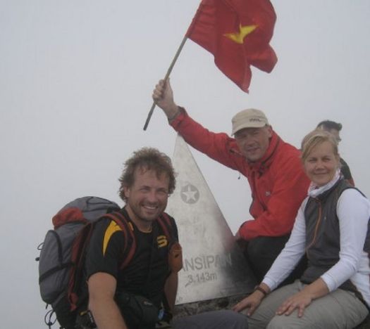
Fansipan is a mountain in Vietnam, the highest in Indochina (comprising Vietnam, Laos, and Cambodia), at 3,143 metres (10,312 ft). …

Update. I’m just about to book my flight. I hope to climb Fancy Pan end of October.

“the Roof of Indochina”

AT A GLANCE
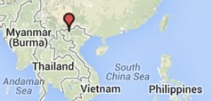
  • map Fansipan3,143 meters (10,312ft), it’s the highest in Indochina
  • Northwest region of Vietnam, near the Chinese border
  • 9km southwest of Sapa (Sa Pa) Township
  • 1-3 days hiking
  • pine forests, bamboo thickets and jungle

I’ll travel to the jumping off tourist town of Sa Pa. Hang out for a day or two looking at guided options. If I feel good, and the weather is reasonable, I’ll try for the one day up-and-down. About 10 hours total.

The best trip report I’ve seen was posted on mymilez:

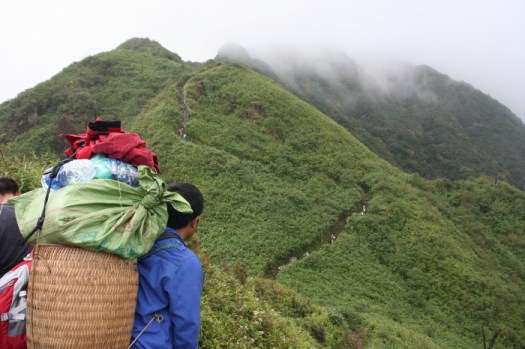
We did not expect the climb to be so heavy. The trail was very steep and mostly ran in the rain forests and bamboo groves, by wet and slippery roots and rocks. …
Fansipan

summit

Climbing Fansipan – highest peak of Indochina

Fansipan Peak was blocked due to snow fall damage January 2014.

Leave a comment if you have any advice for me. I’ve added Fansipan to our list of the best hikes in Asia.
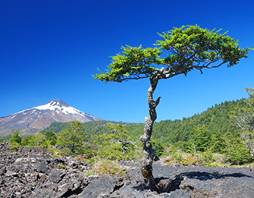
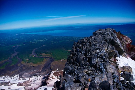
Villarrica Volcano, Chile

Villarrica is one of Chile’s most active volcanoes, rising above the lake and town of the same name. …

Villarrica is one of the world’s most climbed stratovolcanoes. Guided hikes to the crater are offered from the town of Pucón by several enterprises, but ascent might be suspended due to cloudiness and in periods of seismic or increased volcanic activity. Helicopter sightseeing services offer flights over the crater as well. In the winter (July–September) a ski resort operates on the northern slopes. In 2007 a service guided helicopter began to offer flights over the crater. …

Check a trip report by DAMIAN HALL posted on the Merrell blog.

Turning up at the guide company office at 7 a.m. for the third morning in a row, my travel buddy Elizabeth and I had quietly given up on ever climbing the 9,340 foot Volcán Villarrica. …

The weather was calmer. We got the green light to climb the volcano. Gulp. …

It’s hard work climbing up the volcano, but the rewards are great. After a couple of hours of climbing, we gaped at the rich woodlands, discreet villages, vast lakes and hills worthy of hobbit habitation below. Indeed, the climb was about to go a bit Mt Doom …

villarica-tree

read more – Epic Trails – VOLCAN VILLARRICA – A HOT HIKE IN THE CHILEAN LAKE DISTRICT

I once traveled to Pucón to climb this beast. My trip was canceled due to weather. It happens a lot.

8230455575_7c279799a2_z

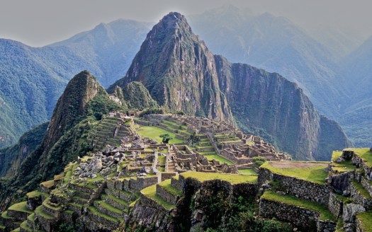
Inca Trail to Machu Picchu

ramblin’ boy:

To walk down from the Gateway of the Sun (Inti Punku) to the site of Machu Picchu is one incredible experience.  …

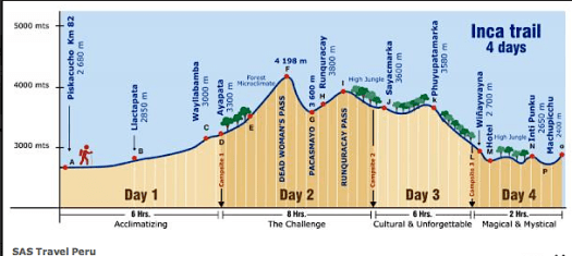
MPThe nice thing about getting to Machu Picchu via the so-called Inca Trail is that walking past a number of other remarkable Inca ruins provides a context as well as a build-up for the ruins of  Machu Picchu.  Here is a graphic that I’ve “borrowed” from the SAS Travel site because it very neatly and quickly encapsulates the entirety of the trek.  …

inca-trail-breakdownWalking The Inca Trail to Machu Picchu

Click through for his excellent trip report.

… Now the downside. The Inca Trail is packed. Up to 500 hikers start each day. REI charges $3,399 and up for 9 days….

That’s $375 / day! 😦

You could do a lot of better adventuring in Peru for $375.

Superior Hiking Trail

The Superior Hiking Trail, also known as The “SHT,” is a 275-mile (442 km) long footpath in Northeastern Minnesota that follows the ridgeline overlooking Lake Superior for most of its length. …

Facilitating this purpose are 81 campsites spread throughout the northern section of the trail. …

Joy Santee just finished.

Music: Akins Birmingham Boys “I Walked and Walked”

Click PLAY or watch it on YouTube.

WHY the Appalachian Trail?

Ever wonder what it’s like to hike 2200 miles through 14 States?

“Five months of solitude”, says Matt Hayden, “it just gives you a lot of time to think”.

Hayden and GreenLife Adventure Sports co-owner Tommy Dunn each completed the trail, 14 years apart. Here they share the experience and advice they picked up while on the trail.

Click PLAY or watch it on YouTube.

Pacific Crest Trail – documentary

Thru-hikers Ian Mangiardi and Andy Laub met doing the Appalachian Trail in Winter. In 2011 they  trekked over 2,600 miles northbound on America’s Pacific Crest Trail in order to create a documentary that would show, first hand, Americas backcountry and its’ splendor.

Click PLAY or watch it on YouTube.

By the time they reached the Washington State border, Ian and Andy were falling apart physically. Their intense friendship in distress.

related – this season Joe McConaughy and at least 5 others are trying to set a new record time for the PCT by  averaging 45+ miles per day, every day, for almost two months.

best hikes Langtang, Nepal?

I’m headed back to Nepal in November.

My plan is to start with Langtang, my first visit. To hike it independently.

Seems the LANGTANG and GOSAINKUND TREK is best in the region. Leave a comment if you have an opinion on that.

Here’s a video preview starting with the very worst part of the adventure, the “bus ride from Hell” to get to the trailhead.

Click PLAY or watch it on YouTube.

I’ll travel light. Decide on my itinerary as I go based on the weather. And how I feel each day. That’s the joy of trekking independently. Certainly I’ll visit Gosaikunda.

Following Langtang, most likely I’ll sign on with a guided trip to somewhere else in the Himalaya. Perhaps Kangchenjunga from the Nepal side. Getting a visa for India isn’t worth the hassle. Nepal is more welcoming.

related – Top 12 Best Treks in Nepal – Snapshot Overview

coast-to-coast Madagascar

The plan is simple – to be a part of the world’s first group to walk across the northern part of the island from east to west, entirely on foot, a distance of almost 400 km, in the seemingly impossible timeframe of three weeks. …

madagascar10a-750x498

Days pass by as we trek west. We camp in rural villages – usually on patchy football fields where, night after night, hundreds of curious children and adults alike surround us, amazed at the presence of a ‘Vaza’, a white ghost – the Malagasy term for westerners. They haven’t seen many before. In fact, in this part of Madagascar, away from the tourist trail in the south, the last foreigners that have entered the foothills of the Tsaratanana were the French army in the late 1940s and occasional mineral prospectors in the 1970s. …

madagascar11a

At exactly the half way point of the journey, after almost two hundred kilometers of uphill slogging, we reach the summit of Maromokotro, Madagascar’s highest mountain. …

madagascar2a-750x421

read more – Adventure Travel: Madagascar

(via Hiking in Finland)

Rumpl – high tech blanket

Do you have a blanket as good as your sleeping bag?

If not, maybe you need a Rumpl. 🙂

Click PLAY or watch it on YouTube.

Blankets start at $95

Check out the product line at GoRumpl.com.

It’s happening. They raised $216,889 on kickstarter, looking for only $15,000 to get the product started.

Mt Townsend Trail, Washington

trip report by site editor Rick McCharles

8.2 miles round trip

In 1792, as Captain George Vancouver was exploring the Puget Sound, he named a large, protected bay Port Townshend. The h was eventually dropped.

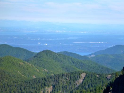
One of the most hiked summits in the Olympics, and it’s easy to see why this peak is so popular. Easy access, a long hiking season, and unparalleled views of Puget Sound and the eastern half of the Olympics give Mount Townsend quite an edge. Of the three trails leading to its summit, Trail No. 839 is the route most taken. …

Most hikers intent on reaching the 6280-foot open summit opt to begin their journey from the upper trailhead. This saves 1.2 miles and 600 feet of elevation gain, but at the expense of missing a beautiful old-growth forest and Sink Lake, a small body of water that causes tumbling Townsend Creek to disappear. …

Washington Trails Association

I did start from the upper trailhead. 4 miles at an angle of about 20 degrees was challenging enough.

P1300317

Perfect weather, the only surprise were solo tent caterpillars dangling down across the trail at lower elevations.

P1300319

It took longer than expected to clear the tress and get to the gorgeous views.

P1300325

Up top, late in the afternoon, it was just me and these guys. 🙂

P1300327

I decided to go for a scramble down this ridge, eventually having to retrace my steps.

P1300320

Somewhere on that ridge, I left a Summit Stone.

I didn’t get back to the parking lot until 7:30pm, much later than I had expected. My trail running down hill was not all that speedy.

more photos

• map

• another trip report – Mount Townsend Trail #839