Adventure moms Brooke Froelich (30), Morgan Brechler (25) and Shannon Robertson (28) share their love of the outdoors with their kids through rock climbing, camping and hiking.
The trio is set to be the subject of the first film in the Born Wild project, which will bring the adventures of parenting into the testoserone-heavy genre of adventure film. …
Canada’sMountain Equipment Co-op has offered the best shopping for hikers for decades. I’d argue it’s still the best hiking shop in the world.
But anyone in one of their stores in 2015 would concur it’s not as good as it once was. The staff is much younger and less experienced in the wild than in the past. Prices are higher. There’s too high a percentage of yuppie, urban crap on the shelves.
Outdoor gear for city folks who have no intention of going to any mountains. Click through to Canadian Business magazine for a history of the change through to 2013.
Climb straight up a cliff in Peru’s Sacred Valley to the Skylodge Adventure Suites, one of the world’s coolest hotel experiences.
The space-age capsule suites are suspended 1,000 ft above the valley floor; walls and ceilings are totally transparent!
To get there, you do a two hour via ferrata up the face of a sheer cliff. The next morning, you do a five stage zipline back down the mountain. The longest stage is a whopping 1,600 ft (500 m). This is one AMAZING experience!
The Everest trek was not much affected by the earthquakes of 2015. If interested in doing this life changing adventure yourself, start with our Everest Base Camp / 3 Passes information page.
No guide required. It’s easy and inexpensive to hike Everest on your own.
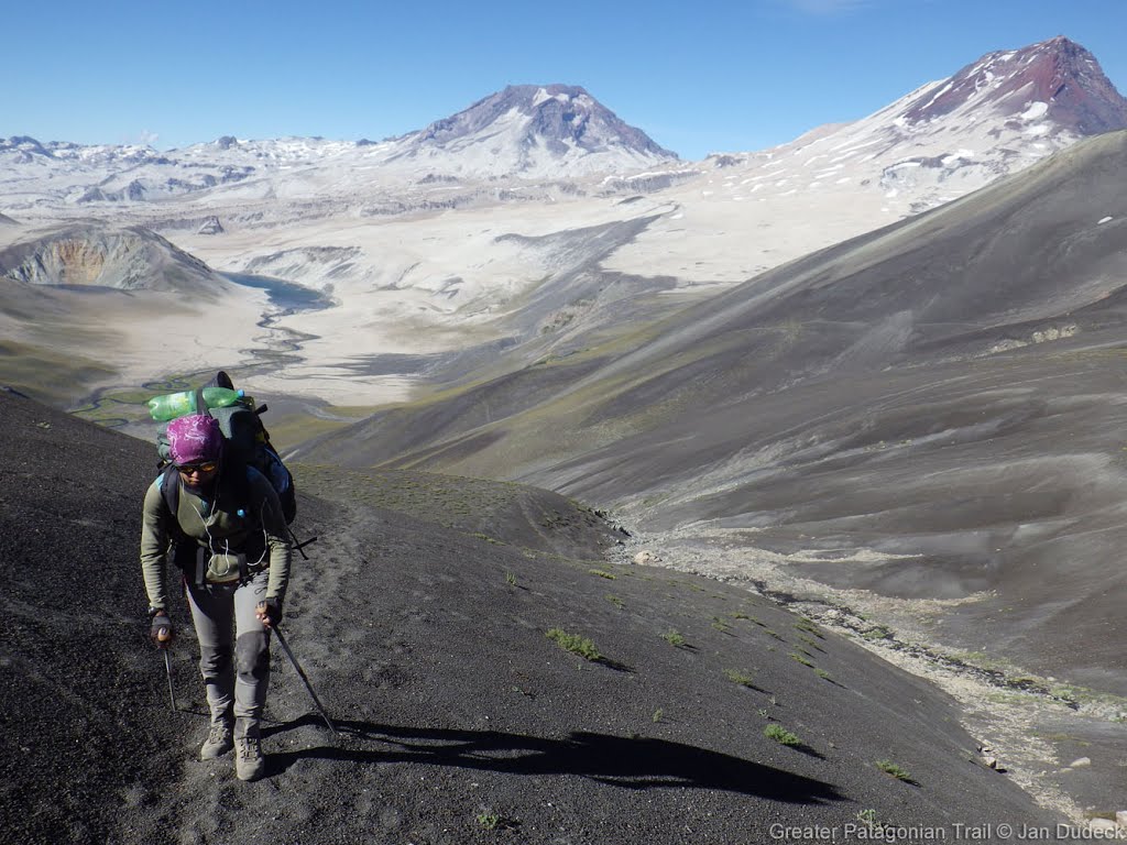
Just booked. I fly to Santiago, Chile January 12, 2016.
Having already done many of the most famous Patagonian hikes 10yrs ago (Paine, Fitz Roy, Cerro Castillo) , this time I’ll be more off the beaten trail.
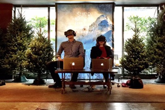
Destination BC has just launched The Wild Within VR Experience, using Oculus Rift technology, making it the first destination marketing organization in North America to use virtual reality to promote the destination.
The Wild Within VR Experience is an interactive, three-dimensional video that allows travellers to experience British Columbia in a truly immersive way, as if they were actually there. …
The Wild Within VR Experience video was filmed in British Columbia’s Great Bear Rainforest, located along the central Pacific coast, over the course of five days in September 2014.
It’s not (yet) possible to share VR on a website. But here’s another of their promotion videos. 🙂
British Columbia is the kingdom of abundance. Where glaciated mountains stand over an unruly Pacific. Rainforests wrap cities. Nature shapes culture. The wild breathing life back into the wild within.
0:10 – Evans Lake, Valhalla Provincial Park
0:18 – Campbell Creek near Kamloops
0:22 – Bobby Burns Creek, Bugaboo Provincial Park
0:25 – Naikoon Provincial Park, Haida Gwaii
0:30 – North Beach, Naikoon Provincial Park, Haida Gwaii
0:33 – Tofino
0:41 – Columbia Flats, East Kootenays
0:48 – Osoyoos
0:49 – Blue Mountain Vineyard
0:53 – Purcell Mountains
0:55 – Mount Nimbus via ferrata
0:58 – Takakkawa Falls, Yoho National Park
1:00 – Bugaboo Spire, Bugaboo Provincial Park
1:06 – Tofino and Ucluelet area
1:14 – Devil’s Range, Valhalla Provincial Park
1:19 – Duncan Lake, West Kootenays
1:23 – Avatar Grove, Pacheedant Village
1:26 – Near Golden
1:29 – Mulvey Lake, Valhalla Provincial Park
1:36 – Little Glacier Creek
1:42 – Chesterman Beach, Tofino
1:44 – Barkley Sound
1:46 – Pigeon and Snowpatch Spires, Bugaboo Provincial Park
1:49 – Naikoon Provincial Park
1:51 – Tofino and Ucluelet area
1:53 – Idaho Peak
1:54 – Spotted Lake near Osoyoos
1:58 – Whistler
2:00 – Emerald Lake, Yoho National Park
2:02 – Potato Ridge
2:04 – Duncan Lake
2:11 – Great Bear Rainforest
2:14 – Arrow Lakes Provincial Park
2:16 – Langara Island, Haida Gwaii
2:18 – Howser Tower, Bugaboo Provincial Park
2:25 – Salmon Glacier
2:27 – Mount Nimbus via ferrata
2:29 – Vancouver
2:34 – Barkley Sound
2:44 – North of Tofino
2:47 – Pacheedaht Village, Vancouver Island
2:49 – Crown Mountain near Vancouver
2:59 – Spear Spire, Bugaboo Provincial Park
In the summer of 2013 Casey Gannon and Colin Arisman thru-hiked the Pacific Crest Trail with cameras in hand.
“Only The Essential” is the story of their 5 month, 2668 mile journey on foot from Mexico to Canada across the wilderness of California, Oregon, and Washington.
Kanchenjunga, meaning “five great treasure houses of the snow,” is the third-highest mountain in the world and the second-highest in Nepal. Until 1856, it was believed to be the highest of all.
$3-$5,000 for an up to a 28 day adventure according to one source.
You could do it cheaper by shopping around in Kathmandu. Doing more of the organizational work on your own.