
running Top Bridge park B.C.
With a 10km run coming up January 1st, I’ve been running a lot of late.


Wet. But good fun. 🙂
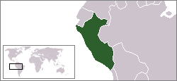
trek to Choquequirao, Peru
Hal Amen:
RESTORATION OF this small Incan city only began in the ’90s. The first visitors had to cross the Apurímac River via a rope bridge to reach it.
During a typical afternoon at Machu Picchu, you’ll be one among 2,500. At Choquequirao, you might see six or seven other visitors.
While the ruins currently sit under the radar, they won’t stay there forever. The regional government is investing $50 million into a cable car project that could get you to this site in 15 minutes intead of the current four-day trek. As early as 2016, there might be around 3,000 people visiting choquequirao per day. Consider yourself warned — get there now. …
DISCOVER YOUR OWN MACHU PICCHU: CHOQUEQUIRAO, PERU
The photo Hal used to top his article is besthike editor Rick McCharles from 2005.

Cabin Porn™

hiking gear for Christmas?
Vilcabamba Trek to Machu Picchu
Mark Whitman of Kandoo Adventures helped us put together an information page on the Vilcabamba Trek in Peru.
The original Lost city of the Inca. A great alternative to the Inca Trail.
AT A GLANCE
- Begin in the Vilcabamba Valley
- Walk 5 days to Machu Picchu
- dry months May-September are best
- Perhaps the toughest Inca trek
- Three high passes
- Hike with a guide or independently
Why We Like This Hike
- Finish at one of the world’s most incredible destinations – Machu Picchu
- ‘off-the-beaten-path’
- No permit required
- Peru is one of the world’s best hiking nations
- Very quiet – you won’t see another hiker
- A more authentic Peruvian experience than the crowded Inca Trail
- Trek on well preserved Inca trails
- Visit rarely seen Inca ruins, including Vitcos-Rosaspata and Ñust’a Hisp’ana
- Great challenge for experienced hikers
- Dramatic scenery and snow-capped peaks
- Hot springs near the end of the trek
Vilcabamba Trek to Machu Picchu
Click through to learn more.
Click PLAY or watch Kandoo Adventures’ itinerary on YouTube.
We’re looking for trip reports from independent hikers. Reply to this post if you know of one.
Cam Honan – off-trail hiking
Great interview.
Are there extra safety precautions you take when you hike an unmarked route?
I generally leave a more detailed description of my proposed route with friends or family before setting out. For someone that is relatively new to off-trail backpacking, I would recommend erring on the side of caution in regards to food, water, sufficient layers, distance estimates, etc. You may also consider carrying a personal locater beacon, such as a SPOT or Delorme inReach. …
What kinds of maps do you use? What Scale? Have they been difficult to get? How much do you study the maps before starting?
In western countries such as the United States, it’s easy to find great topo maps (e.g. USGS 1:24,000 series). In developing nations, it’s often a very different story. Over the decades I’ve made do with everything from 1:250,000 overview sheets to a sketch map on the back of a napkin from a waiter in Arequipa, Peru (Volcan Misti hike, 1996). …
HIKER Q & A – CAM ‘SWAMI’ HONAN ON CREATING ONE’S OWN HIKING ROUTES

related – Cam’s 2015 – The Year in Pictures
in Patagonia
Click PLAY or watch it on Vimeo.
(via Adventure Blog)
hike the length of Vancouver Island
This is ambitious. 🙂
Vancouver Island Spine Trail … will be created from the southern tip of Vancouver Island running from Victoria up to the top of the island at Cape Scott Provincial Park. The trail will be accessible to hikers five months of the year, with some sections available much longer. Various sections will be available for non-motorized multi-purpose, where permitted. …
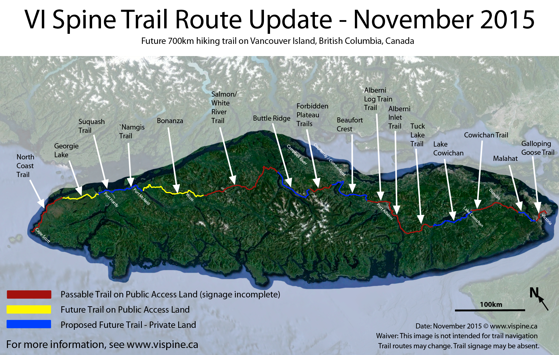
map page
official website – vispine.ca
related – my proposed coast-to-coast Vancouver Island adventure. Bushwhacking.
1001 Walks you must take before you die
Published 2015.
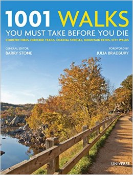 At 960 pages this hard cover coffee table publication looks impressive. But it’s ultimately fairly useless for the serious hiker.
All 1000 hikes get 2-3 paragraphs whether a 10 minute climb up the Cologne Cathedral. Or the 14,000mi (23,000km) Trans-Canada Trail.
There are few links or references.
It’s grouped in these sections:
Overland
Urban
Mountain
Heritage
Coastal & Shoreline
Two index sections are valuable:
Walks by Country
Walks by Distance
The longer walks selected are good. The authors do know hiking. But with 1000 chosen, it would be difficult to miss the best of the best.
They did somehow miss a couple of our top 10:
#4) Ausangate Circuit, Peru
#5) Sunshine to Assiniboine, Alberta, Canada
You can give this 1001 book a miss.
Or … skim it for inspiration. Some of the photos are wonderful.
