
Click PLAY or watch it on Facebook.
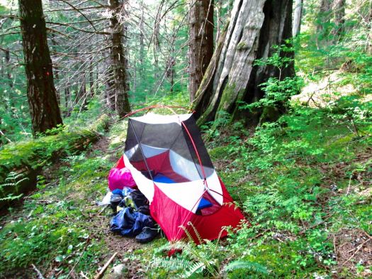
MSR Hubba NX tent
I just got the newest Hubba. It’s somewhat better than the previous model, seems to me.
I’m still using both.
Click PLAY or watch an by the manufacturer on YouTube.
One guy spent 3 years bicycle touring and living out of his Hubba. (The older model.)
My second recommendation would be one of the Big Agnes one person tents.
related – Chris Townsend – Choosing A Wild Camp Site
Sunshine Coast Trail – day 4
trip report by site editor Rick McCharles
Elk Lake to Lois Main
day 1 | 2 | 3 | 4 | Sunshine Coast Trail information page
I left Elk Hut as early, quickly and quietly as possible. Alex was still sleeping upstairs.
Mice are a problem in some huts. You still need to hang your food.

This would be my last day. I hoped it would be easier hiking, descending back to sea level. And it might have been if I’d not been lost once and diverted twice.
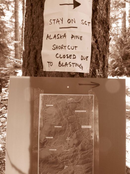
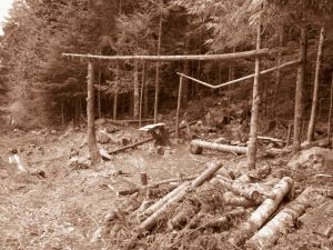
Road building and logging operations are ongoing. It’s not unusual to have to detour around sections of the SCT.
I’d complain more stridently … but one of the detours ended up being a favourite section. Lovely off-trail through temperate rain forest.
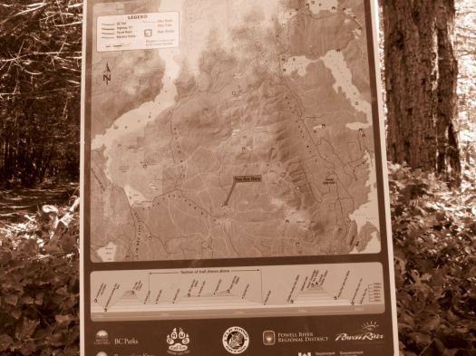
Signage is actually very good on this new, rapidly changing trail. But I still wished I’d brought my GPS.
I left a Summit Stone at one lovely creekside lunch spot.
If you can put up with the bugs, the SCT is endlessly entertaining. Something new around ever corner.


I’ve got one big chunk of the SCT left to do – the Troubridge Trudge (41km for me). I plan to do that in October or November one year to see if the bugs are hibernating.
day 1 | 2 | 3 | 4 | Sunshine Coast Trail information page
Sunshine Coast Trail – day 3
trip report by site editor Rick McCharles
Tin Hat Mountain to Elk Lake
day 1 | 2 | 3 | 4 | Sunshine Coast Trail information page
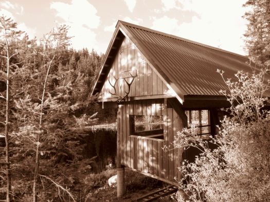
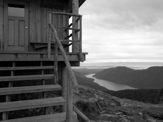
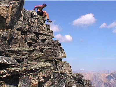
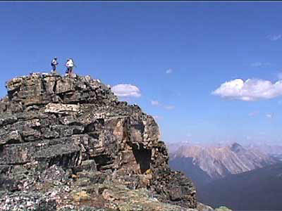
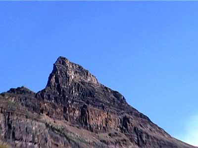
… the Tin Hat hut is an epic 360-degree mountain-top lookout that provides the quintessential view of the rugged mountains, valleys, and lakes that define the Powell River back country experience. This hut is a fully winterized cabin with pellet stove and is located in, arguably, one of the most beautiful spots on the Sunshine Coast Trail. Although it is a climb to get there, the experience is well worth the effort. Summitting this mountain will make you feel like you are, indeed, on top of the world!

It’s the highest elevation point and the biggest attraction of the SCT. I was impressed.

Still early morning, I chatted with Lisa from Calgary in the hut. Then dashed on back down the logging road to where I’d stashed my pack. A savvy hiker like myself doesn’t haul his gear up the mountain unless absolutely necessary. My guidebook hinted at an alternative SCT route that would be easier than the normal steep up and down. 🙂
I was soon lost. 😦
Views were terrific.
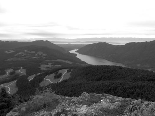
But I found myself on a maze of logging road switchbacks. If you don’t like clear cut, you might not like the Sunshine Coast Trail.
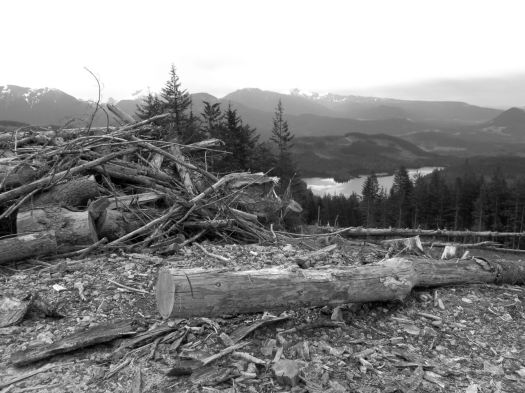
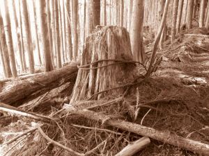
Here you can see an old growth survivor. Secondary growth. And the war zone that is clear cut logging.

Worse than forest devastation, the bugs.

By day 3 I wore my bug shirt non-stop. Flying pests are a very good argument why you should NOT hike the Sunshine Coast Trail. All of the other major B.C. coastal hikes have virtually no bugs
Eventually I found my way back to the SCT.

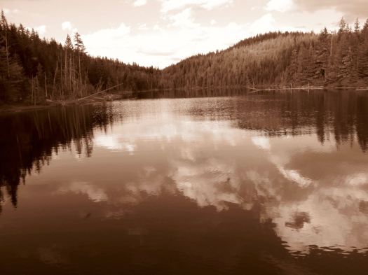
Past Lewis Lake.

On to Elk Lake.
Mosquitos and I had the rustic hut to ourselves. Very tranquil.

Close to dark Alex from Ontario rushed in. Super happy to have made it to the hut in daylight. She’d come from Tin Hat Hut.
day 1 | 2 | 3 | 4 | Sunshine Coast Trail information page
Sunshine Coast Trail – day 2
trip report by site editor Rick McCharles
Inland Lake to Tin Hat Mountain
day 1 | 2 | 3 | 4 | Sunshine Coast Trail information page
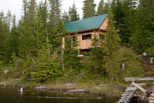
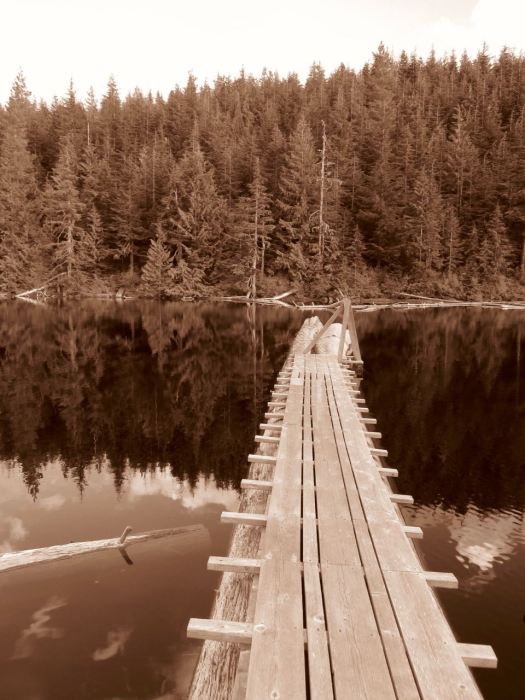
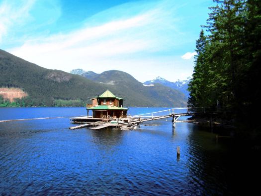
This was my toughest day. A steep scramble up to Confederation Hut on the same-named lake. Then a long descent down to Fiddlehead Landing Hut. And finally a steep slog up to the top of Tin Hat Mountain.

This is not Fiddlehead Landing Hut. Rather a floating holiday home next door.
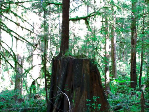
Hiking temperate rain forest can be lovely. Soft mulch underfoot. Plenty of variety. Nurse logs. Good visibility even in the trees.

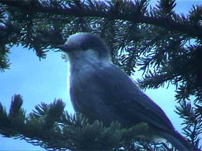
I didn’t see much wildlife. Other than garter snakes.
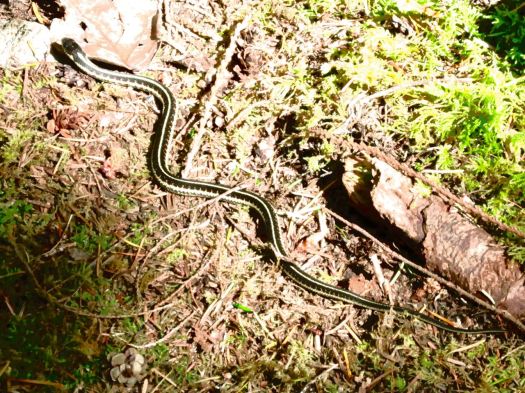
One snake was eating a banana slug. I’d believed NOTHING could eat a banana slug. 🙂
Lisa from Ontario had seen a bear near the start of SCT. But – in general – you don’t see much aside from birds.
… Fact is, I never made it to the top of the mountain. About an hour short of Tin Hat Hut I dropped my pack on the trail and set-up on the trail.
Could barely keep my eyes open. That was 7pm. I’d been almost all of 12 hours on my feet. Mostly climbing up or down.
day 1 | 2 | 3 | 4 | Sunshine Coast Trail information page
Sunshine Coast Trail – day 1
trip report by site editor Rick McCharles
Mowat Bay to Inland Lake
My camera had multiple problems on this trip. Photos are inconsistent, at best. 😦
day 1 | 2 | 3 | 4 | Sunshine Coast Trail information page
AT A GLANCE
- the best jumping off point for the SCT is Powell River, close to Vancouver B.C.
- the Sunshine Coast is less rainy than the rest of the lower mainland, but can still be very wet
- up to 180km (112mi)
- possible to hike hut to hut without carrying a tent
- huts “first-come, first-sleep”. Each can accommodate at least 12 hikers. More huts are being added.
- Canada’s longest hut to hut hiking trail
- NO permits or reservation required
- free 🙂
- it’s considered B.C.’s hidden gem of hiking routes. Many have not yet heard of this adventure.
- recommended to carry a tent as a back-up. There are many scenarios which might cause you not to reach the next hut on any given day.
I caught the 10am ferry from Comox, Vancouver Island to Powell River.

My plan was to do the big central section. About 90km.

July 2015 we’d hired a boat to drop us at the northern trailhead Sarah Point. But quit the hike at Manzanita Hut after only 2 days. Driven out by mosquitos and wasps.
Could have taken a local bus to a trailhead, but instead walked from the ferry about 5km through town to Mowat Bay.
Here’s pretty Cranberry Lake in Powell River town.

Lovely day to start a hike. 🙂
Mowat Bay is close to sea level. It’s uphill from here.

Alder loves to overgrow the relatively little used trails. Blow downs are more frequent than are volunteers with chain saws. It’s rugged and challenging hiking. But pretty.

I ended up paying $5 to camp on Anthony Island. I slept in my tent.

A Danish couple took the hut.

They made dough from flour. Then wrapped it around a green branch to cook over the open fire. A Danish tradition, I understand. Burnt on the outside, raw on the inside. 🙂
day 1 | 2 | 3 | 4 | Sunshine Coast Trail information page
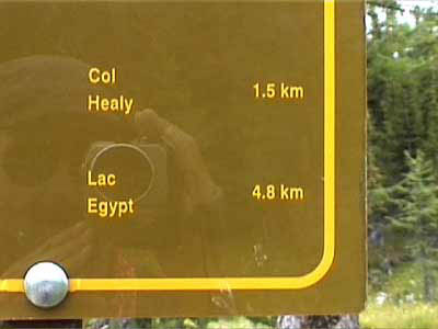
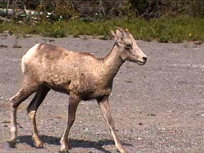
Egypt Lake 2001 photos
by site editor Rick McCharles
The Lakes and Larches hike to Egypt Lake in the Canadian Rockies out of Banff was fantastic.
In bright sunshine, one day temperatures approached 30 degrees Celsius!
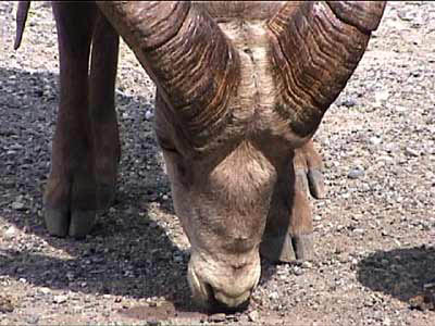
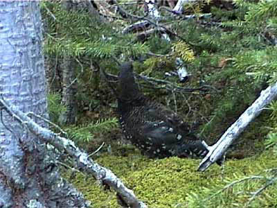
Most of these photos are close-ups as those tend to turn out best from (the fairly low resolution) camcorder. I included some of the amazing wild flowers and many of the animals we saw.


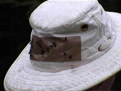
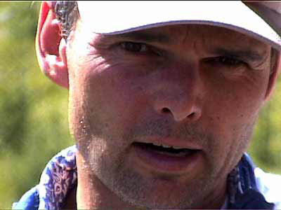
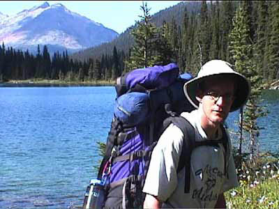
The hat has a disgusting collection of flies stuck to it — a failed gear innovation..


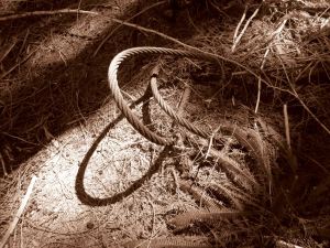
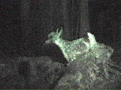
The deer is a surprising illusion — it’s made of deadfall and underbrush.


Merrell Men’s Moab GORE-TEX®
My hiking transportation of choice.
Just bought my 4th pair over the past 5 years. In yet a bigger size. The bigger the better for me it seems when it comes to approach shoes. I’m up to size 10.
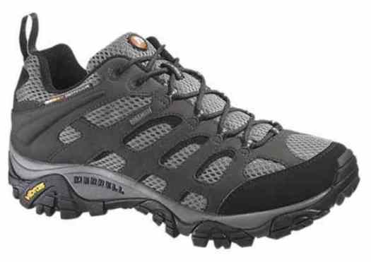
Durability is terrific. I wish they had wider sizing than 2E. (“wide”)
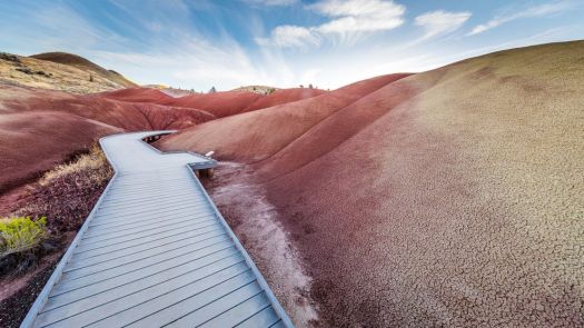
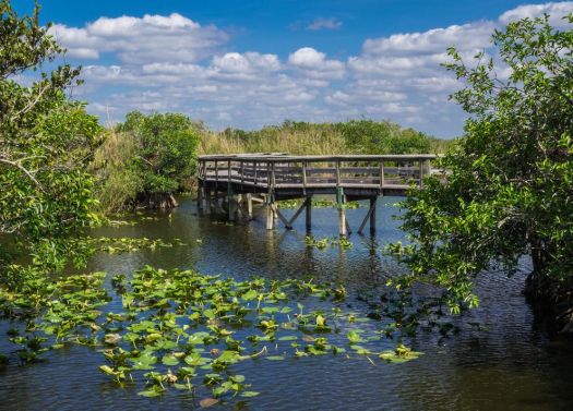
we love boardwalk hiking trails
Especially for trail running. 🙂
See more.
trekking the Everest region, Nepal
Click PLAY or watch it on YouTube.
Cost is about $40 / day / person in 2016 staying and eating in Tea Houses. Carrying your own pack. There’s no earthquake damage in that part of the Himalaya.

Check our Everest Base Camp / 3 Passes information page.
(via The Longer, The Better – Three Pass Trek)
