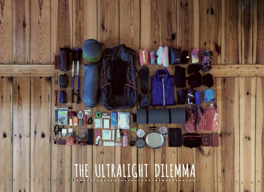
It’s taken decades for the National Park Service (NPS) to purchase the land needed to build an uninterrupted hiking experience through Santa Monica Mountains National Recreation Area. However, it’s now possible for Southern Californians to hike 67 complete mountainous miles across the range on the Backbone Trail, according to the L.A. Times. …
If you are interested in hiking the trail, as this writer is, you can learn more about the process at the National Park Service website. …
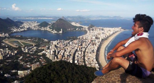
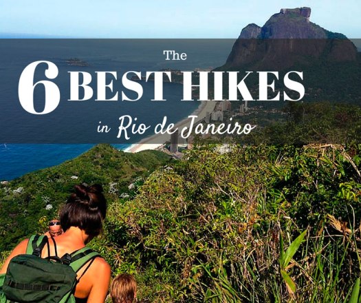
Rio de Janeiro may be famous for it’s beaches, but it’s so much more than that- the city is also home to the Tijuca National Forest, the world’s largest urban forest full of hiking trails, breathtaking views and endless rainforest terrain to keep you busy off the beach.
If you’re coming to Rio, you won’t want to miss hiking at least one of these trails so you can see the other half of Rio de Janeiro’s beauty. There’s something for everyone here, so whether you’re a dedicated mountain climber or just a curious traveler ready to wander off the beach for the day, you won’t be disappointed. …
If you don’t speak Portuguese, logistics are more complicated than expected. Asking a bus driver to let you off at the correct stop not easy. GPS advised.
I was up at 3:30am to check out of my hostel in Xela and walk over to Quetzaltrekkers through dark streets.
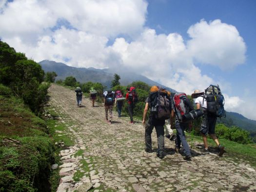
4:45am rendezvous. Our group of 10 included two guides, hikers from Canada, the States, England, Switzerland and Germany.
At 5:15am we climbed into a pick-up to get to the hectic Minerva bus depot. We were first to get seats on the chicken bus.
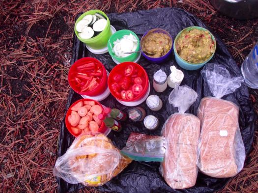
Arriving about 7:30am, we ate a good breakfast at a San Marcos bus station comedor.
Next was an even more crowded bus to Tuichan. By around 10:00am we started up.
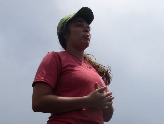
Quetzaltrekkers have no employees. Everyone is a volunteer.
Volunteer guide, Jordan, from Canada.Volunteer guide, Rachael, from the USA.
All proceeds go to a children’s charity.
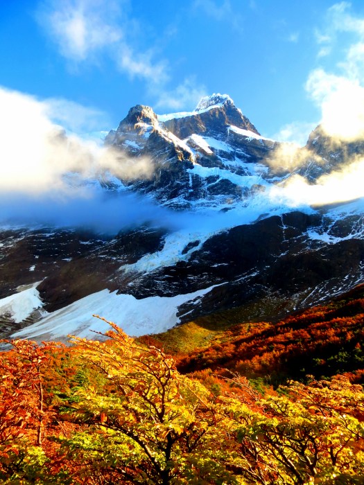
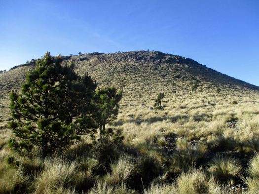
Being a volcano, I feared it would be an unrelenting slog at the same angle. Happily there is a fair bit of variation in the trail – though it is unrelentingly UP.
A highlight are the Hartweg’s pine, a very high altitude species
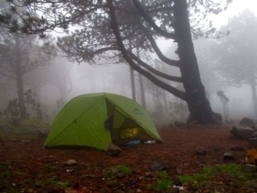
Spooky in the clouds.
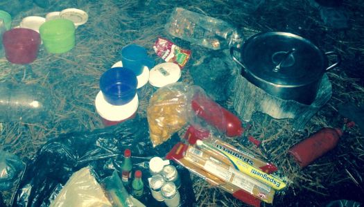
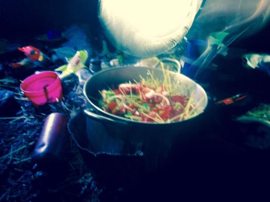
Finally arriving at “base camp” after 4-5 hours, we enjoyed a healthy lunch of local fare.
That was 1000m elevation gain over 4km. Sleeping at about 4000m (13100ft), there’s a real risk of altitude sickness.
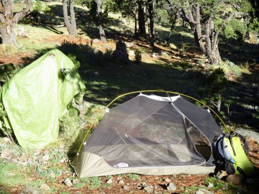
Everyone slept in provided 4 person tents aside from Jordan (who slept in a hammock) and myself who brought my own gear.
We all crashed for siesta, knowing we wouldn’t get much sleep tonight.
We’d planned to climb up to Tajumulco’s second summit, Cerro Concepcion, for sunset. But afternoon rains had come. We stayed in our tents.
By 6:30pm the rain had stopped. We had dinner and hot drinks, hoping the morning would be clear. This was the second trip for one girl – her first summit clouded over.
A brazen mouse ran around the cook area.
___ My alarm went off at 3:30am. I’d not slept particularly well.
Though we had clear skies and near a full moon, it was dark. My borrowed headlamp died quickly. I followed the lead guide closely to take advantage of her lamp.
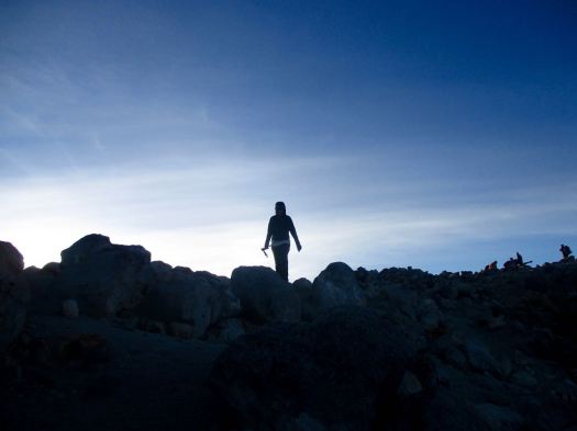
The final 200m is a scramble. Gloves are useful for grabbing stone in the dark.
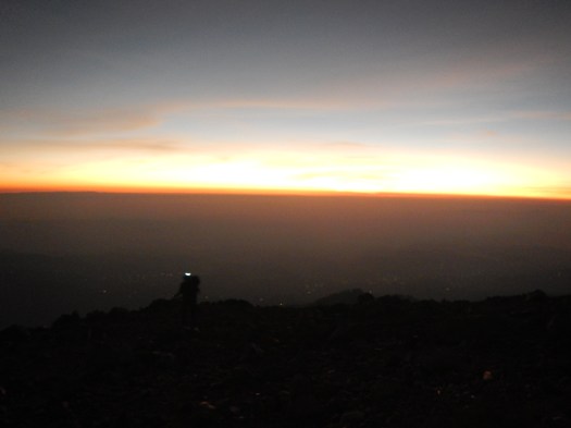
It went well. All 10 of us at the top before dawn. We huddled in our sleeping bags.
Dawn at 5:30am was gorgeous.
Everyone – at this point – was super happy they had joined the trip.
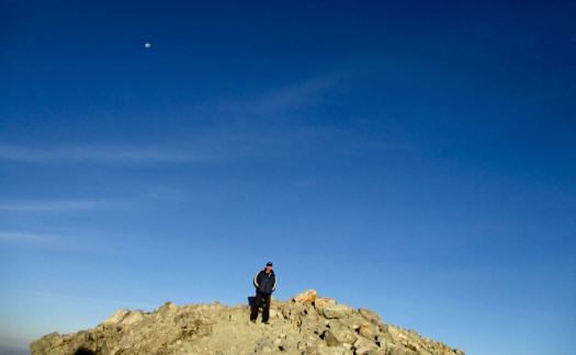
We stayed on top as long as we could handle the cold wind.
Rick the highest man in Central America
There are views to Mexico. And many other volcanos.
This is volcano shadow.
We descended by a different route, first circumambulating the crater.
Quickly into grassland, we started to get hungry.
The water was boiling for breakfast by the time we got back to camp.
This very popular hike is – sadly – quite littered and vandalized. Instead of leaving my Summit Stone at the summit, I left it in one of the excellent climbing trees at camp. 🙂
No rush. We dried the tents, the sun already very hot at 8am.
I was impressed with the toilets provided. Happily there are very few insects this high up.
The descent was relaxed. Our climb already a success.
It’s slippery, however. We had numerous falls on the way down. This could be treacherous in the rain.
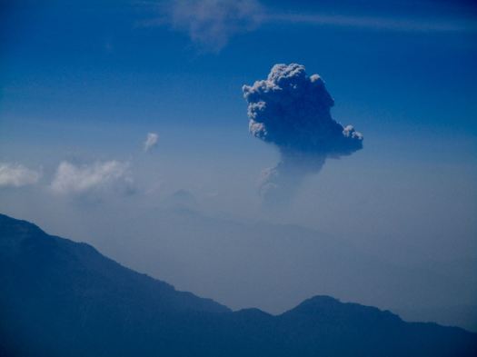
One highlight was seeing the eruption of another volcano – Santiaguito. It’s a near daily occurrence. In fact I’d climbed up another volcano, Santa María, to see that eruption on another hike, 10 years earlier.
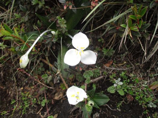
The National flower of Guatemala, Lycaste skinneri, are everywhere. Another highlight.
About Noon we got back to the road. The peak was already clouding up. No doubt it would rain again late afternoon.
We were hungry again for a big lunch at this village restaurant. Most had the fried chicken. And Gallo beer.
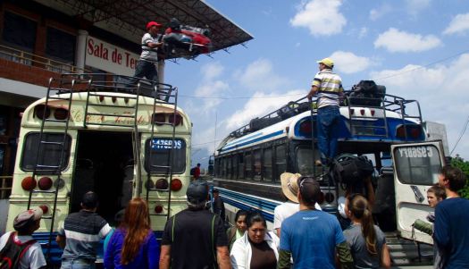
We reversed our route. First a bus back to San Marcos. Our driver parked close to our next so they could throw our packs roof-to-roof. (I’d never seen this before.)
In Xela we again climbed into a pick-up truck to return to Quetzaltrekkers by about 4:30pm
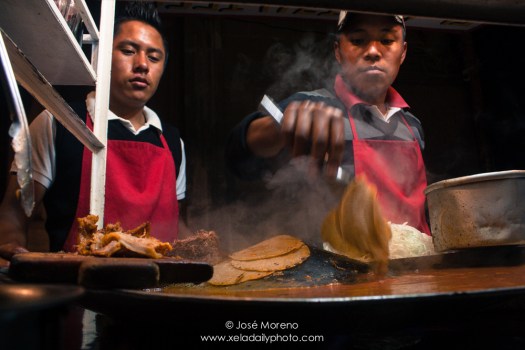
A shower. Some rest. To celebrate some of us got together for street tacos and cheap beer at the Plaza Central.
Tajumulco is highly recommended, so long as you have clear skies in the morning. You can do it on your own, but finding all right buses may be a hassle.