October 29 – November 6th, 2016 in Banff, Canada.
Click PLAY or watch it on YouTube.

Best hikes, treks, tramps in the world.
Andy Davidhazy took a photo of himself and the trail at every single mile over 2660 miles in 5 months.
Click PLAY or watch it on YouTube.
I once cycled DOWN from high up on the Annapurna Circuit. Cycling up there (from Kathmandu) sounds tough.
Drawn by the majesty of the Nepali Himalaya and its welcoming teahouses, Colt Felters sets out to pedal around the region’s infamous Annapurna Circuit. Once he’s found his bike…

(via Hiking in Finland)
3 weeks adventure with the French photographer Brice Portolano backpacking in the wilderness of British Columbia. After a week on Vancouver Island, Brice hiked in the South Chilcotin mountains with the aim of reaching the highest summits.
Click PLAY or watch it on Vimeo.
(via Adventure.com)
 Looks a very good list. Well researched. BestHike.com is proud to be included.
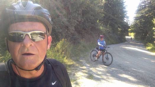
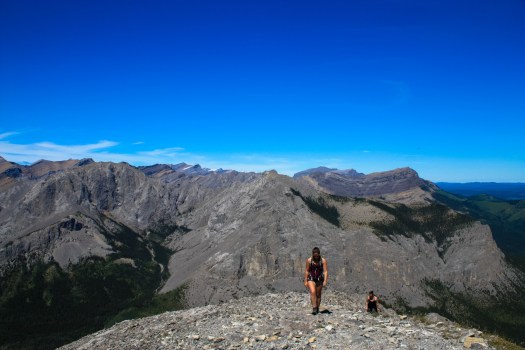
A classic training session for Dave and Jeni is to cycle up to the Chilco trailhead out of Coeur d’Alene. The big push is a relentless 4.2 miles up to the saddle. Some were left gasping.
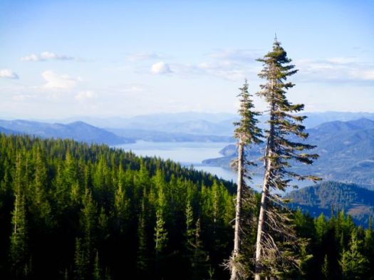
Next a steep hike up to great views on the summit ridge.

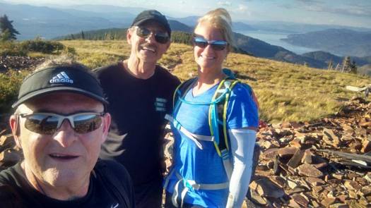
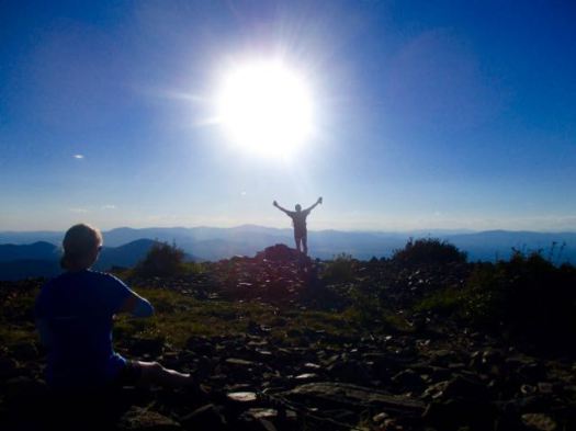
This was Dave’s first real test of his knee since surgery. It survived. 🙂
It’s often windy up here. Today the weather was perfect.

The ride down on gravel I found sketchy. Dave and Jeni are Adventure Racers and found that challenge fairly trivial.
We were 4 hours up and down from Dave’s home. Hot tub and red wine was my reward.
The Optimal U.S. National Parks Centennial Road Trip

(via lifehacker)
I’ll be in the Canadian Rockies end of August. 🙂 I’m still deciding on what hikes to do on that trip.
… the mountains here have all of the spectacle and grandeur of their southern American cousins, and in most places they only have a fraction of the foot traffic. …
Modern Hiker – 6 STUNNING DAY HIKES IN ALBERTA
This 2014 book includes some great walks: Larapinta Trail, Milford Track, Carthew-Alderson, Chilkoot Trail, Yosemite’s Panorama Trail, etc.
But it also includes some surprising choices – Mt Sinai, for example.
It includes an oddball assortment of tips on each. I’d hardly call it a hiking guidebook, however.
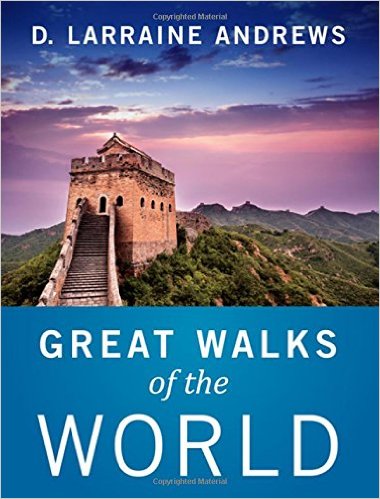
An eclectic collection of 11 global walks and hikes, the book includes destinations on every continent but Antarctica. From one-day saunters to two-week odysseys, readers will find the in-depth story behind each trail, combined with detailed maps and a visual feast of archival and contemporary images from contributors located around the world. …
This site was selected one of 25 top Outdoor Blogs.
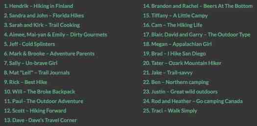
It’s a good list. I’ve started following a number of those selected that I hadn’t known about previously. 🙂
