Hot Springs Rim, Big Bend TX

trip report by site editor Rick McCharles

Note: We were there Jan 2017. Accessibility may change depending on what happens with Trump’s border wall promise.

One highlight of Big Bend National Park you should not miss are the Hot Springs.

A reminder of the park’s past volcanic turmoil, the Langford Hot Springs (or just “hot springs”; everyone will know what you’re talking about) is a small, jacuzzi-sized pool of naturally occurring 105°F (41°C) water from deep below the earth. …

Edge of the Rio Grande

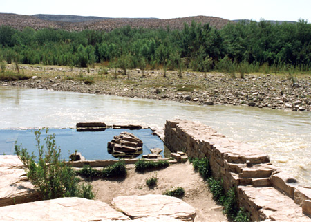
It’s a short walk from the parking lot. Bring a flashlight at night.

Even better is to hike the Hot Springs Rim trail first. Finishing with a dip.

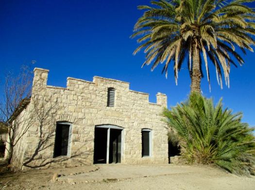
The trailhead features the amazingly well preserved buildings from the Livingston family days.

Hotsprings Trail, Big Bend

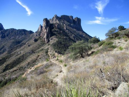
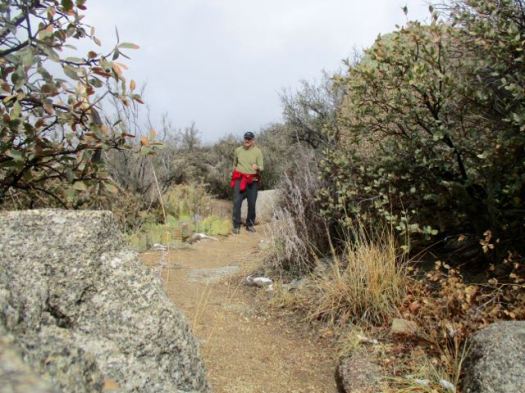
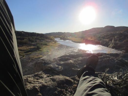
I started up the Hot Springs Trail.

Hotsprings Trail, Big Bend

Hotsprings Trail, Big Bend

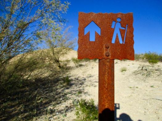
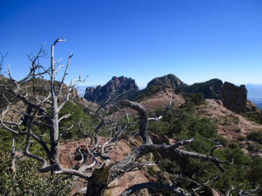
Continued on to the Hot Springs Rim Trail high above the Rio Grande.

Hotsprings Trail, Big Bend

Hotsprings Trail, Big Bend

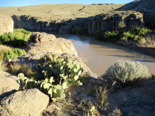
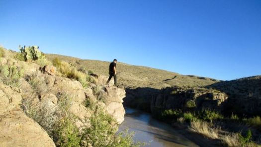
I left a Summit Stone at a nice viewpoint.

Hotsprings Trail, Big Bend

Relaxed there looking over the river into Mexico. Very tranquil.

Hotsprings Trail, Big Bend

I backtracked to the Hot Springs just in time for dusk. 🙂

This is the life.

Lost Mine Trail, Big Bend TX

trip report by site editor Rick McCharles

Very close to Chisos Basin Campground in Big Bend National Park is the super popular Lost Mine Trail.

  • 4.8 miles return
  • perhaps the best half day hike in the Park
  • starts at 5,650 feet, ends at a dramatic rocky ridge at 6,850 feet

On the way up you can look back to the campsiteLost Mine, Big Bend

Pretty views non-stop.

Lost Mine, Big Bend

Surprisingly large trees.

Lost Mine, Big Bend

This is heaven on a nice day.

Lost Mine, Big Bend

I left a Summit Stone atop this feature. You’ll need to scramble to find it.

Lost Mine, Big Bend

I didn’t spend much time at the end of the ridge. It was too windy.

Lost Mine, Big Bend

There is no Lost Mine I’m afraid. That’s an old legend.

But I do highly recommend this hike. Weather permitting.


The Window, Big Bend TX

trip report by site editor Rick McCharles

Chisos Basin Campground is the best in Big Bend National Park. Reserve in advance as it’s very popular.

The Window, Big Bend

Awaking my first morning I found the famed Window hike ran right past my campsite.

I had two mugs of coffee. Then set off down the trail.

The Window, Big Bend

The Window, Big Bend

The moon still out.

The Window, Big Bend

I was first down the trail this morning. My only company were the large, friendly Mexican jays.

mexican_jay_aphelocoma_wollweberi_3

My first trail in Big Bend, I was impressed with construction and management. Check these stairs cut into stone.

The Window, Big Bend

Here’s the Window pour-off. The only outlet for water from the entire mountain basin.

The Window, Big Bend

Don’t get too close. It’s a 220ft drop to Chihuahuan Desert.

related – Trek Southwest – The Window Trail – Big Bend National Park

Manaslu Circuit – new cantilever trail section

The guided Manaslu Circuit trek in Nepal is one of the very best hikes in the world.

Some good news.

The April 2015 earthquake triggered landslides that destroyed many sections of the Budi Gandaki Trail, cutting off Upper Gorkha, affecting the movement of local people and trekkers on the Manaslu Circuit.

Now, engineers have used cantilever technology to restore damaged sections of the trail along the narrowest and steepest parts of the Budi Gandaki gorge. …

Nepali Times 

manaslu-circuit-bridge-2

manaslu-circuit-bridge

(via Manaslu Circuit Trek)

best men’s hiking footwear 2017

top 10 travel likes the HOKA ONE ONE Tor Summit Mid Waterproof Men’s Hiking Boots best.

hoka-one-tor

Click through to see the rest of their list – Best Men’s Hiking Boots 2017 – Buyer’s Guide and Reviews

My own shoe of choice is there – Merrell Men’s Moab GORE-TEX®
I’m on my 4th or 5th pair.

U.S. long distance trails

Backpacker magazine:

Of course there’s the Triple Crown—the Appalachian Trail, Pacific Crest Trail, and Continental Divide Trail—and dozens more, spanning tens of thousands of miles. Whether you want to hike for six days or six months, start your search here. …

Map: America’s Best Long Trails

long-distance-trails

(via Adventure Blog)

Tramway Trail, Albuquerque

trip report by site editor Rick McCharles

I took the Sandia Peak Tramway trip on one of the snowiest days of the year.

It’s one of the top tourist attractions in New Mexico.

img_3438

I first tried hiking to the top. Planning to ride down on the Cable Car. That would have been GREAT.

The La Luz Trail (Trail 137) … on the west face of the Sandia Mountains near Albuquerque, New Mexico. The trail begins at the La Luz Trailhead and proceeds approximately eight miles to either Sandia Crest or the Sandia Peak Tramway. The hike is strenuous, with 3,775 ft (1,151 m) of elevation gain and a grade of 12%. …

click for larger map

I started at the Tramway parking lot on the Tramway Trail (82). Planning to connect to the La Luz.

Tramway Trail, Albuquerque

It’s a pretty traverse above lovely residential homes.

Tramway Trail, Albuquerque

I’d heard a foot of snow had fallen up top. It did not look good for me getting up there.

Tramway Trail, Albuquerque Tramway Trail, Albuquerque

I – happily – backtracked to my vehicle.

Tramway Trail, Albuquerque

At one point I stumbled off trail. Easy to do in the desert. While scrambling an arroyo to regain the trail I kicked a cactus and drove a spine into my foot.

Lesson learned = STAY on the trail in the desert.

The main reason to go to Albuquerque are the 200 miles of Sandia hiking trails many of which are off limits to mountain bikes.

We’ve added the La Luz Trail to our list of best hikes in North America.


Meteor Crater, Arizona

trip report by site editor Rick McCharles

I’d hoped to do the short guided hiking tour of part of the rim, but arrived too late in the afternoon. I missed the last one by minutes.

Meteor Crater is a meteorite impact crater approximately 37 miles (60 km) east of Flagstaff …

640px-meteorcrater

Despite its importance as a geological site, the crater is not protected as a national monument, a status that would require federal ownership. …

… some 170 m (560 ft) deep, and is surrounded by a rim that rises 45 m (148 ft) above the surrounding plains. …

Meteor Crater is a popular tourist attraction …

During the 1960s and 70’s, NASA astronauts trained in the crater to prepare for the Apollo missions to the Moon. …

Click PLAY or watch it on Vimeo.

official website

Management of this natural treasure is excellent. I doubt the National Parks system would do better.

a girl hikes the GR20 in Corsica

The video is complete. On what some call the toughest hike in Europe.

This is an indiegogo campaign.

Three weeks of filming in one of the most amazing location in the world was breathtaking. We walked the route in real time, as we did all filming, with all the obstacles and beauties. Now we can present the authentic story. …

Click PLAY or watch it on YouTube.

Click PLAY or watch a teaser on Vimeo.

https://vimeo.com/197801012

Sunset Crater, Arizona

trip report by site editor Rick McCharles

Climbing to the rim has been closed for decades. Hikers were doing too much damage.

sunset-crater

I did the partly wheelchair accessible 1-mile (1.6km) trail Lava Flow Trail and some of the 1-mile (1.6km) Lenox Crater Trail. Both were snowy.

Sunset Crater AZ

Sunset Crater AZ

But if you are passing anywhere close to Flagstaff, Arizona, any time of the year. I recommend you make this stop. The Visitor Center is excellent.

rick-sunset-crater-az

The date of the eruptions that formed the 340-meter-high cone (1,120 ft) was initially derived from tree-ring dates, suggesting the eruption began between the growing seasons of A.D. 1064–1065. However, more recent geologic and archaeological evidence places the eruption around A.D. 1085. …

On the same road trip visit nearby Wupatki National Monument.

Wupatki Pueblo
Wupatki Pueblo

If you book in advance, Rangers offer guided hikes from October through April. Anywhere from two hours to two days.