Best of The Bruce – Georgian Bay Trail

trip report by site editor Rick McCharles

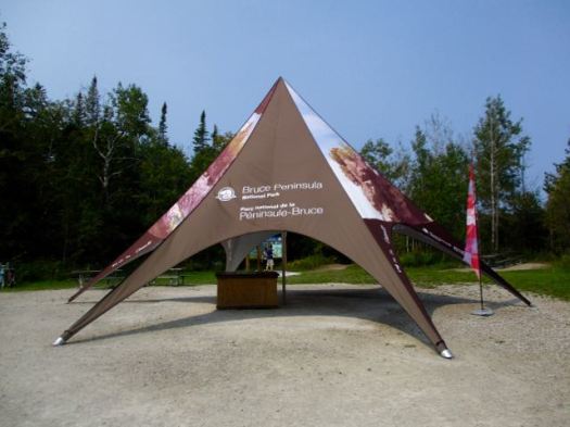
To research the best sections of the Bruce Trail I drove to the northern end – Bruce Peninsula National Park (established 1987).

My first visit.

Very popular. Well run. Rangers gave me good information on hiking.

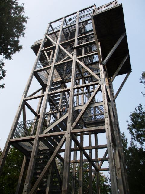
There’s a tall viewing platform just outside the Visitor Centre.
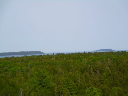
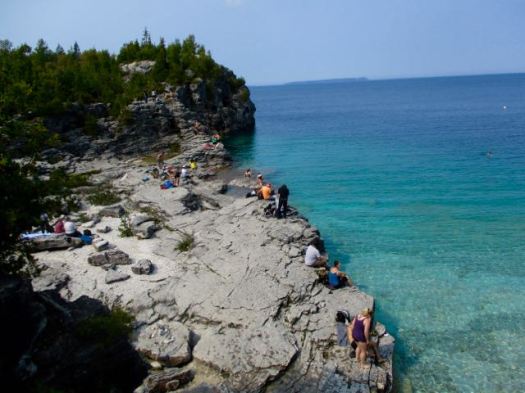
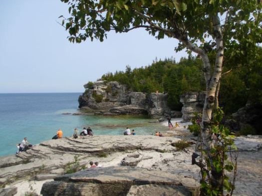
“A sea of forest.”

I come from western Canada. The wild west is the best. The east … is not. More often than not I refer to this Province as On-terrible.

Still, I was excited to finally get on to the most famous hiking trail in the most populous Province.

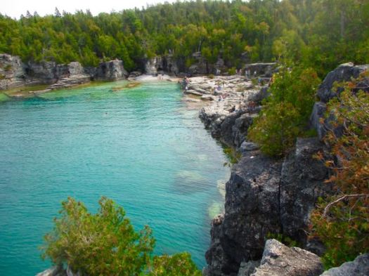
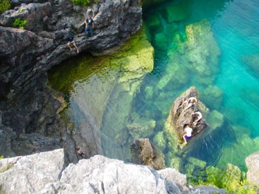
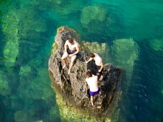
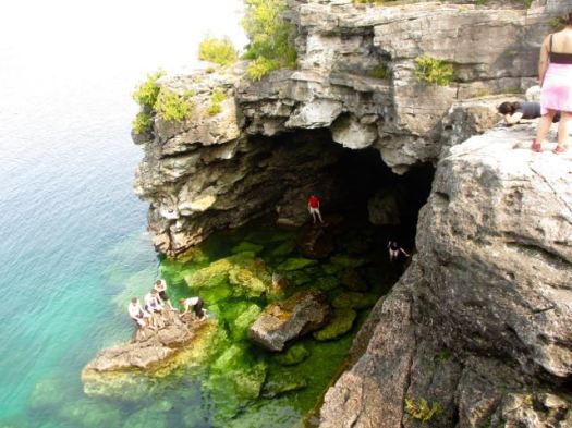
Pretty much every visitor heads directly to the Cyprus Lake trailhead.

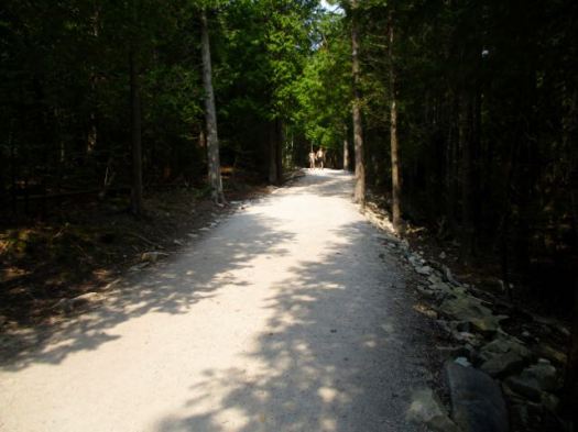
I did one of the standard short loops – Georgian Bay Trail out, Mar Lake Trail back.

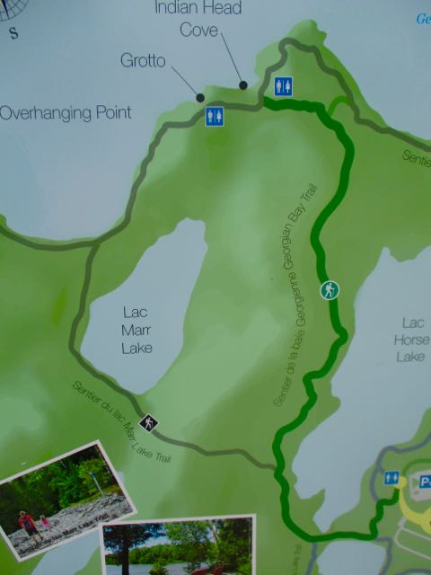
It’s pretty. But pretty crowded. I didn’t stop long at any of the recommended stops.

See my photos on Flickr.

The Bruce Trail is more than 890 km (550 mi) long and there are over 400 km (250 mi) of associated side trails. I spent a week hiking some of the best sections.

related:

• 10 Best Hikes of the Bruce Trail

• Bruce Trail app | Bruce Trail Reference Guide – 29th Ed

• BruceTrail.org

hiking Mt Assiniboine, Canada

trip report by site editor Rick McCharles

One of our top 10 hikes in the world is Sunshine to Mt Assiniboine in the Canadian Rockies.

Nine of us made it to the top of Nub peak for the solar eclipse.

2017

Our trip was nearly cancelled due to forest fire. Assiniboine opened up on the Wednesday before our Sunday start.

Three hiked up on the Assiniboine trail because Sunshine Meadows was still under closure.

Six took the helicopter in from Shark trailhead.

When you chopper in you can bring heavy food. And too much alcohol.

Happy hour at Assiniboine Lodge was 4-5pm.

Click PLAY or watch some highlights on YouTube.

Great trip. The big downside was the hike out.

I told the group we’d be 8-9 hours on the 26 km hike out via Wonder Pass & Bryant Creek. I’d forgotten about the extra 2.5 km to the campground. Due to missing signage at the Wonder Pass turn-off we got lost for another hour or more. In the end it was 32.2 km for the day.

Everyone except for myself suffered a lot of foot pain.

In retrospect I wished I’d scheduled one night in a campground on the descent.

Details on our 3 day hike.


Maah Daah Hey trail system, North Dakota

I’d not heard of Maah Daah until recently. It was designated a National Recreation Trail in December 2016.

The Trail winds through the Little Missouri National Grasslands in North Dakota‘s Badlands. 

This North Dakota Bike Trail Is Stunning. Just Hope You Survive It.

The Maah Daah Hey Trail is the longest and arguably most grueling single-track mountain biking route in the United States.

These trails can be hiked.

more photos

The Maah Daah Hey trail system is comprised of nine trail units of varying size and difficulty. From north to south, they are the Long X (5.8 miles), Summit (3.8 miles), Overlook (0.3 miles), Maah Daah Hey (144 miles), Bennett (3.2 miles), Cottonwood (6.9 miles), Ice Cave (1.5 miles), Buffalo Gap (18.9 miles) and Wolf (8.8 miles). …

There are eleven developed campgrounds on the Maah Daah Hey Trail System: CCCBennettBuffalo GapBurning Coal VeinCoal CreekCottonwoodElkhornMagpieSully CreekSummit, and Wannagan. …

There are twelve trailheads connecting access roads to our beautiful trail system: CCCBear CreekBennettBully PulpitBurning Coal VeinCoal CreekIce CavePlumely DrawSully CreekThird CreekTom’s Wash, and Wannagan.

Mountain bikes account for roughly 70% of the use with horse use in the 25% range with the remaining 5% as hikers or back packers. …

About

scramble Masungi Georeserve, Phillipines

Nina and Tina of The Open Route recommend an adventure combining hiking with a very high ropes course.

Very cool.

That the Masungi Georeserve in the Philippines.

Click through to read their 2017 trip report – The Open RouteMasungi Georeserve: Ultimate Guide for First-timers 2017.

Details on booking a trip.