The trail is well-balanced, easy to follow, doesn’t require good fitness level or hiking experience. In fact anybody relatively fit can do this hike just choose your own pace and go. We were pleasantly surprised by the trail conditions and the service level.
The trail has signs, distance marks, names etc., the huts are very clean, freshly painted with good ablutions and the park rangers are great very friendly and helpful. …
All huts have bunk beds and basic facilities, three have electricity and hot showers. It makes the hike easy you don’t need to carry a tent or mattress only a sleeping bag. …
Windmuelnek hut
The scenery on the hike changes all the time; from forest to top of the hills, from river banks to fern jungle.
Here’s an iOS application specially design for tracking walks and hikes.
LetsWalk allows you to track your daily steps, count calories and record your hikes. It also has social features so you share your hikes with friends and review other people’s hikes. It is very similar to having a Fitbit but it is free and and works directly with your phone.
Currently, LetsWalk has over 50k users from all around the world, and they are growing very rapidly. They plan to add features to create hiking groups, to share hiking experiences, to read hiking blogs within the app and to add a web portal.
We would like you to invite you to try out LetsWalk by visiting this link:
I grew up in Calgary. Had a summer home near Nelson, B.C. for 30 years … yet couldn’t recall any Goat Range Provincial Park.
Have you heard of it?
It’s remote.
Hiking
This park has some rugged possibilites but few developed trails. There is one short but awesome old growth cedar walking trail, and one short hike to a spectacular waterfall. …
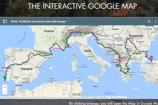
Excluding any means of transportation, during 530 days we will travel 10,600km through 17 countries: Portugal, Spain, France, Italy, Switzerland, Slovenia, Croatia, Bosnia and Herzegovina, Montenegro, Kosovo, Macedonia, Albania, Greece, Bulgaria, Serbia, Romania and Turkey. …
… we will document this experience for 17 months …
Clever Hiker posted the best information on this classic hike we’ve yet seen.
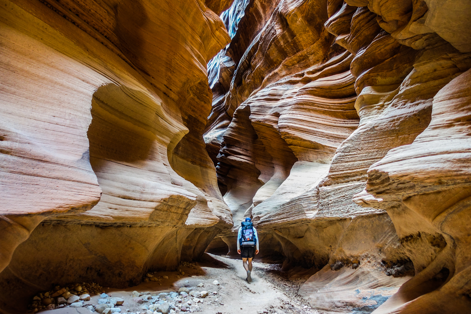
Located in the Vermillion Cliffs Wilderness of Utah and Arizona, this spectacular and unique hike winds through one of the deepest and longest slot canyons in the world.
Wavy sandstone walls twist their way to the sky for nearly thirteen miles, creating surreal patterns of light and sound. The canyon walls often soar hundreds of feet above the wash, and are sometimes only a few feet apart. Buckskin Gulch is truly an amazing place …
Quick Facts
Distance: varies, 21-51 miles depending on trip
Days Needed: 2-5 days
Elevation Gain/Loss: varies, 500-1500 ft, depending on trip
Best Travel Time: April-June or September-November
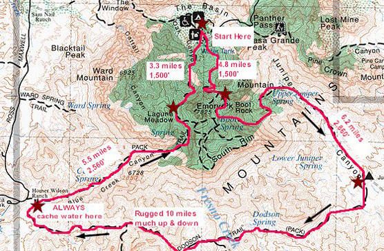
If I return to Big Bend National Park it will be to hike the Outer Mountain Loop.
Backcountry permits are required for all overnight backpacking trips in the park and can be obtained at the Chisos Basin Visitor Center (or another park visitor center).
Begin by caching water near the Homer Wilson (Blue Creek) Ranch. This scenic overlook is located at mile 8.1 along the Ross Maxwell Scenic Drive. Hike down the trail and cache your water in the convenient storage box. Ensure your name and date are written on your bottles. Caching water will make the difference between a dangerous experience and a fun backcountry excursion.
After caching water, head to the Chisos Basin Trailhead to begin the hike. …
Day 2 – Juniper Canyon – Dodson Trail – Blue Creek Canyon (approximately 10-11 miles)
The Dodson Trail is the hottest and most exposed section of the entire trek. Don’t let the relatively short distance fool you. …
Day 3 – Blue Creek Canyon – Laguna Meadows – Chisos Basin (approximately 9 Miles)
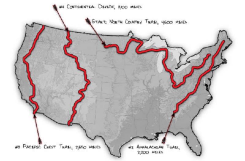
THE NORTH COUNTRY TRAIL (4,600 MILES)
THE APPALACHIAN TRAIL (2,178 MILES)
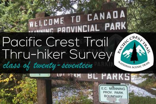
THE PACIFIC CREST TRAIL (2,650 MILES)
..AND THE CONTINENTAL DIVIDE TRAIL (3,100 MILES)
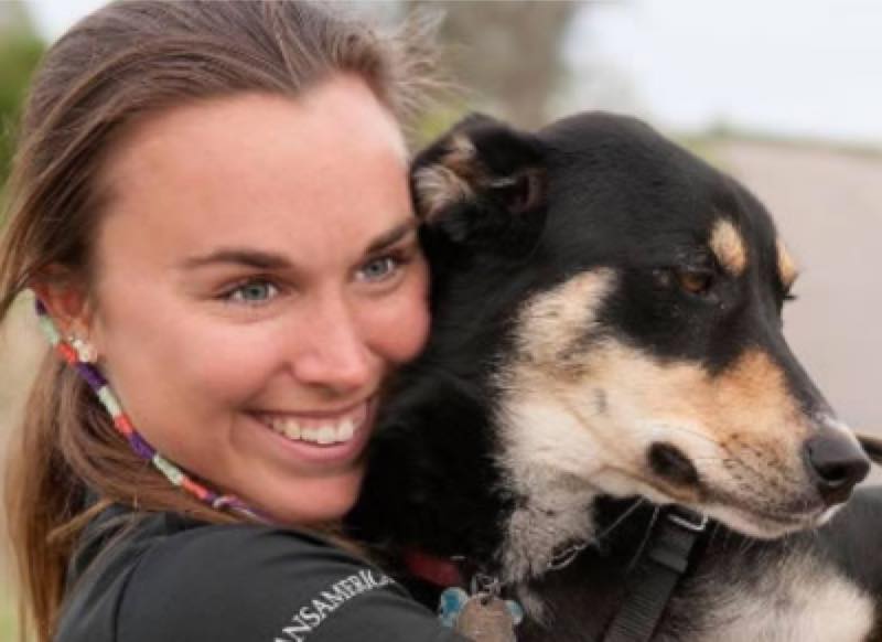
Breanna Cornell and Sophie are going to try it continuously, self supported, back to back to back to back.