Norway’s Lofoten Islands – hike Helvetestind (Hell’s peak) & Bunes beach

Trip report by BestHike editor Rick McCharles.

My first hike in stunning Lofoten above the Arctic Circle was a great one — Bunes beach.

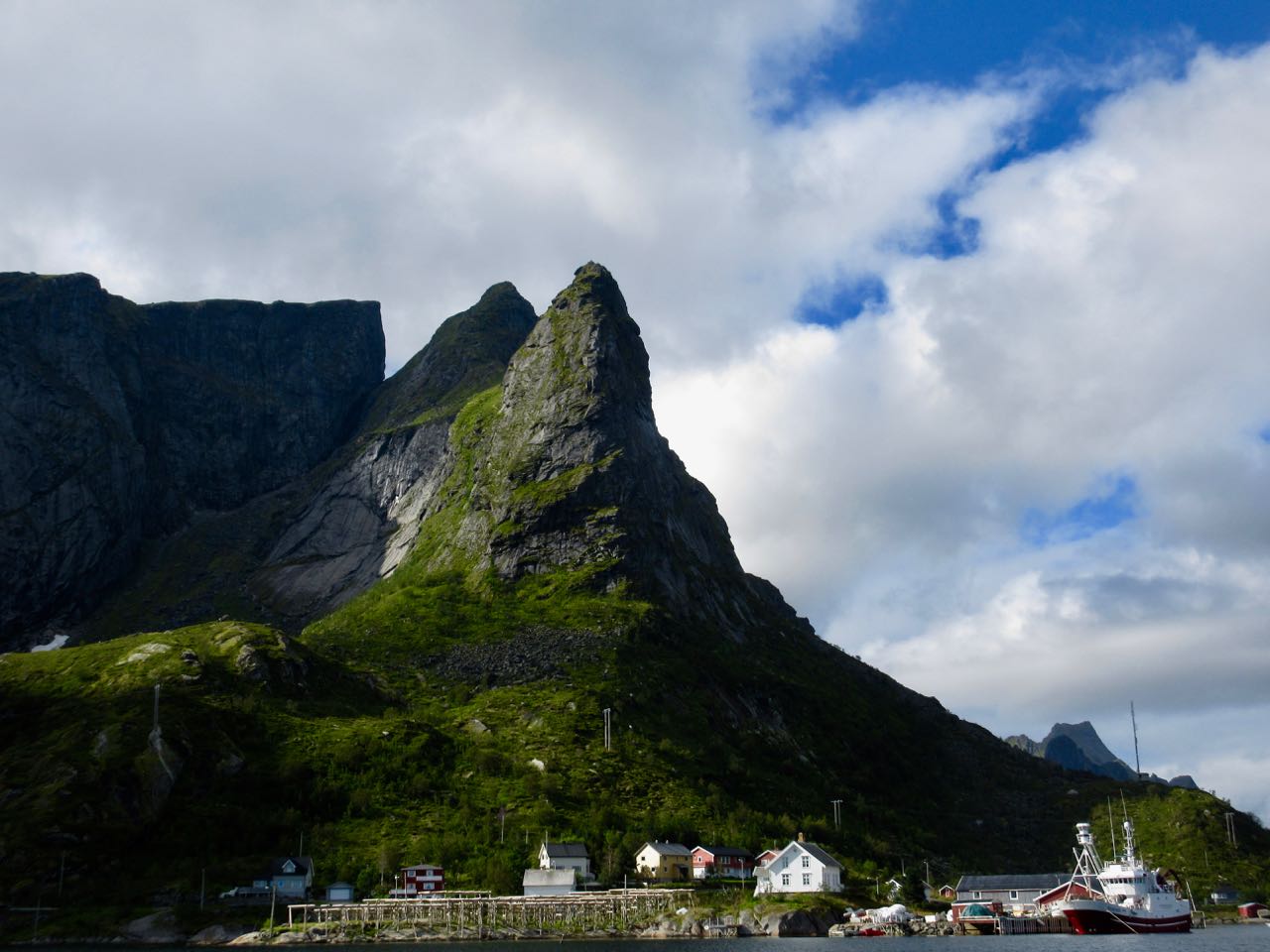
The weather atypically gorgeous in Reine.

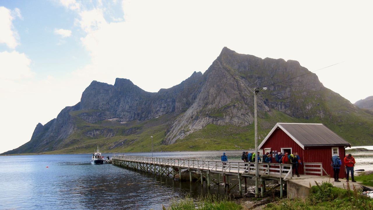
From here you catch a ferry to the end of the Bunesfjorden.

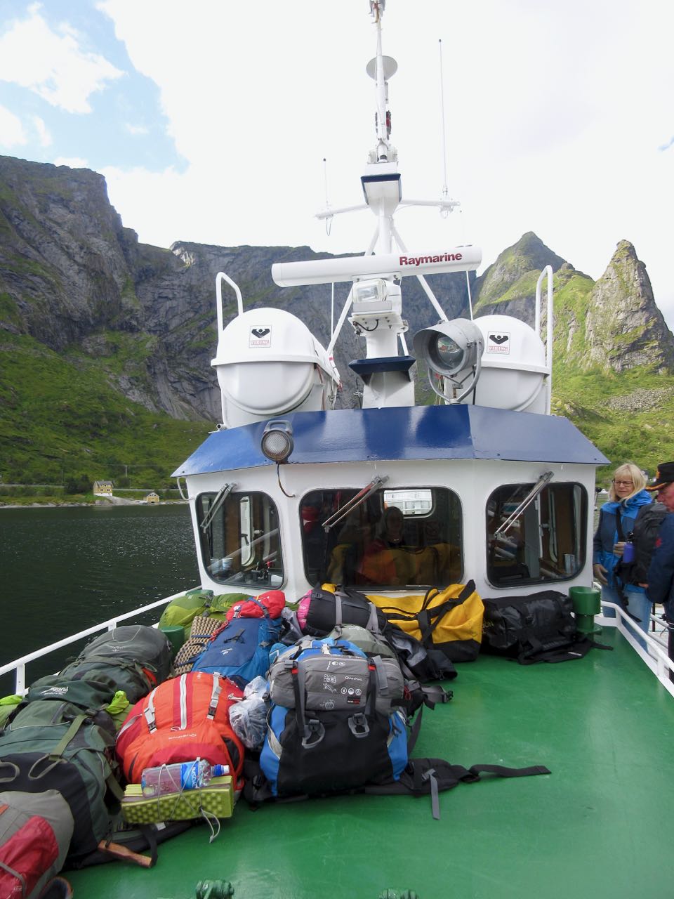
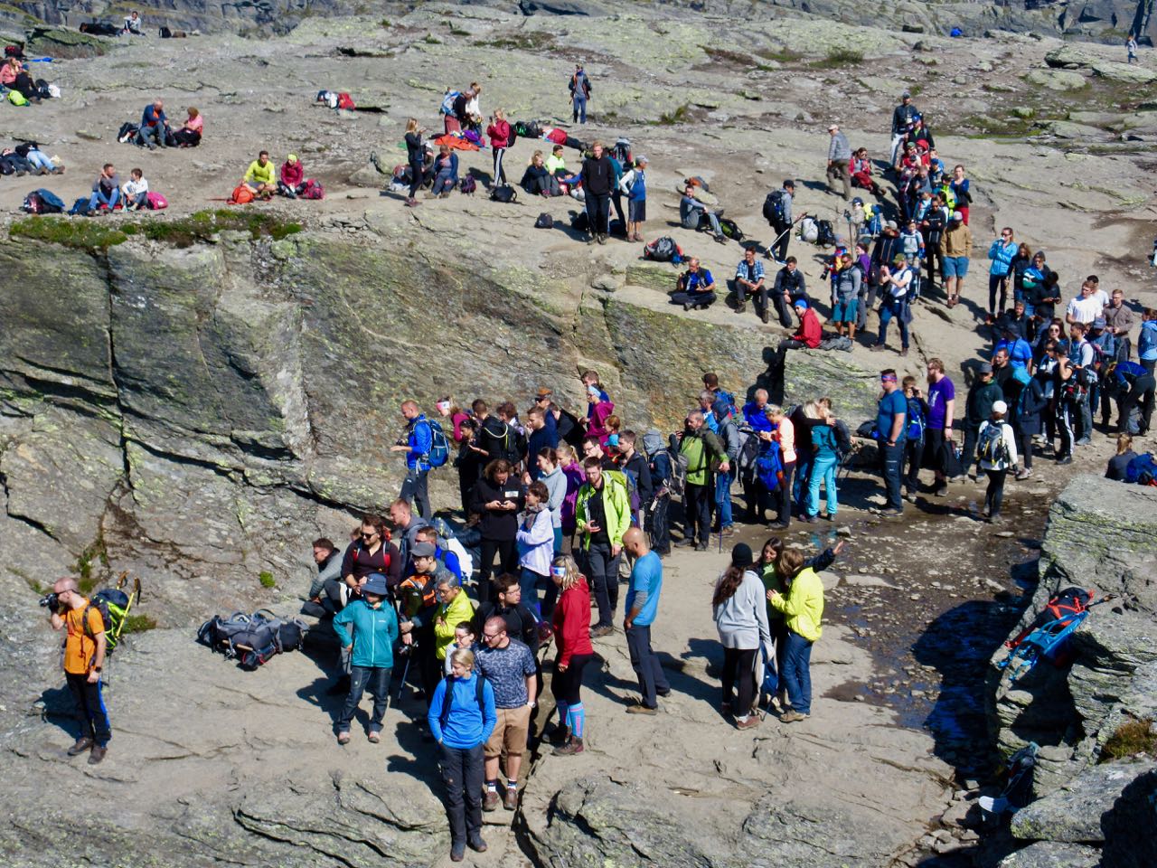
A Norwegian hiker told me he had this beach to himself on a sunny July day 9-years-ago. No more. It’s super popular in 2018. Our boat was packed.

Half the passengers were stuck like sardines in a can below deck. The other half sat up top. Yep … I was front and centre savouring the scenery.

The ferry was at least as good as the hike itself.

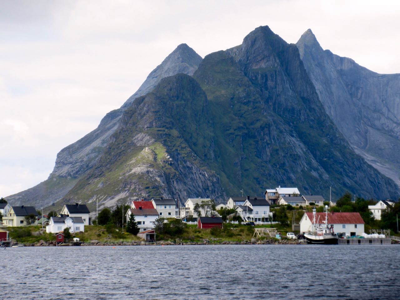
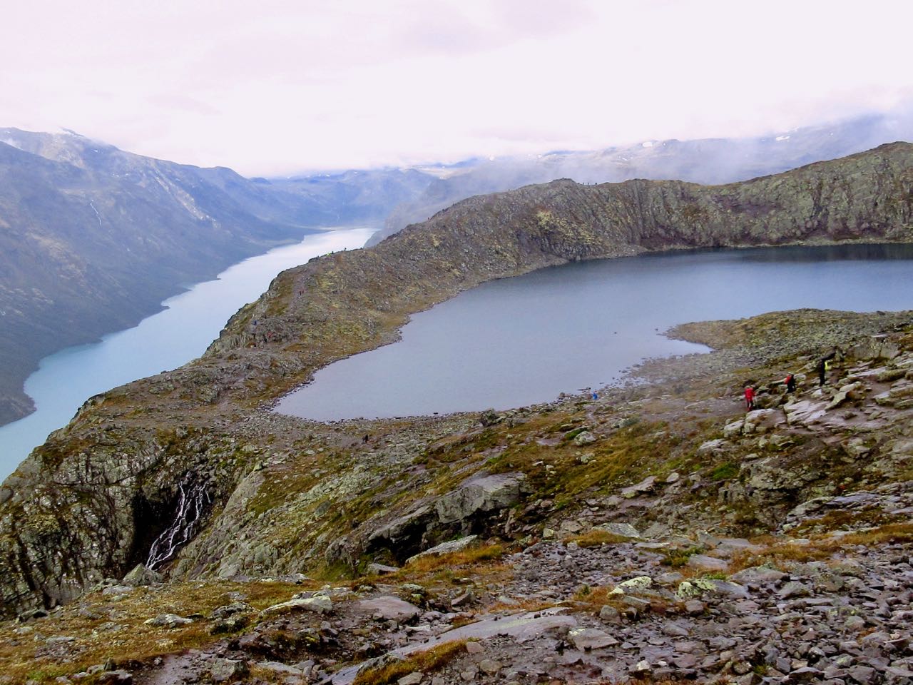
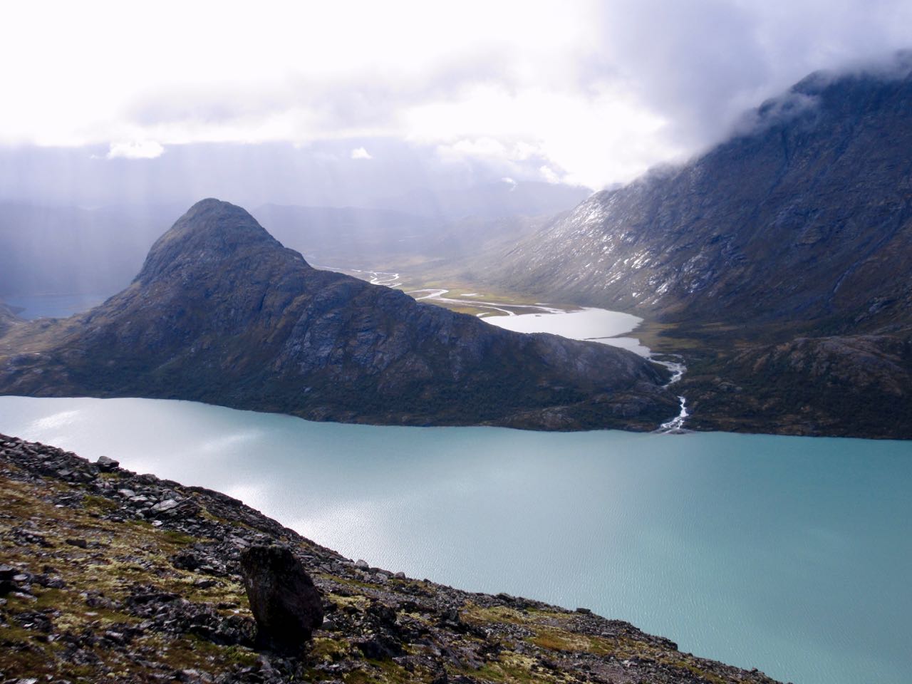
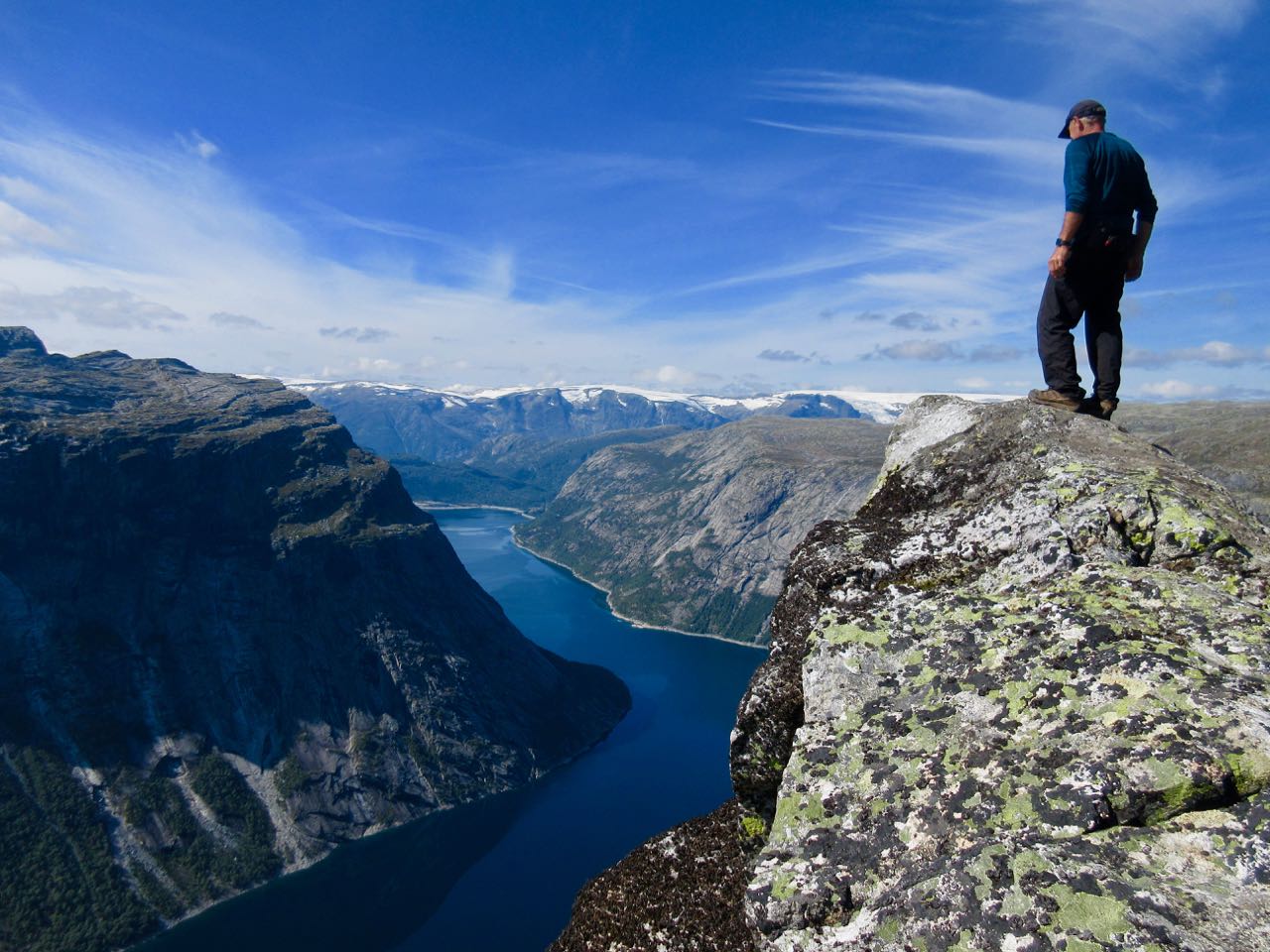
I’ve seen some amazing mountains. Dolomites. Yukon. Patagonia. But I can’t recall seeing so many astonishing peaks anywhere else. They were carved by huge, powerful glaciers.

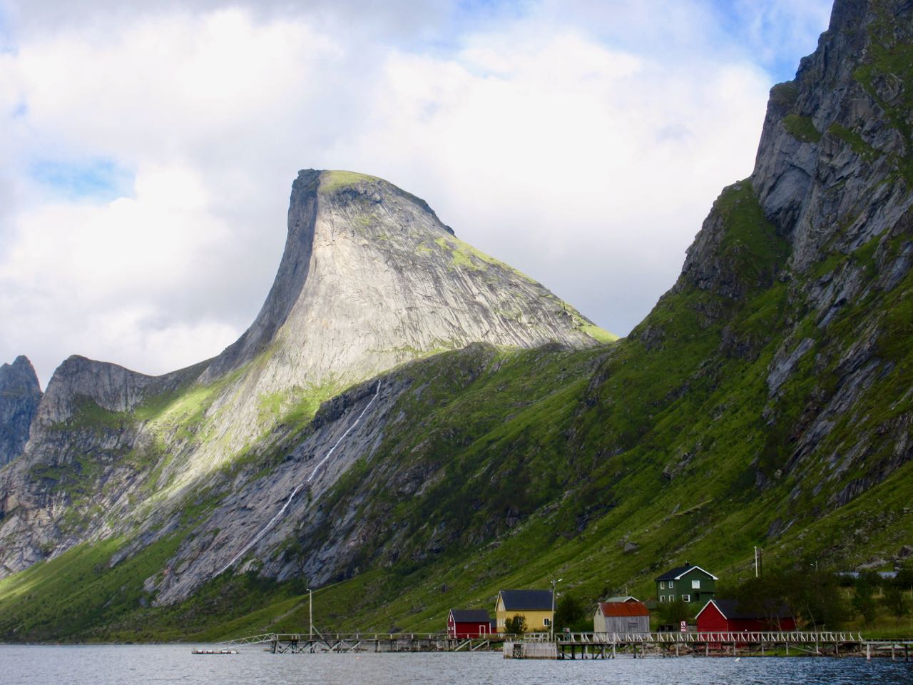
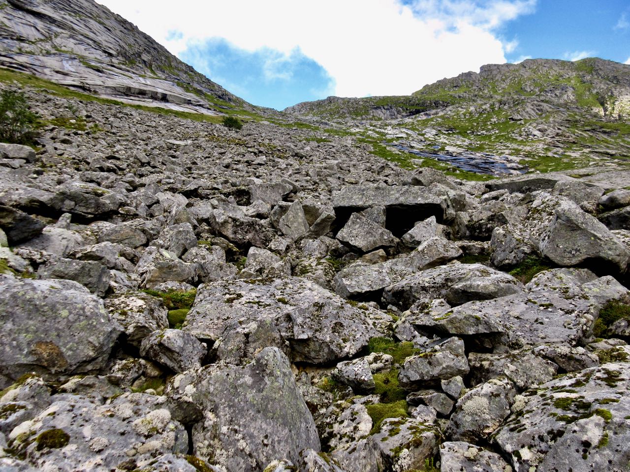
Of two or three potential trailheads, most hikers alight at Vinstad.

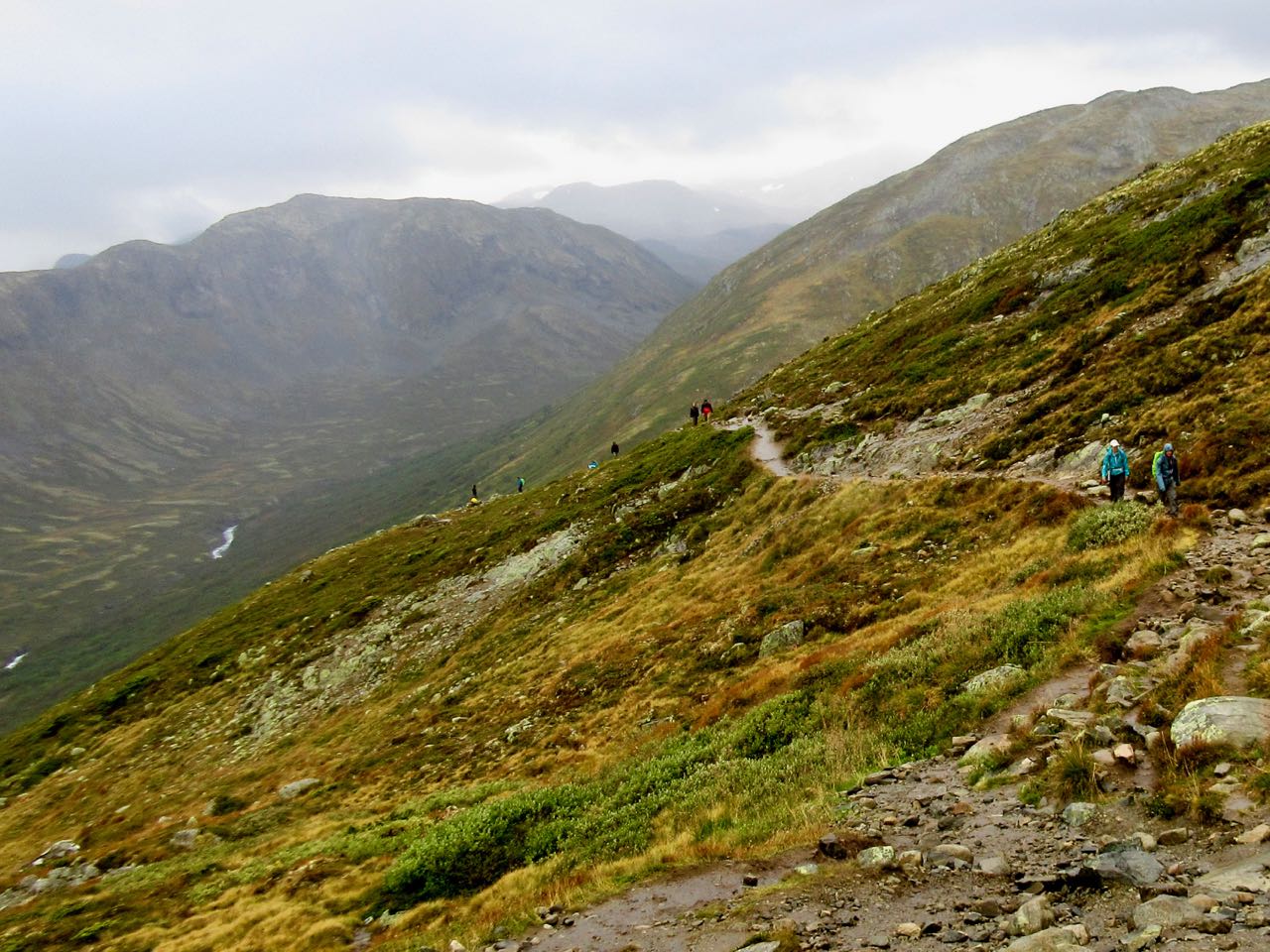
Most dashed straight up the old carriage road to the beach to set up their tents.

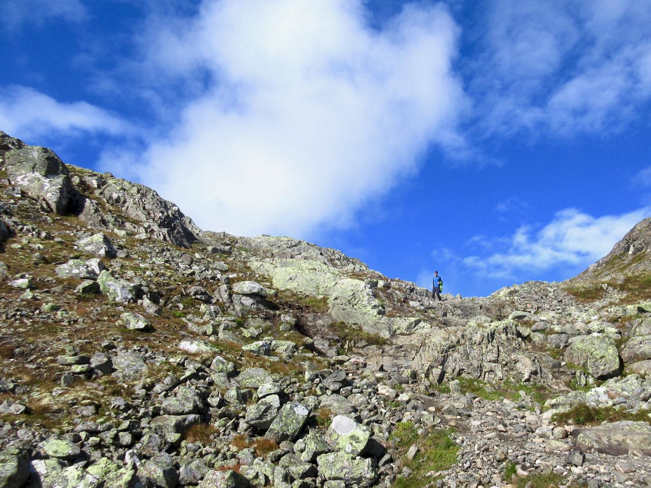
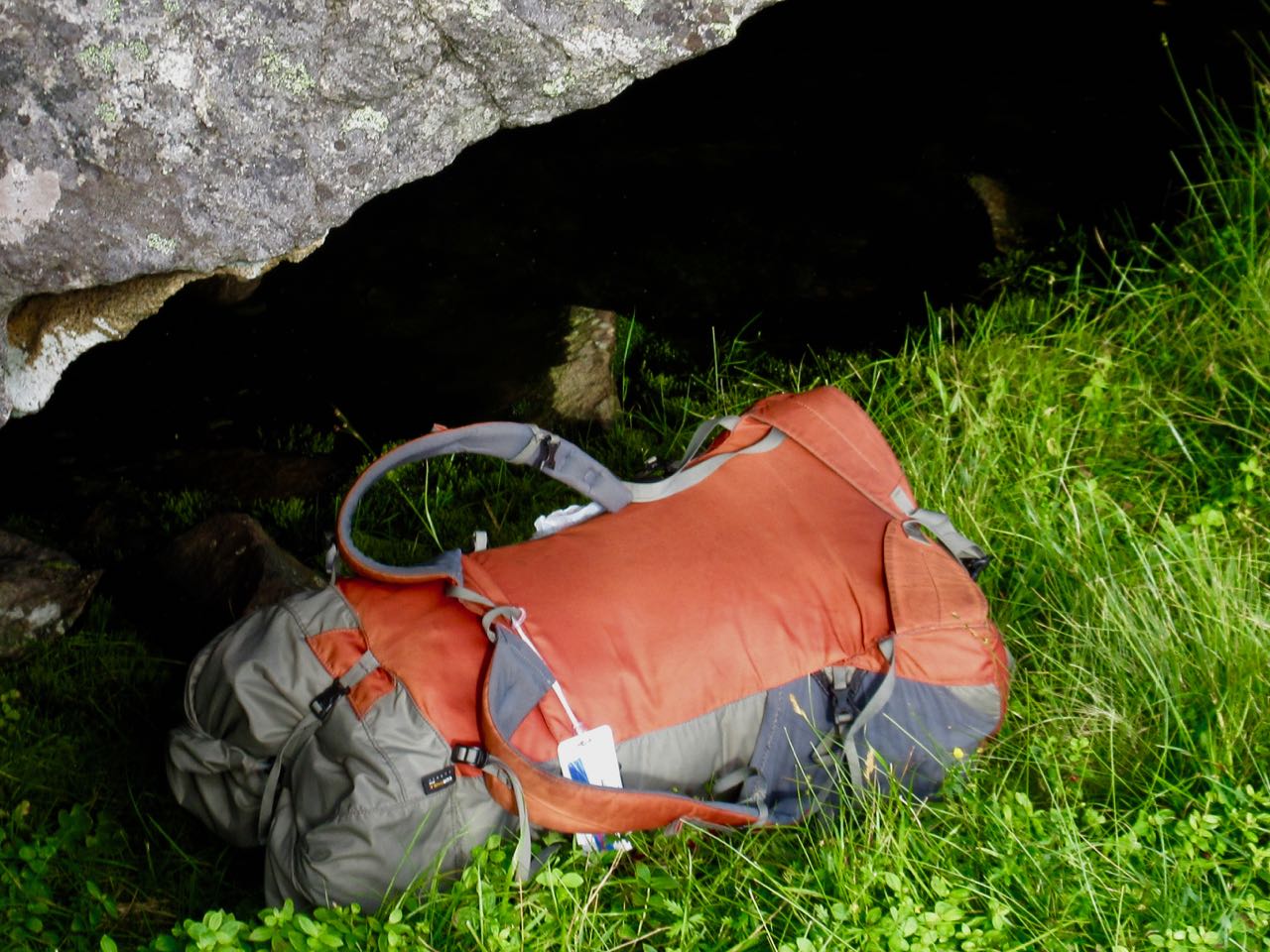
I stopped, instead, at the pass for lunch.

Stashed the pack …

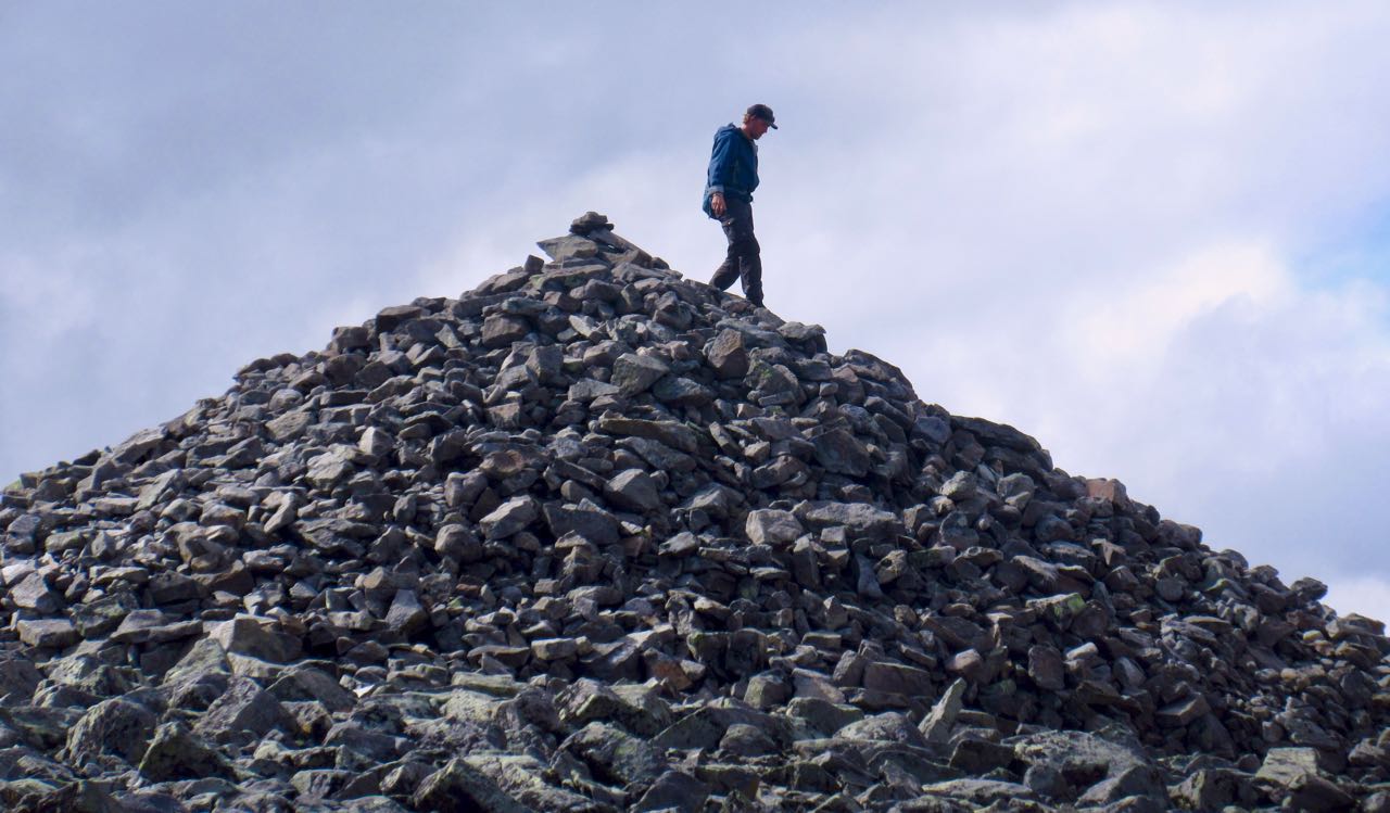
… then headed up Hell’s peak.

Actually it was easier than it looks.

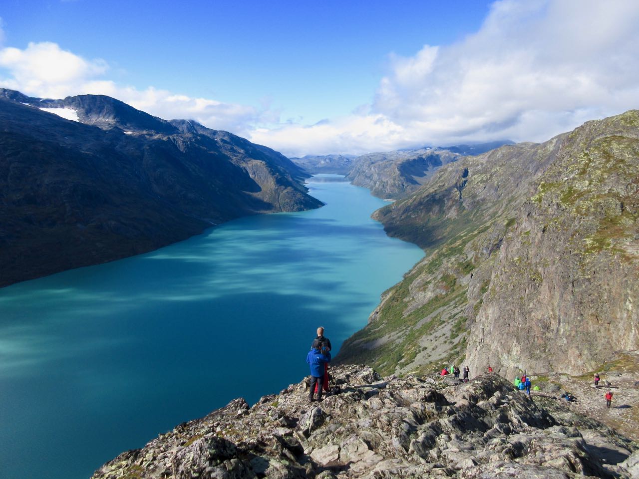
This is Helvetestind (Hell’s peak) 602MASL (metres above sea level). That’s the beach below.

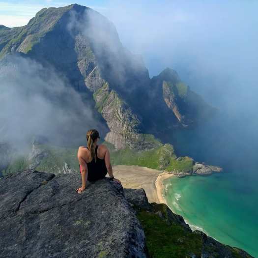
You can see Reine looking back down the fjord.

I took my time coming down.

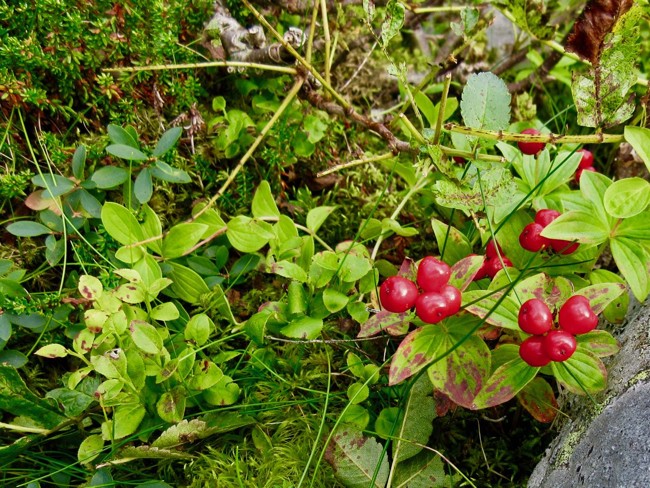
Lofoten is gorgeous in so many ways.

Bunes beach is huge. I dropped my pack and went exploring while I still had sunlight.

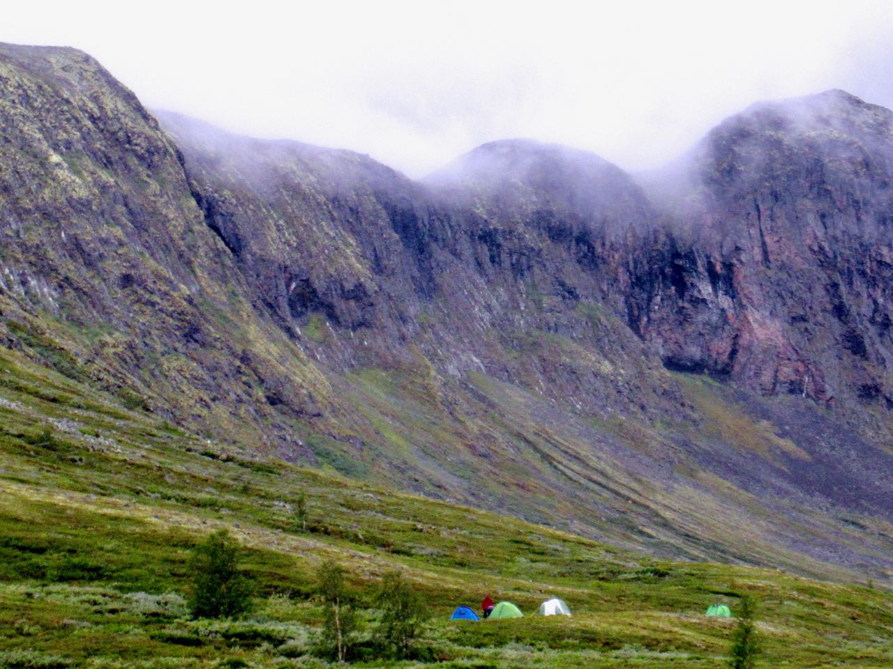
Everyone sets-up under this huge wall.

Next morning I was first up and gone. I sat up on the pass enjoying my coffee in the sun while it was still shady down on the beach.

As a result I got back to Vinstad early.

People live here. I went exploring.

Homes are literally cabled to the ground to keep them from flying away during strong winter storms.

While waiting on the ferry a packraft stopped by. The German adventurer was going to try an off-trail climb for the second day in a row.

Less crowded, everyone got to stay up top on the return.

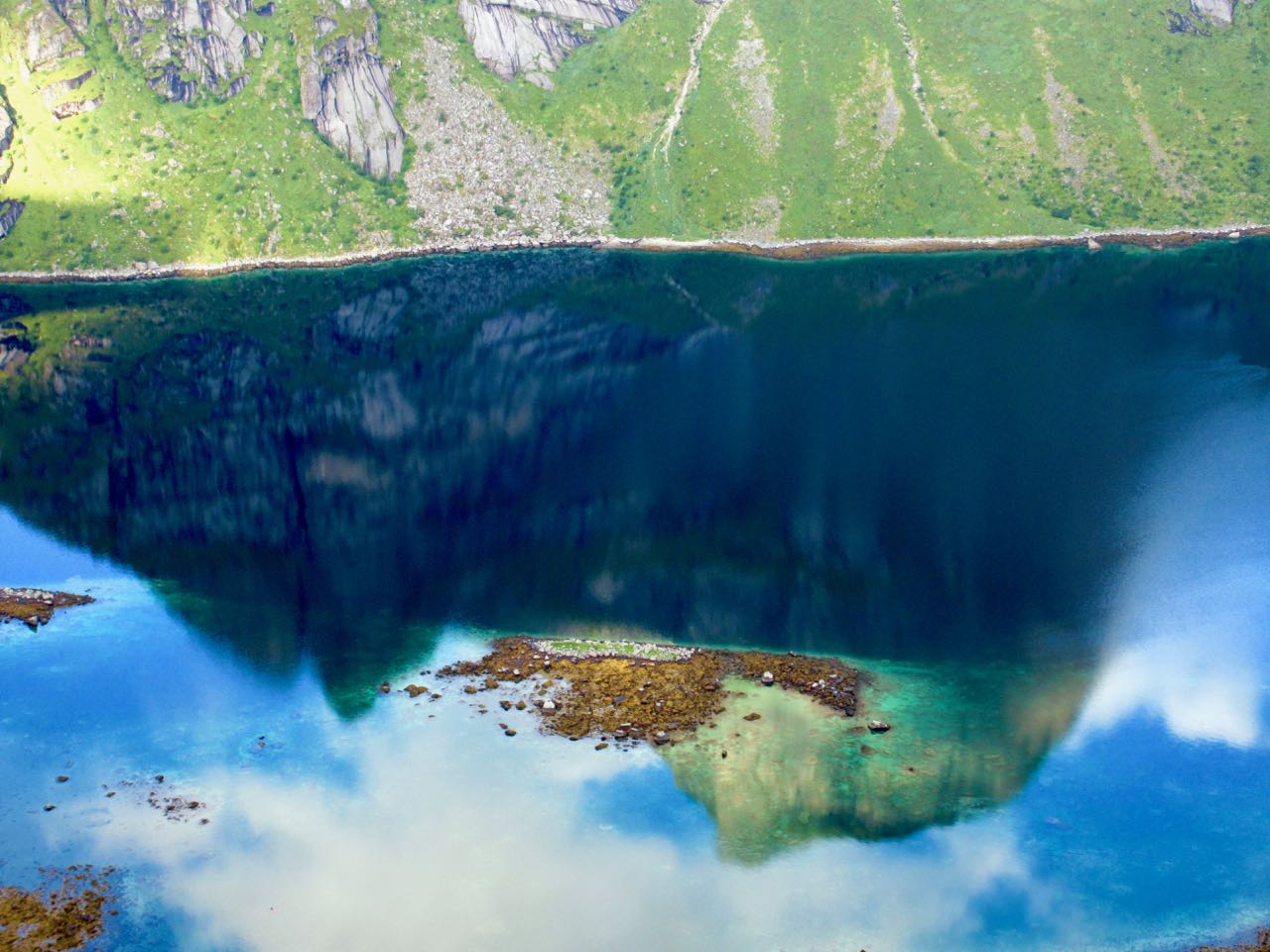
Reine is beautiful. A good kayaking fjord.

Reine is the best base town on the Lofoten Islands for me. You can do 3-4 great hikes like this from here.

famous Norwegian hike closed for Sherpas

For the 3rd season in a row Reinebringen out of Reine, Lofoten Islands is closed.

Several people have died in recent years on the tough, muddy scramble to this iconic vista.

The experts were called. Eight experienced trail builders from the Himalaya.

If people climbed there’s a risk of rock fall down to where they are working.

Out of respect for these guys, I did not climb it.

Reinebringen should open 2019. And be MUCH safer.

There is a good alternative (called by some) Topp 730 that gets you to very similar vistas.

hike Besseggen Ridge, Norway

Trip report by BestHike editor Rick McCharles.

Besseggen, or Besseggi … in Jotunheimen, is a thrilling ridge walk with alpine lakes on either side. You look down on lakes Gjende and Bessvatnet.

  • 13.3km (8.25mi)
  • 6-9 hours
  • 950m elevation gain

Click PLAY or get a quick glimpse of how it goes on YouTube.

Besseggen is a loop with a ferry section.

You walk between Memurubu and Gjendesheim. Both offer lodges and camping. Independent hikers tend to camp outside the official campground area at either. That’s free.

I camped for free.

The vast majority bus in or park at Gjendesheim. Then take the Besseggen Boat. There’s no real reason to book in advance online.

You can hike the other direction but the down climbs are slightly more dangerous that way.

This is Norway’s most exciting National Park: Jotunheimen the “Home of the Giants“.

Camping free at Memurubu.

Besseggen is recommended from the end of June to mid-September. During those months more than 30,000 hikers make the adventure. You won’t be lonely in high season.

Many bring dogs on leash.

The route is well signed. You won’t get lost.

The morning I was there it was foggy on the long slog up.

One you get up on the ridge views are awesome.

I left a Summit Stone at one of the cairns.

Footing is rocky but offers traction everywhere except steep, wet down climbs. Those are dangerous.

As promised, the weather cleared. I love this kind of bleak beauty.

Looking back at the long lake. It’s turquoise due to rock flour.

The last 4km back to the start are sometimes flat and easy, sometimes challenging scramble. There is a chain assist at one point.

Besseggen is definitely one of the best day hikes in the world. I’ll never forget it.

Click PLAY or watch some SAFETY tips on YouTube.

Finally, Click PLAY or watch on YouTube some highlights of my own hike.

related – Visit Norway – BESSEGGEN RIDGE IN JOTUNHEIMEN

Norway – hiking Solstien out of Rjukan

trip report by BestHike editor Rick McCharles

Driving in after dark, I slept at the base of Mt. Gausta, Norway, hoping to get a very early start.

It’s the highest mountain in Telemark, a super popular hike.

When I awoke, however, it was cloudy atop the peak.

After making some coffee I finally decided to drive on and hike instead nearby Hardangervidda plateau.

I drove way, way down to Rjukan town.

For 6 months a year no sun reaches this deep valley.

Why would people live in Rjukan?

Hydroelectricity, of course.

Rjukan Falls, a 104-metre waterfall, provided easy means of generating large quantities of electricity. In 1934 this was the world’s largest power plant.

Easiest way up the opposite side of the valley is via the Krossobanen aerial tramway, built 1928 as a gift from Norsk Hydro to the people of Rjukan (most of them Hydro employees), offering them a view of the sun during winter.

Actually that’s the oldest in Scandinavia. It looks old.

I was in the first car. Happy to gain 814m quickly.

There’s a restaurant and good views across the valley to the mountain.

At the top of the lift I was a bit disappointed to see road, cabins, snow machines, quads. It’s a community up here, not wilderness.

Lonely Planet recommended a 9km walk-in to Helberg cabin.

I had been advised the hike was wet. And it was wet.

Hardangervidda is characterised by barren, treeless moorland interrupted by numerous pools, lakes, rivers and streams. Erosion in this environment makes any trail muddy. Too wet for me.

I turned around.

Instead I tried the Solstien loop. I knew it had a stepping stone stairway. I could keep my feet relatively dry.

Nice.

The sun came out as I got to the top.

Germans in World War II tried to produce heavy water for future nuclear weapons in this valley.

They built these gun emplacements to shoot down British planes.

This weird, bleak, inhospitable environment really appeals to me. I recommend the hike.

By the way, I small-stepped down the 814m back to my car. It did seem long.
___

There’s some good news. The people of Rjukan now get some sunlight without climbing out of their valley. Martin Andersen, an artist who moved there in 2002, pushed an initiative to build a computer-controlled array of three giant mirrors that moves with the sun to light 600 square meters of the town square.

related – Visit Telemark – Solstien

climbing Gaustatoppen, Norway

One super popular hike is climbing Gaustatoppen in TelemarkNorway.

Elevation 1,883 m (6,178 ft)
Prominence 950 m (3,120 ft)

On a clear day from on top you can see 1/6 of the country.

There are a number of routes up from fairly easy to very difficult.

There is a funicular railway inside the mountain, built for military purposes but now available to tourists.

Atop is Gaustatoppen Tourist Cabin which serves delicious waffles as you will definitely see in this promo video.

Click PLAY or watch it on YouTube.

hiking the Troll Tongue, Norway

Trip report by BestHike editor Rick McCharles. 

  • 23-27km return
  • 10-12 hours

Trolltunga (Troll Tongue) is a rock formation situated about 1,100 metres above sea level …

The special cliff is jutting horizontally out from the mountain, into free air about 700 metres (2,300 ft) above the north side of lake Ringedalsvatnet. …

Here’s the Instagram moment people expect.

Here’s the line-up ☹️ when I arrived on one of the best days of the year.

Before 2010 fewer than 800 people hiked to Trolltunga each year. In 2016 more than 80,000 people made the adventure!

It’s packed. 

I certainly didn’t wait.

Instead I walked on to try to find the little Pulpit which is about 2km further past the last emergency hut. It’s close to the best camping area.

Happily I had the small Pulpit to myself for about 25 minutes before anyone else showed up. A great lunch spot.

And I did get to dangle my feet over the edge.

Fact is it’s pretty easy to locate a private cliff edge in Norway. It has the second longest coastline in the world due to all those fjords. Go find your own.

Despite the mob scene at the Tongue I really enjoyed the hiking day. We lucked out and had great weather.

___

Click PLAY or watch it on YouTube.

Parking at the trailhead costs 500 NOK/day (approx. 62 USD or 52 EUR). And over 300 spots were full the morning I arrived. I had to park 6km lower on the mountain for 300 NOK/day … and take a golf cart up for 100 NOK. Yeesh!

Starting 2017 from the higher parking lot you can take a shuttle up an additional 4km for 100 NOK. Worried about finishing in daylight, I paid.

Just to get to the start of the hike cost me CAD $78.

Troll’s Tongue much longer but easier walking than the other two famous cliff edge hikes in Norway. Very enjoyable.

Click PLAY or watch it on YouTube.

Safety is a big concern. September 2015 a 24-year-old Australian woman fell to her death, the first recorded fatality. There are about 40 rescues annually, most on the walk out due to fatigue or exposure. A few get lost.

An additional bonus is the crazy drive to get to the trailhead. I drove both up and down the entire mountain. It’s awesome.

hiking the Pulpit, Norway

Trip report by BestHike editor Rick McCharles. 

  • 7.6km (4.8mi)
  • round-trip 3-4 hours plus Pulpit time
  • elevation differential 334m (1,096 ft)

Preikestolen (English: «Preacher’s Pulpit», «Preacher’s Chair» or «Pulpit Rock’») … is a steep cliff which rises 604 metres (1,982 ft) above the Lysefjorden. …

Tourism at the site has been increasing in recent years, with between 150,000 and 200,000 visitors in 2012 …

It’s crowded on a sunny day in August.

And it’s certainly going to get more crowded now that Tom Cruise was here.

If you want to have the Pulpit all to yourself, tent up there and go late evening or early morning. Tenting is legal, but not on the Pulpit itself.

Click PLAY or watch it on YouTube.

… authorities have opted not to install fencing or other safety devices as they felt it would detract from the natural beauty of the site and the fact that fatalities at the site are extremely rare …

Click PLAY or watch it on YouTube.

Up top I realized I’d left my good camcorder and tripod on my rent-a-car in the very busy parking lot. Surprise, surprise … it was still there when I got back 4 hours later.

related – Victoria’s trip report

Great Redwood Trail CA proposal

I’d fly to California to bike / hike this rails to trail.

It’s been proposed by California Sen. McGuire – SB 1029, The Great Redwood Trail Act.

details at GreatRedWoodtrail.org

related – The Great Redwood Trail would be great for North Coast

The new trail will bring economic benefits to the North Coast, where rural towns need such growth. Outdoor recreation already brings in more than $92 billion a year to California, nearly 700,000 jobs with more than $30 billion in wages and more $6 billion in local and state tax revenues.

tough hike to Kjeragbolten, Norway

trip report by BestHike editor Rick McCharles

Every hiker has seen photos of the boulder wedged into a Kjerag mountain crevasse above a Norwegian fjord.

That’s 984m (3,228ft) high. It’s a popular site for BASE jumping.

A Russian BASE jumper was walking up at the same time as myself — some like to jump close to sunset — but he kept climbing past this spot to something more exciting.

I’d never heard it was a tough hike to get there.

Here’s the start of the easiest ascent from Øygardsstølen visitors center.

It’s 4-6 hour return over beautiful rocky terrain. Some scrambling. Very slippery. There are plenty of chain assists. I used many of them even in dry weather.

By comparison I would say this is much more challenging than Half Dome in Yosemite. And there are all kinds of inexperienced tourists with poor footwear.

Click PLAY or watch it on YouTube.

Surprisingly, it sounds like nobody has ever fallen to their death from Kjeragbolten. (Not counting BASE jumpers.)

The boulder is not as death defying as the photos make it look.

In fact, the scramble down a rocky creek to get there is as difficult as climbing out on to that boulder.

Kjeragbolten itself is a 5-cubic-metre (180 cu ft) glacial deposit …

It is a popular tourist destination and is accessible without any climbing equipment. …

Yes, I was pretty happy to finally get here.

If you have a fear of heights, this might not be the best hike for you.

Click PLAY or watch it on YouTube.

More photos.