Includes BestHike.com editor Rick McCharles. ⛺️
Click through to Outdoors with no Limits:
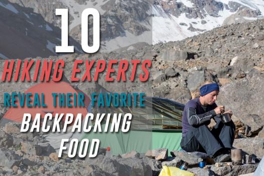
10 Hiking Experts Reveal Their Favorite Backpacking Food

Best hikes, treks, tramps in the world.
Includes BestHike.com editor Rick McCharles. ⛺️
Click through to Outdoors with no Limits:
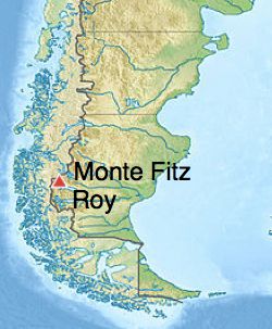
We updated our Fitz Roy information page after our February 2019 visit to El Chaltén.
That town is booming. More and more travellers are taking to the many trails directly out of town.

 AT A GLANCE
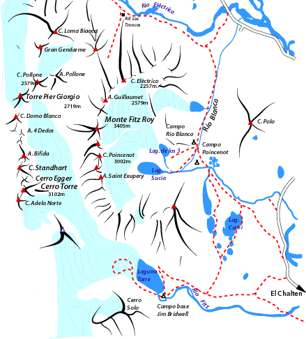
Click through to our Fitz Roy information page.
Sarah and Kirk have been posting great information on trail nutrition for over a decade. Their NEW site looks great. And it’s being hosted on WordPress.com so it’s nearly impossible to hack. That host has over a quarter of the websites on the internet.
Check it out.

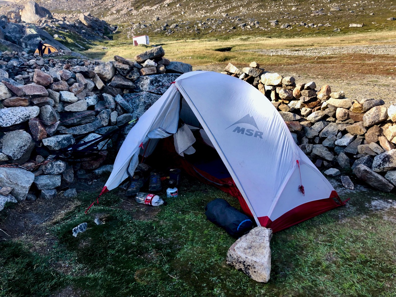
In recent years I’ve been using the JetBoil MiniMo.
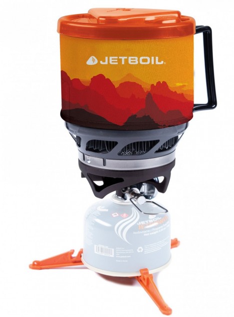
I cook and drink out of the one pot.
I love the convenience of the piezoelectric igniter. The auto-igniters on early JetBoils FAILED quickly, but they seem to have solved that problem now.
You can fit an 8oz canister in the wider pot of the MiniMo. You can also fit a 4 oz canister along with the MiniMo’s burner in its pot sideways. That’s handy.
I don’t need simmer so that’s not a selling point for me.
The MiniMo replaced my much used MSR Reactor.
The best thing about the Reactor is that it is NOT locked on to the stove. I find it safer.

Both those stoves might be nearing end-of-life. … Or they may keep working for another decade. Both are bashed up.
So in advance of my recent, remote Patagonia trip I bought a new stove …
I hadn’t realized it had a colour changing boil indicator. Cute. I did watch.
But I found myself more often boiling over my dinner in the Flash. For me the larger capacity MiniMo is just right. And the MiniMo is easier to clean.
Adventure Alan likes the MiniMo best, as well.
Read about other, lighter options here
related – Outdoor Gear Labs review – JetBoil MiniMo
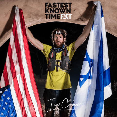
Michael Wardian (born April 12, 1974) is an American marathoner and ultra-marathoner. …
In January 2017, Wardian ran seven marathons in seven days on seven continents in a record average speed of 2:45. …
Click PLAY or watch it on YouTube.
He said the terrain is some of the most beautiful he’s seen in the world. And he felt very safe in Israel.
I listened to an entertaining interview on the Fastest Known Time podcast.
6900+ miles.

Andrew Skurka invented the Great Western Loop and was the only person to complete it before Jeff ‘Legend’ Garmire in 2018.
Click PLAY or watch it on YouTube. (24min)
In 2019, the Great Western Loop will officially become the Great Western Loop Trail and expanded to include the northern and southern termini of both the Pacific Crest Trail (PCT) and the Continental Divide Trail (CDT). …
Most nights tenting in the backcountry I cook up the same basic dinner:
Instant mashed potatoes with instant soup (often Knorr brand).
Instant mashed potatoes are available in small grocery shops the world over as is instant soup.

To keep gear as light as possible I cook, eat and drink out of one pot.
I carry only one metal spoon. No knife, fork or spork.
To enhance the fairly bland base meal I add chilli powder or lemon pepper. Then something like peanuts, raisins or tuna.

I never seem to tire of this grub. Cook up is fast using very little fuel. Clean-up quick and easy.
Like me, Joshua Huff made an effort to do every hike he could in southern Patagonia.
Here are some of his favourites:
Cerro Castillo
Parque Patagonia (Chile Chico to Cochrane)
Torres del Paine
Passage of the Sheep, Ushuaia
La Junta, Cochamó
Parque Tantauco, Chiloé
On a detailed post from his 3 months in the area, Joshua details his own experience and links to other trip reports.
Exploring the Good Life – Argentina, Chile Patagonia
Heather Anderson, who goes by the trail name Anish, has thru-hiked the U.S.’s mega trails—the Appalachian, the Continental Divide, and the Pacific Crest—three times. …
Since 2013, Anderson has speed-hiked 28,000 trail miles—a greater distance than the circumference of Earth at the equator. …
Anish outdid herself last year, when she became the first woman, and fifth person, to complete the Triple Crown—7,944 miles—in a calendar year. She pulled off the feat in stunning fashion, hiking an average of more than 31 miles a day to finish in 251 days, 20 hours, and 10 minutes. (Cam “Swami” Honan holds the overall record at 231 days.) …
All this from a girl who was 70 pounds overweight and often teased while growing up …
How does anyone do this kind of thing?
You hike a lot of 18-hour days — waking up 4 a.m. and walking until 11 p.m.
AND Heather won’t accept rides in and out of town to pick-up her resupply!
She has a new book. Available in paperback and Kindle.
In her new memoir, Thirst: 2600 Miles to Home, Heather, whose trail name is “Anish,” conveys not only her athleticism and wilderness adventures, but also shares her distinct message of courage–her willingness to turn away from the predictability of a more traditional life in an effort to seek out what most fulfills her. …
I’ve uploaded all the hiking photos from my recent 2 months in Patagonia.
Check those out here. There are thousands in the BestHike archive.
Most are Creative Commons licensed so can be used in other projects.
The BEST of BestHike photos (about 1800) are included in one album. That’s the best starting point.
