top 10 hikes – Lake O’Hara, Canadian Rockies

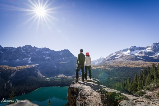
Alpine Circuit, Lake O’Hara 

Super popular, it’s very difficult to get a reservation to camp overnight.

AT A GLANCE

  • Yoho National Park in British Columbia near Banff, Alberta.
  • time zone is Alberta, not B.C.
  • mid-June through the end of September (start and end dates vary)
    • for example, bus operated for hikers and campers from June 19 to October 4, 2018
  • 11.6 km
  • perhaps 9 hours
  • perhaps 900 photos 🙂
  • highest point 2528 m
  • elevation gain 1012 m

Some like O’Hara best late in the season to see the larch change colour. Green to golden.

Details on our Lake O’Hara Alpine Circuit information page.

Pumalín, Chile – Laguna Tronador trail

trip report by besthike editor Rick McCharles

Duration: 4 hours round trip.
Distance: 4,8 km round trip.
Return: Same route.
Difficulty: Medium-High

Parque Pumalín 

This physically challenging trail climbs through an alerce forest, once burned and now recuperating.

Excellent.

You need your own wheels to get to trailheads like this. I tried to hide my bike in the bush before heading up.

The cost to develop trails is here is high. And these workmen are superb.

I love how they use local materials to blend in to the pristine environment.

At one point they tunnelled under roots of a tree.

Though shockingly well maintained despite the climate, one railing did rip out on me. Happily I was using it for balance, not support.

The path generally climbs up near loud waterfalls.

One reason to choose this trail over others is free camping at Laguna Tronador. There are only 2 excellent spots, however.

I recommend the Laguna Tronador trail.

carrying furniture on the PCT?

Kolby Kirk is quoted. So this must be true. 🙂

… due to the recent success of the book and movie “Wild”, many hikers have expressed fears that the trail will become overcrowded with Oprah Winfrey fans wearing enormous backpacks and ill-fitting boots with red shoelaces. …

The 2014 hiking season saw a dramatic rise not only in the number of hikers on the PCT, but also in the number of hikers apparently carrying large pieces of furniture.

“There was a couch at Scissors Crossing, and another one outside of Big Bear,” said Renee “SheRa” Patrick, “I can only imagine that they were carried there by hikers and abandoned when they realized that couches are too heavy for a thru-hike. I mean, a section hike, sure. Maybe somewhere in Oregon. But in the desert? It’s crazy.” …

“Wild” Debates About PCT Overcrowding (Part One)

recliner PCT

10 epic long distance hikes

Gear Junkie:

1. Appalachian Trail
2. Greater Patagonian Trail
3. Continental Divide Trail
4. Nepal’s Great Himalaya Trail
5. Grand Italian Trail
6. Wales Coast Path
7. Pacific Crest Trail
8. Great Wall of China
9. Tokai Nature Trail
10. Te Araroa

10 Epic Long Distance Hikes Around The World

Wales Coast Path
Wales Coast Path

finally – a waterproof backpack

Somebody tell Bill Bryson. 🙂

Mountain Hardware South Col™ 70 OutDry Backpack

The one-pack solution for mountaineering expeditions on the world’s highest peaks. The flexible design and highly evolved compression system lets you add and remove components as well as shrink and expand the pack as needed.

OutDry construction bonds a durable waterproof membrane to the main compartment so that your gear stays safe and dry in even the wettest conditions.

$300

Click PLAY or watch a preview on YouTube.

(via Adventure Blog)

Amathole Trail, South Africa

The 6 day 100km long Amathole Hiking Trail starts near Kings Williams Town and ends at Hogsback in the Amatola Mountains. This trail has been voted the best in South Africa by Getaway Magazine, and is undoubtedly one of the toughest trails as well as one of the most beautiful, descending and ascending through steep, lushly forested valleys and up to the flower strewn grasslands and peaks of the Amatola Range …

The trail is rated as difficult, although there are various paths that can be taken within the overall hut to hut routes, some easier than others. …

Show Me – East London

waterfall hikers

trip report – Amatola Hiking Trail

Google Earth flyover Everest Base Camp

Kraig Becker is getting revved up for the 2012 Spring season on Everest:

… The video below gives you a good idea of what that trek is like. It was created with Google Earth and give an accurate representation of the terrain that surrounds you while hiking through the region. Those that have visited the Khumbu before will recognize some familiar sights, including that grueling hike up the hill into Namche Bazaar, while those just following along at home can get a better sense of scale for the region. …

Click PLAY or watch it on YouTube.

Adventure BlogVideo: Trekking To Everest Base Camp With Google Earth

related – my 2009 17-day Everest trek via Lukla